Embed Size (px)
Citation preview

Our ref: 20191106 -02 TR010018 Natasha Kopala Head of TWA Orders Unit Department for Transport Zone 1/14 – 18 Great Minster House 33 Horseferry Road London SW1P 4DR By email only
Woodlands Manton Lane Bedford MK4 7LW 11 June 2019
Dear Ms Kopala,
The A14 Cambridge to Huntingdon Improvement Scheme Development Consent Order 2016 (SI 2016/547) (as corrected by the A14 Cambridge to Huntingdon Improvement Scheme Development Consent (Correction) Order 2017 (SI 2017/1121))
Application for a Non-Material Change under Section 153 of the Planning Act 2008 and Regulation 4 of the Infrastructure Planning (Changes to, and Revocation of, Development Consent Orders) Regulations 2011
On behalf of Highways England please find enclosed our comments on the second round of consultation responses, received in relation to our application for a proposed non-material change to the A14 Cambridge to Huntingdon Improvement Scheme Development Consent Order 2016 (SI 2016/547) (as corrected1) (“the DCO”).
Alternative routes for agricultural vehicles
Highways England has acknowledged the potential for impact on local farming businesses in our original application statement published in January 2019 (Section 8) and in our comments on consultation responses published in April 2019. We have presented the reasons as to why we consider that the alternative routes, identified in the application, would be reasonable alternatives and the impact of their use to be considered non-material. Due to the rural nature of the business locations many of the roads identified as suggested alternatives to the proposed A1(M) and A14(M) are, in practice, already used by the type of vehicles that would be displaced from the proposed stretches of motorway. These routes are therefore clearly suitable for these types of vehicle.
1 Corrected by the A14 Cambridge to Huntingdon Improvement Scheme Development Consent (Correction)
Order 2011 (SI 2017/1121).

Page 2 of 4
As such, despite the possible minor impact this proposed change may have on a small number of businesses we do not believe that this would be sufficient to indicate that the impact of the proposed change should be considered as material.
During preparation for our original non-material change application submission we undertook various pieces of work and carried out technical assessments of the alternative routes we had identified as being reasonable options. The summary we provided in the application in January 2019 was supplemented by further information, route maps and CCTV data, in our response to the consultation (4 April 2019).
However, we recognise that there may still be some uncertainty around this matter and therefore the previous work completed to support and inform our application has been collated and is presented as a technical report which is appended hereto. We hope in the context of the full investigatory work undertaken, along with the information previously provided, any outstanding questions on this particular matter can be addressed with this document.
Consultation
We would also like to re-confirm the detail included in our Consultation Statement (February 2019) around the consultation we launched in September 2018, after the announcement that Highways England were investigating the possibility to re-classify part of the A14/A1 as motorway. As well as numerous media interviews and sharing information on our social media platforms, we also wrote to key stakeholders, identified by the project stakeholder managers, as being contacts who we should try to engage with as early as possible to ensure the opportunity was taken to discuss the proposal in detail. We continued to engage with various parties throughout this informal engagement period, up until submission in January 2019.
In January 2019 we formally notified over 250 stakeholders of the application submission, the vast majority of which are land owners or farmers. Through our engagement process, during the formal and informal consultation periods, we engaged with large numbers of potentially affected parties and the wider public via local and regional media as well as public engagement via the project’s outreach mobile visitor centre. There have been positive discussions with interested parties since September 2018.
During the formal consultation period in February we were contacted by a small number of farming businesses to discuss the application. We met in person with all parties who contacted us. We discussed the proposal and all relevant matters, including alternative routes. Following on from these meetings a number of parties were satisfied with the proposal and have made no formal representation. A small number have made representation and we will continue to engage with all the interested parties.

Page 3 of 4
In addition to the existing assessments undertaken throughout the application process, further work has been carried out in response to a small number of concerns raised during the first round of consultation. We have undertaken a trial tractor journey to physically assess the suitability of those routes where concerns were raised. The results from this exercise were submitted as Appendix 3 to our consultation response document submitted in April 2019. This focused on a particular number of routes and locations, confirming their suitability for agricultural movements and validating the conclusions from our technical report.
The A14 Cambridge to Huntingdon Improvement Scheme employs an effective team of Stakeholder Managers who liaise closely and regularly with farmers and landowners across the scheme. The vast majority of these potentially affected farmers are content with the alternatives and solutions we have presented. Regrettably, a very small number have made representations and we shall continue to liaise with these parties to try and achieve a suitable outcome.
Further issues
We have also considered the further comments that have been raised during the second round of consultation and have provided further details where we believe clarity is required. Carbon Dioxide emissions were considered within the Air Quality chapter of the Environmental Statement (ES) submitted at the time the original Development Consent Order application was made. Consideration of whether the proposed change to Motorway Regulations would lead to any likely significant effects that would be new, or materially different, to those reported in the ES was part of the non-material change application. The conclusion stands that the proposal would not lead to any material change in the findings of the ES, including the findings of the Air Quality chapter. Therefore, the detail of our technical responses and conclusions, as explained in our submission of 4 April 2019, remain unchanged.
We would also like to provide clarity in relation to comment that signage for A14(M) is already in place. Having carried out investigations we can confirm there were no temporary works signage; current gantry signage or new signage erected that shows A14(M).
There is, however, a short stretch of road linking the existing A1(M) and existing A14 north of Alconbury where approx. 1 mile of road already operates under motorway regulations. Due to this the A1 southbound matrix signage, managed for Highways England by Road Management Services, shows this section of road as A14(M) as part of the variable messaging to provide information for road users, however it is not part of this project nor included in this application.

Page 4 of 4
We are at your disposal if there is any further support or clarity you should require in considering these further comments on the application and look forward to receiving the decision from the Secretary of State for Transport at his earliest convenience.
If you have any questions or require further information please do contact senior project manager Mike Evans on 07810 815390 or via [email protected]
Yours sincerely
David Bray
Project Director, A14 Cambridge to Huntingdon Improvement Scheme
Enc.
TRO010018 - Alternative Routes for Non-Motorway Traffic: Technical Report

Page 1 of 19
Technical Report
Project: A14 Cambridge to Huntingdon Improvement
Scheme
No: TRO010018
Subject: Alternative Routes for Non-Motorway Traffic
Prepared by: Ian Jarrett Date: 10/06/2019
Checked by: David Southcott Date: 10/06/2019
Reviewed/
Approved by:
Don Vann / Philip Baker Date: 10/06/2019
Executive Summary This proposal to re-classify the A1 and A14 to motorway status would bring many benefits to the roads and the Strategic Road Network that they form part of. Operating the roads as motorway would not only provide the road users with a continuous motorway experience from London to Peterborough but it would also provide the increased safety that travelling on motorways provides, statistically being twice as safe as A-road dual carriageways and the reliability of driving on high quality roads at higher and more consistent speeds. Removing the slower moving vehicles in addition to the other non-motorised road users would only improve journey times and further improve the safety of the road users. If the A14 between New Ellington and Girton Junctions, and the A1 between Alconbury and Buckden Junctions, is subject to Motorway Regulations it will mean that certain types of traffic will be prohibited from using the A14 and A1 between these sections. This will affect the agricultural traffic that can currently travel between junctions on the A14 and A1; this traffic will have to use the nearby local road network instead. The A14 improvement scheme provides additional local access roads (LARs) to support local access. Local traffic, including agricultural vehicles would use these routes in conjunction with the existing local road network, to gain access to local areas and facilities. Traffic from further afield would experience no change until they reached these sections. This technical report shows some alternative routes which are suitable for this traffic to use to travel between junctions and compares the current travel time against the new travel time and calculates any difference in journey time. From this it is possible to gauge whether there will be an adverse impact on the local road network and motorists’ journey times, and whether any impact will be sufficient to indicate that the change should be considered as material. On site validation has also been carried out and this has indicated that the methodology used in this technical report and its conclusions are reliable. We conclude that these impacts are not considered to be significant and therefore this application should be considered as non-material.

Technical Report
Page 2 of 19
Methodology The Project Team have identified multiple (but not an exhaustive list of) suitable routes that avoid the use of the A14 and the A1 as shown in appendix B. The multiple routes have been derived based upon their suitability for large, slow vehicles (primarily agricultural vehicles) and are currently used by such vehicles. The following formulae1 have been used to determine journey times in the matrix in appendix A. For 30-50mph road: (Distance2 / 17mph3) + (number of give way junctions x 10 seconds) + (number of signal junctions x 30 seconds) For >50mph road: (Distance / 19mph) + (number of give way junctions x 10 seconds) + (number of signal junctions x 30 seconds) For example, the route from New Ellington to Alconbury West Junction (Weight limit) (3.54 miles at 17mph) + (2 x 10s) + (0 x 30s) =12 minutes and 50 seconds, rounded up to 13 minutes. From this is deducted the time taken by this calculation method for the route via A1, to give the difference in travel time. Cameras on the A14 have been used to understand the current use of the A14 / A1 by non-motorway traffic and the camera positions are provided in Appendix C. Current Non-Motorway Traffic Counts Traffic data was collected from July to October 2018 and identified traffic travelling on the A1 between CCTV cameras 109 / 124 and A14 101 / 207 and cameras 401 / 438 and 539 on the A14 to camera 501 on the A1. Appendix C shows where the cameras are positioned on the network. Traffic data has not been classified by direction of travel. The tables below show the number and types of vehicles recorded between cameras for several weeks between 30th July and 29th October 2018. Slow vehicles between CCTV 109 & 124 & 201 to 207 (extending from A1 north of Buckden to south of Alconbury and including A14 west of Brampton)
w/c
30 J
uly
Monday Tuesday Wednesday Thursday Friday Saturday Sunday
Agricultural 2 1 3 1 0 0 3
Moped 2 0 1 0 0 0 0
Other 0 0 0 0 0 0 0
w/c
6 A
ug
Monday Tuesday Wednesday Thursday Friday Saturday Sunday
Agricultural 1 7 2 0 0 0 0
Moped 0 0 1 1 0 0 0
Other 0 0 0 1 0 0 0
1‘Transport speeds of tractors’ Andreas Herrmann and Peter Pickel, Halle, and Norbert Fröba, Darmstadt , 2000.
17mph is based on the average speed of a tractor without a trailer. 2 Converted to metres 3 Converted to metres per second

Technical Report
Page 3 of 19
w/c
13 A
ug
Monday Tuesday Wednesday Thursday Friday Saturday Sunday
Agricultural 1 1 5 1 1 0 0
Moped 0 0 1 1 1 0 0
Other 0 0 0 0 0 0 0
w/c
20 A
ug
Monday Tuesday Wednesday Thursday Friday Saturday Sunday
Agricultural 4 2 5 6 4 2 3
Moped 0 0 0 0 0 0 0
Other 0 0 0 0 0 0 0
w/c
27 A
ug
Monday Tuesday Wednesday Thursday Friday Saturday Sunday
Agricultural 0 5 5 1 0 1 2
Moped 0 1 1 2 1 1 3
Other 0 0 0 0 0 0 0
w/c
3 S
ept Monday Tuesday Wednesday Thursday Friday Saturday Sunday
Agricultural 5 6 0 5 0 0 1
Moped 2 0 0 0 1 0 0
Other 0 0 0 0 0 0 0
w/c
10
Sept Monday Tuesday Wednesday Thursday Friday Saturday Sunday
Agricultural 5 0 0 0 1 1 1
Moped 0 0 0 0 0 0 0
Other 1 0 0 0 0 0 0
w/c
17 S
ept Monday Tuesday Wednesday Thursday Friday Saturday Sunday
Agricultural 2 2 3 4 1 0 0
Moped 1 0 0 0 0 0 0
Other 0 0 0 0 0 0 0
w/c
24 S
ept Monday Tuesday Wednesday Thursday Friday Saturday Sunday
Agricultural 2 3 0 0 0 0 1
Moped 0 0 0 0 0 0 1
Other 0 0 0 0 0 0 0
w/c
1 O
ct
Monday Tuesday Wednesday Thursday Friday Saturday Sunday
Agricultural 4 3 3 3 1 0 1
Moped 0 2 1 1 0 0 0
Other 0 0 0 0 0 0 0
w/c
8 O
ct
Monday Tuesday Wednesday Thursday Friday Saturday Sunday
Agricultural 7 4 3 5 3 2 1
Moped 2 1 0 2 0 0 0
Other 0 0 0 0 0 0 0
w/c
15 O
ct Monday Tuesday Wednesday Thursday Friday Saturday Sunday
Agricultural 5 4 5 4 0 0 0
Moped 2 0 0 0 1 0 0
Other 0 0 0 0 0 0 0

Technical Report
Page 4 of 19
w/c
22 O
ct Monday Tuesday Wednesday Thursday Friday Saturday Sunday
Agricultural 1 1 2 1 6 0 0
Moped 3 0 0 0 2 0 0
Other 0 0 0 0 0 0 0
w/c
29 O
ct Monday Tuesday Wednesday Thursday Friday Saturday Sunday
Agricultural 0 0 0 2 2 0 1
Moped 0 0 0 0 0 0 0
Other 0 0 0 0 0 0 0
Slow vehicles between CCTV 401 to 438 (540 to 541) & 501 to 539 (on the A14 Girton Interchange to Fen Drayton and the A14 Madingley to Fen Ditton)
w/c
30 J
uly
Monday Tuesday Wednesday Thursday Friday Saturday Sunday
Agricultural 0 0 0 0 0 0 0
Moped 0 0 0 0 0 0 0
Other 0 0 0 0 0 0 0
w/c
6 A
ug
Monday Tuesday Wednesday Thursday Friday Saturday Sunday
Agricultural 0 1 1 0 0 0 0
Moped 0 0 0 0 0 0 0
Other 0 0 0 0 0 0 0
w/c
13 A
ug
Monday Tuesday Wednesday Thursday Friday Saturday Sunday
Agricultural 2 0 0 1 3 1 1
Moped 0 0 0 0 0 0 0
Other 0 0 0 0 0 0 0
w/c
20 A
ug
Monday Tuesday Wednesday Thursday Friday Saturday Sunday
Agricultural 0 1 0 4 0 2 0
Moped 0 0 0 0 0 0 0
Other 0 0 0 0 0 0 0
w/c
27 A
ug
Monday Tuesday Wednesday Thursday Friday Saturday Sunday
Agricultural 0 1 0 0 1 1 1
Moped 0 0 0 0 0 0 0
Other 0 0 0 0 0 0 0
w/c
3 S
ept Monday Tuesday Wednesday Thursday Friday Saturday Sunday
Agricultural 2 1 1 0 0 0 0
Moped 0 0 0 0 0 0 0
Other 0 0 0 0 0 0 0
w/c
10 S
ept Monday Tuesday Wednesday Thursday Friday Saturday Sunday
Agricultural 0 0 2 0 0 0 0
Moped 0 0 0 0 0 0 0
Other 0 0 0 0 0 0 0

Technical Report
Page 5 of 19
w/c
17 S
ept Monday Tuesday Wednesday Thursday Friday Saturday Sunday
Agricultural 0 0 4 1 0 0 1
Moped 0 0 0 0 0 0 0
Other 0 0 0 0 0 0 0
w/c
24 S
ept Monday Tuesday Wednesday Thursday Friday Saturday Sunday
Agricultural 1 1 0 0 1 0 0
Moped 0 0 0 0 0 0 0
Other 0 0 0 0 0 0 0
w/c
1 O
ct
Monday Tuesday Wednesday Thursday Friday Saturday Sunday
Agricultural 0 0 1 0 0 0 0
Moped 0 0 0 0 0 0 0
Other 0 0 0 0 0 0 0
w/c
8 O
ct
Monday Tuesday Wednesday Thursday Friday Saturday Sunday
Agricultural 0 1 0 2 0 0 0
Moped 0 0 0 0 0 0 0
Other 0 0 0 0 0 0 0
w/c
14
Oct Monday Tuesday Wednesday Thursday Friday Saturday Sunday
Agricultural 2 0 0 0 2 0 0
Moped 0 0 0 0 0 0 0
Other 0 0 0 0 0 0 0
w/c
21 O
ct Monday Tuesday Wednesday Thursday Friday Saturday Sunday
Agricultural 0 2 4 0 0 0 0
Moped 0 0 0 0 0 0 0
Other 0 0 0 0 0 0 0
w/c
29 O
ct Monday Tuesday Wednesday Thursday Friday Saturday Sunday
Agricultural 0 0 1 2 1 0 0
Moped 0 0 0 0 0 0 0
Other 0 0 0 0 0 0 0
An agricultural vehicle is defined as any vehicle that is used in farming, typically a tractor, combine harvester or a bailer. The cameras captured tractors and combine harvesters. 4x4 vehicles and HGVs are not agricultural vehicles for the purpose of this exercise. An average of 1.9 (rounded to two for practicality) agricultural vehicles and 0.4 (rounded to one for practicality) mopeds a day were recorded by the Brampton cameras (109 to 124 and 201 to 207). An excavator was recorded by the same cameras on 10th September and was categorised under ‘other’. The highest flows recorded on this camera were 7 agricultural vehicles (observed twice on the 7th August and the 8th October) and 3 mopeds (observed twice on the 2nd September and 22nd October).

Technical Report
Page 6 of 19
An average of 0.5 (rounded to one for practicality) agricultural vehicles a day were recorded by the Swavesey cameras (401 to 438 / 540 to 541 & 501 to 539). The highest flows recorded on this camera were 4 agricultural vehicles (observed twice on the 23rd August and the 19th September). Alternative Routes The following section provides descriptions of each of the routes identified in Appendix B, which are available alternatives for those vehicles that would be unable to use the A14 and/or A1 if they were upgraded to motorway standards. Some of the routes have weight limits but it has been confirmed by Cambridgeshire County Council that agricultural vehicles are exempt from these limits. The weight limits and therefore these routes can be used by any displaced agricultural vehicles regardless of their weight. Characteristics of the alternative routes have been considered and it is noted that these routes are currently used by agricultural vehicles. New Ellington to Alconbury West Junction (Weight limit – not applicable to agricultural vehicles)
This route is a diversion of New Ellington to Alconbury West Junction (with 7.5 and 3 Tonne weight limits) and uses Globe Lane on the western side of the A1.
The route between these junctions would be 2.48 miles if vehicles were able to travel on A14 / A1 Route. The alternative route is 3.63 miles.
This route passes through a generally rural and agricultural area. o New local access road (replaces existing at grade junction of Woolley Rd with A1) –
60mph speed limit. o Globe Lane – national speed limit (60mph) and 30mph when approaching Alconbury.
New Ellington Junction to Alconbury West Junction (avoiding weight limit)
This route is a diversion of New Ellington to Alconbury West Junction using the de-trunked A14 to Spittals and then heading north-west on the de-trunked A14 and turning west at the B1043 (signposted ‘RAF Alconbury’).
This route is 2.85 miles if vehicles were able to travel on A14 / A1 Route. The route for non-motorway traffic is 5.5 miles.
This route passes through a mixture of built up and rural areas, with sections of dual carriageway. o B1043 – national speed limit (60mph). o Great North Road – 30mph Speed Limit. o Existing A14 (to be de-trunked to A1307) - national speed limit (70mph) (Alconbury to
Spittals). o Existing A14 (to be de-trunked to A141 (Spittals to Huntingdon Racecourse) - national
speed limit dual carriageway (70mph).

Technical Report
Page 7 of 19
Alconbury West Junction to Swavesey Junction
This route is a diversion of Alconbury West Junction to Swavesey Junction using the B1043 and the de-trunked A14 south to a new LAR running parallel to the existing A14 at Swavesey (A1307).
This route is 13.42 miles if vehicles were able to travel on A14 / A1 Route. The route for non-motorway traffic is 13.85 miles.
The route passes through a mixture of rural and urban areas. o Great North Road (western side of Alconbury) – 30mph Speed Limit. o B1043 – national speed limit (60mph). o Existing A14 (to be de-trunked to A1307) - national speed limit dual carriageway
(70mph). o Bucking Way Road subject to national speed limit (60mph).
Buckden Road to New Ellington
This route is a diversion of Buckden Road Junction to New Ellington which currently uses the A1 and the A14. It will use the B1514 and the de-trunked A14.
This route is 2.09 miles if vehicles were able to travel on A14 / A1 Route. The route for non-motorway traffic is 4.13 miles.
This route passes through a mixture of built up and rural areas with sections of dual carriageway. o Buckden Road (B1514) – national speed limit (60mph) and 30 mph Speed limit within
urban areas. o Existing A14 (to be de-trunked to A141) - national speed limit (70mph).
New Ellington Junction to Swavesey Junction
This route is a diversion of New Ellington to Godmanchester.
This route is 12.16 miles if vehicles were able to travel on A14 / A1 Route. The route for non-motorway traffic is 12.5 miles.
This route passes through a mixture of built up and rural areas with sections of dual carriageway. o Existing A14 (to be de-trunked to A1307- national speed limit (70mph). o Bucking Way Road subject to national speed limit (60mph).
New Ellington Junction to Godmanchester Junction
This route is a diversion of New Ellington to Godmanchester.
This route is 7.19 miles if vehicles were able to travel on A14 / A1 Route. The route for non-motorway traffic is 7.65 miles.
This route passes through a mixture of built up and rural areas with sections of dual carriageway. o Existing A14 (to be de-trunked to A141) - national speed limit (70mph). o B1514 – national speed limit (60mph). o Thrapston Road (B1514) – 30mph speed limit. o Huntingdon Road (B1514)– 40mph changing to 30 mph speed limit. o Brampton Road (B1514) - 30mph speed limit. o Existing A14 (to be de-trunked to A1307) - national speed limit (70mph). o A1198 – 30mph speed limit.
Technical Report
Page 8 of 19
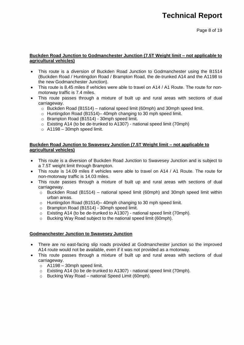
Buckden Road Junction to Godmanchester Junction (7.5T Weight limit – not applicable to agricultural vehicles)
This route is a diversion of Buckden Road Junction to Godmanchester using the B1514 (Buckden Road / Huntingdon Road / Brampton Road, the de-trunked A14 and the A1198 to the new Godmanchester Junction).
This route is 8.45 miles if vehicles were able to travel on A14 / A1 Route. The route for non-motorway traffic is 7.4 miles.
This route passes through a mixture of built up and rural areas with sections of dual carriageway. o Buckden Road (B1514) – national speed limit (60mph) and 30mph speed limit. o Huntingdon Road (B1514)– 40mph changing to 30 mph speed limit. o Brampton Road (B1514) - 30mph speed limit. o Existing A14 (to be de-trunked to A1307) - national speed limit (70mph) o A1198 – 30mph speed limit.
Buckden Road Junction to Swavesey Junction (7.5T Weight limit – not applicable to agricultural vehicles)
This route is a diversion of Buckden Road Junction to Swavesey Junction and is subject to a 7.5T weight limit through Brampton.
This route is 14.09 miles if vehicles were able to travel on A14 / A1 Route. The route for non-motorway traffic is 14.03 miles.
This route passes through a mixture of built up and rural areas with sections of dual carriageway. o Buckden Road (B1514) – national speed limit (60mph) and 30mph speed limit within
urban areas. o Huntingdon Road (B1514)– 40mph changing to 30 mph speed limit. o Brampton Road (B1514) - 30mph speed limit. o Existing A14 (to be de-trunked to A1307) - national speed limit (70mph). o Bucking Way Road subject to the national speed limit (60mph).
Godmanchester Junction to Swavesey Junction
There are no east-facing slip roads provided at Godmanchester junction so the improved A14 route would not be available, even if it was not provided as a motorway.
This route passes through a mixture of built up and rural areas with sections of dual carriageway. o A1198 – 30mph speed limit. o Existing A14 (to be de-trunked to A1307) - national speed limit (70mph). o Bucking Way Road – national Speed Limit (60mph).

Technical Report
Page 9 of 19
Swavesey Junction to Bar Hill Junction
This route is a diversion of Swavesey Junction to Bar Hill Junction using a new route that will run parallel to the A14.
This route is 1.90 miles if vehicles were able to travel on A14 / A1 Route. The route for non-motorway traffic is 1.98 miles.
This route passes through a rural area. o Boxworth End – national speed limit (60mph) and 30mph speed limit at Swavesey. o Bucking Way Road – national speed limit (60mph). o Local Access Road (A14 to be de-trunked to A1307 parallel to the A14) – national
speed limit (60mph). Bar Hill Junction to A14 Histon Junction
This route is a diversion of Bar Hill Junction to Girton Interchange passing through the villages of Histon and Oakington.
The route between these junctions would be 5.68 miles if vehicles were able to travel on A14 / A1 Route. The route without using the A14 is 7.52 miles.
This route passes through a mixture of built up and rural areas with sections of dual carriageway. o The section between Bar Hill and Dry Drayton Road will be a single carriageway road
at national speed limit with one lane in each direction and will be constructed as part of the DCO.
o Dry Drayton Road is subject to the national speed limit until Dry Drayton village where it changes to 30mph.
o Cambridge Road is subject to a speed limit of 30mph, changing to 40mph south-east of Dry Drayton.
o New Road subject to the national speed limit (60mph). o Park Lane is subject to a 30mph speed limit. o School Hill is subject to a 30mph speed limit. o Bridge Road – speed limit of 30mph changing to 40mph on the approach to the A14
junction. Bar Hill Junction to Histon Junction via B1049 and A1307
This route is a diversion of Bar Hill Junction to Girton Interchange but uses an alternative road through north-east Cambridge and a new route on the western side of the A14.
This route is 7.52 miles if vehicles were able to travel on A14 / A1 Route. The route for non-motorway traffic is 6.78 miles.
This route passes through a mixture of built up and rural areas. o Dry Drayton Road is subject to the national speed limit (60mph) o Oakington Road has a 40-mph speed limit. o The new LAR between Oakington Road and Huntingdon Road will be constructed as
part of the DCO and is proposed to be 40mph out of Cambridge, then national speed limit.
o Huntingdon Road-has a speed limit of 40mph but it reduces to 30mph entering the castle area
o Victoria Road has a speed limit of 30mph o Histon Road is subject to a speed limit of 30mph o Cambridge Road is subject to the national speed limit (60mph)

Technical Report
Page 10 of 19
Bar Hill Junction to A428 via Dry Drayton (route from west)
This route is the alternative route between the Bar Hill Junction and the A428 and uses roads from the A428 junction with Scotland Road and passes through Dry Drayton village.
This route is 4.51 miles if vehicles were able to travel on A14 / A1 Route. The route for non-motorway traffic is the same distance however it will be on new local access roads.
This route passes through a mixture of built up and rural areas. o The section between Bar Hill and Dry Drayton Road will be a new LAR single
carriageway road with one lane in each direction and will be constructed as part of the scheme at national speed limit.
o Dry Drayton Road is subject to the national speed limit (60mph). o Oakington Road has a 40-mph speed limit. o Park Street has a speed limit of 30mph. o Scotland Road is subject to a speed limit of 30mph.
Conclusions Traffic was recorded using existing CCTV cameras on the A14 and the A1 and they have captured a small number of vehicles that would be affected by a change to Motorway Regulations. These vehicles have been categorised into three types: ‘Agricultural’, ‘Moped’ and ‘Other’. The cameras recorded data for 13 weeks which included the peak harvest season. On average less than 2 agricultural vehicles per day were recorded by the Brampton cameras whilst on average less than 1 agricultural vehicle per day was recorded by the Swavesey cameras. The numbers of mopeds was also very small with on average less than 1 moped a day captured by the Brampton cameras and none recorded by the Swavesey cameras. The highest number of agricultural vehicles recorded on any one day was 7 on Tuesday 7th August and Monday 8th October 2018 (A1 between Buckden and Alconbury and A14 west of Brampton). These vehicles will be re-routed along the surrounding local network, which is currently used by agricultural vehicles. The small numbers of extra agricultural vehicles that would use these routes would create a negligible impact which is considered non-material. It is permissible for agricultural vehicles to use roads with a weight limit in this network as they are exempt from the Orders and this has been confirmed by Cambridgeshire County Council. The local network is therefore considered suitable to accommodate the displaced agricultural traffic and there is no requirement to design or build additional parallel roads to cater for the displaced agricultural traffic. The extra mileage and difference in journey times was calculated and the additional mileage and journey times are not significantly different (the majority are less than four minutes). Some routes are shorter as they will be more direct compared to the alternative routes via the new roads under Motorway Regulations. The maximum impacts are from Buckden to Alconbury West (10 minutes). We conclude that these impacts are not considered to be significant and therefore this application should be considered as non-material.

Page 11 of 19
Technical Report
Appendix A – Matrix of Journey Times between junctions4 Key: A14 / A1 Route using existing A1 and new A14 Most Suitable Alternative Route Journey Time Differential (based on average speeds of 17mph in 30mph zone / 19mph in >50mph zone and 10 second / at give way / 30 second delays signalised junctions)
From
Histon Junction via B1049 and
A1307
Histon Junction via Histon and
Oakington
A428 via Dry Drayton
Girton Junction / A1307
Bar Hill Junction
Swavesey Junction
Godmanchester Junction5
Buckden Road Junction
Brampton Hut / New Ellington
Junction
Alconbury West Junction
To
Histon Junction via B1049 and A1307
1.59 miles 2.85 miles
+6 minutes
7.52 miles 6.78 miles -1 minute
9.42 miles 8.76 miles -1 minute
No Difference No Eastbound
onslips at Godmanchester
19.34 miles 17.37 miles -6 minutes
21.58 miles 21.26 miles +1 minutes
22.84 miles 22.61 miles +1 minute
Histon Junction via Histon and Oakington
7.52 miles 5.68 miles -5 minutes
9.42 miles 7.66 miles -4 minutes
No Difference No Eastbound
onslips at Godmanchester
23.51 miles 21.69 miles -4 minutes
21.58 miles 20.16 miles -2 minutes
24.43 miles 25.66 miles +6 minutes
A428 via Dry Drayton
4.51 miles
Same route6
No difference
6.41 miles 6.49 miles
No difference
No Difference No Eastbound
onslips at Godmanchester
20.50 miles 20.52 miles +1 minute
18.57 miles 18.99 miles +3 minutes
19.83 miles 20.34 miles +2 minutes
Girton Junction / A1307
1.59 miles 2.85 miles
+6 minutes
3.54 miles 3.67 miles +1 minute
5.44 miles 5.65 miles +1 minute
No Difference No Eastbound
onslips at Godmanchester
19.53 miles 19.68 miles +2 minutes
17.60 miles 19.50 miles +3 minutes
18.86 miles 19.50 miles +4 minutes
Bar Hill Junction 7.52 miles 6.78 miles -1 minute
7.52 miles 5.68 miles -5 minutes
4.51 miles Same route
7
No difference
3.54 miles 3.67 miles +1 minute
1.90 miles 1.98 miles
No difference
No Difference No Eastbound
onslips at Godmanchester
15.99 miles 16.01 miles +1 minute
14.06 miles 13.48 miles +2 minutes
15.32 miles 14.83 miles +2 minutes
Swavesey Junction 9.42 miles 8.76 miles -1 minute
9.42 miles 7.66 miles -4 minutes
6.41 miles 6.49 miles
No difference
5.44 miles 5.65 miles +1 minute
1.90 miles 1.98 miles
No difference
No Difference No Eastbound
onslips at Godmanchester
14.09 miles 14.03miles +1 minute
12.16 miles 12.5 miles
+2 minutes
13.42miles 13.85 miles +2 minutes
Godmanchester Junction
No Difference No Westbound
offslips at Godmanchester
No Difference No Westbound
offslips at Godmanchester
No Difference No Westbound
offslips at Godmanchester
No Difference No Westbound
offslips at Godmanchester
No Difference No Westbound
offslips at Godmanchester
No Difference No Westbound
offslips at Godmanchester
8.45 miles 7.40 miles -3 minutes
7.19 miles 7.65 miles
+2 minutes
7.97 miles 8.31 miles
+ 2 minutes
Buckden Road Junction
19.34 miles 17.37 miles -6 minutes
23.51 miles 21.69 miles -4 minutes
20.50 miles 20.52 miles +1 minute
19.53 miles 19.68 miles +2 minutes
15.99 miles 16.01 miles +1 minute
14.09 miles 14.03miles +1 minute
8.45 miles 7.40 miles -3 minutes
2.09 miles 4.13 miles
+7 minutes
3.9 miles 7.65 miles
+10 minutes
Brampton Hut / New Ellington Junction
21.58 miles 21.26 miles +1 minute
21.58 miles 20.16 miles -2minutes
18.57 miles 18.99 miles +2 minutes
17.60 miles 19.50 miles +3 minutes
14.06 miles 13.48 miles +2 minutes
12.16 miles 12.5 miles
+2 minutes
7.19 miles 7.65 miles
+2 minutes
2.09 miles 4.13 miles
+7 minutes
2.48 miles 3.63 miles
+4 minutes
Alconbury West Junction
22.84 miles 22.61 miles +1minute
24.43 miles 25.66 miles +6 minutes
19.83 miles 20.34 miles +2 minutes
18.86 miles 19.50 miles +4 minutes
15.32 miles 14.83 miles +2 minutes
13.42miles 13.85 miles +2 minutes
7.97 miles 8.31 miles
+ 2 minutes
3.9 miles 7.65 miles
+10 minutes
2.48 miles 3.63 miles
+4 minutes
Figure 1-A14 ESM Diversion Routes for Agricultural Vehicles and Other Vehicles
4 Rounded up to nearest minute
5 No sliproads are proposed on the eastern side of the Godmanchester Junction
6 No existing sliproads between A428 eastbound and A14 northbound
7 No existing sliproads between A428 eastbound and A14 northbound

Technical Report
Page 12 of 19
Appendix B – Route maps

Technical Report
Page 13 of 19

Technical Report
Page 14 of 19

Technical Report
Page 15 of 19

Technical Report
Page 16 of 19

Technical Report
Page 17 of 19

Page 18 of 19
Technical Report
Appendix C – Camera Locations

Page 19 of 19
Technical Report