Embed Size (px)
Citation preview
NFS Form 10-900 (3-82)
OMB No. 1024-0018 Exp. 10-31-84
United States Department of the InteriorNational Park Service
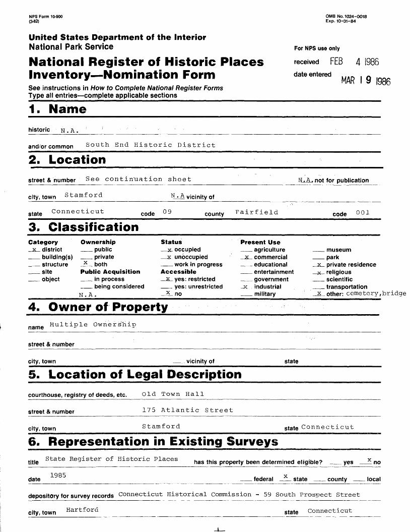
National Register of Historic Places Inventory Nomination FormSee instructions in How to Complete National Register FormsType all entries complete applicable sections _______________
1. Name
For NFS use only
received FEB
date entered
4 1986
MAR I 9 1986
historic . A .
and/orcommon South End Historic District
2. Locationstreet & number See continuation sheet N.A. not for publication
city, town Stamford vicinity of
state Connecticut code county Fairfield code 001
3. ClassificationCategory
x district building(s)structuresiteobject
Ownershippublicprivate
x bothPublic Acquisition
in processbeing considered
N.A.
Status_ 2C. occupied _ 2c unoccupied
work in progressAccessible
x yes: restricted yes: unrestricted
x no
Present Useagriculture
% commercial educationalentertainmentgovernment
.3f industrial military
museumpark
x private residence x- religious
scientifictransportation
x other: cemetery, bridge
4. Owner of Propertyname Multiple Ownership
street & number
city, town vicinity of state
5. Location of Legal Descriptioncourthouse, registry of deeds, etc. Old Town Hall
street & number 175 Atlantic Street
city, town Stamford state Connecticut
6. Representation in Existing Surveys__________State Register of Historic Places has this property been determined eligible? __ yes _2i notitle
date1985 federal x state county local
depository for survey records Connecticut Historical Commission - 59 South Prospect Street
city, town Hartford state Connecticut
7. Description
Conditionexcellent
x goodx fair
Check one Check onex deteriorated x unaltered x original site
ruins x altered moved dateunexposed
Describe the present and original (if known) physical appearance
The South End Historic District is a late-nineteenth-century and early-twentieth century residential/industrial neighborhood occupying most of the low-lying peninsula located south of the downtown Stamford business district, separated from it by the railroad. Its main north-south thoroughfares are: Washington Boulevard, Atlantic Street, and Pacific Street, while the main east-west thoroughfare is Henry Street.
The district includes 449 buildings, almost a fifth of them industrial, as well as an early naturalistic cemetery and an iron bridge. Most structures date between 1870 and 1930 and include examples of the following styles: Italianate, French Second Empire, Victorian Gothic, Queen Anne, and Colonial Revival. Institutional buildings include four churches, a community center (formerly a school), and a fire station. Industrial structures are found throughout the area but are concentrated in the northeast corner of the district, dominated by the former Yale & Towne Lock Works, the largest industrial complex in Stamford. Although there are several former mansions remaining on the relatively high ground west of Atlantic Street, the bulk of the residential building stock consists of working-class housing such as Victorian Gothic cottages, nineteenth-century vernacular row houses, and early-twentieth- century three-deckers.
The north boundary is drawn to exclude two areas between it and the railroad, the traditional northern boundary of the South End. The first area, between the Mill River and Atlantic Street consists mainly of recently built or extensively modernized commercial and industrial structures, including the new railroad station. The second area consists of the northeastern corner of the peninsula, primarily occupied by large parking lots and industrial structures less than fifty years old. The eastern boundary follows the shoreline south to the hurricane barrier, while the zig-zag southern boundary excludes Kosciuszko Park and the Yacht Haven marina, both developed less than 50 years ago, as well as an adjacent corporate office park, several rows of recently built warehouses, a large factory district, and the industrial waterfront facing the west branch of the harbor. The west boundary follows the remaining shoreline of the Mill River (See map).
The principal entrance to the South End is at the Atlantic Street railroad underpass which faces a fork in the highway, Atlantic Street continuing to the right, and Manhattan Street to the left. Occupying this corner is a wood-shingled commercial structure built in many stages, showing a gabled roof, flat-roofed tower and wings, and bracketed cornices of Italianate derivation. The first block of Atlantic Street's east side includes a row of commercial buildings, the most notable being the Conroy Building and the Wassing Block, three-story brick buildings with corbeled cornices (Photograph #1). To the south are several Queen Anne residential structures followed by a brick factory building with a corbeled cornice and segmental-arched windows, and a row of four identical mansard-roofed tenements (#656-690), each showing gabled dormers, bracketed cornices, and a two-story front porch with turned posts, curvilinear brackets, and lattice-work railings (Photograph #2). The second block, south of Henry Street, shows a row of three Queen Anne
8. Significance
Period Areprehistoric1400-14991500-15991600-1699 X
X 1700-1799
X 1800-1899
x 1900-
Criteria A,C.
Specific dates See
as of Significance Carcheology-prehistoric archeology-historic agriculture architecture art commerce communications
Item 7-Inventory
heck and justify belowcommunity planningconservationeconomicseducationengineeringexploration/settlement
x industryinvention
Builder/Architect See
landscape architecture religionlaw scienceliteraturemilitarymusicphilosophypolitics/government
Item 7 - Inventory
sculpturesocial/humanitarian theatertransportation
x other (specify)Ethnic History
Statement of Significance (in one paragraph)
The South End Historic District is of local historical significance because it is Stamford's best example of a "walking city", where residents lived within walking distance of their jobs, as well as the primary staging area for the city's greatest variety of ethnic groups (Criterion A). The district is also of local architectural importance because of the variety of styles and building types represented, including Italianate mansions, Victorian Gothic cottages, Colonial Revival and French Second Empire three-deckers, and an ecclesiatical complex with Shingle and Victorian Gothic elements designed by H. H. Holly and H. Edward Ficken (Criterion C).
Historical Significance
The South End is basically the result of the city's largest employer, the Yale & Towne Lock Works, locating here in 1868 and stimulating the development of adjacent residential neighborhoods, which were formed between 1868 and 1929. Before this urbanization the South End consisted primarily of about a dozen country estates on the relatively high ground between the Mill River and Atlantic Street, a large farm occupying the low, flat land in the center of the peninsula, and Woodland Cemetery, an early naturalistic cemetery (1859) occupying the rolling land along the eastern shore, overlooking the Stamford Harbor. Only four structures survive from this period in the former "country estate" section: the Peter de Mill House (c.1780) at 25 Pulaski Street, the David Comstock House (c.1850) at 779 Atlantic Street, 753 Atlantic Street (1852), and the Duncan Phyfe House (1852) at 4 Pulaski Street. Several more modest structures also survive from a small commercial area centering on Manhattan Street, which developed in response to the first Stamford Railroad Station locating along its north side in 1849.
The principal period of growth which established the symbiotic residential/ industrial character of the South End commenced with the large subdivision of Hoytville, laid out by George Hoyt in 1868 across the flat, low-lying land that takes up most of the penisula. In that same year Henry Towne of the Yale & Towne Lock Works bought up most of the lots north of Henry Street and started construction on the first of his factory buildings. Within a few years a definite community was taking shape. Hoyt built several types of housing according to income level and designated certain areas for each type: the least expensive was the frame row house, located primarily on Ludlow Street and Ludlow Place, followed by the double house (none of which remain today), and the front-gabled cottages on Henry, Cedar, and Stone Streets. Middle-class houses were located between the less expensive eastern sector and the estate area west of Atlantic Street; only a few survive today, located on Henry and Ludlow Streets. Henry Towne built the largest private dwelling in the estate area for himself. The other large subdivision of this period was that of Henry Skelding in 1887, which included the land north of Henry Street and east of Atlantic Street, with most of the lots lining the new street called Garden Street.
One of the foremost furniture designers of his time, Phyfe probably used this house
briefly as a summer residence until his death in 1854.
9. Major Bibliographical References
See Continuation Sheet
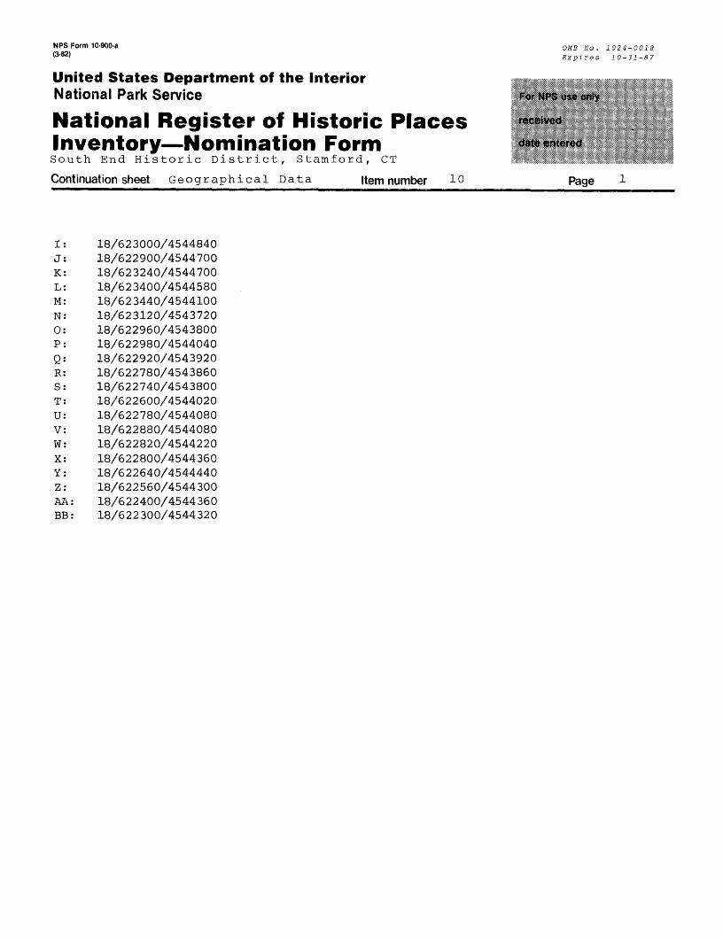
10. Geographical DataAcreage of nominated property 177.1Quadrangle name Stamford, Conn.
UTM References
A |l|8| |6|2,2|2,8,0| I^Sl^lS^O)
Zone Easting Northing
C|l|8| 1612,216,8,01 14,514,416,0,01
El Ml H 2 , 2I 5 I 8 .°I I 4 . 5 ! 4 . 4 ! 7 . 0 . 0 !
G I 1| 8| 1612,219,0,01. 14,514,418,6,01
Quadrangle scale 1:2400 °
1,8 ,612 21540 ,4 514 415.6 0 I I I I I I I
Zone Easting Northing
H 2 , 2 P,Q,Q| I 4 . 5 ! 4 . 1F I 11 8l lei 2l2J7i 6l Q! |4|6| 4| 4| 8| 6| Q|
H I II fil I ftl 21 2J9I 61 Q! UlSl 4i 4J 9l 61 ol
Verbal boundary description and justification
See continuation sheet
List all states and counties for properties overlapping state or county boundaries
state N.A._________________code N - A - county N>A -_________
state . code
N.A. . county
N.A
code
code
N.A,
N.A.
11. Form Prepared Byname/title Nils Kerschus , ^Edited by John Herzan, National Register Coordinator
organization Historic Neighborhood Preservation Prograir^ate August, 1985
street & number 96 Main street telephone 324-9317
city or town Stamford stateConnecticut
12. State Historic Preservation Officer CertificationThe evaluated significance of this property within the state is:
__ national __X_ state __ local
As the designated State Historic Preservation Officer for the National Historic Preservation Act of 1966 (Public Law 89- 665), I hereby nominate this property for inclusion in the National Register and certify that it has been evaluated according to the criteria and procedures set forth by the Natjpnal Park Service.
State Historic Preservation Officer signature
title John W. Shannahan, DirectotT Connecticut Historical Comm. date January 31, 1986
For NPS use onlylereby certify /that this property is included in the National Register
ys date
Keeper of the National Register
Attest date ~~
NPS Form 10-900-a (3-82)
OMB No. 1024-0018 Expires 10-31-87
United States Department of the InteriorNational Park Service
National Register of Historic Places Inventory Nomination FormSouth End Historic District, Stamford, CT
Continuation sheet Item number 2 Page
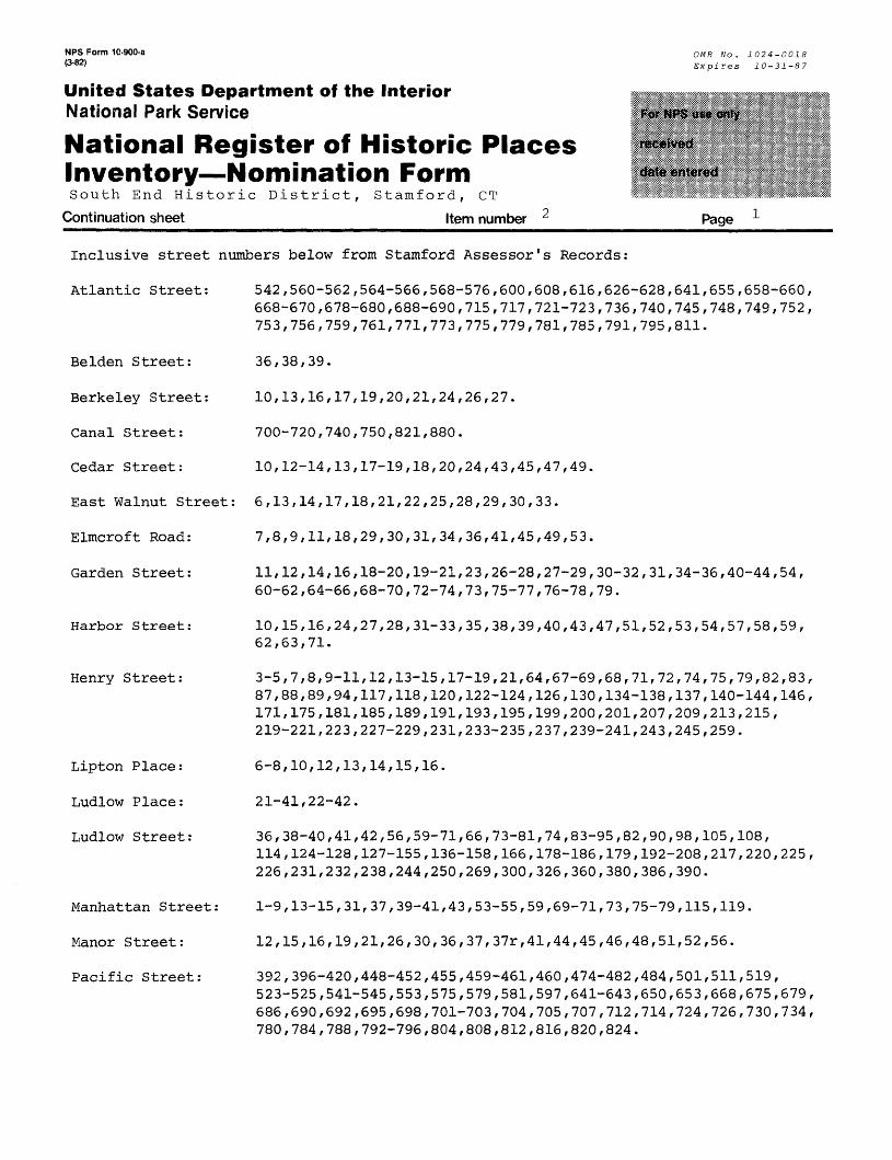
Inclusive street numbers below from Stamford Assessor's Records:
Atlantic Street: 542,560-562,564-566,568-576,600,608,616,626-628,641,655,658-660,668-670,678-680,688-690,715,717,721-723,736,740,745,748,749,752, 753,756,759,761,771,773,775,779,781,785,791,795,811.
Belden Street:
Berkeley Street:
Canal Street:
Cedar Street:
36,38,39.
10,13,16,17,19,20,21,24,26,27.
700-720,740,750,821,880.
10,12-14,13,17-19,18,20,24,43,45,47,49.
East Walnut Street: 6,13,14,17,18,21,22,25,28,29,30,33.
Elmcroft Road:
Garden Street:
Harbor Street:
Henry Street:
Lipton Place:
Ludlow Place:
Ludlow Street:
Manhattan Street:
Manor Street:
Pacific Street:
7,8,9,11,18,29,30,31,34,36,41,45,49,53.
11,12,14,16,18-20,19-21,23,26-28,27-29,30-32,31,34-36,40-44,54, 60-62,64-66,68-70,72-74,73,75-77,76-78,79.
10,15,16,24,27,28,31-33,35,38,39,40,43,47,51,52,53,54,57,58,59, 62,63,71.
3-5,7,8,9-11,12,13-15,17-19,21,64,67-69,68,71,72,74,75,79,82,83, 87,88,89,94,117,118,120,122-124,126,130,134-138,137,140-144,146, 171,175,181,185,189,191,193,195,199,200,201,207,209,213,215, 219-221,223,227-229,231,233-235,237,239-241,243,245,259.
6-8,10,12,13,14,15,16.
21-41,22-42.
36,38-40,41,42,56,59-71,66,73-81,74,83-95,82,90,98,105,108,114,124-128,127-155,136-158,166,178-186,179,192-208,217,220,225,226,231,232,238,244,250,269,300,326,360,380,386,390.
1-9,13-15,31,37,39-41,43,53-55,59,69-71,73,75-79,115,119.
12,15,16,19,21,26,30,36,37,37r,41,44,45,46,48,51,52,56.
392,396-420,448-452,455,459-461,460,474-482,484,501,511,519, 523-525,541-545,553,575,579,581,597,641-643,650,653,668,675,679, 686,690,692,695,698,701-703,704,705,707,712,714,724,726,730,734, 780,784,788,792-796,804,808,812,816,820,824.
NPS Form 10-900-a (3-82)
United States Department of the InteriorNational Park Service
National Register of Historic Places Inventory Nomination FormSouth End Historic District, Stamford, CT
Continuation sheet Item number 2
OMB No. 1024-0018 Expires 10-31-87
Page 2
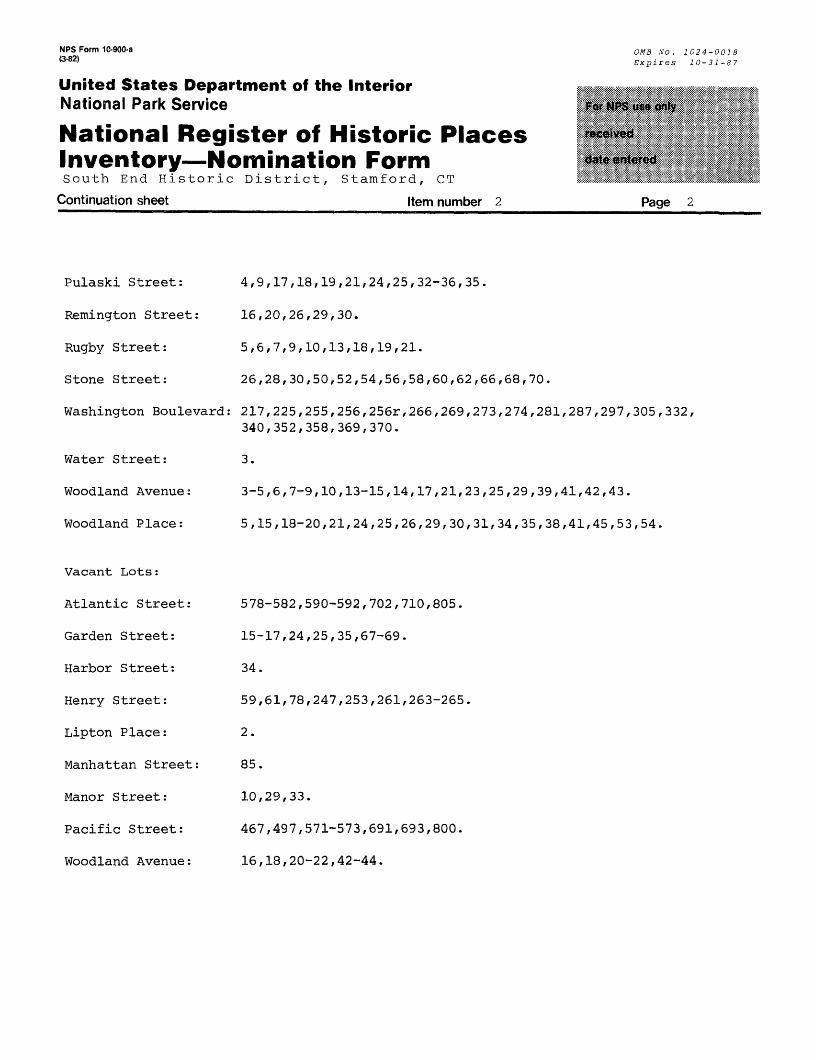
Pulaski Street: 4,9,17,18,19,21,24,25,32-36,35.
Remington Street: 16,20,26,29,30.
Rugby Street: 5,6,7,9,10,13,18,19,21.
Stone Street: 26,28,30,50,52,54,56,58,60,62,66,68,70.
Washington Boulevard: 217,225,255,256,256r,266,269,273,274,281,287,297,305,332,340,352,358,369,370.
Water Street: 3.
Woodland Avenue: 3-5,6,7-9,10,13-15,14,17,21,23,25,29,39,41,42,43.
Woodland Place: 5,15,18-20,21,24,25,26,29,30,31,34,35,38,41,45,53,54.
Vacant Lots:
Atlantic Street:
Garden Street:
Harbor Street:
Henry Street:
Lipton Place:
Manhattan Street:
Manor Street:
Pacific Street:
Woodland Avenue:
578-582,590-592,702,710,805.
15-17,24,25,35,67-69.
34.
59,61,78,247,253,261,263-265
2.
85.
10,29,33.
467,497,571-573,691,693,800.
16,18,20-22,42-44.
NPS Form 10-900-a (3-82)
United States Department of the InteriorNational Park Service
National Register of Historic Places Inventory Nomination FormSouth End Historic District, Stamford, CT
Continuation sheet Item number 6
OMB No. 1024-0018 Expires 10-31-87
Page
Title: Historic Resources Inventory, Stamford, Connecticut
Date: 1978 X Local
Depository for survey records: Connecticut Historical Commission59 South Prospect Street Hartford, Connecticut
Also available at: Municipal Office Building429 Atlantic Street Stamford, Connecticut
NPS Form 10-900-a OMB No . 10 24-0018 *3'82) Expires 10-31-87
United States Department of the InteriorNational Park Service
National Register of Historic Places Inventory—Nomination FormSouth End Historic District, Stamford, CT
Continuation sheet Description Item number 7 Page -1
dwellings, the most notable being #748 on the corner, featuring an L-shaped front porch with turned posts and a reverse-arched valance, and a hip-and-gabled roofline with sunburst peak ornaments. At the corner of Woodland Avenue is another Queen Anne dwelling, this one featuring an angled three-story corner tower with a bell-shaped roof. Woodland Avenue, an unusually wide thoroughfare extending easterly to Pacific Street, shows most of its structures on the south side, the most notable of which is the double house at #13-15. This building features clapboard siding, scalloped shingles, two-story polygonal bays, and a front porch with turned posts, lattice-work railings, a spindled valance, and an ogee-curved panel separating the two entrances. It is flanked by two pairs of three-decker tenements; the pair to the east (#17 & 21) shows full-length three-story porches surmounted with a double cornice, while the pair to the west features original clapboard siding and denticulated cornices.
On the west side of Atlantic Street the most notable structure is #715, a 3^- story gable-roofed tenement retaining its clapboard siding and wood shingles, and featuring an inset three-story front porch with Tuscan columns set on paneled pedestals (Photograph #3). At the intersection with Henry Street, the northwest corner is occupied by a flat-roofed frame commercial structure with a modillioned and denticulated cornice, while the southwest corner shows a three-story brick commercial structure with a curving pressed-metal cornice embossed with an egg-and-dart design. (Photograph #4). Other notable buildings include #753, a front-gabled Italianate with paired curvilinear brackets and paired round-arched attic windows, and a pair of tall gambrel-roofed Dutch Colonial Revivals (at #759 and #761) retaining their wood shingles, two-story polygonal bays, and two-story front porches. Occupying the hill to the west is Lipton Place, a U-shaped street lined with seven modest frame houses.
The western entrance to the South End is at the Pulaski Street Bridge, a wrought-iron lenticular through-truss bridge spanning the Mill River (Photograph #5). Pulaski Street immediately climbs a short steep hill and extends to Washington Boulevard. The most notable structure on its north side is the Peter deMill house, a two-story wood-shingled structure that is the oldest in the district (Photograph #6). It features an inset two-story front porch, a Federal side-lit doorway, and quarter-round attic windows at the side gables. The south side's most important structure is the Holy Name Rectory, a three-story flat-roofed Italianate structure on the southwest corner of Washington Boulevard. It features original clapboard siding, curvilinear brackets projecting from a paneled frieze and supporting the overhanging roof eaves, and a wrap-around porch featuring turned posts, a lattice-work valance, a porte-cochere, and a polygonal corner belvedere (Photograph #7). To the right is the Oliver Scofield House, partially obscured by a brick addition but still retaining its slate-shingled mansard roof punctuated by segmental-arched dormers and a central gambrel-roofed dormer with cutwork bargeboards. Proceeding southerly from Pulaski Street is Berkeley Street, a dead-end street overlooking the Mill River and showing mostly 2^-story frame structures, the most notable being #13 and #17, twin Colonial Revivals retaining their clapboard-and-shingle covering, polygonal bays, stained- glass sidelights and stair-windows, and two-story Tuscan-columned front porches (Photograph #8).
NFS Form 10-900-a OMB No _ 102 4-0018*3'82* Expires 10-31-87
United States Department of the InteriorNational Park Service
National Register of Historic Places Inventory—Nomination FormSouth End Historic District, Stamford, CT
Continuation sheet Description Item number 7 Page 2
Washington Boulevard, which runs perpendicular to Pulaski Street/ is dominated on its east side by the Church of the Holy Name of Jesus, a brick neo-Romanesque edifice featuring a campanile tower with an arched louvered belfry surmounted by a small gold dome, arched corbeling at the gables, a triple-door portal and a wheel- type rose window (Photograph #9). Most of the structures to the south are 2^-story Queen Anne dwellings with three-story towers, panelled bargeboards, and L-shaped front porches. The more notable include #287 and #281, both showing a polygonal tower and alternate bands of clapboards and ornamental-cut shingles, but having different porches, #287 showing paired Tuscan columns on fieldstone pedestals and #281 showing turned posts and lattice-work rails. #269 is similar but more complex, showing a wrap-around porch with a spindle valance, a railing of turned balusters atop a shingled base, a smaller second-story porch, and a square tower with a bracketed pyramidal roof (Photograph #10).
Henry Street, the district's principal east-west thoroughfare, begins at a dead end on the bluff overlooking the Mill River. This initial block shows eight houses, all of Colonial Revival influence with various rooflines and porches, some with stained glass stair-windows. The most notable is #9, on the south side, showing a front porch with fluted, battered columns resting on paneled pedestals connected by turned balustrades. The next block between Washington Boulevard and Atlantic Street, is dominated by three-decker frame tenements, the most noteworthy on the north side, particularly #64 and #68, each showing twin full-height polygonal bays, a frieze and modillioned cornice continuing from the facade to the sides.
The third block of Henry Street, extending between Atlantic and Pacific Streets, is dominated on its south side by the South End Community Center, formerly a school. Built of brick, the building features concrete trim, most evident at the pilastered main entrance. The north side of the block features a row of three Queen Anne dwellings with paneled bargeboards and front porches with turned posts and curvilinear brackets. #126 and #130 also show polygonal bays and small shed-roofed second-story porches. Also notable are two three-story structures: the Daly, a brick apartment house with a corbelled cornice, segmental-arched windows, and terra-cotta pateras and panels, and #146, a frame tenement retaining its clapboard-and-shingle covering, polygonal bays, and paneled frieze and modillioned cornice (Photograph#11) .
The eastern end of Henry Street, between Pacific and Canal Streets, is dominated on its north side by a long six-story row of connected industrial structures, part of the Yale & Towne factory complex (Photograph #12). The south side of the street shows 24 structures, mostly gabled frame houses lh to 2h stories high with front porches. Among the more notable is #185, a frame-and-masonry Victorian Gothic dwelling with a hip-and-gabled roofline, fieldstone walls with brick quoins, and a front porch with turned posts, projecting curvilinear brackets, and turned stickwork railings. #195 is a French Second Empire dwelling with a very low mansard roof with octagonal windows, a bracketed cornice, and a front porch with chamfered posts and
NFS Form 10-900-a OMB Vo _ 1024-0018(3'82) Expires 10-31-87
United States Department of the InteriorNational Park Service
National Register of Historic Places Inventory—Nomination FormSouth End Historic District, Stamford, CT
Continuation sheet D e s c r i p t i o n Item number 1
cutwork railings. To the east is #199, a two-story Italianate dwelling with a flat roof showing a bracketed cornice forming central gables, and a front porch with chamfered posts (Photograph #13). Also notable is #213, a Queen Anne dwelling with its original front porch and a cutwork peak ornament. This end of Henry Street shows a number of l^-story cottages, originally Victorian Gothic in style; the least altered is #243, which has retained its wood-shingle covering and its gabled entry hood supported by large chamfered brackets.
Returning to the district's main entrance at the Atlantic Street railroad underpass, Manhattan Street runs to the east showing mostly two-story commercial structures, all on its south side. The most notable structure is #75-79, a flat-roofed frame building featuring a full-length second-story balcony supported by large knee-brace brackets and distinguished by turned posts and curvilinear brackets (Photograph #14). Garden Street, running south from Manhattan Street to Henry Street, is primarily residential at both ends, but is industrial at the middle. Over half of its structures are similarly designed frame double houses with side-gabled roofs, most also showing a central gable. The best preserved is #18-20, retaining its wood-shingled covering, cutwork bargeboards, and front porch with turned posts, curved brackets, and cutwork railings (Photograph #15).
Pacific Street is the third primary north-south street in the district, beginning at a dead end next to the railroad tracks and running south to Washington Boulevard. Its west side is primarily made up of industrial and commercial structures. South of Woodland Avenue is a row of corniced flat-roofed structures, the last of which (#707) is a frame three-decker with a full-length three-story entablature with a paneled frieze and a modillioned cornice. On the east side of Pacific Street, the first two blocks are primarily industrial, the most important structures being #396-420 (corner of Manhattan Street), a six-story brick factory building featuring five-story brick pilasters (surmounted by terra-cotta capitals) connected by arches over the recessed window bays, and surmounted by a low top story with a corbelled cornice (Photograph #16); and #484, a three-story brick factory building showing highed arched first-story openings.
The third block consists of the former Yale & Towne industrial complex, a 20-acre expanse with 22 buildings, most of them brick structures one to six stories tall with flat, gabled or monitor roofs; recessed corbeled window bays, and large segmental-arched windows. The six-story brick row along Pacific Street has been demolished, but the corresponding row along Henry Street remains, most of it consisting of more recently built reinforced concrete structures (Photograph #12). Among the more notable individual buildings are #7, a Georgian Revival structure formerly housing the employment office (Photograph #17), and #14/14A, surmounted with a low slate-shingled mansard roof with gabled dormers and pyramidal-roofed skylights.
The blocks south of Henry Street are primarily residential and dominated by a fire station and three churches. The Engine & Hose Co. #2, located at the southeast corner with Henry Street, is a two-story brick building with quoins, pilasters, a
NPS Form 10-900-a (3-82)
United States Department of the InteriorNational Park Service
National Register of Historic Places Inventory—Nomination FormSouth End Historic District, Stamford, CT
Continuation sheet Description Item number 7
OMB Wo. 1024-0018 Expires 10-31-87
Page 4
corbeled cornice, and narrow round-arched windows. To the south is the Pentecostal Mission (formerly a Greek Orthodox Church)/ a gabled brick church flanked by flat-roofed towers. Occupying the northeast corner of Woodland Place and Pacific Street is the three-building complex of St. Luke's Chapel, a Shingle-style structure consisting of a large shingle-covered gable/ a steeply pitched off-side pyramidal-roofed tower resting on a random ashlar first-story, and a gable-roofed entrance vestibule with a shingled Syrian arch (Photograph #18). The lower, gable-roofed south wing shows a stained-glass windows and connects to the parish house, a Victorian Gothic structure with a brick-trimmed random-ashlar first-story surmounted by a narrow band of half-timbering and a polygonal-hipped roof. The facade features a gable-roofed vestibule with prominent curvilinear-cut bargeboards supported on projecting beams, a circular conical-roofed stair tower, and a pyramidal-roofed tower at the southeast corner (Photograph #19). To the rear is the adjacent rectory, a 2^-story Shingle-style structure set on a high buttressed random-ashlar basement and marked by a second-story turret rising at the intersection with the connecting west wing which shows large curvilinear beam ends supporting the second-story overhang. The roof consists of shingled gables rising from a pent-eaved base and crowned with pent-eaved, half-timbered peaks.
The southeast corner is occupied by the Church of God (originally St. Mary's Russian Orthodox Church), a gable-roofed brick-and-frame church with a projecting square tower surmounted by small corner domes crowned by Greek crosses and a central polygonal cupola surmounted by a bulbous roof crowned with another Greek cross.
Ludlow Street extends easterly from Pacific Street, one block south of Henry Street, to the Stamford Canal. Its more notable houses include two originally identical French Second Empire residences at #74 and #82, both retaining a very low mansard roof set on a bracketed cornice, a bracketed front porch, and the original covering of wood shingles. Further east are three frame row-house blocks (#136-158, 178-186,192-208), each showing a low Halifax-mansard roof and transomed entrances (Photograph #22). Running to the north, after the last rowhouse/ is Ludlow Place, a short dead-end street lined with two identical frame row-house blocks facing each other across the street, their full-length front porches flush to the sidewalk (Photograph #20). At the eastern end of Ludlow Street's south side is the former Richards and Company Chemical Works, a maze-like arrangement of two and three-story brick factory buildings, notable for the covered entry to the complex and the former power plant which shows large round-arched windows. Opposite the complex's entrance is Canal Street, which runs in a northerly direction, parallel to the Stamford Canal. Among its more notable buildings/ all industrial, are #700-720, a three-story brick structure with recessed, corbeled window bays, a corbeled cornice and a gabled roof. At the northeast corner of Canal and Ludlow Streets is a two-story brick building showing concrete quoins and pilasters with chamfered top edges of Modernistic influence.

NFS Form 10-900-a OMB No _ 1024-0018
@"82) Expires 10-31-87
United States Department of the InteriorNational Park Service
National Register of Historic Places Inventory—Nomination FormSouth End Historic District, Stamford, CT
Continuation sheet Description_________Item number 7_____________Page 5
Intersecting Ludlow Street near its midpoint is Cedar Street, which runs southerly from Henry Street to Stone Street, and features a row of originally identical Victorian Gothic cottages on its east side. Each structure shows a steeply pitched, front-gabled roof and a high basement. Cutwork bargeboards are retained on #18 and #24, the latter also showing a pointed wooden finial (Photograph #21). Stone Street is an L-shaped street beginning at Woodland Place and ending at the Richard's Chemical complex. It features a row of nine originally identical front-gabled cottages on its north side, facing Woodland Cemetery. Encompassing 35 acres of hilly landscaped terrain, the cemetery extends east and south to Stamford Harbor, providing a marked contrast to the flat topography and heavily built-up character of the adjacent industrial and residential areas. Its main entrance is at the eastern end of Woodland Place (which extends westerly to Pacific Street) and is flanked by cut-stone gateposts. To the west is the cemetery office (#54 Woodland Place), a Victorian Gothic cottage constructed of brick-trimmed random ashlar and distinguished by a gabled entry porch with a crossed-diagonal-beam peak ornament with open-work cut-outs. To the north are several original clapboarded barns.
The blocks between Pacific Street and Woodland Cemetery are collectively known as Greyrock Manor, a neighborhood developed between 1910 and 1930. It consists of eight streets lined primarily with front-gabled frame houses, generally l^-story cottages or 2^-story single-and-multi-family dwellings, many showing two-story front porches and polygonal bays (Photographs #23 and #24). The east-west streets (Woodland Place, East Walnut Street, Remington Street, and Belden Street) run between Pacific Street and Elmcroft Road. Running diagonally to the southwest from Belden Street are Harbor Street and Manor Street, while Rugby Street runs to the southeast off Harbor Street.
NPS Form 10-900-a (3-82)
OMB No. 1024-0018 Expires 10-31-87
United States Department of the InteriorNational Park Service
National Register of Historic Places Inventory—Nomination FormSouth End Historic District, Stamford, CT
Continuation sheet Description Item number 7 Page
INVENTORY OP STRUCTURES
Format:
Contributing (C) or Non-contributing (NC), Address, Common Name (Historic Name), Date, S tyle, Architect.
(C), 542 Atlantic Street, c.1895, Commercial Vernacular (Photograph #1).(C), 560-562 Atlantic Street, Conroy Building, c.1898, Commercial Vernacular
(Photograph #1) .564-566 Atlantic Street, 1932, Commercial Vernacular (Photograph #1).568-576 Atlantic Street, Wassing Block, c.1897, Commercial Vernacular withRomanesque Revival elements (Photograph #1).
(C), 600 Atlantic Street, c.1890, Vernacular (Photograph #1). (C), 608 Atlantic Street, c.1890, Queen Anne (Photograph #1). (C), 616 Atlantic Street, c.1890, Queen Anne. (C), 626-628 Atlantic Street, (Blickensderfer Typewriter Factory), 1895,
Industrial Vernacular. (C), 641 Atlantic Street, Bosak Funeral Home, c.1870, Italian Villa, attributed to
H. H. Holly (architect).(NC), 655 Atlantic Street, 1948, Commercial Vernacular. (C), 658-660 Atlantic Street, c.1890, French Second Empire with Queen Anne
elements. (C), 668-670 Atlantic Street, c.1890, French Second Empire with Queen Anne
elements (Photograph #2). (C), 678-680 Atlantic Street, c.1893, French Second Empire with Queen Anne
elements (Photograph #2).(C), 688-690 Atlantic Street, c.1893, French Second Empire with Queen Anne elements (C), 715 Atlantic Street, 1910, Colonial Revival (Photograph #3). (NC), 717 Atlantic Street, 1935, Commercial Vernacular. (C), 721-723 Atlantic Street, 1913, Commercial Vernacular with Italian Renaissance
Revival elements.(C), 736 Atlantic Street, c.1895, Queen Anne. (NC), 740 Atlantic Street, 1957, Commercial Vernacular. (C), 745 Atlantic Street, 1913, Commercial Vernacular with Italian Renaissance
Revival elements (Photograph #4). (C), 748 Atlantic Street, c.1885, Queen Anne.(NC), 749 Atlantic Street, 1978, Commercial Vernacular (Photograph #4). (C), 752 Atlantic Street, c.1885, Queen Anne. (C), 753 Atlantic Street, c.1852, Italianate (Photograph #4). (C), 756 Atlantic Street, c.1885, Vernacular with Queen Anne elements. (C), 759 Atlantic Street, c.1905, Dutch Colonial Revival.
NPS Form 10-900-a (3-82)
OMB No. 1024-0018 Expires 10-31-87
United States Department of the InteriorNational Park Service
National Register of Historic Places Inventory—Nomination FormSouth End Historic District, Stamford, CT
Continuation sheet Description Item number 7 Page 7
761 Atlantic Street, c.1905, Dutch Colonial Revival.771 Atlantic Street, c.1905, Colonial Revival.773 Atlantic Street, c.1925, Colonial Revival.775 Atlantic Street, 1925, Vernacular with Modernistic elements.779 Atlantic Street, 1928, Commercial Vernacular.781 Atlantic Street (David Comstock House), c.1850, Vernacular withGothic Revival elements.785 Atlantic Street, 1910, Vernacular.791 Atlantic Street, 1913, Vernacular.795 Atlantic Street, 1922, Industrial Vernacular.811 Atlantic Street, c.1891, Queen Anne.36 Belden Street, 1923, Vernacular.38 Belden Street, 1924, Vernacular.39 Belden Street, 1970, Industrial Vernacular.10 Berkeley Street, 1930, Vernacular.13 Berkeley Street, 1927, Colonial Revival (Photograph #8).16 Berkeley Street, 1929, Vernacular.17 Berkeley Street, 1927, Colonial Revival (Photograph #8).19 Berkeley Street, 1981, Vernacular.20 Berkeley Street, 1929, Vernacular.21 Berkeley Street, 1928, Vernacular. 24 Berkeley Street, 1968, Vernacular.26 Berkeley Street, c.1865, Vernacular.27 Berkeley Street, 1950, Vernacular.700-720 Canal Street, (Lincrusta-Walton Factory), 1883, Industrial Vernacular, 740 Canal Street, (Lincrusta-Walton Oxydizing House), 1883, Industrial Vernacular.750 Canal Street, c.1915, Industrial Vernacular. 821 Canal Street, 1925, Industrial Vernacular.880 Canal Street, c.1925, Commercial Vernacular with Modernistic elements. 10 Cedar Street, 1868, Vernacular. 12-14 Cedar Street, c.1870, Vernacular. 13 Cedar Street, c.1870, Vernacular. 17-19 Cedar Street, 1981, Industrial Vernacular.18 Cedar Street, c.1870, Vernacular with Victorian Gothic elements. 20 Cedar Street, c.1870, Vernacular.24 Cedar Street, c.1870, Vernacular with Victorian Gothic elements (Photograph #21).43 Cedar Street, c.1870, Vernacular with Italianate elements. 45 Cedar Street, (Bishop Box Company), 1906, Industrial Vernacular. 47 Cedar Street, c.1870, Vernacular. 49 Cedar Street, 1922, Vernacular. 6 East Walnut Street, 1912, Vernacular with Queen Anne elements.
13 East Walnut Street, 1911, Vernacular.14 East Walnut Street, 1910, Vernacular.
NPS Form 10-900-a (3-82) 0MB No. 1024-0018
Expires 10-31-87
United States Department of the InteriorNational Park Service
National Register of Historic Places Inventory—Nomination FormSouth End Historic District, Stamford, CT
Continuation sheet Description Item number 7 Page
(c),(C),(C),(C),(C),(C),(C),(C),(C),(C),(C),(C),(C),(NC),(C),(C),(C),(C),(C),(C),(C),(C),(C) /(C),
(C), (C),(c),(C), (C), (C), (C), (C), (C), (C), (C),(NO, (c),(C), (C), (C), (C),(c),(C), (C), (C) ,
45 Elmcroft Road, 49 Elmcroft Road/
17 East Walnut Street, 1911, Vernacular.18 East'Walnut Street, 1911, Vernacular.21 East Walnut Street, 1920, Vernacular.22 East Walnut Street, 1916, Vernacular with Colonial Revival elements, 25 East Walnut Street, 1920, Vernacular.28 East Walnut Street, 1916, Vernacular29 East Walnut Street, 1912, Vernacular with Craftsman elements.30 East Walnut Street, 1913, Vernacular. 33 East Walnut Street, 1912, Vernacular.7 Elmcroft Road, 1922, Vernacular.8 Elmcroft Road, 1931, Vernacular.9 Elmcroft Road, 1930 Vernacular.
11 Elmcroft Road, 1923, Vernacular. 18 Elmcroft Road, 1940, Industrial Vernacular.29 Elmcroft Road, 1912, Colonial Revival.30 Elmcroft Road, 1924, Vernacular.31 Elmcroft Road, 1912, Vernacular.34 Elmcroft Road, c.1920, Vernacular with Queen Anne elements.36 Elmcroft Road, c.1920, Commercial Vernacular.41 Elmcroft Road, 1925, Vernacular.
1925, Vernacular.1925, Vernacular.
53 Elmcroft Road, 1927, Vernacular.11 Garden Street, (Blickensderfer Typewriter Factory), c.1891, Industrial Vernacular.12 Garden Street, c.1890, Vernacular.14 Garden Street, 1930, Commercial Vernacular.16 Garden Street, c.1890, Vernacular.18-20 Garden Street, c.1890, Queen Anne (Photograph #15).19-21 Garden Street, c.1890, Vernacular with Queen Anne elements. 23 Garden Street, c.1895, Queen Anne.26-28 Garden Street, c.1890, Queen Anne.27-29 Garden Street, c.1890, Queen Anne.30-32 Garden Street, c.1890, Queen Anne.31 Garden Street, c.1890, Vernacular.34-36 Garden Street, c.1890, Vernacular with Queen Anne elements.40-44 Garden Street, 1944, Industrial Vernacular.54 Garden Street, c.1910, Industrial Vernacular.60-62 Garden Street, c.1890, Queen Anne.64-66 Garden Street, c.1891, Queen Anne.68-70 Garden Street, c.1891, Vernacular with Queen Anne elements.72-74 Garden Street, c.1890, Vernacular with Queen Anne elements.73 Garden Street, 1925, Vernacular.75-77 Garden Street/ 1903, Vernacular with Queen Anne elements.76-78 Garden Street, c.1890, Vernacular with Queen Anne elements. 79 Garden Street, 1896, Queen Anne.
NPS Form 10-900-a (3-82) OMB No. 1024-0018
Expires 10-31-87
United States Department of the InteriorNational Park Service
National Register of Historic Places Inventory—Nomination FormSouth End Historic District, Stamford, CT
Continuation sheet Description Item number 7 Page
(C), (C), (c), (C),(NC),(NC) ,(C),(C),(C),(C),(C),(C)-,(c),(C),(C),(C),(C),(C),(C),(C),(NC) ,
(C),(C),(C),(C),(C),(C),(C),(C),(C),(C),(C),(C),(C),(C),(c),(C),(C),(C),(NC),(C),(C),(C),(C) ,(C),
58 Harbor Street59 Harbor Street
10 Harbor Street, 1913, Vernacular.15 Harbor Street, 1922, Vernacular.16 Harbor Street, 1929, Colonial Revival. 24 Harbor Street, 1918, Vernacular.27 Harbor Street, 1978, Industrial Vernacular.28 Harbor Street, 1954, Industrial Vernacular. 31-33 Harbor Street, c.1870, Vernacular. 35 Harbor Street, c.1910, Vernacular.38 Harbor Street, 1927, Vernacular.39 Harbor Street, c.1910, Vernacular.40 Harbor Street, 1923, Vernacular. 43 Harbor Street, c.1910, Vernacular. 47 Harbor Street, c.1910, Vernacular.51 Harbor Street, c.1910, Vernacular (Photograph #23)..52 Harbor Street, c.1910, Vernacular.53 Harbor Street, 1927, Vernacular (Photograph #23).54 Harbor Street, 1911, Vernacular.57 Harbor Street, 1923, Vernacular (Photograph #23).
1912, Vernacular.c.1910, Vernacular (Photograph #23).
62 Harbor Street, 1974, Industrial Vernacular.63 Harbor Street, c.1910, Vernacular. 71 Harbor Street, 1925, Vernacular. 3-5 Henry Street, 1914, Vernacular.7 Henry Street, 1909, Colonial Revival.8 Henry Street, 1924, Vernacular with Colonial Revival elements.9-11 Henry Street, 1909, Colonial Revival.12 Henry Street, 1926, Vernacular with Colonial Revival elements.13-15 Henry Street, 1909, Vernacular with Colonial Revival elements17-19 Henry Street, 1908, Vernacular.21 Henry Street, 1914, Dutch Colonial Revival.64 Henry Street, 1915, Colonial Revival.67-69 Henry Street, 1923, Eclectic.68 Henry Street, 1914, Colonial Revival.71 Henry Street, 1923, Eclectic.72 Henry Street, 1901, Queen Anne.74 Henry Street, 1898, Queen Anne.75 Henry Street, c.1907, Vernacular. 79 Henry Street, c.1907, Vernacular.82 Henry Street, 1929, Commercial Vernacular.83 Henry Street, c.1907, Vernacular.87 Henry Street, c.1907, Vernacular.88 Henry Street, 1906, Colonial Revival.89 Henry Street, 1911, Vernacular.94 Henry Street, 1906, Colonial Revival.
NPS Form 10-900-a (3-82)
OMB No. 1024-0018 Expires 10-31-87
United States Department of the InteriorNational Park Service
National Register of Historic Places Inventory — Nomination Form
South End Historic District, Stamford, CT Continuation sheet Description Item number 7 Page 10
117 Henry Street, 1972, Commercial Vernacular.118 Henry Street, Yale Apartments, 1907, Vernacular.120 Henry Street, Yale Apartments, 1907, Vernacular.122-124 Henry Street, c.1895, Queen Anne.126 Henry Street, c.1895, Queen Anne.130 Henry Street, c.1895, Queen Anne.134-138 Henry Street, c.1890, Vernacular with Queen Anne elements.137 Henry Street, South End Community Center (Woodland Avenue School), c.1925,Vernacular with Georgian Revival elements.140-144 Henry Street, The Daly, c.1905, Italian Renaissance Revival(Photograph #11).146 Henry Street, 1923, Colonial Revival (Photograph #11).171 Henry Street, c.1885, Vernacular.175 Henry Street, c.1885, Queen Anne.181 Henry Street, c.1885, Vernacular.185 Henry Street, c.1870, Victorian Gothic.189 Henry Street, c.1890, Queen Anne.191 Henry Street, c.1893, Queen Anne.193 Henry Street, c.1880, Vernacular.195 Henry Street, c.1880, French Second Empire (Photograph #13).199 Henry Street, c.1880, Italianate (Photograph #13).201 Henry Street, c.1880, Vernacular.207 Henry Street, 1916, Vernacular.209 Henry Street, c.1870, Vernacular with Victorian Gothic elements.213 Henry Street, c.1895, Queen Anne.215 Henry Street, 1976, Industrial Vernacular.219-221 Henry Street, 1973, Industrial Vernacular.223 Henry Street, c.1870, Vernacular.227-229 Henry Street, 1914, Vernacular with Colonial Revival elements.231 Henry Street, 1868, Vernacular.233-235 Henry Street, 1911, Vernacular.237 Henry Street, 1868 (remodelled c.1895), Vernacular with QueenAnne elements.239-241 Henry Street, c.1892, Vernacular.243 Henry Street, 1868, Victorian Gothic.245 Henry Street, c.1891, Vernacular.259 Henry Street, c.1900, Vernacular.6-8 Lipton Place, 1913, Vernacular with Dutch Colonial Revival elements.10 Lipton Place, 1923, Vernacular.12 Lipton Place, 1908, Vernacular.13 Lipton Place, 1907, Vernacular.14 Lipton Place, 1907, Vernacular.15 Lipton Place, 1907, Vernacular.16 Lipton Place, c.1905, Vernacular.
NFS Form 10-900-a (3-82)
United States Department of the InteriorNational Park Service
National Register of Historic Places Inventory—Nomination Form
South End Historic District, Stamford, CT
Continuation sheet Description Item number 7
OMB No. 1024-0018 Expires 10-31-87
Page 11
82 Ludlow Street, 83-95 Ludlow Street
(NC) , (C),
(NC) , (C),
(C), (C), (C), (C), (C), (C), (C), (C), (C), (C),
(C),
(C),
(C),
21-41 Ludlow Place, c.1870, Vernacular (Photograph #20).22-42 Ludlow Place, c.1870, Vernacular (Photograph #20). 36 Ludlow Street, 1907, Industrial Vernacular. 38-40 Ludlow Street, 1893, Vernacular.41 Ludlow Street, c.1870, French Second Empire.42 Ludlow Street, 1926, Vernacular. 56 Ludlow Street, c.1897, Vernacular. 59-71 Ludlow Street, 1972, Vernacular, 66 Ludlow Street, c.1880, Italianate. 73-81 Ludlow Street, 1972, Vernacular. 74 Ludlow Street, c.1880, French Second Empire.
c.1880, French Second Empire.1972, Vernacular.
90 Ludlow Street, c.1880, Vernacular with Italianate elements. 98 Ludlow Street, c.1880, Vernacular (front)/French Second Empire (rear).105 Ludlow Street, c.1870, Vernacular, 108 Ludlow Street, c.1880, Vernacular. 114 Ludlow Street, 1916, Vernacular. 124-128 Ludlow Street, c.1870, Vernacular. 127-155 Ludlow Street, c.1880, Vernacular.136-158 Ludlow Street, c.1880, Vernacular with French Second Empire elements.166 Ludlow Street, 1956, Industrial Vernacular.178-186 Ludlow Street, c.1895, Vernacular with French Second Empire elements (Photograph #22).179 Ludlow Street, 1946, Industrial Vernacular.192-208 Ludlow Street, c.1900, Vernacular with French Second Empire elements (Photograph #22) .217 Ludlow Street, c.1895, Vernacular with Colonial Revival elements. 220 Ludlow Street, 1907, Vernacular.225 Ludlow Street, c.1870, Vernacular with Italianate elements.226 Ludlow Street, 1907, Vernacular.
1907, Vernacular.1907, Vernacular with Queen Anne elements.1907, Vernacular with Queen Anne elements.
244 Ludlow Street, 1907, Vernacular.250 Ludlow Street, Vernacular with Queen Anne elements. 269 Ludlow Street, Richards & Company Building #1, 1920, Industrial Vernacular.269 Ludlow Street, Richards Vernacular.269 Ludlow Street, Richards Vernacular.269 Ludlow Street, Richards & Company Building #3B, 1929, Industrial Vernacular.
231 Ludlow Street,232 Ludlow Street, 238 Ludlow Street,
& Company Building #2, 1920, Industrial
& Company Building #3-3A, 1920, Industrial
NPS Form 10-900-a OMB vo 1024 _ OQ18
(3"82) Expires 10-31-87
United States Department of the InteriorNational Park Service
National Register of Historic Places Inventory—Nomination FormSouth End Historic District, Stamford, CT
Continuation sheet Description Item number 7 Page 12
(C) , 269 Ludlow Street, Richards & Company Building #4, 1920, IndustrialVernacular.
(C), 269 Ludlow Street, Richards & Company Building #5, c.1905, IndustrialVernacular.
(C), 269 Ludlow Street, Richards & Company Building #6, 1920, IndustrialVernacular.
(C), 269 Ludlow Street, Richards & Company Building #7, c.1920, IndustrialVernacular.
(C), 269 Ludlow Street, Richards & Company Building #8, c.1917, IndustrialVernacular.
(C), 269 Ludlow Street, Richards & Company Building #8A, c.1920,Industrial Vernacular.
(C), 269 Ludlow Street, Richards & Company Building #9, c.1917, IndustrialVernacular.
(C), 269 Ludlow Street, Richards & Company Building #10, c.1910, IndustrialVernacular.
(C), 269 Ludlow Street, Richards & Company Building #10A, c.1917, IndustrialVernacular.
(C), 269 Ludlow Street, Richards & Company Building #11-11A-11B, c.1915, IndustrialVernacular.
(C), 269 Ludlow Street, Richards & Company Building #12, c.1920, IndustrialVernacular.
(C), 269 Ludlow Street, Richards & Company Building #13, c.1920, IndustrialVernacular.
(C), 269 Ludlow Street, Richards & Company Building #14, c.1920, IndustrialVernacular.
(C), 269 Ludlow Street, Richards & Company Building #15, c.1915, IndustrialVernacular with neo-Classical elements.
(C), 269 Ludlow Street, Richards & Company Building #16, c.1915, IndustrialVernacular.
(C), 269 Ludlow Street, Richards & Company Building #17, c.1915, IndustrialVernacular.
(C), 269 Ludlow Street, Richards & Company Building #31, c.1920, IndustrialVernacular.
(NC), 390 Ludlow Street, (Atlantic Insulated Wire & Cable Co.), c.1905, IndustrialVernacular.
(C), 1-9 Manhattan Street, 1867, Commercial Vernacular with Italianate elements. (C), 13-15 Manhattan Street, c.1870, Commercial Vernacular with
Italianate elements.(NC), 31 Manhattan Street, c.1925, Commercial Vernacular. (NC), 37 Manhattan Street, c.1900, Commercial Vernacular. (NC), 39-41 Manhattan Street, 1953, Commercial Vernacular. (C), 43 Manhattan Street, 1917, Commercial Vernacular. (C), 53-55 Manhattan Street, 1917, Commercial Vernacular. (C), 59 Manhattan Street, 1916, Commercial Vernacular.
NPS Form 10-900-a (3-82)
OMB No. 1024-0018 Expires 10-31-87
United States Department of the InteriorNational Park Service
National Register of Historic Places Inventory—Nomination FormSouth End Historic District, Stamford, CT
Continuation sheet Descri P tlon |temnumber 7 Page
(C),(NC) , (C),
(C),(C),(C),(C),(C),(C),(C),(C),(NC),(C),(C),(C),(C) ,(C),(C),(C),(C),(NC) ,(C) ,(C),(C) ,
(C),
(C), (NC), (NC) , (C), (C),
(C),
(C),
69-71 Manhattan Street, c.1890, Commercial Vernacular.73 Manhattan Street, Little Zion Church of God in Christ, c.1950, Vernacular.75-79 Manhattan Street, c.1900, Commercial Vernacular with Queen Anne elements(Photograph #14).115 Manhattan Street, c.1855, Vernacular.119 Manhattan Street, 1907, Commercial Vernacular.12 Manor Street, 1929, Vernacular.15 Manor Street, 1910, Vernacular.16 Manor Street, 1929, Vernacular. 19 Manor Street, 1927, Vernacular. 21 Manor Street, 1925, Vernacular. 26 Manor Street, 1928, Vernacular. 30 Manor Street, 1950, Industrial Vernacular.36 Manor Street, 1925, Vernacular.37 Manor Street, 1926, Vernacular. 37r Manor Street, 1914, Vernacular. 41 Manor Street, 1917, Vernacular.44 Manor Street, 1926, Vernacular.45 Manor Street, 1912, Vernacular.46 Manor Street, 1914, Vernacular. 48 Manor Street, 1926, Vernacular.51 Manor Street, 1960, Industrial Vernacular.52 Manor Street, 1925, Vernacular.56 Manor Street, 1923, Vernacular.392 Pacific Street, Stamford Gas & Lighting Company, c.1870, IndustrialVernacular (Photograph #16) .396-420 Pacific Street, (Collender Billiard Table Manufactory), 1873,Industrial Vernacular with Romanesque Revival elements (Photograph #16).448-452 Pacific Street, 1859, Vernacular.455 Pacific Street, c.1870, Vernacular (Photograph #14).459-461 Pacific Street, c.1870, Italianate/Commercial Vernacular.460 Pacific Street, 1944, Commercial Vernacular.474-482 Pacific Street, c.1885, Vernacular with Italianate elements.484 Pacific Street (Schleicher Piano Manufactory), 1892, IndustrialVernacular with Romanesque Revival elements.501 Pacific Street, c.1870, Vernacular.511 Pacific Street, c.1870, Vernacular.519 Pacific Street, c.1870, Vernacular.523-525 Pacific Street, c.1885, Commercial Vernacular.Pacific and Market Streets, Yale & Towne Building #7 (Employment Office),1928, Georgian Revival (Photograph #17).Pacific and Market Streets, Yale & Towne Building #8, 1876/1880/1890,Industrial Vernacular.Pacific and Market Streets, Yale & Towne Building #12^, 1910, IndustrialVernacular (Photograph #12).
NFS Form 10-900-a QMB W(j _ 1024 _ QQ18
Expires 10-31-87
United States Department of the InteriorNational Park Service
National Register of Historic Places Inventory—Nomination FormSouth End Historic District, Stamford, CT
Continuation sheet Description___________Item number 7_____
(C), Pacific and Market Streets, Yale & Towne Building #13, 1881, IndustrialVernacular (Photograph #17).
(C), Pacific and Market Streets, Yale & Towne Building #13A, 1881, IndustrialVernacular (Photograph #17).
(C), Pacific and Market Streets, Yale & Towne Building #14/14A, 1873/1901,Industrial Vernacular.
(C) , Pacific and Market Streets, Yale & Towne Building #15/15A, 1883, IndustrialVernacular.
(C), Pacific and Market Streets, Yale & Towne Building #16, 1883, IndustrialVernacular.
(C), Pacific and Market Streets, Yale & Towne Building #16A, 1904, IndustrialVernacular.
(C), Pacific and Market Streets, Yale & Towne Building #17, 1891, IndustrialVernacular.
(C), Pacific and Market Streets, Yale & Towne Building #18, 1915, IndustrialVernacular (Photograph #12).
(C), Pacific and Market Streets, Yale & Towne Building #19, 1901, IndustrialVernacular.
(C), Pacific and Market Streets, Yale & Towne Building, #19A, 1901, IndustrialVernacular.
(C), Pacific and Market Streets, Yale & Towne Building #20, 1900, IndustrialVernacular.
(C), Pacific and Market Streets, Yale & Towne Building #21, 1894, IndustrialVernacular.
(C) , Pacific and Market Streets, Yale & Towne Building #22/22A, 1900/1905,Industrial Vernacular.
(C), Pacific and Market Streets, Yale & Towne Building #23, 1890/1905/1906,Industrial Vernacular.
(C), Pacific and Market Streets, Yale & Towne Building #24/24A, 1918, IndustrialVernacular (Photograph #12).
(C), Pacific and Market Streets, Yale & Towne Building #29/31, 1902/1910,Industrial Vernacular.
(C), Pacific and Market Streets, Yale & Towne Building #30, 1920, IndustrialVernacular (Photograph #12).
(C), Pacific and Market Streets, Yale & Towne Building #35/35A, 1913, IndustrialVernacular.
(C), Pacific and Market Streets, Yale & Towne Building #52, 1913, IndustrialVernacular.
(C), 541-545 Pacific Street, 1909, Commercial Vernacular. (NC), 553 Pacific Street, 1932, Industrial Vernacular. (C), 575 Pacific Street, 1915, Industrial Vernacular. (C), 579 Pacific Street, 1916, Industrial Vernacular. (C), 581 Pacific Street, 1917, Industrial Vernacular. (C), 597 Pacific Street, 1917, Industrial Vernacular. (C), 641-643 Pacific Street, c.1890, Vernacular. (C), 650 Pacific Street, Engine & Hose Co. #2, 1900, Vernacular with Romanesque
Revival elements.
NPS Form 10-900-a (3-82)
United States Department of the InteriorNational Park Service
National Register of Historic Places Inventory—Nomination FormSouth End Historic District, Stamford, CT
Continuation sheet Description Item number 7
OMB Mo. 1024-0018 Expires 10-31-87
Page 15
(C), 653 Pacific Street, c.1880, Vernacular.(C), 668 Pacific Street, Pentecostal Mission (Greek Orthodox Church of the
Annunciation), 1917, Ecclesiastical Vernacular.(C), 675 Pacific Street, 1917, Vernacular with Colonial Revival elements. (C), 679 Pacific Street, 1923, Commercial Vernacular. (C), 686 Pacific Street, 1925, Vernacular. (NC), 690 Pacific Street, 1952, Commercial Vernacular. (C), 692 Pacific Street, 1912, Vernacular.(C), 695 Pacific Street, Romanchuk Building, 1927, Commercial Vernacular. (C), 698 Pacific Street, c.1880, Vernacular. (C), 701-703 Pacific Street, 1917, Commercial Vernacular. (C), 704 Pacific Street, 1929, Commercial Vernacular. (C), 705 Pacific Street, 1923, Commercial Vernacular with Italian Renaissance
Revival elements.(C), 707 Pacific Street, 1923, Vernacular with Colonial Revival elements. (C), 712 Pacific Street, 1922, Vernacular. (C), 714 Pacific Street, St.Luke's Episcopal Chapel, 1891, Romanesque Revival with
Shingle elements, H. H. Holly (architect) (Photograph #18). (C), 714 Pacific Street, St.Luke's Episcopal Parish House, 1898, Victorian Gothic
with Shingle elements, H. Edward Ficken (architect) (Photograph #19). (C), 714 Pacific Street, St.Luke's Episcopal Rectory, 1898, Shingle, H. Edward
Ficken (architect). (C), 724 Pacific Street, Church of God (Russian Orthodox Greek Catholic Church of
Assumption of St.Mary), 1917, Ecclesiastical Vernacular with neo-Byzantineelements.
(C), 726 Pacific Street, 1913, Vernacular.(C), 730 Pacific Street, 1915, Vernacular with Colonial Revival elements. (C), 734 Pacific Street, 1921, Commercial Vernacular.(NC), 780 Pacific Street, 1940, Commercial Vernacular (Photograph #24). (C), 784 Pacific Street, 1910, Vernacular (Photograph #24). (C), 788 Pacific street, 1910, Vernacular (Photograph #24). (NC), 792-796 Pacific Street, 1965, Industrial Vernacular (Photograph #24). (C), 804 Pacific Street, 1910, Vernacular. (C), 808 Pacific Street, 1925, Vernacular. (C), 812 Pacific Street, 1924, Vernacular.(C), 816 Pacific Street, 1910, Vernacular with Colonial Revival elements. (C), 820 Pacific Street, 1925, Vernacular. (C), 824 Pacific Street, 1927, Vernacular. (C), 4 Pulaski Street, Church of the Holy Name of Jesus Rectory (Duncan
Phyfe House), 1852, Italianate with Queen Anne elements (Photograph #7). (C), 9 Pulaski Street, Ambassador Funeral Chapel (Oliver Scofield House),
c.1870, French Second Empire.(C), 17 Pulaski Street, 1916, Vernacular with Colonial Revival elements. (C), 18 Pulaski Street, 1928, Vernacular.(C), 19 Pulaski Street, 1909, Vernacular with Colonial Revival elements. (C), 21 Pulaski Street, 1916, Vernacular with Colonial Revival elements.
NFS Form 10-900-a (3-82)
OMB No. 1024-0018 Expires 10-31-87
United States Department of the InteriorNational Park Service
National Register of Historic Places Inventory—Nomination FormSouth End Historic District, Stamford, CT
Continuation sheet Description Item number Page
(C), (C),
(C), (C), (C),
(C),(NC) , (c), (NO , (c), (O,(C),(c) f (c),(C),(c),(C),(c),(C), (C),(C), (c), (c),(C), (C), (C), (C), (C), (C), (C), (C), (C),
24 Pulaski Street, 1928, Vernacular.25 Pulaski Street, Peter de Mill House, c.1780, Vernacular withFederal elements (Photograph #6).32-36 Pulaski Street, 1927, Vernacular.35 Pulaski Street, 1922, Industrial Vernacular (Photograph #5).Pulaski Street at Mill River, Pulaski Street Bridge (Oliver Street Bridge),1887, wrought-iron lenticular through-truss bridge, Berlin Iron Bridge Co.(Photograph #5).16 Remington Street, 1923, Vernacular.20 Remington Street, 1929, Vernacular.26 Remington Street, 1928, Vernacular.29 Remington Street, 1926, Vernacular with Colonial Revival elements.30 Remington Street, 1913, Vernacular.5 Rugby Street, 1912, Vernacular.6 Rugby Street, 1930, Vernacular.7 Rugby Street, 1920, Vernacular.9 Rugby Street, 1923, Vernacular.
10 Rugby Street, 1948, Industrial Vernacular. 13 Rugby Street, 1917, Vernacular.18 Rugby Street, 1922, Vernacular.19 Rugby Street, 1922, Vernacular.21 Rugby Street, 1952, Vernacular with Cape Cod elements.26 Stone Street, c.1870, Vernacular with Italianate elements.28 Stone Street, 1981, Industrial Vernacular.30 Stone Street, c.1890, Vernacular.
c.1870, Vernacular.c.1870, Vernacular.c.1870, Vernacular.c.1870, Vernacular.c.1870, Vernacular.c.1870, Vernacular.
68 Stone Street, 70 Stone Street,
50 Stone Street,52 Stone Street,54 Stone Street,56 Stone Street,58 Stone Street,60 Stone Street,62 Stone Street, c.1870, Vernacular.66 Stone Street, c.1870, Vernacular.
c.1870, Vernacular.c.1870, Vernacular.
217 Washington Boulevard, 1928, Vernacular. 225 Washington Boulevard, c.1890, Queen Anne.255 Washington Boulevard, c.1895, Queen Anne256 Washington Boulevard, 1907, Dutch Colonial Revival.256f Washington Boulevard, 1917, Vernacular.266 Washington Boulevard, 1911, Dutch Colonial Revival.269 Washington Boulevard, c.1895, Queen Anne (Photograph #10).273 Washington Boulevard, 1911, Colonial Revival.274 Washington Boulevard, 1907, Vernacular with Colonial Revival elements.281 Washington Boulevard, c.1895, Queen Anne.287 Washington Boulevard, c.1895, Queen Anne.297 Washington Boulevard, Emmanuel Pentecostal Church, c.1895, Queen Anne.
NPS Form 10-900-a (3-82)
0MB Wo. 1024-0018 Expires 10-31-87
United States Department of the InteriorNational Park ServiceNational Register of Historic Places Inventory—Nomination FormSouth End Historic District, Stamford, CT
Continuation sheet Description_________ Item number 7 Page i7
(NC),
(C),
(C), (C), (C), (C), (C),
(C),(NC) ,(C),(C),(C),(C),(C),(C),(C),
(C),
(C), (C), (C), (C),
(C),(NO, (NO, (c), (c),(C),(c), (c),(C),(C),(C),(C),(C),(C),(C),(NC),(C),(C),(NC) ,(C),(C),
305 Washington Boulevard, Convent of the Church of the Holy Name of Jesus,1956, Eclectic.305 Washington Boulevard, Church of the Holy Name of Jesus, 1925, RomanesqueRevival (Photograph #9).332 Washington Boulevard, c.1905, Colonial Revival.340 Washington Boulevard, 1910, Vernacular.352 Washington Boulevard, 1910, Colonial Revival.358 Washington Boulevard, 1923, Vernacular.369 Washington Boulevard, Church of the Holy Name of Jesus Parochial School,1929, Eclectic.370 Washington Boulevard, 1911, Colonial Revival.
3 Water Street, 1965, Commercial Vernacular (Photograph #5). 3-5 Woodland Avenue, 1916, Colonial Revival, Peter Muti (builder).
6 Woodland Avenue, c.1885, Queen Anne.7-9 Woodland Avenue, 1916, Colonial Revival, Peter Muti (builder). 10 Woodland Avenue, 1924, Vernacular.13-15 Woodland Avenue, c.1897, Queen Anne - Colonial Revival. 14 Woodland Avenue, c.1897, Vernacular with Colonial Revival elements. 17 Woodland Avenue, The Jackson, 1907, Vernacular with Colonial Revival elements.21 Woodland Avenue, The Diedrick, 1907, Vernacular with Colonial Revival elements.23 Woodland Avenue, 25 Woodland Avenue, 29 Woodland Avenue, 39 Woodland Avenue, Vernacular.41 Woodland Avenue, c.1900, Queen Anne - Colonial Revival.
1970, Industrial Vernacular. 1981, Industrial Vernacular. 1918, Vernacular.
15 Woodland Place, 1912, Vernacular.18-20 Woodland Place, 1917, Vernacular with Colonial Revival elements. 21 Woodland Place, 1924, Vernacular.
Vernacular with Colonial Revival elements. Vernacular.
1921, Vernacular.1926, Vernacular.1914, Vernacular.1927, Vernacular.
1923, Vernacular. 1923, Vernacular. 1923, Vernacular. Excelsior Hardware Company, 1910-1913, Industrial
42 Woodland Avenue,43 Woodland Avenue,
5 Woodland Place,
24 Woodland Place, 1913,25 Woodland Place, 1929,26 Woodland Place,29 Woodland Place,30 Woodland Place,31 Woodland Place,34 Woodland Place, 1917, Colonial Revival.35 Woodland Place, 1937, Vernacular.38 Woodland Place, 1978, Industrial Vernacular.41 Woodland Place, 1919, Vernacular.45 Woodland Place, c.1890, Queen Anne.53 Woodland Place, 1940, Commercial Vernacular.54 Woodland Place, Woodland Cemetery Office, c.1870, Victorian Gothic.Woodland Place, Woodland Cemetery, 1859.
NPS Form 10-900-a OMB NQ 1024 - 00 18
Expires 10-31-87
United States Department of the InteriorNational Park Service
National Register of Historic Places Inventory—Nomination FormSouth End Historic District, Stamford, CT
Continuation sheet significance__________Item number 8______ Page 1
The area was rapidly built up, mostly with double houses but also with several early three-decker tenements, some middle-class single-family houses, and a large typewriter factory. To the east, along the upper stretch of Pacific Street near the railroad, another industrial area was developing, the largest concerns being the Collender Billiard Table Manufactory at #396 (1873), and the Schleicher Piano Factory at #484 (1892). Further to the east, along the canal, were more factories, the most notable being the Lincrusta-Walton Factory (1883) located at 700-720 Canal Street and famed for the manufacture of textured, linoleum-based wallpaper, the outstanding wall covering of the late nineteenth century.
By the 1890s, the Yale & Towne Lock Works had grown so large that it dominated the economy of Stamford. It would hold this position for over fifty years, during which time the city would be known as the "Lock City." The success of the company was based on the cylinder or five-pin tumbler lock, patented by Linus Yale in 1861. It was compact, offered many combination variations, was virtually pick-proof, and had a light-weight key. Henry Towne, who took over the company after Yale's death in 1861/ instituted a modern factory system to replace what had formerly been done by hand. The manufacturing plant produced some of the outstanding hardware in the country during this period and was also noted for advances in block and pulley design.
By 1900 the South End had grown to a neighborhood of 1,612 people, stratified geographically by income level with the poorest in the east and the wealthiest in the west. The decade after 1900, however, witnessed a large population increase, primarily from immigration; a corresponding expansion in industrial production, especially in the Yale & Towne Lock Works; and a resulting shortage of housing, which led to the construction of three-decker tenements, primarily in the estate section where there was ample space for building. This transformation changed the South End from a community of all income groups and various ethnic backrounds to a more working-class community of even more varied ethnic makeup. The upper class had departed for more suburban areas, their houses transformed into tenements, funeral homes, a church rectory, and a hotel, the last formerly Towne's mansion. Significantly, not one upper-middle-class dwelling was built in the South End after 1906, the year the three-decker building boom began. The largest vacant parcel to be developed during this period was Greyrock Manor, a large subdivision located south of Ludlow Street and primarily built up with two-family houses, 1^-story cottages, and a number of tenements, both gable-roofed and three-decker. The increased industrialization of the peninsula was also apparent, the Richards & Company Chemical Works (1905) on Ludlow Street and the Stamford Canal becoming the second largest industrial complex of the area. Other industries started during this period included the manufacture of hardware, machines, wire and cables, ovens, and postage meters. Until about 1920 industrial expansion took place on formerly vacant land. With the increasing scarcity of vacant parcels, industries began to encroach upon residential areas, a trend that has continued unabated to the present time, resulting in the demolition of many residential structures. During the last decade the commercial real estate boom in downtown Stamford has started to spill over into the South End so that now both residential and industrial areas are being encroached upon by new development, threatening the integrated residential/industrial character of the South End.
NPS Form 10-900-a OMB <Vo- 1024-0018(3-82) Expires 10-31-87
United States Department of the InteriorNational Park Service
National Register of Historic Places Inventory — Nomination FormSouth End Historic District, Stamford, CT
Continuation sheet significance item number 8
The South End is historically the most ethnically diverse of Stamford's neighborhoods, reflecting the wide variety of foreign countries in which the Yale & Towne Lock Works and other industries had placed advertisements for employment. By 1900 almost three quarters of the South End's population was foreign born or of foreign-born parentage. The largest group was the Irish, who numbered 622 and were most numerous in the least expensive, eastern area, south of the lockworks, on Henry and Ludlow Streets. The South End was one of several neighborhoods in Stamford with an Irish plurality but it was neither the oldest nor the largest so Irish institutions were for the most part located outside the neighborhood. The native-born population was the next largest at 421, many of whom came from rural towns in New England to work in the South End's factories. The other groups exceeding 50 persons were the Germans (250) and the English (158). Like the Irish, the Germans were well represented in other neighborhoods, but chose the South End as the location for their church, the Zion Evangelical Lutheran Church, established in 1897. They were most numerous on Garden Street, although ranking second to the Irish. Many of the English were chainmakers in the lockworks and lived primarily on Henry Street and Pacific Street. St. Luke's Episcopal Chapel was organized in 1879 (built in 1891) to administer to their religious needs.
The first decade of the twentieth century witnessed the heaviest immigration from Europe, more than doubling the foreign stock of the South End to 2,480 in 1910. The Irish remained the largest group, increasing slightly to 635, but the second largest group, the Poles, made the most dramatic increase from zero in 1900 to 485 ten years later, making it the largest Polish settlement in Stamford. They were the most numerous group in the eastern section, largely replacing the Irish in the crowded Ludlow Street area. By 1920 they were the largest ethnic group in the South End, maintaining this position until 1970 when they were outnumbered by the Blacks. The Poles built their church, the Holy Name of Jesus Roman Catholic Church, in 1903 on South Street in the western section, which had very few Poles at that time but was situated about mid-way between the heavily Polish Ludlow Street area and the Polish neighborhoods in Waterside and the West Side, located on the other side of the Mill River. The Germans, like the Irish, grew only slightly (to 274), increasing substantially only in the new Henry Street tenement district. The English showed a larger increase, to 250, and also gravitated to the new tenement districts. The Jews numbered 196, over half located in the central area, along Henry and Pacific Streets, and the Italians numbered 175, heavily concentrated on Garden and Pacific Streets. Both groups were more heavily represented in several other neighborhoods in the city. Other groups included the Swedes (94), most of whom lived in the newer tenement district; the Hungarians (85) and Lithuanians (77), both concentrated in the Ludlow Street area alongside the more numerous Poles; and the Greeks (69), who were heavily concentrated in the Manhattan Street commercial district where they formed a majority of the population and operated a number of small businesses, principally restaurants. The Greeks were the only one of the preceding groups to establish a church in the South End, forming the Greek Orthodox Church of the Annunciation in 1912. They
NFS Form 10-900-a QMB WQ 1024 _ 0018
' ' Expires 10-31-87
United States Department of the InteriorNational Park Service
National Register of Historic Places Inventory—Nomination FormSouth End Historic District, Stamford, CT
Continuation sheet significance Item number 8 Page
continued to increase rapidly in numbers, eventually becoming one of the most dominant groups in the South End, The only other ethnic group to establish a church and several clubs was the Russians, who increased rapidly after 1910, settling primarily in the Greyrock Manor section alongside the more numerous Poles. Their church, St. Mary's Russian Orthodox, was built in 1917 on Pacific Street between Woodland Place and East Walnut Street.
This particular ethnic mix endured with no further significant additions until World War II, when Blacks moved into several tenements on Ludlow Street, Pacific Street, and Dyke Lane (Greyrock Manor), By 1970 over 50 percent of the population was Black, making the South End the first neighborhood in Stamford to become predominately Black, even though it was the last of the major Black settlements to develop. The last major group to settle in the area was the Hispanics (mainly Puerto Rican) who began moving into the neighborhood in the late 1950s. Today they are the second largest group, amounting to almost one quarter of the population.
Architectural Significance
The South End is of local architectural importance because of the high quality of its ecclesiastical structures and the various stages of sophistication present within residential structures of several different architectural styles. St. Luke's Chapel consists of one of the most impressive ecclesiastical complexes in Stamford. The chapel itself, designed in the Shingle style by H. H. Holly, is notable for its asymmetry of form: steep, super-imposed front gables; a tall off-side pyramidal tower, and a shingled Syrian arch within the gabled vestibule, a Romanesque element typical of Shingle structures (Photograph #18). The Parish House, occupying the corner of the L-shaped complex, is designed in the Victorian Gothic style by H. Edward Ficken and notable for the polychromatic exterior: ashlar walls, brick trim, half-timbered frieze, and low, pointed arches of the late English Gothic. Another highly stylistic element is the robustly scaled vestibule, which shows prominent, incised bargeboards (Photograph #19). The L-shaped rectory is also designed in the Shingle style but is much different in appearance, showing a high ashlar basement and a turret rising from the intersection of its two wings. The pent-eaved gable and gable peaks are another characteristic of the style. Another notable ecclesiastical complex is the Roman Catholic Church of the Holy Name of Jesus, a structure of Romanesque design which is a simplified version of the Cathedral of Orvieto in Italy. The distinctive campanile tower with its small gold dome is an important landmark in the neighborhood (Photograph #9).
In residential architecture there is a notable progression in the degree of sophistication by different building types in several styles. The Italianate style, for instance, is represented by a high-style example with deep, bracketed eaves (Photograph #7), middle-class examples also showing bracketed eaves although not as prominent (Photograph #13), and vernacular rowhouses showing the barest Italianate influence with flat roofs and no brackets (Photograph #20). Likewise the French
NPS Form 10-900-a (3-82)
United States Department of the InteriorNational Park Service
National Register of Historic Places Inventory—Nomination FormSouth End Historic District, Stamford, CT
Continuation sheet Significance Item number 8
OMB No. 1024-0018 Expires 10-31-87
Page
Second Empire style features a full mansard roof on more expensive versions, a low mansard roof on middle-class examples (Photograph #13), and a low Halifax mansard roof on the inexpensive frame rowhouse (Photograph #22). Victorian Gothic structures also show a progression from high-style polychromatic versions to cottages showing only cutwork bargeboards and gabled hoods as a surviving trademark of the style (Photograph #21) . The more complex Queen Anne-styled dwellings show fully developed towers, wrap-around front porches and variegated bands of shingles (Photograph #10). The working-class versions, mainly double houses, do not have the complex form of the larger houses but show abundant Queen Anne detailing such as cut-work railings and bargeboards (Photograph #15). One particularly detailed double house shows an ogee-curved panel between the entrances. Several of the most striking Queen Anne porches are found on transitionally styled structures, such as the two-story lattice-work porches of the mansard-roofed Atlantic Street tenements (Photograph #2), or as a modernization of an older structure, such as the lattice-work porch of the Italianate rectory on Pulaski Street, which is notable for its corner gazebo and port-cochere (Photograph #7).
The Colonial Revival style was the most popular style during the South End's most rapid growth but was largely limited in scope to tenements and two-family houses, as the upper classes had moved out because of the denser development surrounding their houses. The more elaborate three deckers showed full-height front porches with Tuscan columns set on paneled pedestals (Photograph #3), and modillioned cornices with paneled friezes (Photograph #11).

NFS Form 10-900-a (3-82)
United States Department of the InteriorNational Park Service
National Register of Historic Places Inventory—Nomination FormSouth End Historic District, Stamford, CT
Continuation sheet Major Bibliographical Ref. Item number 9
OMB No. 1024-0018 Expires 10-31-87
Page 1
Historical Sources
Kahn, Renee, comp. Stamford, Connecticut Historic Resources Inventory. Stamford, Connecticut: Stamford Community Development Program, 1978.
Stamford Directory. Stamford, Connecticut: Gillespie Brothers, 1883-1896; Price and Lee Company, 1897-1929.
Stamford Directory: New Haven: Price and Lee Co., 1930-1981.
Stamford, Town of. Land Records.
Stamford, Town of. Tax Assessor's Records.
u. S. Department of Commerce, Bureau of the Census. Thirteenth Census of the United States, 1910: Connecticut. (Washington, D.C.: National Archives Microfilm Publications, _ _ ).
U.S. Department of Commerce, Bureau of the Census. Twelvth Census of the United States, 1900; Connecticut. (Washington, D.C.: National Archives Microfilm Publications, ).
NPS Form 10-900-a (3-82)
United States Department of the InteriorNational Park Service
National Register of Historic Places Inventory—Nomination Form
South End Historic District, Stamford, CT
Continuation sheet Major Bibliographical Ref. Item number 9
OMB No. 1024-0018 Expires 10-31-87
Page
Maps and View
Atlas of New York and Vicinity. New York: F.W. Beers, A.D. Ellis & G. G. Soule, 1867.
Atlas of Stamford and Environs, Connecticut. Philadelphia: G.M. Hopkins, C.E., 1879.
Burleigh, L.R. Bird's Eye View of Stamford, Connecticut. Milwaukee: Beck and Pauli, 1883.
Chace, J. Kr., Barker, W.J., and Hector, N. Clark's Map of Stamford,Fairfield County, Connecticut. 2 vols. Philadelphia: Richard Clark, 1856, 1858
Insurance Maps of Stamford, Fairfield County, Connecticut. New York: Sanborn Map Company, 1906.
Property Atlas of "Lower" Fairfield County, Connecticut. Vol.1. Philadelphia: Franklin Survey Co., 1938.
Robbins Miller, Jr. and Breou, Forsey C.E. Road and Property Map showing the Towns of Stamford and Greenwich/ Conn. New York: Miller Robbins Jr. and Co., 1890.
Sanborn Map of Stamford, Connecticut. New York: Sanborn-Perris Map Co., 1892.
Woodford, E.M. Map of the Town of Stamford, Fairfield County, Connecticut. Philadelphia: Richard Clark, 1851.
NFS Form 10-900-a OMB Wo> 1024-0018
(3-82) Expires 10-31-87
United States Department of the InteriorNational Park Service
National Register of Historic Places Inventory—Nomination FormSouth End Historic District, Stamford, CT
Continuation sheet Geographical Data Item number 10
I: 18/623000/4544840J: 18/622900/4544700K: 18/623240/4544700L: 18/623400/4544580M: 18/623440/4544100N: 18/623120/4543720O: 18/622960/4543800P: 18/622980/4544040Q: 18/622920/4543920R: 18/622780/4543860S: 18/622740/4543800T: 18/622600/4544020U: 18/622780/4544080V: 18/622880/4544080W: 18/622820/4544220X: 18/622800/4544360Y: 18/622640/4544440Z: 18/622560/4544300AA: 18/622400/4544360BB: 18/622300/4544320
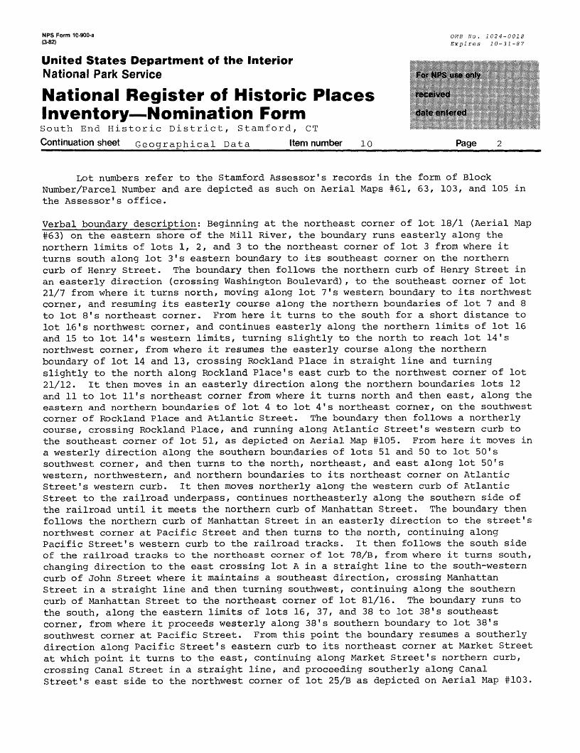
NPS Form 10-900-a QMB NO. 1024-0018f3'82) Expires 10-31-87
United States Department of the InteriorNational Park Service
National Register of Historic Places Inventory—Nomination FormSouth End Historic District, Stamford, CT
Continuation sheet Geographical Data_____Item number lo___________Page 2____
Lot numbers refer to the Stamford Assessor's records in the form of Block Number/Parcel Number and are depicted as such on Aerial Maps #61, 63, 103, and 105 in the Assessor's office.
Verbal boundary description: Beginning at the northeast corner of lot 18/1 (Aerial Map #63) on the eastern shore of the Mill River, the boundary runs easterly along the northern limits of lots 1, 2, and 3 to the northeast corner of lot 3 from where it turns south along lot 3's eastern boundary to its southeast corner on the northern curb of Henry Street. The boundary then follows the northern curb of Henry Street in an easterly direction (crossing Washington Boulevard), to the southeast corner of lot 21/7 from where it turns north, moving along lot 7's western boundary to its northwest corner, and resuming its easterly course along the northern boundaries of lot 7 and 8 to lot 8's northeast corner. From here it turns to the south for a short distance to lot 16's northwest corner, and continues easterly along the northern limits of lot 16 and 15 to lot 14's western limits, turning slightly to the north to reach lot 14's northwest corner, from where it resumes the easterly course along the northern boundary of lot 14 and 13, crossing Rockland Place in straight line and turning slightly to the north along Rockland Place's east curb to the northwest corner of lot 21/12. It then moves in an easterly direction along the northern boundaries lots 12 and 11 to lot 11's northeast corner from where it turns north and then east, along the eastern and northern boundaries of lot 4 to lot 4's northeast corner, on the southwest corner of Rockland Place and Atlantic Street. The boundary then follows a northerly course, crossing Rockland Place, and running along Atlantic Street's western curb to the southeast corner of lot 51, as depicted on Aerial Map #105. From here it moves in a westerly direction along the southern boundaries of lots 51 and 50 to lot 50's southwest corner, and then turns to the north, northeast, and east along lot 50's western, northwestern, and northern boundaries to its northeast corner on Atlantic Street's western curb. It then moves northerly along the western curb of Atlantic Street to the railroad underpass, continues northeasterly along the southern side of the railroad until it meets the northern curb of Manhattan Street. The boundary then follows the northern curb of Manhattan Street in an easterly direction to the street's northwest corner at Pacific Street and then turns to the north, continuing along Pacific Street's western curb to the railroad tracks. It then follows the south side of the railroad tracks to the northeast corner of lot 78/B, from where it turns south, changing direction to the east crossing lot A in a straight line to the south-western curb of John Street where it maintains a southeast direction, crossing Manhattan Street in a straight line and then turning southwest, continuing along the southern curb of Manhattan Street to the northeast corner of lot 81/16. The boundary runs to the south, along the eastern limits of lots 16, 37, and 38 to lot 38's southeast corner, from where it proceeds westerly along 38's southern boundary to lot 38's southwest corner at Pacific Street. From this point the boundary resumes a southerly direction along Pacific Street's eastern curb to its northeast corner at Market Street at which point it turns to the east, continuing along Market Street's northern curb, crossing Canal Street in a straight line, and proceeding southerly along Canal Street's east side to the northwest corner of lot 25/B as depicted on Aerial Map #103.
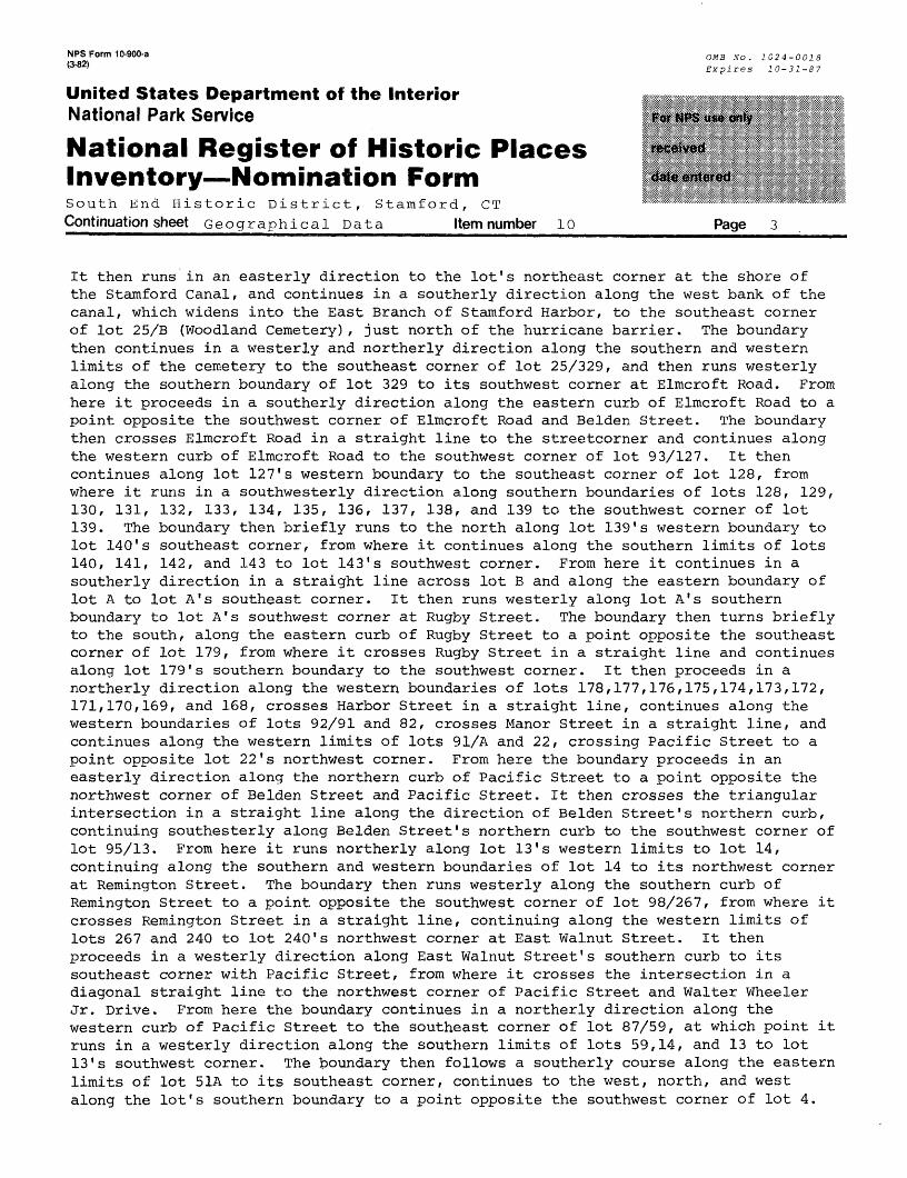
NPS Form 10-900-a (3-82)
United States Department of the InteriorNational Park Service
National Register of Historic Places Inventory — Nomination FormSouth End Historic District, Stamford, CT Continuation sheet Geographical Data Item number 10
OMB No. 1024-0018 Expires 10-31-87
Page 3
It then runs in an easterly direction to the lot's northeast corner at the shore of the Stamford Canal, and continues in a southerly direction along the west bank of the canal, which widens into the East Branch of Stamford Harbor, to the southeast corner of lot 25/B (Woodland Cemetery), just north of the hurricane barrier. The boundary then continues in a westerly and northerly direction along the southern and western limits of the cemetery to the southeast corner of lot 25/329, and then runs westerly along the southern boundary of lot 329 to its southwest corner at Elmcroft Road. From here it proceeds in a southerly direction along the eastern curb of Elmcroft Road to a point opposite the southwest corner of Elmcroft Road and Belden Street. The boundary then crosses Elmcroft Road in a straight line to the streetcorner and continues along the western curb of Elmcroft Road to the southwest corner of lot 93/127. It then continues along lot 127's western boundary to the southeast corner of lot 128, from where it runs in a southwesterly direction along southern boundaries of lots 128, 129, 130, 131, 132, 133, 134, 135, 136, 137, 138, and 139 to the southwest corner of lot139. The boundary then briefly runs to the north along lot 139's western boundary to lot 140's southeast corner, from where it continues along the southern limits of lots140. 141, 142, and 143 to lot 143's southwest corner. From here it continues in a southerly direction in a straight line across lot B and along the eastern boundary of lot A to lot A's southeast corner. It then runs westerly along lot A's southern boundary to lot A's southwest corner at Rugby Street. The boundary then turns briefly to the south, along the eastern curb of Rugby Street to a point opposite the southeast corner of lot 179, from where it crosses Rugby Street in a straight line and continues along lot 179's southern boundary to the southwest corner. It then proceeds in a northerly direction along the western boundaries of lots 178,177,176,175,174,173,172, 171,170,169, and 168, crosses Harbor Street in a straight line, continues along the western boundaries of lots 92/91 and 82, crosses Manor Street in a straight line, and continues along the western limits of lots 91/A and 22, crossing Pacific Street to a point opposite lot 22's northwest corner. From here the boundary proceeds in an easterly direction along the northern curb of Pacific Street to a point opposite the northwest corner of Belden Street and Pacific Street. It then crosses the triangular intersection in a straight line along the direction of Belden Street's northern curb, continuing southesterly along Belden Street's northern curb to the southwest corner of lot 95/13. From here it runs northerly along lot 13's western limits to lot 14, continuing along the southern and western boundaries of lot 14 to its northwest corner at Remington Street. The boundary then runs westerly along the southern curb of Remington Street to a point, opposite the southwest corner of lot 98/267, from where it crosses Remington Street in a straight line, continuing along the western limits of lots 267 and 240 to lot 240's northwest corner at East Walnut Street. It then proceeds in a westerly direction along East Walnut Street's southern curb to its southeast corner with Pacific Street, from where it crosses the intersection in a diagonal straight line to the northwest corner of Pacific Street and Walter Wheeler Jr. Drive. From here the boundary continues in a northerly direction along the western curb of Pacific Street to the southeast corner of lot 87/59, at which point it runs in a westerly direction along the southern limits of lots 59,14, and 13 to lot 13's southwest corner. The boundary then follows a southerly course along the eastern limits of lot 51A to its southeast corner, continues to the west, north, and west along the lot's southern boundary to a point opposite the southwest corner of lot 4.
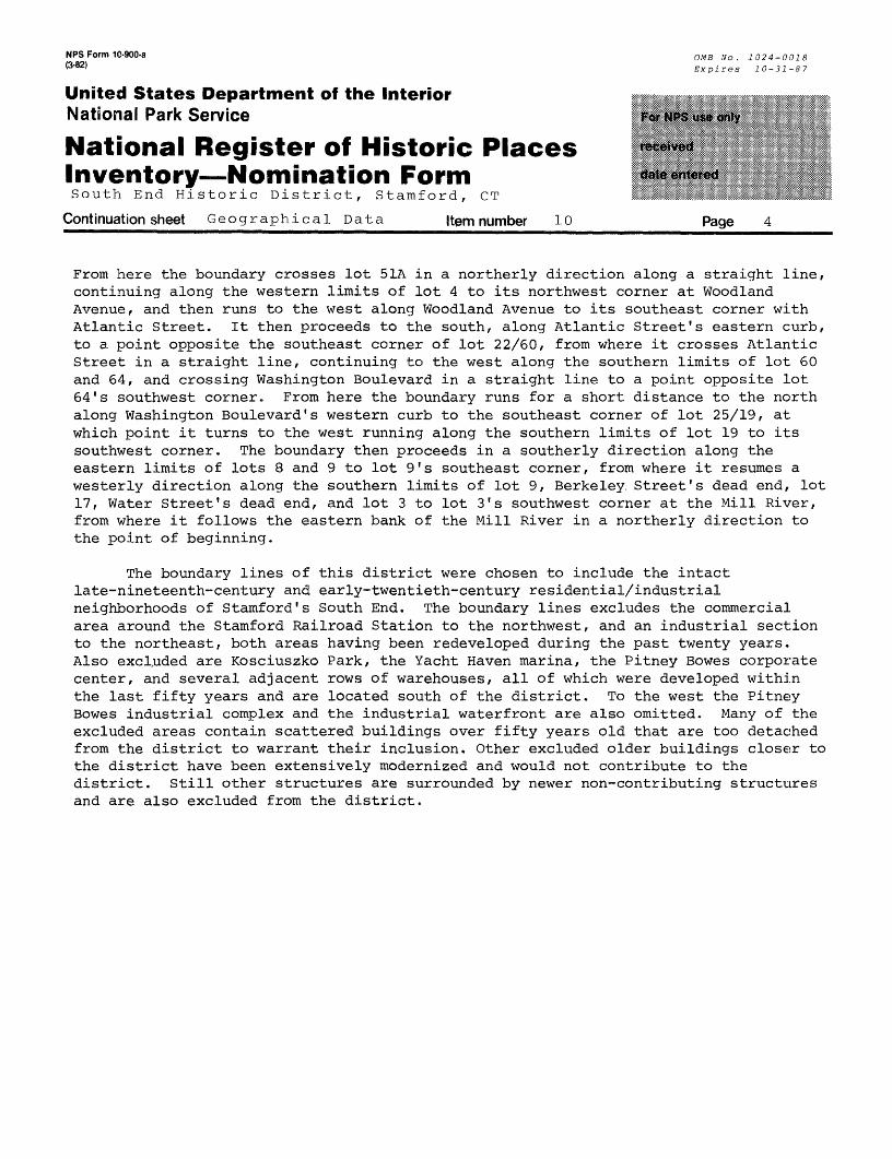
NPS Form 10-900-a (3-82)
United States Department of the InteriorNational Park Service
National Register of Historic Places Inventory—Nomination FormSouth End Historic District, Stamford, CT
Continuation sheet Geographical Data Item number 10
OMB No. 1024-0018 Expires 10-31-87
Page 4
From here the boundary crosses lot 51A in a northerly direction along a straight line, continuing along the western limits of lot 4 to its northwest corner at Woodland Avenue, and then runs to the west along Woodland Avenue to its southeast corner with Atlantic Street. It then proceeds to the south, along Atlantic Street's eastern curb, to a point opposite the southeast corner of lot 22/60, from where it crosses Atlantic Street in a straight line, continuing to the west along the southern limits of lot 60 and 64, and crossing Washington Boulevard in a straight line to a point opposite lot 64's southwest corner. From here the boundary runs for a short distance to the north along Washington Boulevard's western curb to the southeast corner of lot 25/19, at which point it turns to the west running along the southern limits of lot 19 to its southwest corner. The boundary then proceeds in a southerly direction along the eastern limits of lots 8 and 9 to lot 9's southeast corner, from where it resumes a westerly direction along the southern limits of lot 9, Berkeley Street's dead end, lot 17, Water Street's dead end, and lot 3 to lot 3's southwest corner at the Mill River, from where it follows the eastern bank of the Mill River in a northerly direction to the point of beginning.
The boundary lines of this district were chosen to include the intact late-nineteenth-century and early-twentieth-century residential/industrial neighborhoods of Stamford's South End. The boundary lines excludes the commercial area around the Stamford Railroad Station to the northwest, and an industrial section to the northeast, both areas having been redeveloped during the past twenty years. Also excluded are Kosciuszko Park, the Yacht Haven marina, the Pitney Bowes corporate center, and several adjacent rows of warehouses, all of which were developed within the last fifty years and are located south of the district. To the west the Pitney Bowes industrial complex and the industrial waterfront are also omitted. Many of the excluded areas contain scattered buildings over fifty years old that are too detached from the district to warrant their inclusion. Other excluded older buildings closer to the district have been extensively modernized and would not contribute to the district. Still other structures are surrounded by newer non-contributing structures and are also excluded from the district.
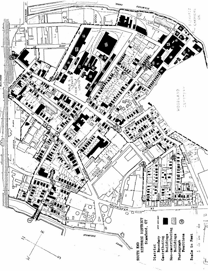
SOU
TH E
ND
HIS
TO
RIC
D
IST
RIC
TS
tam
ford
, CT
••]
Dis
tric
tBo
undary
•——-—
Contributing
Buil
ding
s Non-
cont
ribu
ting
Buil
ding
s Phot
ogra
phPosi
tion
s
Scal
e in F
eet
o )o
o aoo