Embed Size (px)
DESCRIPTION
OC3522 - Remote Sensing of the Atmosphere and Ocean - Summer 2001. Scatterometer. s 0 increases with increasing wind speed for scatterometer angles. increased wind speed. Seasat Scatterometer Pattern. Scatterometer antennas. cross. downwind. cross. upwind. q = 25 o. - PowerPoint PPT Presentation
Citation preview
OC3522OC3522 - Remote Sensing of the Atmosphere and Ocean - Summer 2001Summer 2001
ScatterometerScatterometer

0 increases with increasing wind speedfor scatterometer angles
increasedwind speed

Seasat Scatterometer Pattern
Scatterometerantennas

= 25o
downwindcross crossupwind
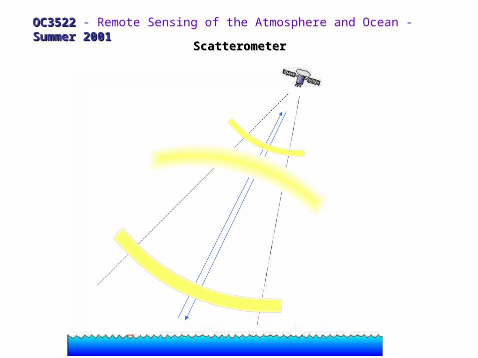
A single measure of 0 at some unknown angle relative to the wind direction produces a set of possible speeds and directions
primary max 0
secondary max 0
min 0
wind
(note here is used for azimuth)
()
4 possible solutions
3 possible solutions
1 solution
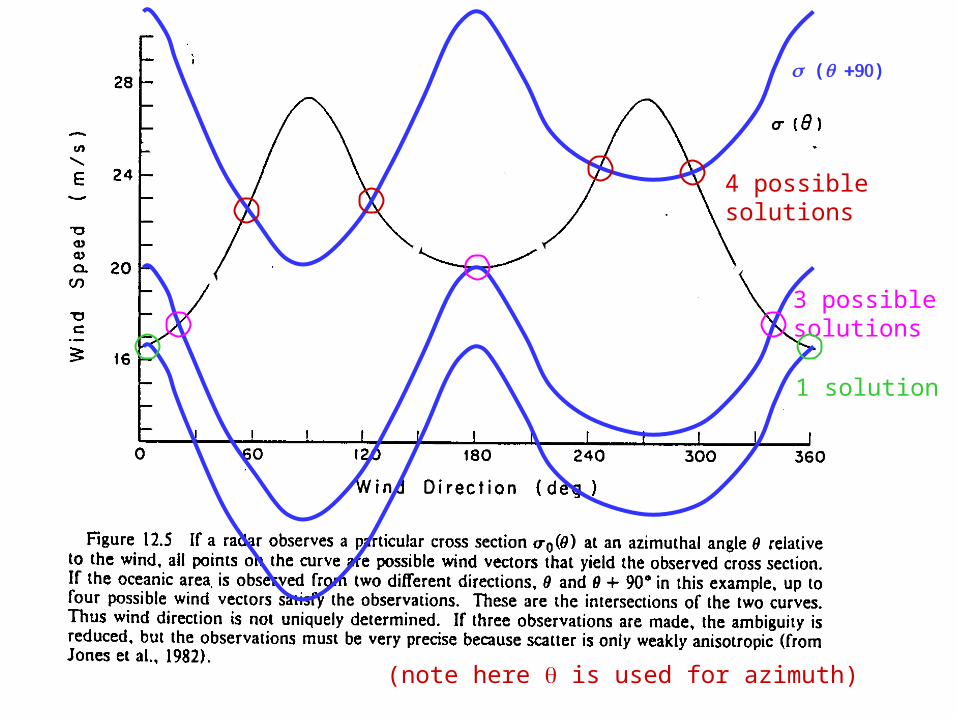
Vector selection:Vector selection:
consistency with the pressure field
or consistency within a model analysis (continuity)

What if a third view direction is added (+20o)
()
Now the solution collapses to two possible wind vectors

NSCATNSCAT
The NASA Scatterometer (NSCAT) was launched on September 15, 1996, measuring global ocean surface wind velocity (both speed and direction). More than 9 months of observations are available.
The instrument was operated continuously at a frequency of 13.995 Giga Hertz.
Six dual-polarized, 3-meter long, stick-like antennas collected backscatter data with a resolution of 50 km for nine months before loss.
Backscatter data was combined and processed to yield 268,000 globally distributed wind vectors per day.

NSCAT CoverageNSCAT Coverage


http://manati.wwb.noaa.gov/cgi-bin/qscat_ocean.pl


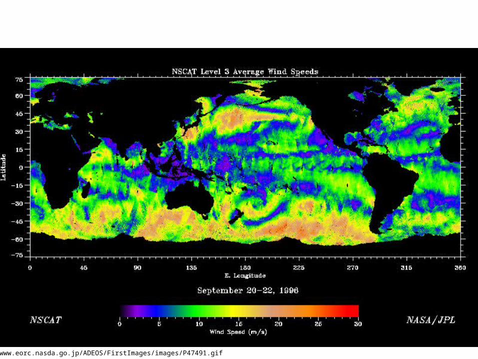
http://www.eorc.nasda.go.jp/ADEOS/FirstImages/images/P47491.gif

JanuaryJanuary
JulyJuly

NASA Scatterometer Data
Scatterometer Missions
Interesting Scatterometer sites:
New Scatterometer SeaWinds on QuickSCAT
And Data
“NASA's Quick Scatterometer (QuikSCAT) was lofted into space at 7:15 p.m. Pacific Daylight Time on Saturday (6/19/99) atop a U.S. Air Force Titan II launch vehicle from Space Launch Complex 4 West at California's Vandenberg Air Force Base. The satellite was launched in a south-southwesterly direction, soaring over the Pacific Ocean at sunset as it ascended into space to achieve an initial elliptical orbit with a maximum altitude of about 800 kilometers (500 miles) above Earth's surface.”