Embed Size (px)
Citation preview

1“Below” 2013.2
Quarterly Journal of the Shropshire Caving & Mining Club Summer Issue No: 2013.2
Apedale Mining GalaApedale Heritage Centre arearranging a Mining Gala on Saturday15th and Sunday 16th June.
To-date representatives from theMines Rescue Service, Winsford SaltMine, North Wales MinersAssociation Trust, Shropshire MinesTrust, the Friends of ChatterleyWhitfield and others are attending.
As well as the mining museum therewill be mine tours operated by thevolunteers at Apedale, train rides onthe Apedale Valley Railway, a funfairand entertainment.
More details on: www.apedale.co.uk
Jiggers Bank MinesDuring the stabilisation work of thevalley side at the top of Jiggers Bank,Coalbrookdale old mine workings(possibly ironstone) werediscovered. - read more on page 20.
Cambrian Mines TrustIn March 2012 Cambrian Mines Trustwas registered as a private companylimited by guarantee with no sharecapital and Objects of Associationdrawn in compliance with CharityCommission guidelines for a Trust.
On 20th May 2013 the whole of theCwmystwyth Mines, an area ofapproximately 138 hectares wasacquired by the Trust from CrownEstate. The Trust is now the absoluteowner of this site in soil, mineral, andsporting rights. The Trust alsoacquired additional sporting andmineral rights to the south.
The Trust is indebted to CrownEstate who have acted inextemporary manner in helping topreserve this important site forposterity. Their actions are highlycommendable and deserve our bestthanks.
New BatsA new group of bats has beendescribed by researchers fromBucknell University, Pennsylvania,US, Flora & Fauna International andthe South Sudanese Ministry ofWildlife Conservation and Tourism.The scientists studied a rare blackand white specimen from SouthSudan with a unique pattern of spotsand stripes.
Analysis revealed the bat had beenfound before but was incorrectlyclassified. Its uniqueness sets it apartfrom other bats, prompting biologiststo describe a whole new group, orgenus, named Niumbaha.
BBC News
Numerous Cave PaintingsArchaeologists in Mexico havefound 4,926 well-preserved cavepaintings in the north-eastern regionof Burgos an area previsously notthought to have been inhabited byancient cultures.
The paintings have been found in 11different sites (one cave had over1,500 scenes). The images drawn inred, yellow, black and white depicthumans, animals and insects, as wellas skyscapes and abstract scenes. Inone of the caves, the experts founddepictions of the atlatl, a pre-Hispanic hunting weapon that hadnot yet been seen in other paintingsin the Tamaulipas state.
The paintings suggest that at leastthree groups of hunter-gatherersdwelled in the San Carlos mountainrange. Experts have not yet been ableto date the paintings, but hope tochemically analyse their paint to findout their approximate age.
No objects have been found becausethe paintings are on ravine walls andin the rainy season the sediments arewashed away.
News Reports, 23rd May 2013
Daren Cilau CollapseIn mid May cavers discovered that alarge section of roof had collapsed in‘Acupuncture’, Daren Cilau. Whathas surprised people is that thecollapse occurred in what hadpreviously been thought of as astable section of passage - unlikeknown unstable areas towards theexit of Acupunture.
The collapse has been partiallyremoved, but the area is still unstableand has been left to ‘settle down”.Visitors to Daren Cilau are requestedNOT to go past ‘Western Union’ andenter Acupunture - a rescue from thisarea would be major!!
Jackfield BoreholesAs part of the Jackfield StabilisationProject boreholes are being used totest and monitor ground movementbetween the Tile Museum and theBoat Inn. The scheme will involveearthworks, the treatment of mineworkings, river bank protection,drainage improvements, highwayconstruction and landscaping andneeds to be completed by 2016.

2 “Below” 2013.2
News Round-Up 1Ivor Brown
Ken Jones DayAbout 100 people attended this dayof lectures and walks in memory of aformer SCMC member, Ken Jones, atthe Ironbridge Gorge Museum on the20th April. Talks were given by themuseum archivist John Powell, fellowresearchers Barrie Trinder and NeilClarke, and Methodist historian JohnDenton.
There was much of interest relatingto the railways, miners housing, localchapels and local miners. Short walksalso took visitors around the sites ofthe main blast furnaces, workershousing and the chapels of thevalley. It is hoped to publish“Proceedings” to record the day.
“Pit Profiles” ExhibitionThis exhibition will be at the Museumof Iron, Coalbrookdale from June 21to December 31 2013. This is atravelling exhibition of portraits ofminers representing each UKcoalfield in the 1940s and 50s byH.A.Freeth.
Freeth was commissioned by the newNCB to visit each area and produce apen portrait and write-up on a localminer.
Shropshire was well represented inthe 56 portraits done with drawingsof Sam Cookson of Madeley, JobHammonds and Lawson Roper ofHighley/Alverley.
T.Wynne, Mines Inspectormanager. A grandson (F.H.Wynne),also became a Senior MinesInspector in the 20th Century. (IJBwon a prize given in his honour atStoke Technical College in 1958).
Shortly before Thomas retired asMines Inspector he took up a newcareer as the owner of ConistonCopper Mine from 1877 to his death.The plant included 13 waterwheels,but it was at the end of BritishCopper mining and not a good buy.
He died in 1891 and his widow was“left in anything but affluence”. Thefull story can be found in “ConistonCopper” by Eric G.Holland.
The family are trying to find a portraitof Thomas can anyone help?
Ken Jones at the entrance to theWalkers Earth Mine, Coalbrookdale,April 1987.
I.J.Brown
Having come across the article onThomas Wynne, Mines Inspector forShropshire from 1852 to 1888,published in Below Winter 1997, adescendant has sent furtherinformation.
Thomas Wynne was born in 1807 inWorcestershire, moved toStaffordshire in 1830 and becamemanaging partner of MossfieldColliery in 1836, as well as a partnerin a pottery company. In 1852, age 45,he became one of the first MinesInspectors. For nearly all of his timeas an Inspector until his retirement in1888, age 81, he covered the mines ofShropshire. He lived in Stone, thenGnosall. He was married 3 times (twowives died) and produced 19 children- one became a Shropshire mine
A further Shropshire miner, Frederick Morgan isgiven as the Warwickshire representative.Morgan had started work at Highley but left toserve in the First World War, afterwards he wentto work at pits in the Tamworth area. He laterbecame Mayor of Tamworth (for more details onthese 4 miners see Below 98.3 and Below 98.4).
The exhibition is complemented by some modernphotographs of laterminers - and by aseparate section onShropshire minersput together by theIGMT museum.Job Hammonds,
Coal, March 1951
Sam Cookson ofKemberton PitCoal, October 1948
Lawson Roperworking the windingengine at Highley,Coal, November 1949
Frederick Morgan,Coal, December 1947(original at the IGMT)

3“Below” 2013.2
Towards the end of last year theinterpretation board for theSnailbeach Mine Trails was erectedin memory of Ken Lock Trail. Thetrails guide visitors around the sitewith the aid of a series of numberedposts.
Ken Lock Mine Trails, Snailbeach
The main board is at the top of thepath past the Halvans engine house.However the design of board is notgood, the wooden surround is atsuch an angle that it collects wateralong the bottom edge.
In memory of Ken Lock - he loved this placeThis mine trail is dedicated to the memory of Ken Lock in recognition of his contribution to preserving the Snailbeach Mine siteand for helping develop our knowledge of its history. Ken was interested in the mine for most of his adult life and was known to
many local Snailbeach people. In 2008, he donated the replica iron plaque that is now above the entrance to Day Level.
Left: The interpretation board at the top of the path past the Halvans, on theedge of the former white tips.Below: The Mine trails board and plan. Kelvin Lake-I.A.Recordings
Nick Southwick has also had to makeremedial repairs to the board to fix thetop more securely to the post!
Hopefully this can be remedied in thefuture.
Snailbeach Mine Plan 1863In the last issue of Below (page 2) itwas mentioned that an original plancarrying the name of H.Dennis,T.Tindale and J.R.Eddy hasbeen returned to the NMRSlibrary after 44 years! Theplan which is to betransferred to ShropshireCounty Record Office wasbrought along to the AprilClub meeting for membersto inspect.
Somewhat larger than expected, itshowed the “Snailbeach Boundary
between the Marquis of Bath and theEarl of Tankerville”.
Above and Right: Clubmembers inspecting the1863 Boundary map.
Left: Detail of the ChapelShaft area.
Kelvin Lake - I.A.Recordings

4 “Below” 2013.2
IntroductionAround 5 years ago, David Adams,the club president, persuaded me toventure out with him one Sundaymorning to investigate a series ofholding down bolts sticking upthrough the ground at PitchcroftLimestone Mine (SJ 739172, Figure 1).He though these were for a windingengine that served the adjacent “Dogshaft” and “Twin Dog shaft”. Thismine was worked by the mightyLilleshall company; the limestonewas taken by canal to its blastfurnaces1 .
I expected that after brushing away acouple of inches of leaf mould wewould come down onto a brick floorand by early afternoon recover theplan of the engine house. Since thenwe have been working at the siteonce a month for 7 or 8 months of theyear, usually accompanied by at leastone mini-digger in excavations thatare in places around 6 feet deep. Atthe dig last December, I finallythought we had done enough tounderstand the site....
So what have we found? The plan inFigure 2 shows the outline of themain features of the site. At thenorth-east end there is probably anengine house (1 in Fig 2); this was asubstantial brick building with wallsbetween 18” and 28” thick, standingup to 6’ high (Figs 3, 4). This isdivided into two unequally-sizedcompartments; the larger of these hasan entrance and a brick-lined ovalwell (W).
To the north of this are further walls(2, 3), which may have housed aflywheel and a spool-type windingdrum as the main wall aligns with theprinciple shaft on top of the mound(Figs 5, 6).
To the south west is a circular feature(4), which is probably the base of ahaystack boiler; an area of mortar andstone adjacent to this (5) may be thesite of a robbed-out chimney (Fig 7).Between the engine house and theboiler base are a series of brickpavements, low walls and drains,bounded to the north and south by
Excavations at Pitchcroft Engine House, Church AstonThe Story So Far, David Poyner
stone retaining walls. The brickstructures are completed by two brickculverts to the north and south of thesite (6, 7); unlike the other featureswhich are aligned on a roughly east-west axis, these are at approximately45o to this direction.
As we dug, it became apparent thatwe had a series of structures ofdifferent dates overlying each other.Eventually it became necessary toremove some features after carefullyplanning and photographing them, towork out the function of the earlierstructures. There are many thingsthat we still do not understand aboutthe site; however, we can now tell atleast a partial story of the mine basedon the archaeology. I should stressthat what follows is simply a personalview; my fellow excavators, oftenbetter informed than I am, may notagree with my conclusions!
The earliest features that we foundwere the remains of a boiler, with anassociated coal bunker, stoking areaand a brick culvert. This first boilerwas identified through the survival ofits ash pit, largely buried underneaththe shell of later haystack boiler(feature 4). Its coal bunker was alsopartly underneath the later boiler.The culvert may have existed to takewater away, after a boiler washout; asimilar culvert was found when theHeslop Engine at Blists Hill wasexcavated in the 1980s2 .
Interestingly, part of the culvert hadto be demolished when the enginehouse was built, so this was clearlynot the original engine house, at leastnot in its current form. However, theengine could not have been far awayand it is possible that parts of itshousing survive in the walls of thepresent house. This incorporates twometal pipes; one passes obliquelythrough the top corner wall of thebuilding and the other ends abruptlyin the middle of the wall; originally itmust have passed straight through,but at some stage the wall must havebeen thickened with the pipe left insitu. The walls associated with theflywheel and spool (features 2 and 3)have also had a complicated history
and show much evidence ofrebuilding. Wall 2 may have been theolder of the two. At the one end ofwall 3, there was also a deep trenchthat probably once held a substantialtimber structure; the timber hadsubsequently been removed and thetrench back-filled. We cannot fullyinterpret any of these features, butwe suspect that the first windingengine and winding drum/spool werearound these features and some partsof them may date back to this firstphase of the mine.
At some stage, there was a majorredevelopment of the mine, with thedemolition of the old boiler and theinfilling of the bunker and firingspace. A new boiler was built andprobably at the same time, the currentwinding engine house was built,albeit perhaps incorporating parts ofthe earlier structure. However, eventhis had a complicated history; wecan trace at least three rebuildings ofthe boiler, each one leaving remainsof a brick or mortar surface to becovered by its successor. Some ofthe alterations to the engine houseand walls 2 and 3 may also belong tothis phase.
We can draw some conclusionsabout how the engine worked. Theengine house was divided into twocompartments. The smallercompartment, furthest away from theboiler, had two long (8’6” and 9’respectively) holding down bolts init. The larger compartment had nosign of a masonry block to support acylinder, but there was evidence fortwo timber beams on the floor, next tothe well. We believe that these beamsprobably supported the cylinder of avertical winding engine. In this case,the well may have housed acondenser, to take steam away fromthe cylinder and to create a vacuumto draw the piston up or down. Thepiston would have moved a beam,pivoted on the wall between the twocompartments. The function of thebolts in the smaller compartment aremysterious. They may havesupported a water pump, but theyseem rather over-engineered for that.They could have held a second

5“Below” 2013.2
Figure 1
Excavations at Pitchcroft Engine House, Church AstonThe Story So Far, continued . . .

6 “Below” 2013.2
Figure 2
Plan of PitchcroftWinding Engine House
Figure 3 (above) and Figure 4 (below) - views of theexcavated engine house. David Poyner
Figure 5 (above) the excavated engine house.Figure 6 (below) - Haystack boiler site. David Poyner
Excavations at Pitchcroft Engine House, Church AstonThe Story So Far, continued . . .

7“Below” 2013.2
cylinder, working the other side ofthe beam; this arrangement was usedin engines designed by AdamHeslop, which were not uncommon inShropshire3 . Or the bolts couldsimply be part of an arrangement tosupport a crankshaft, driven by theother end of the beam. There musthave been such a shaft and it wouldhave driven a flywheel housed in thepit between the engine house andwall 2. Beyond this, possibly drivenby gear wheels, would have been awinding spool or drum, winding fromDog Shaft and Twin Dog Shaft.
The engine was clearly of a late 18th
or early 19th century design; thehaystack boiler would supply steamand only a few pounds aboveatmospheric pressure and theimpetus to drive the piston up anddown would have largely come fromthe creation of a vacuum.
The documentary evidence suggeststhat production began on the site nolater than the mid 1820s; mining hadbeen taking place to the south fromthe mid 1790s so some activity mayhave taken place on the site duringthis earlier period. Mining ceased in1860 when the workings struck waterand were flooded. Thus the site had aminimum life of 35 years.
It is possible to show that the minewent through a number of phases.However, absolute dating is muchharder. Maps exist of the mine in the1840s (Fig 1), but their interpretationis not easy. One intriguing feature isthe use of conical drainage pipes,rather than cylindrical pipes. A run ofcylindrical pipes was discovered inthe north east of the site, but theywere clearly inserted into an existingbank of spoil. Cylindrical, machine-made pipes first appeared in the late1840s; by the early 1850s they wereubiquitous, due to the ease withwhich they could be made. Thepresence of conical pipes,particularly underlying pavement a,associated with the final haystackboiler would suggest that it was putin place no later than the very early1850s. In theory, pipes produced
between 1826 and 1850 should havethe word “PIPE” stamped on them, toavoid payment of the brick tax4 ; noexamples of stamped pipes exist atPitchcroft. Some caution needs to beattached to this; the Lilleshallcompany had their own brick and tileworks and may have not beenscrupulous about observing the lawwhen it came to pipes for their ownuse. However, the simplestinterpretation is that the conicalpipes were made and laid shortlyafter 1850, just before the switch tocylindrical pipes. It may seem oddthat the Lilleshall Company wereusing an antiquated design of steamengine at one of their mines, but theyclearly considered the arrangementsto be cost-effective.
So, after five years, we have a storyto tell of the winding engine atPitchcroft. However, this is not theend of the tail. The 1840 maps show asecond, larger complex of buildingsto the north of the winding engine;these are associated with anothershaft and we suspect they may bethe remains of a pumping engine. Wehave now started to investigate thisand have uncovered foundations atleast as large as those of the windingengine - see Below 2013.1, page 3!
The excavations have been led byDavid Adams, who has also carried
out the surveying. Substantialcontributions to the interpretation ofthe site have been made by PeteEggleston, Kelvin Lake, Alan Taylorand Edwin Thorpe. Numerousmembers of the Shropshire Cavingand Mining Club and the ShropshireMines Trust have assisted with theexcavation. We wish to thank theDuchy of Cornwall and Mr. DavidWilliams, tenant farmer, forpermission to carry out this work. Afuller version of this article willappear in the proceedings of the 2011NAHMO conference5 .
References1 The history of the site is docume
nted by David Adams in Thehistory of limestone mining inChurch Aston and Lilleshall,Shropshire Caving and MiningClub Account 25, 2007
2 Day, M. and Higgins, D., BlistsHill Mine- archaeological site,1983
3 Lake, K., Adam Heslop, SteamEngine Builder, Below 1999.4,pp5-9 and Lamb, R., Adam Heslop– a follow up, Below, 2001.1,pp13-17.
4 Anon, Field drainage pipes andtiles, English Museum of RuralLife, Reading, nd
5 Available from myself;[email protected]
Figure 7 - The excavated engine house, the haystack boiler was too the left.David Poyner
Excavations at Pitchcroft Engine House, Church AstonThe Story So Far, continued . . .

8 “Below” 2013.2
Flanged Rails in Shropshire & West YorkshireIvor J. Brown
The recent closure of Shibden Minenear Halifax, West Yorkshire, whichwas the last British mine to useflanged rails for its haulage, bothunderground and on surface, hasturned some thoughts toShropshire’s contribution to thissystem.
According to the Guinness Book ofRail Facts by J.Marshall (1975),Coalbrookdale was one of the firstareas to use waggonways at mines in1631. Indeed by 1767 cast iron barson wooden rails had been tried. By1788 flanged iron rails were in use onthe Ketley inclined plane and fromsoon after this the word ‘tramway’had been adopted to tracks where ‘L’shaped flanged rails were used andthe word ‘railway’ to tracks usingflanged-wheel traffic.
The Coalbrookdale Company (seePhoto 1), and later the MadeleyWood Company were major users oftramways as can be seen from manydocuments and later photographs.Indeed some tramways with L shapedrails continued in use until the mid20th Century. Photo. 2 shows theremains of a tramway over a bridgeon the Blists Hill site, while photo 3shows a tramway inside the remainsof a mine cage at the old LadywoodMine, Jackfield in 2006. Anotherpicture showing a mine wagon onflanged rails at Broseley appears in“East Shropshire Coalfield”(Tempus). These rails could still beseen in the 1950s.
The tramway at Shibden Mine, a newmine constructed on an old mine sitein 1972, survived until last year. Itwas first visited by the writer in 1977and at that time very small wagons,about 2cwt capacity were in use (seePhoto.4). Between then and the early1990s these were replaced by largermetal wagons and the surfacetramway considerably extended tonew drifts (Photo.6). By the timeI.A.Recordings visited the site in2006, new drifts had been openednearer the site access road and only ashort length of surface 18 inch gaugetramway remained.
Underground the working methodsremained much the same. In 1977 thestalls were slightly wider, althoughthey were reduced to about 6ft. bythe building of packwalls on eachside. The miners used imported stoneand material taken from the floor togive extra height (the useful seamitself was only about 2ft. thick, but afurther foot of clay was taken fromthe floor for the packing material).
Before entering the mine each minerfilled a tub with stone from a heapoutside, leaving only enough spacefor his knee. Kneeling on one leg inthe space he would push the tub withhis other leg and set off undergroundto his workplace - ensuring that hecrouched low enough to keep hishead close to the rim of the truck (seephoto 8). Some of the stone would beused at the working place to build thewalls and pave between the tracks.
In 2006 fewer men were employedand more wooden props were used tosupport the roof and sides, thesebeing backed by corrugated sheets,but otherwise conditions had hardlychanged.
The writer is most grateful to theCompany for allowing his many visitsto the mien over the years and forallowing the recording of theoperations by I.A.Recordings. Thiswork will be a permanent record ofearly mining methods surviving intothe 21st century.
1. Flanged rail and cast iron sleeper(inscribed with ‘Coalbroo...’) with cmscale stick. Kelvin Lake-I.A.Recordings
2. Flanged rail plateway, Blists Hill1950s. Howard Williams
3. Flanged rail in the remains of acage at C.R.Jones Pit, Ladywood.
Kelvin Lake-I.A.Recordings
4. Shibden Mine, 1977 - Miner withmine tub and ‘penny wheels’.
Ivor Brown
5. Entrance to Shibden Mine, 2006.Kelvin Lake-I.A.Recordings

9“Below” 2013.2
Flanged Rails in Shropshire & West Yorkshirecontinued ...
7. Side and top views of a Shibden‘Penny wheel’ with cm scale stick.Kelvin Lake-I.A.Recordings
6. Shibden Mine railway (18 inch gauge, flanged rails), October 1997.Ivor Brown
8. A miner about to enter the drift, kneeling in the tuband pushing with the other leg. The drift was down hill,so going in was easy - you just had to keep your headdown! Kelvin Lake-I.A.Recordings
9. A miner working on the face, picking out the clay.Due to the height of the workings the men found iteasier to sit on a small stool to make the cuts.
Kelvin Lake-I.A.Recordings
10. A miner pushing a tub down the entrance drift pasta side passage to older workings.
Kelvin Lake-I.A.Recordings
11. Peter Eggleston fixing a camera to the front of a tubto record the descent into the mine.
Kelvin Lake-I.A.Recordings

10 “Below” 2013.2
Some Notes on the Mines of the Lilleshall Company, No.14Addendum 2 (Cont.): Day Level Sough and Shafts. The Sough
(Southern Section) and recent problems in the North, Ivor Brown
The Day Level seems to have beenextended southwards from MumptonHill around 1850 and is known tohave connected with Dark Lane andStafford Pits. There is also evidencethat it connected at a later stage withPudley Hill Pit which became acentral pumping station (pumpingexcess water up to the sough) for anumber of Lilleshall Company andHaybridge Company Pits and works.Local information also asserts thatthe level terminates at the Randlay Pitand this appears to be borne out by awitness at an Inquiry J.Bennett vGreat Western Railway 1858 (Shrops.CRO) who stated that the “LilleshallCo. brought their level 3 or 4 yearsago - it terminates at the Randles”.The distance, excluding branches,from Donnington to Randlay is about4 miles, the branches would also beabout 3 or 4 miles, making 7 or 8 milesof sough in all. A former engineer ofthe Lilleshall Co. Mr E.Wood hasalso informed the writer that theSough, known to him as the LilleshallFree Level “terminated at theRandlay” in an area once called theDeep Angle.
For many years the sough had to beinspected periodically (known as“Level Creeping”) and this seems tohave been done in three sections.The southern section from StaffordPit through Dark Lane Pit toMumpton Hill Pit (Albion Mound),central section from Waxhill Barracksthrough to the Cockshutt and NabbPits to Mumpton Hill and thenorthern section from WaxhillBarracks to Lamey Lakes
(Donnington) where there was aSough Mouth Cabin. At this Cabin,which is shown on the 1914 EstateSale Plan, the level creepers couldhave a wash, a change of clothes andsome food.
The inspection was difficult anddangerous, the level alwayscontained water and was less than 3ft6in .high in places. Their lamps(open-flame ‘shukie’ type) had to beheld in the mouth while crawling inwater on “all fours” and freshsupplies, fuel, food etc. were receiveddown each shaft. On arrival at thebottom the creepers would call up theshaft “Lower the bond”, the ‘bond’being the local name for a hookedchain, tub or cage.The Lilleshall Company paid for anannual dinner for the ‘creepers’ andan invoice survives dated October22nd 1874 (IGMT), see figure 1,below.
In more recent years the inspectionbecame annual, usually a New YearsDay trip, and this continued untilabout 1920. The last ‘creepers’ werenamed Dennis Kinsey and Mr.Padgett. Mr. Kinsey’s daughter Mrs.R.Brown lived (or lives) in WestStreet, St. Georges.
1930sSince 1930 the Day Level Sough hascaused many problems since itsconstruction, particularly due to itcollapsing and damming thedischarge. This causes water levelsto rise and gush out at surface fromnearby shafts causing flooding. The
water is very ochreous and can causea serious nuisance. For this is veryreason all it’s shafts had to beprotected as any collapse or back-filling would have a similar effect.Again the shafts themselves had tobe fenced or otherwise protected toprevent accidents. (In 1890 a 3 yearold child was lost when she fell downthe Cockshutt Shaft “used forcleaning the sough”).
The Lilleshall Collieries Report Bookfor the 1930s (formerly with Mr.T.Blower of Stafford) states that on28 Feb. 1931 a blockage occurred “atthe Donnington end of the Day level,causing water to make an appearancethrough the top of some of the pitscausing slight damage to farmlandsbelonging to T.Ward”. The Companycarried out work underground tomake a new water course and thenput in a length of shallowunderground drain beyond theblockage area as well as leaving asection as an open ditch.
NationalisationImmediately after Nationalisation in1947 the NCB realised the importanceof the Drainage System andinstructions were given that noshafts on the line of the Day Levelwere to be filled. Additionally, allshafts on the associated line of thelevel were capped. These caps weredone by Mr. Tom Weston and carrythe initials “TW” and the date 1950.Only the shafts to the North ofAlbion Pit were treated in thismanner.
The Lllleshall Co. Queens Head
October 22nd 1874
To R.TranterTo Level Creeping Dinner,
sell £9-18-6d.
R.Tranter
Figure 1. Note: The Queens Head was the house recently called ‘Erindale’ on Moss Road, Wrockwardine Wood - opposite Cappoquin Drive.

11“Below” 2013.2
Figure 2 - Approximate layout of the Day Level Sough
13 13
1414
12 12
11 11
10 10
99
8 8
70 71 72 73
Brad
leys
Faul
t
Ligh
tmoo
rFa
ult
X
XX X
X
X
XX
X
X
Branch toLodge Pits
PriorsleeHollinswood
OakengatesSt. Georges
Wrockwardine Wood
New Donnington
Donnington Wood
PickeringsHouse (1788)
Malinslee
Cockshutt
Nabb
Lawn Pit
Randlay Pit
Pudley Hill Pit
Stafford Pit
Dark LanePit
Albion
Sough MouthCabin
MechanicsRow
Glasshouse(Smiths)
Shaws
Oakworths
No.4 No.8
Engine Pit
LodgeFurnaces
BarnPit Old Lodge
Mansion
WaxhillBarrack Pit
N
Scale 1:25000one mile
General Line of the Day Level Soughand it’s Principal Branches
(Ordnance Survey Grid shown)
Some Notes on the Mines of the Lilleshall Company, No.14Addendum 2 (Cont.): Day Level Sough and Shafts. The Sough
(Southern Section) and recent problems in the North, continued ...

12 “Below” 2013.2
In 1965 the local NCB Surveyor (andnow Club Member) Ray Rushtonwalked along the surface over theSough and examined the shaftsbelieved to be associated with it. Henoted the following:
Pudley Hill - 2 shafts, both filled.Albion - 3 shafts, 2 filled, one with a
concrete cap, depth 280ft.Nabb Pit - 2 shafts, Eastern shaft had
concrete cap. This cap had beenbreached in 1963 and measureddepth to water 168ft.. Total depth234ft. (by Mr. Nicholl’s bungalow).
Gin Pit - 1 shaft found with aconcrete cap, depth about 240ft.
Cockshutt Pit - 1 shaft, concrete capdepth about 270ft.
Un-named Pit (bottom of incline) - 1shaft found with concrete cap.
Glasshouse Pit (Gig-house) by oldwinding house in Smiths Crescent -1 shaft found with concrete cap,depth about 130ft. (This wouldhave been Shaw’s Pit mentionedpreviously).
Mechanics Row - 1 shaft found withconcrete cap, now breached butwork is continuing, thought to beabout 100ft. deep.
There were many other known orsuspected construction shafts ofshallow depth, particularly North ofMechanics Row which were notinspected on this occasion.
1970sIn the early 1970s the newly formedDevelopment Corporation maintainedthe earlier NCB view that none of theshafts above the Sough should befilled and the situation was monitoredby the British Waterways Authoritywho were concerned that anyinterruption in water supply couldalso affect their operations to theNorth of the Coalfield. The presentpolicy is not known, but it is thoughtthat some of the shafts have beenfilled in recent years.
In 1974 the shallow drain put induring the 1930s collapsed within thethen closely guarded CentralOrdnance Depot, Donnington.Realising that they had a problem the
Military Authorities called in thewriter, who at the time wasresponsible for dealing with miningproblems for Telford DevelopmentCorporation.
On arrival at the Depot the writer wasmet by armed officers and escorted ina jeep to the hole. It was a collapseperhaps 5ft deep with water flowingat the bottom. It was at the height ofthe IRA Troubles in Britain and themilitary expressed concern thatpersons may gain entry to the Depotby this route. This was correct andthe writer took the Military to aposition outside the ‘Camp Fence’near the Public Toilets where thereappeared to be a short length of theold sough exposed as a ditch.Ochrous water flowed out of a grilledentrance to the undergroundworkings at one end of the ditch andback through another poorly grilledentrance into the “shallow surfacedrain” at the Depot end. Greatconcern was expressed that thisaccess route had been present butnot known about throughout the lastwar and for 20 years thereafter. Thewriter is not able to comment on theremedial measures.
In 1994 the writer received amysterious telephone call fromsomeone purporting to represent“the Council” asking whether hecould supply details of the tunnel atDonnington. As he was suspicioushe responded by asking them to putthe question down officially inwriting, but is still awaiting the letterfrom “the Council”, IRA or any otherbody!
The whole area has changed greatlysince the coming of the New Town,reclamation schemes, new roads,parks, residential and industrial areashave appeared but in the 1970s it wasstill possible to follow the line of theSough on the surface. Sough MouthCabin at Lamey Lakes was possiblysurviving in the heavily guardedDepot, somewhere by the TelephoneExchange, but could not normally bevisited.
There was an open shaft at theGarage on the main Wellington Road(and rumours of a further access nearMechanics Row, Donnington). Thethen-called “Gig” Pit was visible inSmiths Crescent near the convertedhouse called Smiths Engine House.There were also shafts nearOakworths Works and at the Inclinebut the Gin Pit in Mr Nicholl’sGarden. The Nabb, had been coveredas had the pit at Albion Mound. Themassive remains of the Pudley HillPumping Engine could also be seenon the southern section of the soughtogether with masonry and wasteheaps on all the other colliery sites.
During the early reclamation works inthe 1970s care was taken at therequest of the Waterways Board notto fill any shaft, that would block thesough. These were only capped sothat water could still flow andconsequently provide supplies to thecanal at Donnington. In any case ablockage could cause a damming ofthe water and an enormousunderground reservoir coulddevelop. This might break out withexplosive violence as has occurred ina number of cases in Britain recently.The treatment given to the shaftssince 1977 is not known to the writer,but occasionally there are stillreferences to the flooding problemsin the press.
To summarise, the map providedshowing the sough can only be takenas the general direction. It is believedthat the flow of water is now capableof changing route whenever there isa collapse underground, unless thecollapse is near the Northwest exit. Ifit happens here then the water wouldjust burst out at any point ofweakness.
AcknowledgementsThe writer would like to thank themany old local miners who helpedover the years in this research. Hewould wish to thank also HowardWilliams, Cyril Nicholls and of courseRay Rushton. Ray and his son Neal,have done much recent work in thisarea and this continues.
Some Notes on the Mines of the Lilleshall Company, No.14Addendum 2 (Cont.): Day Level Sough and Shafts. The Sough
(Southern Section) and recent problems in the North, continued ...

13“Below” 2013.2
Club Tour of the Day Level Sough Sites26th January 2013, Leader Neal Rushton
Despite the deep snow and slipperyroad conditions the ‘tour’ wentahead - and we did manage to seesomething other than snow!
The tour started at the GreyhoundIsland, Oakengates with Nealexplaining the general route of theSough and the various mines itserved in this part of Telford,although there was nothing to see atthis stage.
From the Greyhound we moved ontothe site of the Albion Pit, on top ofthe mound 2 shaft markers werelocated - cunningly inscribed withthe letters ‘MS’. We then attemptedto travel to the Nabb, but due to theicy conditions there were a fewissues!
The second of the 2 shaft markersfound on the Albion Pit mound.
Eventually we made it onto the edgeof the Nabb and successfully located(thanks to Neal) 2 shaft caps. Thefirst reputed to be one of the “TW”shaft caps made by Tommy Weston,although we were unable to clear thedebris and snow off sufficiently tosee this.
Above: Club members on the Albion Pit mound with one of theshaft markers (left foreground)
After the Nabb it was a quick stop inSmith’s Crescent to view the site ofthe Glasshouse Pit, now an openspace, but private. Followed by a‘road trip’ around various sites downto playing field at Donnington andthe site of the shallow culvertedsection towards the Depot.
Below: Site of the Glasshouse Pit in Smith’s Crescent -no sign of the shaft!
Left & below: Club members manage tolocate one of the concrete shaft capsinscribed with “TW” on the Nabb
Below: Ochre staining from a shaft in Oakengates Road,Donnington caused by water overflowing from the sough.
Pictures: Kelvin Lake - I.A.Recordings

14 “Below” 2013.2
Pitchcroft Report - Update, March 2013David Adams
Nevertheless there was no sign ofany original land form, only a mixtureof soil and broken bricks butsurprisingly at depth a piece of achina mug was found. Rex Keyidentified the shape of this beingsimilar to one found at Snailbeachdated to 1852, although decorationcould put it a little later to about 1860,the date of the loss of the mine. Alsoa clay pipe stem was found stampedby Southerns of Brosley (Broseley)which he dated to the 1820-1840period or mid 19th century. How thesecame to be at depth well below thefoundations of the brick pillar is amystery.
Final digging revealed a greatersurprise of not natural landform but abrick floor with one straight edge.Investigating this further at thisdepth will be difficult but for safety itwas decided to cover it with a splitpolythene bag and partly back fill thepit. The fill, as stated above,consisted of nothing but soiland broken bricks, withoutany trace of mine spoil asmight be expected, evidence
On 17th March the team consisted ofDavid Adams, David Poyner, PeterEggleston, Steve Holding, EdwinThorpe, Kelvin Lake, and JohnHendy with his digger. GeorgePoyner, also visited during the day.
The object this time was to furtherinvestigate the area around the‘Pumping Engine’ site, first the hardarea which had originally led the teamto the site by excavating further tothe N.W. ie away from the site butthis produced little, although may beworth another attempt.
D.A. checked levels to compare thelevel of the brick floor between thepillars of Site 3 (the area with thelarge curves brick wall) and the floorin the highest part of the brick linedculvert of Site 2 (the area excavatedin 2012) finding it just 6 centimetreslower.
While the level was set up the dropin the culvert towards the spoil heapwas found to be 28 centimetres orapproximately 1 foot. A level wasalso taken between the Site 3 brickfloor and the approximate height ofthe shaft collar, the collar being 18centimetres (7”) lower.D.P. really wanted to ascertain howdeep the original land surface wasbelow the fill, in consequence thedeep pit was re-excavated at the sideof the southern and smaller brickpillar, to a depth of 2.6 metres (9ft) ornearly 3 metres below the level of thefield, this had to be shaved back forsafety creating a massive amount ofspoil.
of some massive amounts of earthmoving before the real age ofmachines. These finds obviouslycomplicate any dating theories withregard to the pillars and strangecurved wall of Site 3 which wouldappear to have been built after the fillwas deposited. Some further workwas done in cleaning off thebrickwork corners on this site.
Finally it was decided to excavatedown to the collar level on theeastern side of the shaft, thisrevealed two short curved wallsextending claw like from the shaftside. This area will need to becarefully excavated further on thenext dig, in fact it will be instructionalto dig as far as possible right roundthe shaft collar and follow the brickprotrusions from there.
Work on this enigmatic sitecontinues!
Stem of the W.Southorn pipe found in the deep excavation.
Above and right: Uncovering the curved walls against the shaft collar.

15“Below” 2013.2
Shaft and Adit at White Grit
Over the Christmas and New Yearperiod the woods to the South ofWhite Grit engine house were clearedby the landowners. The area of thedressing floors beside the road toPriest Weston was used as the‘timber yard’. Clearing the trees hasexposed two mining features: a shaftand possible adit.
Club Account 22 suggests there are 2air-shafts and a drainage adit in thisarea, however the revealed featuresdo not seem to match the locationsgiven. The exposed shaft is relativelysmall, but only a couple of feet deep -this could possibly be the air-shaftnoted as being open to 10ft. depth inAccount 22 (earlier Club Accountsdon’t mention anything in the woodshere).
North of the shaft there appears to bea run-in adit which is issuing aconsiderable amount of water (this isrunning West to a small stream).Although the location of thispossible adit doesn’t match the onein Account 22, it is quite likely that itis the drainage adit for the higherworkings on the Grit Sett - early ClubAccounts say they were “unable tolocate it”.
Above: The shaft exposed in the former wooded area South of White Gritengine house and the Priest Weston road.
Below: Site of a the possible run-in drainage adit.
Shelve Miner’s Rock CanonsIt was reported last year that theminers rock canons in the village ofShelve had ‘disappeared’. However itwould seem that they were onlytemporarily hidden by spoil fromdrainage works.
Now that the work hasfinished, the spoil has beenremoved and the rock canonsexposed once again.
Above: The three rock canons, still visible (just!).
Left: Location of the rock canons on theNorth side of the road through Shelveoutside ‘The Long Barn’.

16 “Below” 2013.2
News Round-Up 2
Daw Mill and UK Coal FutureFollowing the underground firewhich closed Daw Mill Colliery (asignificant part of UK Coal), minersunions are concerned that minerscould lose out on redundancy pay ifthe company applies for voluntaryliquidation. UK Coal admits the firehas left it with cash-flow problems,but says it’s business is still viable.
Most of Daw Mill's 650 staff will bemade redundant at the end of Maybut could lose benefits if UK Coalbegins insolvency proceedings.
However, the firm has stated that theremaining deep mines at Kellingley inNorth Yorkshire, Thoresby inNottinghamshire and six surfacemines, remain viable and discussionsare “continuing with a wide range ofinterested parties.”
UK Coal’s surface mines are:Butterwell, Morpeth in
NorthumberlandHuntington Lane, TelfordPark Wall North, near Crook in
County DurhamPotland Burn, near Ashington in
NorthumberlandLodge House, Ilkeston, DerbyshireMinorca, Measham, Leicestershire
Over the past year, the company hadannounced a restructuringprogramme at Daw Mill and lastAugust it said it was “unlikely” themine would remain open after 2014.At the time, UK Coal said it had madeoverall losses of £20.6m in the sixmonths to 30 June 2012, with DawMill contributing to a 20% fall inproduction.
Cumbria Mine VoidIn April, Cumbria County Councilbanned vehicles weighing more than7.5 tonnes from Newton Road inNewton in Furness as a precautionafter a “deep void” was detectedunder the carriageway. Trafficrestrictions have been in place on theroad since October 2012 following anearlier collapse. Geotechnical surveywork has revealed a deep void belowthe carriageway, hence the HGVrestrictions.
Maltby ClosesHundreds of miners marched throughthe South Yorkshire town of Maltbyin early April to mark the end of over100 years of coal mining there. Theparade led by the Maltby MinersWelfare band went to the towncemetery, where two wreaths werelaid and a lump of coal buried.
Maltby Colliery (7 miles east ofRotherham), was one of the last deepmines in England. HargreavesServices bought the colliery from UKCoal in 2007, and mining wasexpected to continue until 2015. InMay 2012 the company said“unusual geological conditions” hademerged, with excess levels of water,gas and oil. Work to seal off the mineis expected to be completed by theend of June.
About 250 people have lost their jobsas a result of the closure, while 150have been redeployed to HatfieldColliery, which is now the onlyremaining deep mine in SouthYorkshire.
On May 24th, the ShareCast newsservice announced that AlkaneEnergy, the AIM-listed independentgas-to-power company, completedthe “acquisition of certain of the coalmine methane assets of MaltbyColliery and associated £6m grossfund-raising”. So it would appear thatat least part of the mine will have aproductive future.
Zip WorldA new zip line has been created atPenrhyn Slate Quarry, Bethesda,North Wales. The wire starts 1,000 ftup, is over a mile long (the lastsection is up hill to slow you down!)and designed to carry people atspeeds of more than 100mph (161km/h). It is claimed to be the longest inthe northern hemisphere and thefastest in the world!
However it hit the news in early Aprilwhen BBC reporter Joanne Whalleyfound herself stuck on the wire. Highwinds slowed her down too much, soshe didn’t make it to the end - in factshe actually went backwards downthe terminal slope. Workers had totraverse along the wire to reach herand attach a rescue line.
If you don’t fancy the big wire thereis the Little Zipper a mere 500m long.
If you are interested in a ‘flight’, thefull experience (including the LittleZipper) is £50, Little Zipper only £15,Quarry Trip only £10.
Visit: www.zipworld.co.uk to book.
Notts Road DamagedA crack about 16m long opened upon the A614 between Ollerton andA1 in early March causing theclosure of the road for several dayswhile it was rebuilt.The crack was caused by miningsubsidence due to work at UK Coal’sThoresby Colliery, some 229m (750ft.)below the road.
News Reports, 20th March 2013
Boulby ExpansionCleveland Potash have announced amajor investment in Boulby Potashmine, which should create more than270 jobs by the end of 2015.Parent company Israel Chemicals Ltd(ICL) is set to invest £300m in themine over the next five years. Plansinclude extending the mine to theeast and upgrading the productionfacilities. One of the first steps (asmentioned at a NAMHO 2012 lecture)will be the £16m replacement of theconcrete winding tower at Rockshaft, which winds the mineral skips.The renewal will raise the amount ofore capable of being lifted to around5.3 million tonnes a year, a onemillion tonne increase on the currentmaximum.
Underground equipment will also bemodernised as well as the upgradingof the company’s Teesport operationnear Middlesbrough, which exportspotash mined at Boulby. The aim isto extend the life of the mine by atleast another 40 years.
BBC News, 16th April 2013
Andean Mine FinedChilean authorities have fined theworld’s largest gold mining company,Barrick Gold Corp, more than $16mfor environmental offences at it’sPascua-Lama mine, on the Argentinaborder, due to acid discharges.

17“Below” 2013.2
Reopening of Blists Hill Mineshaft 1973-5Ivor Brown
The shaft at what is now known asthe “Blists Hill Red Clay Mine” wasoriginally sunk c1790 and workedcoal, ironstone and clay. The shaftwas last used in the 1940s and wasthen back-filled with rubbish,including pigs with swine fever. Thefinal depth of the 8ft. diameter shaftwas 606ft.
The museum’s plan was to re-openthe shaft to the level of the TarTunnel (about 150ft. down).However, the contractors Messrs.Thyssens only re-opened to justover 45ft. because the cactus grabused caused so much damage to theold brick walling that it had to berepaired with concrete lining. As aresult the money available ran out.
1. Headframe (Shropshire ‘H’ form)to original design, new timbers, butoriginal pulley.
2. Reconstructed brick winding housewith Milburgh Pit steam winder.Temporary compressed air winchbeing used for shaft sinking.
3 (above). Kibble used forinspection purposes, shaftcover arrangements open toallow for kibble use.(Viewfrom winch.)
4. View from bottom of shaftwhen nearly complete,showing ladders and rigidsteel cage guides. The shaft isround but the opening at thetop is square.
A number of photographs were takenby Messrs. Thyssens for Contractrecord purposes, plus some by thewriter.

18 “Below” 2013.2
5. Cover removed and kibble beingused for materials. (View towardswinch).
6. Cage being fitted and tried. (Viewtowards winch).
7. Removal of backfill by cactusgrab, shaft cover dropped with dumptruck running onto it for loading fromgrab. (View from winch).
Reopening of Blists Hill Mineshaft 1973-5Continued ...
Hydrogen Storage in Salt Mines for PowerGeneration
strength to store a significant amountof pressurised hydrogen safely.
ETI is working with the BritishGeological Survey (BGS) for this partof the project, surveying possiblesites for salt caverns andestablishing the potential forhydrogen storage.
ETI stresses that this project,projected to cost £5million, is just afirst step in a long process, which ifsuccessful could have potentiallyhuge benefits.
The ETI operates as a public-privatepartnership bringing together energyindustry majors to accelerate thedevelopment of low-carbon energytechnologies, by doing thegroundwork to remove some of theuncertainty around them and givefinanciers more confidence to investin their development. This, so thestrategy goes, is key to helpinginnovative green technologies bridgethe gap from conceptual research to adeployable commercial offering.
The Engineer, 11th March 2013
The Energy Technologies Institute(ETI) has been working on a 5 yearscheme for a national network ofelectricity generating turbinesconfigured to run on hydrogen. Theywill provide power to the Grid when‘renewables’ are not providingenough.
The hydrogen for these turbines willbe produced by the gasification offossil fuels (which might already begases) into CO
2 and hydrogen.
While the CO2 would be put into
depleted oil or gas wells, or salineaquifers, the hydrogen would bestored at high pressure inunderground salt caverns, mainlyoffshore (for safety reasons).
Large salt deposits occur in manylocations in and around the UK -reserves in the Northwest havesupplied the chemicals industry formany years. Salt caverns, which canbe made by dissolving away a voidwithin the salt stratum, usingtechniques originally developed forsalt-mining by ICI, are thought tohave the right sort of volume and
Objections to NewPotash Mine
The new potash mine planned for theNorth York Moors National Park bySirius Minerals is coming under firefrom the Park’s authority. They needthe authority’s approval to build themine head on farmland south ofWhitby.
A report by Sirius Minerals foundthat the mine would not adverselyimpact tourism to the park as visitorsto the area mainly went to Whitbyand Scarborough.
However, the Authority’s ownresearch showed during the four-yearconstruction of the mine there wouldbe a 15% decrease in visitors,resulting in a loss of £40m a year inspending. Once operational, itpredicted annual visitor numberswould drop by 14%, equal to about£38m.
To counter this, Sirius say that oncethe mine is in full production it willcreate 1,000 jobs and could add over£1bn to the economy.
A decision on whether to approvethe mine is expected in the summer.
BBC News, 15th May 2013

19“Below” 2013.2
What the Papers Said - Wellington Journal & Shrewsbury Newssubmitted by Steve Dewhirst
short of anything. They could not release the water fromthe top.William Churm, living at Old Park, a sinker, corroboratedBradburn’s evidence.Dr. Thornton of Mossy Green said deceased-had awound on his right leg, below the knee-cap, and a woundon his left thigh, and bruises all over his body. Hesuffered slightly from shock. The cause of death wasexhaustion, due to erysipelas. Freeman had kidney disease,heart disease, and gout.The jury returned a verdict that deceased died from the
result of injuries accidentally received.
28th July 1900
SHROPSHIRE COAL SUPPLY.To the Editor. Sir, —I should be obliged if you willallow me space in the “Journal” in which to make afew comments on this matter. I believe that in theWellington district in this county many acres of coal,especially the commoner class, are unworked andunworkable, owing to the mines being flooded. Ofcourse it is easily understood that the propertyunder which the coal exists, belonging to a numberof owners, stands in the way of the mines beingcleared of water by pumping operations, as oneowner would lay out the capital, and other mineowners would benefit thereby, perhaps even morethan the person who had speculated his money. Thisis manifestly unfair; and I think for this reason acresof coal in the Shropshire coalfield remain unworked.Why do not all the mine owners join hands in thismatter, and form a drainage area, in which area asmall amount would be paid on each ton of coalraised, which could be paid into a general fund, forpayment of the cost of maintaining the pumpingplant, and the repayment of the capital outlaid.Certainly there are difficulties in the way but I donot see that they are insurmountable. I am ofopinion we could at on precedent; I understandsome similar arrangement has been arrived at inStaffordshire, which has made it possible to raisethousands of tons of coal that otherwise would haveremained unworked. Existing pumping engines couldbe bought, and might form part of a general scheme,so that persons who had already laid out their capitalwould not have to pay twice over for having thewater pumped out of their mines. If this were done,the rateable value of much of the property in thisdistrict would be increased, which would tend to aslight diminution of the rates, besides increasing thetrade of the neighbourhood in all its branches.
SALOPIA.8
th December 1900
FATAL COLLIERY ACCIDENT AT PRIORSLEE.On Monday morning an inquest was held at Old Park,near Wellington, before Mr. J. V. T. Lander (coroner), onthe body of John Freeman of the Collier Row, a sinker,aged 53 years, who had been employed by the LilleshallCompany. Mr. W. N. Atkinson (inspector of mines) waspresent, and Mr. N. T. Beech represented the LilleshallCompany.- It appeared that the deceased went to hiswork, at the Stafford Pits on the 4th inst., and wasengaged tapping water, which broke in on him, andcaught the deceased before he could get away. His legswere injured, and death resulted yesterday week.Mary Freeman said her husband (the deceased) went towork at one o’clock in the afternoon on the 4th inst. Hereturned about seven o’clock. He told her that he had metwith a blow on his legs, caused by something that hadfallen on him in the pit. She sent for Dr. Thornton, buthe got worse, and death ensued.John Fletcher, a sinker, employed by the LilleshallCompany, living at Ragfield, said he was close to deceasedwhen the accident happened. Freeman was getting stuffout of the shaft, and boring up to tap the water. Witnesstold him to be careful that it did not fall on to his hands,and in about a minute after the water came through thehole with a rush, and they all had to move, but thedeceased was left. They went up to him after it hadstopped, and they found him sitting on the side, about15 to 20 yards away. He said, “Oh, dear.” They took holdof him, and got a conveyance and removed him to hishome. He did not say what had happened. He was acompetent sinker, and worked under witness, whowarned him to be careful a minute before the accidenthappened. Witness saw de-ceased after the accident, buthe made no complaint whatever.- In answer to theInspector, witness said deceased would not have to boreabove three or four feet before he got to the water. Thewater came with a rush. He could not say how much waterwas in the shaft. They had never had an accident therebefore. Witness could not say what hurt deceased. Thewater would run for about five minutes. The deceasedhad done the work before. Witness had stopped theremany times after he had tapped the water.Joseph Bradburn, a sinker, living at the Nabb, andemployed by the Lilleshall Company at the Stafford Pits,said he was working with Freeman, who said, “Now lads,now’s the time.” They moved away. Witness went to thebottom after the water had stopped, and there met withFletcher, and witness said to him, “Let as go and seewhere that man is.” Witness went, and found deceasedsitting on some pipes on the side of the road. He said hewas hurt. He told witness that he had got fast, andcomplained of his legs being hurt very badly.The Inspector said he thought they could tap the waterin some other way, so as to avoid the danger whencoming at such a flush. Mr. Beech said he would takesome means to tap it differently in future. There wassufficient timber for what was required. They were not

20 “Below” 2013.2
Notes on Some Mines in the Coalbrookdale CoalfieldIvor J. Brown
This issue includes the last article in the series on themines of the Lilleshall Company. The series followedsimilar series on two of the other important companiesactive in the Coalbrookdale Coalfield in the late 19th/early 20th Centuries. There were, however, othercompanies that could have been covered similarly asshown below.
In 1875, just after the peak of mineral production in theCoalfield, there were at least seven major companiesactive and owning groups of pits (called “collieries”)and most of them also owned blast furnaces, cokeworksand brickworks too. These included:
a)Lilleshall Co. 7 collieries, about 40 pairs of pits.b)Madeley Wood Co. 3 collieries, about 20 pairs of pits.c)Madeley Court Co. 3 collieries, 8 pairs of pits in
Madeley/Broseley.d)Old Park Co. 3 collieries (Old Park, Malinslee &
Stirchley areas).e)Coalbrookdale Co. 8 collieries (Dawley, Lightmoor &
Broseley areas).f) Ketley Co. 2 collieries (Wombridge & Dawley areas).g)Haybridge Co. 3 collieries (Dark Lane, Hinksay & Old
Park areas).
Between 1874 and 1890 the number of miners inShropshire fell sharply from 8,122 to 3,551 and theaggregate production of the principal minerals, coal,
ironstone and clay fell from over 1.6 million tons toabout 0.76 million. The amount of ironstone producedfell from 418,000 tons to 47,000 tons, but it should beremembered that on top of this for each ton ofironstone, about 10 tons of shale was raised from whichthe ironstone was separated. The shale was the materialthat made up most of the waste heaps that covered thearea. By the turn of the century the iron industry wasalmost dead and the spoil heaps as we know themcomplete (except those associated with the large pits ofthe twentieth century coal producers).
By 1894 the numbers employed by the companies listedabove had fallen to (a) 1,472, (b) 668, (c) 252, (d) 158and the others less than 250 total.
The companies which have been covered in ‘Below’can be found in the following issues:
Early Coalbrookdale and Madeley Wood Cos. 1997.3 to2001.1
Madeley Wood Co., Halesfield & Kemberton Pits2001.3 to 2004.2
Madeley Court Co. Pits 2004.3 to 2005.2Lilleshall Co. 2009.3 to 2013.2
Some of the pits of the of the smaller companies havebeen described elsewhere and the writer is alwayswilling to provide members with information on them.
Jiggers Bank Mine Workings, Ivor J. BrownDuring the stabilisation work of thevalley side at the top of Jiggers Banknear Coalbrookdale contractorsrecently broke into old mineworkings.
Geologically these workings musthave been at either the very bottomof the Productive Coal Measures orthe top of the Lower Coal Measures.They seemed to be about 4 metreswide, about 5 metres long and 0.5metres high and to have a pillar ofrock down the centre of their length.
The seam in which they are situatedis mainly sandstone, but there was acoal seam some metres above,possibly a poor seam immediatelyabove and another below. It doeshowever, seem to have been a trial,possibly for ironstone. Access to theworkings was difficult and it isunderstood that they have not beenentered for “health and safetyreasons”. Photographs have beentaken from the outside (see pictureright) using a telephoto lens.
Excavation work at the top of Jiggers Bank removed the workings at the endof April. Things were very different in the 1960s and 70s when such findswere made locally. For example, the “finding” of the Tar Tunnel in 1965, theironstone workings in the Crawstone and Pennystone and the limestoneworkings a little later - Club members were immediately given the opportunityto use their expertise to survey and properly report on their findings. Thepresent attitude of the authorities is not at all helpful towards our aims ofrecording the development of mining within the County.
Cavity in transitional measures at the top of Jiggers Bank, April 2013.Ivor Brown

21“Below” 2013.2
Foreign News Round-Up
Polish Mine RescueNineteen Polish miners were rescuedin March from the Rudna coppermine in Lower Silesia, near theborders with Germany and the CzechRepublic following an earthquake.The men were trapped for about 8hours, 600m (2,000ft.) undergroundwhen a large section of tunnelcollapsed following the 10 secondquake.
The mine is owned by KGHM -Poland’s largest copper mining firmand has operated since 1969.
Ghana Gold Mine Collapse -17 KilledSeventeen people were killed when adisused gold mine near the town ofKyekyewere in central Ghanacollapsed trapping the illegal miners.
Despite efforts by the Authorities,Ghana’s abandoned mines attract alot of illegal miners, who are usingincreasingly sophisticated equipmentto process the ore. In March over 120Chinese nationals were arrested aspart of a clamp down on suchactivity. Around 100 people werefeared dead after an illegal gold minecollapsed following heavy rain in2010.
Ghana is one of the world’s majorgold producers and the country usedto be known as the Gold Coast.
News Reports, April 2013
Burma Mine ProtestsIn April several policemen andprotesters were injured duringprotests at a Chinese backed coppermine in North-western Burma. Themine at Monywa is jointly owned bya Chinese company and MyanmarEconomic Holdings, owned by theBurmese military.
The protests started last Novemberwhen farmers in 26 villagessurrounding the mine were told tosurrender about 3,000 hectares ofland to the mining company. Manyhave accepted compensation, butsome have not. On the 24th and 25thApril about 100 villagers tried to goand cultivate their land and wereconfronted by about 400 policemen.
During the protest one man was shotin the leg and the police are accusedof using military issue smoke bombscontaining white phosphorus, whichcaused a number of chemical burnsto the villagers. In November theGovernment apologised for attackson Buddhist monks who werestaging a sit-in with the villagers.
News Reports, April 2013
Darfur Over 60 Gold MinersFeared DeadAt least 60 people are feared deadafter a 40m (131ft) deep well at theJebel 'Amer Gold mine in NorthDarfur collapsed on the 29th April .Rescuers resorted to using traditionaltools to try to reach the miners amidfears that more of the mine maycollapse.
Rival groups in North Darfur foughtfor control of the mine in February.Gold has become a key commodityfor Sudan since the oil-rich southseceded nearly two years ago. Thissplit led to Sudan losing about 75%of its oil production.
The government hopes to producearound 50 tonnes of gold in 2013,which could make Sudan Africa’sthird-largest gold miner and push itinto the top 15 producers globally.
News Reports, May 2013
Mine Protests CauseGuatemalan EmergencyAt the beginning of May theGuatemalan government declared astate of emergency in the south-eastof the country after clashes betweenpolice and anti-mining protesters.Troops were sent to four towns(Jalapa, Mataquescuinlta, and theareas of Casillas and San Rafael LasFlores) near the controversialCanadian-owned Escobal Silver minein the district of San Rafael LasFlores, about 70km (40 miles) east ofGuatemala City.
Protests have become increasinglyviolent after the mine gained anoperating permit in April, withresidents fearing the mine will draintheir water supplies.
On the 29th April a police officer wasshot dead, and six protesters werereportedly wounded by gunfire fromsecurity guards the previous day. Inanother confrontation, protesterscaptured 23 police officers who werelater freed. Two security guards werereportedly killed during a protestagainst the mine in January.
The mine, which is not yetoperational, is owned by BritishColumbia-based Tahoe Resources.
News Reports, May 2013
French Caves Searched forMassacre SuspectPolice in France have begunsearching caves in the southern Varregion for a man suspected ofshooting dead his wife and fourchildren in April 2011. Theirbodieswere found under a patio atthe family’s townhouse in Nantes.
Xavier Dupont de Ligonnes is thechief suspect in the murder, hedisappeared before their bodies werediscovered, and was last seenstaying at a hotel in the Var regionshortly after the killings, which wentundetected for more than two weeks.
A team of about 50 investigators,gendarmes and firefighters arecombing the area south ofDraguignan, two weeks after reportedsightings and his car was foundabandoned near the hotel.
BBC News 2nd May
Mozambique Mine ProblemsHuman Rights Watch claims thatInternational mining giants, includingVale, of Brazil, and Rio Tinto, ofAustralia, are failing in theirobligation to people displaced bycoal mining by resettling them on aridlands.The companies have made multi-billion-dollar investments in thecountry and coal exports have helpedcreate an economic boom in one ofthe world’s poorest countries.However, in one coal-rich province,Tete, 60% of land is now earmarkedfor mining, leaving local people fewoptions for resettlement.
News Report 23rd May 2013

22 “Below” 2013.2
New Books
British Mining No.95Thomas Sopwith Jnr, La Tortilla and his other mining
ventures at Linares, Spain.
By Robert W.Vernon, Softback, A5,88pp,
This is a nice little volume whichexplains some of the history ofmining in Linares, with a plethora ofmining remains, its like Cornwall onlyin the sunshine! If you haven’tvisited it’s an area well deserving of avisit.
Thomas Sopwith senior is famous forhis overseeing of the W.B. leadmines in the North Pennines. His sonTom followed very much in hisfather's footsteps but at a time whenthe UK mines were about to decline.
Tom became the manager of theSpanish Lead Co., a UK companyformed in 1864 to work the La TortillaMine to the north west of Linares,Spain. The company was laterrefinanced as T. Sopwith and
Company Ltd. The area was exploitedby a series of UK companies(including John Taylor & Sons theinternationally renowned firm ofmining consultants based in London)and generated consistent profitseven at times when lead prices werelow.
This volume traces Tom’sprofessional career from his visits toother European mines to his tragicand untimely death in 1898. It has adetailed history of the lead mines atLa Tortilla together with theirassociated workings is richlyillustrated with many photographsand drawings from the archives atLinares, including several of the Leadsmelting works.
Price: £10.00 + P&P.
Classic Darksite DivingCave Diving Sites of Britain and Europe
visit. This “where to go” bookcontains an excellent cross section ofvenues to cater for all levels ofability.
Contained in this lavishly illustratedwork are a multitude of surveys,precise details of site location,access, contacts, history ofexploration and, most importantly,what one can expect in terms ofdiving. Preferred equipment andother essential details regardinglength, depth, water conditions,indeed all practical considerations,are set down in clear unambiguousdescriptions.
Additional information, includinginvaluable emergency procedures, iscontained in several complementaryappendices.
This book will open a door to anexciting new world.
Price: £27.50 + P&P
Secret UndergroundLondon
By Nick Catford, Hardback, 224pages, 250mm x 250mm.
This stylish new book is acomprehensive photographic recordof a hidden world which lies beneaththe capital but which is not generallyseen by the public.
Included in this book is a miscellanyof sites, from the disused tubestations and closed sections of theLondon underground railway system,many of which were given someother lease of life, to the secretcentral government and militarybunkers - operations rooms andcontrol centres - which protectedLondon against the German bombersduring the Second World War.
The book also tells the story ofLondon’s Cold War bunkers, neverused in anger; and similarly the moremodest Royal Observer Corps posts.There are air raid shelters, large andsmall, public and private; mines andunderground quarries, some goingback to the 17th century, and tunnelsof all sorts: pipe tunnels, horsetunnels, tram tunnels, servicetunnels, and the tunnel under theThames Barrier. Last but not least,and not for the fainthearted, is acollection of photographs showingthe capital’s creepy Victoriancemetery catacombs.
This large-format volume containsapproximately 400 archive and colourphotographs, accompanied bycomprehensive captions and anauthoritative text.
Nick Catford was grantedunprecedented access to many of thesites in order to compile thecollection of images reproduced inthis book
Price: £24.99 + P&P
By Martyn Farr, Softback, 17cm x24.5cm, 192pp, 300 photographs,surveys and maps, in full colourthroughout
Publishers description:Classic Darksite Diving is the longawaited companion volume to theglobally acclaimed Diving inDarkness, published in 2003. Whileits predecessor is an instructionalguide to activity in overheadenvironments, this latest publicationpresents all the necessary practicalinformation relating to specific caveand mine diving sites.
The sites selected are classic popularvenues of relatively easy access andthese are described for the benefit ofpeople who may be wholly unfamiliarwith that site or area.
Those individuals new to the sport,or indeed more experiencedpractitioners, will find all theinformation they need here to plan a
All books mentioned here areavailable from Mike Moore at Clubmeetings, or online at
www.moorebooks.co.uk

23“Below” 2013.2
Books and Videos
HISTORIC MINES OF SPAIN VOL.2
full details available at:www.iarecordings.org
EXPLORING THE MINES OF SIERRA MINERA AND MAZARRÓN
In April 2008, the Club visited theSierra Minera region of Murcia inSpain to see some of the vast rangeof ancient and modern mines whichsurvive so well in the area. At scoresof sites, flat-rope winders standbeside intact steel or woodenheadframes over extremely deep openshafts! The footage in this recordingis a compilation of the many sitesvisited, along with location maps andcaptions - it has no commentary, butthere is incidental dialogue inSpanish and English.
Las Matildes mining museum near LaUnión, is where the Fundación SierraMinera preserves and exhibits a widevariety of mines, buildings andequipment. Later we visited thepicturesque ruins in the Rambla delAvenque and at Portman we exploredpart of the large elaborate processingmill Lavadero Roberto.
At La Union, we toured the workbeing done to convert AgrupaVicenta into a show mine, thenfollowed the "33 Road" mine trackover the mountain through Romanmining remains and pastmanganese kilns to Portman Bay.At Corta Emilia we were givenpermission to examine a uniquedonkey gin.
Cabezo Rajado - the "Riven Hill"has been mined for hundreds ofyears and still has plenty to show:450m deep shafts, ornate steelheadframes, a flat rope winder, alarge mill containing 40 woodenflotation cells and a ball mill.The winder at Mina Ocasión, LaUnion, has both its flat ropes stillin good condition.
At El Lirio, levels with wooden pitprops lead to an undergroundstables. Other sites visited include:Corta Brunita opencast, La Parreta,Lavadero San Ignacio, Jose Maestretunnel and more ...
Mazarrón west of Cartagena is anochre-red zone of rich lead and silver,mined before the Romans. The hill iscut by open stopes and dotted withopen shafts; many with headframesof stone, wood or steel. Under awooden building, a steam winder stillhas its flat ropes connected to awooden headframe.
Running time: 1 hour 42 minutes
Price: £14. 40 (High Definition Blu-rayversion £18.00)Discounted price for Club members:£ 10 (£14 for Blu-ray) - if you collecte.g. at Club Meetings.
The Lead, Copper & BarytesMines of Shropshire
By Michael Shaw, Logaston press.
While SCMC publications have oftencarried articles about the variousmines covered by this book, therehas long been a need to try and pulleverything together into a coherentpublication. In this aim Mike Shawhas been very successful.
He has spent years researchingrecords and books, talking tosurviving miners, members of theirfamilies, SCMC members and trackingdown original documents and thesites of numerous mines - many ofwhich only lasted a year or two!
The first few chapters cover the earlymining history of Shropshire, theproducts and processes, beforedelving off into the different miningareas and covering the mines in moredetail, so it will have general appeal.
There are plenty of interestingsnippets and facts to keep‘enthusiasts’ engaged. This excellentpublication is a must for anyoneinterested in Shropshire’s mininghistory.
ISBN: 978-906663-09-4Softback, 320 pages, over 200 b&wphotographs, drawings and plans.Price £12.95.
Available from Mike Moore at Clubmeetings, or online at
www.moorebooks.co.uk
Earth Colours Mendip and Bristol Ochre MiningBy Marie Clarke, Neville Gregory andAlan Gray, HB, 292pp, in full colour.
Earth Colours provides an historicalrecord of ochre mining and the use ofochre on Mendip from the Romantimes until the mid 20th century.
Neville concentrated on the technicaland historical aspects of the industry
and Marie looked at what the impactof ochre mining was – her anecdotesof characters and life of the timesgive a human aspect to this book.and some unexpected insights – notleast of which being lies, theft andmurder!
Price: £20.00 + P&P.
24 “Below” 2013.2
Diary Dates2013
Club Officers
Catch us on the World Wide Web. Club activities & the labyrinth: www.shropshirecmc.org.uk
14th - 16th June: BCA AGMweekend, Rotary Centre, Castleton.
15th - 16th June: Mining Gala,APedale Heritage Centre, Newcastle-under-Lyme.
22nd June: S&MWCRT Mid-WalesMine Rescue Practice, Cwmystwytharea.
28th June - 1st July: NAMHOConference, Aberystwyth.
11th July: MCRO Training night atRuiton Mill, Dudley.
21st-28th July: 16th InternationalCongress of Speleology, Brno, CzechRepublic.
17th - 26th August: Craven PCGaping Gill winch meet.
24th - 26th August: ShrewsburySteam rally, Onslow Park - withShropshire Mines Trust Miningdisplay.
27th -29th September: Hidden Earth,UK’s National Caving Conference,hosted by the BCRA and BCA. Thisyear it will be held at MonmouthLeisure Centre, Monmouth, SouthWales. More details (and onlinebookings from 1st June) at:
hidden-earth.org.uk
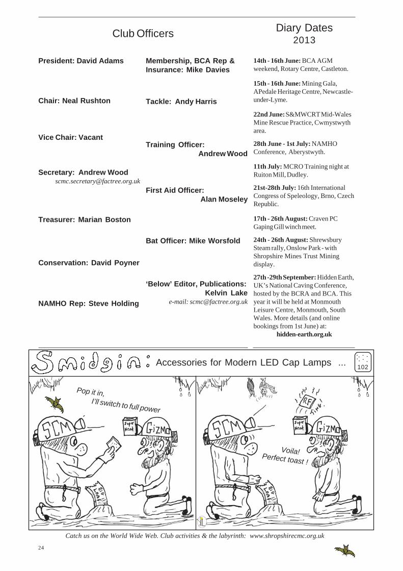
Accessories for Modern LED Cap Lamps ...
Pop it in,I’ll switch to full power
Voila!Perfect toast !
102
.....
...
Membership, BCA Rep &Insurance: Mike Davies
Tackle: Andy Harris
Training Officer:Andrew Wood
First Aid Officer:Alan Moseley
Bat Officer: Mike Worsfold
‘Below’ Editor, Publications:Kelvin Lake
e-mail: [email protected]
President: David Adams
Chair: Neal Rushton
Vice Chair: Vacant
Secretary: Andrew [email protected]
Treasurer: Marian Boston
Conservation: David Poyner
NAMHO Rep: Steve Holding