Embed Size (px)
Citation preview
NPMapWhat Can it Do For You?
insidemaps.nps.gov & maps.nps.gov
Outline
• Quick Overview• Use Cases• NPMap’s Roles• Next Steps
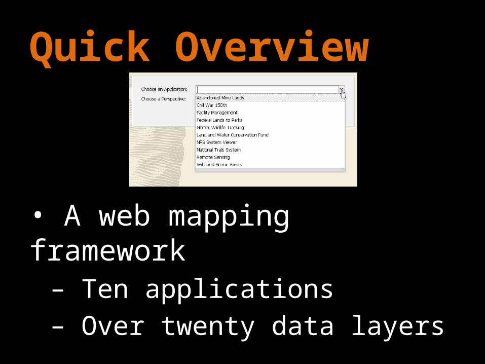
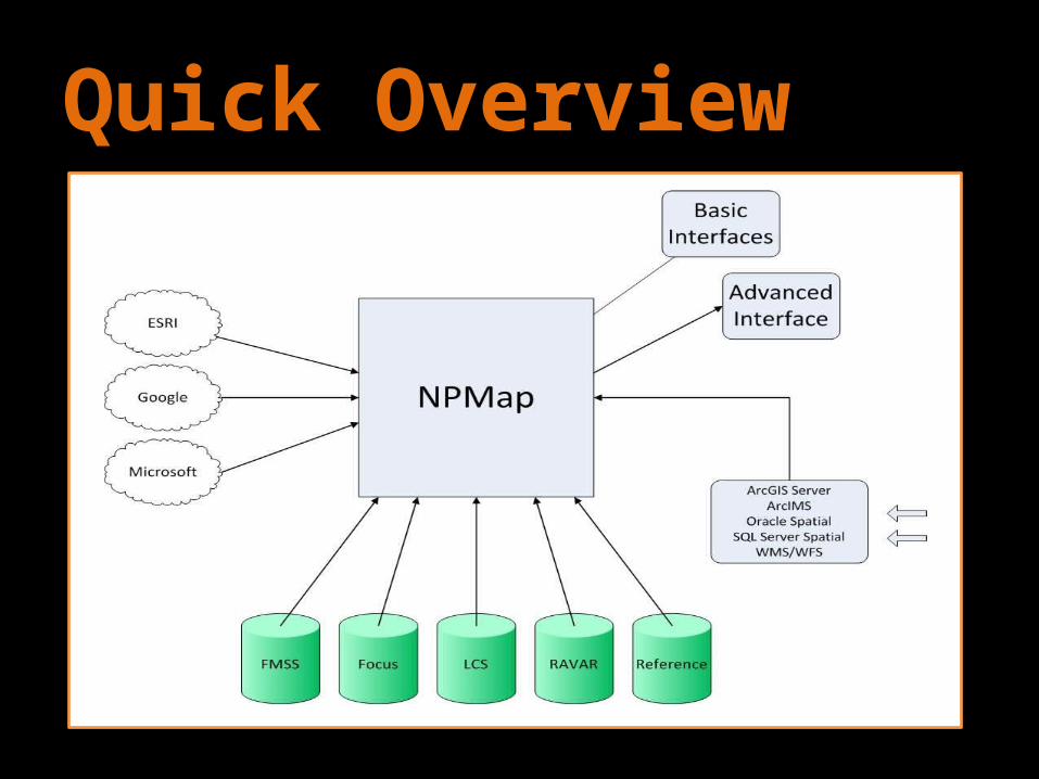
Quick Overview
• A web mapping framework– Ten applications– Over twenty data layers
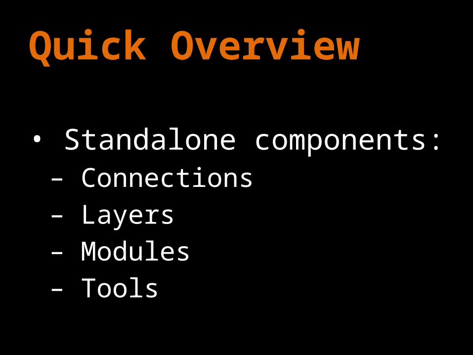
Quick Overview
• Standalone components:– Connections– Layers– Modules– Tools

Quick Overview
• Connections– Integrates external system– Provides geospatial “context”
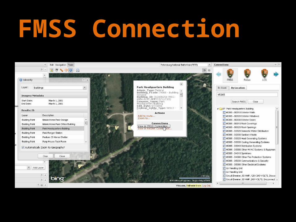
FMSS Connection

Focus Connection
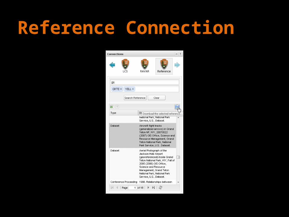
Reference Connection
Quick Overview
• Layers– ArcGIS Server– ArcIMS– JavaScript– Rtree– Others…

Quick Overview
• Modules– Admin – Favorites– Help– Route
Quick Overview
• Tools– Capture X/Y– Identify– Navigation– Print

Quick Overview
• Easily extended• Not one single interface– Advanced interface– Basic interfaces
Quick Overview
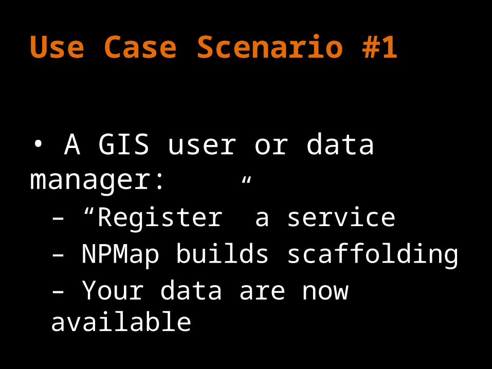
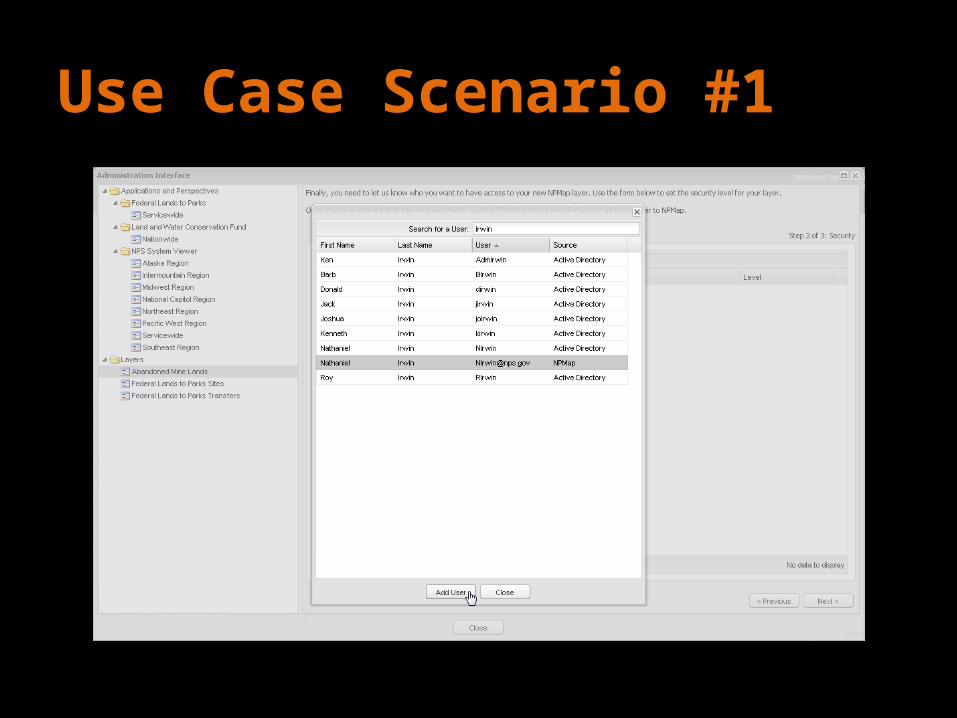
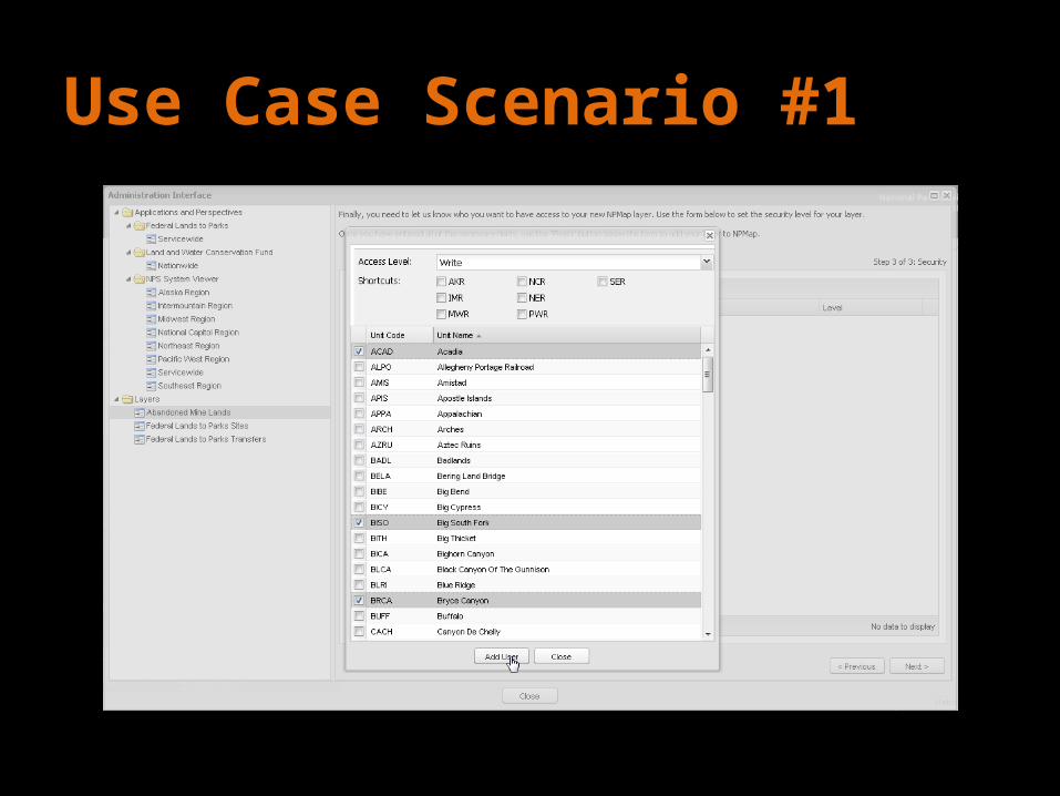
Use Case Scenario #1
• A GIS user or data manager: – “Register” a service– NPMap builds scaffolding– Your data are now available
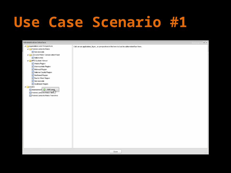
Use Case Scenario #1

Use Case Scenario #1
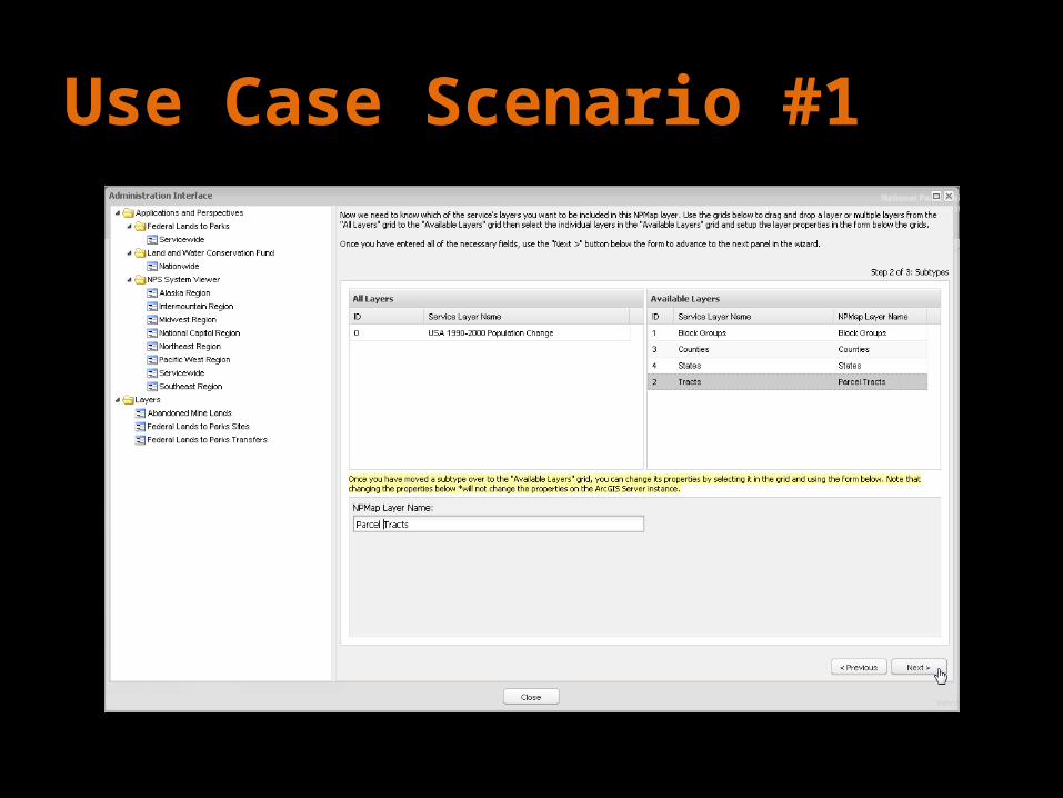
Use Case Scenario #1
Use Case Scenario #1
Use Case Scenario #1
Use Case Scenario #2
• Manager: – “Register” a service– Build an application– Embed application and share

Use Case Scenario #3
• Most end users: – Go to a website and use maps
NPMap’s Roles
• Integration with websites:– nps.gov– Any web page• Data management• Standalone web app
Next Steps
• Catch up on backlog• Expand developer support• Finish admin wizards• Roll out “Basic” interfaces
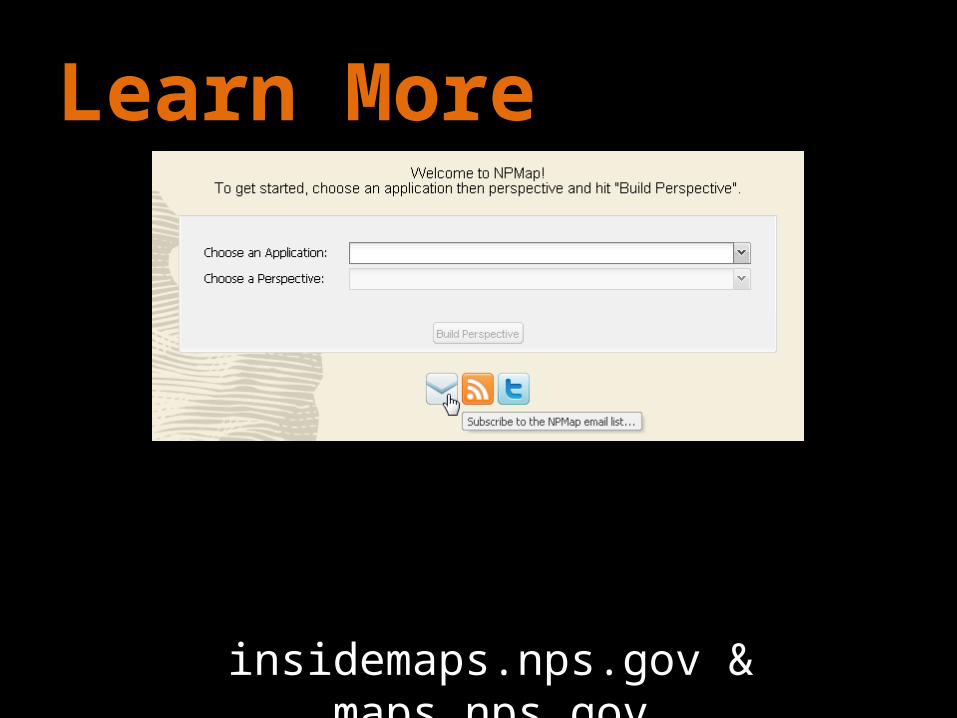
Learn More
insidemaps.nps.gov & maps.nps.gov

Questions?