Embed Size (px)
Citation preview

North-East Lead Local Flood Authorities Sustainable Drainage Local Standards
Durham County Council Gateshead City Council Newcastle City Council North Tyneside Council Northumberland County Council South Tyneside Council Sunderland City Council

Version Date Author(s) Comment
Draft October 2019 Ian Dalgleish (SCC) For LLFA review
For comment November 2019 Brian Weatherall (DCC) Peter Burrows (GC) Jimmy Young (GC) Darren Varley (NeCC) Venus Sanchez (NeCC) James Hitching (NoCC) Helen Parkin (NoCC) Andy Burnett (NTC) Michelle Hogg (STC) Amy Ridgeon(STC) Paul Armin (SCC) Ian Dalgleish (SCC)
Post comment
May 2020 Helen Parkin (NoCC) Updated post comment period Feb 2020
Final Issue July 2020 Helen Parkin (NoCC) Final editing and formatting
The North-East Lead Local Flood Authorities (NE LLFA) consist of Durham, Gateshead, Newcastle, Northumberland, North Tyneside, South Tyneside and Sunderland. Contact details for each Lead Local Flood Authority are as below. Please contact the Local Authority directly if you cannot contact the persons named below.
Local Authority Email
Durham [email protected]
Gateshead [email protected]
Newcastle [email protected]
Northumberland [email protected]
North Tyneside [email protected]
South Tyneside [email protected]
Sunderland [email protected]
Glossary
LLFA Lead Local Flood Authority
NE LLFA North-East Lead Local Flood Authorities
FWMA Flood and Water Management Act 2010
SuDS Sustainable Drainage Systems
NPPF National Planning Policy Framework
CIRIA Construction Industry Research and Information Association
LASOO Local Authority SuDS Officer Organisation
FEH Flood Estimation Handbook
IOH Institute of Hydrology

Introduction
Lead Local Flood Authorities were created by the Flood and Water Management Act with responsibility to manage flooding from surface water, groundwater and ordinary watercourses. The accepted NE LLFA definition of SuDS is: The means of managing rainwater
(including snow and other precipitation) by
mimicking natural drainage with the aim of
reducing damage from flooding, improving
water quality, protecting and improving
the environment, providing amenity and
ensuring the stability and durability of
drainage systems.
The NPPF (163-165) states that SuDS are
required on major developments and LLFAs
are statutory consultees for surface water
management under the Town and Country
Planning Act (TCPA) 2015. Typically, the
approach of the NE LLFA toward drainage
design will follow the NPPF, Planning
Practice Guidance - Flood Risk and Coastal
Change, Non-Statutory Technical Standards
for Sustainable Drainage and the FWMA.
Best practice guidance will be used to
supplement the above documents such as
the CIRIA SuDS Manual (C753 at time of
writing, LASOO guidance, BS8582:2013, and
C532, C648 and C768). All NE LLFAs will
have a Local Flood Risk Management
Strategy, Strategic Flood Risk Assessment
and requirements in relation to flood risk,
water quality, biodiversity and amenity
within a Local Plan or Core Strategy. Some
NE LLFAs have other drainage or SuDS
guidance and adoption documents. There
may also be specific drainage requirements
in planning validation checklists required
before an application will be validated.
This guidance provides the approach the NE LLFA will take on some key questions often asked through the planning process by developers with the aim to improve the submission of flood risk assessments, drainage strategies and SuDS design and promote consistency and best practice within the NE LLFA area. It does not attempt to answer all questions on drainage design and pre-application consultation with a NE LLFA is always recommended. This guidance has been developed considering feedback from developers and their consultants, the Tees Valley Combined Authority (TVCA) local standards for sustainable drainage and in consultation with Northumbrian Water and the Environment Agency.
Green roof In Sunderland

Planning pre-application consultations, NE LLFA SuDS adoption and Highway Authority SuDS adoption All the NE LLFAs are agreed that consultation with the LLFA during the pre-application stage is the only way of ensuring SuDS are best incorporated into development. In addition, some authorities offer a separate pre-application priority charged service relating to SuDS and some NE LLFAs adopt SuDS either via an estate rent charge or Community Infrastructure Levy (CIL). It is important to note that the adoption of development SuDS by the NE LLFA which this guidance refers to is separate to requirements of the Highway Authorities relating to highway drainage. Some Highway Authorities adopt SuDS too. To ensure the best design and any chance of adoption pre-application consultation must be undertaken. From 1st April 2020 Northumbrian Water may adopt forms of SuDS considered sewers in line with Design and Construction Guidance March 2020.
Lemington SuDS Basin
M&S Living wall Newcastle Source : Chronicle Live
Dry Basin In Stobhill Morpeth

The North- East LLFA Local Standards The NE LLFA Local Standards are set out below with reference to the Non-Statutory Technical Standards for Sustainable Drainage in brackets.
Basin in Construction in Warkworth Northumberland
Peak Flow Control (S2 & S3) Local Standard 1 – Equivalent Greenfield Run-Off (GFRO) discharge rates should be provided for new development at all sites (Greenfield and Brownfield). The only limitation on the lowest restricted run-off rate for smaller sites may be the smallest orifice sized flow control as accepted by Northumbrian Water (i.e. 100mm unprotected and 50mm protected – See Design and Construction Guidance). Local Standard 2 – The NNE LLFA accept either FEH or IOH124 methods for calculating GFRO rates. Use of FEH (particularly FEH2013 data) is preferred. See https://fehweb.ceh.ac.uk/. However the LLFAs will accept the FSR
method. For some sites the LLFA may ask for the 2013 FEH method to be used. Local Standard 3 – For calculating GFRO rate the whole site area minus significant areas of public open space should be used. Enclosed areas such as gardens may be included in the GFRO rate for the site. You can use tools such as at the UK SuDS website to determine GFRO rates. https://www.uksuds.com/ Volume Control (S4-S6) Local Standard 4 – The NNE LLFA will set allowable discharge rates following Local Standards 1-3, unless the permissible discharge rate Northumbrian Water will allow to sewer is below GFRO rates.
Elba Park SuDS Sunderland Whenever there is a proposed discharge to sewer it will be expected that formal agreement for a discharge rate to sewer will be provided by Northumbrian Water. You should contact Northumbrian Water Developer Services via their website to make a pre planning enquiry or email [email protected]. It is expected any pre planning enquiry response will be included in submitted documents to LLFAs. Outline planning
The Sill Green Roof Hexham
applications will need to provide a Pre Development Enquiry. Local Standard 5 – Urban creep allowances to be applied up to 10% for residential developments and 0% for commercial developments. Unless a site has a design life of less than 100 years or the current site is 100% impermeable an allowance of 10% for urban creep should be supplied to calculations. PIMP factors (impermeable area as a % of total area) can be set up to 110% to model this. See LASOO guidance for further details. https://www.susdrain.org/files/resources/other-guidance/lasoo_non_statutory_suds_technical_standards_guidance_2016_.pdf
Local Standard 6 – The NE LLFA will accept a single Qbar discharge rate from site or rates no more than the 1 in 1 and 1 in 100-year GFRO in accordance with Defra Standards. For both greenfield and brownfield sites, the LLFA will accept equivalent greenfield runoff rates. At some sites use of a complex control with managed flooding on site may
be the most appropriate way to deliver development. In other areas of known flood risk developers will only be allowed to discharge at Qbar. Please contact your LLFA during pre-application to confirm requirements. If discharge is through existing sewerage networks connected to other offsite drainage GFRO restrictions (or Northumbrian Water restrictions) will apply.
Flood risk within the development (S7 – S9)
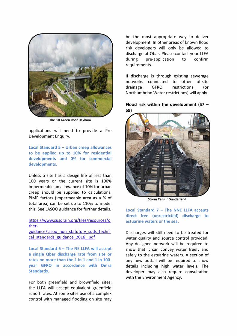
Storm Cells In Sunderland Local Standard 7 – The NNE LLFA accepts direct free (unrestricted) discharge to estuarine waters or the sea. Discharges will still need to be treated for water quality and source control provided. Any designed network will be required to show that it can convey water freely and safely to the estuarine waters. A section of any new outfall will be required to show details including high water levels. The developer may also require consultation with the Environment Agency.

Local Standard 8 – Storm events should be checked as a minimum between 15 minutes and 360 minutes.
Swales in Witton Gilber Durham It is expected that as a minimum all events from a 15-minute storm to the 360-minute (6 hour) storm will be assessed to ensure the volume of water leaving the developed site is not greater than the existing GFRO. This would apply to the 1 year and 100-year + 40% climate change storm event. Attenuation drain down times will be checked for half empty in 24 hours for larger catchments and modelling times extended where required. Local Standard 9 - Climate change allowances to be applied are 40% on the extreme event modelling (100 year return period) This is equal to the current upper end requirement as noted by the Environment Agency. https://www.gov.uk/guidance/flood-risk-assessments-climate-change-allowances.
Structural Integrity (S10-S11) Local Standard 10 - 300mm free board is required in SuDS design 300mm freeboard should be provided or 300mm between top level of water during the 1 in 100 year +40% climate change storm event and finished floor level must be shown and exceedance routes should be checked. Local Standard 11 – 1D or 2D modelling may be required for ordinary watercourses within or adjacent to new developments. The developer should contact the LLFA to ensure the approach and modelling package they use is appropriate
Designing for Maintenance Considerations (S12)
Permeable paving in Gateshead Local Standard 12 – Overland flow modelling for surface water flood routes or other reasons may be required as part of formal submissions. Sites where surface water overland flow routes are present, are located on sloping sites or are in are location of known surface water flood risk will be required to submit

detail on overland flow management. The LLFA may request overland flow modelling. This is required to show surface water flow routes will be managed. The type of modelling package required should be confirmed with the LLFA. Indicative overland flow routes can viewed online https://flood-warning-information.service.gov.uk/long-term-flood-risk/map
Construction (S13-S14)
Swales under construction Gateshead
Local Standard 13 – To assess the risk of tide locking a combined tidal and surface water event must be assessed where the development is in or directly adjacent to flood zone 2 or 3.
The key risk to be assessed is whether the outfall is surcharged affecting site drainage. For example, a 1 in 100-year tidal level and a 1 in 10-year surface water flow or a 1 in 200-year tidal level and a 1 in 5-year surface water flow could be assessed. The drainage network of the development should still be assessed to show that it can convey flow up to the 1 in 100 year plus 40% rainfall event. A similar requirement may apply to discharges to watercourses where outfalls may be surcharged. Coastal design sea level
data can be found as Environment Agency Open Data.
Silksworth Basin Sunderland
Local Standard 14 – SuDS design should meet the latest CIRIA SuDS Manual, Sewers for Adoption, British Standards and other best practice guidance. A formal pre-application check should be made with local authorities to determine where there may be any change allowed from this standard based on site specific requirements. See also: https://www.susdrain.org/resources/ , http://sfa.wrcplc.co.uk/home.aspx & https://www.bsigroup.com/en-GB/
Other Local Standards (S15-S22) Local Standard 15 – A site specific maintenance plan will be required to detail how SuDS will be maintained and who will maintain them. This plan should include consideration of practicalities such as access routes. Some LLFAs may allow this to be conditioned or a final plan to be conditioned. Check with the LLFA during formal pre-application discussions. Management and maintenance company details will need to be supplied prior to occupation.

Local Standard 16 - A construction plan is required to show surface run off, any water receptors and an outline of mitigation measures.
Swales in Hexham Northumberland
This is to manage risk to development sites when the surface of the site is stripped or on larger sites as the wider site is developed. Some LLFAs may allow this to be conditioned or a final plan to be conditioned. Check with the LLFA during formal pre-application discussions. These standards add further detail to the approach provided in the Non-Statutory Technical Standards for Sustainable Drainage and are intended to clarify the local approach. Local Standard 17- The NNE LLFA consider SuDS to be on the surface "green SuDS" that show multifunctional benefit (including quantity control, water quality, biodiversity and amenity) and mimic natural drainage in line with the NPPF and FWMA definitions
Consideration of landscaping and ecology should be an integral part of the selection and design process for SuDS. Local Planning Authorities will ensure that liaison between drainage, landscape and ecology
teams will occur through pre planning enquiry to support these applications. It will be expected that landscaping and ecology details will be referred to and described on drainage layouts and where required supported by additional plans before planning approval. Other drainage solutions such as tanked storage will be considered only on a site by site basis. A viability assessment will be required if multifunctional benefit vegetated SuDS are not proposed
Monkseaton Flood Alleviation scheme
Local Standard 18 – The NNE LLFA typically follow LASOO guidance for FRA and Drainage Strategy requirements at Outline and Full planning permission Some LLFAs have further defined requirements. Please contact them during formal pre-application to obtain further information. The LASOO guidance can be found at: https://www.susdrain.org/files/resources/other-guidance/lasoo_non_statutory_suds_technical_standards_guidance_2016_.pdf

Permeable Paving Newcastle Airport
Local Standard 19 – Infiltration testing is required at all sites before planning approval. While it is accepted at most sites full infiltration will not be possible partial infiltration (10-6 ms-1 to 10-8 ms-1) may be achievable. Infiltration tests should be undertaken as part of site investigations including falling head tests (in line with DG365) at all sites. A minimum of 2 representative tests of 6 hours at likely discharge locations should be provided and the results submitted. Should tests be favourable for full infiltration further testing in specific locations for infiltration should be undertaken. The only exceptions are sites where ground contamination is present, there are proven concerns over ground stability (i.e. coal mining reports), or groundwater levels are measured within 1m of the surface. Copies of DG365 may be obtained at https://www.brebookshop.com/details.jsp?id=327631 Local Standard 20 - Source control interception (retaining 5mm rainfall on site) should be applied for the
impermeable area of all sites using the CIRIA SuDS manual method. Where source control interception is not
possible for all impermeable areas as
evidenced through site investigation and
infiltration testing every reasonable effort
should be made to provide as much source
control across the site as possible using
features like permeable paving. See the
SuDS Manual section 24. The developer may
use site infiltration results and SuDS design
evidencing infiltration and/or evaporation
to demonstrate provision of source control
by volume. Infiltration tests results, risk of
subsidence, ground contamination and
measured high ground water levels can all
be used to determine whether full
interception can be provided at a site.
Local Standard 21- SuDS can be used as open space outside of the area wetted by a 1-year return storm. SuDS should be designed to be accessible and useable spaces outside of frequent storm extents both for amenity and wildlife with appropriate health and safety assessments considered. Gradients of 1 in 5 are preferred for useable amenity space. Local Standard 22 - Water quality information should be assessed using criteria in the current CIRIA SuDS manual. The approach of the developer should be explained within submitted documents in terms of pollutant loading and removal. Where required consideration should be given to treatment volumes, velocities, depths and retention times of water being treated. Each design should be assessed against treatment stages and the simple indices method of the SuDS Manual. See the SuDS Manual section 26.


