Embed Size (px)
Citation preview
Ministry of Land, Infrastructure, Transport and Tourism
1
New NSDI and National Mapping Policy of Japan
Geographical Survey Institute, JapanYukiko TACHIBANA

Ministry of Land, Infrastructure, Transport and Tourism2
NSDI Act and FGD

Ministry of Land, Infrastructure, Transport and Tourism
3
Utilization of Geospatial Information in Japan
GSI established over 1,200 GPS-based control stations throughout the country.
Crustal movement is monitored near real time.Observation data can be downloaded through the Internet
for free of charge.
GPS stations are already an important infrastructure in Japan
Utilization of GPS
GPS-based control station distribution Crustal movement around Japan
Ministry of Land, Infrastructure, Transport and Tourism
4
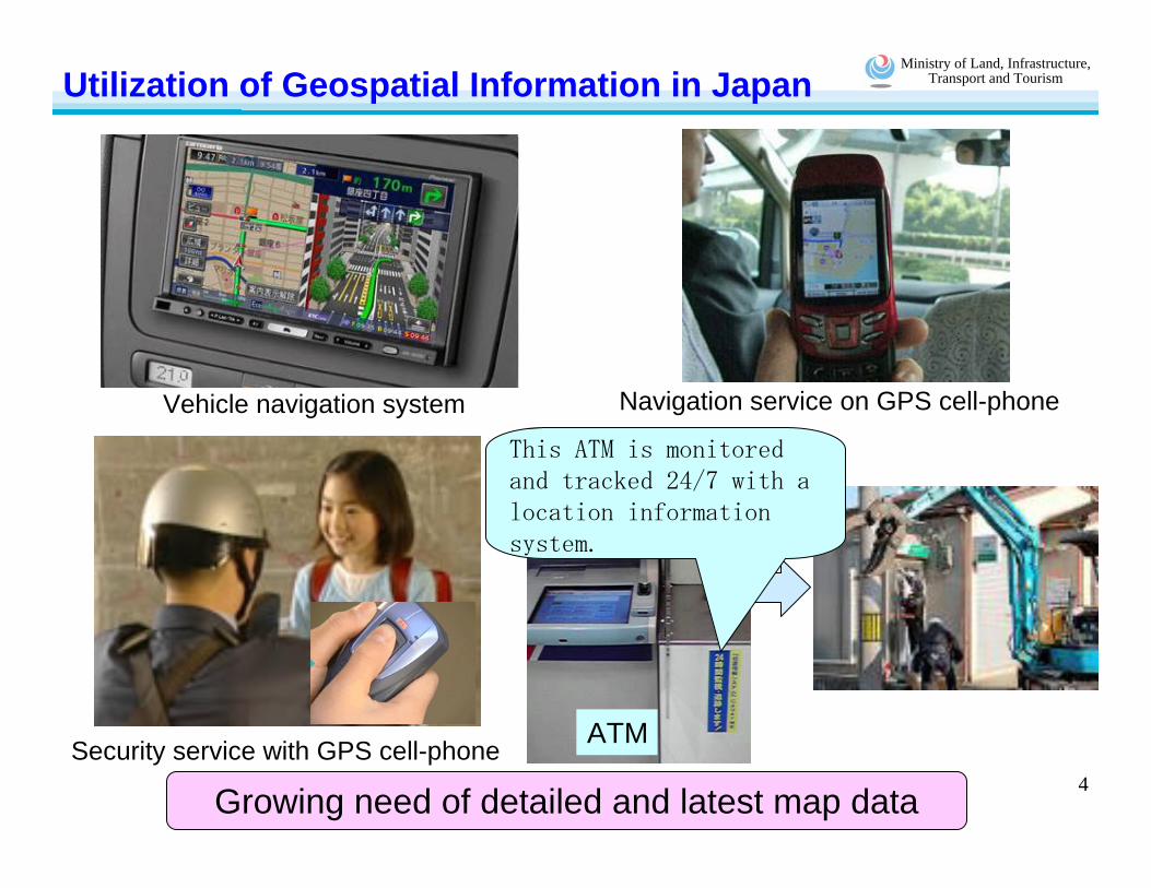
Utilization of Geospatial Information in Japan
Vehicle navigation system Navigation service on GPS cell-phone
Growing need of detailed and latest map dataSecurity service with GPS cell-phone ATM
This ATM is monitored and tracked 24/7 with a location information system.
Ministry of Land, Infrastructure, Transport and Tourism
5
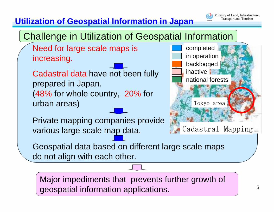
Challenge in Utilization of Geospatial InformationUtilization of Geospatial Information in Japan
Major impediments that prevents further growth of geospatial information applications.
completedin operationbacklogged
national forestsinactive
Cadastral Mapping
Tokyo area
Need for large scale maps is increasing.
Cadastral data have not been fully prepared in Japan.(48% for whole country, 20% for urban areas)
Private mapping companies provide various large scale map data.
Geospatial data based on different large scale maps do not align with each other.
Ministry of Land, Infrastructure, Transport and Tourism
6
NSDI Act of Japan
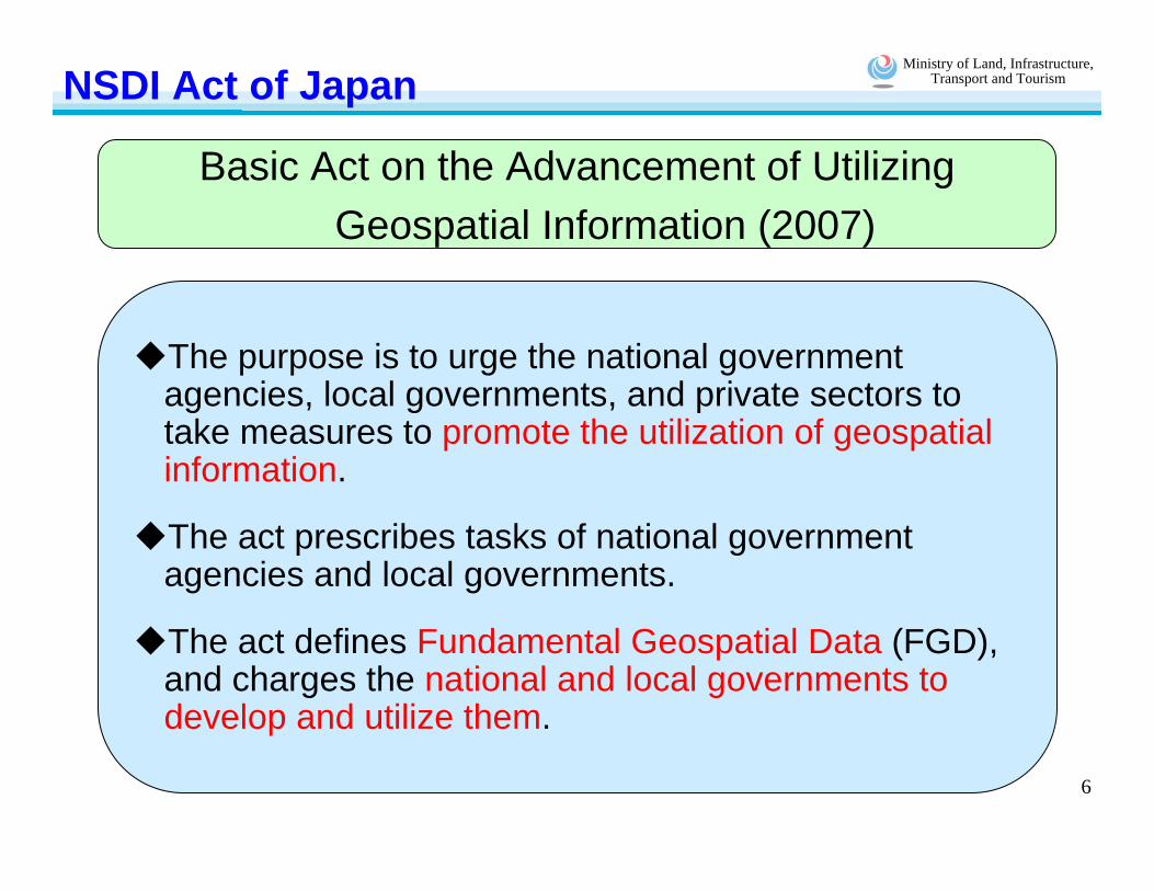
Basic Act on the Advancement of UtilizingGeospatial Information (2007)
The purpose is to urge the national government agencies, local governments, and private sectors to take measures to promote the utilization of geospatial information.
The act prescribes tasks of national government agencies and local governments.
The act defines Fundamental Geospatial Data (FGD), and charges the national and local governments to develop and utilize them.
Ministry of Land, Infrastructure, Transport and Tourism
7
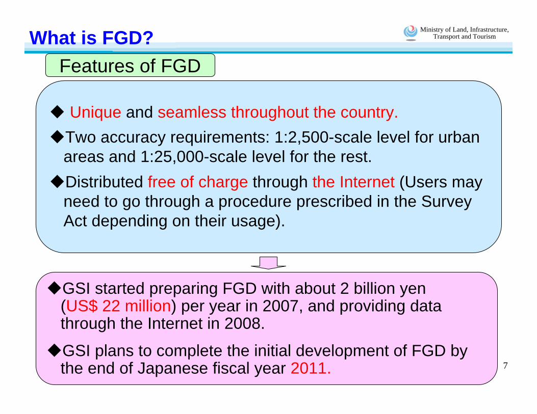
What is FGD?
Unique and seamless throughout the country.Two accuracy requirements: 1:2,500-scale level for urban areas and 1:25,000-scale level for the rest.Distributed free of charge through the Internet (Users may need to go through a procedure prescribed in the Survey Act depending on their usage).
GSI started preparing FGD with about 2 billion yen (US$ 22 million) per year in 2007, and providing data through the Internet in 2008.
GSI plans to complete the initial development of FGD by the end of Japanese fiscal year 2011.
Features of FGD

Ministry of Land, Infrastructure, Transport and Tourism
8
What is FGD?
Geodetic Control Point Coastline Boundary of public facilities(Road Management Boundary)
Boundary of public facilities(River Management Boundary)
Administrative Boundary (town level; with a point in each polygon) Road Edge
Riverside Edge of Levee Crown Railroad Track Centerline
Elevation (ground surface point where the elevation is known Shoreline
Building Outline Community Boundary (with a point in each polygon)
Street Block Boundary (with a point in each polygon)
Items of FGDInformation that is included in FGD for positional reference

Ministry of Land, Infrastructure, Transport and Tourism
9
Development and Updating of FGDCurrent Status of FGD Preparation
Completed for urban area(about 60,000km2)
Designated urban area (about 100,000 km2)
Data provided for urban area(about 21,700km2)1:25000 scale map coverage area(already provided)

Ministry of Land, Infrastructure, Transport and Tourism
10
Development and Updating of FGDLarge-scale maps
(prepared by local and national governments)
City A Road Management Office B City C
Seamless integrationAccuracy assurance
FGD
Ministry of Land, Infrastructure, Transport and Tourism
11
Development and Updating of FGD
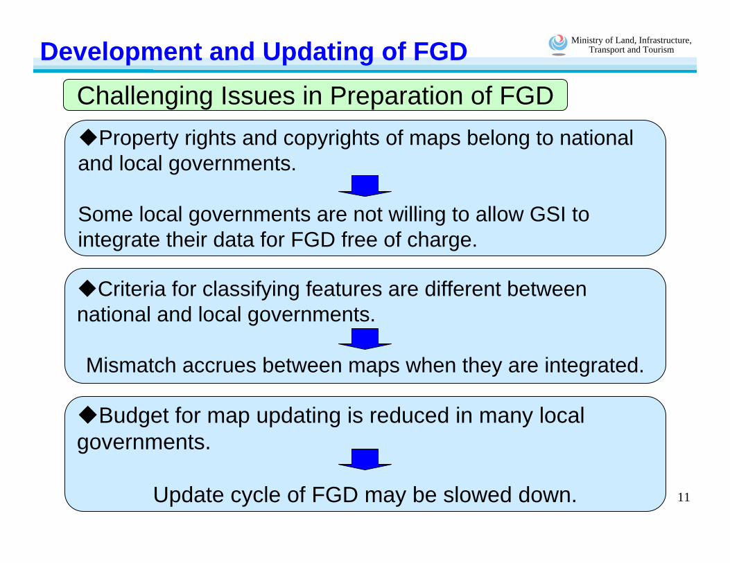
Criteria for classifying features are different between national and local governments.
Mismatch accrues between maps when they are integrated.
Property rights and copyrights of maps belong to national and local governments.
Some local governments are not willing to allow GSI to integrate their data for FGD free of charge.
Budget for map updating is reduced in many local governments.
Update cycle of FGD may be slowed down.
Challenging Issues in Preparation of FGD

Ministry of Land, Infrastructure, Transport and Tourism
12
New Basic Map Database:Digital Japan Basic Map
Ministry of Land, Infrastructure, Transport and Tourism
13
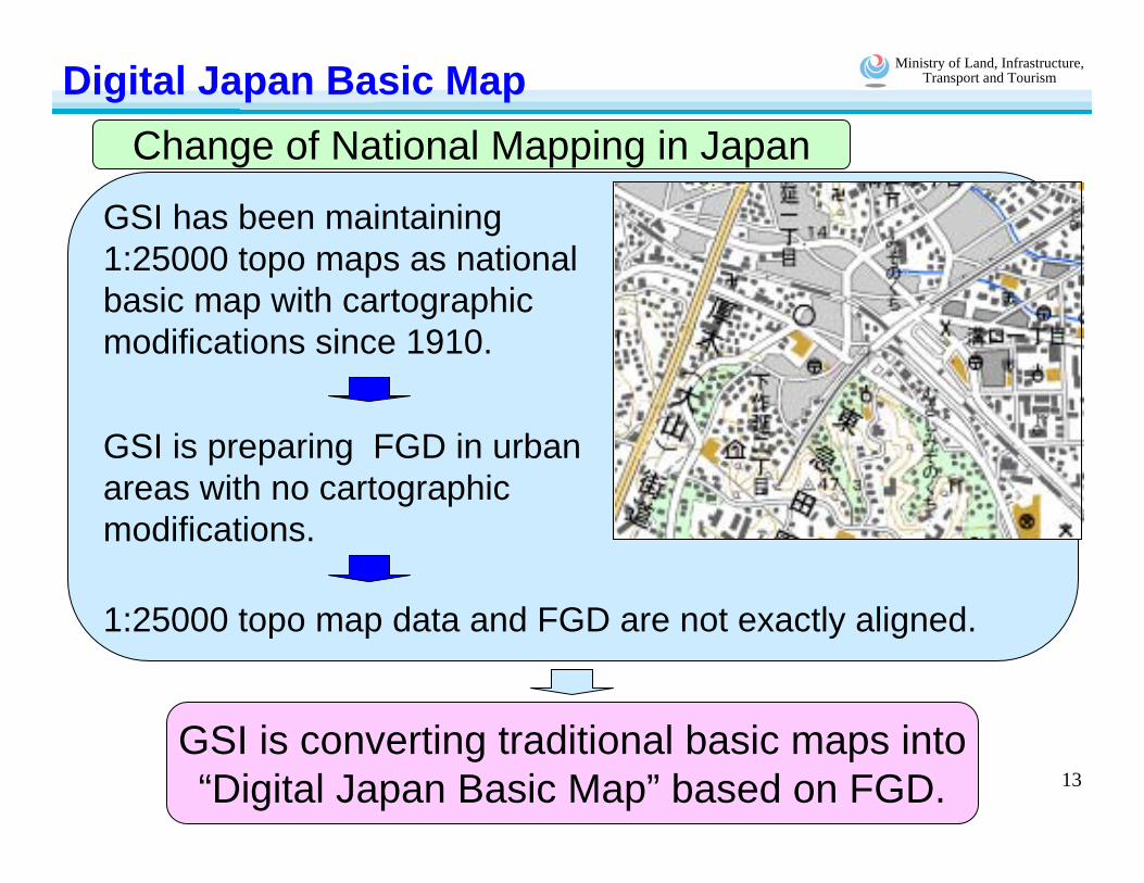
Digital Japan Basic MapChange of National Mapping in Japan
GSI is converting traditional basic maps into“Digital Japan Basic Map” based on FGD.
GSI has been maintaining 1:25000 topo maps as national basic map with cartographic modifications since 1910.
GSI is preparing FGD in urban areas with no cartographic modifications.
1:25000 topo map data and FGD are not exactly aligned.

Ministry of Land, Infrastructure, Transport and Tourism
14
Digital Japan Basic Map
New National Basic Map of Japan
New national map database replacing conventional 1:25000-scale topographic maps.
New database consists of three components;map information, digital ortho imagery and geographic names
FGD
Additional information
Map information
Digital Japan Basic Map
Digital ortho image
Geographic names

Ministry of Land, Infrastructure, Transport and Tourism
15
Summary
GSI makes effort to prepare and update FDG with the cooperation of other national government agencies and local governments.
GSI will update “Digital Japan Basic Map”, new national basic map that is based on FGD.