Embed Size (px)
Citation preview
HAL Id: halshs-00950902https://halshs.archives-ouvertes.fr/halshs-00950902
Submitted on 23 Feb 2014
HAL is a multi-disciplinary open accessarchive for the deposit and dissemination of sci-entific research documents, whether they are pub-lished or not. The documents may come fromteaching and research institutions in France orabroad, or from public or private research centers.
L’archive ouverte pluridisciplinaire HAL, estdestinée au dépôt et à la diffusion de documentsscientifiques de niveau recherche, publiés ou non,émanant des établissements d’enseignement et derecherche français ou étrangers, des laboratoirespublics ou privés.
A New Examination of Urban Intervention: SocialAcceptance of Urban Development
Nora Semmoud
To cite this version:Nora Semmoud. A New Examination of Urban Intervention: Social Acceptance of Urban Development.Gülçin Erdi-Lelandais. Understanding the city Henri Lefebvre and urban studies, Cambridge ScholarsPublishing, pp. 91-116, 2014. �halshs-00950902�
A New Examination of Urban Intervention:
Social Acceptance of Urban Development
Nora Semmoud
This article provides a partial description of research1 that has the potential to be the urban studies counterpart of the perspective developed by Jauss (1978) concerning the dialectical, open and flowing relationship between the production of literature and its public reception. Following Jauss’ example, my approach is based on the dialectics behind the conditions of production of urban space and its acceptance by the people for whom it is intended. Any transformation of space (or instrumentalisation of the space, according to Lefebvre, 2000), therefore, has an impact on social organisation. This impact can only be explained by shifting the analysis towards the means by which space is appropriated2 or used. In this process, professionals believe they have designed a space for certain uses but in reality something else has taken place. The reflection is based here on the concept of the instrumentalisation of the space elaborated by Lefebvre (2000), who believed that there is an important distinction between what is happening in the space (what is lived and perceived by the inhabitants) and what is done of the space by the urban planning professionals. The space, considered abstract by the author, is subject to manipulation and serves as an instrument of domination. Here, the representation of space is a specific conceptualisation of the instrumentation of the spatial organisation - a procedure -, through the iconographic tools or the norms, to produce a space that follows the dominant group’s interests (Lefebvre, 1970).
By facing any new urban organisation, inhabitants readjust the way they behave in the space. As Lefebvre points out: “[...] the designed space of the scientists, planners, urbanists, technocrats ‘carvers’ and ‘organisers’ [...] pushed to confuse the experience and the perceived with the designed” (2000, 48). Inhabitants, therefore, restructure the space according to their representations of it. It must be stressed that the forms of appropriation and acceptance of urban development correspond largely to the very features of urbanism (that is, its nature and social coherence because people relate to it through their past experiences and accumulated knowledge). Taking these aspects into account and as suggested by Lefebvre, it seems that a change in attitude on the part of professionals of urban development and planning is called for: they must necessarily take into account the usages of the inhabitants. This would enable them to see strictly the social impact
2
of urban projects. The gap between the lived space and the conceived space shed lights on “blind spot” in the operational view of institutional decision-makers that reflects their relative blindness to social organisation and the effects produced of their interventions on space. Lefebvre had already analysed this relationship between institutional decision-makers and social organisation. He shows, through such varied terminology as blind spot, the non-see [le non-voir] and the non-formal knowledge [le non-savoir], that the behaviour of the decision-makers could switch between the refusal to see and to know, and the ignorance and lack of discernment and foresight.
“The blindness, the non-see and non-formal knowledge involve an ideology. The blind spot take place in the re-presentation. There is first the presentation of the facts and the set of facts; the way of perceiving it and putting them together. Then, there is the re-presentation, the interpretation of the facts” (Lefebvre, 1970, 44).
Starting from these assertions and based on an empirical examination of urban planning actions, this article reveals the primary focus of reflection required when assessing the social acceptance of urban planning. First, in order to understand the social logic of an urban planning project, the conditions of production of space are examined through the representations and practices of decision-makers. Attention is then given to the contradictions that may arise between the promoters of a project and the project managers. Examination of relations between decision-makers and the social requirements expressed by neighbourhood associations, meanwhile, allow a critical analysis of participative approach and their paradoxical manifestations. These sometimes appear as an area of conflict, of conflict/negotiation and learning, or sometimes as an undertaking to legitimise urban planning.
Secondly, the conditions of appropriation of urban space, which reveal the social organisation, are analysed. It is important to recall here the words of Lefebvre, who considers that:
“The right to the city [...] as the superior form of rights: the right to freedom, to individuation in the socialisation, to the habitat and to the living. The right to work of art (to activity participating) and the right to appropriation (although distinct from the right to property) are involved in the right to the city” (2009, 125).
The conditions of appropriation enable us to understand the social construction
of a district, the specificities of the social groups that live inside and their relationships with one another. They shed light on the interactions between social groups (Goffman, 1974) and the way in which their representations manage in defining their forms of cohabitation and constructing of a neighbourhood
3
community. Above all, they stress the dynamics of ‘revision/adaptation’ of the urban space by its inhabitants to make it conform to their habitus3 (Bourdieu, 1972). Apart from the fact that this social reorganisation of space reveals the ‘blind spot’ with which institutions and professional decision-makers viewed their interventions, it also provides elements that enable someone to re-examine the results of urban organisation.
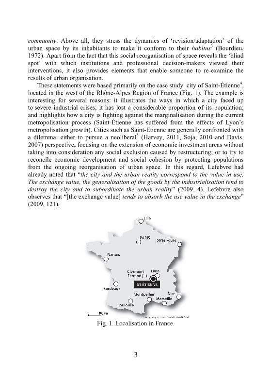
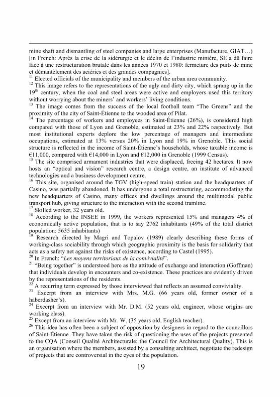
These statements were based primarily on the case study city of Saint-Étienne4, located in the west of the Rhône-Alpes Region of France (Fig. 1). The example is interesting for several reasons: it illustrates the ways in which a city faced up to severe industrial crises; it has lost a considerable proportion of its population; and highlights how a city is fighting against the marginalisation during the current metropolisation process (Saint-Étienne has suffered from the effects of Lyon’s metropolisation growth). Cities such as Saint-Etienne are generally confronted with a dilemma: either to pursue a neoliberal5 (Harvey, 2011, Soja, 2010 and Davis, 2007) perspective, focusing on the extension of economic investment areas without taking into consideration any social exclusion caused by restructuring; or to try to reconcile economic development and social cohesion by protecting populations from the ongoing reorganisation of urban space. In this regard, Lefebvre had already noted that “the city and the urban reality correspond to the value in use. The exchange value, the generalisation of the goods by the industrialisation tend to destroy the city and to subordinate the urban reality” (2009, 4). Lefebvre also observes that “[the exchange value] tends to absorb the use value in the exchange” (2009, 121).
Fig. 1. Localisation in France.
4
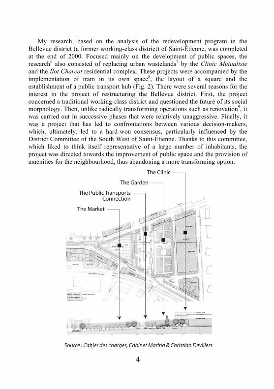
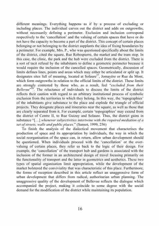
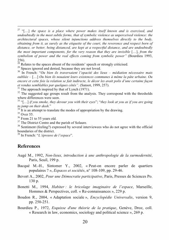
My research, based on the analysis of the redevelopment program in the Bellevue district (a former working-class district) of Saint-Étienne, was completed at the end of 2000. Focused mainly on the development of public spaces, the research6 also consisted of replacing urban wastelands7 by the Clinic Mutualiste and the Îlot Charcot residential complex. These projects were accompanied by the implementation of tram in its own space8, the layout of a square and the establishment of a public transport hub (Fig. 2). There were several reasons for the interest in the project of restructuring the Bellevue district. First, the project concerned a traditional working-class district and questioned the future of its social morphology. Then, unlike radically transforming operations such as renovation9, it was carried out in successive phases that were relatively unaggressive. Finally, it was a project that has led to confrontations between various decision-makers, which, ultimately, led to a hard-won consensus, particularly influenced by the District Committee of the South West of Saint-Étienne. Thanks to this committee, which liked to think itself representative of a large number of inhabitants, the project was directed towards the improvement of public space and the provision of amenities for the neighbourhood, thus abandoning a more transforming option.

5
Fig. 2. Le Projet Devillers.
1. The conditions for the emergence of the project and its
implementation
The concrete effects of the representations on social interaction and territorial process make them essential when examining public policies of urban development. The collective memory10 and the economic and social crises are the cause of negative and demeaning representations that have affected the Saint-Étienne area. These representations were of concern to the public authorities and so they attempted to reverse them. The representations often reflect the relationships between the dominant and the dominated and can be either shared or divergent, even if their institutionalisation usually ends in consensus. Thus, other representations beyond the strategies of the dominant urban decision-makers have had some effect on influencing public opinion, as shown in local mindsets, particularly for those whose family histories were marked by working-class and mining backgrounds. Aware of the important role that their families had played in the economic development of the metropolitan area, they strongly opposed all forms of socio-spatial marginalisation. Institutional decision-makers11, who had thoroughly understood the effectiveness of the representations on the perception of a territory, sought to influence these areas by erasing or promoting images, such “black city”12 being replaced by “green city”13. This manipulation of images would be synchronised with urban transformation programs. Thus, transformation of reality that minimised the nature of social structure, regarded as a handicap14, would legitimise the image and urban transformation strategies and policies designed to attract affluent social categories and economic operators.
These diverse perspectives resulted in paradoxical urbanism where development operations were taking place in Bellevue at the same time as large-scale operations were starting up at the sites of GIAT15 and Châteaucreux16. The goal was to attract executives and economic operators, and to offer an elitist central location, but this then raised the question of the fate of existing social space. Conflicting ideas of urban projects correspond to a consensus that seeks to combine the desire to attract both the upper classes and economic operators and to maintain the working classes wishing to remain. However, this consensus was characterised by a certain fragility when faced with the entrenched positions of the decision-makers. A number of them called for authoritarian urban development and exclusion aiming to erase the working-class past and opening up the city to new forms of economic investment, and others urging urban programs aimed at distributing services in the city (e.g., public transport, social and cultural facilities) to meet the needs of low-income groups of the population, while at the same time welcoming the upper classes.

6
The evolution of the Bellevue development project captures perfectly the changes that affect the balance of power between the different decision-makers. In 1992, the first description of the project by the Catalan architect Ricardo Bofill, was characterised by densely built-up areas, the monumental design of which produced a crushing effect on the volume of existing buildings. Local residents then set up a neighbourhood association that initially was able to assert itself during the consultation period of the project. Questioned by the elected officials about its representativeness, the association organised a broad survey of the inhabitants, who rejected the logic of radical transformation of the area proposed by the Bofill project. Local councilors then decided to change the logic of the project that was reformulated by the Devillers design office in a less aggressive version. It directed its interventions on the improvement of public space and the provision of services in the neighbourhood, notably the construction of a clinic and a multimodal public transport hub.
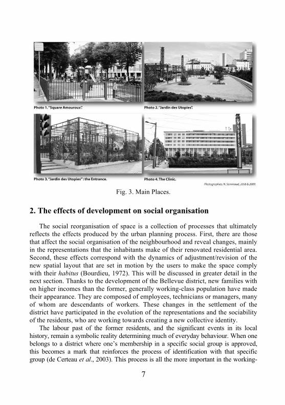
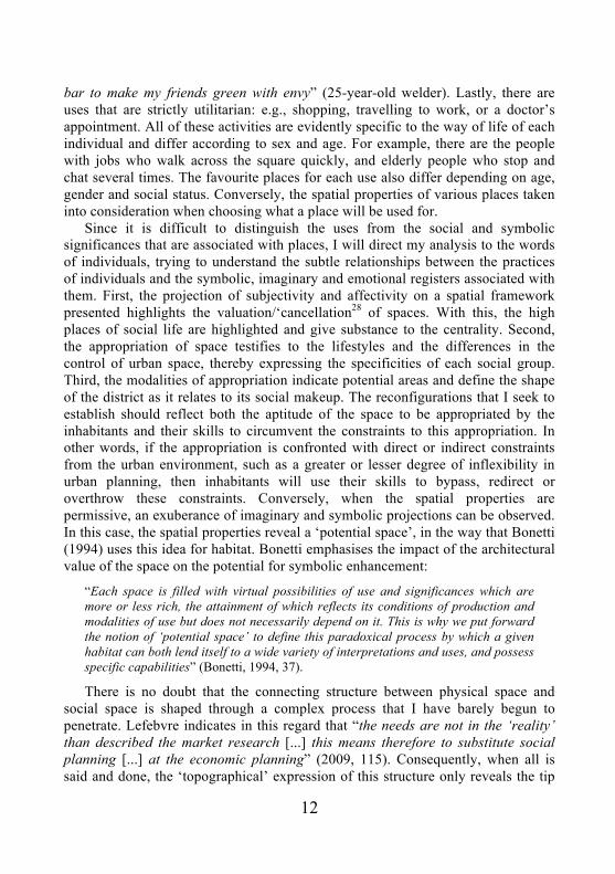
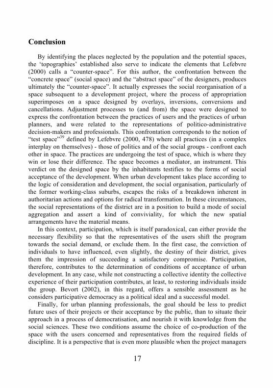
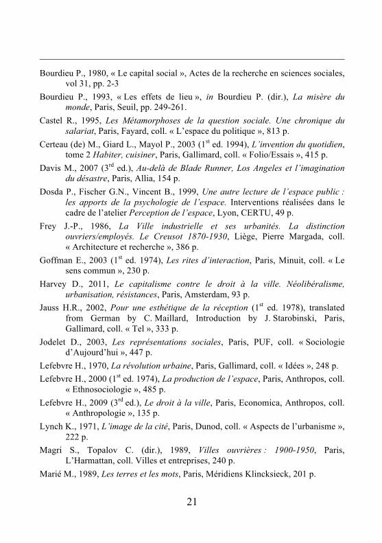
The contradictions between the politico-administrative objectives and their awareness of the expressed social demands were reflected in the contrasted evolution of the project and made the decision-makers’ work more complex. In addition, the process of enlargement/fragmentation of decision-making was common to urban areas and related to the large number of decision-makers and partnerships. Thus it has inevitably led to a struggle for position by the decision-makers on the new local power scene, while it made necessary the construction of a consensus. The large number of decision-makers and the divergent interests that they represented revealed their contradictions and therefore directly aided the action of the neighbourhood association. Despite a consensus on the unaggressive approach to the overall project, disagreements between promoters were reactivated by the project managers at the time of construction. They worked in a disorganised manner and individualised their work thus diverging from the coherence of the overall project. The space thus produced is more like a puzzle that testifies to the division of the designers by their field of expertise: the clinic is an architectural structure that does not fit into its urban surroundings; the multimodal public transporta hub, designed according to the rules of transporta engineering, does not take into account the practices of the users; and the garden designed by landscape artists is more concerned with geometrics and aesthetics than its use by the public (Fig. 3). After examining the condition of the realisation project, in the next section, I propose to analyse its social effects.
7
Fig. 3. Main Places.
2. The effects of development on social organisation
The social reorganisation of space is a collection of processes that ultimately reflects the effects produced by the urban planning process. First, there are those that affect the social organisation of the neighbourhood and reveal changes, mainly in the representations that the inhabitants make of their renovated residential area. Second, these effects correspond with the dynamics of adjustment/revision of the new spatial layout that are set in motion by the users to make the space comply with their habitus (Bourdieu, 1972). This will be discussed in greater detail in the next section. Thanks to the development of the Bellevue district, new families with on higher incomes than the former, generally working-class population have made their appearance. They are composed of employees, technicians or managers, many of whom are descendants of workers. These changes in the settlement of the district have participated in the evolution of the representations and the sociability of the residents, who are working towards creating a new collective identity.
The labour past of the former residents, and the significant events in its local history, remain a symbolic reality determining much of everyday behaviour. When one belongs to a district where one’s membership in a specific social group is approved, this becomes a mark that reinforces the process of identification with that specific group (de Certeau et al., 2003). This process is all the more important in the working-
8
class district of Bellevue, where the new amenities partly concern the children of workers who in terms of education have been able to rise socially and attain a higher social status than their parents. For this latter group, they belong to what is generally considered the reference group (Boudon, 2004). For many executives with their roots in other social strata who chose to settle in this neighbourhood, the working class represents a group whose values are mythologised. These executives may have the impression that the neighbourhood is friendly, and they associate this with the legacy of its working-class past and its work ethic of sacrifice and solidarity: “if there is a hard blow, we are not alone. We can help each other even if we haven’t frequent relations […]. We keep the relations with the unemployed persons, don’t let them down, it’s tradition”17. In this case, what is important is not the numerical superiority18 of the working-class social group, but rather its influence on the relationships between inhabitants. It imprints the image of the place, the lifestyle and, sometimes, the processes of populating.
The gentrification following the arrival of a new population in the district has had consequences for the social interaction between old and new residents. It is understood that the forms of sociability between individuals gives the district its social value. The interactions between the old and new inhabitants accelerate the transformation of the neighbourhood. When recomposing a traditional working-class district, there is in fact evidence of the disappearance of a system of sociability characteristics of working-class communities19. One of the negative consequences of the intensity of social relations in the district is often overwhelming social control (Bacqué, Sintomer, 2002). Its replacement by a system including other social groups diversifies its forms of social bonds, enlarges its territoriality and frees individuals from community constraints. This diversification of the forms of sociability also depends on the social category, gender and age of the individual, and concerns several scales (e.g., residence, district, city, urban centre). All of these forms of sociability participate, each in its own way, in the construction of the social capital (Bourdieu, 1980) of the district.
The analysis of the forms of cohabitation between old and new residents overlaps with other work, representing reflections on the present day mechanisms of urban social aggregation, and highlights two important ideas. First, the reconfiguration of formerly working-class neighbourhoods occurs through changes in the representations that people make of themselves, others and their neighbourhood. Social cohabitation and the relationships that are progressively introduced are built from the representations of interdependence between individuals of each social category. From the symbolic capital of the district, which pre-existed but were reactivated by them, new residents have been able to build positions for themselves in the local social space more rapidly and more easily than they could have done in another type of district, such as a wealthier neighbourhood. At the same time, they have taken advantage of the feelings of security offered by the working class, with its potential for solidarity. In this form of
9
cohabitation, long-time residents may be able to get out of a chronic process of confinement in poverty or to free themselves from a path that condemns them to social stagnation. In any case, they benefit from the added value that this cohabitation offers.
The representations, fundamental to this collective identity, are fed by a real dynamic of diverse forms of exchange between long-time residents and new arrivals, such as child minding, rooms for rent, do-it-yourself and tutoring. In the end, the collective identity is built on a sort of interdependence where each one needs everyone else; an idea that can be expressed as: “you consider me worthwhile, I’ll give you security; you give me security, I’ll consider you worthwhile”. This is indicated by the following remarks: “there are good people in the neighbourhood, executives, rich and they do not look down upon others” (Retired worker); “they are very supportive, honest among themselves [...] they give us lessons” (retired bank manager). The elements of identity are made up of a set of attributes that each individual assumes in imaginary fashion or that others assign to them (Bonetti, 1994). This is what Augé (1992) defined as anthropological domain.
Secondly, the above research underlines that the results of the reconfiguration of working-class districts according to the features of social diversity is dependent on the nature of the urban development undertaken. When they were spared by brutal transformation of the urban morphology to maintain the social fabric while encouraging the arrival of new populations, they gave the district “territorial means of conviviality”20 (Raymond, 1988, 4) or in any case, the spatial arrangements for promoting this social cohabitation and a development of the idea of being together21. Differences in the forms of reconfiguration of traditional working-class districts and the new features that they produce are undoubtedly associated with the political and social conditions of the transformation of these areas.
The Bellevue district, spared by these brutal transformations, found itself in a central location characterised by easy access to public transport, and a large number of retail outlets and amenities. These are, along with the moderate cost of real estate, undoubtedly the fundamental reasons for the middle-class population’s housing choice in the district. There are other less evident reasons that emerged from the discussions and highlighted their search for the village22 and the working-class culture as an urban norm. Furthermore, the notion of territorial valence (Raulin, 1999), which in my case goes back to the idea of added value, emphasises the relationship that city dwellers make between the spatial characteristics of their district and the social life that it offers. They willingly consider, therefore, the composite character of the district (diversity of habitat and activities), centrality location (e.g., amenities, accessibility, dynamism) and the quality of the spaces as vectors of social life and conviviality. However, if the process had not aimed to transform the social morphology, the fact remains that the land and real estate processes that it produced could, in the end, have caused Bellevue to evolve
10
towards gentrification. Indeed, the measures used to regulate the property market. This begs the following question: is the choice to let the real estate markets taking over and creating social change in Bellevue deliberate? Social effects are inevitably accompanied by changes in population behaviour in space, as shown in the next section.
3. Processes of adjustment/adaptation of developed space
The appropriation of space is a three-dimensional matrix: first that of uses (e.g. patronage, travel, avoidance); the representations and significances that individuals associate with a space; and, lastly, the imaginary and symbolic projections that they bring into play. Furthermore, according to Dosdas et al. (1999), the psychology of space distinguishes three levels of perception of space by individuals, which are: the real, the imaginary and the symbolic. This enabled us to sort the information gathered from discussions with the residents. The real corresponds with the description of the physical characteristics of the space and with its spatial properties: “there are not enough trees providing shade in the formal garden” 23. The imaginary, while disregarding the real, feeds on it to create a dream: “the garden fence is cold. We get the feeling we will be locked in” 24. The symbolic attaches the significance to the meaning of words: “the neighbourhood is a village” 25. Beyond the convenience they present so as to demonstrate the distinction between the real, the imaginary and the symbolic, these levels appear to be strongly interlinked with the appropriation of space. According to the psychology of space, the properties of the perception of space by man are thought to be determined by impulses, motivations, attraction and repulsion in a ‘space’, which is sometimes imaginary, sometimes real.
The users’ appropriation of the developed space is complex and includes the processes of adjustment/adaptation/revision, the significances, the imaginary, the symbolic and ends with the reconfiguration of a new sort of topography, reinterpreting the spatial arrangements produced by the development project. Specifying this form of ‘reinterpretation’ reveals both the spaces and the constraints that oppose appropriation by users: spaces that do not initially appear to have the capacity to be appropriated socially and, in contrast, those that will be overvalued and rapidly appropriated by users. The distinction, designation and the organisation into a hierarchy of these spaces by users, and the representations of the inhabitants, correspond to a large extent with the purpose for which they were designed, and reveal the obvious differences between spatial organisation and the conditions of use of the area. This is the case in situations that hinder the conformity of the space with the habitus, notably the spatial arrangements that make conditions of appropriation difficult.
11
Those making the decision to develop, and particularly the designers,26 do not shrink from using the idea that the space always ends up being socially appropriated, in order to argue in favour of their architectural and urban plans. For designers, this idea exonerates them from the separation they create, on the one hand, between the space of architectural and urban creation and real estate promotion, and, on the other hand, the practices and representations of the recipients in relation to their projects. A limited view of the appropriation of space does not realise the symbolic violence27 (Bourdieu, 2002) that the population can undergo (via these projects). It does not take into account the adjustment process of the population in its spatial arrangements that do not allow a sufficient compromise. In this case, the conditions are ripe for social upheaval and processes for demanding of rights.
“[…] when a gap forms between the social and spatial organisation, individuals attempt to manage this contradiction dialectically, with greater or lesser success, by adapting the space to their practices and by adjusting their practices to the space. The work of continual adjustment aims to reduce the tensions between these two levels by trying to re-establish certain coherence between them […] with the compromises that are made for each one never being satisfactory. They end in processes where rights are asserted or in reactions that can provoke social uprisings” (Bonetti, 1974, 197).
The ‘revisions’ made by the inhabitants produce reconfigurations where various uses increasingly leave their mark on the space as the frequency in its use intensifies. In this way, practices such as patronage, travel and avoidance will ‘reconfigure’ the space in proportion to the use that is made of them. The various uses of space by individuals appear in several aspects of social life and those that recur most frequently in their statements will be cited. There are uses associated with meetings and social relationships, such as discussions and appointments, drinks with acquaintances or having a chat. For example, an elderly person will go to market, the grocer’s or the butcher’s as much to speak with the shop owner and with other customers as to shop. A youngster will arrange to meet up with his friends by the footbridge or the tram stop. There are uses associated with observing other people and what they enable someone to learn: “I sit on a bench and watch people go by, see the way they dress and speak… I like watching people. Some I like a lot and others not so much” (former miner). Some uses are for leisure and recreation, such as walking around the square to relax, going regularly to the park or to a cafe for a drink. There are uses whose implicit goal is ostentation and representation, as demonstrated in the comments by Mrs M.L. (a retired French teacher): “I don’t just wear anything when I go out in the neighbourhood, especially when I go to the market […]. The vendors notice your new shoes or the brand, and are more than ready to tell anyone who will listen”. A young person confessed: “I drive around the square several times and I’m parking in front of the
12
bar to make my friends green with envy” (25-year-old welder). Lastly, there are uses that are strictly utilitarian: e.g., shopping, travelling to work, or a doctor’s appointment. All of these activities are evidently specific to the way of life of each individual and differ according to sex and age. For example, there are the people with jobs who walk across the square quickly, and elderly people who stop and chat several times. The favourite places for each use also differ depending on age, gender and social status. Conversely, the spatial properties of various places taken into consideration when choosing what a place will be used for.
Since it is difficult to distinguish the uses from the social and symbolic significances that are associated with places, I will direct my analysis to the words of individuals, trying to understand the subtle relationships between the practices of individuals and the symbolic, imaginary and emotional registers associated with them. First, the projection of subjectivity and affectivity on a spatial framework presented highlights the valuation/‘cancellation28 of spaces. With this, the high places of social life are highlighted and give substance to the centrality. Second, the appropriation of space testifies to the lifestyles and the differences in the control of urban space, thereby expressing the specificities of each social group. Third, the modalities of appropriation indicate potential areas and define the shape of the district as it relates to its social makeup. The reconfigurations that I seek to establish should reflect both the aptitude of the space to be appropriated by the inhabitants and their skills to circumvent the constraints to this appropriation. In other words, if the appropriation is confronted with direct or indirect constraints from the urban environment, such as a greater or lesser degree of inflexibility in urban planning, then inhabitants will use their skills to bypass, redirect or overthrow these constraints. Conversely, when the spatial properties are permissive, an exuberance of imaginary and symbolic projections can be observed. In this case, the spatial properties reveal a ‘potential space’, in the way that Bonetti (1994) uses this idea for habitat. Bonetti emphasises the impact of the architectural value of the space on the potential for symbolic enhancement:
“Each space is filled with virtual possibilities of use and significances which are more or less rich, the attainment of which reflects its conditions of production and modalities of use but does not necessarily depend on it. This is why we put forward the notion of ‘potential space’ to define this paradoxical process by which a given habitat can both lend itself to a wide variety of interpretations and uses, and possess specific capabilities” (Bonetti, 1994, 37).
There is no doubt that the connecting structure between physical space and social space is shaped through a complex process that I have barely begun to penetrate. Lefebvre indicates in this regard that “the needs are not in the ‘reality’ than described the market research [...] this means therefore to substitute social planning [...] at the economic planning” (2009, 115). Consequently, when all is said and done, the ‘topographical’ expression of this structure only reveals the tip

13
of the iceberg. I can also consider a multitude of reconfigurations, each with variants of social specificities -- e.g., symbols attached to places, the imaginary. For example, the appropriation of a space reflects the social characteristics of individuals and reveals the differences in their lifestyles and urbanity. Thus, as Frey demonstrated for the city of Creusot, urbanity reflects the differences in control of urban space and the lifestyles of people in relation to their degree of integration in urban income levels. In other words, urbanity reflects the duration of urban socialisation.
“A person can, in fact, consider urban areas as a set of properties to be appropriated, and the differences in appropriation as the result of the process of capitalisation through different economic, social and cultural means that are the primary distinction between different categories of employees” (Frey, 1986, 180).
Thus, in the case described in the current paper, there are many examples of appropriation that demonstrate the social characteristics of individuals, their differences in urbanity and the representations they make of each other. The number of people shopping at the market varies, for instance, depending on whether it sells second-hand clothes or not; goods sold at the neighbourhood’s Casino supermarkets define which customers shop there; and the choice of the hypermarket Auchan or Casino indicates different modes of consumption. Thus, each concept mobilised by the process of appropriation could lead to a line of research, and, in the spirit of this section, to specific reconfigurations. In the next section, I try to translate the new behaviour of the population in space, through a specific mapping that I have named “Topography”.
4. New configurations, new topographies
Taking into account previous considerations and the difficulty to transcribing to Euclidean space the markings of the appropriation, I propose to focus on common characteristics of the majority of individuals. The practices of residents are most evident when they are making synchronously the “cancellation”29 of some places and over-valuation of others. Different reconfigurations appear as a sort of ‘negative’ where strong contrasts appear between certain spaces that are more or less ‘opaque’ and where there is the ‘superimposition’ of others. In any case, each site that is assigned of sense is then recorded in a hierarchy and plays a specific role in the daily life of individuals. In other words, the hierarchy represents a scale of emotional ties whose expression ranges from eclipse to excessive possession of the spaces.
“Either they crossed the opacity of the places -mandatory mediation but forgotten- […] or they tied their common existence to the very urban substance. Or else the
14
decor had fashioned them somehow and made them similar in some respects, through an indirect relationship” (Sansot, 1999, 257)30.
It is clear that when places are considered to be real “headlight” of social life and, as a result, benefit from being over-valued by individuals, they become a focal point or point of centrality. This is not surprising since centrality crystallises the positive values attached to a district and, as it is part of its history, it is the primary vector of integration and improvement. Nevertheless, when mapping out the many routes taken by individuals across the square, in particular for those with no specific goal, we are reminded of the dramatisation of daily life in public spaces as suggested by Sansot:
“We are surprised to see the same people leave the square by one street and return by another, multiplying false exits and false entrances to the theatre. The city then has ceased to exist outside of the square. It becomes a kind of decor in which we pretend to believe, to which we grant, by convention, an appearance of depth.” (Sansot, 1999, 260)
I see in this process of over-valuing or “cancellation” of space an irony of fate: in appropriating urban space, individuals render “invisible” the places they do not like, as an implicit response to the blindness of the designers.
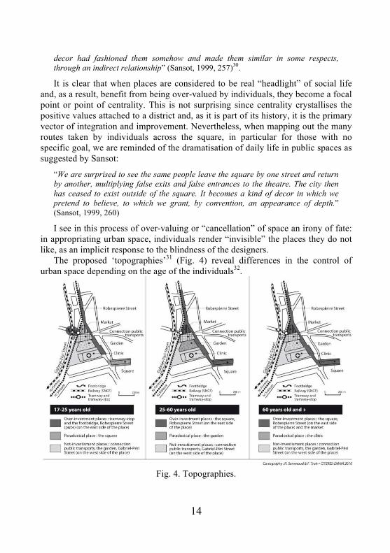
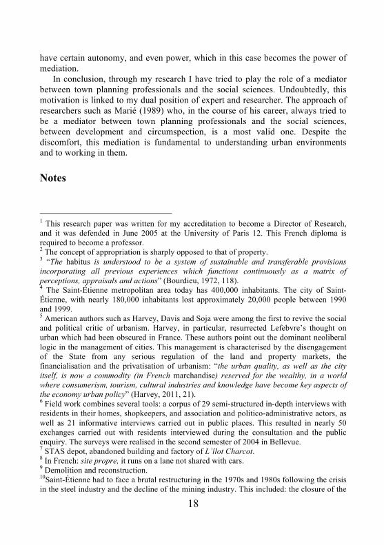
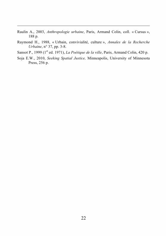
The proposed ‘topographies’31 (Fig. 4) reveal differences in the control of urban space depending on the age of the individuals32.
Fig. 4. Topographies.
15
Young people between the ages of 15 and 20 reveal two important areas on the perimeter of the square: Rue Robespierre and the area made up by the tram stop and the footbridge that links the district to the secondary schools. For them, the rest of the square is more or less obscured to the point of disappearing altogether. It should be remembered that these ‘topographies’ identify the preferential places and rank them. The concentration of young people between the tram stop and the footbridge is striking, even outside of school hours. This supports youth sentiment about this place, which is connected in their discourse despite being separated by the tramline, swarms of people and excitement that characterise the place remind the young people the “entrances of concerts or nightclubs, it is where everything is decided and it is there that one can to trying pick up someone without being seen” (student, 16 years old). It is significant to note that many young people eat their sandwiches while sitting on the footbridge, when they are only a few meters from the Jardin des Utopies gardens. Respondents mentioned that the cafes of the Rue Robespierre are particularly appreciated by young people. They can spend the afternoon there by chillaxing (chilling and relaxing), talking or sharing information. It is not surprising, therefore, that they are the only ones who refer to a lack of cafes in the square. Without Rue Robespierre and the square formed by the tram stop and the footbridge, the young people ignore the other spaces or they assign them to other inhabitants: the market for elderly people and the parks for children and mothers. Young people are the only ones who resort to this kind of assigning, which resembles territorial division, creating a distance with others and oppressive social33 control. In short, the few places favoured by young people, as well as those they use for avoidance, represent a very limited space, symptomatic of their lack of freedom in the district. Undoubtedly, they are compensating for this by their appropriation of the city centre and other places in the city to which they devote considerable space in their discourse.
The market, Rue Robespierre and Amouroux Square are first on the list of places favoured by the ‘topography’34 of seniors35. The paradoxical relationship between seniors and the clinic takes second place. On the one hand, the park, the public transport hub, the car park and Rue Gabriel Péri are more or less shrouded in darkness. In the end, the ‘topography’ of seniors includes their traditional or customary spaces and rules out the newly created ones. As for the intermediary age group36, it combines virtually both of the two previous ‘topographies’, using the places of young people as well as those preferred by seniors. On the other hand, the clinical and, to a lesser extent the garden, are affected of opacity by the population. Individuals in this age bracket, have undeniably more space in their ‘topography’, which reflects a greater freedom of appropriation.
If the configuration of ‘topographies’ seemed relatively clear to us in individuals’ discourses, then the limits fixed in the district are quite variable. The very notion of limit is questioned in the variable geometry of the district and its
16
different meanings. Everything happens as if by a process of excluding or including places. The individual carves out the district and adds on outgrowths, without necessarily defining a perimeter. Exclusion and inclusion correspond respectively to the ‘cancellation’ and the valuing of certain spaces that have or do not have the capacity to become a part of the district. This concept of certain places belonging or not belonging to the district supplants the idea of fixing boundaries by a perimeter. For example, Mrs. P., who was questioned specifically about the limits of the district, cited the square, Rue Robespierre, the market and the tram stop. In this case, the clinic, the park and the hub were excluded from the district. There is a sort of tacit refusal by the inhabitants to define a geometric perimeter because it would require the inclusion of the cancelled spaces. Geometrically, discussion of limits defines lines, points and areas which may either be articulated or split up. It designates sites full of meaning, located at Solaure37, Jomayère or Rue du Mont, which form outgrowths in relation to the official limits of the district. These limits are strongly contested by those who, as a result, feel “excluded from their Bellevue”38. The reluctance of individuals to discuss the limits of the district reflects their caution with regard to an arbitrary institutional process of symbolic exclusion from the territories to which they belong. In this way, the ‘topographies’ of the inhabitants give substance to the place and explode the triangle of official projects. They designate places and itineraries near the square, as well as those that are clearly separated from it. For example, certain ‘topographies’ may extend from the district of Centre II, to Rue Guizay and Solaure. Thus, the district gains in substance “[…] whenever subjectivities intertwine with the required mediation of a set of streets, walls and public places.” (Sansot, 1999, 256)
To finish the analysis of the dialectical movement that characterises the production of space and its appropriation by individuals, the way in which the social reorganisation of the space can, in return, allow urban development should be questioned. When individuals proceed with the ‘cancellation’ or the over-valuing of certain places, they refer us back to the logic of their design. For example, the ‘cancellation’ of the transport hub and gardens is associated with the inclusion of the former in an architectural design of travel focusing primarily on the functionality of transport and the latter in geometrics and aesthetics. These two types of spatial organisation limit appropriation, while the development of the market bolstered the conviviality that was characteristic of this place. Furthermore, the forms of reception described in this article reflect an unaggressive form of urban development that differs from radical, authoritarian urban planning. The unaggressive quality of the development of Bellevue reflects the dialogue which accompanied the project, making it coincide to some degree with the social demand for the modification of the district while maintaining its population.
17
Conclusion
By identifying the places neglected by the population and the potential spaces, the ‘topographies’ established also serve to indicate the elements that Lefebvre (2000) calls a “counter-space”. For this author, the confrontation between the “concrete space” (social space) and the “abstract space” of the designers, produces ultimately the “counter-space”. It actually expresses the social reorganisation of a space subsequent to a development project, where the process of appropriation superimposes on a space designed by overlays, inversions, conversions and cancellations. Adjustment processes to (and from) the space were designed to express the confrontation between the practices of users and the practices of urban planners, and were related to the representations of politico-administrative decision-makers and professionals. This confrontation corresponds to the notion of “test space”39 defined by Lefebvre (2000, 478) where all practices (in a complex interplay on themselves) - those of politics and of the social groups - confront each other in space. The practices are undergoing the test of space, which is where they win or lose their difference. The space becomes a mediator, an instrument. This verdict on the designed space by the inhabitants testifies to the forms of social acceptance of the development. When urban development takes place according to the logic of consideration and development, the social organisation, particularly of the former working-class suburbs, escapes the risks of a breakdown inherent in authoritarian actions and options for radical transformation. In these circumstances, the social representations of the district are in a position to build a mode of social aggregation and assert a kind of conviviality, for which the new spatial arrangements have the material means.
In this context, participation, which is itself paradoxical, can either provide the necessary flexibility so that the representatives of the users shift the program towards the social demand, or exclude them. In the first case, the conviction of individuals to have influenced, even slightly, the destiny of their district, gives them the impression of succeeding a satisfactory compromise. Participation, therefore, contributes to the determination of conditions of acceptance of urban development. In any case, while not constructing a collective identity the collective experience of their participation contributes, at least, to restoring individuals inside the group. Bevort (2002), in this regard, offers a sensible assessment as he considers participative democracy as a political ideal and a successful model.
Finally, for urban planning professionals, the goal should be less to predict future uses of their projects or their acceptance by the public, than to situate their approach in a process of democratisation, and nourish it with knowledge from the social sciences. These two conditions assume the choice of co-production of the space with the users concerned and representatives from the required fields of discipline. It is a perspective that is even more plausible when the project managers
18
have certain autonomy, and even power, which in this case becomes the power of mediation.
In conclusion, through my research I have tried to play the role of a mediator between town planning professionals and the social sciences. Undoubtedly, this motivation is linked to my dual position of expert and researcher. The approach of researchers such as Marié (1989) who, in the course of his career, always tried to be a mediator between town planning professionals and the social sciences, between development and circumspection, is a most valid one. Despite the discomfort, this mediation is fundamental to understanding urban environments and to working in them.
Notes
1 This research paper was written for my accreditation to become a Director of Research, and it was defended in June 2005 at the University of Paris 12. This French diploma is required to become a professor. 2 The concept of appropriation is sharply opposed to that of property. 3 “The habitus is understood to be a system of sustainable and transferable provisions incorporating all previous experiences which functions continuously as a matrix of perceptions, appraisals and actions” (Bourdieu, 1972, 118). 4 The Saint-Étienne metropolitan area today has 400,000 inhabitants. The city of Saint-Étienne, with nearly 180,000 inhabitants lost approximately 20,000 people between 1990 and 1999. 5 American authors such as Harvey, Davis and Soja were among the first to revive the social and political critic of urbanism. Harvey, in particular, resurrected Lefebvre’s thought on urban which had been obscured in France. These authors point out the dominant neoliberal logic in the management of cities. This management is characterised by the disengagement of the State from any serious regulation of the land and property markets, the financialisation and the privatisation of urbanism: “the urban quality, as well as the city itself, is now a commodity (in French marchandise) reserved for the wealthy, in a world where consumerism, tourism, cultural industries and knowledge have become key aspects of the economy urban policy” (Harvey, 2011, 21). 6 Field work combines several tools: a corpus of 29 semi-structured in-depth interviews with residents in their homes, shopkeepers, and association and politico-administrative actors, as well as 21 informative interviews carried out in public places. This resulted in nearly 50 exchanges carried out with residents interviewed during the consultation and the public enquiry. The surveys were realised in the second semester of 2004 in Bellevue. 7 STAS depot, abandoned building and factory of L’îlot Charcot. 8 In French: site propre, it runs on a lane not shared with cars. 9 Demolition and reconstruction. 10Saint-Étienne had to face a brutal restructuring in the 1970s and 1980s following the crisis in the steel industry and the decline of the mining industry. This included: the closure of the
19
mine shaft and dismantling of steel companies and large enterprises (Manufacture, GIAT…) [in French: Après la crise de la sidérurgie et le déclin de l’industrie minière, SE a dû faire face à une restructuration brutale dans les années 1970 et 1980: fermeture des puits de mine et démantèlement des aciéries et des grandes compagnies]. 11 Elected officials of the municipality and members of the urban area community. 12 This image refers to the representations of the ugly and dirty city, which sprang up in the 19th century, when the coal and steel areas were active and employers used this territory without worrying about the miners’ and workers’ living conditions. 13 The image comes from the success of the local football team “The Greens” and the proximity of the city of Saint-Étienne to the wooded area of Pilat. 14 The percentage of workers and employees in Saint-Étienne (26%), is considered high compared with those of Lyon and Grenoble, estimated at 23% and 22% respectively. But most institutional experts deplore the low percentage of managers and intermediate occupations, estimated at 13% versus 20% in Lyon and 19% in Grenoble. This social structure is reflected in the income of Saint-Étienne’s households, whose taxable income is €11,000, compared with €14,000 in Lyon and €12,000 in Grenoble (1999 Census). 15 The site comprised armament industries that were displaced, freeing 42 hectares. It now hosts an “optical and vision” research centre, a design centre, an institute of advanced technologies and a business development centre. 16 This site, organised around the TGV (high-speed train) station and the headquarters of Casino, was partially abandoned. It has undergone a total restructuring, accommodating the new headquarters of Casino, many offices and dwellings around the multimodal public transport hub, giving structure to the interaction with the second tramline. 17 Skilled worker, 32 years old. 18 According to the INSEE in 1999, the workers represented 15% and managers 4% of economically active population, that is to say 2762 inhabitants (49% of the total district population: 5635 inhabitants) 19 Research directed by Magri and Topalov (1989) clearly describing these forms of working-class sociability through which geographic proximity is the basis for solidarity that acts as a safety net against the risks of existence, according to Castel (1995). 20 In French: “Les moyens territoriaux de la convivialité”. 21 “Being together” is understood here as the attitude of exchange and interaction (Goffman) that individuals develop in encounters and co-existence. These practices are evidently driven by the representations of the residents. 22 A recurring term expressed by those interviewed that reflects an assumed conviviality. 23 Excerpt from an interview with Mrs. M.G. (66 years old, former owner of a haberdasher’s). 24 Excerpt from an interview with Mr. D.M. (52 years old, engineer, whose origins are working class). 25 Except from an interview with Mr. W. (35 years old, English teacher). 26 This idea has often been a subject of opposition by designers in regard to the councillors of Saint-Étienne. They have taken the risk of questioning the uses of the projects presented to the CQA (Conseil Qualité Architecturale; the Council for Architectural Quality). This is an organisation where the members, assisted by a consulting architect, negotiate the redesign of projects that are controversial in the eyes of the population.
20
27 “[…] the space is a place where power makes itself known and is exercised, and undoubtedly in the most subtle forms, that of symbolic violence as unperceived violence: the architectural spaces, whose silent injunctions address themselves directly to the body, obtaining from it, as surely as the etiquette of the court, the reverence and respect born of distance, or better, being distanced, are kept at a respectful distance, and are undoubtedly the most important components, for the very reason that they are invisible […], from the symbolism of power and the real effects coming from symbolic power” (Bourdieu 1993, 256). 28 Relates to the spaces absent of the residents’ speech or strongly criticised. 29 Spaces ignored and denied, because they are not loved. 30 In French: “Ou bien ils traversaient l’opacité des lieux – médiation nécessaire mais oubliée – […] Ou bien ils nouaient leurs existences communes à même la pâte urbaine. Ou encore et cette fois la relation se fait indirecte, le décor les avait polis d’une certaine façon et rendus semblables par quelques côtés”. (Sansot, 1999, 257). 31 The approach inspired by that of Lynch (1971). 32 The suggested age groups result from the analysis. They correspond with the thresholds where differences were seen. 33 “[…] if you smoke, they devour you with their eyes”; “they look at you as if you are going to jump on their dosh.” 34 It is an attempt to translate the modes of appropriation by the drawing. 35 Over 55. 36 From 21 to 55 years old. 37 The District Centre and the parish of Solaure. 38 Sentiment (feeling?) expressed by several interviewees who do not agree with the official boundaries of the district. 39 In French: “L’épreuve de l’espace”.
References
Augé M., 1992, Non-lieux, introduction à une anthropologie de la surmodernité, Paris, Seuil, 199 p.
Bacqué M.-H., Sintomer Y., 2002, « Peut-on encore parler de quartiers populaires ? », Espaces et sociétés, n° 108-109, pp. 29-46.
Bevort A., 2002, Pour une Démocratie participative, Paris, Presses de Sciences Po. 130 p.
Bonetti M., 1994, Habiter : le bricolage imaginaire de l’espace, Marseille, Hommes & Perspectives, coll. « Re-connaissances », 229 p.
Boudon R., 2004, « Adaptation sociale », Encyclopédie Universalis, version 9, pp. 250-251.
Bourdieu P., 1972, Esquisse d'une théorie de la pratique, Genève, Droz, coll. « Research in law, economics, sociology and political science », 269 p.
21
Bourdieu P., 1980, « Le capital social », Actes de la recherche en sciences sociales,
vol 31, pp. 2-3
Bourdieu P., 1993, « Les effets de lieu », in Bourdieu P. (dir.), La misère du monde, Paris, Seuil, pp. 249-261.
Castel R., 1995, Les Métamorphoses de la question sociale. Une chronique du salariat, Paris, Fayard, coll. « L’espace du politique », 813 p.
Certeau (de) M., Giard L., Mayol P., 2003 (1st ed. 1994), L’invention du quotidien, tome 2 Habiter, cuisiner, Paris, Gallimard, coll. « Folio/Essais », 415 p.
Davis M., 2007 (3rd ed.), Au-delà de Blade Runner, Los Angeles et l’imagination du désastre, Paris, Allia, 154 p.
Dosda P., Fischer G.N., Vincent B., 1999, Une autre lecture de l’espace public : les apports de la psychologie de l’espace. Interventions réalisées dans le cadre de l’atelier Perception de l’espace, Lyon, CERTU, 49 p.
Frey J.-P., 1986, La Ville industrielle et ses urbanités. La distinction ouvriers/employés. Le Creusot 1870-1930, Liège, Pierre Margada, coll. « Architecture et recherche », 386 p.
Goffman E., 2003 (1st ed. 1974), Les rites d’interaction, Paris, Minuit, coll. « Le sens commun », 230 p.
Harvey D., 2011, Le capitalisme contre le droit à la ville. Néolibéralisme, urbanisation, résistances, Paris, Amsterdam, 93 p.
Jauss H.R., 2002, Pour une esthétique de la réception (1st ed. 1978), translated from German by C. Maillard, Introduction by J. Starobinski, Paris, Gallimard, coll. « Tel », 333 p.
Jodelet D., 2003, Les représentations sociales, Paris, PUF, coll. « Sociologie d’Aujourd’hui », 447 p.
Lefebvre H., 1970, La révolution urbaine, Paris, Gallimard, coll. « Idées », 248 p.
Lefebvre H., 2000 (1st ed. 1974), La production de l’espace, Paris, Anthropos, coll. « Ethnosociologie », 485 p.
Lefebvre H., 2009 (3rd ed.), Le droit à la ville, Paris, Economica, Anthropos, coll. « Anthropologie », 135 p.
Lynch K., 1971, L’image de la cité, Paris, Dunod, coll. « Aspects de l’urbanisme », 222 p.
Magri S., Topalov C. (dir.), 1989, Villes ouvrières : 1900-1950, Paris, L’Harmattan, coll. Villes et entreprises, 240 p.
Marié M., 1989, Les terres et les mots, Paris, Méridiens Klincksieck, 201 p.
22
Raulin A., 2003, Anthropologie urbaine, Paris, Armand Colin, coll. « Cursus »,
188 p.
Raymond H., 1988, « Urbain, convivialité, culture », Annales de la Recherche Urbaine, n° 37, pp. 3-8.
Sansot P., 1999 (1st ed. 1971), La Poétique de la ville, Paris, Armand Colin, 420 p.
Soja E.W., 2010, Seeking Spatial Justice, Minneapolis, University of Minnesota Press, 256 p.