Embed Size (px)
Citation preview
NHERI ScIENcE plaN 2017 1
JUlY 2017
Five-Year Science PlanNatURal HazaRdS ENgINEERINg RESEaRcH INfRaStRUctURE
MUltI-HazaRd RESEaRcH to MakE a MoRE RESIlIENt WoRld

NHERI ScIENcE plaN 2017 2
Table of Contents
1. Introduction .....................................................................................4
2. Purpose..............................................................................................5
3. National Imperative for Resilience to Natural Hazards.....5
4. Plan for NHERI .................................................................................6
5. Grand Challenge Subject Areas and Key Research Questions ...........................................................7
6. NHERI Facilities and Capabilities ..............................................15
7. Concluding Remarks.....................................................................16
8. Appendices
A1: florida International University ..................................18 Wall of Wind International
Hurricane Research Center
A2: lehigh University Experimental Facility with Large-Scale Multi-Directional Hybrid Simulation Testing Capabilities ...............................22
A3: oregon State University O.H. Hinsdale Wave Research Laboratory Experimental Facility ............................................................24
A4: University of california at Berkeley SIMCenter .................................................................................27
A5: University of california at davis Centrifuge Facility .................................................................30
A6: University of california at San diego Large High-Performance Outdoor Shake Table .........33
A7: University of florida Wind Experimental Facility ................................................36
A8: University of texas at austin Cyberinfrastructure -- DesignSafe ...................................39
A9: University of texas at austin Large Mobile Shakers ...........................................................42
A10: University of Washington RAPID Facility ..........................................................................45
Grant ListingThe Natural Hazards Engineering Research Infrastructure (NHERI) is supported by multiple grants from the National Science Foundation:
Network coordination office (NSF award #1612144)
florida International University Wall of Wind International Hurricane Research Center (NSF award #1520853)
lehigh University Experimental Facility with Large-Scale Multi-Directional Hybrid Simulation Testing Capabilities (NSF award #1520765)
oregon State University O.H. Hinsdale Wave Research Laboratory Experimental Facility (NSF award #1519679)
University of california at Berkeley SIMCenter (NSF award #1612843)
University of california at davis Centrifuge Facility (NSF award # 1520581)
University of california at San diego Large High-Performance Outdoor Shake Table (NSF award # 1520904)
University of florida Wind Experimental Facility (NSF award # 1520843)
University of texas at austin Cyberinfrastructure – DesignSafe (NSF award # 1520817)
University of texas at austin Large Mobile Shakers (NSF award # 1520808)
University of Washington RAPID Facility (NSF award # 1611820)

NHERI ScIENcE plaN 2017 3
Foreword
The development of the five-year NHERI Science Plan was guided by the following members of the Science Plan Task Group:
Ross W. Boulanger, Ph.D., P.E., N.A.E., Professor, Department of Civil and Environmental Engineering, University of California, Davis
Jonathan D. Bray, Ph.D., P.E., N.A.E., Professor, Department of Civil and Environmental Engineering, University of California, Berkeley
Gregory G. Deierlein, Ph.D., N.A.E., Professor of Engineering, Stanford University
Jennifer L. Irish, Ph.D., P.E., D.CE, F.ASCE, Professor, Department of Civil and Environmental Engineering, Virginia Tech
Bret Lizundia, S.E., Principal, Rutherford + Chekene Consulting Engineers
Forrest J. Masters, Ph.D., P.E., Professor and Associate Dean for Research and Facilities, University of Florida
Lelio H. Mejia, Ph.D., P.E., G.E., Senior Principal, Geosyntec Consultants
Maryam Asghari Mooneghi, Ph.D., Advanced Technology and Research, Arup
Lori Peek, Ph.D., Professor, Department of Sociology, University of Colorado-Boulder
Dorothy A. Reed, Ph.D., P.E., Professor, Civil and Environmental Engineering, University of Washington
Solomon C. Yim, Ph.D., P.E., Professor, Civil and Construction Engineering, Oregon State University
NEtWoRk cooRdINatIoN offIcE, taSk gRoUp SUppoRt
Billy L. Edge, P.E., Ph.D., Dist.M. ASCE, Professor of Practice, Civil, Construction, and Environmental Engineering Department, North Carolina State University
William T. Holmes, S.E., N.A.E., Senior Consultant, Rutherford + Chekene Consulting Engineers
Thomas L. Smith, AIA, RRC, F.SEI, TLSmith Consulting Inc.
NHERI ScIENcE plaN 2017 4
1. IntroductionThe Natural Hazards Engineering Research Infrastructure (NHERI) is a distributed, multi-user, national facility that provides the natural hazards engineering community with state-of-the-art research infrastructure.
Funded by the National Science Foundation (NSF), NHERI enables researchers to explore and test ground-breaking concepts to protect homes, businesses, and infrastructure lifelines from earthquakes and windstorms, including tsunamis, storm surges, and waves, enabling innovations to help prevent natural hazards from becoming societal disasters.
The NHERI Five-Year Science Plan is posed as a set of three Grand Challenges with five Key Research Questions to guide NHERI research. The research will deliver technical breakthroughs to improve the resilience and sustainability of existing and future civil infrastructure, also known as the built environment. High priority research subject areas are also provided for each of the key research questions to assist future researchers in achieving Grand Challenges.
The development of the five-year NHERI Science Plan was guided by the Science Plan Task Group, with review and input from the NHERI facilities, the Network Coordination Office (NCO), and broad community-based participation of earthquake, wind, and coastal engineering professionals, as well as engineering education experts. The NCO and each of the experimental facilities submitted a science plan with their proposals to NSF; these have been used as input for this document.
The civil infrastructure shelters and sustains communities and their activities and is built on a network of facilities and services that includes housing, business, water, gas, electricity, sanitation, communications, transportation, and institutions.
All are interconnected and must be designed, constructed, and maintained with the expectation that they will provide adequate performance when subjected to effects of earthquakes, windstorms, and related natural hazards of tsunami and storm surge.
The failure of civil infrastructure adds considerable strain to communities and puts lives, health, and societal functions at risk.

NHERI ScIENcE plaN 2017 5
2. Purpose The NHERI Science Plan provides the earthquake, wind, and coastal hazards community, including NSF and other funding agencies, a roadmap for high-impact, high-reward, hazards engineering research at NHERI facilities. The research results are intended to enable damage mitigation and prevent loss of life from natural hazards.
3. National Imperative for Resilience to Natural Hazards
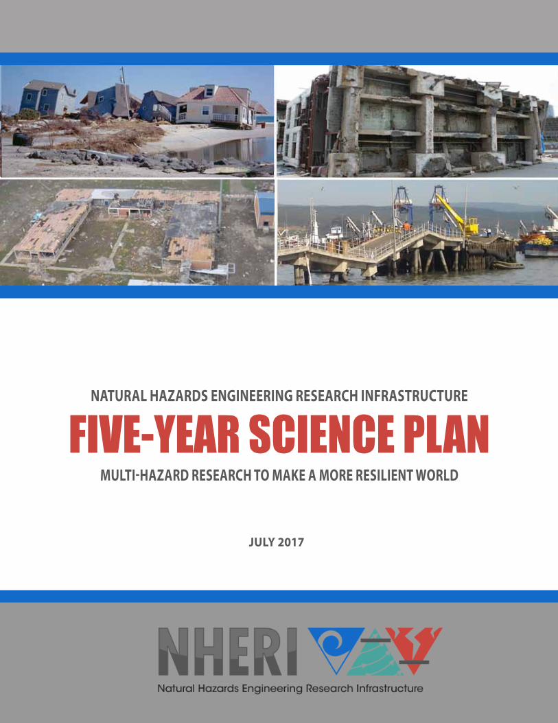
Natural hazards in the form of earthquakes, windstorms, and associated events such as tsunami and storm surge can be devastating to the civil infrastructure of a community and highly disruptive to broader society. As evidenced by experiences from the Canterbury earthquake sequence in New Zealand, the Tohoku tsunami in Japan, Hurricanes Katrina (U.S. Gulf Coast) and Sandy (U.S. northeastern coast), and the Joplin, Missouri tornado, communities can take years to recover from widespread failures of, or damage to, civil infrastructure.
Disaster resilience is a national imperative. In 2011, the United States was struck by multiple disasters — including 14 related to weather and climate — that caused more than $55 billion in economic damage, breaking all records since these data were first reported in 1980. Nearly 600 Americans died, and many thousands more were displaced. Further, federal expenditures are borne by the entire country and have been growing steadily for the past 60 years. In 1953, for example, federal spending on disasters totaled $20.9 million (adjusted to 2009 dollars) or $0.13 per person. In 2009, with many more disaster declarations, the federal government spent $1.4 billion — about $4.75 per person — on disaster relief. This federal spending does not include the staggering costs of disasters to cities, states, industry, companies, and individuals, only part of which is covered by insurance. If the present course is continued, data suggest that the cost of disasters will continue to rise both in dollar amounts and in social, cultural, and environmental losses to communities.
The outcomes of this Science Plan, if fully realized by the NHERI community of researchers and professionals, will provide a significant contribution through the implementation of new knowledge and technologies towards reducing loss of life and expenditures caused by natural hazards of earthquake, windstorm, tsunami, and storm surge.
NHERI ScIENcE plaN 2017 6
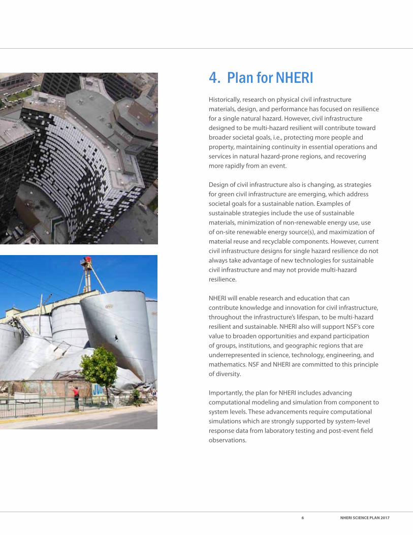
4. Plan for NHERIHistorically, research on physical civil infrastructure materials, design, and performance has focused on resilience for a single natural hazard. However, civil infrastructure designed to be multi-hazard resilient will contribute toward broader societal goals, i.e., protecting more people and property, maintaining continuity in essential operations and services in natural hazard-prone regions, and recovering more rapidly from an event.
Design of civil infrastructure also is changing, as strategies for green civil infrastructure are emerging, which address societal goals for a sustainable nation. Examples of sustainable strategies include the use of sustainable materials, minimization of non-renewable energy use, use of on-site renewable energy source(s), and maximization of material reuse and recyclable components. However, current civil infrastructure designs for single hazard resilience do not always take advantage of new technologies for sustainable civil infrastructure and may not provide multi-hazard resilience.
NHERI will enable research and education that can contribute knowledge and innovation for civil infrastructure, throughout the infrastructure’s lifespan, to be multi-hazard resilient and sustainable. NHERI also will support NSF’s core value to broaden opportunities and expand participation of groups, institutions, and geographic regions that are underrepresented in science, technology, engineering, and mathematics. NSF and NHERI are committed to this principle of diversity.
Importantly, the plan for NHERI includes advancing computational modeling and simulation from component to system levels. These advancements require computational simulations which are strongly supported by system-level response data from laboratory testing and post-event field observations.

NHERI ScIENcE plaN 2017 7
5. Grand Challenge Subject Areas and Key Research Questions
The NHERI Science Plan covers both the scope of and the process of conducting multi-hazard research for improving civil infrastructure.
ScopE
Three Grand Challenge subject areas are:
1. Identify and quantify the characteristics of earthquake, windstorm, and associated hazards — including tsunamis, storm surge, and waves — that are damaging to civil infrastructure and disruptive to communities.
2. Evaluate the physical vulnerability of civil infrastructure and the social vulnerability of populations in communities exposed to earthquakes, windstorms, and associated hazards.
3. Create the technologies and engineering tools to design, construct, retrofit, and operate a multi-hazard resilient and sustainable infrastructure for the nation.
Social vulnerability often refers to both the pre- and post-event social and economic conditions of population groups within a given community or defined geographical space.
The most socially vulnerable groups tend to have the fewest economic and social resources to prepare for, respond to, and recover from a disaster.
In addition to being economically marginalized, these groups often tend to have less political power, fewer social networks, and less access to information. They also often live in neighborhoods and communities with decaying infrastructure and housing stock that is older and less likely built to modern standards. Thus, social vulnerability is often amplified by vulnerability of the civil infrastructure.

NHERI ScIENcE plaN 2017 8
pRocESS
NHERI seeks to foster ground-breaking research in the Grand Challenge areas. At the same time, NHERI will spur new ways of conducting research that are collaborative, multidisciplinary, and innovative. In addition, NHERI is focused on developing information and tools that can be implemented--either in the near term or the long term--in measurable, effective ways that will improve community resilience. To address this, the following approaches to NHERI research proposals are encouraged.
• Growing convergent research is one of the 10 Big Ideas for Future NSF Investments (NSF 17-065). Investigators are encouraged to form diversely composed research teams to create a deep integration across disciplines and accelerate the transfer of knowledge, theories, data, and research methods. Fresh voices can open new ways of thinking about old issues.
• Formulate proposals that focus on multiple hazards or that clarify how the research in one hazard could be beneficial in addressing other hazards.
• Include a time horizon for potential implementation. Some research might aim for developing information that can be implemented within a few years; other, more fundamental research might take longer to understand the implications, and how it might best be used. Both horizons are encouraged, but identifying expectations for both cases helps improve efficacy.
• Where appropriate, include practitioners in research projects to provide advice on what specific elements of the research are needed, to help communicate research results, and to suggest how to implement results.
• Where appropriate, research proposal work plans should include as final steps how the research can be transferred to practice or what steps might be needed to accomplish the transfer. To assist researchers, NHERI has a Technology Transfer Committee.
An important measure for NHERI research is how the newly discovered knowledge impacts modern architectural and engineering practice and reduces the vulnerability to earthquake, wind, tsunami, and storm surge hazards.
NHERI addresses this challenge with the creation of a Technology Transfer Committee (TTC), which is a group of key volunteer experts and decision-makers who have influence to contribute to design guidelines, technical briefs, seminars, building codes, and standards.
TTC members identify completed research projects in natural hazards that are ready for implementation, and champion the research results for inclusion in widely-accepted standardized documents that define the state-of-practice in a given architectural or engineering community.
The membership on the TTC is selected to address a multitude of key stakeholder communities, including those with expertise in earthquake, wind, coastal engineering, concrete/masonry/steel/wood construction, geotechnical engineering, architecture, lifeline infrastructure, social sciences and policy, and standards development.

NHERI ScIENcE plaN 2017 9
Key Research QuestionsFive key NHERI research questions at the cusp of emerging transformative discoveries for earthquake, wind, and coastal hazards engineering are the following:
1. How do we characterize the transient and variable nature of the loading actions imposed on the nation’s civil infrastructure from earthquakes, windstorms, and associated hazards?
2. How can the scientific community enable robust simulation of the performance of civil infrastructure to loading from earthquakes, windstorms, and associated hazards, while also considering individual- and community-level impacts?
3. What are the key physical responses, vulnerabilities, and factors influencing post-event recovery of civil infrastructure and communities?
4. What are effective mitigation actions to achieve community resilience, especially when considering different hazards, shifting vulnerabilities, emerging technologies, and sustainability goals?
5. How can the scientific community more effectively collect and share data and information to enable and foster ethical, collaborative, and transformative research and outcomes?
The following subsections elaborate on each of these research questions.
Creating and capitalizing on forward-thinking technology are fundamental to the mission of the National Science Foundation and are essential to advancing the mission of the NHERI program.
Despite decades of advancements of our understanding of how civil infrastructure responds to earthquakes, extreme wind events, and coastal hazards, natural hazard-induced infrastructure damage and loss of community function continue to rise.
Technologies that advance or optimize the design, operation, and construction of civil infrastructure are sought. Artificial intelligence and robotics are ripe areas for investigation. NHERI researchers should seek to leverage emerging trends giving rise to these developments.

NHERI ScIENcE plaN 2017 10
kEY RESEaRcH QUEStIoN #1
How do we characterize the transient and variable nature of the loading actions imposed on the nation’s civil infrastructure from earthquakes, windstorms, and associated hazards?
Loading actions are at the start of the design process. The large uncertainty of loading actions from natural hazards is particularly challenging for performance-based engineering. Reduction of the uncertainty would lead to more efficient and effective designs. Research is necessary to:
1. Develop better approaches for laboratory testing to evaluate earthquake, wind, and wave effects. Initially, this must be done in the context of existing facilities, but new and potentially transformative procedures, instrumentation, and facility improvements will be enabled in the NHERI program. The advanced testing will lead to superior numerical models with more realistic nonlinear and stochastic interactions that leverage NHERI cyberinfrastructure and computational and simulation components.
2. Develop methods to more realistically characterize wind, earthquake, tsunami, and storm surge loading on buildings and other structures. The highly-simplified models of loading effects used in engineering practice can dramatically under or overestimate the loading effects, especially on components and subsystems. Examples include concentrated wind loading effects on building components and cladding, water and debris flow loads on structures, and soil-structure interaction under spatially incoherent earthquake ground motions. Advanced numerical simulation methods based on high-fidelity computational models should be verified based on data obtained from laboratory experiments and field measurements and observations.
3. Improve our ability to connect frequency and intensity hazard data to site-specific loading actions on geomaterials, geostructures, buildings (including non-structural components), and other structures. The earthquake, wind, and coastal engineering communities, seismologists, and atmospheric scientists and engineers develop broad hazard data; but loading actions are heavily influenced by local effects such as path-of-travel, site geomaterials, and local surface environment.

NHERI ScIENcE plaN 2017 11
kEY RESEaRcH QUEStIoN #2
How can the scientific community enable robust simulation of the performance of civil infrastructure to loading from earthquakes, windstorms, and associated hazards, while also considering individual- and community-level impacts?
Development of improved end-to-end simulation overlaps with Key Research Question #1 and brings to the forefront the importance of a coordinated approach between researchers and NHERI. However, improvements in simulating loading actions should be done in the larger context of predicting structural and non-structural response. Research is necessary to:
1. Improve methods for simulating earthquakes, windstorms, tsunami, and storm surge loading actions as well as ground, geostructural, structural, non-structural, and building envelope response — for the purpose of establishing physics-based, end-to-end models.
2. Improve simulation of regional effects and response, including interrelated and system effects as well as response and recovery decisions.
3. Improve methods to simulate detailed response of above- and below-water geostructures, structures, and building components as alternates or adjuncts to physical testing.
4. Improve models for use in design that can capture the more complex behavior that occurs under actual loading from natural hazards.

NHERI ScIENcE plaN 2017 12
kEY RESEaRcH QUEStIoN #3
What are the key physical responses, vulnerabilities, and factors influencing post-event recovery of civil infrastructure and communities?
Characterizing response and performance of buildings and other structures using “vulnerability” enables identification of threats to resilience and enables prioritization of research. Research is necessary to:
1. Systematically investigate interrelationships of components in systems to identify key vulnerabilities affecting resilience at all levels.
2. Systematically investigate civil infrastructure and community interrelationships to identify the most efficient balance between improved mitigation and improved response and recovery.
3. Enhance performance-based design procedures for tsunami, storm surge, and wind effects parallel to those available for seismic ground motion, particularly considering debris impact and performance of the building envelope. These procedures should enable economical designs at lower cost, designs for improved performance, and life-cycle analysis with defined uncertainty. Eventually, these procedures should be integrated to produce consistent multi-hazard analysis.
4. Improve system and component fragilities for use in performance-based design and loss estimation.

NHERI ScIENcE plaN 2017 13
kEY RESEaRcH QUEStIoN #4
What are effective mitigation actions to achieve community resilience, especially when considering different hazards, shifting vulnerabilities, emerging technologies, and sustainability goals?
Few, if any, communities assess themselves as being adequately resilient for all natural hazards. Research is necessary to:
1. Develop sensor systems that can measure changes in civil infrastructure vulnerability due to age or hazard loading from component to system level, including inaccessible structures such as buried pipelines. Identifying increased vulnerability of infrastructure is necessary to maintain resilience, particularly in promoting mitigation actions and in post-event response and recovery.
2. Understand spatiotemporal variation in wind, surge, wave, and related erosion and debris during coastal storms in order to better characterize and predict infrastructure impacts. Develop sensors and sensor systems that can improve the prediction of formation and motion of wind storm systems such as hurricanes and tornadoes.
3. Develop and identify new strategies and materials to mitigate the impact of earthquakes and windstorms and related natural hazards of tsunami and storm surge on civil infrastructure and to identify life-cycle benefits of improving performance for existing infrastructure.
4. Develop best practice for design and construction of geotechnical, structural, and non-structural systems, including use of new materials for the most common model building types (e.g., structural material, occupancy, and size) and non-building elements used in the U.S. considering cost, multi-hazard performance, and sustainability.
5. Develop methods to consider life-cycle performance under earthquakes, windstorms, and related natural hazards of tsunami and storm surge. These methods need to be incorporated into performance-based design procedures.
6. Identify and develop improvements to the sustainability benefits of proposed enhanced performance under hazard loading to components and systems as well as enhanced resilience of communities.
7. Develop approaches by which the characteristics of natural geomaterials can be enhanced either alone or in concert with other components using natural and/or human inspired and/or mediated techniques so that their performance during extreme loading events is enhanced.

NHERI ScIENcE plaN 2017 14
kEY RESEaRcH QUEStIoN #5
How can the scientific community collect and share data and information to enable and foster ethical, collaborative, and transformative research and outcomes?
Field observations and analyses are key to providing the data and information that is required to evaluate both experimental and numerical studies. These observations can reveal information that overlap several disciplines and will stimulate integrative studies. Research is necessary to:
1. Improve availability of quality inventories of soils and civil infrastructure for use in research studies. Such partial or complete inventories can help identify threats to community resiliency and prioritize research on the civil infrastructure components.
2. Develop regional systems to collect and analyze sensor and image information for use in planning, mitigation, response, and recovery.
3. Develop instrumentation and measurement systems that, in documenting damage, can create 3-D images of the facility or structures in the pre-event condition, which will allow analysis to further understand the event that caused the damage — often well after the event has passed.
4. Develop systems to collect, store, and analyze field damage-data from hazard events using a long-sought-after community resource: a data repository cyberinfrastructure. The DesignSafe cyberinfrastructure, holding data from the RAPID facility and NHERI projects, will give researchers the ability to study hazard-event data at a more granular level than ever before. There are existing data repositories, but they are fragmented and often not readily accessible. In the NHERI plan, all natural-hazard field damage data can be stored on DesignSafe and be accessible to anyone. This is a much-needed resource for the wind, tsunami, and storm surge community, because no centralized system is in place for archiving their post-event observations.
NHERI ScIENcE plaN 2017 15
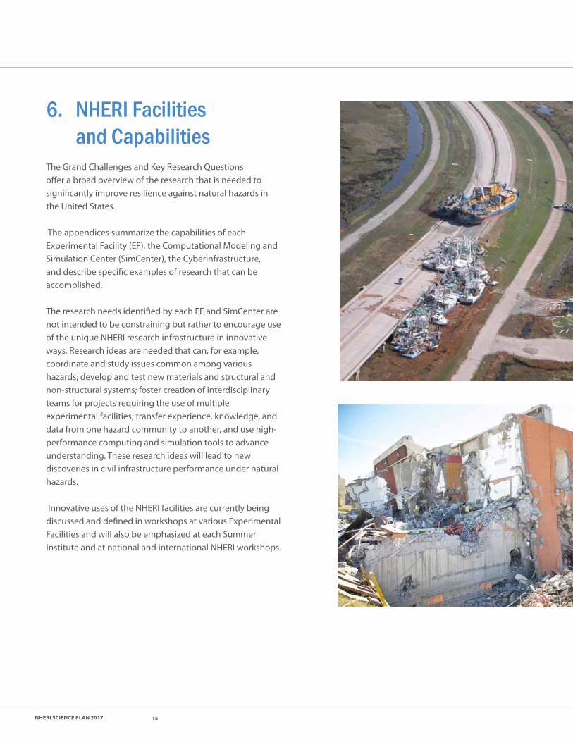
6. NHERI Facilities and CapabilitiesThe Grand Challenges and Key Research Questions offer a broad overview of the research that is needed to significantly improve resilience against natural hazards in the United States.
The appendices summarize the capabilities of each Experimental Facility (EF), the Computational Modeling and Simulation Center (SimCenter), the Cyberinfrastructure, and describe specific examples of research that can be accomplished.
The research needs identified by each EF and SimCenter are not intended to be constraining but rather to encourage use of the unique NHERI research infrastructure in innovative ways. Research ideas are needed that can, for example, coordinate and study issues common among various hazards; develop and test new materials and structural and non-structural systems; foster creation of interdisciplinary teams for projects requiring the use of multiple experimental facilities; transfer experience, knowledge, and data from one hazard community to another, and use high-performance computing and simulation tools to advance understanding. These research ideas will lead to new discoveries in civil infrastructure performance under natural hazards.
Innovative uses of the NHERI facilities are currently being discussed and defined in workshops at various Experimental Facilities and will also be emphasized at each Summer Institute and at national and international NHERI workshops.

NHERI ScIENcE plaN 2017 16
7. Concluding Remarks The NHERI Five-Year Science Plan provides information for constituents, including practitioners, as well as guidance for members of the research community. The sense of purpose, ethic, and ingenuity of the community is among our greatest assets, so this document is not intended to constrain or limit other ideas, but rather to both identify high value research needs and to spark development of meaningful research proposals.
This Science Plan is meant to serve as a living document — one that will be reviewed and updated to reflect new funding streams, new projects, and new scientific breakthroughs. Thus, the ongoing quality and usability of this document is contingent on community input and feedback from NHERI researchers. Various architectural, engineering, and scientific outputs will continue to be shared with members of the research, practice, and policy communities that can most benefit from learning of the ongoing progress.
Ultimately, this Science Plan and the ongoing work among the NHERI researchers is focused on improving resilience and promoting life safety through taking a multi-hazards approach to engineering research and associated work.
NHERI facilities are organized to build on prior scientific breakthroughs and successes, while looking toward the future for the next transformative ideas that will ultimately help save lives and reduce the damage and dollars lost associated with disastrous events.

NHERI ScIENcE plaN 2017 17
AppendicesA1: florida International University ..................................................................................18
Wall of Wind International Hurricane Research Center
A2: lehigh University ...............................................................................................................22 Experimental Facility with Large-Scale Multi-Directional Hybrid Simulation Testing Capabilities
A3: oregon State University .................................................................................................24 O.H. Hinsdale Wave Research Laboratory Experimental Facility
A4: University of california at Berkeley ...........................................................................27 SIMCenter
A5: University of california at davis .................................................................................30 Centrifuge Facility
A6: University of california at San diego .......................................................................33 Large High-Performance Outdoor Shake Table
A7: University of florida ........................................................................................................36 Wind Experimental Facility
A8: University of texas at austin ........................................................................................39 Cyberinfrastructure -- DesignSafe
A9: University of texas at austin ........................................................................................42 Large Mobile Shakers
A10: University of Washington .............................................................................................45 RAPID Facility

NHERI ScIENcE plaN 2017 18
Appendix A1: Florida International University Wall of Wind
facIlItY ovERvIEW
The Wall of Wind (WOW) is a large open jet wind tunnel facility with distinct advantages over conventional wind tunnels, including:
• High-speed holistic testing at multiple scales in simulated hurricane wind speeds up to and including Category 5.
• Destructive tests to study progressive damage and failure modes of systems, sub-assemblies, and components to enhance their designs and improve performance.
• Wind-driven rain simulations to study water intrusion through building envelopes.
• Testing under extreme wind and rain environments to develop innovative mitigation strategies to attenuate wind damage and rain infiltration, and to validate efficacy and system-level integrity of mitigation devices and connections.
• Full- and large-scale aerodynamic and aeroelastic testing of large models in atmospheric boundary layer (ABL) flows at high Reynolds numbers to minimize scaling errors and better simulate the effects of finer geometrical details.
• Conventional boundary layer wind tunnel testing of small scale models in flows with various exposures and with full turbulence spectrum.
The Wall of Wind Experimental Facility Science Plan is aligned with the NHERI Vision as it includes:
• Predicting the lifecycle performance of civil infrastructure, from component to holistic system levels, under wind hazard events,
• Reducing the reliance on physical testing through providing data for validating advanced computational modeling and simulation capabilities,
• Building fundamental knowledge to evaluate wind effects and foster wind-hazard resilient and sustainable civil infrastructure and communities, and
• Translating research into innovative mitigation strategies and technologies to reduce the impact of wind hazards.
The objective of the Experimental Facility as part of the NHERI program is to enable an external, broadly inclusive user-base to undertake fundamental research in various fields such as, among others, aerodynamics, fluid mechanics, thermodynamic modelling, wind-induced vibrations, aeroelastic instabilities, stochastic processes and advanced statistical methods, structural reliability, fragility of building systems, rain infiltration mechanisms (e.g., direct rain admittance and surface runoff phenomena), wind simulation methodologies (physical simulation and validation of computational simulation), and non-linear structural behavior under wind loading.
Supporting EF services include: Test specimen design, construction and instrumentation; test protocols and software implementation, operating the WOW; high definition video recording; data acquisition, processing, archiving and curation; safety and user training; organize faculty engagement workshops and webinars; support users in NSF proposal development; and enhance active NSF projects through Testing Enhancement Program (TEP).
Additional information regarding the facility and leadership group is available at the DesignSafe website: https://fiu.designsafe-ci.org.
ExaMplES of RESEaRcH poSSIBIlItIES
validating computational fluid dynamics and other Numerical Simulation MethodsThe WOW EF has the ability to physically subject building components, holistic building systems, and scale models of such systems, to the impacts of hurricane force wind and rain. Detailed measurements of wind pressures, forces, wind-induced dynamic responses, and rain infiltration can be made under realistic hurricane conditions. Thus the EF has unique experimental resources and multi-scale testing capabilities that can be used for benchmark academic research on complicated fluid-structure interaction problems. The EF can help study the features of the flow-field (visualizing air flow with smoke/fog generators and other flow-visualization tools), turbulence effects, and fluid-dynamic phenomena that lead to pressure patterns and responses.

NHERI ScIENcE plaN 2017 19
Computational software systems and means for verification of model results are needed and WOW EF can provide a very useful test bed for developing and validating Computational Fluid Dynamics and other numerical simulation methods, thereby reducing the future reliance on physical testing, and for developing mitigation methods. Such research may also provide means for assessing and reducing uncertainties in simulation results to foster data-driven modeling.
performance of Building EnvelopeDevelop new insights into wind effects on building envelopes (including multi-layered cladding systems) and new designs to reduce wind loads and minimize rain infiltration. Research the effect of wind driven rain and the effects of rain, on air permeable building envelope systems which depend on pressure equalization. Performance of the existing building envelope components can be improved based on results from system-level experimentation. EF can also provide new knowledge on the strength, condition, remaining service life, and ability to resist penetration of wind-driven rain for cladding systems.
Effect of Shapes and Surroundings on Wind loading Develop wind load time histories and coefficients for a wide range of different building shapes in various surroundings, accounting for interference and shielding effects. Conduct statistical studies of peak loads and variability introduced by non-uniform surrounding terrain, topography, and nearby buildings. Tools are also needed to automate the process by taking advantage of widely available digital aerial photographic and elevation data. The results are intended to improve wind load provisions in codes and standards. The datasets will also be useful for designing buildings using Database Assisted Design method. (Grand
collaboration opportunity This research topic lends itself to parametric studies/collaboration with the University of Florida EF and research groups at traditional boundary layer wind tunnel laboratories.
Wind Effects on Small StructuresTraditional small scale model wind tunnel testing to predict wind loads on large structures (e.g., tall buildings, long-span bridges) is well established. However, for small structures much larger model scales are needed to maintain modeling accuracy and minimize Reynolds number effects. At these larger scale simulation of the low frequency end of the wind turbulence spectrum and of the turbulence integral scale is generally compromised by the test section size of the wind tunnel facility. However, the FIU team has recently developed a new Partial Turbulence Simulation (PTS) approach, verified by comparison with field data, which divides the turbulence spectrum into two distinct portions. This is a hybrid method combining experimental simulation of higher frequency turbulence with computer modeling of low frequency turbulence effects. The method opens up whole new possibilities of obtaining more accurate wind load information on smaller structures by testing them at much larger scales than was previously possible (e.g. 1:10 rather than 1:100 for low-rise buildings, 1:3 rather than 1:30 for building appurtenances). Applications have already been numerous: wind loads on solar panels; wind uplift on roof pavers; wind response of variable message signs, wind loads on canopies and sunrooms, etc. The new PTS approach, and associated EF software codes, will allow EF users to create new fundamental knowledge on bluff-body aerodynamics in high Re flows by minimizing errors due to scaling limitations.
Wind-induced vibrations The ASCE 7 standard indicates that if a structure’s natural frequency is above 1 Hz, it will not experience significant resonance effects. This provision was originally developed with buildings in mind. When applied to smaller structures and components, however, it can be very misleading. Examples are photovoltaic (PV) arrays, satellite dishes, shading devices, highway signage and signal systems, and architectural ornamentation (e.g., spires and trellises). Recent WOW testing indicated that wind-induced resonant vibrations may occur in PV systems with higher natural frequency (>10Hz). Similar behavior might be present on other building components and appurtenances.
Appendix A1: Florida International University Wall of Wind

NHERI ScIENcE plaN 2017 20
Appendix A1: Florida International University Wall of Wind
Analytical modeling of resonant responses and combining with experimental data obtained from rigid models provides a methodology for assessing total wind-induced responses (background + resonant) of smaller structures, which can then be validated using system-level full scale tests at the EF. The multi-scale modeling capabilities of WOW can help researchers in investigating wind-induced vibrations of not only small structures but also other structures including tall buildings, long span bridges, pedestrian bridges or special structures. Wind-induced motions affecting occupants can be studied and innovative methods of control can be developed. Overall, the WOW EF can help users to study wind-induced vibrations and develop new designs or techniques to reduce vibrations to harmless levels and satisfy serviceability criteria.
Innovations in Mitigation techniquesThe WOW has proven to be an effective tool to test and validate wind mitigation devices, such as aerodynamic edge shapes to reduce roof suction, porous screens to mitigate wind load on rooftop units, and corner modifications to reduce wind drag on Variable Message Signs (VMS). These types of aerodynamic mitigation measures often require the large scale capabilities of the WOW to be properly validated. Other mitigation approaches such as damping to control wind induced vibrations can also be very effectively investigated in the WOW, including non-linear effects. The WOW EF provides system-level large scale testing capabilities to address these challenges and validate the effectiveness of retrofitting techniques and mitigation methods for reducing not only direct wind impacts and but also rain intrusion. System-level tests enable the structural integrity of the mitigation devices and their connections to be assessed under high winds. Such experimentation can inform risk modeling by comparing fragility curves for structures with and without mitigation. There are many fragility curves developed for seismic applications, but not so many for wind. For wind besides the fragility curves need to reflect vulnerability to water penetration as well as wind loading.
Engineered Building Systems Using New Sustainable MaterialsConsiderable wind damage occurs owing to lack of construction quality control, particularly for the mass residential market where houses are built using traditional methods by a multitude of contractors of varying levels of competence, experience, and workmanship. Maintaining quality while using numerous components and connections is a challenging task. However, if a building can be assembled from a few large engineered components using well engineered connections, then quality control moves from the building site to the much more controlled conditions of the factory floor. The EF has been used to explore new types of building assembly and components to advance this area and improve resilience. Examples are special composite panels engineered pre-fabricated buildings, and large precast composite roof panel systems which integrate strength and aesthetics to replace vulnerable roof tiles, sheathing, underlayment, and trusses.
performance Based Wind Engineering Current design procedures for resisting wind loads assume linear elastic material behavior. There is a lack of procedures for applying nonlinear analysis methods for wind loads. Such methods are needed to provide the ability to predict building performance to failure. Computational modeling of non-linear response of buildings and wood frame structures involve fundamental principles of non-linear deformations of members and connections. The efficacy of such complex simulations can be validated using results from WOW EF. This will facilitate the development of performance based wind engineering. The topic of performance based design in wind engineering is gaining significant attention in the wind engineering community. This can include not only tall buildings but also low- and mid-rise buildings, including cladding systems. The EF can help explore application of PBD principles, involving experimentation on non-linear models to explore strength reserve, ductile behavior and plasticity, collapse mechanisms, and cladding performance under various levels of wind load.

NHERI ScIENcE plaN 2017 21
Environmental Sustainability and green EnergyThe WOW EF can help promote sustainable communities and engineered systems that support human well-being under conducive environment. (a) The WOW can be used to model winds over complex local terrains using models constructed from Geographic Information System (GIS) data to maximize the efficiency of wind farms. This includes assessing the best sites, predicting the power that can be obtained and maximizing it through layout optimization and reducing wake effects. Dynamic turbine response to fluctuating wind loads can be studied using large-scale aeroelastic models, leading to substantially improved overall lifetime performance. Large-scale aerodynamic tests can help to better understand air flows near buildings to increase the use of small wind turbines on buildings as on-site renewable energy sources. (b) The WOW can be used to help improve Building Integrated Photovoltaic design by studying at full scale the effect of pressure equalization on wind uplift reduction. Experiments on passive aerodynamic cooling can help increase PV energy efficiency by reducing solar cell operating temperatures. The effect of turbulence on wind responses of PV racking systems can be studied. (c) Large-scale models can help study wind effects on natural ventilation in buildings with an aim to reducing non-renewable energy consumption for maintaining occupant comfort. (d) Smart cities can be designed through synergistic integration of critical infrastructures – such as sustainable buildings, smart transportation, communication systems, water networks, and power grids. Large-scale modeling can help investigate interdependencies and interactions of these systems under hazards. (e) The wind environment and microclimate around buildings including pedestrian safety and comfort can be studied. (f ) Many high- and mid-rise buildings have issues with wind-induced noise generated by architectural façade elements. Multi-disciplinary research (including structural, architectural, mechanical, material science) can be conducted to understand and mitigate such effects.
Infrastructure Resiliency and public SafetyStudying the aerodynamics and aeroelastic instabilities of various infrastructure systems (i.e., power delivery systems, communications towers, highway signs, intersection traffic signal systems, etc.) requires deep understanding of wind induced effects on these lifeline elements. Phenomena such as vortex shedding, galloping, and flutter need to be understood and designed for. Computational modeling of these phenomena often need very complex numerical simulations (such as aeroelastic analysis using moving grids). Such modeling techniques need to be calibrated and validated based on experimentation at ‘holistic’ system or subassembly levels (rather than at component levels) -- a unique capability of the WOW EF. The EF test-based full-scale dynamic and scale model aeroelastic data can inform and validate computational simulation of realistic fluid-structure interaction mechanisms for infrastructure safety research. This can inform reliability-based risk modeling and make transformative improvements in understanding the wind dynamics of infrastructure assemblies and in developing high performance risk-consistent designs. Thus the WOW’s multi-scale capability will help researchers to address growing concerns over infrastructure vulnerability.
Non-Straight line and Short duration Wind StormsThere is limited information about the loading effects on buildings from non-synoptic winds, and building occupants are in danger of death or injury from these types of events, in addition to significant property damage occurring annually. Additional modeling or simulation of the wind effects from these events needs to be conducted. Although tornado, downburst, and hurricane winds have different flow structures, these types of wind are characterized by their strong intensity. Research can be performed to gain understating of how the aerodynamic data from straight-line winds can be applicable to wind design for tornados and downbursts. Effects of non-stationarities in the wind events (e.g., sharp changes in wind speed and direction) can be studied.
Appendix A1: Florida International University Wall of Wind
NHERI ScIENcE plaN 2017 22
facIlItY ovERvIEW
The Lehigh NHERI Experimental Facility operates in the Multi-Directional Testing Laboratory at the Advanced Technology for Large Structural Systems (ATLSS) Engineering Research Center at Lehigh University. Over 25 years of ATLSS Center operations, including the past 12 years as a NEES@Lehigh equipment site, the Lehigh NHERI Experimental Facility has acquired a unique portfolio of equipment and instrumentation, has assembled a well-trained and skilled staff, and has developed state-of-the-art algorithms, software, and tools for real-time integrated simulation control to enable large-scale real-time hybrid earthquake simulations to be performed on a routine basis. The strength of the Lehigh Experimental Facility is accurate large-scale simulations of the effects of natural hazard events on civil infrastructure.
The unique equipment portfolio (capabilities exist only at Lehigh) includes:
• Three 1700 kN and two 2300 kN servohydraulic actuators with 1000 mm stroke and maximum velocities of up to 1140 mm/sec.
• Hydraulic power supply system consisting of 5-454 lpm pumps and a 3030 liter accumulation system enables earthquake effects on structures to be sustained for more than 30 seconds during a large-scale real-time hybrid simulation.
• Real-time integrated IT control system, which integrates laboratory data acquisition, computational simulation, and servo-hydraulic actuator control in a single IT system.
• ATLSS Center with its 3-D reaction wall-strong floor laboratory, skilled laboratory staff (instrumentation, construction, hydraulics, and control) and additional resources (other servo-controlled actuators, instrumentation, digital image correlation system, mechanical testing laboratory, metallography and microscopy laboratory, non-destructive evaluation laboratory, machine shop, offices for visiting researchers,
Appendix A2: Lehigh University Experimental Facility with Large-Scale Multi-Directional Hybrid Simulation Testing Capabilities
conference rooms, and an auditorium). Numerous large-scale testbeds exist that are available for users of the Lehigh NHERI Experimental Facility. The testbeds include a large-scale damper characterization testbed, a non-structural component testbed, a soil-box with embedded piles and foundation, a tsunami debris impact testbed, and a lateral load resisting frame system testbed.
Additional information regarding the facility and leadership group is available at the DesignSafe website: https://lehigh.designsafe-ci.org.
ExaMplES of RESEaRcH poSSIBIlItIES
characterization of large-Scale Response Modification devices Stakeholders are interested in promoting resiliency of their structural to the effects of natural hazards. Consequently, there has been an interest in developing new and innovative response modification devices and structural systems that reduces damage and downtime of a building following an extreme natural hazard, such as wind or an earthquake event. The equipment at the NHERI Lehigh EF can be used to characterize large-scale devices that are placed in structural systems for the purpose of modifying the building response in order that the system become more resilient to these events. Examples of these devices includes passive controlled dampers (e.g., nonlinear viscous dampers, elastomeric dampers, negative stiffness dampers), semi-active controlled dampers (e.g., magnetorheological damper), and yielding devices (e.g., buckling restrained braces). Several testbeds and an environmental chamber exist at the Lehigh EF that can be used to perform the characterization tests pm response modification devices considering as parameters: displacement amplitude, frequency of loading, and ambient temperature. Such data is useful to develop and calibrate computational models for the purpose of performing numerical simulations to investigate the effectiveness of these devices in improving the resiliency of the building.
NHERI ScIENcE plaN 2017 23
Appendix A2: Lehigh University Experimental Facility with Large-Scale Multi-Directional Hybrid Simulation Testing Capabilities
Use of Supplemental damping Systems in Mitigating the Effects of Natural Hazards A number of building codes have published criteria for using supplemental damping systems to mitigate the effects of earthquake and wind. However, experimental validation of the criteria is lacking, enabling improved design criteria and efficiency to be developed and utilized by the profession. An example is the allowable reduction of the design base shear to 75% of the code seismic design base shear. Is this an acceptable value that results in an adequate margin of collapse under extreme earthquake or wind loading? A testbed exists at the Lehigh EF that will enable real-time hybrid simulations to be performed on lateral load resisting systems outfitted with dampers, or other types of response modification devices. The large-scale dynamic actuators in combination with the multi-directional wall will enable large-scale test specimens to be tested. Through real-time hybrid simulation the interaction of the lateral load resisting system, the supplemental damper system, and the gravity load system, soil and foundation can be investigated.
Real-time Hybrid Simulation of Semi-active controlled Base Isolation SystemsBase isolation has become a popular technique to mitigate the effects of strong ground motions caused by earthquake that lead to damage and downtime. However, there are still a number of research questions that need to be addressed, particularly the effects of near-fault ground motions on base-isolated structures. It has been shown analytically that conventional base-isolated systems do not perform as well under these type of ground motions compared to far-field ground motions. A possible solution is to incorporate semi-active devices to create a semi-active controlled base isolation system. Real-time hybrid simulations can be performed at the Lehigh EF, where the isolation system is located in the laboratory (i.e., is the experimental substructure) and kinematically linked to the superstructure through their common degrees of freedom. The superstructure is modeled numerically through the analytical substructure. This will be economical to test, since only the isolators need to be physically constructed, enabling many tests to be performed using the same testbed and isolators. The Lehigh EF has hardware in its real-time integrated control system that would enable researchers to implement and study different control laws for the isolation system.
geographically distributed Hybrid SimulationOften the size of the test specimen exceeds the capabilities of the experimental testing facility (e.g., number of testbeds, actuators, laboratory-testing space). The Lehigh EF has the capabilities to team up with other testing laboratories to perform geographically distributed hybrid simulation of structural systems. An example of a geographically distributed hybrid simulation is where several experimental substructures are located at Lehigh and the collaborator’s laboratory. The simulation is directed by a conductor, using the Internet with communication protocols to issue command displacements and obtain feedback forces. This method could be used to investigate the response of a structure to wind or earthquake loading with a large number of response modification devices. Testbeds for the devices are located amongst the laboratories. The devices are linked to the remaining part of the structure which is modeled analytically (numerical substructure) for the hybrid simulation.
The effects of soil-structure interaction on the response of a structural system to wind or earthquake loading can also be investigated using this simulation approach. Components of the foundation could be located in a soilbox either at Lehigh or remotely at another laboratory, where this experimental substructure is linked to other experimental substructures of components of the superstructure located at Lehigh.

NHERI ScIENcE plaN 2017 24
Appendix A3: Oregon State University O.H. Hinsdale Wave Research Laboratory Experimental Facility
facIlItY ovERvIEW
The Experimental Facility for coastal surge, wave and tsunamis is located inside the O.H. Hinsdale Wave Research Laboratory (HWRL) at Oregon State University. It is the largest coastal engineering laboratory at any U.S. academic institution. The EF consists of a three-dimensional Directional Wave Basin (DWB) and a two-dimensional Large Wave Flume (LWF). The DWB measures 48.8 m (160 ft) long by 2.1 m (7 ft) deep by 26.5 m (87 ft) wide, and has a maximum water depth of 1.37 m (4.5 ft). The DWB is equipped with 29-segmented piston-type waveboards. It is capable of generating long-stroke solitary waves to simulate tsunamis as well as either periodic or random waves to simulate the wave spectra associated with wind storms. It can generate waves at mean angles to the wavemaker or at multiple angles to simulate a directionally spread (short-crested) sea state. The LWF measures 104 m (342 ft) long by 4.6 m (15 ft) deep by 3.6 m (12 ft) wide and has a maximum still water depth of 2.7 m (9 ft). The LWF wavemaker is a large-stroke, piston-type wavemaker capable of generating unidirectional waves, consisting of long-stroke solitary waves to simulate tsunamis or periodic or random waves to simulate the wave spectra associated with wind storms.
The facility is equipped with a suite of in-situ instrumentation. The free surface is observed with surface-piercing wire wave gages and ultrasonic range finders. Water particle velocities are observed with up to 16 acoustic Doppler velocimeters. Fluid pressures are observed with strain-gage-based pressure sensors, and total loads on structures are observed with load cells at capacities up to 50 kip. The facility is capable of deploying these sensors in fixed locations or from movable instrument platforms that span either the LWF or the DWB. It is equipped with survey and bathymetric profiling instrumentation for locating sensors in the tanks or for observing erosion or deposition of the bed. Observations are made using a data acquisition system (DAQ) that is synchronized with CUT (Coordinated Universal Time) and across multiple runs of the same wave conditions to provide synoptic data sets. The DAQ is operated on a university-wide site license of National Instruments
LabVIEW and updated and tested annually. The facility also operates remote-sensing instrumentation including stereo (3D) PIV and surface tracking, six DOF motion capture, and HD video cameras for tracking wave runup or large-scale hydrodynamic features. Where applicable, all instrumentation is regularly and traceably calibrated.
The overall vision for the facility is to support the broader vision of NHERI to increase the resilience of civil infrastructure and communities to coastal storms and tsunamis. In this context, resilience is the ability of a system to absorb and recover from a sudden disturbance (e.g., NRC 2012). Earthquakes and windstorms represent multi-hazards, and this facility will contribute to the broader societal goals of reducing the loss of life and human suffering, decreasing direct economic damages, and increasing the rate at which socio-economic recovery can occur for coastal hazards.
Additional information regarding the facility and leadership group is available at the DesignSafe website: https://oregonstate.designsafe-ci.org/
RESEaRcH oppoRtUNItIES
This Experimental Facility is available for the following key NHERI five-year research topics:
Surge/Wave and tsunami Inundation HazardsA grand challenge for overland flow is to model the hazard intensity over scales ranging from entire regions (several hundred kilometers) to subassemblies of structures (several meters). Current state of the practice assumes ‘bare earth’ models, meaning that the effect of the built environment is not modeled in detail, although it is known that the built environment has significant influence on the local flow field. Other key research questions include how to account for the time-varying conditions — for example the changing bathymetry and topography due to coastal erosion and roughness due to damage/failure of buildings and other infrastructure.
Additional challenges related to overland hazard include the quantification of flood-borne debris hazards that are related to debris impact, debris damming, and debris removal challenges. The inundation and subsequent return flow

NHERI ScIENcE plaN 2017 25
Appendix A3: Oregon State University O.H. Hinsdale Wave Research Laboratory Experimental Facility
also generate significant currents and other navigational hazards. It is generally accepted that velocity is more difficult to quantify compared to the water level, so the generation of current hazards remains an open area of research. The generation of tsunamis from landslides remains an open area of research. Although it is difficult to model climate change effects over the long term, anticipated changes to sea level rise can be modeled through static changes to water level in the flume and basin.
Surge, Wave and tsunami loadsEstimating surge/wave and tsunami loads on coastal infrastructure, including building, transportation, water, power, and communication lifelines, remains an engineering grand challenge. Although significant progress has been made for offshore and coastal structures which regularly experience extreme wave loads, similar progress has not been made for near-coast structures for which these conditions are rare. Our ability to accurately predict the pressure distributions for both horizontal and uplift loads remains a challenge. Moreover, because the wave climate is random in nature, the wave loading will follow some distribution. The probabilistic nature of extreme wave loads for a given sea state remains an open research question.
The effects of cyclic loading from long-duration storms, multiple storms, and/or multiple tsunami waves, particularly cyclic loading from conditions less than the design conditions and its impacts on coastal infrastructure is an important research area and within the capabilities of the EF.
Related to the issue of wave loads, additional challenges include wave/surge and tsunami damage functions. Some progress has been made since the 2004 Indian Ocean tsunami and the 2011 Japan tsunami to develop empirical fragility curves for buildings and bridges. Additional work has been done to develop flood damage functions that may be suitable for coastal environments. However, the development of probabilistic approaches for community scale risk assessment remains a grand challenge. Load combinations for simultaneous flood hazards such as the static buoyancy due to flooding, the hydrodynamic drag due to currents, and the impulsive forces due to waves remains a research question. Performance-based design for coastal structures also remains a research question.
Building performance over the lifecycle of the building/infrastructure accounting for conditions specific to the coastal environment like corrosion and their impact on design performance are important research questions. Corrosion can be studied through proper aging of the material specimens prior to testing at the EF. The EF can also be used to evaluate the effectiveness of various flood proofing techniques and other methods to mitigate the direct damage of coastal hazards.
Coastal Erosion and Scour Our nation relies on coastal beaches and dunes to mitigate the effects of extreme storm surges. A grand challenge is to account for coastal erosion during extreme events to quantify overtopping of dunes, revetments, seawalls and other measures to mitigate storm surge. Moreover, coastal infrastructure including pile foundations, slab on grade construction, seawalls, surface transportation, and buried pipelines depend on an understanding of the local scour to design resilient infrastructure.
Natural and Nature-Based features for coastal Hazard MitigationSimilar to our reliance on beach nourishment and dune construction, the U.S. is relying increasingly on natural and nature-based features (NNBF) including coastal reefs and wetland features for coastal hazard mitigation because NBBF provides a wide range of benefits including economic and ecological functions. Although the ecological good and services are reasonably well known, the capacity of such systems to provide adequate protection is still an open research question. These systems are also expected to change over seasonal and decadal time scales, further complicating our understanding of the performance of these systems. The integration of such systems into multiple lines of defense also remains on open research question. The EF is suitable for modeling beach/dune systems for coastal defense as well as different dune construction techniques and the hyrbrid construction of dunes. The use of artificial and live vegetation is also possible at the EF.
Numerical Model development and BenchmarkingSignificant progress has been made on numerical modeling of hydraulic flows at a range of scales. Direct Numerical Simulation (DNS) is only feasible at scales much smaller

NHERI ScIENcE plaN 2017 26
than what is necessary for coastal hazards engineering, therefore suitable methods for turbulence closure remain a challenge. Additional challenges include multi-phase flow, including air-water-sediment. For example, accounting for air entrainment is necessary to capture impulsive breaking waves and the uplift for complex shapes which frequently trap air. The coupling of fluid structure models is also a research question. Local wave impact and structural component elasticity occur at a significantly smaller time scale (micro- to milli-seconds) than the surge, wave and tsunami load durations (seconds to kilo-seconds), necessitating multi-physics models and multi-time scale computation. Enforcing interface compatibility and matching time step are paramount for accurate long-term response prediction. Additional topics for numerical modeling and benchmarking include wave and tsunami runup, wave breaking and bottom boundary layer turbulence, sediment suspension and transport, and multi-phase (air-water-sediment) dynamics.
Appendix A3: Oregon State University O.H. Hinsdale Wave Research Laboratory Experimental Facility

NHERI ScIENcE plaN 2017 27
facIlItY ovERvIEW
The SimCenter is developing technologies to provide access to computational modeling and simulation software tools, user support, and educational materials needed to advance the capability to simulate the impact of natural hazards on civil infrastructure. The SimCenter’s approach is to create software technologies that can seamlessly integrate a broad array of simulation software with high-performance computing platforms and data repositories. In addition to assembling tools to streamline computational workflows, the SimCenter offers training to educate and empower the next generation of researchers to use these tools.
The SimCenter provides an open-source framework to integrate modeling and simulation tools to: • Address earthquakes, windstorms, and related natural
hazards of tsunami and storm surge.
• Tackle complex, scientific questions of concern to disciplines involved in natural hazards research, including earth sciences, geotechnical and structural engineering, computer sciences, architecture, urban planning, disaster and risk management, decision science, public policy, and finance.
• Utilize machine learning to facilitate and improve modeling and simulation using data obtained from experimental tests, field investigations, and previous simulations.
• Integrate uncertainty propagation and quantification at all levels of the software suites through traditional and state-of-the-art schemes.
• Utilize high-performance parallel computing, data assimilation, and related capabilities to smoothly combine software applications into advanced workflows with embedded complexity.
• Extend and refine software tools for carrying out performance-based engineering evaluations and supporting decisions that enhance the resilience of communities susceptible to multiple natural hazards.
• Utilize existing applications that already provide many of the components required for the complex computational workflows.
Appendix A4: University of California Berkeley SimCenter
The SimCenter will:
• Develop a computational framework to support decision-making to enhance community resilience to natural hazards in the face of uncertainty.
• Seed the framework with enough data and connectivity to existing simulation tools that it can be employed in the near-term and thus improve as users identify weakness and new needs.
• Create a framework that is sufficiently flexible, extensible, and scalable so that any of its components can be enhanced to improve the analysis and thereby better meet the needs of a user group.
• Provide an ecosystem that fosters collaboration between scientists, engineers, architects, urban planners, decision-makers, and others who seek to improve community resilience to natural hazards.
The SimCenter is working closely with the DesignSafe team to make computational tools for NHERI research and education through the DesignSafe Research Workbench. As the SimCenter develops these tools, the SimCenter invites NSF researchers to participate in the development, trial studies, and evaluation of the software by incorporating simulation-related research activities into their research plans. Because the computational workflows will be run through DesignSafe, the studies are limited to simulation software and datasets accessible through DesignSafe.
Examples of computational simulation tools either currently available or expected to be available in the coming year include:
• Finite Element Modeling: OpenSees, LS-DYNA*, ABAQUS*, ANSYS*
• Computational Fluid Dynamics: OpenFOAM, ADCIRC
• Statistics, Uncertainty Propagation, Optimization: DAKOTA, R, MATLAB*
*Note – requires users’ license to access on DesignSafe
In future years, simulation tools will be addressing regional modeling, including UrbanSim and other software to analyze distributed infrastructure systems.
NHERI ScIENcE plaN 2017 28
Appendix A4: UC Berkeley SimCenter
Additional information regarding the SimCenter, tool development and supported software is available at the DesignSafe website: https://www.designsafe-ci.org/facilities/simcenter/
RESEaRcH oppoRtUNItIES
Included below are examples of topics that researchers are encouraged to consider in research proposals where collaboration and utilization of SimCenter technologies can be applied to address NHERI research challenges.
validating computational Simulations and Estimating Model parameters using Experimental data Computational workflow tools will facilitate the integration of advanced computational modeling software with statistical and optimization tools to calibrate and validate computational simulations with data from tests conducted at the NHERI and other state-of-the art experimental facilities as well as post-disaster observations collected through the NHERI Rapid Center. For example, the workflows can automate the calibration of model parameters in simulation software for solid and fluid mechanics, such as OpenSees, OpenFoam, LS-Dyna, and others to experimental test data, through statistical optimization algorithms in Dakota (https://dakota.sandia.gov/). Seamless integration of the simulation tools on high-performance computers will facilitate parameter estimation across multiple test series to provide robust estimates of central values (medians or means) and the associated dispersion. Applications can involve experiments conducted at any of the NHERI experimental facilities, including structural labs, wind facilities, geotechnical facilities, and tsunami basins, or data collected from past earthquakes from instrumented structures and lifeline facilities. Observations from such calibration studies and parameter estimation can be harnessed through knowledge-based tools which will leverage the learning from such studies to improve modelling technologies.
developing damage and loss functions for Building and Infrastructure components and Systems Fragility functions for relating loading demand parameters to damage and loss are essential for performance-based methods to assess the performance of buildings and resilience of communities. Uncertainty quantification tools coupled with computational simulation models, laboratory test data, and high performance computing provide unprecedented capabilities for extrapolating experimental studies of component damage fragilities to address a wider range of conditions and to extend from component-level damage to system-level damage. Coupling of computational damage simulation data with post-disaster loss data (e.g., repair costs and downtime) can enable further development and calibration of loss functions.
performance-Based Engineering for Natural Hazard Risk Mitigation Performance-based engineering and design require integration of models and data to characterize natural hazards and propagate their damaging effects on buildings and civil infrastructure, including the impact of the damage on socio-economic factors. In concept, the performance-based framework is straightforward; however, the required integration of simulation models, data, and uncertainty propagation creates many challenges.
The SimCenter is developing data and meta-data models for performance-based engineering applications necessary to link data sets and simulation tools to go from hazard characterization to physical response of structures, to damage assessment and to the resulting consequences (economic losses, functional losses, and downtime).
The SimCenter welcomes collaboration with researchers committed to early-stage development to (1) articulate the required data and meta-data models, (2) develop and evaluate computational workflows to link data sets and simulation software, and (3) conduct trial studies and evaluations.

NHERI ScIENcE plaN 2017 29
Appendix A4: UC Berkeley SimCenter
Simulating community Resilience A major challenge to be addressed by the SimCenter is extending performance-based engineering tools to evaluate community-level resilience to natural hazards. The goal is to integrate data and models across geographically distributed lifeline systems, building inventories, and the socio-economic features of communities. This involves extension of data and meta-data models of buildings, infrastructure components and infrastructure systems to include data compatible with geographic information systems that form the basis of urban planning tools and models. To develop and explore these tools, the SimCenter is working with the open-source platform UrbanSim (http://www.urbansim.com/), which has a growing user base among urban planners. Testbed applications to integrate natural hazard information into UrbanSim are being explored in San Francisco and other U.S. cities. Studies utilizing UrbanSim or other tools wherein data and metadata can be aggregated will enable diverse groups of researchers to carry out community/system resilience studies at network and regional levels. Tools that harvest data/metadata that can be used to build analysis models, and testbed studies that will utilize the SimCenter framework—which will enable its further development and refinement—are of particular interest.
Harnessing High performance computing for Natural Hazards Research and Engineering Effective utilization of high performance computing is essential to achieve the envisioned outcomes for the NHERI program. The SimCenter is collaborating closely with DesignSafe to develop workflow tools that can simplify and facilitate integration of databases, simulation software, and uncertainty quantification tools on multi-processor supercomputers, computing clusters, and cloud-based computing resources. The SimCenter is collaborating with developers of the Pegasus workflow system (https://pegasus.isi.edu/) to develop workflow tools that will allow express multi-step computational tasks across a range of computing environments from desktops to campus clusters, grids, and clouds. Testbed studies involving large distributed systems (lifelines, transportation systems, etc.) or regions are needed explore and quantify the scalability of cloud-based simulations capabilities that SimCenter framework will offer.
Empowering the Next generation of Natural Hazards Researchers Complementing the computational tool development, the SimCenter’s education and outreach program is deploying educational software, webinars, and online resources to educate undergraduate and graduate students on the use of advanced computational methods for natural hazards research. Where appropriate, the SimCenter will partner with DesignSafe and the NHERI-EF’s to develop hands-on bootcamps and online programs to apply the simulation tools across all domains of NHERI. The SimCenter encourages NHERI researchers to utilize these tools, contribute content, and provide feedback.
NHERI ScIENcE plaN 2017 30
facIlItY ovERvIEW
The 9-m and 1-m radius geotechnical centrifuges at the Center for Geotechnical Modeling (CGM) at UC Davis provide unique and versatile modeling capabilities for advancing our ability to predict and improve the performance of soil and soil-structure systems affected by earthquake, wave, wind and storm surge loadings. Centrifuges enable the use of scale models to represent nonlinear, stress-dependent responses of soil masses that are many times larger than is possible on the world’s largest 1-g shaking tables. The centrifuge facilities enable the building of basic science knowledge; the validation of advanced computational models from the component to holistic system level; and the validation of innovative mitigation strategies.
Additional information regarding the facility and leadership group is available at the DesignSafe website: https://ucdavis.designsafe-ci.org.
ExaMplES of RESEaRcH poSSIBIlItIES
complex Modeling with the 9-M Radius centrifugeThe 9-m radius centrifuge, which has the largest radius of any centrifuge with a shake table worldwide, enables testing of physical models large enough to: (1) model holistic system levels of complexity and (2) obtain measurements of complex local mechanisms through inverse analyses of data from dense instrumentation arrays.
Models with holistic levels of complexity can produce one-of-a-kind measurements of:
• Non-linear dynamic multi-story structure soil-structure interactions with various shallow or deep foundation systems.
• Non-linear dynamic interactions between bridge approach embankments, piled abutments, and intermediate piers.
• Seismic demands on pipelines, underground structures, or tunnels, including uplift mechanisms where submerged and surrounded by liquefiable soils.
Appendix A5: University of California at Davis Centrifuge Facility
• Non-linear deformations and seismic performance of retaining structures, including mechanically stabilized earth retaining systems and quay walls.
• Seismic performance of structures and embankments supported on liquefiable or weak soil profiles remediated with geosynthetic drains, geosynthetic reinforcements, local densification techniques, soil-cement reinforcements, structural reinforcing elements, chemical grouting, or bio-mediated cementation or desaturation techniques.
Inverse analyses of data from dense instrumentation arrays in these large models can produce measurements complex local mechanisms, such as:
• Dynamic soil-pile load-transfer (p-y) mechanisms in liquefying soil.
• Dynamic soil-pile-cap load transfer mechanisms in laterally spreading ground.
• Foundation rocking mechanisms for linear and nonlinear structures supported on shallow foundations or mixed foundation systems.
• Pore pressure diffusion and volumetric strain profiles leading to strain localizations (or water film formation) between liquefying sands and overlying clay layers.
Research possibilities using the 9-m radius centrifuge are as varied as the geotechnical and foundation systems encountered in practice and the ingenuity of our users, as evidenced by the ever broadening array of problems examined by current and past projects.
Exploration of New Ideas and parametric StudiesThe 1-m radius centrifuge, with its smaller models, provides for a high throughput of relatively simple (component) tests that enables efficient exploration of new ideas and rapid parametric studies. For example, the 1-m centrifuge has been used to demonstrate the use of bio-cementation to increase liquefaction resistance of sands and to examine the cyclic (quasi-static) rocking responses of single-footings by performing dozens of tests with varying soil types, footing geometries, and imposed axial, shear, and moment loadings. The 1-m centrifuge provides an effective and economical training ground for users to gain hands-on experience in centrifuge modeling prior to moving to test on the 9-m radius centrifuge.

NHERI ScIENcE plaN 2017 31
validation of advanced computational ModelsThe 9-m and 1-m centrifuges provide a multi-faceted basis for validation of advanced computational models, which is an overarching challenge that will persist for some time due to the variety of multi-scale, multi-physics, coupled nonlinear interactions that come to the forefront in different realizations of natural, extreme hazards. The physically large and densely instrumented experiments on the 9-m centrifuge enable validation against the complex local mechanisms defined through inverse analyses of dense instrumentation arrays, while the versatility of having both 9-m and 1-m centrifuges enables validation from component to holistic levels of system complexity. A densely instrumented model of a pile group subjected to seismic, wind, or wave loading could provide multiple levels of data for validating computational models by comparing predicted and measured stress-strain responses in the soil, force transfer relationships for the piles (e.g., p-y and t-z behaviors), and pore pressure diffusion processes around the piles (local flow rates and volumetric strains), in addition to traditional comparisons of point measurements of accelerations, displacements, pore pressures, bending moments, and axial forces. Validation against measurements of complex local mechanisms provides a higher-resolution evaluation of computation models, and can help identify computational modeling limitations that affect simulation accuracy and generalization at a global scale.
Seismic Response and characterization of challenging Soils The 9-m and 1-m centrifuges also provide unique opportunities for developing and validating engineering procedures for determining, for a range of challenging soil types, the properties required for advanced computational models. Determining soil properties for heterogeneous natural deposits or constructed fills across the scale of civil infrastructure systems usually involves a program of in-situ testing (destructive or nondestructive) and/or laboratory testing of field samples. All currently available in-situ tests, sampling tools, and laboratory tests have known limitations in certain types of soils. Worse yet, there are a broad range of soil types for which no reliable in-situ test or sampling procedure has been developed, which makes the estimation of properties a dominant source of uncertainty in the application of advanced computational models. Examples include sensitive clays and silts (e.g., instabilities
due to strain softening), gravelly and cobbly soils (e.g., particle size effects for in-situ tests and loading responses), intermediate soils (e.g., interpretation of in-situ test data in clayey sands to sandy silts), and finely inter-bedded sands and fine-grained soils (e.g., effect of inter-bedding on composite response, and lack of resolution in in-situ test data in thin layers).
Centrifuges provide opportunities to obtain inflight characterization tests (e.g., vane shear, T-bar, CPT, Vs, Vp, and samples for lab testing) and system performance data on the same experimental specimen. The 9-m centrifuge offers the greatest capability for performing these characterization tests in models with realistic holistic levels of system complexity (including geologic complexity, such as inter-bedded sand and silt deposits) and minimizing scale effects (e.g., distorted ratio of penetrometer size to particle or interlayer size). Smaller centrifuges could contribute as well, but their smaller sizes limit model complexity and increases scale effects for some soils and characterization tests. The largest 1-g soil boxes (e.g., at UCSD) could also contribute, but again they have limits on model complexity and the range of achievable overburden stresses.
collaborative opportunityCombinations of experiments using the NHERI centrifuge facilities (UC Davis), mobile field dynamic shakers (UT Austin), and large 1-g soil box (UCSD) provide flexibility and potential synergy for enabling progress across many of the above challenges.
Response of geotechnical Systems to loadings from Earthquakes, Waves, Wind, and StormThere are numerous other opportunities for technical breakthroughs on issues affecting specific geotechnical infrastructure systems under loadings from earthquakes, waves, wind, and storms. Examples include the effects of ground deformations or erosion on underground pipelines, effects of tsunamis or storm surge on levees and foundations, effects of storms and earthquakes on foundation systems for near-shore and offshore wind turbines, and development of innovative, low-cost ground improvements for residential homes or levees where society requires a finer balance between costs and performance.
Appendix A5: University of California at Davis Centrifuge Facility

NHERI ScIENcE plaN 2017 32
collaborative opportunityA combination of NHERI facilities could be particularly effective for addressing some problems; e.g., the performance of near-shore wind turbines could be examined using model tests at the wind facilities to understand their dynamic responses, model tests at the centrifuge facilities to understand the performance of different foundation systems, and the mobile shakers to characterize the response characteristics of turbines in the field.
These and other pressing research needs offer opportunities for partnerships between industry, academia, and public agencies utilizing the centrifuge facilities in combination with other NHERI facilities (wind, tsunami, mobile shaker, 1-g shake table, and RAPID) to contribute to safer and better-managed civil infrastructure systems.
Appendix A5: University of California at Davis Centrifuge Facility
NHERI ScIENcE plaN 2017 33
facIlItY ovERvIEW
The large, high-performance outdoor shake table (LHPOST) at UC San Diego, with a steel platen that is 12.2 meters long by 7.6 meters wide, has performance characteristics that allow the accurate reproduction of near- and far-field earthquake ground motions. The facility supports seismic testing of large/full-scale structural, nonstructural, geotechnical, and geostructural systems up to a weight of 20 meganewton. Two large soil boxes can be used in conjunction with the shake table to investigate the seismic response of soil-foundation-structural systems. Basic hardware and software are available to support real-time hybrid shake table testing. Systems tested at the facility can utilize extensive instrumentation and data acquisition capabilities, including a broad array of state-of-the-art and advanced analog sensors and high-definition video cameras, to support detailed monitoring of the system response through hundreds of data channels. To accommodate available funding at the time of construction of the LHPOST, it was built as a single axis (horizontal) shake table. Upgrade of the LHPOST to multi (up to six) degrees of freedom will not require any modification to the infrastructure, but only the acquisition, installation and connection of additional servo-hydraulic equipment. A partial upgrade has already been implemented by replacing the initial six pressure-balanced vertical bearings with six vertical actuators. Plans are underway to raise funds (outside of NHERI) to upgrade the LHPOST to multi degrees of freedom. A reinforced concrete slab, 13.41 m by 9.14 m and 0.91 m thick, designed to resist heavy crane loads, was built near the shake table to serve as a staging area for the construction of small to moderate size specimens (up to a weight of 100 tons). This staging area increases the efficiency of the facility by allowing off-table construction of some test specimens.
The NHERI shake table facility at UC San Diego is transforming seismic hazard mitigation research by enabling large/full-scale component and system tests that:
• Provide fundamental knowledge for understanding complete systems behavior during earthquakes, from initiation of damage to the onset of collapse, including the effects of soil-foundation-structure interaction and the contributions of lateral and gravity load-resisting systems and non-structural systems.
Appendix A6: University of California at San Diego Large High-Performance Outdoor Shake Table
• Provide data for the development, calibration and validation of high-fidelity physics-based computational models of structural/geotechnical/soil-foundation-structural systems that will progressively shift the current reliance on physical testing to model-based simulation for the design and performance assessment of civil infrastructure systems subjected to earthquake hazards.
• Provide data and fragility information, and enable the development of simulation tools that can achieve the full realization of performance-based design, which has emerged as the most rational and scientific way to evaluate and reduce the risks of the civil infrastructure to natural and man-made hazards.
• Provide the ultimate validation tests for retrofit methods, protective systems, and the use of new materials, components, systems, and construction methods that can protect civil infrastructure systems against earthquake hazards.
Supporting EF services include: Assistance in NSF research proposal development; test specimen design, construction and instrumentation; test protocols and software implementation; operating the shake table; high definition video recording; data acquisition, processing, archiving and curation; safety and user training.
Additional information regarding the facility and leadership team is available at the DesignSafe website: https://ucsd.designsafe-ci.org.
ExaMplES of RESEaRcH poSSIBIlItIES
performance in future Earthquakes of Existing older (Wood, concrete, Masonry, and Steel) Buildings, Which Were Not designed and constructed according to current codes and construction practicePreservation of existing civil infrastructure systems is essential to attaining disaster resilience and sustainability. Past earthquake events in the U.S. and around the world repeatedly demonstrated that the vast majority of structural collapses in any seismic event have been associated with older structures. Factors leading to such poor performance include inadequate load transfer mechanisms, low-quality

NHERI ScIENcE plaN 2017 34
materials, inadequate connection details, limited ductility of structural elements, excessive interaction between structural and non-structural elements, and limited system redundancy. The development of adequate databases and reliable computational tools to evaluate the earthquake performance of these older structures so as to accurately identify the “killer” structures is of critical importance to ensuring life safety and disaster-resilient communities.
collaborative opportunityThis research topic lends itself to collaboration with the Lehigh University Experimental Facility.
Effectiveness of New and Existing Seismic Retrofit and Mitigation techniques and post-Earthquake Repair Methods for Building Structures and critical facilities Identifying and improving the effectiveness of economical seismic retrofit methods will encourage building and facility owners to adopt such measures and upgrade deficient structures to meet current safety standards. The performance of a retrofitted structure is often governed by the interaction and connectivity of new and existing materials and components in the system. This often presents a challenge in computational modeling. Sometimes, localized retrofit or strengthening of structural elements produces unexpected behavioral outcomes at the system level. Hence, system-level testing provides the ultimate assurance of the effectiveness of these measures. Collaborative Opportunity: This research topic lends itself to collaboration with the Lehigh University Experimental Facility.Actual seismic performance of structural systems designed according to current code standards. Can their damage and failure mechanisms be reliably predicted? Do they have an acceptable margin of safety against collapse? Current seismic design provisions are largely based on experimental data from structural component and subassembly tests as well as field data from past earthquakes. The behavior of structural components in a system can be quite different from that observed in laboratory component tests. This may be due to varying boundary conditions and/or interaction with other structural or nonstructural components. The next-generation performance based design (PBD) code provisions will focus on the system-level performance as predicted
by computational simulation models, which have to be calibrated with available experimental data. Testing large-scale structural and SFS systems will provide critically needed data to assess how existing code provisions measure up to new performance criteria and to calibrate computational simulation models.
collaborative opportunityThis research topic lends itself to collaboration with the Lehigh University Experimental Facility.
Effects of Soil-foundation-Structure Interaction (SfSI) on the performance of Structural SystemsSFSI can be beneficial or detrimental to the performance of structures during earthquakes. Design guidelines considering these effects are mostly based on analytical models, computational simulations, small-scale shake-table experiments in centrifuges, large-scale field testing of pile and slab foundations, and field observations from past earthquake events. Large-scale field testing provides pertinent data to calibrate soil properties in analytical and computational models; however, it cannot conclusively validate how SFSI affects structural response during an earthquake, because these tests neglect the dynamics of soil response during earthquake shaking and the inertial interaction with the superstructure. Moreover, they are generally at amplitudes lower than design target earthquake demands. The scale of soil-foundation-structural specimens in centrifuge tests has to be necessarily very small. This means that detailing of superstructure elements and materials for these tests necessitates simplicity due to the small scale. Therefore, results of such tests will have limited accuracy regarding the behavior of the actual structure or foundation. Shake-table tests used in combination with large soil boxes and reasonable size foundation and structural models are needed to complement centrifuge tests to validate corresponding computational models. These types of tests can also be used to study the performance of underground structures, bridge abutments, earth retaining walls and slope stability in hillside construction.
collaborative opportunityThis research topic lends itself to collaboration with the UC Davis Experimental Facility.
Appendix A6: University of California at San Diego Large High-Performance Outdoor Shake Table
NHERI ScIENcE plaN 2017 35
ability of Innovative Structural Systems, Materials, construction Methods, design concepts, and Response Modification devices to deliver their targeted System-level performance Through years of research, current seismic design and construction standards more or less satisfy the life-safety design criterion. To move towards a sustainable and disaster-resilient community, methods and techniques to minimize structural and non-structural damage, post-earthquake downtime and repair cost, and the total economic loss in an earthquake event have received much attention. These include the development of sustainable and high-performance materials, innovative structural configurations, and effective earthquake protection technologies. There also exists tremendous potential to transform the construction process of civil infrastructure using modern fabrication technologies. For example, borrowed from the field of rapid prototyping, it is now possible to use 3-dimensional printing together with sustainable rapid-set cementitious materials to accelerate the construction process. System-level testing provides the ultimate evaluation of these concepts, which can lead to new breakthroughs in structural engineering and earthquake hazard protection.
collaborative opportunityThis research topic lends itself to collaboration with the UC Davis Experimental Facility.
Impacts of Nonstructural components on overall losses in Earthquakes and Strategies to Minimize these lossesDamage to architectural elements, mechanical/electrical/plumbing systems, and building contents, often collectively referred to as nonstructural components and systems (NCSs), can incur significant direct and indirect economic losses in the event of an earthquake. Repair and replacement costs can be significant and the temporary loss of functionality of critical facilities like hospitals is not only costly but also has direct and indirect impacts on life safety. Moreover, to support safe evacuation and post-event rescue, it is absolutely essential that some of these systems, such as those supporting egress, remain operable following an earthquake.
This has become an important consideration in the next-generation PBD methodology. Understanding how non-structural components respond and interact with the structural system and devising effective means to protect them from damage are essential. This requires system-level studies with realistic structures and realistic earthquake excitation on total structural systems (structures that house NCSs). Data from these studies can be used to derive fragility functions for PBD.
Appendix A6: University of California at San Diego Large High-Performance Outdoor Shake Table
NHERI ScIENcE plaN 2017 36
facIlItY ovERvIEW
This Experimental Facility supports five major experimental resources:
1. Self-configuring Boundary layer Wind tunnel (BlWt)The BLWT simulates the first few hundred meters of the earth’s atmosphere at reduced geometric scale on the order of 1:25 - 1:400. Air is forced through a large duct with an artificially roughened floor that imparts the surface drag caused by buildings, trees and other elements in the Earth’s landscape. The geometric dimensions and configuration of roughness elements in the upwind section are calibrated to effect desired approach flow conditions. Trips, spires or strakes are installed upwind of the roughness elements to introduce large-scale motions and to promote mixing. The roughness elements generate mechanical turbulence and induce boundary layer growth. Similarity requirements include the mean velocity and turbulence intensity profiles, power spectra and integral length scales. A geometrically scaled model of the test subject installed on a turntable downwind is instrumented to record pressure, acceleration, displacement or base reaction data. Models can be manufactured using onsite 3D printers.
2. Multi-axial Wind load System (MaWlS)The MAWLS is a unique large-scale dynamic wind effects simulator that imposes dynamic wind pressure in combination with static in-plane shear or uplift forces. The system was designed to accommodate walls, components or cladding specimens up to 5.5 m by 7.3 m. The system is based on the pressure-loading actuator concept originally developed by the Building Research Establishment and later improved upon by the University of Western Ontario. The system provides a means to replicate naturally occurring dynamic wind and pressure in a controlled laboratory environment. The MAWLS is composed of four principle components: fans, ducting, a control system, and the pressure chamber. The fan is a centrifugal blower with maximum pressure of 22 kPa at an airflow rate of 2,832 m3/min (100,000 CFM) and is powered by a 1818 HP at 1750 rpm power unit. Five dampers comprise the control system: four butterfly dampers and a custom-built fast-acting opposed-blade louver damper. The four butterfly dampers change the
Appendix A7: University of Florida Wind Experimental Facility
flow configuration so that pressure or suction can be applied to the specimen, or alternatively bypass the chamber to drive air through a high-speed wind tunnel section (i.e. the DFS described in the next section). When positive pressure is desired, the valves can be set to drive air into the pressure chamber. The valves also may be arranged to create suction in the pressure chamber. The air-tightness of the pressure chamber is maintained by placing seals between the specimen edges and pressure chamber. Seals are fit around the supports, which can be adjusted to induce either one-way or two-way bending. The high capacity of the system ensures that a fast response time will be maintained even if there is minor air leakage through or around the specimen. Dynamic fluctuation in air pressure is created by the louver damper, which rapidly changes the airflow in/out of the pressure chamber. A low range wet/wet differential pressure transducer is mounted in the pressure chamber to constantly measure pressure for feedback loop processing.
To conduct a test, the specimen is mounted in the reaction frame that is secured to the open side of the pressure chamber. The primary frame, fabricated from HSS shapes, is mounted to the face of the pressure chamber. It resists catenary or arching forces developed when the test specimen is subjected to loading and can also be used to apply in-plane loads to simulate shear or uplift. The frame capacity is 150 kN/m (10 kip/ft.) applied either horizontally or vertically. The primary frame is permanently attached to the pressure chamber, while the secondary reaction frames can be removed and resized to accommodate the dimensions of the specimen. Three Enerpac 30-ton actuators apply force to the top of the specimen through a loading head.
3. dynamic flow Simulator (dfS)The DFS is used to determine ultimate wind uplift capacities of full-scale discontinuous roofing system specimens (tiles, asphalt- or metal- shingle systems), for which the uplift capacity is dependent on the geometric profile and the air permeability. The unique features of the DFS it its ability to replicate dynamic waveforms. Test specimens inside the DFS are subjected to the mean and turbulent components of near-roof wind, providing a unique tool to accurately measure the wind load and resistance of discontinuous

NHERI ScIENcE plaN 2017 37
roofing systems. The BLWT pressure-scanning system is used to measure pressures. Models can be manufactured using onsite 3D printers.
4. High airflow pressure loading actuator (Hapla)The HAPLA is ideally suited to conduct testing on wall materials and construction in wood, masonry, and aluminum-glass curtain walls and fenestration. Conceptually based upon the Univ. of Western Ontario-designed pressure-loading actuators, the HAPLA was designed to test highly air-porous systems and wall systems that progressively fail during testing. The HAPLA can be used to study (a) through-soffit wind-driven rain effects in residential attics; (b) effects of weathering and aging on structural performance of wall or cladding systems; (c) structural load path at residential building corner walls; (d) validation of standard test protocols against realistic simulations of wind and wind-driven rain; and (e) fenestration performance. The HAPLA consists of two 75 HP centrifugal fans that operate in series. A closed-loop air valve controls chamber pressure by modulating the amount of air traveling from the test chamber to the exhaust port. This design enables the HAPLA to test components under simultaneous fluctuating pressure up to 6 kPa under minimal leakage conditions. A variable intensity water spray system (VIWSS) was developed to simulate wind-driven rain effects on building envelope systems. The VIWSS is installed within the steel chamber and consists of 25 nozzles. Wetting rates are adjustable from 50 mm/hr to 550 mm/hr. This large wetting range is required because rain deposition on a building façade is a function of the (nominal) product of the horizontal rainfall intensity (i.e. the flux of rain toward to the ground) and the wind speed.
5. Spatiotemporal pressure loading actuator (Spla)The Spatiotemporal Pressure Loading Actuator (SPLA) is a similar instrument to the MAWLS and HAPLA, but is an array of four independent Pressure Load Actuators (PLAs) which can be simultaneously controlled to apply independent pressure traces on separate regions of a single test specimen. In contrast to industry-accepted test protocols, the SPLA can more realistically simulate both the spatial and time-varying pressures on building surfaces that cause elements like roofing systems and wall siding to fail.
The key features of the SPLA design are that it a) produces wind loads up to a Category 5 Hurricane (i.e. +7 kPa to -7 kPa range; b) can follow a pressure trace with high accuracy; c) has a frequency response of up to of 3 Hz; and d) can operate with substantial air leakage through cracks in the building materials. The SPLA uses a large re-configurable test bed that can be operated in vertical or horizontal orientations to more closely approximate the spatially correlated pressure fluctuations over large roof surfaces.
Additional information regarding the facility and leadership group is available at the DesignSafe website: https://ufl.designsafe-ci.org.
RESEaRcH oppoRtUNItIES
This Experimental Facility is available for the following key NHERI five-year research topics:
Boundary layer Wind tunnel• Cyberphysical testing of rigid and aeroelastic models,
including buildings, bridges and other structures.
• Shape, mass, damping and stiffness optimization of civil structures and lifelines.
• Characterization of pressure coefficient fields on bluff-bodies for highly discretized ranges of aerodynamic roughness length or turbulence intensities. Characterization of wind-induced base shear and moment reactions using a high-frequency force balance.
• Modeling higher-order wind and pressure descriptors that are sensitive to small changes in approach flow.
• Testing and refinement of UAV control algorithms in highly dynamic wind conditions (e.g. damage inspections, first-response search efforts, pollutant dispersion sampling, etc.).
• Generation of time-varying loads to command hybrid testing systems, e.g., ATLSS at Lehigh University, MAWLS, HAPLA, SPLA.
• Input generation and validation of CFD and FSI modeling.
• Future (anticipated spring 2018): simulation of nonstationary winds and non-neutral velocity profiles.
Appendix A7: University of Florida Wind Experimental Facility
NHERI ScIENcE plaN 2017 38
destructive testing Equipment (Hapla, Spla, MaWlS, dfS)• Cyberphysical testing of full-scale wall components and
building systems.
• Performance-based design of partial mockups, components, and cladding for low-rise building systems, applying dynamic wind pressure and time-varying wind-driven rain (wetting) conditions.
• Characterization of the behavior and failure mechanisms of continuous and discontinuous roofing systems.
• Comparison of performance between conventional (human-built) construction and advanced approaches that apply additive manufacturing, prefabrication or robotics.
• Bridging ASTM and other test protocols to expected performance and failure thresholds under realistic dynamic extreme wind loading — i.e. advance pass/fail criteria to a rating-scale referenced to wind intensity.
Appendix A7: University of Florida Wind Experimental Facility

NHERI ScIENcE plaN 2017 39
Appendix A8: University of Texas at Austin Cyberinfrastructure -- DesignSafe
facIlItY ovERvIEW
The DesignSafe cyberinfrastructure (CI) has been developed as part of NHERI to enable and facilitate transformative research in natural hazards engineering, which necessarily spans across multiple disciplines and can take advantage of advancements in computation, experimentation, and data analysis. DesignSafe (https://www.designsafe-ci.org/) allows researchers to more effectively share, find, and analyze data; perform numerical simulations and utilize high performance computing (HPC); and integrate diverse datasets. These functionalities allow researchers to answer questions and make discoveries that they could not before. DesignSafe has been developed as a flexible, extensible, community-driven cyberinfrastructure, and it embraces a cloud strategy for the big data generated in natural hazards engineering. DesignSafe provides a comprehensive CI that supports the full research lifecycle, from planning to execution to analysis to publication and curation.
DesignSafe includes the following components:
• An interactive DesignSafe web portal.
• The Data Depot, a flexible data repository with streamlined data management tools.
• The Discovery Workspace that allows simulation, data analytics, and visualization to be performed in the cloud and linked with the Data Depot.
• The Reconnaissance Portal that provides access to RAPID reconnaissance data through a geospatial framework.
• The Learning Center to provide training materials.
• Developer’s Portal for developing new capabilities.
designSafe Web portalThe portal is the primary point of entry for users of the DesignSafe capabilities (Figure 1). It includes an area for interactions among the larger NHERI Community, provides access to the Research Workbench and its components that enable research activities, provides information regarding the NHERI research facilities, and supports cyberinfrastructure training through the Learning Center.
data depotAt the heart of the cyberinfrastructure, the Data Depot is the central shared data repository that supports the full research lifecycle, from data creation to analysis to curation and publication. Researchers have access to private space, project space, shared space and public space; with a simple click, data from a user’s private “My Data” home directory can be shared with a peer or a research team, or with the entire public through the web. The Data Depot provides an intuitive data interface to facilitate interaction with the data. Upload/download of data is streamlined through a range of interactive and automated options for both single file and bulk transfer, including drag and drop file upload, federation with existing cloud data services (e.g. Box.com, Dropbox), command line interfaces that can be automated by power users, and interactive web tools that lead the user through an interactive interface to input data and create the minimum necessary metadata.
Data curation services are provided to all users in DesignSafe. Curation involves organizing data and gathering the documentation that is needed for its use now and in the future, assuring data sustainability and long-term preservation. DesignSafe provides the tools and resources required to fully curate the complex datasets generated
Figure 1: DesignSafe Web Portal

NHERI ScIENcE plaN 2017 40
Appendix A8: University of Texas at Austin Cyberinfrastructure -- DesignSafe
by natural hazards engineering. DesignSafe has adopted a progressive approach to data curation, in which the research team provides the curation information during the course of the research, and thus shares responsibility for the curation process. When initially uploaded, data may have limited or even no user-supplied metadata. As data progresses towards publication, the requirements for metadata increase, as metadata provides users with search and discovery functions. At the end of the research project, the user may edit the information for publication and complete the process of assigning Digital Object Identifiers (DOIs) and applying the appropriate license. On-demand assistance from a curator is available to provide training and to guide users through their data curation and publication needs.
discovery WorkspaceThe Discovery Workspace is intended to be the preeminent place for researchers to store and share their data, results, and workflows; analyze, visualize, and transform their data; perform simulations using sophisticated computational tools; share notes, methods, scripts, and software with their teams; and discover the work of colleagues. It is an extensible, web-based environment that provides a desktop metaphor, with a Data Depot window to give the user access to the contents of the Data Depot and an Apps window to give the user access to a list of available tools, scripts, etc. The software tools available within the Discovery Workspace will evolve over time as the needs of the research community evolve and change, and as new tools are developed by the SimCenter and the broader natural hazards engineering community. Our initial deployment of tools includes open source computational simulation tools, as well as tools for both data analytics and visualization (e.g. MATLAB; Jupyter, jupyter.org; ParaView, www.paraview.org). These tools have access to high-performance computing (HPC) resources, making it easy for researchers to employ these resources in their work. Importantly, the tools span all of the technical domains involved in natural hazards engineering and also include commercial programs, such as MATLAB. DesignSafe makes commercial codes available through a “Bring-Your-Own-License” functionality, which allows the CI to confirm that a user has an active license for the software.
Reconnaissance Integration portalThe Reconnaissance Integration Portal will be the main access point to data collected during the reconnaissance of windstorm and earthquake events. These data may be collected by the RAPID facility, its users, or other researchers participating in reconnaissance. Reconnaissance activities produce diverse data, including civil infrastructure performance data (e.g., damage estimates, ground movements, coastal erosion, wind field estimates), remotely sensed data (e.g., photos, video, LIDAR point clouds, satellite imagery data), or human experiential data (e.g., social media data, societal impact data, survey or interview data). These diverse data types have different metadata requirements, but their use hinges on information regarding the location from which the data were collected. Therefore, a geospatial framework will be used to interface with much of the data to provide the contextual location of the data with respect to the windstorm or earthquake event. The reconnaissance data will be physically located in the Data Depot and accessible by analytics and visualization tools in the Discovery Workspace, but the Reconnaissance Integration Portal will provide an additional interface to the data.
learning center The Learning Center is the central repository for self-paced, on-demand materials to teach users (e.g., undergraduate students, graduate students, researchers and faculty) to take advantage of the CI capabilities of DesignSafe. The availability of on-demand instructional materials ensures that the user community has access to training when and where they need it. These instructional materials are being developed by the CI development team in partnership with users from the natural hazards engineering community. This collaboration ensures that the training materials are developed at an appropriate level for the audience, and it provides valuable feedback to the development team.
developer’s portalThe Developer’s Portal is the central place for users and developers who wish to extend the capabilities of the DesignSafe infrastructure. Through the portal users can access a tool builder, which supports the deployment of new applications to the Discovery Workspace, or they can access complete information regarding the DesignSafe

NHERI ScIENcE plaN 2017 41
Appendix A8: University of Texas at Austin Cyberinfrastructure -- DesignSafe
APIs. API functions include the ability to ingest or download data, run analysis jobs, translate data types, or create public identifiers for data. Through this interface, users can embed DesignSafe capabilities into other applications. For instance, a researcher can publish research results on their lab website, directly embedding a link to the associated data archived in the DesignSafe Data Depot along with access to the workflow that created that data and the tools to visualize it. Or, a researcher at an experimental facility can take advantage of the DesignSafe APIs to automatically send data as it is captured from their facility to the DesignSafe Data Depot, initiate a workflow to do quality assurance on the data and analyze it, and send notices to interested users when it is complete. The Developer’s Portal transforms DesignSafe from a static web application built by the design team to a user-extensible “App store” that can grow with changes in the community and the creativity of individual research teams.

NHERI ScIENcE plaN 2017 42
facIlItY ovERvIEW
The NHERI@UTexas Experimental Facility contributes unique, literally one-of-a-kind, large, mobile dynamic shakers and associated instrumentation to the study and development of novel, in-situ testing methods that can be used to both evaluate the needs of existing civil infrastructure and optimize the design of future civil infrastructure, such that our communities become more resilient to earthquakes and other natural hazards.
The NHERI@UTexas equipment resources were primarily established with funding from the National Science Foundation (NSF) under the George E. Brown, Jr. Network for Earthquake Engineering Simulation (NEES) program.
This equipment includes: (a) five large dynamic shakers that can be used as mobile, wide-band dynamic sources for excitation of geotechnical and structural systems, (b) a tractor-trailer rig used to transport the four largest shakers, (c) a field supply truck for refueling and field maintenance of the mobile shakers, (d) an instrumentation van that houses state-of-the-art data acquisition systems and electrical power generation capabilities, (e) a field instrumentation trailer that has air-conditioned work space and electrical power generation capabilities, and (f ) an extensive collection of field instrumentation, DAC systems and a wide range of numerous sensors that are used to measure vibrational motions and pore water pressures.
Additional information regarding the facility and leadership group is available at the DesignSafe website: https://utexas.designsafe-ci.org.
RESEaRcH poSSIBIlItIES
characterizing the Nonlinear dynamic Response and liquefaction Resistance of complex geomaterials In SituIn 2010-2011, the city of Christchurch, New Zealand was devastated by a series of powerful earthquakes. The seismic demands imposed on the civil infrastructure at many locations in the city were higher than engineering design levels, causing severe structural damage and collapse, especially within the central business district (CBD). Ultimately, the Christchurch Earthquake resulted in
Appendix A9: University of Texas at Austin Large Mobile Shakers
181 casualties, thousands of injuries, and widespread soil liquefaction that caused billions of dollars of damage to civil infrastructure. While it is hard to quantify all economic factors, most estimate the Christchurch earthquakes resulted in approximately $40 billion NZD in damage (roughly 20% of the entire New Zealand GDP). These statistics are shocking, considering that New Zealand seismic design standards are on par with countries such as the U.S. and Japan. Clearly, the “old Christchurch” was not resilient or sustainable under the demands of earthquake hazards. The research equipment of NHERI, then operated as NEES@UTexas equipment, was called upon following these earthquakes for help with in-situ testing and research needed for building a “new and resilient Christchurch”.
The 2010-2011 Canterbury earthquakes caused repeated, widespread and severe liquefaction throughout the suburbs of Christchurch. There was a great need to investigate simple, cost-effective ground improvement methods for increasing the resilience of residential construction during future earthquakes. Such ground improvement techniques could be used worldwide to reduce the impacts of liquefaction. As such, a series of full-scale field tests of various shallow ground improvement methods was initiated using T-Rex (one of the NHERI@UTexas mobile shakers). This effort was sanctioned by four New Zealand authorities [Earthquake Commission (EQC), Housing New Zealand (HNZ), Canterbury Earthquake Recovery Authority (CERA), and Ministry of Business Innovation and Employment (MBIE)] and partially funded by NSF.
The four ground improvement methods selected by New Zealand authorities for the test trials were: (1) Rapid Impact Compaction (RIC), also known as dynamic compaction, (2) Rammed Aggregate Piers (RAP), (3) Low-Mobility Grouting, also known as compaction grouting, and (4) construction of one or two rows of horizontal beams beneath the residential structure using in-situ soil mixing. The relative effectiveness of these ground improvement methods to inhibit liquefaction triggering was evaluated by shaking the ground and monitoring the subsurface movements and dynamic pore water pressures within the improved zones using the embedded sensor array. Specifically, in-situ measurements of shear strain and pore water pressure ratio were made within each of the four ground improvement
NHERI ScIENcE plaN 2017 43
zones, and within an unimproved (natural soil) zone, at three separate test sites in the city. Test results show that the RIC and RAP methods were found to be effective at mitigating liquefaction triggering. This research, aimed at rehabilitating a city devastated by earthquakes and increasing community resilience against future hazards, could not have been completed without the in-situ testing resources of NHERI@UTexas. Similarly, the NHERI@UTexas equipment can enable future research efforts investigating liquefaction performance of in situ natural and improved soils for enhanced seismic performance.
performing deeper, More accurate, Higher Resolution, 2d/3d Subsurface geotechnical ImagingIn earthquake engineering, the need to develop reliable, site-specific subsurface models with accompanying dynamic material properties cannot be overstated. Subsurface materials nearly always play a critical role in the areal extent and severity of damage associated with earthquakes. However, these materials are the least investigated, most variable, and least controlled of all civil infrastructure materials. All forms of ground motion prediction, from rudimentary to complex, rely on some knowledge of the subsurface small-strain shear modulus (Gmax)/shear wave velocity (Vs) profile. The more accurately this information is known, the more accurately we can estimate the amplitude and frequency content of future seismic ground motions can be estimated. Without a good subsurface Vs model, these attempts are futile.
The deep profiling with the NEES@UTexas equipment in Christchurch is an excellent example of the importance of this work. The ground motions recorded during the Christchurch Earthquake significantly exceeded design levels at many locations in the city. While higher-than-expected, short-period ground motions were not a surprise, given the closer-than-expected fault rupture, higher-than-expected long-period ground motions could not be explained, and were postulated as potentially the result of site effects (1D amplification), basin-edge effects (2D/3D amplification) and/or rupture directivity effects. Detailed back-analyses aimed at reproducing the recorded ground motions were hampered by the lack of information on the Vs structure of the deep interlayered sand and gravel deposits of the Canterbury basin. Therefore, confidence in predicting more robust, future design ground motions from forward-analyses was lacking.
The unique equipment resources of NEES@UTexas (now NHERI@UTexas) were mobilized to Christchurch with the goal of performing ultra-deep (>400m), non-intrusive Vs profiling to aid in developing a 3D velocity model of the Canterbury basin. The combined large, active-source and ambient-wavefield surface wave testing program had never been applied before. This unique equipment, coupled with advanced signal processing and data analysis techniques, allowed 500- to 1000-m deep Vs profiles to be developed at each site, with accompanying estimates of uncertainty. These ultra-deep Vs profiles revealed subsurface structure, including a very strong, deep impedance contrast, that played a significant role in the long-period amplification observed in the recorded ground motions. This information could not have been obtained economically in any other way. However, there is still much future work to do in refining and validating these methods. Furthermore, as these combined large, active-source and ambient-wavefield techniques have been employed only sparingly in the U.S., much work remains to study the Vs structure beneath cities in high seismicity areas underlain by deep sedimentary deposits, such as Los Angeles, Seattle, Salt Lake City, Memphis, and Charleston.
continuous 2d/3d In-Situ profiling for anomaly detectionA major scientific and engineering breakthrough would be the ability to rapidly and non-intrusively image the subsurface in 2D/3D for the purpose of site characterization and anomaly detection. In this context, anomalies refer to any abnormality/irregularity such as cavities/voids, soft/weak zones, dipping layers, buried objects, etc. Consider for example the levee systems in the U.S., which consist of approximately 160,000 km of earth embankments constructed to protect cities, urban areas, and farmlands from flooding. The reliability of this levee system is largely unknown under the demands of natural hazards such as flooding/hurricane inundation and earthquakes, and the cost to repair or rehabilitate these levees is currently estimated to be $100 billion. The ability to rapidly and reliably profile levee systems in order to search for weak zones would greatly increase the resiliency of civil infrastructure, while simultaneously reducing the cost to do so. The NHERI@UTexas equipment can be used to help solve this 2D/3D imaging problem.
Appendix A9: University of Texas at Austin Large Mobile Shakers

NHERI ScIENcE plaN 2017 44
developing Rapid, In-Situ Methods for Structural Health Monitoring and Soil-foundation-Structure Interaction (SfSI) StudiesThe mobile field testing equipment of NHERI@UTexas can also be used to help answer critical structural engineering research questions, under realistic conditions, that have not been addressed previously. Several of the other NHERI structural engineering experimental facilities (e.g., Lehigh, UCSD) provide resources for quasi-static, pseudo-dynamic, or shake table testing of structural specimens that have idealized boundary conditions (e.g., fixed foundation and/or assumed stationary inflection points at actuator loading locations). These types of tests are ideal for characterizing nonlinear performance of structural components under lateral loading; however, they often neglect the complex soil-foundation-structure interaction (SFSI) that can critically impact performance of complete civil infrastructure systems. Experimental facilities that address SFSI often involve small-scale structural models in containers of uniform soil excited on a shake table or in a centrifuge (e.g. the NHERI centrifuge facility at UC-Davis). These small-scale specimens may not be representative of actual construction methods or structural materials and only consider a limited range of idealized soil conditions. While scaled and idealized laboratory experimental research programs provide important findings for understanding structural behavior, the next frontier of natural hazards research requires that researchers couple their findings from idealized laboratory testing with investigations of large-scale, complex structure-foundation-soil systems. The mobile NHERI@UTexas equipment can provide capabilities for in-situ testing of realistic and complex soil-foundation-structure civil infrastructure systems in a range of soil conditions.
collaborative opportunityDynamic characterization of civil infrastructure through in-situ testing can be used along with laboratory testing of specimens at NHERI facilities such as UC-Davis, UCSD, and Lehigh to validate and improve numerical models of soil-foundation-structure systems for computational studies using, for example, NHERI SimCenter resources.
Appendix A9: University of Texas at Austin Large Mobile Shakers

NHERI ScIENcE plaN 2017 45
facIlItY ovERvIEW
The RAPID Facility provides infrastructure and services that will allow the execution of the next generation of disaster rapid response research and data-enabled science. By supporting the prompt collection of high-resolution integrated data sets, the RAPID Facility will play a central role in providing the academic, research, and professional communities with an unprecedented amount of high-quality, open-source, disaster engineering, geophysical, social, and behavioral data. In addition, software tools created by the RAPID Facility and DesignSafe will allow for the archiving, integration, exploration, and visualization of complex data sets, which have been a key challenge for disaster rapid response research. Together with the rich data, these software tools will facilitate collaboration among experts across different fields to support advancements at the intersections of the natural hazards specialty disciplines. A particularly unique aspect of the RAPID Facility is its planned portfolio of geospatial, image-centric data collection equipment. High-resolution georeferenced laser, image, and video data collected from full fields of view (top to bottom; inside and outside) of civil infrastructure within affected regions will support development of 3-D post-event civil infrastructure models. Such models can be safely interrogated to extensive detail when research teams return to their home institutions—a feature that will allow researchers the time and vision to collaboratively continue to discover new and important aspects of the impact of the surveyed event.
The planned main elements of the RAPID Facility are:• A portfolio of state-of-the-art data collection tools,
including terrestrial lidar, SfM and gigapixel imaging, airborne (UAS) lidar and imaging, seismological instruments, building survey and monitoring equipment, field-deployable sensors (including for real-time collection during an event), ground investigation equipment, and informational and communication technologies (ICTs) such as equipment to collect message streams (e.g., Twitter) and infrastructure to support crowd sourced data.
• A collection of new software tools that include (i) an application to facilitate standardized data collection by field teams, (ii) software to integrate complex, multimode
Appendix A10: University of Washington RAPID Facility
geospatial data sets, (iii) a custom Web portal to support social science reconnaissance, and (iv) a citizen science application to facilitate the public and businesses in contributing post-disaster observations and data.
• Education, outreach and training services to (i) train the natural hazards community on state-of-the art field data collection and analysis techniques and encourage user collaboration, (ii) involve citizen scientists in natural hazard science and engineering, (iii) engage members of the professional community who have not traditionally participated in disaster investigations, and (iv) facilitate information exchange by making reconnaissance data publicly available.
• Initial deployment services for the capture of highly perishable data by facility staff, select members of the RAPID Facility team, and possible other experts from outside the facility. Advisory services provided by the RAPID Facility equipment and discipline specialists to assist reconnaissance teams with the planning of safe and successful field missions. Such services will also help facility users identify unique data gathering opportunities in support of the broader Five -Year Science Plan for NHERI.
• The Rapid Facility personnel will form deployment teams with multi-hazard expertise that will perform natural hazard reconnaissance and collect perishable data. The project leadership team has expertise in the strategic areas of interest (i.e., geotechnical, structural, lifelines, social science, wind storm, storm surge, storm waves, seismic, tsunami, and advanced data collection technologies) for reconnaissance and a wealth of reconnaissance experience.
• A RAPID Facility center housed at the University of Washington. This center will include a 3-D mini-CAVE (computer-assisted virtual environment) for users to view and preliminarily analyze the various forms of image data collected during field campaigns. The use of such technology has vastly improved data interpretation for members of the reconnaissance team after recent disasters. The center will also include a work facility for calibrating and maintaining field equipment.
Additional information regarding the facility and leadership group is available at the DesignSafe website: https://rapid.designsafe-ci.org/.

NHERI ScIENcE plaN 2017 46
RESEaRcH poSSIBIlItIES
community Resilience framework To better understand the direct and indirect impacts of natural hazards events, a framework is needed to measure, monitor, and evaluate community-level resilience. The lack of historical data on community impacts and recovery following past disasters presents a major impediment to meeting this goal. The RAPID Facility will help to address this challenge by providing tools to systematically collect and archive post-disaster data pertinent to engineering and the natural and social sciences. Equally important will be the RAPID Facility’s data integration software, which will aid in linking data and identifying connections across different systems (e.g., civil infrastructure and social/economic processes). This knowledge can be used to evaluate the utility and validity of the wide range of community resilience frameworks—a significant gap in the state-of-the-art in disaster science and engineering.
Hazard and Impact Simulation and decision-MakingComputational simulation and forecasting of the timing and regional distribution of the hazard itself, as well as its physical and social impacts, are critically important for decision making, planning, and mitigation. Yet, such simulations—which span a range of temporal scales, including both short-term (e.g., informing electricity restoration with expected damage patterns) and long-term timeframes (e.g., identifying local vulnerabilities for risk reduction policy making), including impacts from consecutive events and/or concurrent hazards (e.g., multiple storms in one season)—present a crucial challenge to the professional community. New, high performance computing platforms provide the opportunity to make significant progress with this challenge. But such simulations are highly complex and require extensive hypervariate data sets for model development and testing. Since many of these models are inherently information driven, they also require high quality data (e.g., initial and boundary conditions) to provide reliable forecasts. Nearly all of the RAPID Facility’s elements (tools, software, training, to include airborne data acquisition and citizen science) will serve to address the data needs of simulations models across a wide range of geospatial scales.
Hazard Mitigation Renewal and retrofit (e.g., floodproofing) strategies are essential to mitigate hazards posed to civil infrastructure. The development of effective mitigation strategies requires computational models (see above), design methods, and construction standards that, when harmonized, are capable of identifying critical vulnerabilities and quantifying the impacts of risk reduction measures. In addition, post-event data are needed to evaluate loss estimation methodologies, such as HAZUS-MH, investigate the efficacy of mitigation approaches, and provide feedback for state-mandated insurance incentives for homeowners who employ mitigation. The RAPID Facility’s multi-scale tools will provide the means to address these needs. For example, terrestrial lidar and building survey equipment could be used to collect data on the seismic performance of retrofitted buildings. Lidar can be used in coastal communities after hurricanes to quantify morphological changes, civil infrastructure damage, and ecological damage in detail and on a large scale. Importantly, all of these data sources can be harmonized and overlaid with imagery to develop 3-D models of disaster-impacted regions or damage-affected civil infrastructure.
design tools Improved ability to characterize uncertainty in the predictive capability of design tools is essential to better exploit, for example, newer, more sustainable and resilient building materials and foundations, and novel hard and nature-based engineering measures (e.g., dunes, wetlands, and grey infrastructure) to reduce the hazard(s). Improved design tools are also needed to capitalize on innovative structural, geotechnical, and lifeline concepts. Performance-based design provides the framework for addressing this challenge, but such design relies on high quality performance data to define model relationships (e.g., fragility functions). This RAPID Facility will provide the tools to help meet this challenge. For example, sensors could be installed on structures and earth systems to monitor response to aftershocks, and aerial imagery could be used to validate the performance of wind resistant roof covers.
Appendix A10: University of Washington RAPID Facility

NHERI ScIENcE plaN 2017 47
The following presents examples of the types of projects the RAPID Facility can support, all of which cut across two or more of the RAPID Facility’s four supported Critical Areas:
Research Example 1: Characterize vulnerability of infrastructure to natural hazards damage. The RAPID Facility supports development of high-resolution, geocoded data sets to constrain or otherwise reduce uncertainties in stochastic-based models of the vulnerability of infrastructure to natural hazards damage. These include aerial photography, lidar and ground-based documentation of post-event damage. Current models are populated with assumptions regarding probabilistic structural component capacities, load paths, the influence of aging, and cascading damage from neighboring structures. Model projections of scenario-based economic impacts and cost-benefit assessments of mitigation strategies will benefit from refinements to these assumptions, informed by detailed geocoded field data stratified by building code and localized hazard intensity.
Research Example 2: Characterize structural response to ground shaking. Simulation of structural response to ground shaking is largely validated through comparison with data from experiments in controlled laboratory environments and with data collected from reconnaissance following earthquakes, such as the data collection supported by this RAPID Facility. The structural models may be focused on component behaviors, building behaviors, or even the behavior of entire classes of buildings through the development of fragility functions. Such observation-based fragility data is also critical to loss estimation software such as FEMA HAZUS-MH.
Research Example 3: Characterize inundation, waves (including propagation onshore), erosion (e.g., of shorelines, islands, and dunes), and other destructive physical phenomena associated with natural coastal hazards. The RAPID Facility supports provision of the rare, but critical, perishable data needed to quantify underlying physical phenomena and to develop, validate, improve, and reduce uncertainty in physics-based, computational modeling of wind, waves, storm surge, tsunami inundation, sediment transport, morphological change, and other related
processes representing the inter-related, destructive forcing mechanisms. Data during and following natural coastal hazards are needed to characterize, for example, inundation extent, flow speeds, flow depth, wave conditions, wind speeds, soil properties, erosion and accretion, and inundation-related damage to civil infrastructure and the natural environment. These data will help improve understanding of, for example, (a) the interplay between the natural landscape (land cover, topographic features), the built environment (critical infrastructure, homes), and hydrodynamics, (b) how and when concurrent multi-hazard components (e.g., flooding by wave runup vs. wind surge vs. other phenomena [rainfall runoff near the coast]; wind vs. flooding) lead to the functional failure of critical infrastructure—ultimately leading to more resilient communities.
Research Example 4: Characterize and quantify socio-technical loss due to and recovery from natural hazards. Lifelines and other elements of the built environments are ultimately socio-technical systems. That is, there are core social, economic, and behavioral components to the development, operation, and maintenance of all physical systems. There is a crucial need for post-disaster research, such as that which can be supported by this RAPID Facility, to better unpack and quantify the socio-technical dimensions related to damage, restoration, and reconstruction of elements of the built environment. This research is needed to advance existing socio-technical loss and recovery models, as well as to develop new ones. Most socio-technical modeling efforts to date have focused on modeling disaster losses.
Research Example 5: Characterize co-seismic landslide displacement. The RAPID Facility supports provision of appropriate data to test, verify, and calibrate co-seismic landslide displacement models. Specifically, the RAPID Facility’s portfolio of geomatics technologies such as lidar could be used to capture complex ground deformation patterns and landslide morphological features, which erode quickly after an event. There are relatively few high quality case histories of co-seismic landslide displacement, which represents an important research need in the field of geotechnical earthquake engineering.
Appendix A10: University of Washington RAPID Facility
NHERI ScIENcE plaN 2017 48