Embed Size (px)
Citation preview

National Weather ServiceNational Weather Service
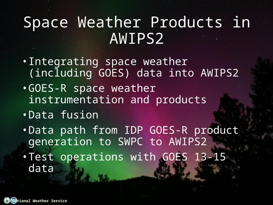
Space Weather Products in AWIPS2
Steven Hill, NOAA/SWPC
SWPC: Chris Lauer, Ratina Dodani, Kelvin Fedrick, Mike Carpenter, Ann Newman, Chris Balch, Bob Rutledge, Rob Steenburgh, Brent GordonNCO: Shova Gurung, David Plummer, Stephen Gilbert, Jason Travis
NGDC: Johnathan Darnel, Janet Machol, Bill Denig, Pau Loto’aniu, Rob Redmon
National Weather ServiceNational Weather Service
Space Weather Products in AWIPS2
• Integrating space weather (including GOES) data into AWIPS2• GOES-R space weather instrumentation and
products• Data fusion • Data path from IDP GOES-R product generation to
SWPC to AWIPS2• Test operations with GOES 13-15 data

National Weather ServiceNational Weather Service
Not Exactly a Science Issue, but…• GOES Space Weather Data have previously been
developed and managed exclusively by SWPC• For GOES-R• GOES-R program is developing the L1B products• NGDC is developing the L2+ algorithms and processing
system• NWS IDP will host operational L2+ processing• AWIPS2 will replace many custom SWPC systems, not
just for GOES SWx data, but also for all other SWx data

National Weather ServiceNational Weather Service
AWIPS2 Context
• SWPC provides data pipeline• NCO provides AWIPS2 applications• AWIPS2 Functions include:• Image ingest, rendering, animation and analysis• Time series data (GOES, ACE, STEREO, DSCOVR)• Coded messages, events, regions, other text I/O• Ground magnetometer data• General forecaster applications (Products, Alerts…)• Enlil applications: SPI, CMENT, CAT• Model ingest, rendering and animation
4

National Weather ServiceNational Weather Service
SWPC Reliance on Satellites• Most Products Require Satellite
Data• 95% of SWPC products use satellite
data• Only 10% of products can be
produced without satellite data
• Two of the Three Space Weather Scales are Derived solely from Satellite Observations • Future Satellite Missions are
Critical• DSCOVR: Continuity of observations
from L1• GOES-R: Continuity of observations
from GEO• COSMIC II: Expanding real-time
observations on a global scale
Aurora Location and Intensity Model: Driven by solar wind data measured at the L1 point (1% of the distance between Earth and sun

National Weather ServiceNational Weather Service
GOES R Instruments
• EXIS - Ultraviolet and X-ray Irradiance Sensors (EXIS): X-ray sensor, expanded dynamic range and flare location • SUVI – Full-disk extreme ultraviolet imager: Active
region characterization, filament eruption, and flare detection• SEISS – Electrons, protons, heavy ions – Surface
charging, internal charging, single-event upsets• MAG - Detection of geomagnetic storms and
magnetopause crossing, energetic particle products, model validation

National Weather ServiceNational Weather Service
Data Integration and Fusion• Data fusion for forecaster interpretation• Solar Image overlays for situational awareness• Over-plots of solar wind measurements vs. models
National Weather ServiceNational Weather Service
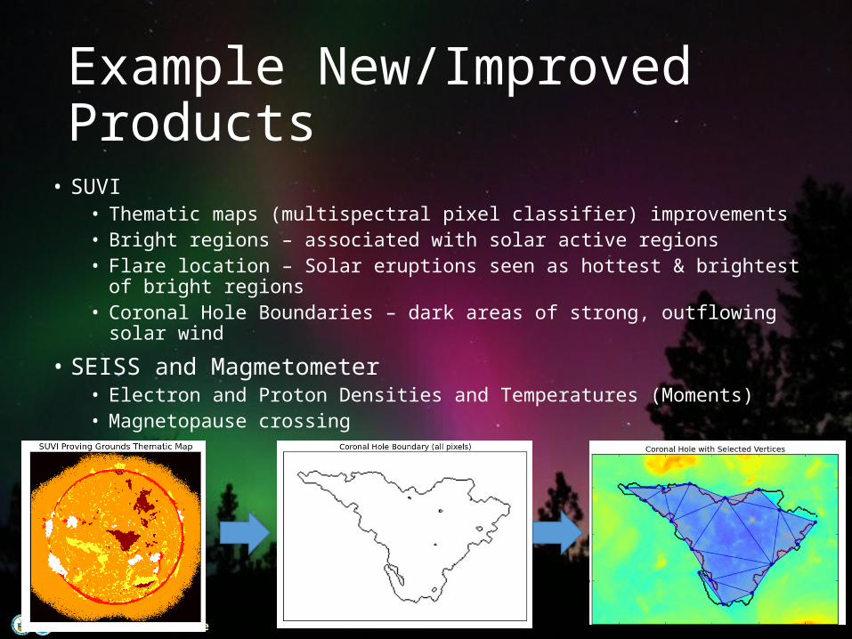
Example New/Improved Products• SUVI
• Thematic maps (multispectral pixel classifier) improvements• Bright regions – associated with solar active regions• Flare location – Solar eruptions seen as hottest & brightest of bright regions• Coronal Hole Boundaries – dark areas of strong, outflowing solar wind
• SEISS and Magmetometer• Electron and Proton Densities and Temperatures (Moments)• Magnetopause crossing

National Weather ServiceNational Weather Service
Demonstration(s)
• Proxy data• GOES 13-15• ACE• SDO
• Requirements and Specifications• Latency: < 15 sec for time series; < 1 min for images• Formats: XML for time series; FITS for images
• Reliability• File type must be easily and quickly validated, self-describing, etc.• System elements must be robust against interruption and corrupt data
• Other Guiding Principles: • Minimize technical debt• Minimize maintenance• Maximize extensibility (easy to add new data sets)

National Weather ServiceNational Weather Service
Solar Imagery on AWIPS2
• SDO 19.3nm and HMI magnetogram data• Science level data now
accessible to forecasters via FITS format• Quantitative images
with accurate navigation

National Weather ServiceNational Weather Service
Time Series data on AWIPS2• ACE and GOES data• Data formats and
samples generated• Encoders and decoders
written• Prototype pipeline
developed• Preparing for
operational deployment of the data pipeline

National Weather ServiceNational Weather Service
• Substantial progress toward highly reliable system• Integrating a system very unlike prior GOES space
weather data systems• Components developed across organizations
(GOES-R, NGDC, NCO, NWS, and SWPC)• AWIPS2 image and time series data will soon be
available to forecasters in real-time
Conclusion
12