Embed Size (px)
Citation preview
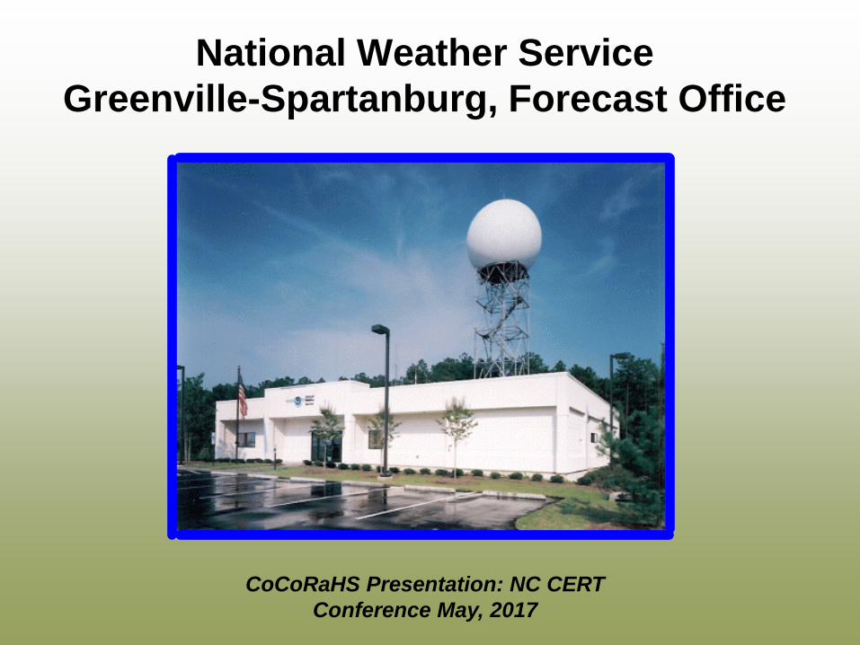
National Weather Service Greenville-Spartanburg, Forecast Office
CoCoRaHS Presentation: NC CERT Conference May, 2017
Introduction- who we are……….
Federal Agency Within the U.S. Dept. of Commerce
Introduction- who we are……….

Introduction- who we are……….
122 NWS forecast offices
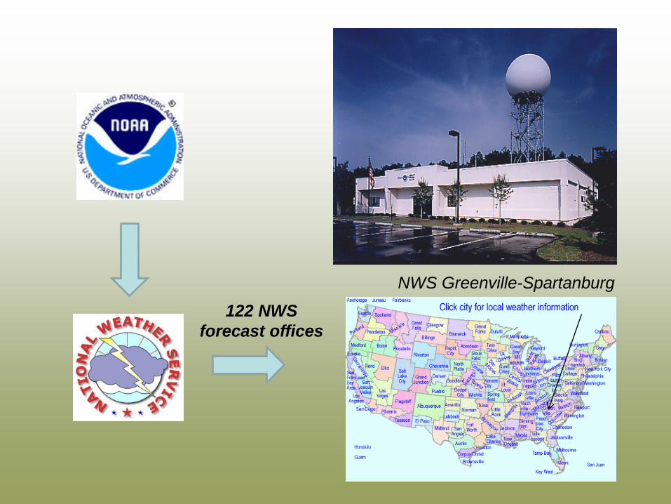
122 NWS forecast offices
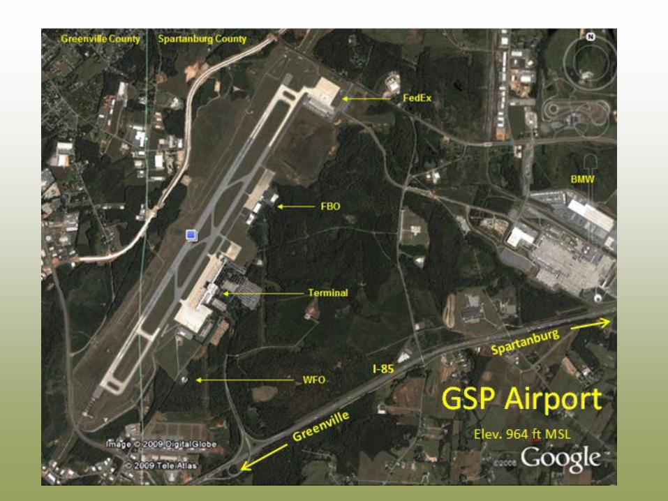
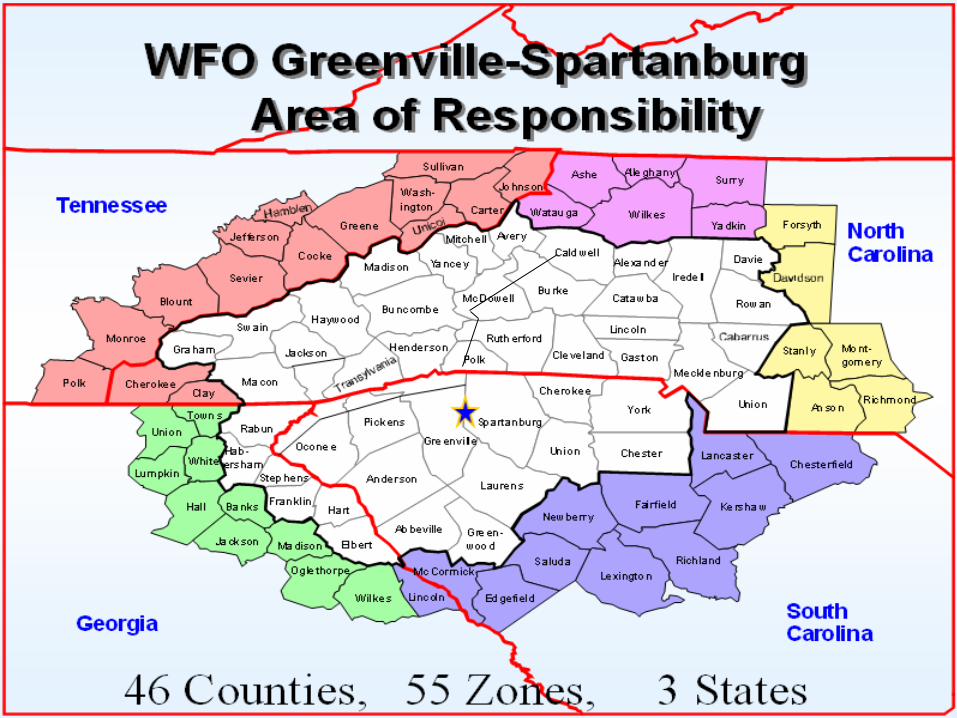
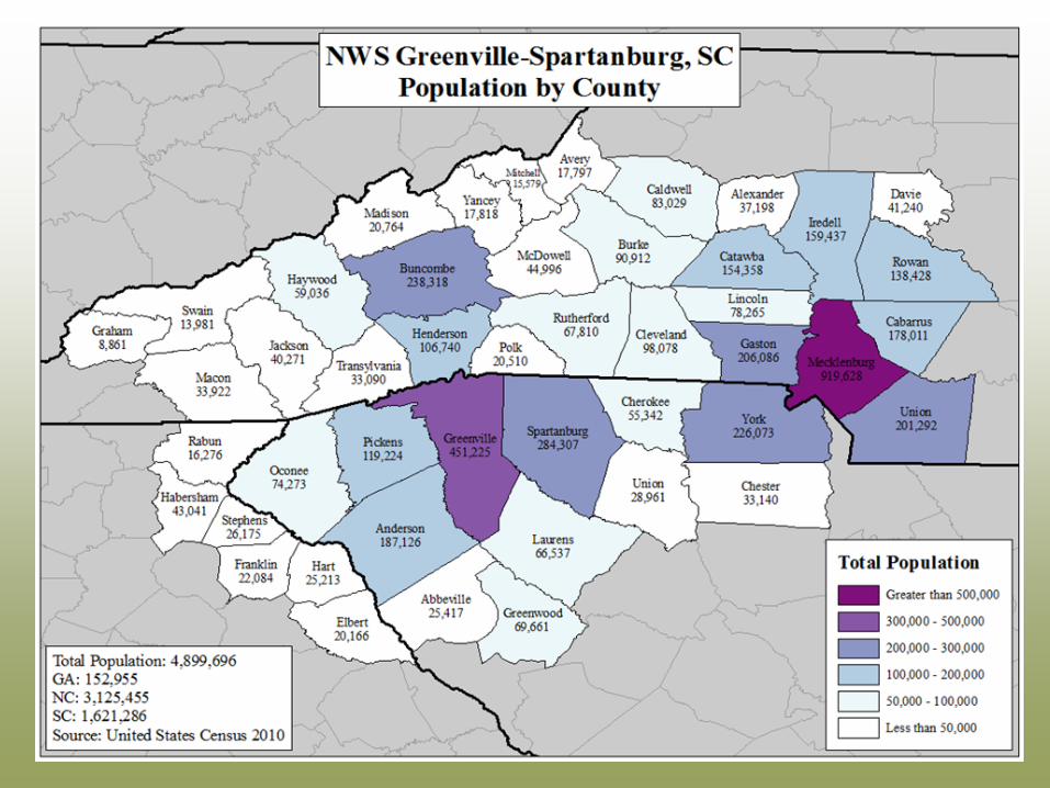
NWS Greenville-Spartanburg
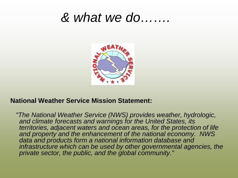
National Weather Service Mission Statement:
"The National Weather Service (NWS) provides weather, hydrologic, and climate forecasts and warnings for the United States, its territories, adjacent waters and ocean areas, for the protection of life and property and the enhancement of the national economy. NWS data and products form a national information database and infrastructure which can be used by other governmental agencies, the private sector, the public, and the global community."
& what we do…….
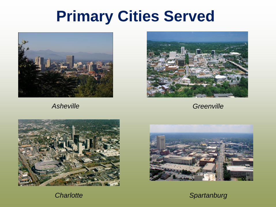
Asheville Greenville
Charlotte Spartanburg
Primary Cities Served
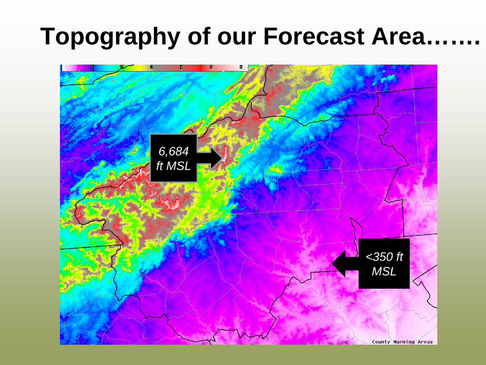
Topography of our Forecast Area…….
<350 ft MSL
6,684 ft MSL
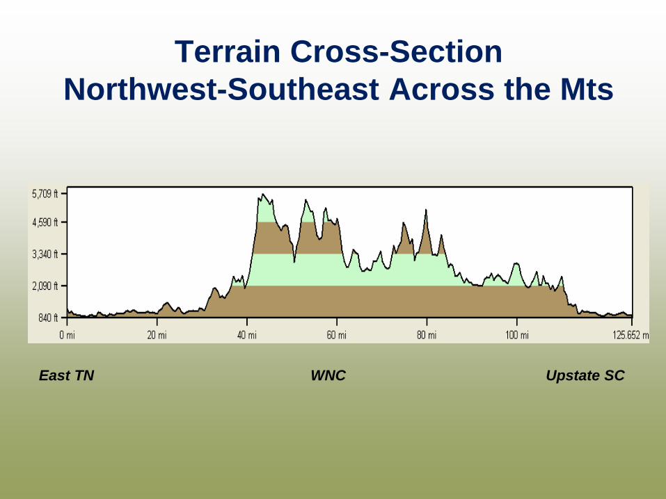
East TN WNC Upstate SC
Terrain Cross-Section Northwest-Southeast Across the Mts
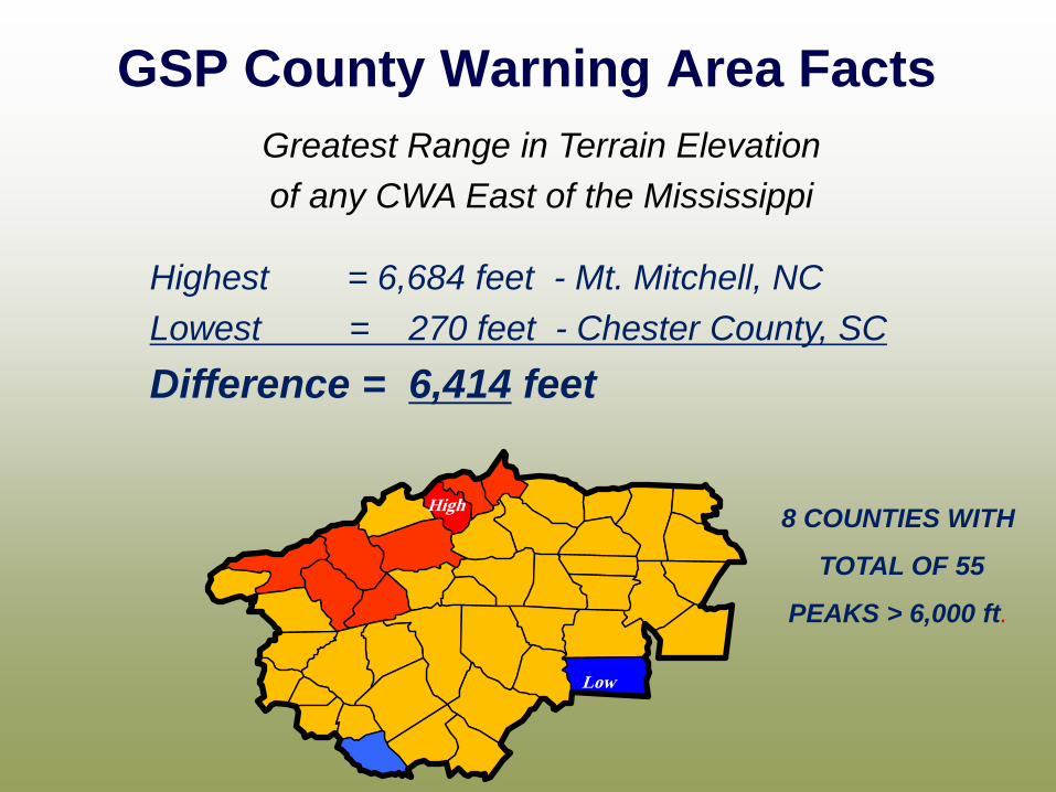
GSP County Warning Area Facts Greatest Range in Terrain Elevation of any CWA East of the Mississippi
Highest = 6,684 feet - Mt. Mitchell, NC Lowest = 270 feet - Chester County, SC Difference = 6,414 feet
High
Low
8 COUNTIES WITH
TOTAL OF 55
PEAKS > 6,000 ft.
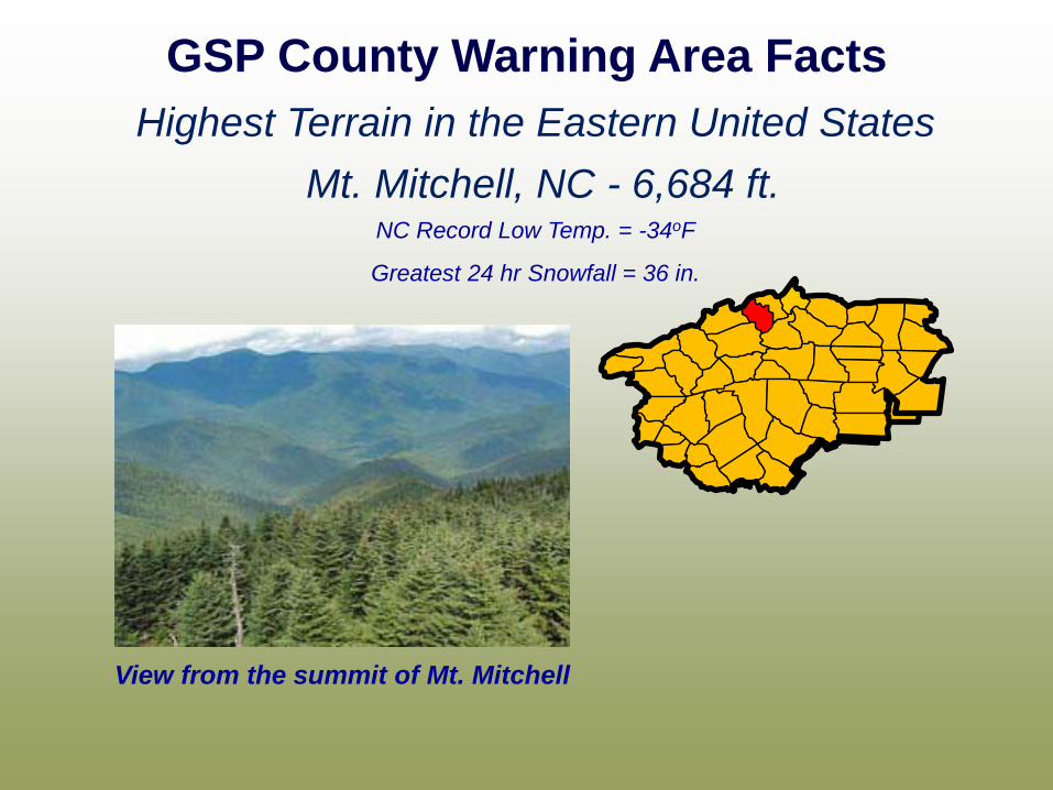
Mt. Mitchell, NC - 6,684 ft.
GSP County Warning Area Facts Highest Terrain in the Eastern United States
NC Record Low Temp. = -34oF
Greatest 24 hr Snowfall = 36 in.
View from the summit of Mt. Mitchell
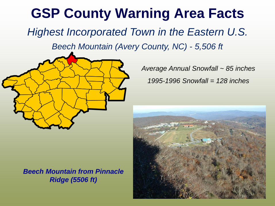
GSP County Warning Area Facts Highest Incorporated Town in the Eastern U.S.
Beech Mountain (Avery County, NC) - 5,506 ft
Average Annual Snowfall ~ 85 inches
1995-1996 Snowfall = 128 inches
Beech Mountain from Pinnacle Ridge (5506 ft)
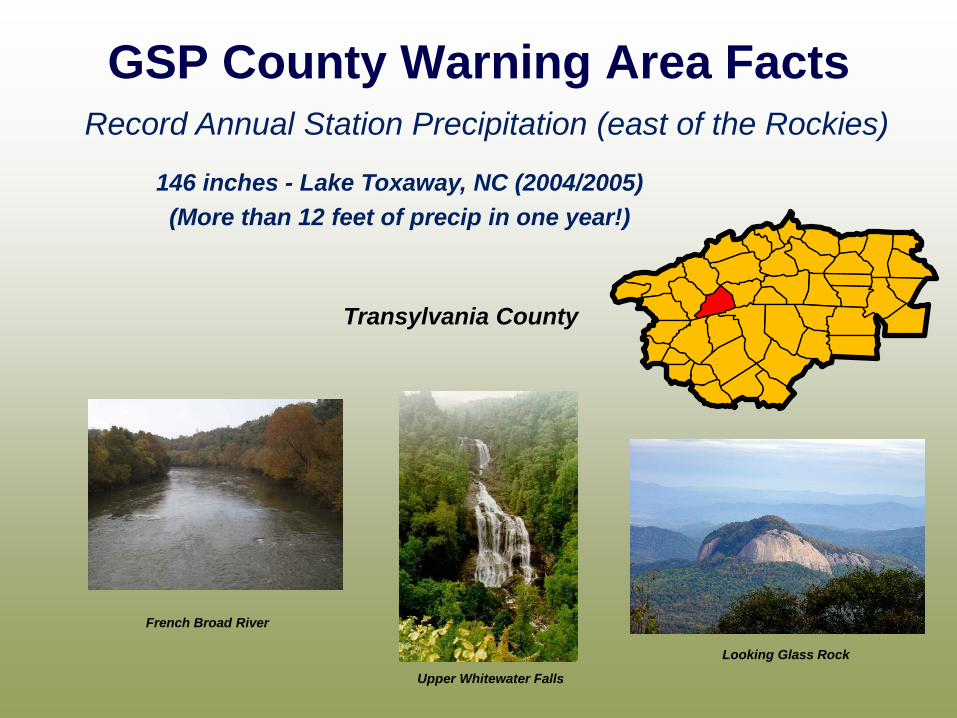
GSP County Warning Area Facts Record Annual Station Precipitation (east of the Rockies)
146 inches - Lake Toxaway, NC (2004/2005) (More than 12 feet of precip in one year!)
French Broad River
Upper Whitewater Falls
Transylvania County
Looking Glass Rock
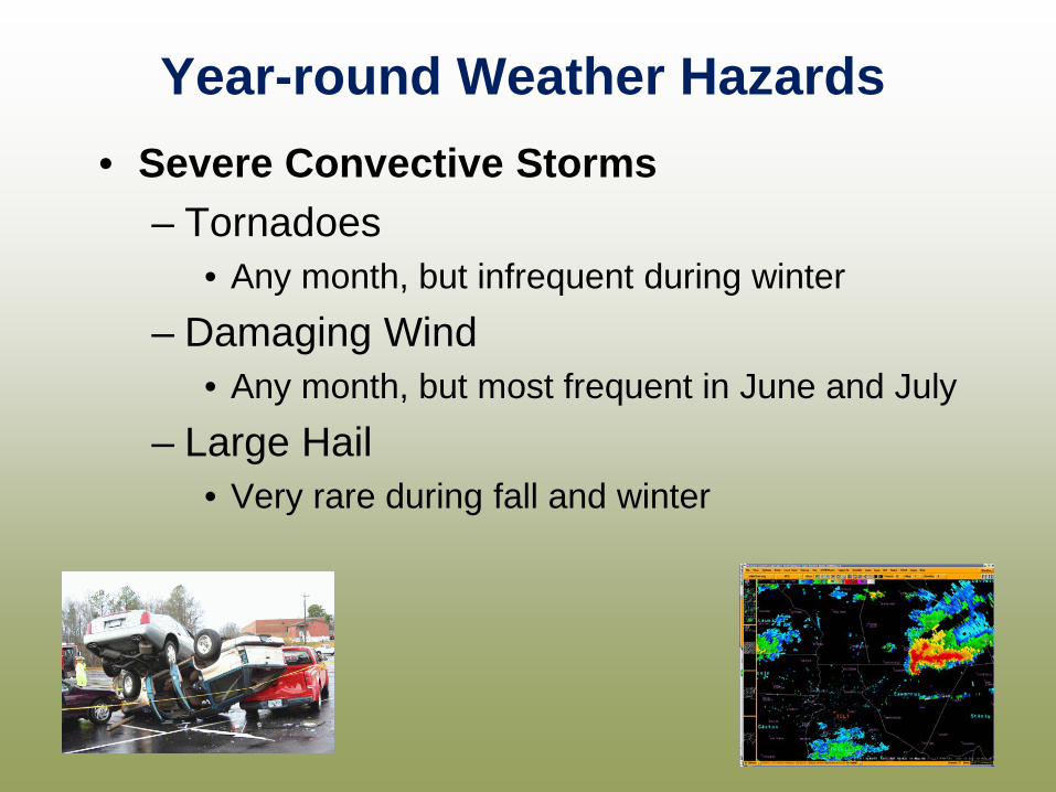
Year-round Weather Hazards • Severe Convective Storms
– Tornadoes • Any month, but infrequent during winter
– Damaging Wind • Any month, but most frequent in June and July
– Large Hail • Very rare during fall and winter
SKYWARN Storm Spotters
SKYWARN® spotters - provide essential information for all types of weather hazards, the main responsibility of a spotter is to identify and describe severe local storms. The information provided by SKYWARN® spotters, coupled
with Doppler radar technology, improved satellite and other data, has enabled NWS to issue more timely and accurate warnings for tornadoes, severe thunderstorms and flash
floods.

Reporting Criteria
Hail – of any size, especially quarter-size or larger
Wind – recorded gusts of 58 mph or greater Any damage caused by wind
Flooding – where it doesn’t normally occur
Tornadoes, funnel clouds, rotation in a storm
Not Reported:
Lightning, heavy rain, scud clouds

How to Report Severe Weather • Directly to the NWS Severe Wx Hotline: 1(800) 268-7785
• To your local Emergency Manager or 911 center
• Try calling your county’s non-emergency phone number first
• If not available, Dial 911 and make your report
What to include in your report:
• Your location: County, miles and direction from a town or city,
road intersection, etc...
• Time of event: When did the event occur or end?
• Actual event: What you observed, without exaggerating!
Official Spotter Training
Online spotter training is available at: https://www.meted.ucar.edu/training_course.php?id=23
(You will need to create an account on the COMET website in order to access the training material.)
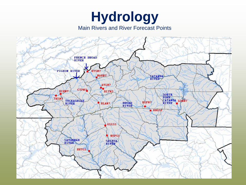
Hydrology Main Rivers and River Forecast Points
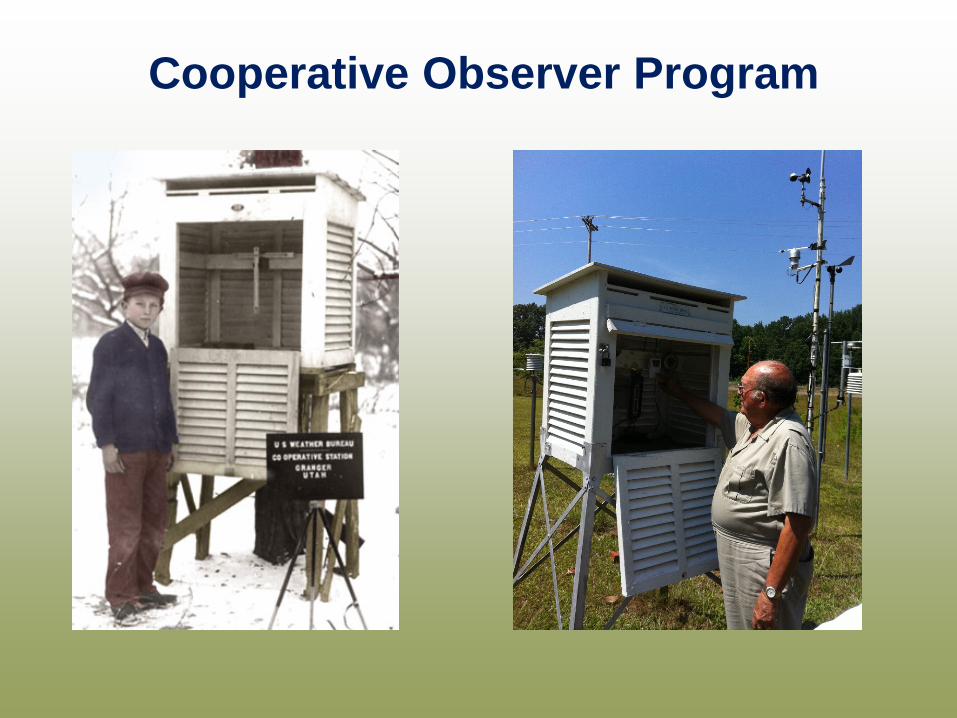
Cooperative Observer Program
The Cooperative Observer Program was formally created in 1890 under the
Organic Act. Its mission is two-fold:
1: To provide observational meteorological data, usually consisting of daily maximum and minimum temperatures, snowfall, and
24-hour precipitation totals, required to define the climate of the United States and to help measure long-term climate changes
2: To provide observational meteorological data in near real-time to support forecast, warning and other public service programs
of the NWS.
Cooperative Observer Program
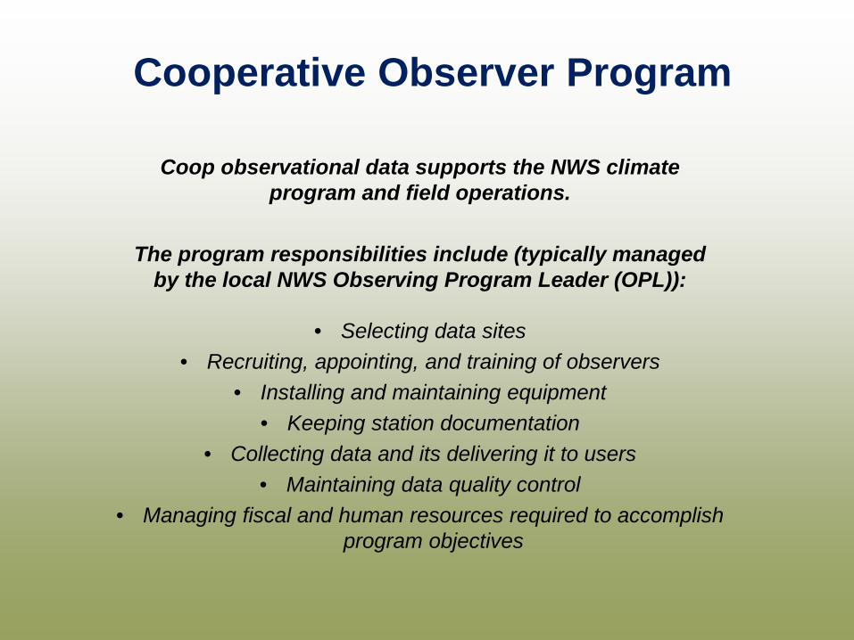
Coop observational data supports the NWS climate program and field operations.
The program responsibilities include (typically managed
by the local NWS Observing Program Leader (OPL)):
• Selecting data sites • Recruiting, appointing, and training of observers
• Installing and maintaining equipment • Keeping station documentation
• Collecting data and its delivering it to users • Maintaining data quality control
• Managing fiscal and human resources required to accomplish program objectives
Cooperative Observer Program

Nationwide network of around 10,000 volunteer observers and institutions. Some stations are more than 100 years old.
The majority report daily temperature and precipitation.
Cooperative Observer Program
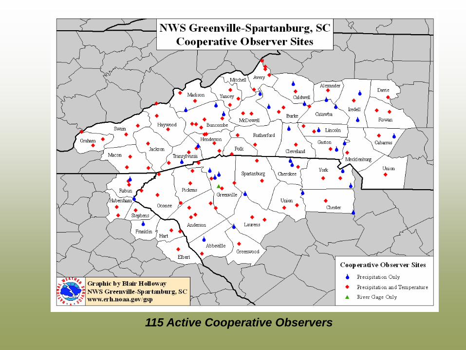
115 Active Cooperative Observers
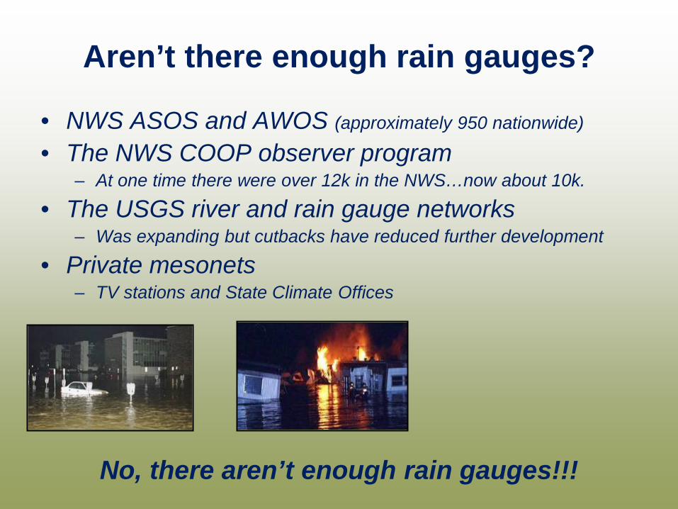
Aren’t there enough rain gauges?
• NWS ASOS and AWOS (approximately 950 nationwide)
• The NWS COOP observer program – At one time there were over 12k in the NWS…now about 10k.
• The USGS river and rain gauge networks – Was expanding but cutbacks have reduced further development
• Private mesonets – TV stations and State Climate Offices
No, there aren’t enough rain gauges!!!
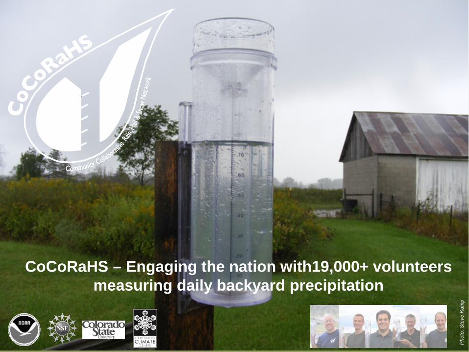
CoCoRaHS – Engaging the nation with19,000+ volunteers measuring daily backyard precipitation
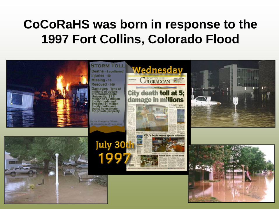
CoCoRaHS was born in response to the 1997 Fort Collins, Colorado Flood
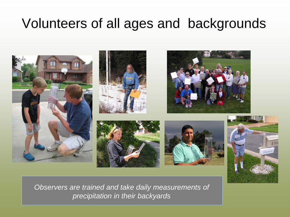
Volunteers of all ages and backgrounds
Observers are trained and take daily measurements of precipitation in their backyards

Simple, low-cost measurement tools
4-inch diameter High capacity rain gauges
Aluminum foil-wrapped Styrofoam hail pads
Snow rulers marked in tenths of an inch
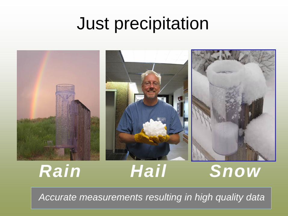
Just precipitation
Rain Accurate measurements resulting in high quality data
Snow Hail
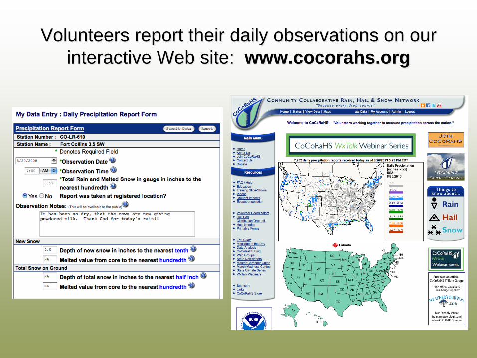
Volunteers report their daily observations on our interactive Web site: www.cocorahs.org
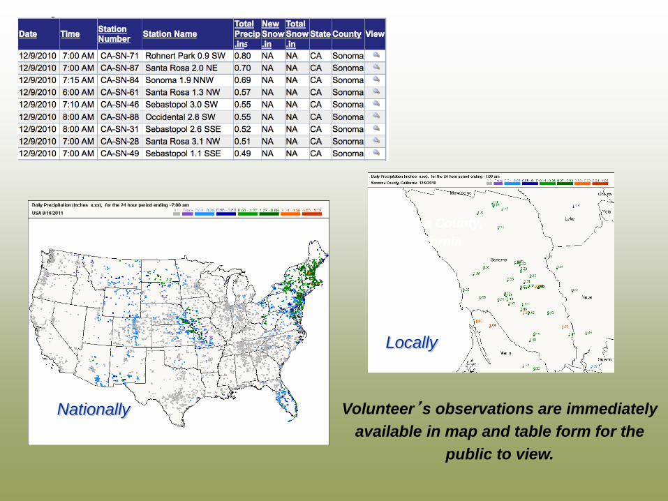
Locally
Nationally Volunteer’s observations are immediately available in map and table form for the
public to view.
Sonoma County, California

Rainfall Data
CoCoRaHS has quickly become the largest source of daily precipitation measurements in the United States
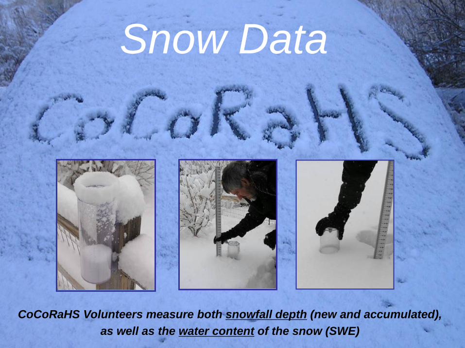
CoCoRaHS Volunteers measure both snowfall depth (new and accumulated), as well as the water content of the snow (SWE)
Snow Data
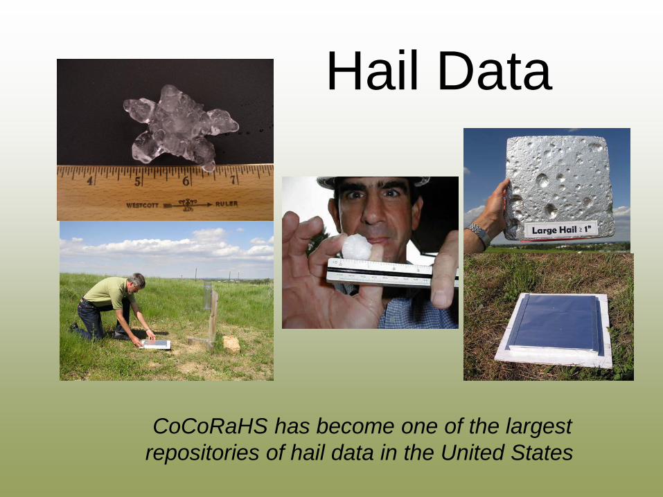
Hail Data
CoCoRaHS has become one of the largest repositories of hail data in the United States
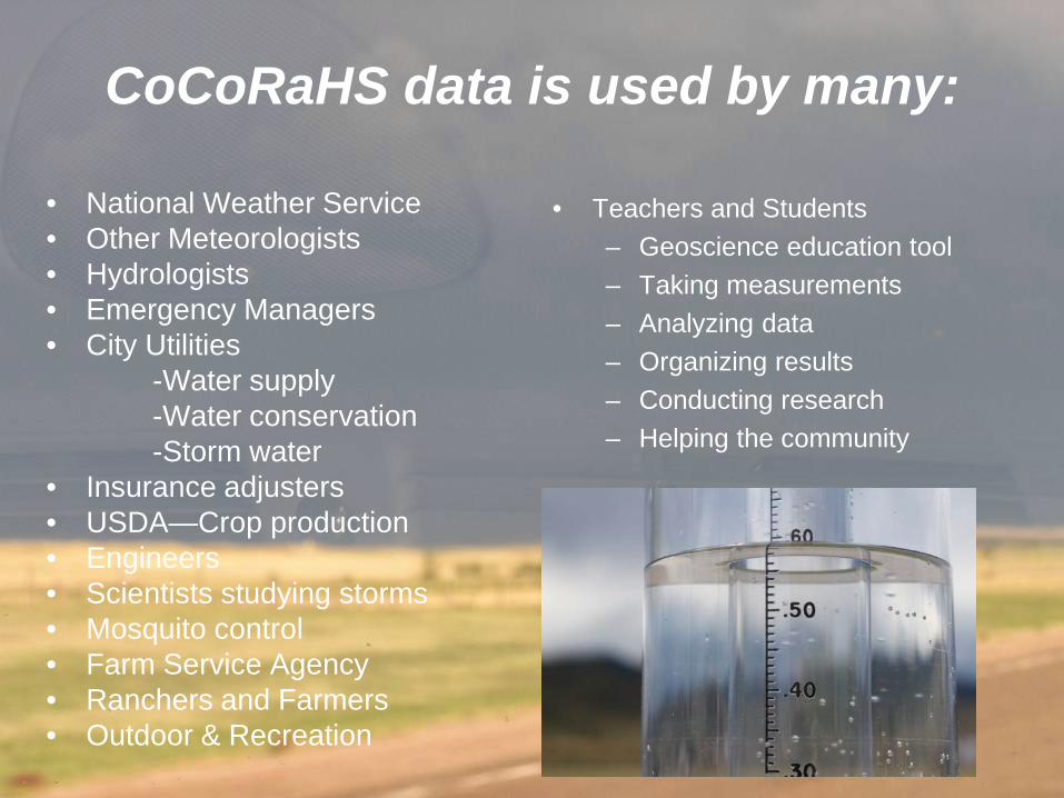
CoCoRaHS data is used by many:
• National Weather Service • Other Meteorologists • Hydrologists • Emergency Managers • City Utilities -Water supply -Water conservation -Storm water • Insurance adjusters • USDA—Crop production • Engineers • Scientists studying storms • Mosquito control • Farm Service Agency • Ranchers and Farmers • Outdoor & Recreation
• Teachers and Students – Geoscience education tool – Taking measurements – Analyzing data – Organizing results – Conducting research – Helping the community
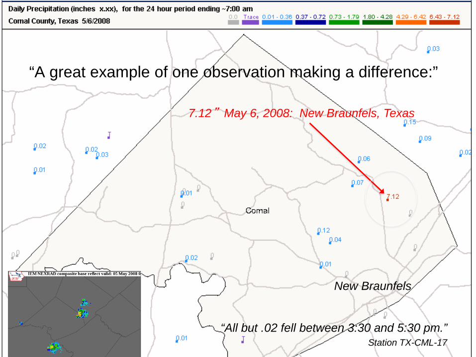
7.12” May 6, 2008: New Braunfels, Texas
San Antonio
“A great example of one observation making a difference:”
“All but .02 fell between 3:30 and 5:30 pm.” Station TX-CML-17
New Braunfels
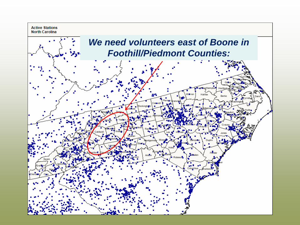
We need volunteers east of Boone in Foothill/Piedmont Counties:
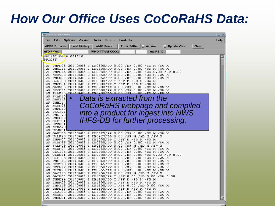
How Our Office Uses CoCoRaHS Data:
• Data is extracted from the CoCoRaHS webpage and compiled into a product for ingest into NWS IHFS-DB for further processing.

• Daily summary text product compiled and transmitted.
COCORAHS DATA USE WITHIN NWS
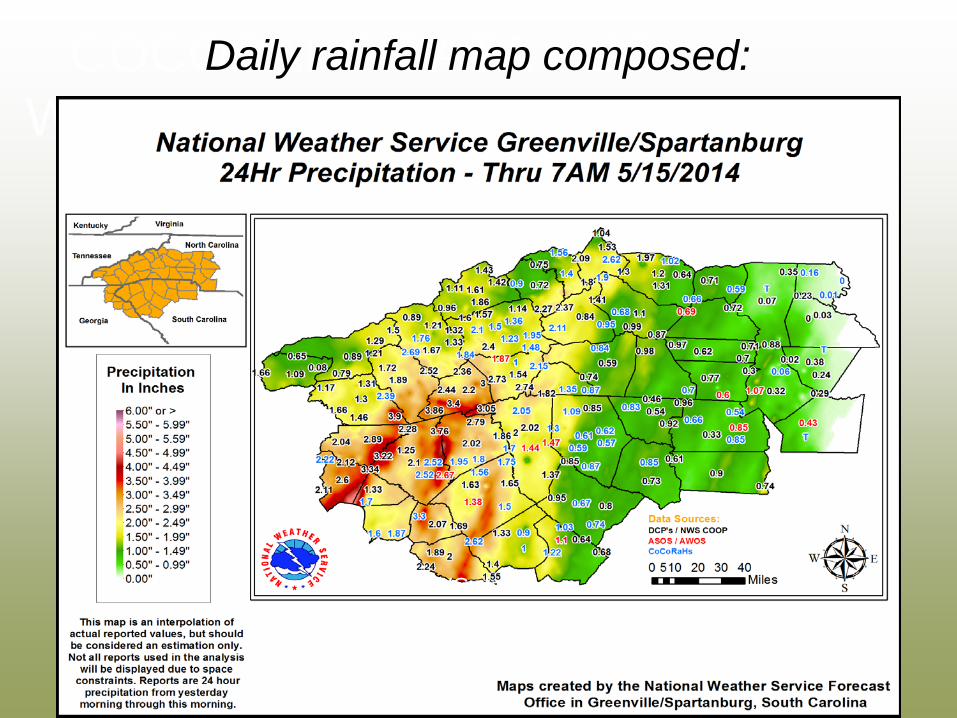
Daily rainfall map composed:
CoCoRaHS data in blue
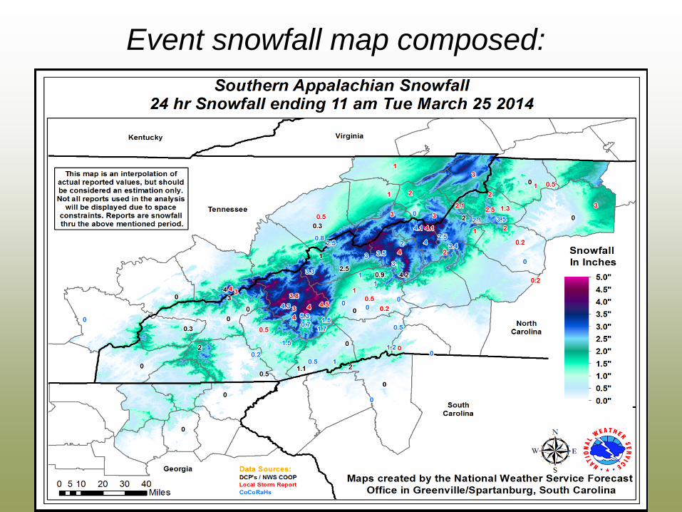
Event snowfall map composed:
“Helping to provide the public with a better understanding of weather and climate”
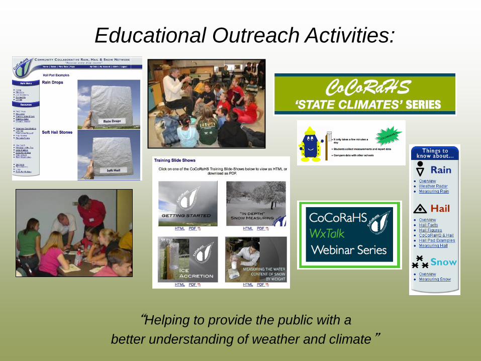
Educational Outreach Activities:
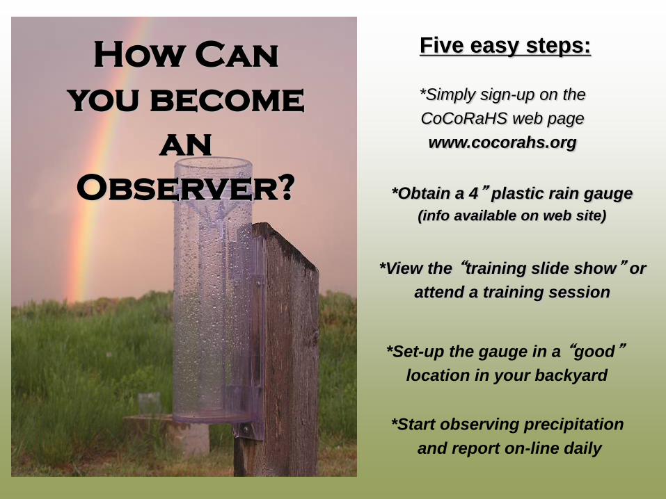
How Can you become
an Observer?
*Simply sign-up on the CoCoRaHS web page www.cocorahs.org
*Obtain a 4” plastic rain gauge (info available on web site)
*Set-up the gauge in a “good” location in your backyard
*Start observing precipitation and report on-line daily
Five easy steps:
*View the “training slide show” or attend a training session
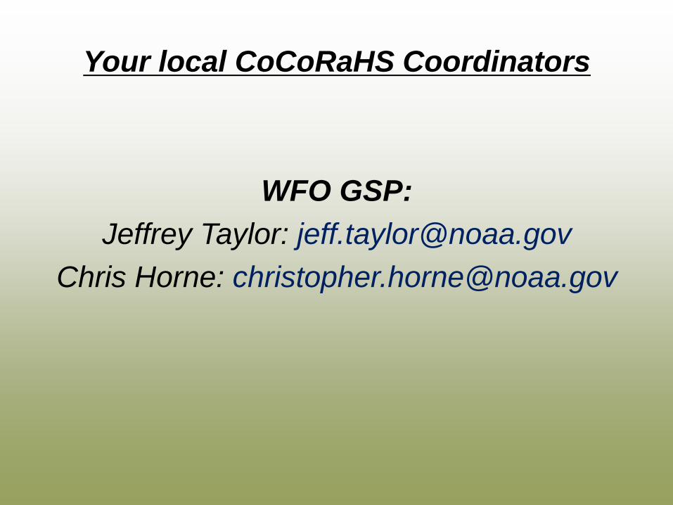
Your local CoCoRaHS Coordinators
WFO GSP: Jeffrey Taylor: [email protected]
Chris Horne: [email protected]
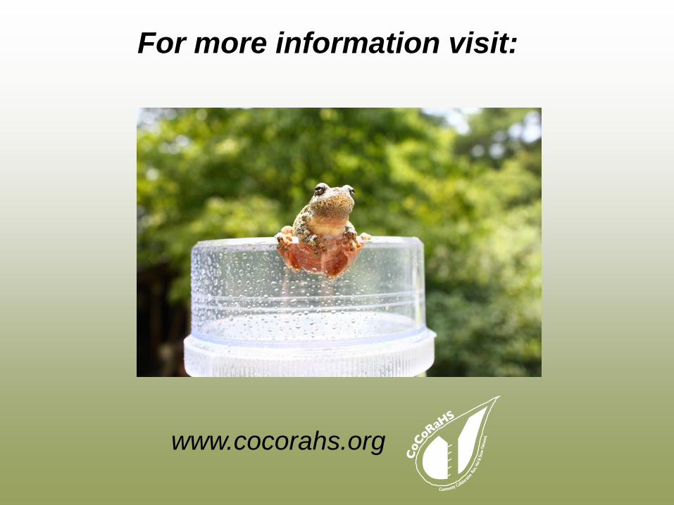
For more information visit:
www.cocorahs.org