Embed Size (px)
Citation preview

8/6/2019 Mountian Flying
http://slidepdf.com/reader/full/mountian-flying 1/42
mountain f lying
NOTICE: The following is a summation of the minimum knowledge areas needed to fly safely in themountains. Further study and instruction (from a knowledgeable instructor) are required prior to flyingthe mountains. This minimum knowledge information is intended to supplement, not replace, yourpreparation for flying in the mountains.
basic premises
Without exception, you must adhere to the two basic premises of mountain flying, whether flying "withthe mountains" or over the mountains.
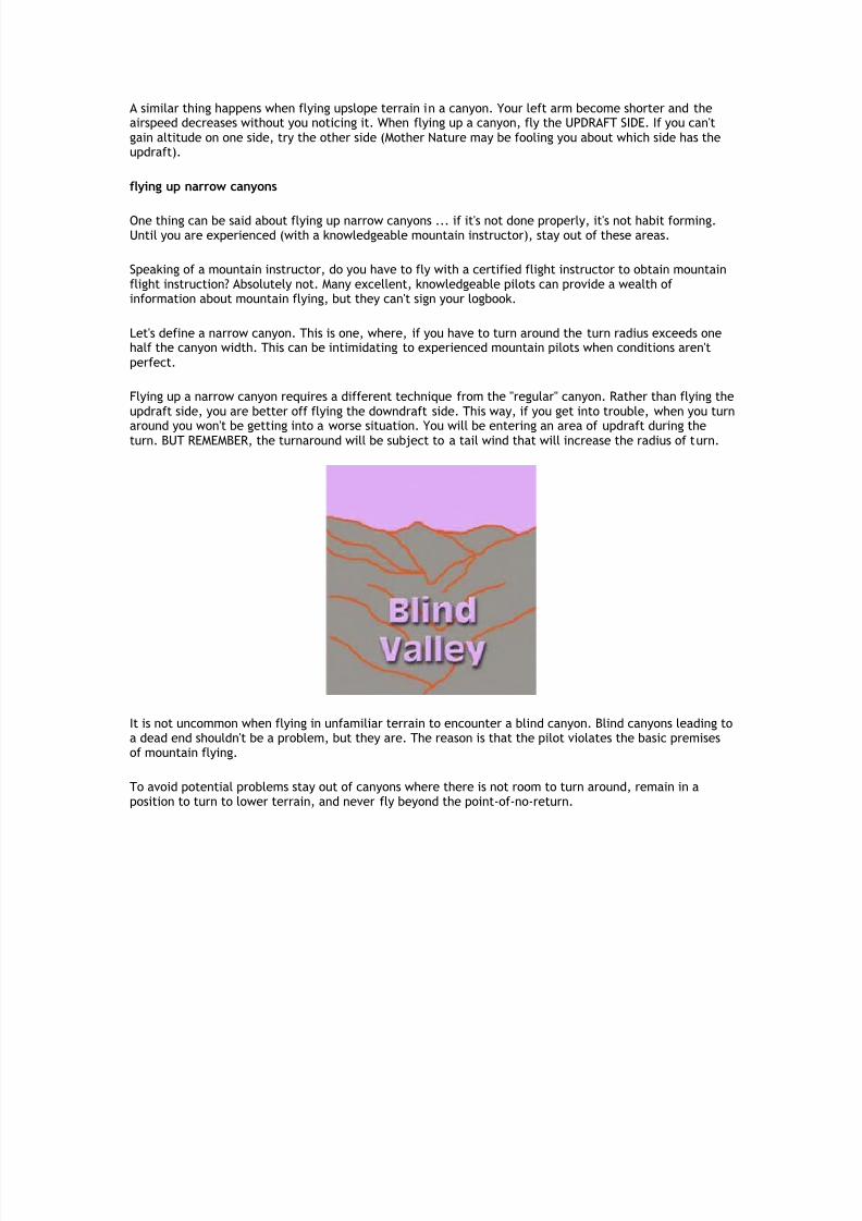
Always remain in a position where you can turn toward lowering terrain
The novice mountain pilot should plan to fly 2,000 feet above the terrain along the route of flight. Whenapproaching within ½ to ¼ mile from the mountain ridges, turn to approach the ridge at a 45-degreeangle. This permits an easy escape with less stress on the airplane if downdrafts or turbulence areencountered. Never fly in a canyon where there is not room to turn around.
Never fly beyond the point of no return.

8/6/2019 Mountian Flying
http://slidepdf.com/reader/full/mountian-flying 2/42
When flying upslope terrain, the "point of no return" is defined as the position where, if you reduce thethrottle to idle, you can lower the nose for a normal glide and perform a 180-degree turn withoutimpacting the ground. At or prior to this point, circle away from the mountain to gain additional altitudebefore proceeding.
mountain meteorology
A complete check of the weather is necessary to develop a go/no-go decision. Stay out of marginalweather areas. Winds aloft greater than 30 knots at cruise altitude usually means the novice pilot shoulddelay or postpone the flight until more favourable conditions prevail.
Airport (TEX) at Telluride, Colorado, perched 1,000 feet above the San Miguel River on Deep Creek Mesa (about 4 ½ miles westof town. It is the highest altitude commercial airport in the U.S. Sinking air is a problem when surface winds reach 15 knots or
more.
density altitude
Density altitude is the altitude the airplane thinks it is at and performs in accordance with. High, hot andhumid conditions may raise the effective physical altitude of an airstrip to a performance altitude manythousands of feet higher than its actual elevation.
runway length
A handy rule-of-thumb for operating from a short runway is that if you obtain 71 percent of the speednecessary for rotation at the halfway point of the runway, you can take off in the remaining distance.
Note: This rule of thumb guarantees takeoff performance, but not rate-of-climb after the takeoff.

8/6/2019 Mountian Flying
http://slidepdf.com/reader/full/mountian-flying 3/42
Short-field takeoff
leaning the mixture
For density altitudes of 3,000 feet or greater, lean the mixture for takeoff according to the airplanemanufacturer's recommendation. Do not lean turbocharged or supercharged engines for takeoff.
Lacking any recommendation, lean the mixture during the takeoff roll slowly until encountering engineroughness, then enrich for engine smoothness.
approach ridges
Turn to approach ridges at a 45-degree angle to provide you the option of escaping toward loweringterrain. Begin this turn to approach the ridge at the 45-degree angle when you are about 1/2 to 1/4 milefrom the ridge.
The visual aspects of mountain flying can be deceiving, but if you can see more and more of the terrainon the other side of the ridge you are approaching, you are higher than the ridge and can probablycontinue.
As you near the ridge, arriving at a position where the power can be reduced to idle and the airplane willglide to the top of the ridgeline, a commitment to cross the ridge can be made. At this position, theairplane is close enough to the ridgeline not to experience an unexpected downdraft of a nature that willcause a problem. If a downdraft is encountered, keep the power on, lower the nose to maintain airspeedand the airplane will clear the ridge.
flying canyons
Until you have the experience of flying canyons with a knowledgeable instructor, do not fly up canyons. If it is necessary to fly in a canyon, gain altitude, fly to the head of the canyon, then fly downslope terrain.
airspeed control
Landing at a short mountain strip requires exact airspeed control to eliminate float. A 10-percent increasein the proper approach speed results in a 21-percent increase in landing distance.
Use the same indicated airspeed for approach when landing at a high-elevation mountain strip that youwould use for the approach at a sea level airport. The thin air at high altitudes affects the airspeedindicator.

8/6/2019 Mountian Flying
http://slidepdf.com/reader/full/mountian-flying 4/42
8/6/2019 Mountian Flying
http://slidepdf.com/reader/full/mountian-flying 5/42
course reversal
Everyone flying in the mountains will encounter situations when it becomes necessary to make a 180-degree turn. Forget hammerhead turns, wingovers, chandelles and the other fancy manoeuvres. By thetime you figure out you are in trouble and need to turn around, there is insufficient speed to performthese manoeuvres.
To turn around, slow down. This will decrease the radius of turn. Pull back on the control wheel to tradeairspeed for altitude if you have extra speed. Then make the steepest turn you can comfortably make, upto 60 degrees.
arrival
The mountainous terrain surrounding many air strips prevents a normal descent from cruise altitude topattern altitude. It is necessary to make progressive power reductions to prevent thermal stresses frombeing induced in the engine. This allows the engine to cool slowly, preventing not only thermal shock, butalso preventing de-tuning. Always make smooth power changes when adding or reducing power.
c a u t i o n : This is not the total information you need to fly safely in the mountains. It is merely anoutline of the minimum information that should be studied.
t h e p s y c h o l o g y o f m o u n t a i n f l y i n g
True mountain flying—that is, terrain, contour or drainage flying, as opposed to flying well above themountains—can be done with total safety only when the pilot becomes conditioned to apply the basicpremised during flight, without having to think about them.
A l w a y s r e m a i n i n a p o s i t i o n w h e r e y o u c a n t u r n t o w a r d l o w e r i n gt e r r a i n .
This axiom also encompasses the idea that you will not enter or fly in a canyon where there is notsufficient room to turn around. Another way of stating this truth is to have an escape route in mind andbe in a position to exercise this option.
D o n o t f l y b e y o n d t h e p o i n t o f n o r e t u r n .
This is the position when flying upslope terrain where, if you reduce the throttle to idle and begin anormal glide, you will have sufficient altitude to turn around without impacting the terrain.

8/6/2019 Mountian Flying
http://slidepdf.com/reader/full/mountian-flying 6/42
C o n s t a n t l y e v a l u a t e where you are and decide if you can lose altitude before having to turn theairplane. If not, you are narrowing your options substantially.
What happens when the pilot flies beyond the point of no return? First, and usually the less seriousconsequence, involves landing the airplane straight ahead into whatever terrain exists. This normallyresults in destruction of the aircraft, but with proper technique the occupants will survive. Propertechnique means the airspeed is maintained to allow transition to a normal landing attitude (often
upslope terrain) without stalling the airplane.
The second outcome of flying beyond the point of no return involves the stall-spin accident. Becausethere is insufficient altitude or manoeuvring space to complete the turn around, the pilot may try to hurrythe turn with excessive bottom rudder, thus yawing the airplane. This induces a stall-spin.
It is necessary for you to constantly think about the axioms of flight until you become conditioned tounconsciously remain in a position where you can turn toward lowering terrain and never fly beyondthe point of no return.
p r o b l e m s i n t h e m o u n t a i n s
Occasionally the wind defies all common sense reasoning and visualization. When this occurs it is usuallydue to one or a combination of the following:
subsidenceinversionterrain modificationvalley breezemountain breeze
Circulation(This discussion is limited to the northern hemisphere)A quick review of some basic weather phenomena helps make the point. Circulation refers
simply to the movement of air about the earth's surface. The sun heats the Earth's surfaceunevenly. The most direct rays strike near the equator, heating the equatorial regions morethan the polar regions. The equatorial region re-radiates to space less heat than is receivedfrom the sun, while the reverse is true at the poles.
Yet the equator does not continue to get hotter and hotter, nor does the polar region get colder. The onlyexplanation is that heat is transferred from one latitude to another by the actual transport of air.
Warm air forced aloft at the equator begins to move north at high elevation. Coriolis force turns it to theright (east). This turning develops a strong band of winds, "prevailing westerlies," at about 30º northlatitude.
Similarly, cool air from the poles begins a low-elevation journey toward the equator. It is also deflectedto its right by Coriolis force creating a belt of low-level "polar easterlies." The result is to create an
temporary impasse that disrupts simple, convective transfer.
The atmosphere seeks stability and in an attempt to reach equilibrium, huge masses of air overturn in themiddle latitudes. Cold air masses break through the barriers, plunging southward. The result is a mid-latitude bank of migratory storms with ever-changing weather.

8/6/2019 Mountian Flying
http://slidepdf.com/reader/full/mountian-flying 7/42
Air Mass
The large air masses are high pressure areas. In the northern hemisphere, high pressure areas circulate ina clockwise direction. The high pressure system depicted on weather maps should be visualized as amountain of air. The mountain is composed of isobars or lines of equal pressure. Consider the isobars astopographic in nature. If they are far apart, the high pressure area has a shallow topography. When closetogether, there is a very steep slope to the mountain of air.
Where isobars are close together it indicates the air is squeezed into a smaller, more confined area with asteep slope creating a rapid flow of air and strong surface winds.
Between the high pressure areas will be areas of low pressure where the air flows counter-clockwise.Visualize the low pressure area as a valley between air masses.
None of the pressure areas are stagnant. The earth's atmosphere is in a constant state of imbalance, butthere is always a tendency to regain a state of balance.
Wind
Three forces act on wind. The pressure gradient force drives the wind. Pressure gradient is the decrease
of pressure with distance and is in the direction of greatest decrease, thus, pressure gradient is fromhigher to lower pressure and perpendicular to the isobars. If pressure gradient was the only force actingon the wind, wind would always blow perpendicular to the isobars.
Rotation of the earth generates a force that deflects from a straight path any mass moving relative to theearth's surface. Coriolis force is zero at the equator and increases with latitude to a maximum at thepoles. It is at a right angle to wind direction and is directly proportional to wind speed. Air in motion, dueto pressure gradient, blows straight across the isobars from higher to lower pressure. When the air is inmotion, Coriolis force begins to act at right angles to the wind, turning it to the right. Coriolis forcecontinues to deflect the wind until is is blowing parallel to the isobars. Coriolis force and pressuregradient force balance, and above surface friction (about 2,000 feet), causes the wind to blow parallel tothe isobars.
The winds at the earth's surface do not blow parallel to the isobars. Instead, they cross the isobars at an
angle from higher to lower pressure.
Frictional force always acts opposite to wind direction. As friction slows the wind speed, Coriolis forcedecreases; however, friction has no effect on pressure gradient force. Pressure gradient and Coriolisforces are no longer in balance. Above 2,000 feet AGL the wind blows parallel to isobars. Below thataltitude, friction causes the surface wind to blow 45º inward toward a low pressure area and 45º outwardfrom a high pressure area.
Subsidence
Variations in temperature and humidity create a contrast in pressure and density. The pressuredifferences drive a complex system of air currents in a never-ending attempt to attain equilibrium.
Suppose an air mass (high pressure area) arrives over the plateau area of the upper Arkansas River Valleynear Leadville, Colorado. The down flow, sinking are may be a stronger force than the prevailing windsaloft. The pilot departing Aspen and flying up the Roaring Fork River toward Independence Pass will behard pressed to find an updraft in the face of this down flow. Yet it's always been there before. This pilotmay be an accident waiting to happen.
According to Aviation Space Environment Medicine, 232 airplanes crashed within 50 nautical miles of Aspen, CO, between 1964 and 1987. A total of 202 people died and 69 were seriously injured. This pointsout the need for better training in mountain flying.

8/6/2019 Mountian Flying
http://slidepdf.com/reader/full/mountian-flying 8/42

8/6/2019 Mountian Flying
http://slidepdf.com/reader/full/mountian-flying 9/42
landing on an airstrip in a drainage, there will be a tailwind to contend with. The average wind speed is 6-8 knots.
fig. 3
Figure 3 - Mountain Breeze
During the late afternoon and evening the valley walls cool quickly, cooling a layer of air next to the
slope. This more dense air moves downslope into the valley causing the mountain breeze (gravity ordrainage wind). The slopes cool at a rate faster than they heat up, so the mountain breeze may bestronger than the valley breeze, averaging 10-12 knots. Departing downslope will mean the airplane maybe subject to the tailwind.
Coping
We tend to think in constants when contemplating the weather and associate whatever is happening asaffecting a large area. Often a phenomena is isolated or may crop up in various isolated areas. Despitewhat is happening or where it is happening, it is important to visualize what is going on.
Air is fluid, similar to water—although less dense. Ask "What would water do in this situation?" More oftenthan not the picture becomes clear, you will know where there are areas of lift, sink and turbulence.
So what will happen to the pilot heading up the Roaring Fork River toward Independence Pass? As long ashe remains in a position where he can turn to lowering terrain and does not fly beyond the point of noreturn, Mother Nature will not have a chance to perform a "got-cha."
The "point of no return" is defined as a point on the ground of rising terrain where the terrain out climbsthe aircraft. The turn-around point is determined as the position where, if the throttle is reduced to idle,the aircraft can be turned around during a glide without impacting the terrain.
Never fly beyond this point of no return. Turn around and manoeuvre for additional altitude prior tocontinuing.

8/6/2019 Mountian Flying
http://slidepdf.com/reader/full/mountian-flying 10/42

8/6/2019 Mountian Flying
http://slidepdf.com/reader/full/mountian-flying 11/42

8/6/2019 Mountian Flying
http://slidepdf.com/reader/full/mountian-flying 12/42

8/6/2019 Mountian Flying
http://slidepdf.com/reader/full/mountian-flying 13/42

8/6/2019 Mountian Flying
http://slidepdf.com/reader/full/mountian-flying 14/42
The most distinctive characteristic of the mountain wave is the lenticular cloud. This is a "signpost of thesky" indicating that mountain wave activity is present.
there are several terms for mountain wave:-
Mountain waveStanding waveLee waveGravity waveStanding lenticularACSL (altocumulus standing lenticularis)Or just plane "wave"
The wave that forms over the mountain is more properly called the "mountain wave." The wavesdownwind from the mountain are the "standing wave" or "lee wave." Pilots have come to accept all of these names for wave activity, regardless of position of the lenticular clouds.
To set up a mountain wave condition three elements are needed:
Wind flow perpendicular to the mountain range, or nearly so, being within about 30 degrees of
perpendicular.An increasing wind velocity with altitude with the wind velocity 20 knots or more near mountaintop
level.Either a stable air mass layer aloft or an inversion below about 15,000 feet.
Because of these elements, the weather service is able to predict the mountain wave condition with over90-percent accuracy.
Figure 1
In figure 1, we have likened an atmosphere with low stability to a flimsy spring that offers littleresistance to vertical motion. So while the lower coils move easily up and over the mountain, the joltreceived at ground level is not transmitted very far upward.

8/6/2019 Mountian Flying
http://slidepdf.com/reader/full/mountian-flying 15/42

8/6/2019 Mountian Flying
http://slidepdf.com/reader/full/mountian-flying 16/42
The up-and-down action forms a trough at the bottom of its flow and a crest at the top of the flow. Thedistance from trough to trough (or crest to crest) is called the wave length. The wave length is directlyproportional to wind wind and inversely proportional to stability.
The wave length is used for visualization. In the area from the trough to the crest is an area of updrafts.The area from the crest to the trough is predominately downdrafts.
In the intermountain west the wave length can vary from about 2 nautical miles to over 25 nautical miles.It averages 8 miles and extends downrange about 150-300 nautical miles. Satellite photos have shown thewave capable of extending over 700-nautical miles downwind from the mountain range.
Cap cloud of the Teton mountain range This cloud is mostly on thewindward side of the mountain.
FoehngapThe foehngap exists because moisture is reabsorbed during the
down rush of air.
With sufficient moisture three typical wave clouds will form, although there are four types of cloudsassociated with the wave.
Cap cloud (foehnwall)LenticularRoll (rotor, arcus)Mother-of-Pearl
The presence of clouds merely point out wave activity and not wave intensity at any particular level.Because moist air takes less vertical distance to reach its condensation level than does dryer air, thepresence of a lenticular cloud is not necessarily an indication of the strength of the updrafts ordowndrafts in a mountain wave.
For example, high altitude lenticulars may indicate there is sufficient moisture at that altitude to formthem, when in fact the strongest wave lift and sink occurs at a lower altitude where there isn't enoughmoisture to form the lenticular clouds. This is one reason visualization is so important.
The mother-of-pearl or nacreous cloud is a pancake-shaped cloud that is extremely thin and visible foronly a short time after sunset or before sunrise when the sky is dark. It is normally seen in latitudes higher
than 50 degree north, or over Antarctica. It is best seen in the polar regions at 80,000 to 100,000 feetwhen the sun is below the horizon.

8/6/2019 Mountian Flying
http://slidepdf.com/reader/full/mountian-flying 17/42
Lenticulars over Montana Rotor cloud in Alaska
The lenticular cloud appears to be stationary although the wind may be blowing through the wave at 50knots or more. The wave lift can extend into the stratosphere, more than 10 miles above sea level, so youcan't escape wave effects by flying over them.
What are the flight conditions in lenticular clouds? Generally the lenticular area will be quite smooth. Theonly danger is the magnitude of the sustained updrafts and downdrafts. Usually individual lenticulars arecomposed of ice crystals, but when they are composed of super-cooled water droplets watch out forsevere icing conditions.
Line of rotors - Calgary
mountain wave safety
practices
• altitude 50% above terrain
• approach at 45 degree angle • avoid ragged & irregular
lenticulars
• climb in lift • dive in sink
• avoid the area of the rotor
• visualise the wave length
Normally the rotor clouds is centred beneath the lenticular cloud. Most often it extends anywhere fromground level to mountaintop level, but is frequently observed up to 35,000 feet. Destructive turbulencefrom the rotor rarely exists more than 2,000-3,000 feet above mountaintop level.
The rotor is described as a "dark, ominous-looking cloud with a rotating appearance." If it forms near theground where it can pick up dust and debris, it is dark and ominous looking, but more often it looks
similar to a fair-weather cumulus. Turbulence is most frequent and most severe in the standing rotors justbeneath the wave crests at or below mountaintop level (visualization is helpful where there is insufficientmoisture to form the rotor or the lenticular).
The rotor area forms beneath the lee wave where a large swirling eddy forms. Sometimes with aninversion (normally stable air), turbulence succeeds in overturning the air in the stable layer. Once warmair is suddenly forced beneath colder and denser air a vigorous convection is set up in an attempt torestore normal equilibrium. This makes the roll cloud a particularly turbulent hazard. If the top of thecloud is rotating faster than the bottom, avoid the area like the plague.

8/6/2019 Mountian Flying
http://slidepdf.com/reader/full/mountian-flying 18/42
The most dangerous characteristic of the standing wave is the rotor. The rotor can be assumed to existwhenever a mountain wave forms, but a cloud will not always form to alert you to its presence. Avoid thearea where the rotor will form with visualization.
Often the three conditions that must exist to form a mountain wave will exist (perpendicular wind flow,increasing wind velocity with altitude, and a stable air mass layer or inversion) ... but there is insufficientmoisture for the wave clouds to form. This is called a dry wave. All of the updrafts, downdrafts and rotor
turbulence exists, you just can't see the clouds. You must use visualization.
Just because a mountain wave exists, it is not a sure sign that your flight must be delayed or cancelled.The degree of stability can be determined from pilot reports or by a test flight.
Mountain wave safety practices
Altitude 50 percent above the terrain - Turbulence caused by extreme mountain waves can extend intoall altitudes that you might use, but dangerous turbulence can usually be avoided by clearing themountains at least half again as high as the height of the mountain. In Colorado there are 54 peaks over14,000-foot elevation. Does this mean we have to fly at 14,000 plus one-half (7,000) or 21,000 feet? No,use the base of the terrain to begin measuring. For example, if the surrounding terrain is 10,000 feet andthe mountaintop is 14,000 feet, use one-half of the 4,000-foot value and fly 2,000 feet above themountaintops.Approach at a 45-degree angle - The rule-of-thumb of flying half again as high as the mountain is
designed to reduce the risk of entering the turbulent rotor zone, but it does not necessarily give you asufficient margin to allow for height loss due to downdrafts. You must have an escape route.Avoid ragged or irregular-shaped lenticulars - Ragged and irregular-shaped lenticulars can contain the
same turbulence as the rotor area.Climb in lift - Dive in sink - By diving in sink, rather than trying to maintain altitude, the airplane is
exposed to the effects of the downdraft for a lesser amount of time. Even though the rate of descent willlikely be double or more the rate of climbing at the best rate-of-climb airspeed, the airplane will looseless altitude overall.Avoid the rotor - If rotor clouds are not present, visualize the area of the rotor and avoid it.Visualize the wave length - When flying parallel to the wave, fly in the updraft area.

8/6/2019 Mountian Flying
http://slidepdf.com/reader/full/mountian-flying 19/42
r u n w a y l e n g t h
Operating at mountain airstrips presents us with various passenger loads and different density altitudeconditions for nearly each takeoff. These factors combine to provide a loss of performance, creatingconcerns about whether or not the runway is long enough for takeoff.
Airstrip runs NW-SE on right side
You might not be too concerned about landing at this airstrip. There are unobstructed approaches fromeither end. But, when it comes time to depart, you might have some doubts about the runway length. Wehave a rule of thumb that can determine if the runway length is adequate for the takeoff; although, itwill not guarantee rate of climb after the takeoff. The POH (pilots operating handbook) should beconsulted to determine the rate of climb.
The rule really is quite simple. It states: "Ten times the square root of the percentage of lift-off distancerequired is equal to the percentage of lift-off speed that should be attained in that distance."
Because airplanes stop better than they accelerate, we can easily accelerate to the halfway point of arunway and determine if there is sufficient performance to continue the takeoff. If there is insufficientspeed, we can easily stop in the remaining half of the runway. (This really doesn't work well on downhillrunways.)
So we will use the halfway point of the runway for "lift-off distance required."
Rule of thumb to determine if the
runway length is adequate
10 times the square root of the percentage of lift-off distance required is equal to the percentageof lift-off speed that should be attained in thatdistance
Remember, this rule of thumb does not guarantee that the rate of climb will be sufficient to clear anyobstacles after takeoff, but it does guarantee there is sufficient runway for the takeoff.
Mark the halfway point on the runway. This might require you to walk the length and count your steps,then walk back and determine a distinguishing characteristic or place a flag or marker at this point.
Using the rule, "10 times the square root of the percentage of lift-off distance," we use 50 percent for thelift-off distance and the square root of 50 is 7.07. Ten times 7.07 equates to 70.7 percent of the lift-off speed should be obtained at the halfway point to guarantee takeoff in the remaining half of the runway.If you have the speed, continue. If you do not have the speed abort.

8/6/2019 Mountian Flying
http://slidepdf.com/reader/full/mountian-flying 20/42
m a x i m u m l i f t f l a p s e t t i n g
There is a concern about the use of flaps for takeoff from a backcountry strip among many pilots. Shouldflaps be used or not, and if used, how much flap should be used?
The majority of mountain pilots agree ... flaps should be used for takeoff.
How much flaps? The POH or Owner's Manual may give a recommendation, in which case you are obligatedto use their wisdom. But, if there is no blessing listed, the following procedure will provide the maximumlift from any particular airfoil section.
Begin by making full control deflection, aileron control (wheel or stick) moved full left in this picture.This represents the maximum lift for the airfoil design. Remember, lift and drag are directly proportional.Increase lift and you increase drag. Here the manufacturer determined the maximum lift for the ailerondeflection is obtained at the particular angle formed.
Next, match the flap deflection to the aileron deflection. This provides the maximum amount of lift forthe airfoil (considering the effect of drag). This works for normally aspirated engines. With the Cessna-type airplanes, it is necessary to parallel the flap deflection to match the aileron deflection since theyare not side-by-side. This will result, for example, in about 12-degrees flap extension in the Cessna 150-170 series airplanes.
If your airplane happens to be a turbo-super charged wild duck, or some such derivative, the flaps willprobably be set at 50 percent because you are not as concerned with the balance of engine power andlift.

8/6/2019 Mountian Flying
http://slidepdf.com/reader/full/mountian-flying 21/42
c a n y o n f l y i n g
Most pilots don't read a book about aerobatics and go out to practice on their own. Flying in canyons isusually done after you have gained experience from someone knowledgeable in canyon flying. It is farbetter to go out with an experienced flight instructor first.
Generally speaking the best path to fly through a canyon will be on the updraft side (a narrow canyon isthe exception). The canyon may be more or less level terrain, or it may be sloping terrain.
The airplane will have to be close to the mountain side to take advantage of the potential orographic lift.Manoeuvre the airplane to within a couple of hundred yards of the canyon side if lift is desired. Beyondthis area the lift is insignificant.
Novice pilots often fly down the centre of a canyon. This places them the farthest away from the sides of those scary old mountains. But, this is not the correct position for the airplane.
There are two good reasons for flying the side of a canyon.
First, you will avoid the shear area caused by the mixing of air flowing down one side and up the otherside.
And, second, you will be in a better position from which a turnaround can be safely made. You have thefull canyon width to perform the turnaround manoeuvre if the terrain becomes unsuitable, adverseweather is encountered or you don't want to be there.

8/6/2019 Mountian Flying
http://slidepdf.com/reader/full/mountian-flying 22/42
Always remain in a position to turn to lowering terrain; and, never fly beyond the point of no return.These two axioms encompass the idea that you will never enter a canyon if there is not room to turnaround.
Only fly in a canyon when there is adequate room to allow a turnaround. Otherwise, fly the terrain. Thatis, gain altitude and over-fly the canyon area from the high end to the low end.
It doesn't matter which side you fly down a canyon, either the updraft or downdraft side, because flyingdownhill makes it easy to transition to either side. Normally we associate updrafts with the sunny side of a mountain, but in canyons it depends on the airflow down a slope more than whether or not the sun isshining on the surface.
The majority of mountain instructors will caution you when flying in canyons to gain sufficient altitude togo to the head of the canyon and then fly downslope terrain. This is sage advice. But, often it is necessaryto fly up canyons (fire patrol, game and fish surveys, search and rescue, law enforcement).
flying up canyons
There is nothing wrong with flying up canyons ... when you do it properly. In addition to never entering acanyon where there
is not room to turn around, you must remain in a position that allows a turnaround if the canyons narrowsor if the terrain begins to out climb the airplane. It is a good idea to fly at a speed faster than Vx (bestangle-of-climb airspeed).
Have you ever flown over water beyond power-off gliding distance from the shore? Have you noticed theengine goes to "automatic rough?" You start hearing strange noises that you haven't noticed before. The oilpressure gauge begins ticking and the engine seems to run rough.
8/6/2019 Mountian Flying
http://slidepdf.com/reader/full/mountian-flying 23/42
A similar thing happens when flying upslope terrain in a canyon. Your left arm become shorter and theairspeed decreases without you noticing it. When flying up a canyon, fly the UPDRAFT SIDE. If you can'tgain altitude on one side, try the other side (Mother Nature may be fooling you about which side has theupdraft).
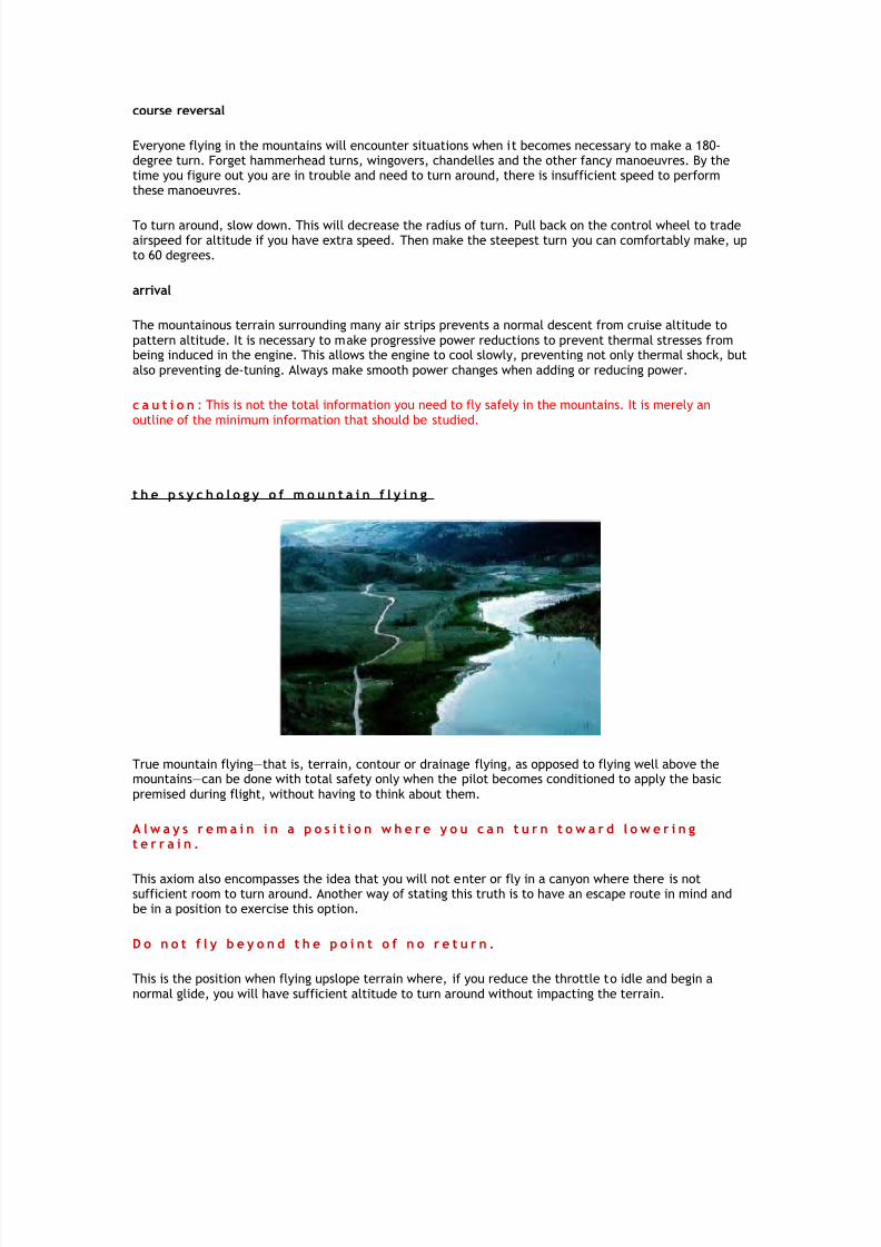
flying up narrow canyons
One thing can be said about flying up narrow canyons ... if it's not done properly, it's not habit forming.Until you are experienced (with a knowledgeable mountain instructor), stay out of these areas.
Speaking of a mountain instructor, do you have to fly with a certified flight instructor to obtain mountainflight instruction? Absolutely not. Many excellent, knowledgeable pilots can provide a wealth of information about mountain flying, but they can't sign your logbook.
Let's define a narrow canyon. This is one, where, if you have to turn around the turn radius exceeds onehalf the canyon width. This can be intimidating to experienced mountain pilots when conditions aren'tperfect.
Flying up a narrow canyon requires a different technique from the "regular" canyon. Rather than flying theupdraft side, you are better off flying the downdraft side. This way, if you get into trouble, when you turn
around you won't be getting into a worse situation. You will be entering an area of updraft during theturn. BUT REMEMBER, the turnaround will be subject to a tail wind that will increase the radius of turn.
It is not uncommon when flying in unfamiliar terrain to encounter a blind canyon. Blind canyons leading toa dead end shouldn't be a problem, but they are. The reason is that the pilot violates the basic premisesof mountain flying.
To avoid potential problems stay out of canyons where there is not room to turn around, remain in aposition to turn to lower terrain, and never fly beyond the point-of-no-return.
8/6/2019 Mountian Flying
http://slidepdf.com/reader/full/mountian-flying 24/42

8/6/2019 Mountian Flying
http://slidepdf.com/reader/full/mountian-flying 25/42
While flying upslope terrain in a canyon, the "student" (actually, the participants are all experiencedpilots) is asked to determine the turn around point. The Cessna 182 or T-41 is used for the backcountryflying in this course.
The instructor must monitor the position diligently in order not to fly beyond the turn-around point. Thisis definitely a place where complacency will "get you."
This picture shows flying up a canyon after completing thelast pass of a contour search
The contour search began at the top of the ridge and moved backand forth with step-downs in 500-foot intervals
The airspeed is 80 knots indicated, the speed used for the contour search technique. When the student determines the
turn around point, the throttle is reduced to idle and the turn around is commenced. Because of the slow speed it isnecessary to lower the nose to a position most students consider excessive; however, to maintain a constant airspeed, it
is required.
This is the last pass of the contour. In this case it results inthe airplane flying upslope terrain at low altitude
The student continues up the canyon until reaching the "turnaround point"
If the student has judged the position properly, the airplane will complete the 180-degree turn just over the tree tops at80 knots indicated airspeed.

8/6/2019 Mountian Flying
http://slidepdf.com/reader/full/mountian-flying 26/42
At the "turn around point" the throttle is reduced to idle anda gliding turn is begun
Because of the slow speed the nose must be lowered tomaintain 80 KIAS. Operation in a confined area may also
require a steep turn. Lowering the nose further is necessary tomaintain the constant 80-KIAS airspeed.
It is in this area of the turn that the 'student's' heart rateincreases. The nose is pointed downward and the airplane is
approaching the trees.
Most students find this demonstration quite exuberating ... and most of the time the instructor does too.This demonstration is made with the power at idle. If the student misjudges the turn-around point, poweris used to get out of the situation, so it is not as dangerous as it may appear.
Required Altitude
What altitude is required for the Cessna 182 to complete the 80-KIAS turn around? It's going to be about400-500 feet above ground level, probably closer to 500 feet.

8/6/2019 Mountian Flying
http://slidepdf.com/reader/full/mountian-flying 27/42
b o x c a n y o n t u r n
No one should need the box canyon turn under normal circumstances. If you need this manoeuvre,you have violated the laws of mountain flying.
To explain the box canyon turn it is necessary to consider two scenarios. In the first, the pilot is flying along at cruise power setting and cruise airspeed. In the second case, the pilot is flying at minimum controllable airspeed. Thisminimum controllable airspeed is probably not an intentional flight condition.
Flying over water beyond the power-off gliding distance from the shore, sometimes causes the oil pressure gauge to
begin ticking. And it hasn't done that before. Next the engine may appear to give a little shudder of roughness. Thismight happen several times before you again approach the safety of the shoreline.
A similar phenomenon occurs when flying upslope terrain in the mountains. Your left arm becomes shorter. This is anormal self-preservation aspect of flight. You unconsciously pull away from the rising terrain and often thedeterioration of airspeed goes unnoticed.
Conditioned Response
Mountain flying, like Mother Nature, can be harsh and unforgiving for the novice who fails to adhere to the two basic
premises for all mountain flying: It’s really a simple matter to flirt with the mountains if you always remain in a position to be able to turn toward lowering terrain and never fly beyond the point of no return.
The first law, being able to turn while having some extra altitude to descend, does encompass the idea that you never
enter into a canyon if there is not sufficient room to turn around.
The second law, to never fly beyond the point of no return, requires the pilot to establish a turn-around point whenever
flying upslope terrain. The point of no return is defined as a point on the ground of rising terrain where the terrain outclimbs the aircraft. The turn-around point is determined as the position where, if the throttle is reduced to idle, theaircraft can be turned around during a glide without impacting the terrain. Obviously, the power is not reduced to idle.This merely is a gauge to judge and establish the point over the ground where an escape turn must be made.
For the unconcerned aviator bopping along through the mountains at cruise power setting, it is still necessary tomaintain a conditioned reflex of maintaining a position where you can always turn to lowering terrain and never fly
beyond the point of no return.
This must be a conditioned reflex rather than instinct, because instinct is often wrong in an airplane. For example, if you have ever experienced a spin, your first impression is that the airplane is pointing straight towards the ground whilerotating. The Cessna 172, for example, has its nose 46 degrees below the horizon, only about halfway from the horizon
to the vertical. Your instinct will be to raise the nose with back pressure. It's always worked before. But now you mustuse the conditioned reflex of relaxing the controls (or pushing the controls forward) to break the stall and then fly out of the resulting dive without exceeding the critical angle of attack (somewhere around 16-18 degrees).
Another example of the conditioned reflex is the forced landing procedure experienced at the beginning of the private
pilot training. After several lessons, the flight instructor reaches out and pulls the power lever, stating something like,"You're engine just quit, proceed as you would in an actual emergency."
To begin, your first endeavours don't provide much satisfaction for yourself or the instructor. You try to pick out anarea for a forced landing and next try to extend the glide to make it to that spot; however, without experience only luck will allow you to approach anywhere near your projected spot.
If you have an excellent flight instructor, someone who teaches the spot method of landing, it is easy to determine how
far the airplane will glide. Using the spot method technique allows you to look at a windscreen mark during a glide anddetermine the spot on the ground where the airplane will glide. By mentally subscribing a line in an arc from this point,
the area surrounding the airplane within which the airplane can be landed is defined.

8/6/2019 Mountian Flying
http://slidepdf.com/reader/full/mountian-flying 28/42
The instructor continues this "conditioning," much as Pavlov conditioned his dogs, but hopefully without quite as much
salivating. At some point during this process, your subconscious begins mentally picking out forced-landing areas.When the conditioning is complete, the instructor pulls the engine power and you, without really thinking or
concentrating about it, head for a forced-landing spot. The spot may be ahead or behind the airplane, it doesn't reallymatter for your subconscious has already made the decision.
Until you have practiced the box canyon turn and understand the mechanics of and the ramifications of an unintentional
stall close to the terrain, the best advice for escaping from a "tight," or rapidly rising terrain or the narrowing confinesof a canyon, is to make a steep turn at a slow speed, using flaps if prudent.
What possible options are available for the course reversal manoeuvre to escape the precarious position?
Hammerhead Turn
Pilots, in all seriousness, have asked my advice about performing the hammerhead turn as an emergency procedure for
getting out of a tight spot. There are several problems that immediately jump to mind, negating the possibility of performing the hammerhead turn.
First by way of definition, the hammerhead turn is an aerobatic manoeuvre where the airplane enters a vertical climbfrom manoeuvring speed (or the recommended indicated airspeed for the aerobatic airplane involved). As the airplane
slows, but before it encounters stall buffet, the pilot initiates the turn. For a left turn, the torque of the engine aids inmaking the turn. Application of left rudder is coordinated with the application of right aileron and forward movement
of the control wheel (left rudder and left aileron used together causes the airplane to roll onto its back). When theairplane pivots to a nose-down position, back pressure is used to fly out of the resulting dive. Definitely it is best to
avoid this manoeuvre in a "tight."
The airplane is usually at a dangerously low airspeed when the pilot arrives at the "tight." This precludes even thinking
about performing the hammerhead manoeuvre. Even with plenty of airspeed, it would be stupid (as in not exhibitingcommon sense) to try the hammerhead.
The airplane used for mountain flying is probably not an aerobatic certified machine.
Wing Over
The wing over is more of a fun manoeuvre than an emergency escape manoeuvre. Usually the pilot pre-plans the wingover, allowing sufficient airspeed to transition from level flight to a climbing pitch attitude of about 40 degrees. During
the increase in pitch, a coordinated bank is begun. The maximum pitch is reached after about a quarter turn (45 degreesof turn). At this point the back pressure is completely relaxed, but the bank continues to increase to 90 degrees. The
bank is rolled out during the last quarter of the turn and back pressure is increased to arrest the descent. The airplaneshould arrive at the 180-degree turn point at the same altitude at which it began the manoeuvre.
Again, this is a manoeuvre that is intentionally performed for fun, rather than to escape during an emergency situation.
Steep Turn
The safest and perhaps the most commonly used method of course reversal is the steep turn. It is very similar to the boxcanyon turn.
The stall speed of an airplane increases as the square root of the wing load factor. In a 60-degree coordinated turn,regardless of airspeed, the airplane experiences a 2-g load factor. The square root of 2 is 1.41, so there is a 41 percent
increase in stall speed.
Most pilots don't really care how to determine the radius of turn. By formula, the radius of a turn is equal to the velocity
in true airspeed (knots) squared and then divided by a constant of 11.26 times the tangent of the bank angle in degrees.
The valid information this formula provides is the fact that the radius of turn can be shortened by either reducing thetrue airspeed, or by increasing the angle of bank. A combination of the two provides the greatest benefit.

8/6/2019 Mountian Flying
http://slidepdf.com/reader/full/mountian-flying 29/42
The ratio of turn radius to an increase in airspeed at a constant bank varies as the square of the true airspeed. If the
airplane doubles its speed, it will quadruple the distance travelled. So even if the airplane is going faster (twice as fastin this case), it still takes twice the amount of time to complete the turn around (four times further travelled).
What about using flaps during this steep turn? Definitely, use them as appropriate to the flight conditions. Flaps wereinvented to allow an airplane to increase its approach angle without an increase in airspeed. They work because lift and
drag are directly proportional. If the lift is increased (by applying flaps to increase the camber of the wing), the drag is
increased (and hence, no increase in airspeed).
For most airplanes the addition of flaps, up to half the total available, provides more lift than drag because the drag can be “subdued” with excess power.
At a high density altitude it may not be possible to use full flaps without intentionally losing altitude to maintain a safeairspeed. If a trade-off between altitude and airspeed cannot be made because of rapidly rising terrain, limit the use of
the flaps to the extent that the airplane will maintain a constant altitude during the turn.
Remember too that flaps reduce the structural strength of the airplane. Many of the normal category airplanes are
stressed for 3.8 gs (g = gravity unit). This is the limit-load factor that should not be exceeded. Okay, you say, whatabout the ultimate load factor, you know, that 50-percent safety factor built into the airplane? Shouldn't the airplane be
capable of flying at 5.7 gs?
The correct response requires a definite and emphatically strong NO. For certification the airplane must be able to
withstand the ultimate load factor for a period of fewer than 2 seconds without permanent deformation of the structure.More time than this at a load greater than the limit-load factor and the airplane may experience structural failure (thatis, the wing breaks off).
Check the POH (pilots operating handbook) to determine the amount of reduction in structural strength with the
application of flaps. The book may say: normal category 3.8 gs; flaps extended 2.2 gs (a 42 percent reduction).
Box Canyon Turn - Introduction
The box canyon turn varies from the steep turn in that it is either performed from level flight at such a slow airspeedthat an unintentional stall is imminent, or some excess airspeed at the beginning of the manoeuvre allows the nose to beraised above the horizon prior to initiating the bank and the airspeed, during the turn, will be too slow to sustain level
flight.
We have learned the airplane always stalls at the same critical angle of attack. When banking the airplane, the stallspeed increases (remember? it increases as the square root of the wing load factor). Whenever the airplane is banked ina coordinated turn, it is balancing the centripetal force (horizontal lift component that causes the turn) and thecentrifugal force (the force of the turn). The turn takes place because the centripetal force pulls the airplane towards the
inside of the turn.
Without a compensating increase in the amount of total lift during a turn, the airplane will lose altitude. The total lift
(lift) is divided between a vector force that sustains the weight of the airplane and its contents (weight). The portion of lift that is directed sideward (centripetal force) causes the turn. The centrifugal force acts towards the outside of theturn.
To maintain level flight while turning it is necessary to increase back pressure (more lift equals an increase in angle of
attack). This increases the load factor and stall speed.
Some pilots get into trouble with the box canyon turn without realizing it because they have been "conditioned" to
maintain level flight when performing steep turns.
Box Canyon Turn - Procedure from Cruise Flight
The first time a pilot has to perform a box canyon turn in a true life situation, he may feel like the lady who climbs on astool to avoid a mouse scampering across the floor. A little scream to get the adrenaline flowing wouldn’t hurt either.

8/6/2019 Mountian Flying
http://slidepdf.com/reader/full/mountian-flying 30/42
The box canyon turn could be described as a combination of the steep turn and wing over (when entered at or near
cruise airspeed). The nose is raised above the horizon, but nowhere near the 40-degree attitude of the wing over. Aboutfive to 20 degrees is about right, depending on the airspeed.
This does two things for you. First it trades airspeed for altitude and second, it slows the airspeed for a smaller radius of turn.
At the same time, full power is added and full flaps (providing the airspeed is within the flap operating range) areapplied while beginning the bank. The bank will be a minimum of 60 degrees and may approach 90 degrees.
To insure that the g-load factor is not exceeded during the steep bank it is necessary to relax the back pressure
once the bank passes about 45 degrees. The back pressure is not increased again until the bank passes through
about 45 degrees toward zero degrees during the rollout.
Initiate the turn - the procedure requires coordination to accomplish all items at the same time:
Increase pitch attitudeIncrease power
Begin a bank Apply full flaps
At approximately 45 degrees of bank increasing toward 60-90 degrees:
Relax back pressure from the control wheel
Recovery - at approximately 45 degrees of bank, decreasing from 60-90 degrees:
Increase back pressure on the control wheel to arrest any loss of altitude.
When the airplane is in a position that allows, reduce flaps to one half
Box Canyon Turn - Procedure from Climbing Flight
When operating near cruise airspeed the box canyon turn was described as a combination of the steep turn and wing
over where the nose was raised above the horizon.
Hopefully, the airspeed is near the best rate-of-climb speed or best angle-of-climb speed. This is usually a criticalsituation because the airspeed will probably be slower than Vy or Vx due to the “short-arm” effect.
While applying full power and full flaps, a bank is established at a minimum of 60 degrees. Again the bank mayapproach 90 degrees.
Previously we stated that the back pressure was relaxed to insure that the g-load factor was not exceeded. This is not asmuch of a problem at low speed, but it still exists. At the slow speed the airplane will probably stall before it exceeds
the structural limitations. The main reason for relaxing the back pressure now is so the airplane does not stall. The back pressure is not increased again until the bank passes through about 45 degrees toward zero degrees during the
rollout.
Initiate the turn - the procedure requires coordination to accomplish all items at the same time:
Maintain pitch attitude initiallyIncrease power
Begin a bank Apply full flaps
8/6/2019 Mountian Flying
http://slidepdf.com/reader/full/mountian-flying 31/42
At approximately 30 degrees of bank, increasing toward 60-90 degrees:
Relax back pressure from the control wheelThe pitch attitude will fall below the horizon
Recovery - at approximately 30 degrees of bank, decreasing toward zero degrees:
Increase back pressure on the control wheelReduce flaps to one half
Natural Horizon
The natural horizon is used to teach flying by outside visual reference. An instructor demonstrates a climb attitude atthe best rate-of-climb airspeed. The student mimics this attitude. The airspeed indicator can be covered and the student,
by noticing the pitch attitude in relation to the horizon (where the horizon intersects the side of the nose cowling), isable to fly at the best rate-of-climb airspeed within plus or minus one knot. Learning the “climb attitude” can provide
for a very accurate climb speed, without looking at the airspeed indicator.
The instructor also demonstrates where is the nose in relation to the horizon in level flight, where are thewings in relation to the horizon in level flight, and where is the nose in relation to the horizon in a steep
turn (left and right turns).
This natural horizon is easy to use in the flatlands as a reference for basic attitude flying. In the mountains, the naturalhorizon may disappear. By visualizing a horizon, basic attitude flying can still be maintained. The base of the
mountains, at least six to eight miles away, represents the natural horizon.
What if the airplane is closer than the six to eight miles? Visualization must be used. Perhaps the mountains at least six
to eight miles in the distance are visible out the side window. Project the same horizon visually to the front of theairplane.
Summary
The box canyon turn is an emergency procedure. It is best to practice it with an experienced instructor prior to the time
when it becomes necessary as a life-saving manoeuvre.
Without practice it is very easy to get into an accelerated stall condition that will exacerbate the original situation.
C a v e a t
You must exercise caution in using full flaps during the practice of the box canyon turn and for drainagesearches because of the possibility of the flaps failing in the extended position.
For practice you may want to restrict the use of flaps because of the real possibility of the flaps failing toretract. It is possible to demonstrate and learn the box canyon turn without full flaps where the same
technique, using full flaps, is applicable to a real "tight" or emergency condition.

8/6/2019 Mountian Flying
http://slidepdf.com/reader/full/mountian-flying 32/42

8/6/2019 Mountian Flying
http://slidepdf.com/reader/full/mountian-flying 33/42

8/6/2019 Mountian Flying
http://slidepdf.com/reader/full/mountian-flying 34/42
If you elect to make a flight without maintaining the 2,000-foot clearance altitude above the ridges, youcan determine if you have sufficient altitude to cross the ridge by picking two spots. The first spot iswhatever you can see over the ridgeline. The other spot is an arbitrary point. In the example to the right,the first point is the bottom of the yellow arc and the arbitrary point is the top of the yellow arc.
As you get closer to the ridge the spacing between the two spots will increase if you are higher than theridge (the pick arc). If the distance decreases, there is not sufficient altitude to cross the ridge.
don't like this method of determining sufficient ridge clearance. As an instructor I found my studentsdeveloping "tunnel vision," where they concentrated only on the points and became unaware of otherthings going on in and around the airplane.
It is easier (and better) to just be aware of the terrain. If you can see more and more of the terrain onthe other side of the ridge, you are higher than the ridge and can probably continue. If the terrain on theother side of the ridge is disappearing, get out. Turn around, gain more and try again.
If this technique causes you worry or concern rather than challenging your ability, don't do it. Fly over theridge with 2,000-foot terrain clearance.
In the photo to the left the airplane has been following I-70 (Colorado) east from the Dillon Reservoir areaalong Straight Creek. The Eisenhower Tunnel is below the nose to the left. Denver is ahead of theairplane. The ridgeline ahead is the Continental Divide. Loveland ski area is visible on the right side.
The wind is from the west-northwest (left rear of the airplane). The airplane is being flown up the right(south) side of the canyon to be in an area of updraft. Can the pilot make a commitment to cross theridgeline at this point? NO.
Once the pilot manoeuvres to a position (maintain the 45-degree angle approach) where the throttle canbe reduced to idle and the airplane has sufficient altitude to dive and hit the top of the ridgeline, the
8/6/2019 Mountian Flying
http://slidepdf.com/reader/full/mountian-flying 35/42
pilot can make the commitment to cross the ridge. I'm not suggesting that it is proper procedure toreduce the throttle to idle -- this is how you just the proper position for making a commitment.
If you have gotten to this position without encountering a downdraft, any downdraft experienced can beovercome by lowering the nose slightly to maintain airspeed while crossing the ridge. Once you have madethe commitment it is a good idea to fly toward lowering terrain. This "safe ridge crossing" technique maybe used whether approaching the ridge from upwind or downwind.
A word of caution. If you are trying to cross an extended plateau as opposed to the ridgeline, this rule willnot work. In this case you will need additional altitude and you must remain in a position to turn to lowerterrain.
n i g h t f l y i n g
About one-tenth of all general aviation accidents occur at night, while fewer than 10 percent of the flyingis done after dark.
Presuming that night flying is more dangerous than day flying on the basis of statistics is a fallacy. Theairplane does not discriminate between light and dark.
Conditions of night flight are different from daytime flying and it is the pilot's knowledge, or lack of it,combined with a lack of visual clues that present an extra challenge.
A pilot may be subjected to times when the destination airplane lies beyond the rays of the setting sun.Perhaps an engagement becomes a compelling reason to venture out into the black of night.
Flying at night in the mountains is a matter of determining the weather condition to arrive at a personalgo/no-go decision.
For those who decide to fly at night, an understanding of night vision differences and adjusting the flightoperation accordingly, will increase the margin of safety.
night vision
Even a competent attitude-instrument pilot will need to use his outside vision during a night flight, if onlyin the transition during takeoff and landing.
What you see, or don't see, in the dark is dependent on the state of dark adaptation of your eyes.
If you enter a dark area, your vision improves slowly. After six to seven minutes the eyes are 100 timesmore sensitive than when you entered the dark. Full adaptation takes 30 minutes, at which time the rodsof the eye are 100,000 time more sensitive.
This is due to the build-up of a photosensitive chemical called visual purple, the key to night vision.Visual purple is dependent on vitamin A (carrots, eggs, milk, cheese and most vegetables). Vitamin Acannot be stored by the body; it is necessary to eat well-balanced meals before night flying.
Although it takes 30 minutes for dark adaptation to occur, it can be lost in a second or two of exposure tobright light. Minimize the use of white light in the cockpit and keep it as dim as possible.
Dark adaptation is an independent process in each eye. If you are exposed t light, close one eye topreserve half your dark adaptation.
scanning techniques

8/6/2019 Mountian Flying
http://slidepdf.com/reader/full/mountian-flying 36/42
The cones of the eye, used for day vision, provide peripheral vision. Night vision uses rods. This creates ablind spot in the centre of the eye at night. If you detect something with peripheral vision, the naturaltendency is to turn and look directly at it. Night vision is impossible at the centre of the eye, so atechnique called "off-centre scanning" must be developed. Look six to 12 degrees away from the objectyou wish to see.
autokenesis
A visual illusion may occur at night if you stare at one light for a long period of time. Involuntary muscletwitches cause the light to be displayed on a different portion of the eye, creating false motion, wherethe light appears to move. Avoid autokinesis by the off-centre scanning technique.
night take-off and departure
Before departing from a mountain airport at night, firmly fix in your mind the nature of the terrain andobstructions adjacent to the airport.
Pilots have no intention of making an emergency landing shortly after takeoff, especially at night, but itdoes not hurt to survey the terrain during daylight conditions to form a plan of action.
With the interior lights adjusted to the minimum brightness that affords instrument readability, initiate anormal takeoff.
Acceleration error in the attitude indicator will cause an indication of a higher nose attitude than during aregular climb. As a consequence, some pilots have lowered the nose to the normal attitude and haveflown into the ground.
The moment the airplane leaves the ground on a dark night, it is enveloped in black. Outside visualreference becomes impossible. Maintain a positive rate of climb based on the airspeed indication,regardless of the attitude indicator display.
climb out
If you become disoriented during the climb out, terrain clearance becomes a big concern. Fly toward therotating beacon. At airstrips without lighting, fly toward any light on the ground.
terrain clearance
Proper pre-flight planning includes studying charts and developing a plan of action. Still, at some timeduring a night flight, you are going to experience a moment of fear arising from your concern aboutterrain clearance.
If there are any light around, use them. Fly directly toward the light. As you approach this light, selectanother light. If the light flickers or disappears, there is something between you and the light.Immediately choose another light to fly toward.
If there is only one usable light in the area, a shuttle climb in a holding pattern may be the most prudentcourse of action.
To perform a shuttle climb, make a 90-degree turn (direction depends on obstructions) and immediatelyturn the opposite direction for 270 degrees. This is the same as a 180-degree turn, but keeps the airplaneconfined to a small geographical area.
Before passing beyond the ground light, perform a 180-degree turn back to the ground light. Continue thismanoeuvring while climbing to a safe en route altitude before proceeding on course.

8/6/2019 Mountian Flying
http://slidepdf.com/reader/full/mountian-flying 37/42
weather
It is difficult to see and avoid weather at night. The first indication of a cloud may be a glow emanatingfrom the navigation lights, or a brilliant flash of the strobes being diffused throughout a cloud.
VFR pilots should do an immediate 180-degree turn.
Restricted visibility conditions become apparent with the gradual disappearance of lights on the ground orwhen they become fuzzy and flow.
Remember, the horizontal visibility through a restriction such as fog, haze or smoke is must less thanwhen looking down through it from above.
Pilots get into trouble trying to land at an airport with fog because they fly over and can see the runway,but when on final approach they can't see anything.
approach for landing
Distances at night are deceptive, due to lack of illumination and inability of the pilot to judge them by
the usual method of comparing the size of different objects.
At night, fly towards an airport light and make a standard pattern, rather than attempting a straight-inapproach. The perception of distance can be dealt with by flying the downwind leg until the touchdownpoint is half-way between the wing tip and tail. They turn onto the base leg.
The only way to approach a runway in the mountains at night, with complete safety, is to incorporate the"spot method for landing" technique.
The flare and landing is accomplished in the same manner as during the day. There may be a tendency tolook too far down the runway, causing the flare to be too high.
night flying tips
Always carry a workable flashlight (You can recognize the pilot who has flown at night without aflashlight. He's the one that has two or more flashlights in his bag).
Close one eye when exposed to bright light.
Force the eyes to view off-centre.
Blink the eyes if they become blurred.
Do not attempt violent or abrupt manoeuvres at night.
Watch for the disappearance of ground lights or an area of glow around the navigation lights. This
indicates entering instrument conditions.
Remember the deceptiveness of altitude and speed at night. A normal approach looks steeper at night,creating an illusion of overshooting.
Distance judgment at night is less accurate than by day. A simple visual assessment can lead to apremature descent.
8/6/2019 Mountian Flying
http://slidepdf.com/reader/full/mountian-flying 38/42
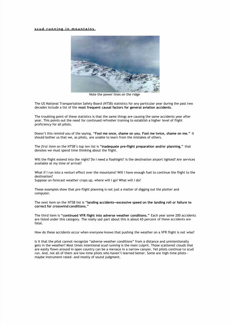
s c u d r u n n i n g i n m o u n t a i n s
Note the power lines on the ridge
The US National Transportation Safety Board (NTSB) statistics for any particular year during the past twodecades include a list of the most frequent causal factors for general aviation accidents.
The troubling point of these statistics is that the same things are causing the same accidents year afteryear. This points out the need for continued refresher training to establish a higher level of flightproficiency for all pilots.
Doesn’t this remind you of the saying, “Fool me once, shame on you. Fool me twice, shame on me.” Itshould bother us that we, as pilots, are unable to learn from the mistakes of others.
The first item on the NTSB’s top ten list is “inadequate pre-flight preparation and/or planning,” thatdenotes we must spend time thinking about the flight.
Will the flight extend into the night? Do I need a flashlight? Is the destination airport lighted? Are servicesavailable at my time of arrival?
What if I run into a venturi effect over the mountains? Will I have enough fuel to continue the flight to thedestination?Suppose un-forecast weather crops up, where will I go? What will I do?
These examples show that pre-flight planning is not just a matter of digging out the plotter andcomputer.
The next item on the NTSB list is “landing accidents—excessive speed on the landing roll or failure tocorrect for crosswind conditions.”
The third item is “continued VFR flight into adverse weather conditions.” Each year some 200 accidentsare listed under this category. The really sad part about this is about 65 percent of these accidents arefatal.
How do these accidents occur when everyone knows that pushing the weather on a VFR flight is not wise?
Is it that the pilot cannot recognize “adverse weather conditions” from a distance and unintentionallygets in the weather? Most times intentional scud running is the main culprit. Those scattered clouds thatare easily flown around in open country can be a menace in a narrow canyon. Yet pilots continue to scudrun. And, not all of them are low-time pilots who haven’t learned better. Some are high-time pilots—maybe instrument-rated—and mostly of sound judgment.

8/6/2019 Mountian Flying
http://slidepdf.com/reader/full/mountian-flying 39/42
Flying above a layer of clouds with the sun at your back will produce a "glory" if the cloud is composed of liquid water. This rainbow circle is caused by a diffraction phenomenon. Beware of icing in these clouds if the outside air temperature is near freezing or below freezing.
Often the aircraft's shadow is visible in the centre of the "glory" rainbow ring.
Some pilots scud run successfully, having found it necessary to do so from time to time because of ice orturbulence aloft, strong headwinds at IFR altitudes, navigation equipment failures, or flying to adestination that does not have an instrument approach facility.
Whatever the reason, they do it. But, they have disciplined themselves and learned how to scud runsafely.
Experienced pilots develop rules that they will not deviate from under any circumstances.
Minimum weather: 2,000-foot ceiling and 5 miles visibility. If weather reports of five miles visibility orbetter do not exist at stations beyond the destination, don’t go.
Do not scud run a route you have not previously flown at 1,500 feet AGL or less. Even so, the terrain looksmuch different when the weather is bad.
Do not scud run toward worsening weather. The tendency to push on for a few more miles is just toogreat.
scary practice
One frightening pilot technique unconsciously practiced by many pilots when the weather is marginal isthat of flying near the cloud base. This is a natural tendency since it places the airplane farther away

8/6/2019 Mountian Flying
http://slidepdf.com/reader/full/mountian-flying 40/42
from the ground. But, you have to realize the forward visibility will be severely limited near the cloudbase, allowing you to fly into trouble before you can see it.
An experienced pilot will fly low. Divide the area from the ground to the cloud base into thirds and fly themiddle or lower third. If terrain constraints prohibit this, don’t fly.
rules
Keep navigation simple by following a highway or railroad. Pay attention to your chart to make sure thereisn’t a tunnel. Be cautious about following a river. That’s where the poorest visibilities tend to gather.
Turn on all your lights. It’s not likely that anyone else will be out there with you, but if they are, youwant them to see and avoid your airplane. When flying through a narrow canyon like The Gorge betweenPortland and The Dalles, Ore., it is customary to remain to the right side, just as on a highway, to avoidpilots going the other way.
Throttle back to a comfortable slow-speed cruise to keep the terrain features clearly in sight.
life saving manoeuvre
It is with hesitation and trepidation that the following manoeuvre is presented. Not because it is difficultto perform, but because someone is going to use it as a crutch to scud run when he shouldn’t. Remember,this is an “out,” not a manoeuvre that is reserved as a routine part of flight. This is an emergencylifesaving manoeuvre.
Suppose your weather check meets your parameters for safe flight. You take off and fly toward thedestination and somehow get lulled into a situation where the visibility makes you a strong candidate forflying into cumulo-granite.
Descend close to the ground and find a prominent landmark that can be circled without worrying aboutthe lateral terrain clearance. Fly around and around until the visibility improves. You might be stuckthere for a long time. The object is to remain flying without running into something.
Kelvin-Helmholtz Billow Clouds are similar to whitecaps on a lake and indicate turbulence.

8/6/2019 Mountian Flying
http://slidepdf.com/reader/full/mountian-flying 41/42
Different form of Kelvin-Helmholtz Billow Clouds.
Scud running is, like Russian roulette, a dangerous game. With reduced visibility only the foolhardy flirtwith Mother Nature.
When the visibility is unrestricted beneath the clouds, a look-see may (with a strong emphasis on may) betried. Be careful.

8/6/2019 Mountian Flying
http://slidepdf.com/reader/full/mountian-flying 42/42
Even with good forward visibility, the unwary can get trapped in an area with low clouds that does notallow room for an escape manoeuvre.
When the terrain tightens up (narrows), it may be difficult to continue the flight. Some scud-runners havehad to land the airplane in trees to avoid a more serious out-of-control crash.
Rotor turbulence may affect the controllability of the airplane when manoeuvring at low altitude and slowairspeed.
Pilots have flown into trouble before they even see it by flying near the base of the clouds Experienced