Embed Size (px)
Citation preview

Modeling High Pressure DistributionFor Integrity Management
Cindi SalasManager, GIS
CenterPoint Energy
Bill MeehanDirector, Utility Solutions
ESRI

What’s This About• Key Concepts in the New Rules• Why Distribution?• Transmission vs. Distribution Data Models• Practical Implementation at CenterPoint
Energy• Summary

Why New Rules?• Carlsbad, New Mexico, August 19, 2000• 12 people killed• 1Million Dollars direct damage• 18 Million Dollar per day economy hit• Since 1986
– 300 Deaths, 1400 Injuries– $300,000,000 in Property Damage– 2400 Natural Gas Incidents

NTSB Findings• The Major Safety Issues:
– The Design and Construction of the Pipeline
– The Adequacy of the Operator’s Internal Corrosion Control Program
– The Adequacy of Federal Safety Regulations for Natural Gas Pipelines
– The Adequacy of Federal Oversight of the Pipeline Operator

Pipeline Safety Improvement Act of 2002
• DOT is charged with Enacting the Regulations:– Research and Special Programs
Administration (RSPA)– Office of Pipeline Safety– Title 49 of CFR– Part 192 – Transportation of Natural and
Other Gas By Pipeline: Minimum Safety Standards
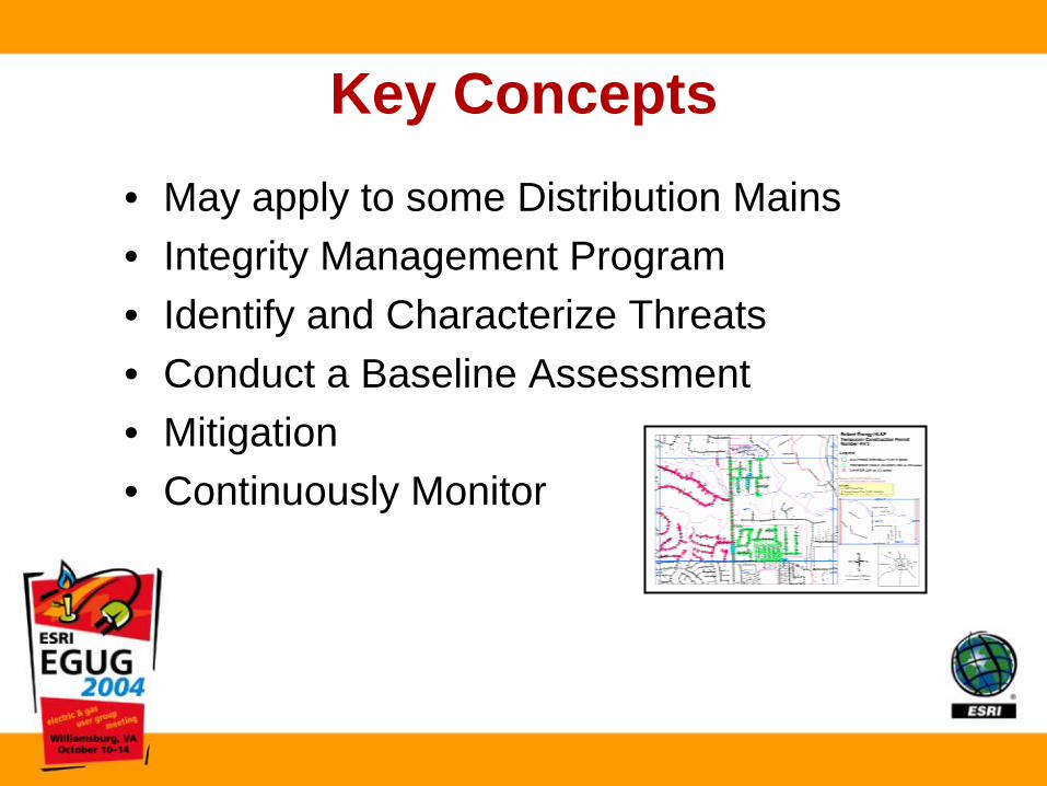
Key Concepts• May apply to some Distribution Mains• Integrity Management Program• Identify and Characterize Threats• Conduct a Baseline Assessment• Mitigation• Continuously Monitor

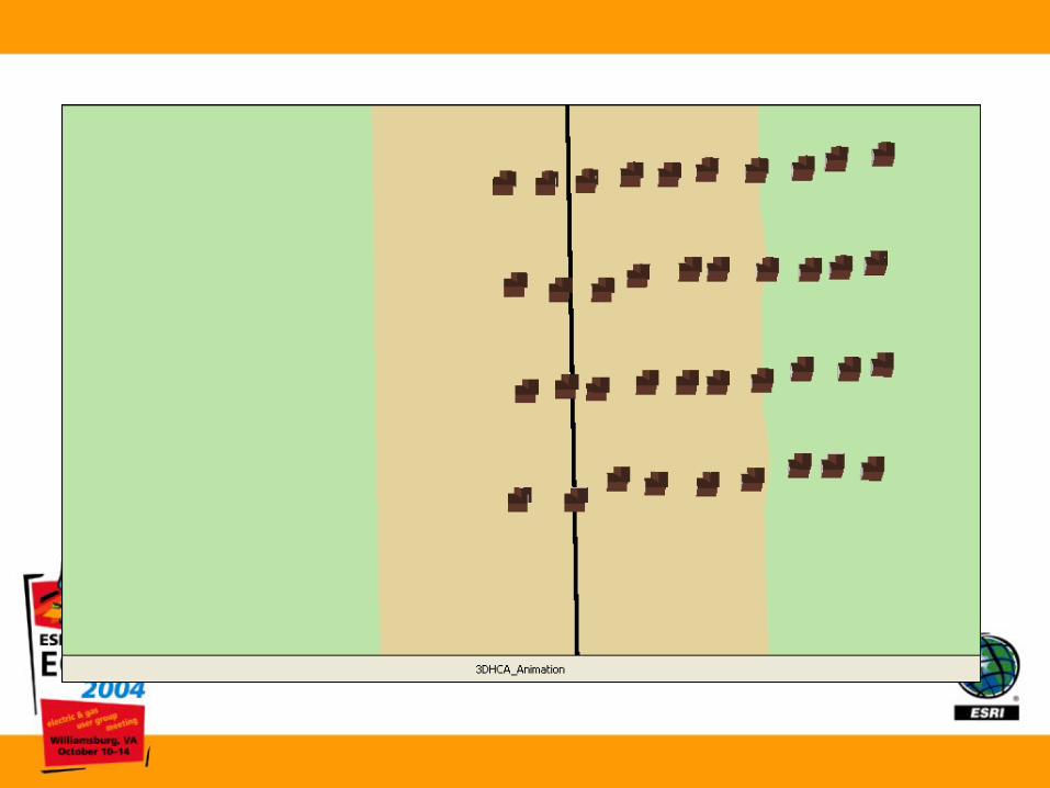
New Term - HCA• Applies to the Engineering/Regulatory
Definition of Transmission• Depends on DOT Class Definition• The Nature of the Line Itself• Depends on the Structures Surrounding the
Line• Requires a Complex Spatial Analysis
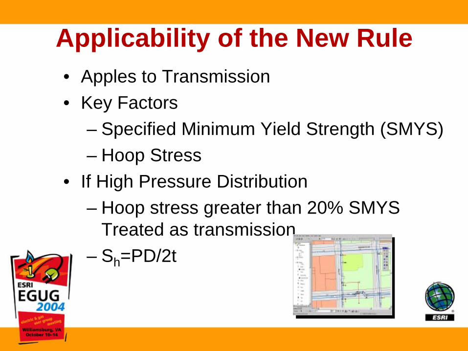
Applicability of the New Rule• Apples to Transmission• Key Factors
– Specified Minimum Yield Strength (SMYS)– Hoop Stress
• If High Pressure Distribution– Hoop stress greater than 20% SMYS
Treated as transmission– Sh=PD/2t

What is Transmission?
• Transports gas from a gathering station • Operates at Hoop Stress of 20% or more of
SMYS• Transports gas within a storage field

May Apply to High Pressure Distribution Mains

So What?• Different Operating Characteristics
– Pressure (usually less than 500psi)– Configuration– Concerns– Business Processes
• Tough to Meet Inspection– In-line Inspection– Hydrostatic Testing– Direct Assessment

Data Models
• Old data models just tables• Evolved into Data Base Schema’s• Data Model is a metaphor for the real system

Intelligent GIS Supports Industry Data Models Industry Data Models ––
Electric, Gas, Water, Telco, . . .
. . . Defining Real World Features. . . Defining Real World Features
Generic Data SetsGeneric Data Sets
Data ModelsData Models
User FeaturesUser FeaturesSmithSmith
StreetStreetParcelParcel
BuildingBuildingNameName
VectorsVectorsTopologyTopology
NetworksNetworks SchemaSchemaRulesRulesRelationshipsRelationshipsDefinitionsDefinitionsBehaviorBehavior

• Options:– Single Data Model (Transmission and Distribution)– High Pressure Distribution Data Model (3rd Model)– Separate Transmission and Distribution Data
Model
Transmission and Distribution Pipeline Data Models

Facilitating Pipeline Integrity Regulations
at CenterPoint Energy

Who is CenterPoint Energy?Who is CenterPoint Energy?
Houston Houston ElectricElectricLight Light
& & PwrPwr18821882
Houston Houston Lighting Lighting & Power& Power19221922
Houston Houston Industries Industries 19761976
ReliantReliantEnergyEnergy19991999
CenterPointEnergy
ReliantResources
REGULATED
DEREGULATED
2002

Who is CenterPoint Energy?Who is CenterPoint Energy?CenterPointCenterPoint
EnergyEnergy
ReliantReliantResourcesResources
REGULATED
DEREGULATED
•• One of the largest energy delivery companiesOne of the largest energy delivery companies
in U.S.in U.S.
•• Electric transmission and distributionElectric transmission and distribution
•• Natural gas distribution salesNatural gas distribution sales
•• Interstate pipelines and gathering operationsInterstate pipelines and gathering operations
•• 14K MW electric generating capacity14K MW electric generating capacity
•• Wholesale and retail energy servicesWholesale and retail energy services
•• Unregulated power generationUnregulated power generation
•• Retail electricity serviceRetail electricity service

Who is CenterPoint Energy?Who is CenterPoint Energy?
Houston ElectricLight & Pwr1882
Houston Lighting & Power1922
Houston Houston IndustriesIndustries19761976
ReliantEnergy1999
CenterPointEnergy
2002
H.I. AcquiresH.I. AcquiresNoramNoram GasGasCompaniesCompanies
19971997CenterPointCenterPoint
EnergyEnergyArklaArkla/Entex/EntexMinnegascoMinnegascoHouston GasHouston GasHouston ElectricHouston Electric

CenterPointCenterPointEnergyEnergy
ArklaArkla/Entex/EntexMinnegascoMinnegascoHouston GasHouston Gas
Houston ElectricHouston Electric
LDCsLDCs
PipelinePipeline
•• Interstate Pipelines:Interstate Pipelines:CNP Gas TransmissionCNP Gas TransmissionCNP Miss. River Transmission CorpCNP Miss. River Transmission Corp
•• Pipeline Services Pipeline Services Comprehensive operation & Comprehensive operation & maintenance and project maintenance and project management services management services
•• Field Services Field Services Gas gathering companyGas gathering company

Etx
Stx
MS
LA
HoustonGas &
Electric
•• Centrally locatedCentrally located•• Centralized Centralized Administration & Administration & SupportSupport
AR
OK
MGC
GIS at CenterPoint EnergyGIS at CenterPoint Energy
Pipeline
ArcGISArcGIS
LDC’sLDC’s

Challenge to GIS for Challenge to GIS for LDC’sLDC’s
Facilitate a repository, within the enterprise GIS, for data to support pipeline integrity regulations
– Within the required timeframe
– Building the best solution for the long term

Q: Can’t you just add this new data Q: Can’t you just add this new data to the existing GIS database?to the existing GIS database?
A: No, it’s not that easyA: No, it’s not that easy
LDCsGIS
Existing Data Model ! For gas distribution! Comprised of points, lines, polygons – things with static characteristics! Two dimensional x,y coordinate system
New Data Model Needed! To handle linear data with characteristics that are dynamic in nature
! Commonly referred to as linear referencing or dynamic segmentation
! To allow multiple sets of attributes to be associated with ‘any’ portion of a linear feature
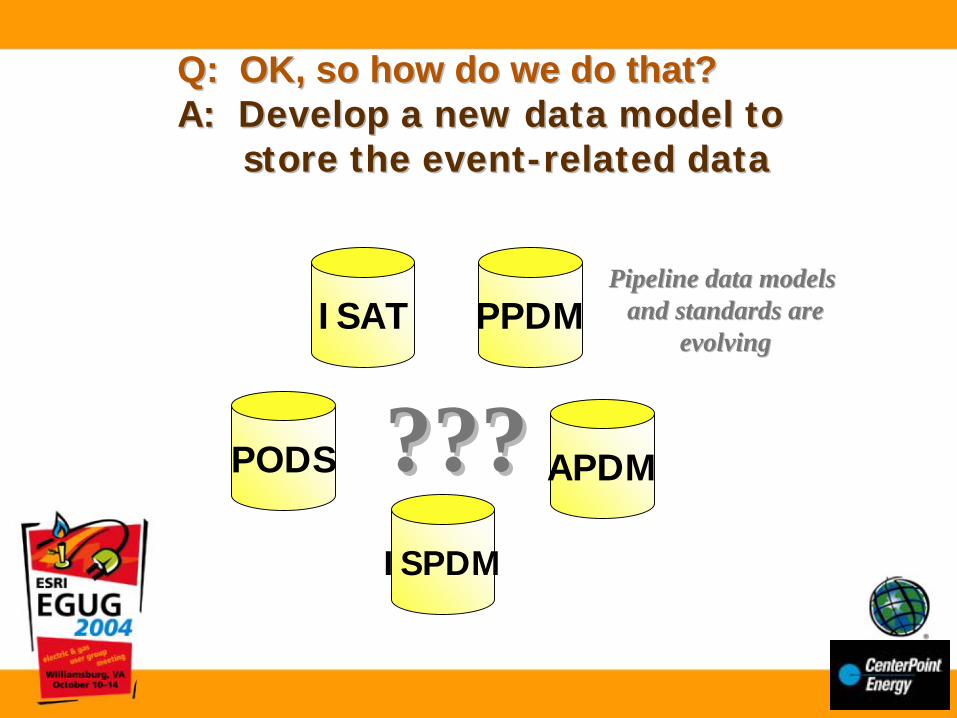
Q: OK, so how do we do that? Q: OK, so how do we do that? A: Develop a new data model to A: Develop a new data model to
store the eventstore the event--related datarelated data
PODS
ISAT
ISPDM
PPDM
APDM??????
Pipeline data modelsPipeline data modelsand standards areand standards are
evolvingevolving
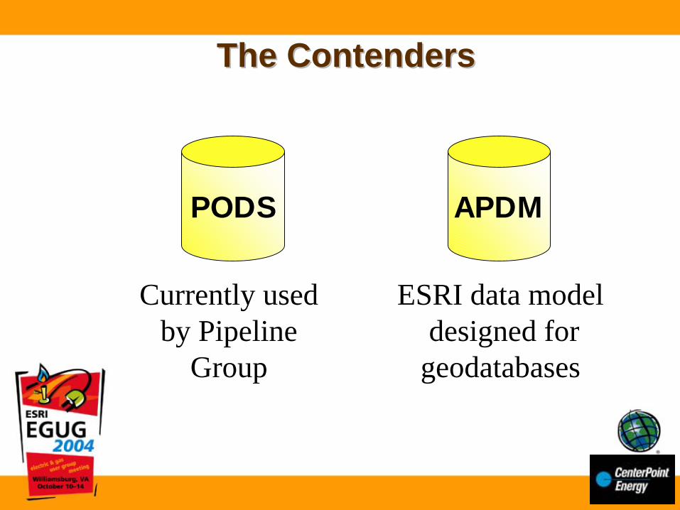
The ContendersThe Contenders
PODS APDM
Currently usedby Pipeline
Group
ESRI data model designed for
geodatabases

Comparison –Either Model ‘could’ work
PODS APDM
• Both data models can be used to store pipeline data for use in a GIS.
• Both have origins with the ISAT data model.
• Both have many pipeline components and attributes. Neither has every possible pipeline feature or component.
• Some of the PODS member companies also participate on the APDM committees.
• Both can be implemented with ESRI GIS technology.
• ESRI is supportive of both.
• User applications will be needed to use both data models

PODS APDM
•• RelationalRelational data modeldata model
•• Platform neutral Platform neutral
•• More work to integrate with More work to integrate with ESRI GISESRI GIS
•• Could affect distribution GIS Could affect distribution GIS system performance since the system performance since the database has to be linked to database has to be linked to ESRI rather than the data being ESRI rather than the data being stored within an ESRI standard stored within an ESRI standard data formatdata format
•• Model must be implemented in Model must be implemented in its entirety to be PODS its entirety to be PODS compliantcompliant
•• Built on the ESRI Built on the ESRI geodatabase geodatabase
•• Vertical integration with Vertical integration with SDE and the geodatabase SDE and the geodatabase with fullwith full--featured featured geoprocessing geoprocessing --------better better able to take advantage of able to take advantage of ESRI geodatabase ESRI geodatabase technologytechnology
•• Only required to Only required to implement “core” tables implement “core” tables --------more flexibility more flexibility
Comparison –Either Model ‘could’ work
So what differentiates these two?

Comparison –PODS and APDM are two completely different
types of database models, designed for two different purposes
PODS APDM
•• Pipeline industry Pipeline industry standard model, driven standard model, driven by membership of the by membership of the PODS AssociationPODS Association
•• Owned by the PODS Owned by the PODS AssociationAssociation
•• Annual membership Annual membership fees for participation in fees for participation in associationassociation
•• ESRI ‘template’ or ESRI ‘template’ or example geodatabase example geodatabase designed to implement designed to implement pipeline system in a pipeline system in a geodatabasegeodatabase
•• Owned by ESRIOwned by ESRI
•• No fees to participate No fees to participate on committees on committees

Recommendation
APDM
Best leverage our enterprise Best leverage our enterprise GIS in both the short and long GIS in both the short and long termterm•• Integrated enterprise solutionIntegrated enterprise solution
•• More efficient processing of data via More efficient processing of data via geodatabasegeodatabase
•• Easier to support inEasier to support in--house with existing house with existing ESRI tools (data and database maintenance)ESRI tools (data and database maintenance)
•• Major new releases of ArcGIS will Major new releases of ArcGIS will consider data model requirements consider data model requirements
•• Better spatial analysis, mapping and Better spatial analysis, mapping and reportingreporting
•• Likelihood that most ESRI business Likelihood that most ESRI business partners will include new product partners will include new product development for APDMdevelopment for APDM
Cost effectiveObject oriented
Linear referencingGIS driven
Feature drivenEnterprise driven
APDM

HoustonGas
APDM
MGC
GIS
GIS
GISGIS
GISGIS
GIS
Arkla/Entex
GIS
Common Tools, Applications,
Reporting
HoustonGas
APDM
MGC
GIS
GIS
GISGIS
GISGIS
GIS
Arkla/Entex
GIS
Common Tools, Applications,
Reporting
Pipeline(PODS)
GIS
Known, stable Known, stable migration path migration path to move data to move data from PODS from PODS into APDMinto APDM
One common
data model
Integrated “Enterprise”Solution
Integrated“LDC” Solution

Data Modelling Timeline & Milestones
• Data Model Review and Development Workshop (including gap analysis)
• Draft Pilot Logical Model Development• Draft Pilot Physical Model Development• Pilot Data Development• Data Migration Requirements/Plan• Pilot Data Model Review Workshop• Finalize Logical Model• Finalize Physical Model
Jul 04
Dec 04
currently
What do we need beyond just the data model?What will it take?How much will it cost?
What do we need beyond just the data model?What do we need beyond just the data model?What will it take?What will it take?How much will it cost?How much will it cost?
Full needs assessmentBeing conducted concurrently with data model effort
Migration of HPT data from distribution model to new APDM dataset
Will be handled by internal resources
Generation of control points and acquisition of additional data
Will probably be handled by internal resources
Purchase or development of various tools/applications

Future ??
ArcIMSWEB
Access
* Imagery* CADD* Database
A P D M{ C O M }
I n d u s t r y S t a n d a r dC u s t o m
Central Database
{COM}
Industry StdCustom
Other Data
Alignment SheetsPlan & Profile Sheets
Integrity & HCA WorksheetsOther Alignment ReportsOther Integrity Reports
{COM}
Insustry StdCustom
ArcGIS
INIPlug In
Class Locator
INIPlug In
For HCAcalculation
INIPlug In
For MAOPcalculation
INIPlug In
For Risk calculation
INIPlug In
Other. . .
Pipeline Tools
© 2004 James W. Sewall Company
Reporting