Embed Size (px)
Citation preview

MITIGATED NEGATIVE DECLARATION
PROJECT: RANCHO SAN ANDRÉS CASTRO ADOBE SEISMIC STABILIZATION PROJECT LEAD AGENCY: California Department of Parks and Recreation AVAILABILITY OF DOCUMENTS: The Initial Study for this Mitigated Negative Declaration is available for review at:
•
•
•
•
Northern Service Center California Department of Parks & Recreation
One Capitol Mall - Suite 410 Sacramento, CA 95814
Santa Cruz District Headquarters
California Department of Parks & Recreation 303 Big Tree Park Road Felton, CA 95081
Watsonville Public Library Main Library 310 Union St. Watsonville, CA 95076 California Department of Parks and Recreation website www.parks.ca.gov/default.asp?page_id=980
PROJECT DESCRIPTION: DPR proposes to make the improvements described herein to the Rancho San Andrés Castro Adobe. The Adobe is listed on the National Register of Historic Places and is designated as a State Landmark. Therefore, all work will be conducted in a manner consistent with the California Historical Building Code and the Secretary of the Interior's Standards for the Treatment of Historic Properties with Guidelines for Preserving, Rehabilitating, Restoring, and Reconstructing Historic Buildings (Weeks and Grimmer 1995) and all applicable state building and safety codes and the Historic Structures Report (Kimbro et al. 2003).
The following is a summary of the planned improvements:
1.) Provide structural stabilization of the building.
2.) Seal the building envelope and reestablish historic elements of the building.
3.) Provide design work to improve architectural elements of the building. A copy of the Initial Study is attached. Questions or comments regarding this Initial Study/Mitigated Negative Declaration should be submitted in writing to: Gail Sevrens – Environmental Coordinator California Department of Parks & Recreation Northern Service Center One Capitol Mall - Suite 500 Sacramento, CA 95814

2 Seismic Stabilization Draft IS/MND Rancho San Andrés Castro Adobe
California Department of Parks & Recreation
Pursuant to Section 21082.1 of the California Environmental Quality Act, the California Department of Parks and Recreation (DPR) has independently reviewed and analyzed the Initial Study and Negative Declaration for the proposed project and finds that these documents reflect the independent judgment of DPR. DPR, as lead agency, also confirms that the project mitigation measures detailed in these documents are feasible and will be implemented as stated in the Negative Declaration. _________________________________________ __________________ Gail Sevrens Date Environmental Coordinator
_Original Signature on File____________________ __________________ Stephen R. Lehman Date Deputy Director, Acquisition and Development

1 Seismic Stabilization Draft IS/MND Rancho San Andrés Castro Adobe California Department of Parks & Recreation
TABLE of CONTENTS Chapter/Section Page 1 INTRODUCTION………………………………………………………………... 2 2 PROJECT DESCRIPTION……………………………………………………….. 5 3 ENVIRONMENTAL CHECKLIST………………………………………………..... 9 I. Aesthetics………………………………………………………… 13 II. Agricultural Resources…………………………………………. 15 III. Air Quality………………………………………………………... 17 IV. Biological Resources……………………………………………. 21 V. Cultural Resources……………………………………………… 25 VI. Geology and Soils………………………………………………. 29 VII. Hazards and Hazardous Materials……………………………. 33 VIII. Hydrology and Water Quality………………………………….. 37 IX. Land Use and Planning…………………………………………. 41 X. Mineral Resources………………………………………………. 43 XI. Noise………………………………………………………………. 45 XII. Population and Housing………………………………………… 47 XIII. Public Services…………………………………………………… 49 XIV. Recreation………………………………………………………… 51 XV. Transportation/Traffic………………………………………….... 53 XVI. Utilities and Service Systems…………………………………… 55 4 MANDATORY FINDINGS OF SIGNIFICANCE.................................................... 57 5 SUMMARY OF MITIGATION MEASURES………………………………………... 59 6 REFERENCES………………………………………………………………….. 63 7 REPORT PREPARATION.............................................................................. 65 Appendices A MAPS, TABLES, AND CHARTS
B PROJECT DESIGN GRAPHICS
C CNDDB RECORD SEARCH
D ACRONYMS

2 Seismic Stabilization Draft IS/MND Rancho San Andrés Castro Adobe
California Department of Parks & Recreation
CHAPTER 1 INTRODUCTION
1.1 INTRODUCTION AND REGULATORY GUIDANCE The Initial Study/Mitigated Negative Declaration (IS/MND) has been prepared by the California Department of Parks and Recreation (DPR) to evaluate the potential environmental effects of the proposed Rancho San Andrés Castro Adobe Seismic Stabilization Project at 184 Old Adobe Road, Watsonville, Santa Cruz County, California. This document has been prepared in accordance with the California Environmental Quality Act (CEQA), Public Resources Code §21000 et seq., and the State CEQA Guidelines, California Code of Regulations (CCR) §15000 et seq. An Initial Study is conducted by a lead agency to determine if a project may have a significant effect on the environment [CEQA Guidelines §15063(a)]. If there is substantial evidence that a project may have a significant effect on the environment, an Environmental Impact Report (EIR) must be prepared, in accordance with CEQA Guidelines §15064(a). However, if the lead agency determines that revisions in the project plans or proposals made by or agreed to by the applicant mitigate the potentially significant effects to a less-than-significant level, a Mitigated Negative Declaration may be prepared instead of an EIR [CEQA Guidelines §15070(b)]. The lead agency prepares a written statement describing the reasons a proposed project would not have a significant effect on the environment and, therefore, why an EIR need not be prepared. This IS/MND conforms to the content requirements under CEQA Guidelines §15071. 1.2 LEAD AGENCY The lead agency is the public agency with primary approval authority over the proposed project. In accordance with CEQA Guidelines §15051(b)(1), "the lead agency will normally be an agency with general governmental powers, such as a city or county, rather than an agency with a single or limited purpose." The lead agency for the proposed project is DPR. The contact person for the lead agency is:
Terry Lee, Project Manager Department of Parks and Recreation Acquisition and Planning Division One Capitol Mall - Suite 500 Sacramento, CA 95814 (916) 445-8579
Questions or comments regarding this Initial Study/Mitigated Negative Declaration should be submitted to: Gail Sevrens – Environmental Coordinator California Department of Parks and Recreation Northern Service Center One Capitol Mall, Suite 500 Sacramento, California 95814

3 Seismic Stabilization Draft IS/MND Rancho San Andrés Castro Adobe California Department of Parks & Recreation
1.3 PURPOSE AND DOCUMENT ORGANIZATION The purpose of this document is to evaluate the potential environmental effects of the proposed Rancho San Andrés Castro Adobe Seismic Stabilization Project at 184 Old Adobe Road, Watsonville, Santa Cruz County, California. Mitigation measures have also been incorporated into the project to eliminate any potentially significant impacts or reduce them to a less-than-significant level. This document is organized as follows: • Chapter 1 - Introduction. This chapter provides an introduction to the project and describes the purpose and
organization of this document. • Chapter 2 - Project Description. This chapter describes the reasons for the project, scope of the project, and project
objectives. • Chapter 3 - Environmental Setting, Impacts, and Mitigation Measures. This chapter identifies the significance of potential environmental impacts, explains the
environmental setting for each environmental issue, and evaluates the potential impacts identified in the CEQA Environmental (Initial Study) Checklist. Mitigation measures are incorporated, where appropriate, to reduce potentially significant impacts to a less-than-significant level.
• Chapter 4 - Mandatory Findings of Significance This chapter identifies and summarizes the overall significance of any potential impacts to
natural and cultural resources, cumulative impacts, and impact to humans, as identified in the Initial Study.
• Chapter 5 - Summary of Mitigation Measures. This chapter summarizes the mitigation measures incorporated into the project as a result of
the Initial Study. • Chapter 6 - References. This chapter identifies the references and sources used in the preparation of this IS/MND. It
also provides a list of those involved in the preparation of this document. • Chapter 7 - Report Preparation This chapter provides a list of those involved in the preparation of this document. 1.4 SUMMARY OF FINDINGS Chapter 3 of this document contains the Environmental (Initial Study) Checklist that identifies the potential environmental impacts (by environmental issue) and a brief discussion of each impact resulting from implementation of the proposed project.

4 Seismic Stabilization Draft IS/MND Rancho San Andrés Castro Adobe
California Department of Parks & Recreation
Based on the IS and supporting environmental analysis provided in this document, the proposed Rancho San Andrés Castro Adobe Seismic Stabilization Project would result in less-than-significant impacts for the following issues: aesthetics, agricultural resources, air quality, biological resources, cultural resources, geology and soils, hazards and hazardous materials, hydrology and water quality, land use and planning, mineral resources, noise, population and housing, public services, recreation, transportation/traffic, and utilities and service systems. In accordance with §15064(f) of the CEQA Guidelines, a MND shall be prepared if the proposed project will not have a significant effect on the environment after the inclusion of mitigation measures in the project. Based on the available project information and the environmental analysis presented in this document, there is no substantial evidence that, after the incorporation of mitigation measures, the proposed project would have a significant effect on the environment. It is proposed that a Mitigated Negative Declaration be adopted in accordance with the CEQA Guidelines.

5 Seismic Stabilization Draft IS/MND Rancho San Andrés Castro Adobe California Department of Parks & Recreation
CHAPTER 2 PROJECT DESCRIPTION
2.1 INTRODUCTION This Initial Study/Mitigated Negative Declaration (IS/MND) has been prepared by the California Department of Parks and Recreation (DPR) to evaluate the potential environmental effects of the proposed Seismic Stabilization Project at Rancho San Andrés Castro Adobe, located in Santa Cruz County, California. The proposed project would stabilize the existing historic Adobe, as discussed in a recent historic structure report (Kimbro et al. 2003). The proposed work would enhance public safety by bringing the structure into compliance with current standards for fire and life safety, security, and electrical and plumbing codes.
2.2 PROJECT LOCATION The Rancho San Andrés Castro Adobe is a more than 150-year-old Monterey Colonial adobe residence located on about one acre of land at 184 Old Adobe Road, Santa Cruz County, northwest of Watsonville, California.
2.3 BACKGROUND AND NEED FOR THE PROJECT The Rancho San Andrés Castro Adobe is one of only four Hispanic period adobe structures remaining in Santa Cruz County and is the largest rancho home ever constructed in the county. It was built by the prominent, Mexican-era Jose Joaquin Castro family. The structure is listed on the National Register of Historic Places (#76000531) and is designated as State Landmark Number 998. The structure has received temporary shoring at the north gable ends of the main structure and cocina (historic kitchen). The structure is now in need of a permanent structural stabilization.
The Adobe is a two-story gabled structure with a one-story attached adobe constructed cocina and adjacent, nonhistoric carport. The structure was severely damaged by the Loma Prieta earthquake in 1989 and is currently not habitable. Progressive creep over time in the floor joists has caused a compromising of the second floor load capacity. Prior to the current temporary shoring work, previous bracing measures have proven to be inadequate. This is particularly the case on the north end of the structure where the cocina wall has slipped further out of alignment with more adobe blocks falling from the upper walls, particularly along the northwest corner. Increased damage was documented last year after a moderate earthquake shook the Gilroy region. In addition, several architectural elements, including both the exterior and interior stairs, are inadequate for habitation or are inaccurate for the historically correct interpretation of the building.
The second floor suffers excessive deflection and requires stabilization to support possible live loads of people and activities. Presently, the second floor is suspended by steel rods from trusses in the attic space concealed by walls. The roofing material was historically shingles. Since the roof framing of the one-story cocina shall be visible to future visitors, the design should be historically sensitive, while effective in minimizing seismic damage. Additional structural and architectural improvements are described below.
2.4 PROJECT OBJECTIVES The objectives related to this proposed project center, primarily, on the protection and preservation of the Rancho San Andrés Castro Adobe as a significant historical resource. These include:
• Limiting further deterioration and loss of the building's historic fabric.
• Providing seismic stability for the building.

6 Seismic Stabilization Draft IS/MND Rancho San Andrés Castro Adobe
California Department of Parks & Recreation
• Maintaining standards of compliance for continued listing in the National Register of Historic Places.
The proposed project, as outlined above, would further the Department’s mission by:
• Preserving and protecting a significant cultural site and structure.
• Providing education, interpretation, and leadership to assist the public in understanding the significance and value of the state’s natural and cultural resources.
2.5 PROJECT DESCRIPTION
DPR proposes to make the improvements described herein to the Rancho San Andrés Castro Adobe. The Adobe is listed on the National Register of Historic Places and is designated as a State Landmark. Therefore, all work will be conducted in a manner consistent with the California Historical Building Code and the Secretary of the Interior's Standards for the Treatment of Historic Properties with Guidelines for Preserving, Rehabilitating, Restoring, and Reconstructing Historic Buildings (Weeks and Grimmer 1995). The following is a summary of the planned improvements:
1.) Provide structural stabilization of the building, including:
a. Seismically retrofitting the Adobe structure, incorporating center core-drilled rods through full height of walls.
b. Strengthening the second floor by cladding steel strengthening plates alongside each floor joist.
c. Reframing roof of main structure, and anchoring it to the perimeter adobe walls, leaving historic roof framing material in place.
2.) Seal the building envelope and reestablish historic elements of the building, including:
a. Repair or reconstruction of the damaged or collapsed portions of adobe brick walls. Replacement includes 35% of the cocina walls and the upper south gable of the main structure.
b. Replacement of the cocina roof structure, bringing the framing back to its historic accuracy
c. Reroof cocina with the historically accurate long barn shingles, which shall be visible from below through spaced skip sheathing, vs. the existing nonhistoric standard type shinges currently on the building.
d. Reconstruction of the east wall, southerly direction of the cocina.
e. Repair the exterior abobe plaster finishes to seal the building envelope and protect against moisture intrusion.
f. Reroof the main structure.
3.) Provide design work to improve architectural elements of the building, including:
a. Replacement of the east corredor (balcony) roof to its historically correct pitch and framing, the east balustrade to historic and code-compliant height, and the corredor support posts to their historic design.
b. Removal of the nonhistoric fireplace and chimney and the reconstruction of the wall in this area.
c. Replacement of four west elevation windows in their historic location and replacement of deteriorated wood lintels at the doors.

7 Seismic Stabilization Draft IS/MND Rancho San Andrés Castro Adobe California Department of Parks & Recreation
d. Replacement of the exterior stair, making it compliant with current building and safety codes requirements and more historically accurate.
e. Replace nonhistoric interior stair with one that is safer and less obtrusive.
f. Relocation of west corredor wood posts to their historically accurate locations.
g. Replace nonhistoric paving surfaces at east and west corridors with wood-framed boardwalk, as per the historic photographs. Both walks shall meet current accessibility requirements.
4.) All work shall conform to the guidelines set forth in the Secretary of the Interior’s Standards for the Treatment of Historic Properties, and all applicable state building and safety codes and the Historic Structures Report (Kimbro et al. 2003).
Rancho San Andrés Castro Adobe does not have a state park general plan. Consequently, the proposed project does not include the development of any new facilities and work will be restricted to the repair, replacement and/or stabilization of the existing structure and related facilities, and actions necessary to protect public health and safety.
2.6 PROJECT CONSTRUCTION
The construction window for this project would extend from approximately July 15, 2005 to approximately June 30, 2006. The Adobe would remain fenced off to deter unauthorized access. Inconvenience to the public would be minimal. All work would occur between the hours of 7:00 a.m. and 4:00 p.m. daily, Monday through Friday. Work would not occur on weekends and holidays, except under emergency conditions.
Work would be performed by a crew of 4-6 people, and 1-3 monitors may also be on-site at any one time. Most work would be performed with small power or hand tools, including a hand-held jack hammer, saws, drills, nail guns, etc. A flatbed truck, small backhoe, and small dump trucks may be used. Other individual crew vehicles may also be on-site during construction. Staging areas for construction equipment would be adjacent to both sides of the building.
2.7 VISITATION TO RANCHO SAN ANDRÉS CASTRO ADOBE The Adobe is not open to the public, nor would it be opened as a part of this project. No change is visitation is anticipated. 2.8 CONSISTENCY WITH LOCAL PLANS AND POLICIES The project is the stabilization of an existing structure, with no change in use, and is therefore consistent with the Santa Cruz County General Plan. 2.9 DISCRETIONARY APPROVALS
DPR has approval authority for the proposed Seismic Stabilization at Rancho San Andrés Castro Adobe. However, because this is a National Register Property and State Landmark, the project will also be reviewed by the State Office of Historic Preservation for conformity with accepted stabilization guidelines. Conditions for compliance with these standards may be presented and would be met prior to project initiation. The need for other interagency coordination is not anticipated. No other discretionary approvals are required.
2.10 RELATED PROJECTS
No additional work, other than regular maintenance, is currently in progress or planned for this unit.

8 Seismic Stabilization Draft IS/MND Rancho San Andrés Castro Adobe
California Department of Parks & Recreation
This page left intentionally blank.

9 Seismic Stabilization Draft IS/MND Rancho San Andrés Castro Adobe California Department of Parks & Recreation
CHAPTER 3 ENVIRONMENTAL CHECKLIST
PROJECT INFORMATION
1. Project Title: Rancho San Andrés Castro Adobe Seismic Stabilization 2. Lead Agency Name & Address: California Department of Parks and Recreation 3. Contact Person & Phone Number: Terry Lee, Project Manager, (916) 445-8579 4. Project Location: 184 Old Adobe Road Watsonville, CA County of Santa Cruz 5. Project Sponsor Name & Address: California Department of Parks and Recreation Acquisition and Planning Division Northern Service Center One Capital Mall - Suite 500 Sacramento, California 95814 6.General Plan Designation: “Rural Residential”, Santa Cruz County General Plan (1994) 7. Zoning: “Agriculture” and “Historic Landmark” Santa Cruz County General Plan (1994) 8. Description of Project:
• •
•
•
Provide structural stabilization of the building. Seal the building envelope and reestablish historic elements of the building. Provide design work to improve architectural elements of the building. All work shall conform to the guidelines set forth in the Secretary of the Interior’s Standards for the Treatment of Historic Properties, and all applicable state building and safety codes and the Historic Structures Report.
9. Surrounding Land Uses & Setting: Refer to Chapter 3 of this document (Section IX, Land Use Planning)
10. Approval Required from Other Public Agencies
This is a National Register Property and State Landmark; therefore, the project will be reviewed by the State Office of Historic Preservation for conformity with accepted stabilization guidelines.

10 Seismic Stabilization Draft IS/MND Rancho San Andrés Castro Adobe
California Department of Parks & Recreation
1. ENVIRONMENTAL FACTORS POTENTIALLY AFFECTED:
The environmental factors checked below would be potentially affected by this project, involving at least one impact that is a "Potentially Significant Impact", as indicated by the checklist on the following pages.
Aesthetics Agricultural Resources Air Quality Biological Resources Cultural Resources Geology/Soils Hazards & Hazardous Materials Hydrology/Water Quality Land Use/Planning Mineral Resources Noise Population/Housing Public Services Recreation Transportation/Traffic Utilities/Service Systems Mandatory Findings of None
Significance
DETERMINATION On the basis of this initial evaluation: I find that the proposed project COULD NOT have a significant effect on the environment and a NEGATIVE DECLARATION will be prepared. I find that, although the original scope of the proposed project COULD have had a significant effect on the environment, there WILL NOT be a significant effect because revisions/mitigations to the project have been made by or agreed to by the applicant. A MITIGATED NEGATIVE DECLARATION will be prepared. I find that the proposed project MAY have a significant effect on the environment and an ENVIRONMENTAL IMPACT REPORT or its functional equivalent will be prepared. I find that the proposed project MAY have a "potentially significant impact" or "potentially significant unless mitigated impact" on the environment. However, at least one impact has been adequately analyzed in an earlier document, pursuant to applicable legal standards, and has been addressed by mitigation measures based on the earlier analysis, as described in the report's attachments. An ENVIRONMENTAL IMPACT REPORT is required, but it must analyze only the impacts not sufficiently addressed in previous documents. I find that, although the proposed project could have had a significant effect on the environment, because all potentially significant effects have been adequately analyzed in an earlier EIR or Negative Declaration, pursuant to applicable standards, and have been avoided or mitigated, pursuant to an earlier EIR, including revisions or mitigation measures that are imposed upon the proposed project, all impacts have been avoided or mitigated to a less-than-significant level and no further action is required. ____________________________________________ ___________________________ Gail Sevrens Date Environmental Coordinator

11 Seismic Stabilization Draft IS/MND Rancho San Andrés Castro Adobe California Department of Parks & Recreation
EVALUATION OF ENVIRONMENTAL IMPACTS 1. A brief explanation is required for all answers, except "No Impact", that are adequately supported by the information
sources cited. A "No Impact" answer is adequately supported if the referenced information sources show that the impact does not apply to the project being evaluated (e.g., the project falls outside a fault rupture zone). A "No Impact" answer should be explained where it is based on general or project-specific factors (e.g., the project will not expose sensitive receptors to pollutants, based on a project-specific screening analysis).
2. All answers must consider the whole of the project-related effects, both direct and indirect, including off-site, cumulative,
construction, and operational impacts. 3. Once the lead agency has determined that a particular physical impact may occur, the checklist answers must indicate
whether that impact is potentially significant, less than significant with mitigation, or less than significant. "Potentially Significant Impact" is appropriate when there is sufficient evidence that a substantial or potentially substantial adverse change may occur in any of the physical conditions within the area affected by the project that cannot be mitigated below a level of significance. If there are one or more "Potentially Significant Impact" entries, an Environmental Impact Report (EIR) is required.
4. A "Mitigated Negative Declaration" (Negative Declaration: Less Than Significant with Mitigation Incorporated) applies
where the incorporation of mitigation measures, prior to declaration of project approval, has reduced an effect from "Potentially Significant Impact" to a "Less Than Significant Impact with Mitigation." The lead agency must describe the mitigation measures and briefly explain how they reduce the effect to a less than significant level.
5. Earlier analyses may be used where, pursuant to the tiering, program EIR, or other CEQA process, an effect has been
adequately analyzed in an earlier EIR (including a General Plan) or Negative Declaration [CCR, Guidelines for the Implementation of CEQA, § 15063(c)(3)(D)]. References to an earlier analysis should:
a) Identify the earlier analysis and state where it is available for review. b) Indicate which effects from the environmental checklist were adequately analyzed in the earlier document, pursuant to
applicable legal standards, and whether these effects were adequately addressed by mitigation measures included in that analysis.
c) Describe the mitigation measures in this document that were incorporated or refined from the earlier document and
indicate to what extent they address site-specific conditions for this project.
6. Lead agencies are encouraged to incorporate references to information sources for potential impacts into the checklist or appendix (e.g., general plans, zoning ordinances, biological assessments). Reference to a previously prepared or outside document should include an indication of the page or pages where the statement is substantiated.
7. A source list should be appended to this document. Sources used or individuals contacted should be listed in the source
list and cited in the discussion. 8. Explanation(s) of each issue should identify: a) the criteria or threshold, if any, used to evaluate the significance of the impact addressed by each question and
b) the mitigation measures, if any, prescribed to reduce the impact below the level of significance.

12 Seismic Stabilization Draft IS/MND Rancho San Andrés Castro Adobe
California Department of Parks & Recreation
This page left intentionally blank.

13 Seismic Stabilization Draft IS/MND Rancho San Andrés Castro Adobe California Department of Parks & Recreation
ENVIRONMENTAL ISSUES
I. AESTHETICS.
ENVIRONMENTAL SETTING The Adobe house on the Rancho San Andrés land grant was built and inhabited by the Jose Joaquin Castro family from the 1840s through 1883. It overlooks the fertile Pajaro River valley, the site of the City of Watsonville, in Santa Cruz County. Rancho San Andrés was granted to Castro by Governor Arguello in 1823. There were several buildings constructed through the years on the rancho, the only remaining one of which is the Rancho San Andrés Castro Adobe.
The house is situated atop a low ridge, a little over three miles east of Monterey Bay and northwest of the City of Watsonville. The Adobe formerly stood alone in this area, but now is surrounded by more recent structures, in particular private residences.
Very little of the structure is currently visible from Old Adobe Road, which is a private road and adjoins the parcel of land where the building sits. Much of the building is concealed by a nonhistoric fence and by trees. Portions of the Adobe are visible from neighboring private properties.
Watsonville was incorporated in 1868, and the Southern Pacific Railroad linked the area to the Santa Clara Valley in 1871. It is bounded on the east by the Coast range, and is an agricultural center, featuring row crops, berries, and fruit orchards. However, the area is also becoming more urbanized, with a visible increase in home construction.
LESS THAN POTENTIALLY SIGNIFICANT LESS THAN SIGNIFICANT WITH SIGNIFICANT NO IMPACT MITIGATION IMPACT IMPACT WOULD THE PROJECT:
a) Have a substantial adverse effect on a scenic vista?
b) Substantially damage scenic resources, including, but not limited to, trees, rock outcroppings, and historic buildings within a state scenic highway?
c) Substantially degrade the existing visual character or quality of the site and its surroundings?
d) Create a new source of substantial light or glare which would adversely affect day or nighttime views in the area? DISCUSSION
a) As noted in the Environmental Setting, the Rancho San Andrés Castro Adobe was formerly an isolated structure, but is now surrounded by private residences. The area has not retained its historic flavor and continuity of appearance. Although there will be little disturbance to the exterior of the structure as a result of the proposed project, the presence of construction equipment and fencing restricting access would present a limited, temporary adverse visual impact to neighbors of the structure. However, no views or access to viewing areas would actually be blocked or restricted and there would be no long-term or permanent impact to the existing scenic vista. Therefore, the project would have a less than significant impact.
b) Although the project site is within one mile of State Route 1, which is designated as a state scenic highway, the project is not within the viewshed of the highway. No impact.

14 Seismic Stabilization Draft IS/MND Rancho San Andrés Castro Adobe
California Department of Parks & Recreation
c) As with any construction project, there would be some temporary decrease in the visual appeal of the area immediately affected by the work being performed. The exterior work proposed as part of this project will improve the currently dilapidated exterior. Much of the proposed work will occur within the structure, away from casual observation. Therefore, the impact from this project would be less than significant.
d) Lighting is not an element of this project and no new light sources would be introduced into the landscape. All construction work would be limited to daylight hours, eliminating the need for work lights. Therefore, there would be no impact from this project.

15 Seismic Stabilization Draft IS/MND Rancho San Andrés Castro Adobe California Department of Parks & Recreation
II. AGRICULTURAL RESOURCES. ENVIRONMENTAL SETTING The Rancho San Andrés Castro Adobe overlooks the Pajaro River valley, which contains rich, fertile farmland where a wide variety of row crops, orchards, and berry farms abound, and ranchland supporting substantial numbers of livestock and poultry. Agriculture established a foothold in this area in the early 1800s, with hay as the prime commodity. Agriculture income is still a primary source of revenue for many residing in Santa Cruz County. The proposed project location is within the boundaries of the Rancho San Andrés property and contains no lands in agricultural use. While the property is zoned “agriculture” under the Santa Cruz County General Plan, it has a combining district of “historic landmark”. Combining districts may be applied to basic zone districts to impose specific limitations or exercise land use regulation. Allowable uses under the “agriculture” zone district include agriculture, farm buildings, livestock raising, lumber mills, visitor accommodations, zoos and natural science museums, and one single-family dwelling. The “historic landmark” combining district indicates that the structure or property has been designated a historic landmark and is subject to the County’s Historic Resources Ordinance (County of Santa Cruz Planning Department, Basic Zone Districts, 2005). None of the land within the property is included in any of the Important Farmland categories, as delineated by the California Department of Conservation, under the Farmland Mapping and Monitoring Program (FMMP). LESS THAN POTENTIALLY SIGNIFICANT LESS THAN SIGNIFICANT WITH SIGNIFICANT NO IMPACT MITIGATION IMPACT IMPACT WOULD THE PROJECT*: a) Convert Prime Farmland, Unique Farmland, or Farmland of Statewide Importance (Farmland), as shown on the maps prepared pursuant to the Farmland Mapping and Monitoring Program of the California Resources Agency, to non-agricultural use?
b) Conflict with existing zoning for agricultural use or a Williamson Act contract?
c) Involve other changes in the existing environment which, due to their location or nature, could result in
conversion of Farmland to non-agricultural use? * In determining whether impacts to agricultural resources are significant environmental effects, lead agencies may refer to the
California Agricultural Land Evaluation and Site Assessment Model (1997), prepared by the California Department of Conservation as an optional model for use in assessing impacts on agricultural and farmland.
DISCUSSION
a-c) As noted in the Environmental Setting above, Rancho San Andrés Castro Adobe does not support any agricultural operations. All work proposed as part of this project would be confined within site boundaries. The project consists of stabilization of an existing structure and does not involve any change of use. Therefore, this project will have no effect on any category of California Farmland, conflict with zoning for agricultural use or any Williamson Act contract, or result in the conversion of farmland to non-agricultural use. No impact.

16 Seismic Stabilization Draft IS/MND Rancho San Andrés Castro Adobe
California Department of Parks & Recreation
This page left intentionally blank.

17 Seismic Stabilization Draft IS/MND Rancho San Andrés Castro Adobe California Department of Parks & Recreation
III. AIR QUALITY. ENVIRONMENTAL SETTING
Air Quality Regulatory Context Regulation of air quality is achieved through implementation of national and state ambient air quality (concentration) standards (AAQS) and enforcement of emissions limits for individual sources of air pollutants. The Federal Clean Air Act required the U.S. Environmental Protection Agency (EPA) to identify National Ambient Air Quality Standards (NAAQS) to protect public health and welfare. NAAQS have been established for ozone, carbon monoxide, nitrogen dioxide, sulfur dioxide, suspended particulate matter (PM10), and lead. These pollutants are called “criteria” air pollutants because the corresponding ambient standards satisfy criteria specified under the Clean Air Act. The State of California has established its own ambient air quality standards (SAAQS) which are generally more stringent than their national counterparts. The Federal Clean Air Act required U.S. EPA to designate air basins, or portions thereof, as either “attainment” or “non attainment” for each criteria air pollutant, based on whether or not the national standards have been achieved. The California Clean Air Act, patterned after the Federal Clean Air Act, also required that areas be designated as “attainment” or “non attainment” but with respect to the state standards rather than the national standards. The Rancho San Andrés site is in Santa Cruz County, which falls within the North Central Coast Air Basin (NCCAB) and is regulated by the Monterey Bay Unified Air Pollution Control District (MBUAPCD). Under the Federal Clean Air Act, air basins designated as “nonattainment” were required to prepare air quality plans that set forth a strategy to attain the standards. The plans and programs developed for a given state are referred to as State Implementation Plans (SIPs). California’s SIP comprises plans developed at the regional or local level. Under the California Clean Air Act, air basins designated as “nonattainment” with respect to the state standards must prepare plans to achieve the standards or that, at a minimum, implements all feasible measures. Therefore, the Monterey Bay Unified Air Pollution Control District (MBUAPCD) prepared and adopted the 1991 Air Quality Management Plan for the Monterey Bay Region (1991 AQMP) that addressed planning requirements related to the state ozone standard and recommended adoption of measures to control emissions. The AQMP was updated in 2000. The CARB, California’s state air quality management agency, regulates mobile emissions sources and oversees the activities of Air Pollution Control Districts and Air Quality Management Districts. CARB indirectly regulates local air quality by establishing state ambient air quality standards and vehicle emission standards, conducting research activities, and planning and coordinating activities. The MBUAPCD is the regional agency empowered to regulate air pollution emissions from stationary sources in the NCCAB. MBUAPCD regulates air quality through its permit authority over most types of stationary emission sources and through its planning and review activities. MBUAPCD operates air quality monitoring stations that provide information on ambient concentrations of criteria air pollutants. Existing Air Quality and Climate The primary factors that determine air quality are the locations of air pollutant sources and the amounts of pollutants emitted tempered by meteorological and topographical conditions. Atmospheric conditions such as wind speed, wind direction, and air temperature gradients interact with the physical features of the landscape to determine the movement and dispersal of air pollutants. The NCCAB is comprised of Monterey, Santa Cruz, and San Benito Counties. The semi-permanent high pressure cell over the eastern Pacific Ocean is the basic controlling factor in the climate of the air basin. In the summer, the high pressure cell is dominant and causes persistent west and northwest winds over the entire California coast. The onshore air currents pass over cool ocean waters and bring fog and relatively cool air into the coastal valleys. The warmer air aloft acts as a lid to inhibit vertical air

18 Seismic Stabilization Draft IS/MND Rancho San Andrés Castro Adobe
California Department of Parks & Recreation
movement. The generally northwest-southeast orientation of mountainous ridges tends to restrict and channel the summer onshore air currents. Typically during the fall, when surface winds become weak, north or east winds develop and transport pollutants into the NCCAB from either the San Francisco Bay area or the Central Valley. During the winter, the Pacific high pressure area has less influence on the air basin. Air frequently flows in a southeasterly direction especially during night and morning hours. Northwest winds are still dominant in the winter, but easterly flow is more frequent. The absence of deep, persistent inversions and the occasional storm systems usually result in good air quality for the basin as a whole in winter and early spring. Table 1 below shows current state and federal air quality designations for Santa Cruz County.
Table 1: Santa Cruz County Air Quality Designations Pollutant 2003 State Levels 2004 National Levels Ozone (O3) Nonattainment-Moderate Unclassifiable/Attainment Carbon Monoxide (CO) Unclassified Unclassifiable/Attainment Nitrogen Dioxide (NO2) Attainment Unclassifiable/Attainment Sulfur Dioxide (SO2) Attainment Unclassifiable/Attainment Particulate Matter 10 (PM10) Nonattainment Unclassifiable/Attainment Particulate Matter 2.5 (PM2.5) Unclassified Not Applicable (n/a) Sulfates Attainment n/a Sulfur dioxide n/a Unclassifiable/Attainment Lead (Pb) Attainment Unclassifiable/Attainment Hydrogen Sulfide Unclassified n/a Visibility-Reducing Particles Unclassified n/a Sources: California Air Resources Board, U.S. Environmental Protection Agency There are several ambient air monitoring stations located in the NCCAB. The nearest one to the project site is the Watsonville station, located at 444 Airport Boulevard in Watsonville. Between 1999 and 2003, the station did not record any instances of exceeding state 1-hour ozone, federal 8-hour ozone, or state PM10 ambient air quality standards (MBUAPCD 2004). CEQA and Air Quality MBUAPCD has prepared CEQA guidelines for air quality within the air district. Quantitative thresholds of significance of air quality impacts established by MBUAPCD include:
• Emission of 137 lb. or more of VOC or NOx. • Direct emission of 550 lb./day or more of CO. • Generation of traffic that significantly affects levels of service. • Direct emission of 82 lb./day or more of PM10 on site during operation or construction. For a
construction site with minimal earthmoving, such as this project, the air district estimates that 8.1 acres would need to be disturbed per day to exceed this threshold.
• Generation of traffic on unpaved roads of 82 lb./day or more of PM10. • Direct emission of 150 lb./day or more of SOx. • Violation of any CO, PM10, or toxic air contaminant standards at an existing or reasonably
foreseeable sensitive receptor.

19 Seismic Stabilization Draft IS/MND Rancho San Andrés Castro Adobe California Department of Parks & Recreation
Sensitive Receptors Land uses such as schools, hospitals, and convalescent homes are considered to be relatively sensitive to poor air quality because infants and children, the elderly, and people with health afflictions, especially respiratory ailments, are more susceptible to respiratory infections and other air-quality-related health problems than the general public. Residential areas are also considered to be sensitive to air pollution because residents (including children and the elderly) tend to be at home for extended periods of time, resulting in sustained exposure to any pollutants present. Calabasas School is located less than two miles from the project site. The project sits on approximately one acre and is bounded by other, larger lots that have residences, although there are large setbacks. LESS THAN POTENTIALLY SIGNIFICANT LESS THAN SIGNIFICANT WITH SIGNIFICANT NO IMPACT MITIGATION IMPACT IMPACT WOULD THE PROJECT*: a) Conflict with or obstruct implementation of the applicable air quality plan or regulation?
b) Violate any air quality standard or contribute substantially to an existing or projected air quality violation?
c) Result in a cumulatively considerable net increase of any criteria pollutant for which the project region is in non-attainment under an applicable federal or state ambient air quality standard (including releasing emissions which exceed quantitative thresholds for ozone precursors)?
d) Expose sensitive receptors to substantial pollutant concentrations (e.g., children, the elderly, individuals with compromised respiratory or immune systems)?
e) Create objectionable odors affecting a substantial number of people? * Where available, the significance criteria established by the applicable air quality management or air pollution control district may
be relied on to make these determinations. DISCUSSION
a) The project will not conflict with or obstruct implementation of the 2000 Air Quality Management Plan for the Monterey Bay Region or other plans or regulations. No impact.
b, c) The proposed project would not emit air contaminants at a level that, by themselves, would violate
any local, state, or federal ambient air quality standards (AAQS), or contribute to a permanent or long-term increase in any air contaminant. It also would not generate new vehicle trips to the project location once construction is completed. Trips related to construction would be less than two round trips for four to six vehicles daily and would not affect existing traffic levels of service. Very little excavation is required for the project. However, project construction could potentially generate very limited short-term emissions of fugitive dust (PM10) and would involve the use of equipment and materials that would emit ozone precursors (i.e., reactive organic gases [ROG] and nitrogen oxides [NOx]). Increased emissions of PM10, ROG, and NOx could contribute to existing nonattainment conditions, but would not be significant enough to interfere with the projected attainment schedule for any AAQS.
Excavation related to this project would be very limited and would be expected to generate
significantly less than 82 pounds of PM10 per day.

20 Seismic Stabilization Draft IS/MND Rancho San Andrés Castro Adobe
California Department of Parks & Recreation
Nonetheless, construction emissions could be considered a potentially significant short-term
adverse impact and implementation of the following mitigation measure, along with Mitigation Measure Geo-2, would reduce potential impacts to a less than significant level.
MITIGATION MEASURES AIR-1 All equipment engines will be maintained in good condition, in proper tune (according to
manufacturer’s specifications), and in compliance with all applicable State and federal requirements.
Excavation activities would be suspended when sustained winds exceed 15 mph or instantaneous gusts exceed 25 mph.
All trucks hauling dirt, sand, or loose materials will be covered or maintain at least two feet of freeboard.
Inactive storage piles will be covered.
d, e) Calabasas School is located within two miles of the project site, however the school is too distant to receive any significant exposure to anything generated at the project site. The project sits on approximately one acre and is bounded by other, larger lots that have residences. However, due to residence setbacks, prevailing winds, limited construction hours, the restriction of access to the construction site, and the minimal nature of any emissions at the project site exposure is unlikely. Less than significant impact.

21 Seismic Stabilization Draft IS/MND Rancho San Andrés Castro Adobe California Department of Parks & Recreation
IV. BIOLOGICAL RESOURCES. ENVIRONMENTAL SETTING The Rancho San Andrés Castro Adobe is located within an unincorporated, suburban portion of Santa Cruz County. The proposed project site is a developed and landscaped area, which does not support any natural communities. The wildlife habitat types around the project site can be classified as barren, urban, and deciduous orchard. Barren habitats are typically absent of vegetation, and they include urban settings that are covered with pavement and buildings. The paths and buildings in the project area are a part of the barren habitat. Urban habitats are characterized by lawns, shade trees, and hedges. The landscaped portion of the park comprises its urban habitat. This area includes a few native coast live oaks (Quercus agrifolia), some cork oaks (Quercus suber), and big-leafed maple (Acer macrophyllum). Deciduous orchards are typically tree dominated habitats with a linear pattern and an open understory. The park’s orchard habitat is primarily comprised of walnut trees (Juglans sp.), but apple (Malus sp.) and other fruit trees are also present at the site. SPECIAL STATUS SPECIES To determine the sensitive plant and animal species that have the potential to occur at or near the project site, a query of the California Department of Fish and Game’s Natural Diversity Database (CNDDB) was conducted for sensitive species within the Watsonville West 7.5-minute USGS quadrangle map. Twenty-three special status species, including nine plant species and 14 wildlife species, have the potential to occur at or near the project area (see Appendix C, Figure 1). Due to the developed, urban nature of the project area as well as the limits of the project footprint, most of the sensitive species listed in Figure 1 are not found in the area. The Rancho San Andrés Castro Adobe is within the range of several special status bat species that can use buildings as roosting sites. The potential exists for the pallid bat (Antrozous pallidus), the greater mastiff bat (Eumops perotis), the western long-eared bat (Myotis evotis), and the Yuma bat (Myotis yumanensis) to use the building as a roosting site. SENSITIVE NATURAL COMMUNITIES Sensitive natural communities are those that are regionally uncommon, unusually diverse, or of special concern to local, state, and federal agencies. Elimination or substantial degradation of these communities would constitute a significant impact under CEQA. According to the CNDDB, Central Dune Scrub and Coastal and Valley Freshwater Marsh are sensitive natural communities that occur within the Watsonville West quadrangle. Neither of these communities or any other sensitive natural community is found at the project site. WETLANDS AND WATERS OF THE UNITED STATES The U.S. Army Corps of Engineers defines wetlands as lands that are inundated or saturated by surface or groundwater at a frequency and duration sufficient to support, and under normal conditions do support, a prevalence of vegetation typically adapted for life in saturated soil conditions. Waters of the United States are defined to include the coastal ocean waters up to the high tide line and ephemeral and intermittent streams and drainages. No wetlands or waters of the U.S. occur at the project site.

22 Seismic Stabilization Draft IS/MND Rancho San Andrés Castro Adobe
California Department of Parks & Recreation
LESS THAN POTENTIALLY SIGNIFICANT LESS THAN SIGNIFICANT WITH SIGNIFICANT NO IMPACT MITIGATION IMPACT IMPACT
WOULD THE PROJECT: a) Have a substantial adverse effect, either directly or through habitat modification, on any species identified as a sensitive, candidate, or special status species in local or regional plans, policies, or regulations, or by the California Department of Fish and Game or the U.S. Fish and Wildlife Service?
b) Have a substantial adverse effect on any riparian habitat or other sensitive natural community identified in local or regional plans, policies, or regulations, or by the California Department of Fish and Game or the U.S. Fish and Wildlife Service?
c) Have a substantial adverse effect on federally protected wetlands, as defined by §404 of the Clean Water Act (including, but not limited to, marsh, vernal pool, coastal, etc.) through direct removal, filling, hydrological interruption, or other means?
d) Interfere substantially with the movement of any native resident or migratory fish or wildlife species or with established native resident or migratory wildlife corridors, or impede the use of native wildlife nursery sites?
e) Conflict with any local policies or ordinances protecting biological resources, such as a tree preservation policy or ordinance?
f) Conflict with the provisions of an adopted Habitat
Conservation Plan, Natural Community Conservation Plan, or other approved local, regional, or state habitat conservation plan? DISCUSSION
a) The potential exists for the pallid bat (Antrozous pallidus), a California Species of Special Concern; the greater mastiff bat (Eumops perotis), a California and Federal Special Concern species; the western long-eared bat (Myotis evotis), a Federal Special Concern species; and the Yuma bat (Myotis yumanensis), a California and Federal Special Concern species, to use the building as a roosting site. The interior of the building and the carport area are absent of bats and bat signs, but the exterior roof shingles could potentially provide habitat to roosting bats, including these sensitive species. Construction activities involving roof removal and repair have the potential to affect individuals of these species if present; however this project is not expected to significantly affect any bat population due to its small size and the small size of the potential habitat area.
b) No riparian habitat or sensitive natural communities occur in the project area. c) No wetlands occur in the project area. d) No fish or wildlife movement or native nursery site use will be impeded by the project. e) The project will not conflict with any local policies or ordinances protecting biological resources.

23 Seismic Stabilization Draft IS/MND Rancho San Andrés Castro Adobe California Department of Parks & Recreation
f) The project will not conflict with any habitat conservation plans or natural community conservation plans.

24 Seismic Stabilization Draft IS/MND Rancho San Andrés Castro Adobe
California Department of Parks & Recreation
This page left intentionally blank.

25 Seismic Stabilization Draft IS/MND Rancho San Andrés Castro Adobe California Department of Parks & Recreation
V. CULTURAL RESOURCES. ENVIRONMENTAL SETTING
The Rancho San Andrés Castro Adobe was built in the mid-1840s, or possibly as late as 1849 (Kimbro et al. 2003: 21). “The outstanding character defining features that distinguish this building include the spacious fandango room on the second floor, the cocina, one of five such original kitchens remaining in the state, and the Monterey Colonial architectural style of the Mexican era in California as typified by the two stories and the balcony” (Kimbro et al. 2003: 5).
The Castro family occupied the Adobe until 1873, when it was sold at auction to recover court costs and damages. This was the result of long litigation between Castro descendants and others over the Rancho San Andrés holdings. In 1883, the Adobe was purchased and refurbished by Hans Hansen. The Adobe was damaged by the great 1906 earthquake, and the Hansens built a new home nearby.
Twelve different owners occupied the structure through the 20th Century, and numerous alterations were made to the Adobe over the years. The last private owners of the Rancho San Andrés Castro Adobe were Joe and Edna Kimbro, who had the misfortune of purchasing the structure shortly before the Loma Prieta earthquake of 1989.
The Kimbros were unable to find funds for the repair of the Adobe. Eventually, the State and the County of Santa Cruz joined forces with Assemblyman Fred Keeley, which led to DPR acquiring the structure, now known as Rancho San Andrés Castro Adobe, in order to preserve this historic building. Edna Kimbro, who is also a Historian II who works for DPR, then headed an interdisciplinary team to produce the historic structure report that provides the guidance for this project (Kimbro et al. 2003).
Previous Archaeological Investigations An organized archaeological surface collection was conducted by Cabrillo College faculty and students around the Rancho San Andrés Castro Adobe while it was still the Kimbros’ property. A mixture of historic and proto- or pre-historic items were found. The fact that the Castros employed Native American help might be one explanation for the apparent prehistoric material.
LESS THAN POTENTIALLY SIGNIFICANT LESS THAN SIGNIFICANT WITH SIGNIFICANT NO IMPACT MITIGATION IMPACT IMPACT WOULD THE PROJECT:
a) Cause a substantial adverse change in the significance of a historical resource, as defined in §15064.5?
b) Cause a substantial adverse change in the significance of an archaeological resource, pursuant to §15064.5?
c) Disturb any human remains, including those interred outside of formal cemeteries?
DISCUSSION
a) Many of the proposed project actions have the potential to adversely affect the historic fabric or significance of the Adobe, and will require mitigation to reduce the potential for adverse impacts to a historical resource to a less than significant level.

26 Seismic Stabilization Draft IS/MND Rancho San Andrés Castro Adobe
California Department of Parks & Recreation
MITIGATION MEASURE CULT-1 •
•
•
•
Whenever applicable, the Secretary of the Interior’s Standards for historic structure rehabilitation will be followed. Wherever possible, historic building elements and features must be protected, preserved and/or reproduced with like-kind materials. Any material attached to the historic fabric of the building must be done in a reversible manner. Any attachment to historic fabric that differs from the Rehabilitation Drawings must be approved, in advance, by a DPR-qualified cultural resource specialist. All modifications will comply with the California Historical Building Code. The recommendations of the RSA Castro Historic Structure Report will be used to determine design and construction criteria.
Several non-historic elements are slated for removal or demolition: cocina roofing and framing; east corridor roof; second floor framing and truss supports; adobe roofing and roof sheathing; interior stair and railings; west corridor posts; and the fireplace and chimney. During these operations, care must be taken to preserve historic fabric. When historic fabric is exposed, a cultural resource specialist should record as much information about the evidence of the structure history as possible.
MITIGATION MEASURE CULT-2 • A DPR-qualified cultural resource specialist must be notified 72 hours in advance, when
the exposure of historic fabric is likely. The cultural resource specialist will monitor the work and record pertinent information.
Adobe walls will be center-cored and reinforced with steel rods. Significant cracks in the walls will be injected with grout. Heavily damaged or collapsed portions of the walls will be removed and replaced with new adobe bricks. The walls will finally be treated with exterior finishes to protect against moisture intrusion.
MITIGATION MEASURE CULT-3 • Coring and rod reinforcement will be completely hidden within the walls. • Grout injected into wall cracks will be tinted to match the existing bricks and grout. • Wall finishes will closely match existing surfaces wherever possible. • Existing adobe bricks will be used whenever possible. • Replacement adobe bricks will be selected in consultation with a DPR-qualified cultural
resource specialist.
Windows 5, 10, 11 and 12 on the west elevation (for locations, see Appendix B) will be restored to the historic configuration that is still evident at window 13. Alterations will be made to the sash, sill, trim and embrasure. Like kind materials will be used.
MITIGATION MEASURE CULT-4 • As discussed in the Historic Structure Report, Window 13, which exhibits all the attributes
of original construction, is the model for the historic window construction. • Replacement materials will be selected in consultation with a DPR-qualified cultural
resource specialist.
b) Any excavation work during this project may expose archaeological material. Previous surface collections and observations of rodent back dirt indicate a high probability of buried cultural material in the area adjacent to the Adobe. Thus, the current project has the potential to impact important cultural resources.

27 Seismic Stabilization Draft IS/MND Rancho San Andrés Castro Adobe California Department of Parks & Recreation
MITIGATION MEASURE CULT-5 • Due to the archaeological nature of the area surrounding the Adobe, all ground-disturbing
activities will be monitored by a DPR-qualified cultural resource specialist familiar with the area's historic landscape and cultural resources.
• DPR Cultural Resource staff will be notified a minimum of 72 hours prior to the start of ground-disturbing work to schedule archaeological monitoring.
• The monitor will have the authority to request the State Representative to suspend work in the immediate area, if potentially significant cultural resources are unearthed.
• A report of the findings from the monitoring and any resulting excavations will be completed and copies distributed to the Office of Historic Preservation, the DPR Cultural Resource Division, DPR Northern Service Center and Santa Cruz District Headquarters.
Of the six main features of the proposed project, two present the potential for significant impact to archaeological resources if mitigation measures are not implemented: excavations for footings of the reconstructed cocina walls and the removal of non-historic paving blocks on the east and west sides along with the excavation of footings beneath the new boardwalks and corredor posts.
The northwest corner and the north wall of the cocina exterior adobe walls will have to be rebuilt. In order to support the wall, a continuous concrete footing will be constructed below ground level. This will necessitate a trench up to 36 inches deep. Cultural resource monitoring, as described above, will be in effect. In this one area, since safety concerns associated with an unstable overhanging wall prevent full excavation, the cultural resource monitor will screen samples of the trench back dirt. Implementation of the following mitigation measures, combined with CULT-5, above, would reduce the potential impact from this portion of the proposed project to a less than significant level.
MITIGATION MEASURE CULT-6 •
•
•
In areas where safety concerns prevent full excavation, samples of soil excavated by construction workers will be screened through mesh. Any artifacts recovered would be cleaned, sorted, catalogued, and prepared for curation at a DPR facility. Where possible, features encountered will be documented in place (or removed and curated, at the discretion of the supervising archaeologist) and trench profiles drawn. A report of the findings from the excavations will be incorporated into the monitoring report.
c) No human remains or burial sites have been documented or are expected to be found on the site. However, the possibility always exists that human remains may be encountered. Mitigation Measure CULT-7 will mitigate this effect.
MITIGATION MEASURE CULT-7 • In the event that human remains are discovered, work will cease immediately in the area of
the find and the project manager/site supervisor will notify the appropriate DPR personnel. • The DPR Sector Superintendent (or authorized representative) will notify the County
Coroner in accordance with §7050.5 of the California Health and Safety Code. • If the coroner determines the remains represent Native American interment, the Native
American Heritage Commission in Sacramento would be consulted to identify the most likely descendants and appropriate disposition of the remains. Work will not resume in the area of the find until proper disposition is complete, per PRC §5097.98.

28 Seismic Stabilization Draft IS/MND Rancho San Andrés Castro Adobe
California Department of Parks & Recreation
This page left intentionally blank.

29 Seismic Stabilization Draft IS/MND Rancho San Andrés Castro Adobe California Department of Parks & Recreation
VI. GEOLOGY AND SOILS. ENVIRONMENTAL SETTING Topography Rancho San Andrés Castro Adobe (Adobe) is located in the Santa Cruz Mountains, a part of the Coast Range Geomorphic Province (CRGP) of California. The CRGP is a discontinuous series of northwest-southeast trending mountain ranges and intervening valleys characterized by complex folding and faulting ultimately caused by the interaction along the San Andreas Fault Zone. The Adobe is approximately 2.5 miles northwest of the town of Watsonville and one mile north of State Route 1. The Adobe is located on relatively gentle topography on a ridge top at an elevation of approximately 240 feet mean sea level (see Appendix A, Figure 2). Geology and Soils The Adobe project site is located within the Salinian Block, a tectonic terrane bounded by the San Andreas Fault Zone on the east and the San Gregorio Fault Zone offshore to the west. According to the regional geologic map (CDMG, 1959) the project area is underlain by Quaternary non-marine Coastal Terrace Deposits (Qt) and the Aromas Formation (Qa). The Coastal Terrace Deposits consist of interbedded sands, silts, and clays with occasional channel deposits of well-rounded gravels. The Aromas Formation has two facies: a reddish-brown dune sand and a fluvial deposit containing interbedded sands, silts, gravels, and clay. The Santa Cruz County geologic map (Brabb, 1979) indicates the project is underlain by eolian (dune) deposits correlative with the Aromas Formation. A limited soils investigation was conducted at the Adobe by James G Reynolds and Associates (1985), using hand augers to a total depth of six feet below grade. The upper 3.5 feet consists of a loose clayey sand, which grades to a medium dense to dense sand with some clay. These soils are indicative of the Aromas Formation in the area. The soils map (Santa Cruz, 2005) indicates two possible soil series underlying the site: Pinto Loam or Tierra-Watsonville complex. Seismicity The Adobe project site is located between two major active fault zones, the San Andreas Fault zone to the east and the San Gregorio Fault Zone offshore to the west (see Appendix A, Figure 3). The closest active fault is the Zayante-Vergeles Fault, located approximately two miles to the east. Other active faults are indicated in Table 2 below. The Zayante-Vergeles Fault zone lies west of the San Andreas Fault and extends 51 miles from the Watsonville lowlands to the Santa Cruz Mountains. This fault is considered potentially active and capable of generating a 6.8 magnitude earthquake.
Table 2: Active Nearby Faults FAULT Distance from
Project and Direction Age of last known activity1 Maximum Credible
Earthquake Zayante-Vergeles 2 miles east Pleistocene 6.8 San Andreas 5 miles east Historic to Holocene 6.82
Calaveras 16 miles east Historic to Holocene 6.2 Monterey Bay 15 miles west Holocene 7.1 San Gregorio 22 miles west Holocene 7.9 1: Historic: last 200 years; Holocene: last 10,000 years; Pleistocene: last 700,000 years; Quaternary: last 1.6 million years. 2: Closest segment is the creeping segment that is not rated. The Pajaro segment is rated for a 6.8.

30 Seismic Stabilization Draft IS/MND Rancho San Andrés Castro Adobe
California Department of Parks & Recreation
LESS THAN POTENTIALLY SIGNIFICANT LESS THAN SIGNIFICANT WITH SIGNIFICANT NO IMPACT MITIGATION IMPACT IMPACT WOULD THE PROJECT:
a) Expose people or structures to potential substantial adverse effects, including the risk of loss, injury, or death involving: i) Rupture of a known earthquake fault, as delineated on the most recent Alquist-Priolo Earthquake Fault Zoning Map, issued by the State Geologist for the area, or based on other substantial evidence of a known fault? (Refer to Division of Mines and Geology Special Publication 42.) ii) Strong seismic ground shaking? iii) Seismic-related ground failure, including liquefaction? iv) Landslides? b) Result in substantial soil erosion or the loss of topsoil?
c) Be located on a geologic unit or soil that is unstable, or that would become unstable, as a result of the project and potentially result in on- or off-site landslide, lateral spreading, subsidence, liquefaction, or collapse?
d) Be located on expansive soil, as defined in Table 18-1-B of the Uniform Building Code (1997), creating substantial risks to life or property?
e) Have soils incapable of adequately supporting the use of septic tanks or alternative waste disposal systems, where sewers are not available for the disposal of waste water?
f) Directly or indirectly destroy a unique paleontological resource or site, or unique geologic feature? DISCUSSION
a) The Adobe project site is located within the seismically active Central California coastal region, west of the San Andreas Fault Zone. The chance of the rupture of a known earthquake fault, strong seismic ground-shaking, or seismic-related ground failure have happened in the past and are possible in the future. This project would not increase the exposure of the structure to damage, as this is an existing building. The seismic retrofitting and stabilization of the Adobe is the purpose of this project and will strive to prevent future additional seismic-induced damage to the Adobe.
i) The Adobe project site is not located within an Alquist-Priolo Earthquake Fault Zone
(APEFZ) (see Figure 3), as designated by the California Geological Survey (CGS). The APEFZ Act (California Public Resources Code, Division 2, Chapter 7.5, Section 2621-2630) requires the CGS to identify and delineate earthquake fault zones within which development is limited to reduce seismic risks. The Zayante-Vergeles Fault, located approximately two miles to the east of the project site, is the nearest APEFZ to the project site. While ground rupture from an unknown fault could occur, the potential is small and the impact is less than significant.

31 Seismic Stabilization Draft IS/MND Rancho San Andrés Castro Adobe California Department of Parks & Recreation
ii) The Adobe project area is and has been susceptible to strong seismic shaking due to
earthquakes on the nearby faults (see Table 2 above). Seismic shaking of up to 0.6g could occur at the site (CGS, 2003). The Adobe had significant structural damage from the 1989 Loma Prieta Earthquake. There is also evidence that some damage occurred during earthquakes prior to the Loma Prieta (ELT & Associates, 2003). Since this project involves the seismic stabilization and retrofit of the Adobe, there should be a decreased risk to the structure as part of this project. Risk will be reduced to less than significant by implementation of Mitigation Measure Geo-1 below.
iii) Seismic-induced ground failure, such as liquefaction, usually occurs in Holocene-age,
unconsolidated granular soils that are water saturated. During seismic-induced ground shaking, pore water pressure can increase in loose soils, causing the soils to change from a solid to a liquid state (liquefaction). The site location and underlying soil types do not indicate a high potential for liquefaction. Liquefaction usually occurs in younger alluvial sediments along stream and river channels and beaches. For example, strong seismic shaking and liquefaction caused the failure of the State Route 1 Bridge over Struve Slough south of Watsonville during the Loma Prieta earthquake.
iv) No known landslides exist within the Adobe project area; therefore no seismic-induced
landslides are expected to occur or be reactivated. There is a less than significant impact due to this project.
MITIGATION MEASURE GEO-1 SEISMIC RETROFIT • This project will stabilize and seismically retrofit the Adobe according to earthquake design
requirements as specified in the current version of the California Historical Building Code, California Code of Regulations, Title 24, Part 8, and the recommendations in the 2003 Seismic Evaluation and Retrofit Report by E. Leroy Tolles of ELT and Associates (included as part of the 2003 Historic Structures Report).
• Any new (or existing) equipment (hot water heaters, tall bookcases, etc.) installed as part of the building stabilization will be secured to the walls and/or floor to prevent damage in the event of a large earthquake, per California Building Code requirements.
• State Park staff will inspect the building as soon as possible after a large earthquake to ascertain any damage. Any major damage would require inspection by a qualified structural engineer before the building could resume use.
b) The project does not involve any new construction or any extensive ground disturbing activities that
could result in erosion and soil loss. If rainfall events are expected and there is disturbed soil that is subject to erosion from stormwater runoff, then the following mitigation will be followed. Therefore, there would be less than significant impacts expected due to this project.
MITIGATION MEASURE GEO-2 • Best Management Practices (BMPs) would be used to prevent excessive soil erosion or
loss of topsoil while the ground surface is disturbed. Any stormwater inlets in the project vicinity would be protected with silt fences or fiber rolls as necessary. Stockpiled soil would be covered and secured, especially during rainfall or windy conditions.
c) The soils at the project area are not considered to be unstable or susceptible to liquefaction, lateral
spreading, subsidence, or landslides. To date, no damage has occurred to the Adobe due to soil problems. Therefore, there is no impact.

32 Seismic Stabilization Draft IS/MND Rancho San Andrés Castro Adobe
California Department of Parks & Recreation
d) The soils underlying the Adobe and vicinity are not known to be expansive as defined in the California Building Code or Uniform Building Code. Therefore, there is no impact due to this project.
e) This project does not involve the installation or use of a septic system and leach field, therefore no
impact from this project. f) There are no known unique geologic or paleontological features within the project area; therefore,
no impact.

33 Seismic Stabilization Draft IS/MND Rancho San Andrés Castro Adobe California Department of Parks & Recreation
VII. HAZARDS AND HAZARDOUS MATERIALS. ENVIRONMENTAL SETTING Rancho San Andrés Castro Adobe is located in a rural area of Santa Cruz County, north of the town of Watsonville. The project would be conducted within the Rancho San Andrés Castro Adobe, an historic setting. None of the unit's facilities use or store substantial amounts of hazardous materials on-site. The Adobe site is not suspected of containing any hazardous wastes, debris, or soil contamination. Hazardous Materials Survey A site survey for lead paint and asbestos was conducted in 2004 (KELLCO). Asbestos-containing material was detected in the garage floor asphalt, in window putty, ceramic tile mastic (kitchen area), plaster skim coat (kitchen area), and in the texturing and joint compounds of all drywall within the Adobe. Lead was detected in the white paint on the exterior shed and exterior Adobe walls, and interior Adobe walls and trim. Green paint on the garage door and black paint on the Adobe exterior trim also contained lead. Gray window putty (kitchen and back living room) contains lead as does the white ceramic tile on the kitchen counter and the blue ceramic border tiles on the kitchen walls. Schools and Airports The project site is not located within an airport land use zone, but is located within two miles of the Watsonville Municipal Airport. There are no private airstrips in the vicinity of the park. The closest school to the project area is Calabasas Elementary School, located approximately one mile to the east in Watsonville. The closest city to the project site is Watsonville, located approximately one mile to the southeast.
LESS THAN POTENTIALLY SIGNIFICANT LESS THAN SIGNIFICANT WITH SIGNIFICANT NO IMPACT MITIGATION IMPACT IMPACT WOULD THE PROJECT:
a) Create a significant hazard to the public or the environment through the routine transport, use, or disposal of hazardous materials?
b) Create a significant hazard to the public or the environment through reasonably foreseeable upset and/or accident conditions involving the release of hazardous materials, substances, or waste into the environment?
c) Emit hazardous emissions or handle hazardous or acutely hazardous materials, substances, or waste within one-quarter mile of an existing or proposed school?
d) Be located on a site which is included on a list of hazardous materials sites, compiled pursuant to Government Code §65962.5, and, as a result, create a significant hazard to the public or environment?
e) Be located within an airport land use plan or, where such a plan has not been adopted, within two miles of a public airport or public use airport? If so, would the project result in a safety hazard for people residing or working in the project area?
f) Be located in the vicinity of a private airstrip? If so, would the project result in a safety hazard for people residing or working in the project area?

34 Seismic Stabilization Draft IS/MND Rancho San Andrés Castro Adobe
California Department of Parks & Recreation
g) Impair implementation of or physically interfere with an adopted emergency response plan or emergency evacuation plan?
h) Expose people or structures to a significant risk of loss, injury, or death from wildland fires, including areas where wildlands are adjacent to urbanized areas or where residences are intermixed with wildlands? DISCUSSION
a) Construction activities may require the use of certain potentially hazardous materials, such as fuels, oils, and solvents. These materials are generally used for construction equipment and would be contained within vessels engineered for safe storage. Large quantities of these materials would not be stored at the construction site. Spills, upsets, or other construction-related accidents could result in a release of fuel or other hazardous substances into the environment. The following mitigations would reduce the potential for adverse impacts from these incidents to a less than significant level.
MITIGATION MEASURE HAZMAT-1 • All equipment would be inspected for leaks immediately prior to the start of construction,
and regularly inspected thereafter until equipment is removed from park premises. • The contractor(s) would prepare an emergency spill response plan prior to the start of
construction and maintain a spill kit on-site throughout the life of the project. This plan would include a map that delineates construction staging areas, where refueling, lubrication, and maintenance of equipment may occur. In the event of any spill or release of any chemical in any physical form at the project site or within the boundaries of Rancho San Andrés Castro Adobe during construction, the contractor would immediately notify the appropriate DPR staff (e.g., project manager or supervisor).
• Equipment would be cleaned and repaired (other than emergency repairs) outside the park boundaries. All contaminated water, sludge, spill residue, or other hazardous compounds would be disposed of outside park boundaries, at a lawfully permitted or authorized destination.
b) Stabilization and seismic retrofitting of the structure will include repair/replacement of historic
wall and wood finishes, paint, and plaster. Old pipes and conduit may also be encountered. Asbestos and lead is known to occur in areas of the Adobe that will be stabilized and/or seismically retrofitted as part of this project. According to the KELLCO report (2004), all asbestos results were less than 10% by the Polarized Light Microscopy method. The point count method was not utilized to further determine the percentage of asbestos.
Lead was detected in both interior and exterior paint and in window putty. For the purposes of demolition, all paints and window putty should be considered lead-containing. The white ceramic kitchen counter tile and the blue accent ceramic wall tile in the kitchen also contain lead (KELLCO, 2004). If the proper procedures are followed, as discussed in Mitigation Measure Hazmat-2 below, the risk to the public or the environment due to a release of hazardous materials should be less than significant. The 2004 KELLCO report contains more details on the mitigation of lead and asbestos containing materials.

35 Seismic Stabilization Draft IS/MND Rancho San Andrés Castro Adobe California Department of Parks & Recreation
MITIGATION MEASURE HAZMAT-2 ASBESTOS AND LEAD CONTAINING MATERIALS • Materials containing hazardous substances will either be removed or encapsulated as
necessary to protect public health and safety, including workers. Since the point count method was not utilized to refine the asbestos percentage results, all asbestos-containing material must be disposed of as hazardous asbestos waste. Asbestos-containing materials in good condition that will not be disturbed as part of this project do not need to be removed. Workers should be advised not to drill, saw, scrape, or otherwise disturb the material without taking precautionary measures.
• Lead-containing materials in good condition that will not be disturbed as part of this project do not need to be removed. Painted surfaces that contain lead will be made known to workers who may disturb them as part of the project. Building components with intact lead paint and no other hazardous materials can be disposed of as non-hazardous construction waste.
• Removal or disturbance of material with any detectable amount of asbestos-containing material or lead paint must be handled in accordance with OSHA regulations. All hazardous materials will be removed by trained and authorized personnel and disposed of at a licensed facility (generally a Class III landfill), in compliance with local, state, and federal regulations and guidelines.
c) There are no schools or proposed schools within one-quarter mile of the project site. The closest
school is located approximately one mile from the Adobe. Therefore, this section does not apply to this project. No impact.
d) The Adobe is not included on a list of hazardous materials sites compiled pursuant to Government
Code §65962.5 (Cortese List). Therefore, no impact would occur due to the project.
e,f) The Adobe project area is not located within an airport land use plan, but is located within two miles of the Watsonville Municipal Airport. There are no private airstrips in the vicinity. The project would not result in a safety hazard for people residing or working in the project area, since any hazards from the proximity to the airport are existing conditions. Therefore, no impact would occur as a result of this project.
g) All construction activities associated with the project would occur within the boundaries of Rancho
San Andrés Castro Adobe and work would not restrict access to or block any public road. The Adobe will not be open to the public during or after construction. This project only involves stabilization of the building. Access to the immediate construction area adjacent to the Adobe would be restricted to authorized personnel only. Therefore, the impact of this project on any emergency response or evacuation plan would be less than significant.
h) The project site is located in a rural area containing primarily non-native landscaping that does
present a low to moderate fire risk. The area surrounding the Adobe contains significant amounts of annual grasses and vegetation that become flammable during the dry season (June-October). DPR maintenance staff members regularly mow grasses to reduce fire risk during the dry months. However, heavy equipment can get very hot with extended use; this equipment may at times be in close proximity to vegetation. Improperly outfitted exhaust systems or friction between metal parts and/or rocks could generate sparks, resulting in a fire. Implementation of Mitigation Measure Hazmat-2 below would reduce the potential for adverse construction impacts from this project to a less than significant level.

36 Seismic Stabilization Draft IS/MND Rancho San Andrés Castro Adobe
California Department of Parks & Recreation
MITIGATION MEASURE HAZMAT- 3 CONSTRUCTION FIRE MANAGEMENT • A fire safety plan will be developed by the contractor and approved by DPR prior to the start
of construction. • Spark arrestors or turbo-charging (which eliminates sparks in exhaust) and fire extinguishers
will be required for all heavy equipment. • Construction crews will be required to park vehicles away from flammable material, such as
dry grass or brush. At the end of each workday, heavy equipment will be parked over mineral soil, asphalt, or concrete to reduce the chance of fire.
• Fire suppression equipment will also be available and located on park grounds.

37 Seismic Stabilization Draft IS/MND Rancho San Andrés Castro Adobe California Department of Parks & Recreation
VIII. HYDROLOGY AND WATER QUALITY. ENVIRONMENTAL SETTING Watershed Rancho San Andrés Castro Adobe (Adobe) is located within the Watsonville Hydrologic Subunit of the Pajaro River Hydrologic Unit, as designated by Central Coast Regional Water Quality Control Board (CCRWQCB). Two creeks border the Adobe project area: Corralitos Creek, one mile to the northeast, is a tributary to the Pajaro River (see Appendix A, Figure 4). However, the project site does not appear to be in the Corralitos Creek watershed. The Adobe is within the upper watershed of Harkins Slough, located 0.3 mile to the west, which then flows southeasterly to Watsonville Slough and may have originally flowed to the Pacific Ocean. Probably due to coastal development, it now turns abruptly south and parallels the coast, eventually draining to the Pajaro River close to its mouth. Harkins Slough is the largest and most north-reaching slough in the Watsonville system. It receives drainage from Larkin Valley (adjacent to the project area) and flows eastward under State Route 1, between Buena Vista Road and Airport Boulevard (Watsonville Wetlands Watch, 2005). Flooding The Adobe, situated on a ridge, does not fall within a FEMA-designated 100-year floodplain (City of Watsonville, 2005). Corralitos Creek, situated to the north and Harkins Slough to the west and south do have designated 100-year floodplains. Water Quality The Central Coast Regional Water Quality Control Board (CCRWQCB) regulates water quality in the region and provides water quality standards and management criteria as required by the Clean Water Act. These standards and criteria are presented in the 1994 Water Quality Control Plan (Basin Plan) for the Central Coast Basin (CCRWQCB, 1994). The Basin Plan identifies the beneficial uses and water quality objectives for the Central Coast region. The following table lists the beneficial uses for Harkins Slough. The last three (COMM, EST, and SHELL) may only apply to the lower reaches of the slough.
Table 3: Beneficial Uses – Harkins Slough Beneficial Use Harkins Slough Water Contact Recreation (REC 1) X Non-Water Contact Recreation (REC-2) X Wildlife Habitat (WILD) X Warm Fresh Water Habitat (WARM) X Spawning, Reproduction and/or Early Development for Fish (SPAWN)
X
Preservation of Biological Habitats of Special Significance (BIOL)
X
Rare, Threatened, or Endangered Species (RARE)
X
Estuarine Habitat (EST) X Commercial and Sport Fishing (COMM) X Shellfish Harvesting (SHELL) X
Source: CCRWQCB, 1994 Groundwater The Department of Water Resources (DWR, 2003) defines the area for groundwater purposes as the Pajaro Valley Groundwater Basin within the Central Coast Hydrologic Region. Water bearing units consist of the Purisima Formation, Aromas Formation (sand unit), terrace and dune deposits, and Recent alluvium. The Pajaro basin is in an overdraft state, since groundwater extraction exceeds the recharge rate. This over pumping has led to declines in groundwater elevations and has allowed

38 Seismic Stabilization Draft IS/MND Rancho San Andrés Castro Adobe
California Department of Parks & Recreation
seawater intrusion along the coast (Duffy, 2002). Water Supply Water for the Adobe is supplied by a groundwater well on the neighboring property owned by a State park employee (Kimbro, 2005). The stabilization activities will require a small use of water from the site well. Most of the water usage will come from a water tank provided during construction.
LESS THAN POTENTIALLY SIGNIFICANT LESS THAN SIGNIFICANT WITH SIGNIFICANT NO IMPACT MITIGATION IMPACT IMPACT WOULD THE PROJECT:
a) Violate any water quality standards or waste discharge requirements?
b) Substantially deplete groundwater supplies or interfere substantially with groundwater recharge, such that there would be a net deficit in aquifer volume or a lowering of the local groundwater table level (e.g., the production rate of pre-existing nearby wells would drop to a level that would not support existing land uses or planned uses for which permits have been granted)?
c) Substantially alter the existing drainage pattern of the site or area, including through alteration of the course of a stream or river, in a manner which would result in substantial on- or off-site erosion or siltation?
d) Substantially alter the existing drainage pattern of the site or area, including through alteration of the course of a stream or river, or substantially increase the rate or amount of surface runoff in a manner which would result in on- or off-site flooding?
e) Create or contribute runoff water which would exceed the capacity of existing or planned stormwater drainage systems or provide substantial additional sources of polluted runoff?
f) Substantially degrade water quality?
g) Place housing within a 100-year flood hazard area, as mapped on a federal Flood Hazard Boundary or Flood Insurance Rate Map, or other flood hazard delineation map?
h) Place structures that would impede or redirect flood flows within a 100-year flood hazard area?
i) Expose people or structures to a significant risk of loss, injury, or death from flooding, including flooding resulting from the failure of a levee or dam?
j) Result in inundation by seiche, tsunami, or mudflow?
DISCUSSION
a) During any grading or excavation operations associated with the building restoration, a release of sediment or other pollutants to surface waters (Harkins Slough) is a slight possibility. Other impacts to water quality could result from releases of fuels or other fluids from vehicles and equipment during the construction process. These activities could result in a violation of water

39 Seismic Stabilization Draft IS/MND Rancho San Andrés Castro Adobe California Department of Parks & Recreation
quality standards and waste discharge requirements. Mitigation Measures Geo-2 and Hazmat-1 will control releases of pollutants in storm (or other) water runoff. A plan to prevent, contain, and clean up any spills (Spill Prevention and Response Plan) will be used to mitigate for any impacts to water quality. Implementation of Mitigation Measures Geo-2 and Hazmat-1 would reduce any impacts to less than significant.
b) As noted in the Environmental Setting above, the Adobe water supply is from an existing well on
an adjacent private property. Most of the water usage during construction will come from a water tank provided during construction. Currently there is sufficient water supply and the proposed project is not expected to deplete groundwater supply or interfere with groundwater recharge. Water application might be required during construction activities (e.g., for dust control), but this demand would be minor and temporary, and would not substantially or permanently affect the groundwater level. Impact to groundwater from this project would be less than significant.
c-e) Grading of the area adjacent to the perimeter foundation would result in minor alterations to
existing drainage patterns. Changes would be localized and have no impact beyond the immediate perimeter area of the structure. Rainwater runoff would continue to be directed to existing storm drains or dispersed over an area away from the building, where it can percolate into the soil. Limited grading and trenching would be required, but construction would occur in a relatively flat area and the amount of impermeable surface would remain substantially the same. Proposed work would have no significant impact on current drainage patterns, rate of erosion, or contribute to on- or off-site flooding. Therefore, project design, combined with mitigation measure Geo-2, would result in a less than significant adverse impact to drainage patterns and runoff.
f) See VIII (a-e) discussions above. Implementation of Mitigation Measures Geo-2 and Hazmat-1
would reduce any potential impact to a less than significant level. g,h) The Adobe is an existing structure that is not located within a 100-year floodplain, as indicated on
the Federal Emergency Management Agency (FEMA) flood zone map (City of Watsonville, 2005). Construction of additional structures is not planned as part of this project. No impact due to this project.
i) There are no dams or levees in the Adobe project that could fail and threaten the health and safety
of people or structures within the Adobe project area, and none would be added as part of this project. Therefore, there is no impact due to this project.
j) The Adobe is in an inland location on a ridge top and would not be impacted by either a seiche or a
tsunami. No mudflows have occurred or are expected to occur at the project site. Therefore, there is no risk from this project.

40 Seismic Stabilization Draft IS/MND Rancho San Andrés Castro Adobe
California Department of Parks & Recreation
This page left intentionally blank.

41 Seismic Stabilization Draft IS/MND Rancho San Andrés Castro Adobe California Department of Parks & Recreation
IX. LAND USE AND PLANNING.
ENVIRONMENTAL SETTING As the project site is located in an unincorporated area of Santa Cruz County, it is subject to the County’s 1994 General Plan (GP). The project site is described as “rural residential” in the GP land use description and zoned “agriculture” and “historic landmark” under the GP (Santa Cruz County GIS, 2005). While the Adobe and land are owned by DPR, there is currently no DPR general plan in place for the property. Although the project site is outside the city limits of Watsonville, it is inside the area the city claims for its planning area boundary (City of Watsonville, 1994, Figure 3-1). This planning area boundary is designed to encompass land that relates to the agricultural economy and historical character of the city. While the city may not have zoning jurisdiction over the area, it advocates against development in the area absent annexation. The site is located outside of the Coastal Zone. LESS THAN POTENTIALLY SIGNIFICANT LESS THAN SIGNIFICANT WITH SIGNIFICANT NO IMPACT MITIGATION IMPACT IMPACT WOULD THE PROJECT:
a) Physically divide an established community?
b) Conflict with the applicable land use plan, policy, or regulation of any agency with jurisdiction over the project (including, but not limited to, a general plan, specific plan, local coastal program, or zoning ordinance) adopted for the purpose of avoiding or mitigating an environmental effect?
c) Conflict with any applicable habitat conservation plan or natural community conservation plan? DISCUSSION
a) The project is the stabilization of an existing structure. No communities will be divided. No impact. b) The project is the stabilization of an existing structure; there will be no new structures or change of
use with this project. Protection of the Adobe is consistent with historical landmark zoning. While there is no DPR general plan for the property, nothing in this project consists of the creation of permanent public facilities. No impact.
c) The project does not conflict with any habitat conservation plans or natural community conservation
plan as none are applicable to the site. No impact.

42 Seismic Stabilization Draft IS/MND Rancho San Andrés Castro Adobe
California Department of Parks & Recreation
This page left intentionally blank.
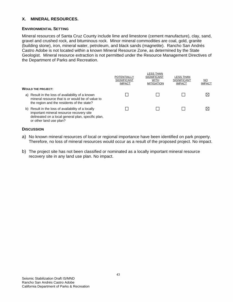
43 Seismic Stabilization Draft IS/MND Rancho San Andrés Castro Adobe California Department of Parks & Recreation
X. MINERAL RESOURCES. ENVIRONMENTAL SETTING Mineral resources of Santa Cruz County include lime and limestone (cement manufacture), clay, sand, gravel and crushed rock, and bituminous rock. Minor mineral commodities are coal, gold, granite (building stone), iron, mineral water, petroleum, and black sands (magnetite). Rancho San Andrés Castro Adobe is not located within a known Mineral Resource Zone, as determined by the State Geologist. Mineral resource extraction is not permitted under the Resource Management Directives of the Department of Parks and Recreation. LESS THAN POTENTIALLY SIGNIFICANT LESS THAN SIGNIFICANT WITH SIGNIFICANT NO IMPACT MITIGATION IMPACT IMPACT WOULD THE PROJECT:
a) Result in the loss of availability of a known mineral resource that is or would be of value to the region and the residents of the state?
b) Result in the loss of availability of a locally important mineral resource recovery site delineated on a local general plan, specific plan, or other land use plan? DISCUSSION
a) No known mineral resources of local or regional importance have been identified on park property. Therefore, no loss of mineral resources would occur as a result of the proposed project. No impact.
b) The project site has not been classified or nominated as a locally important mineral resource
recovery site in any land use plan. No impact.

44 Seismic Stabilization Draft IS/MND Rancho San Andrés Castro Adobe
California Department of Parks & Recreation
This page left intentionally blank.

45 Seismic Stabilization Draft IS/MND Rancho San Andrés Castro Adobe California Department of Parks & Recreation
XI. NOISE. ENVIRONMENTAL SETTING The Rancho San Andrés Castro Adobe is located on a one-acre parcel in a rural area that is primarily residential. The site is on Old Adobe Road, a private road. Ambient noise at the site includes birds, infrequent road traffic, and periodic noises from residential maintenance projects. The Santa Cruz County Code (Chapter 8.30) limits noise between 10 p.m. and 8 a.m. The Santa Cruz County General Plan (section 6.9.1, Land Use Compatibility Guidelines), states that “All new residential and noise sensitive land developments should conform to a noise exposure standard of 60dBLdn (day/night average noise level) for outdoor use and 45dBLdn for indoor use.” LESS THAN POTENTIALLY SIGNIFICANT LESS THAN SIGNIFICANT WITH SIGNIFICANT NO IMPACT MITIGATION IMPACT IMPACT WOULD THE PROJECT:
a) Generate or expose people to noise levels in excess of standards established in a local general plan or noise ordinance, or in other applicable local, state, or federal standards?
b) Generate or expose people to excessive groundborne vibrations or groundborne noise levels?
c) Create a substantial permanent increase in ambient noise levels in the vicinity of the project (above levels without the project)?
d) Create a substantial temporary or periodic increase in ambient noise levels in the vicinity of the project, in excess of noise levels existing without the project?
e) Be located within an airport land use plan or, where such a plan has not been adopted, within two miles of a public airport or public use airport? If so, would the project expose people residing or working in the project area to excessive noise levels?
f) Be in the vicinity of a private airstrip? If so, would the project expose people residing or working in the project area to excessive noise levels? DISCUSSION
a) Santa Cruz County Code, Chapter 8.30 limits noise between 10 p.m. and 8 a.m. All noise associated with this project is expected to take place outside of these hours. As noted above in the environmental setting section, the Santa Cruz County GP provides guidance on new developments, but does not provide specifications for work on existing structures.
Once the project begins, construction noise levels at and near the project area would fluctuate,
depending on the type and number of construction equipment and vehicles operating at any given time. Tools used at the site will be limited to small power or hand tools, such as saws, drills, a hand-held jack hammer, nail guns, etc. Construction vehicles will be limited to flatbed trucks, small backhoes, and small dump trucks as well as individual crew vehicles. The distance from residences in the vicinity of the proposed work site will limit objectionable levels of noise.

46 Seismic Stabilization Draft IS/MND Rancho San Andrés Castro Adobe
California Department of Parks & Recreation
However, depending on the specific construction activities being performed, short-term increases in ambient noise levels could result in speech interference at the work site and a potential increase in annoyance to the closest residences. While the noise generated would be no greater than that generated by a simple residential remodeling project, construction-generated noise would be considered to have potentially significant short-term impacts. Implementation of the following mitigation measure NOISE-1 would reduce those potential impacts to a less than significant level.
MITIGATION MEASURE NOISE-1 • •
•
Construction activities would generally be limited to 7 a.m. to 5 p.m., Monday - Friday. Internal combustion engines used for any purpose at the job site would be equipped with a muffler of a type recommended by the manufacturer. Equipment and trucks used for construction would utilize the best available noise control techniques (e.g., engine enclosures, acoustically attenuating shields or shrouds, intake silencers, ducts, etc.) whenever feasible and necessary.
Stationary noise sources will be muffled to the extent feasible and/or, where practicable, enclosed within temporary sheds.
b) The project is the seismic stabilization of a building. As such, all excess vibration will be avoided to
protect the integrity of the building. Construction activity would not involve the use of explosives, pile driving, or other intensive construction techniques that could generate significant ground vibration or noise. Therefore, groundborne vibration or noise generated by the project would have a less than significant impact.
c) The project is the stabilization of an existing building, with no change in use. Once the proposed
project is completed, all related construction noise would disappear. Nothing within the scope of the proposed project would result in a substantial permanent increase in ambient noise levels. Therefore, no impact.
d) See Discussion XI (a) above. Mitigated to a less than significant impact. e) The project site is not in airport clear zone and would not expose workers to excessive noise levels.
No impact. f) Not in the vicinity of any known private airstrip. No impact.

47 Seismic Stabilization Draft IS/MND Rancho San Andrés Castro Adobe California Department of Parks & Recreation
XII. POPULATION AND HOUSING ENVIRONMENTAL SETTING The Castro Adobe is located in a rural neighborhood in an unincorporated area of Santa Cruz County. While it was once used as a residence, it does not serve that function now, nor would its use change with this project. LESS THAN POTENTIALLY SIGNIFICANT LESS THAN SIGNIFICANT WITH SIGNIFICANT NO IMPACT MITIGATION IMPACT IMPACT WOULD THE PROJECT:
a) Induce substantial population growth in an area, either directly (for example, by proposing new homes and businesses) or indirectly (for example, through extension of roads or other infrastructure)? b) Displace substantial numbers of existing housing, necessitating the construction of replacement housing elsewhere? c) Displace substantial numbers of people, necessitating the construction of replacement housing elsewhere?
DISCUSSION
a-c) The project does not contain a housing or infrastructure component, nor will it displace any housing or people. No impact.

48 Seismic Stabilization Draft IS/MND Rancho San Andrés Castro Adobe
California Department of Parks & Recreation
This page left intentionally blank.

49 Seismic Stabilization Draft IS/MND Rancho San Andrés Castro Adobe California Department of Parks & Recreation
XIII. PUBLIC SERVICES. ENVIRONMENTAL SETTING The project site is located on a private road in an unincorporated area of Santa Cruz County. It is located within the County of Santa Cruz Fire Service Area #48, and fire protection services are contracted to the California Department of Forestry (CDF). Corralitos Fire Station at 120 Eureka Canyon Road is the closest station. Police services are provided by the Santa Cruz County Sheriff’s South County Service Center. The center is located at 790 Green Valley Road at Mesa Park, in Watsonville. LESS THAN POTENTIALLY SIGNIFICANT LESS THAN SIGNIFICANT WITH SIGNIFICANT NO IMPACT MITIGATION IMPACT IMPACT WOULD THE PROJECT:
a) Result in significant environmental impacts from construction associated with the provision of new or physically altered governmental facilities, or the need for new or physically altered governmental facilities, to maintain acceptable service ratios, response times, or other performance objectives for any of the public services:
Fire protection?
Police protection?
Schools?
Parks?
Other public facilities? DISCUSSION
a) The project consists of the stabilization of an existing structure. There would be no change in use, population, or need for recreational facilities under the project. The project site is not in a high-risk fire area. Implementation of Mitigation Measure Hazmat-3 will reduce the potential impact to fire protection to a less than significant level.

50 Seismic Stabilization Draft IS/MND Rancho San Andrés Castro Adobe
California Department of Parks & Recreation
This page left intentionally blank.

51 Seismic Stabilization Draft IS/MND Rancho San Andrés Castro Adobe California Department of Parks & Recreation
XIV. RECREATION. ENVIRONMENTAL SETTING The project will be conducted at the Rancho San Andrés Castro Adobe, which is owned by the Department of Parks and Recreation but is closed to the public. It is located within a rural area of Santa Cruz County on a private road. LESS THAN POTENTIALLY SIGNIFICANT LESS THAN SIGNIFICANT WITH SIGNIFICANT NO IMPACT MITIGATION IMPACT IMPACT
WOULD THE PROJECT: a) Increase the use of existing neighborhood and regional parks or other recreational facilities, such that substantial physical deterioration of the facility would occur or be accelerated?
b) Include recreational facilities or require the construction or expansion of recreational facilities that might have an adverse physical effect on the environment? DISCUSSION
a, b) This project would have no effect on existing recreational facilities, as it is the stabilization of an existing structure that is not open to the public and involves no change in use. There is no recreational component to the project. No impact.

52 Seismic Stabilization Draft IS/MND Rancho San Andrés Castro Adobe
California Department of Parks & Recreation
This page left intentionally blank.

53 Seismic Stabilization Draft IS/MND Rancho San Andrés Castro Adobe California Department of Parks & Recreation
XV. TRANSPORATION/TRAFFIC. ENVIRONMENTAL SETTING The project site is located at 184 Old Adobe Road, in an unincorporated area of Santa Cruz County. Old Adobe Road is a private one-lane paved road that is accessed via Larkin Valley Road (near its intersection with Buena Vista Drive), which in turn is accessed by State Route 1. Larkin Valley Road is classified as an “arterial” under the Santa Cruz County GP circulation element. Under the GP, arterials are defined as containing 2-6 lanes, discouraging or prohibiting on-street parking, with average daily traffic at a level of 10,000 to 15,000+. Level of Service (LOS) describes traffic conditions as they relate to speed and traffic flow. While the County has not done any traffic counts or determined an LOS at the Larkin Valley Road/Buena Vista Drive intersection, it is most likely at least LOS D or higher (Rivas, 2005), which is considered acceptable. Table 4 shows average daily traffic volumes for on-ramps and off-ramps between State Route 1 and Larkin Valley Road. Table 4: Average Daily Traffic Volumes, Larkin Valley Road On-ramps and Off-ramps at State Route 1 Ramp 1995 1999 2002 Southbound on-ramp 890 1,000 1,250 Northbound off-ramp 850 950 1,200 Southbound off-ramp 3,900 4,100 4,700 Northbound on-ramp 3,800 400 4,500 Eastbound on-ramp 1,650 1,500 1,650 Source: California Department of Transportation, Division of Traffic Operations, 2004. LESS THAN POTENTIALLY SIGNIFICANT LESS THAN SIGNIFICANT WITH SIGNIFICANT NO IMPACT MITIGATION IMPACT IMPACT
WOULD THE PROJECT: a) Cause a substantial increase in traffic, in relation to existing traffic and the capacity of the street system (i.e., a substantial increase in either the number of vehicle trips, the volume to capacity ratio on roads, or congestion at intersections)?
b) Exceed, individually or cumulatively, the level of service standards established by the county congestion management agency for designated roads or highways?
c) Cause a change in air traffic patterns, including either an increase in traffic levels or a change in location, that results in substantial safety risks?
d) Contain a design feature (e.g., sharp curves or a dangerous intersection) or incompatible uses (e.g., farm equipment) that would substantially increase hazards?
e) Result in inadequate emergency access?
f) Result in inadequate parking capacity?
g) Conflict with adopted policies, plans, or programs supporting alternative transportation (e.g., bus turnouts, bicycle racks)?

54 Seismic Stabilization Draft IS/MND Rancho San Andrés Castro Adobe
California Department of Parks & Recreation
DISCUSSION
a, b) As Old Adobe Road is a one-lane road, construction vehicles will need to use care and observe proper rights of way when encountering local traffic. The project would not block or restrict access to any road. Only a limited number of construction and crew vehicles are anticipated; trips related to construction would be less than two round-trips for four to six vehicles daily. Construction vehicles will be small (flatbed truck, small backhoe, small dump trucks), and construction duration will be limited. Vehicle and equipment staging areas will be located on the Adobe property, not on any roads. Traffic impacts will be comparable to a residential remodel project and will not change existing levels of service. The project will not generate new vehicle trips to the project location once construction is completed. Less than significant impact.
c) The project will have no impact on air traffic. d) This project does not have a transportation component and involves no change in use. No impact. e) There will be no change in access to the property or in use. No impact. f) There is no public access component to this project; the Adobe will remain closed to the public. As
noted above, construction and crew vehicles will park on the property itself, not on the roadway. No impact.
g) The project does not have a transportation component and will not conflict with any transportation
policies. No impact.

55 Seismic Stabilization Draft IS/MND Rancho San Andrés Castro Adobe California Department of Parks & Recreation
XVI. UTILITIES AND SERVICE SYSTEMS. ENVIRONMENTAL SETTING The Adobe property is served by water from a well located on adjoining private property that is subject to a well-sharing agreement. The project property has its own septic system, which has not been tested. The project property has electrical service with its panel located at the storage shed. The project property’s electricity also powers the well on the adjoining private property, so any interruptions to electrical service on the Adobe property need to be coordinated with the neighbor.
LESS THAN POTENTIALLY SIGNIFICANT LESS THAN SIGNIFICANT WITH SIGNIFICANT NO IMPACT MITIGATION IMPACT IMPACT
WOULD THE PROJECT: a) Exceed wastewater treatment restrictions or standards of the applicable Regional Water Quality Control Board?
b) Require or result in the construction of new water or wastewater treatment facilities or expansion of existing facilities?
Would the construction of these facilities cause significant environmental effects?
c) Require or result in the construction of new storm water drainage facilities or expansion of existing facilities?
Would the construction of these facilities cause significant environmental effects?
d) Have sufficient water supplies available to serve the project from existing entitlements and resources or are new or expanded entitlements needed?
e) Result in a determination, by the wastewater treatment provider that serves or may serve the project, that it has adequate capacity to service the project’s anticipated demand, in addition to the provider’s existing commitments?
f) Be served by a landfill with sufficient permitted capacity to accommodate the project’s solid waste disposal needs?
g) Comply with federal, state, and local statutes and regulations as they relate to solid waste? DISCUSSION
a-e) The stabilization activities will require a small use of water from the site well. Most of the water usage will come from a water tank provided during construction. Water will be needed for workers, washing tools, and dust control. The project will employ the use of chemical toilets on site and will not use the existing septic system. There will be no change to storm water drainage under the project. Once the project is complete, there will be no change to previous water use and wastewater levels. No impact.
f) There will be minimal solid waste generated from the project; all solid waste will be removed from
the site and deposited in a landfill. Once the project is complete, there will be no change to solid waste disposal needs. No impact.
g) The project will comply with all applicable regulations relating to solid waste. No impact.

56 Seismic Stabilization Draft IS/MND Rancho San Andrés Castro Adobe
California Department of Parks & Recreation
This page left intentionally blank.

57 Seismic Stabilization Draft IS/MND Rancho San Andrés Castro Adobe California Department of Parks & Recreation
CHAPTER 4 MANDATORY FINDINGS OF SIGNIFICANCE
LESS THAN POTENTIALLY SIGNIFICANT LESS THAN SIGNIFICANT WITH SIGNIFICANT NO IMPACT MITIGATION IMPACT IMPACT WOULD THE PROJECT: a) Does the project have the potential to degrade the quality of the environment, substantially reduce the habitat of a fish or wildlife species, cause a fish or wildlife population to drop below self-sustaining levels, threaten to eliminate a plant or animal community, reduce the number or restrict the range of a rare or endangered plant or animal? b) Have the potential to eliminate important examples of the major periods of California history or prehistory?
c) Have impacts that are individually limited, but cumulatively considerable? (“Cumulatively considerable” means the incremental effects of a project are considerable when viewed in connection with the effects of past projects, other current projects, and probably future projects?)
d) Have environmental effects that will cause substantial adverse effects on humans, either directly or indirectly? DISCUSSION
a) The proposed project was evaluated for potential significant adverse impacts to the natural environment. The park does not support any native plant communities or special status plants or animals. Certain project construction activities, if not mitigated, could have the potential to degrade air quality or cause soil erosion. However, full implementation of all mitigation measures incorporated into this project would reduce those impacts, both individually and cumulatively, to a less than significant level.
b) The proposed project was evaluated for potential significant adverse impacts to cultural resource. It
has been determined that much of the work proposed in this project would have the potential to cause a significant adverse impact to the historic fabric and/or significance of the Castro Adobe. However, full implementation of all mitigation measures incorporated into this project would reduce those impacts, both individually and cumulatively, to a less than significant level.
The proposed project would also have the potential to eliminate important examples of major
periods of California history or prehistory by trenching and grading in an area known to contain rich archaeological deposits. However, full implementation of all mitigation measures incorporated into this project would also reduce this impact to a less than significant level.
c) DPR often has other smaller maintenance programs and rehabilitation projects planned for a park
unit. At this time, no other projects are in progress or planned for this unit in the foreseeable future. Additionally, impacts from other environmental issues addressed in this evaluation do not overlap in such a way as to result in cumulative impacts that are greater than the sum of the parts. No impact.

58 Seismic Stabilization Draft IS/MND Rancho San Andrés Castro Adobe
California Department of Parks & Recreation
d) Most project-related environmental effects have been determined to pose a less than significant impact on humans. However, possible impacts from construction accidents (Hazards and Hazardous Waste) and noise, though temporary in nature, have the potential to result in significant adverse effects on humans. These potentially significant adverse impacts would be reduced to a less than significant level if all mitigation measures incorporated into this project are fully implemented.

59 Seismic Stabilization Draft IS/MND Rancho San Andrés Castro Adobe California Department of Parks & Recreation
•
•
•
•
•
•
•
•
•
CHAPTER 5 SUMMARY OF MITIGATION MEASURES
The following mitigation measures would be implemented by DPR as part of the Rancho San Andrés Castro Adobe Seismic Stabilization Project. AIR QUALITY MITIGATION MEASURES AIR-1
All equipment engines will be maintained in good condition, in proper tune (according to manufacturer’s specifications), and in compliance with all applicable State and federal requirements. Excavation activities would be suspended when sustained winds exceed 15 mph or instantaneous gusts exceed 25 mph. All trucks hauling dirt, sand, or loose materials will be covered or maintain at least two feet of freeboard. Inactive storage piles will be covered.
CULTURAL RESOURCES MITIGATION MEASURE CULT-1
Whenever applicable, the Secretary of the Interior’s Standards for historic structure rehabilitation will be followed. Wherever possible, historic building elements and features must be protected, preserved and/or reproduced with like-kind materials. Any material attached to the historic fabric of the building must be done in a reversible manner. Any attachment to historic fabric that differs from the Rehabilitation Drawings must be approved, in advance, by a DPR-qualified cultural resource specialist. All modifications will comply with the California Historical Building Code. The recommendations of the RSA Castro Historic Structure Report will be used to determine design and construction criteria.
MITIGATION MEASURE CULT-2 A DPR-qualified cultural resource specialist must be notified 72 hours in advance, when the exposure of historic fabric is likely. The cultural resource specialist will monitor the work and record pertinent information.
MITIGATION MEASURE CULT-3 • Coring and rod reinforcement will be completely hidden within the walls. • Grout injected into wall cracks will be tinted to match the existing bricks and grout. • Wall finishes will closely match existing surfaces wherever possible. • Existing adobe bricks will be used whenever possible. • Replacement adobe bricks will be selected in consultation with a DPR-qualified cultural
resource specialist.

60 Seismic Stabilization Draft IS/MND Rancho San Andrés Castro Adobe
California Department of Parks & Recreation
•
•
•
MITIGATION MEASURE CULT-4 • As discussed in the Historic Structure Report, Window 13, which exhibits all the attributes of
original construction, is the model for the historic window construction. • Replacement materials will be selected in consultation with a DPR-qualified cultural resource
specialist. MITIGATION MEASURE CULT-5 • Due to the archaeological nature of the area surrounding the Adobe, all ground-disturbing
activities will be monitored by a DPR-qualified cultural resource specialist familiar with the area's historic landscape and cultural resources.
• DPR Cultural Resource staff will be notified a minimum of 72 hours prior to the start of ground-disturbing work to schedule archaeological monitoring.
• The monitor will have the authority to request the State Representative to suspend work in the immediate area, if potentially significant cultural resources are unearthed.
• A report of the findings from the monitoring and any resulting excavations will be completed and copies distributed to the Office of Historic Preservation, the DPR Cultural Resource Division, DPR Northern Service Center and Santa Cruz District Headquarters.
MITIGATION MEASURE CULT-6 In areas where safety concerns prevent full excavation, samples of soil excavated by construction workers will be screened through mesh. Any artifacts recovered would be cleaned, sorted, catalogued, and prepared for curation at a DPR facility. Where possible, features encountered will be documented in place (or removed and curated, at the discretion of the supervising archaeologist) and trench profiles drawn. A report of the findings from the excavations will be incorporated into the monitoring report.
MITIGATION MEASURE CULT-7 • In the event that human remains are discovered, work will cease immediately in the area of the
find and the project manager/site supervisor will notify the appropriate DPR personnel. • The DPR Sector Superintendent (or authorized representative) will notify the County Coroner in
accordance with §7050.5 of the California Health and Safety Code. • If the coroner determines the remains represent Native American interment, the Native
American Heritage Commission in Sacramento would be consulted to identify the most likely descendants and appropriate disposition of the remains. Work will not resume in the area of the find until proper disposition is complete, per PRC §5097.98.
GEOLOGY AND SOILS MITIGATION MEASURE GEO-1 SEISMIC RETROFIT • This project will stabilize and seismically retrofit the Adobe according to earthquake design
requirements as specified in the current version of the California Historical Building Code, California Code of Regulations, Title 24, Part 8, and the recommendations in the 2003 Seismic Evaluation and Retrofit Report by E. Leroy Tolles of ELT and Associates (included as part of the 2003 Historic Structures Report).
• Any new (or existing) equipment (hot water heaters, tall bookcases, etc) installed as part of the building stabilization will be secured to the walls and/or floor to prevent damage in the event of a large earthquake, per California Building Code requirements.
• State Park staff will inspect the building as soon as possible after a large earthquake to ascertain any damage. Any major damage would require inspection by a qualified structural engineer before the building could resume use by Park staff or the public.

61 Seismic Stabilization Draft IS/MND Rancho San Andrés Castro Adobe California Department of Parks & Recreation
• MITIGATION MEASURE GEO-2
Best Management Practices (BMPs) would be used to prevent excessive soil erosion or loss of topsoil while the ground surface is disturbed. Any stormwater inlets in the project vicinity would be protected with silt fences or fiber rolls as necessary. Stockpiled soil would be covered and secured, especially during rainfall or windy conditions.
HAZARDS AND HAZARDOUS MATERIALS MITIGATION MEASURE HAZMAT 1 All equipment would be inspected for leaks immediately prior to the start of construction, and
regularly inspected thereafter until equipment is removed from park premises. The contractor(s) would prepare an emergency spill response plan prior to the start of
construction and maintain a spill kit on-site throughout the life of the project. This plan would include a map that delineates construction staging areas, where refueling, lubrication, and maintenance of equipment may occur. In the event of any spill or release of any chemical in any physical form at the project site or within the boundaries of Rancho San Andrés Castro Adobe during construction, the contractor would immediately notify the appropriate DPR staff (e.g., project manager or supervisor).
Equipment would be cleaned and repaired (other than emergency repairs) outside the park boundaries. All contaminated water, sludge, spill residue, or other hazardous compounds would be disposed of outside park boundaries, at a lawfully permitted or authorized destination.
MITIGATION MEASURE HAZMAT-2 ASBESTOS AND LEAD CONTAINING MATERIALS • Materials containing hazardous substances will either be removed or encapsulated as necessary to
protect public health and safety, including workers. Since the point count method was not utilized to refine the asbestos percentage results, all asbestos-containing material must be disposed of as hazardous asbestos waste. Asbestos-containing materials in good condition that will not be disturbed as part of this project do not need to be removed. Workers should be advised not to drill, saw, scrape or otherwise disturb the material without taking precautionary measures.
• Lead-containing materials in good condition that will not be disturbed as part of this project do not
need to be removed. Painted surfaces that contain lead will be made known to workers who may disturb them as part of the project. Building components with intact lead paint and no other hazardous materials can be disposed of as non-hazardous construction waste.
• Removal or disturbance of material with any detectable amount of asbestos-containing material or
lead paint must be handled in accordance with OSHA regulations. All hazardous materials will be removed by trained and authorized personnel and disposed of at a licensed facility (generally a Class III landfill), in compliance with local, state, and federal regulations and guidelines.
MITIGATION MEASURE HAZMAT- 3 CONSTRUCTION FIRE MANAGEMENT • A fire safety plan will be developed by the contractor and approved by DPR prior to the start of
construction. • Spark arrestors or turbo-charging (which eliminates sparks in exhaust) and fire extinguishers will be
required for all heavy equipment. • Construction crews will be required to park vehicles away from flammable material, such as dry
grass or brush. At the end of each workday, heavy equipment will be parked over mineral soil, asphalt, or concrete to reduce the chance of fire.
• Fire suppression equipment will also be available and located on park grounds.

62 Seismic Stabilization Draft IS/MND Rancho San Andrés Castro Adobe
California Department of Parks & Recreation
• •
•
NOISE MITIGATION MEASURE NOISE-1
Construction activities would generally be limited to 7 a.m. to 5 p.m., Monday - Friday. Internal combustion engines used for any purpose at the job site would be equipped with a muffler of a type recommended by the manufacturer. Equipment and trucks used for construction would utilize the best available noise control techniques (e.g., engine enclosures, acoustically attenuating shields or shrouds, intake silencers, ducts, etc.) whenever feasible and necessary.
Stationary noise sources will be muffled to the extent feasible and/or, where practicable, enclosed within temporary sheds.

63 Seismic Stabilization Draft IS/MND Rancho San Andrés Castro Adobe California Department of Parks & Recreation
CHAPTER 6 REFERENCES
General California Department of Parks and Recreation, 2003. The Forest of Nisene Marks State Park,
Preliminary General Plan/Draft EIR, State Clearinghouse #2001022080. Kimbro, Edna E. et al., 2003. Historic Structure Report for Rancho San Andrés Castro Adobe,
California State Parks. Mapquest, www.mapquest.com. Santa Cruz County Code, 2005. http://ordlink.com/codes/santacruzco/index.htm. Santa Cruz County Geographic Information System. http://gis.co.santa-cruz.ca.us. U.S. Geological Survey, 1998. Watsonville West Quadrangle, 7.5-Minute Series. Agriculture California Department of Conservation, Farmland Mapping and Monitoring Program (1998
Designations), 2002; website: www.consrv.ca.gov/dlrp/FMMP. County of Santa Cruz Planning Department, 2005. Basic Zone Districts – Summary of Uses,
http://sccounty01.co.santa-cruz.ca.us/planning/brochures/basic_zone_dist.htm. Air Quality California Air Resources Board, 2005. Air Designations Maps. www.arb.ca.gov/desig/adm/adm.htm Monterey Bay Unified Air Pollution Control District website, www.mbuapcd.org/, including CEQA Air
Quality Guidelines, July, 2004, www.mbuapcd.org/index.cfm?Cat=3. U.S. Environmental Protection Agency, 2005. Green Book: Nonattainment Areas for Criteria Pollutants.
www.epa.gov/air/oaqps/greenbk/index.html Geology and Soils Brabb, E. E., 1979, Geologic Map of Santa Cruz County, USGS Open File Report 79-489. CGS, 2003, Seismic Shaking Hazards in California, Interactive Maps,
website:http://www.consrv.ca.gov/cgs/rghm/pshamap/pshamain.html CDMG (California Division of Mines and Geology), 1959, (now the California Geological Survey),
Geologic Map of California, Santa Cruz Sheet, scale 1:250,000. ELT and Associates, 2003, Seismic Evaluation and Retrofit report, Ranch San Andrés Castro Adobe,
Watsonville, California, prepared for the California Department of Parks and Recreation Monterey District Office.

64 Seismic Stabilization Draft IS/MND Rancho San Andrés Castro Adobe
California Department of Parks & Recreation
EQE Engineering, 1991, Feasibility Study of Seismic Strengthening Schemes for the Castro Adobe in Watsonville, California.
James C. Reynolds & Associates, Inc., 1985, Limited Soil Investigation for the Castro Adobe, Santa
Cruz County, California, prepared for Mr. David Potter. Hazards and Hazardous Materials KELLCO, 2004, Pre-Renovation Asbestos and Lead Paint Inspection Report, prepared for California
Department of Parks and recreation (California State Parks). Hydrology City of Watsonville, 2005, Watsonville 2030 General Plan Update, Local Environmental Constraints
Map, website: http://watsonvillevista.info/page2.html DWR (Department of Water Resources), 2003, California’s Groundwater, Bulletin 118 Update 2003 Duffy, Denise and Associates, 2002, Draft Environmental Impact Report for the Watsonville Municipal
Airport Master Plan, prepared for the City of Watsonville. Kimbro, Edna, 2005, Personal Communication during a 3-16-2005 project meeting. Watsonville Wetland Watch, 2005, Visiting the Slough, Harkins Slough, website:
www.watsonvillewetlandswatch.org/harkins.htm Land Use and Planning City of Watsonville, Community Development Department, 1994. City of Watsonville 2005 General
Plan. http://www.ci.watsonville.ca.us/departments/cdd/genplan.html City of Watsonville, 2005, Watsonville 2030 General Plan Update, http://watsonvillevista.info County of Santa Cruz, 1994. County of Santa Cruz General Plan and Local Coastal Program.
http://sccounty01.co.santa-cruz.ca.us/planning/PDF/generalplan/toc.pdf County of Santa Cruz Planning Department, 2005. Basic Zone Districts – Summary of Uses,
http://sccounty01.co.santa-cruz.ca.us/planning/brochures/basic_zone_dist.htm. Public Services Pajaro Valley and the Monterey Bay Area Emergency and Disaster Services Agencies website,
www.pajarovalley.com/emerg.htm. Santa Cruz County Sheriff website, www.scsheriff.com/. Transportation and Traffic California Department of Transportation, Division of Traffic Operations, 2004. 2003 Ramp Volumes on
the California State Freeway System District 5, www.dot.ca.gov/hq/traffops/saferesr/trafdata/03ramps/d52003ramp.PDF
Rivas, Rodolfo. Santa Cruz County Public Works Department, pers. comm., April 22, 2005.

65 Seismic Stabilization Draft IS/MND Rancho San Andrés Castro Adobe California Department of Parks & Recreation
Report Preparation CALIFORNIA DEPARTMENT OF PARKS AND RECREATION NORTHERN SERVICE CENTER - SACRAMENTO, CALIFORNIA Kathleen Considine Associate Engineering Geologist Amy Palkovic Associate State Park Resource Ecologist Gail Sevrens Associate Park and Recreation Specialist Warren Wulzen Associate State Archaeologist