Embed Size (px)
Citation preview

Outline
• Introduction
• Research interests
• Main projects and results
Introduction
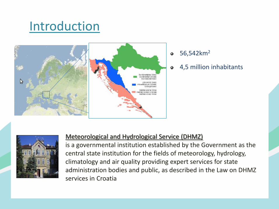
56,542km2
4,5 million inhabitants
Meteorological and Hydrological Service (DHMZ) is a governmental institution established by the Government as the central state institution for the fields of meteorology, hydrology, climatology and air quality providing expert services for state administration bodies and public, as described in the Law on DHMZ services in Croatia
Introduction
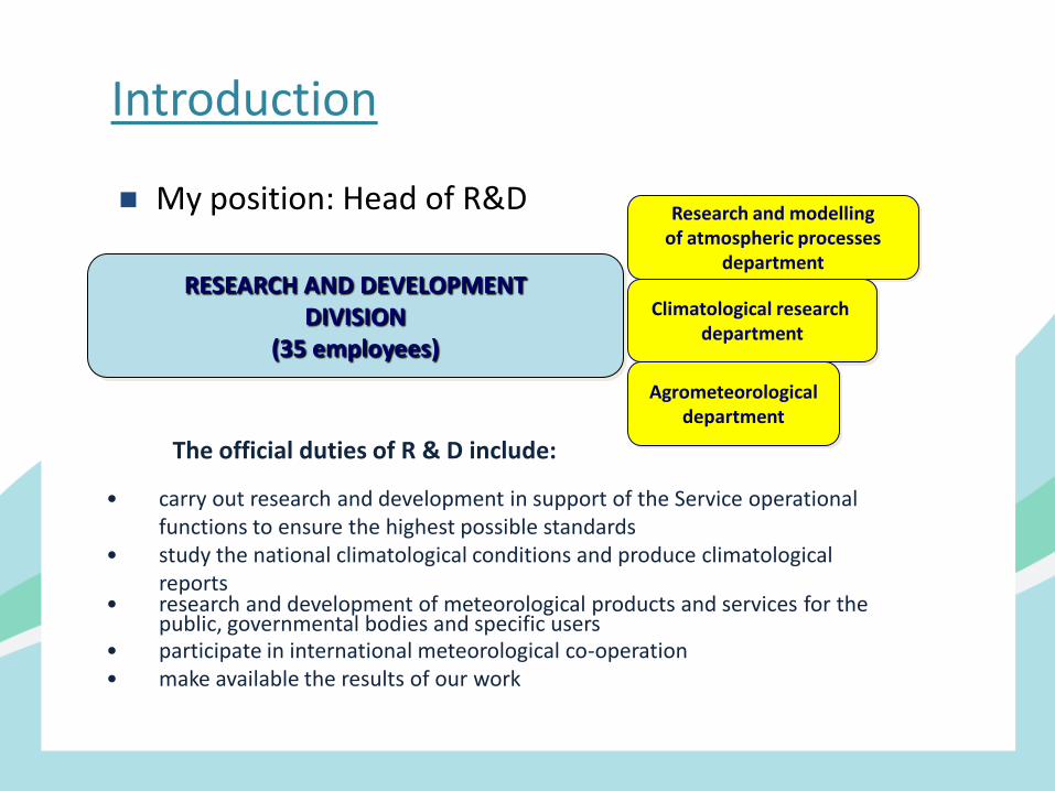
My position: Head of R&D
RESEARCH AND DEVELOPMENT
DIVISION (35 employees)
Research and modelling of atmospheric processes
department
Climatological research department
Agrometeorological department
• carry out research and development in support of the Service operational functions to ensure the highest possible standards
• study the national climatological conditions and produce climatological reports
• research and development of meteorological products and services for the public, governmental bodies and specific users
• participate in international meteorological co-operation • make available the results of our work
The official duties of R & D include:
Research interests
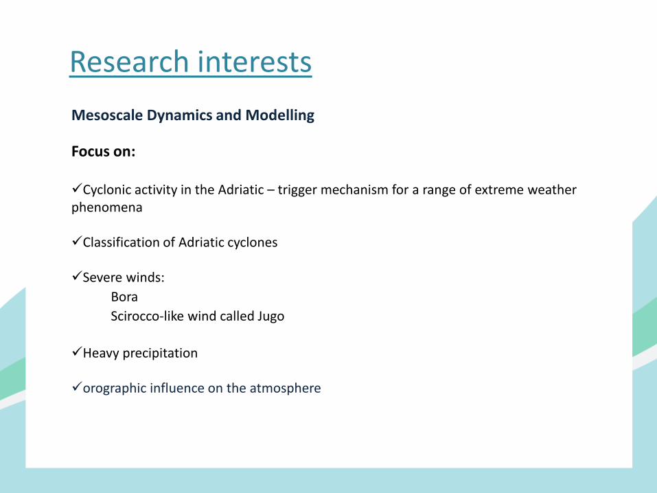
Mesoscale Dynamics and Modelling Focus on: Cyclonic activity in the Adriatic – trigger mechanism for a range of extreme weather phenomena Classification of Adriatic cyclones Severe winds:
Bora
Scirocco-like wind called Jugo
Heavy precipitation orographic influence on the atmosphere
Main projects
2015 – 2018: DHMZ coordinator for the activity of EU-CIRCLE project “A panEuropean framework for strengthenining Critical Infrastructure resilience to climate change” (HORIZON 2020) 2002 – 2011: project leader “Storms and natural disasters in Croatia”, Ministry of Science and Education
2016 - : PannEx – RHP project over the Pannonian basin 2010 – 2020: HyMeX – HYdrological cycle in Mediterranean Experiment – member of ISSC
2000 – 2010: WMO-MEDEX (Cyclones that produce high impact weather in the Mediterranean) - member of ISSC
1998 – 1999: MAP (Mesoscale Alpine Programme) – coordination of Croatian participation
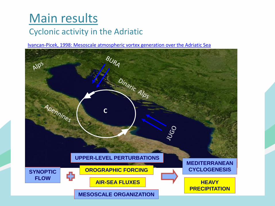
Cyclonic activity in the Adriatic
C
AIR-SEA FLUXES
UPPER-LEVEL PERTURBATIONS
OROGRAPHIC FORCING
MESOSCALE ORGANIZATION
HEAVY
PRECIPITATION
MEDITERRANEAN
CYCLOGENESIS SYNOPTIC
FLOW
Main results
Ivancan-Picek, 1998: Mesoscale atmospheric vortex generation over the Adriatic Sea
Main results
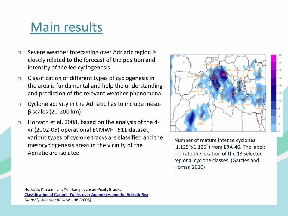
Severe weather forecasting over Adriatic region is closely related to the forecast of the position and intensity of the lee cyclogenesis
Classification of different types of cyclogenesis in the area is fundamental and help the understanding and prediction of the relevant weather phenomena
Cyclone activity in the Adriatic has to include meso-β scales (20-200 km)
Horvath et al. 2008, based on the analysis of the 4-yr (2002-05) operational ECMWF T511 dataset, various types of cyclone tracks are classified and the mesocyclogenesis areas in the vicinity of the Adriatic are isolated
Horvath, Kristian; Lin, Yuh-Lang; Ivančan-Picek, Branka. Classification of Cyclone Tracks over Apennines and the Adriatic Sea. Monthly Weather Review. 136 (2008)
Number of mature intense cyclones (1.125°x1.125°) from ERA-40. The labels indicate the location of the 13 selected regional cyclone classes. (Garcies and Homar, 2010)
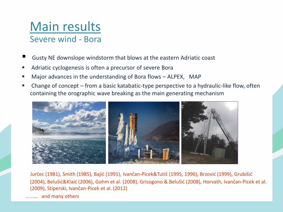
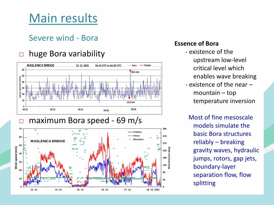
Main results Severe wind - Bora
Gusty NE downslope windstorm that blows at the eastern Adriatic coast
Adriatic cyclogenesis is often a precursor of severe Bora
Major advances in the understanding of Bora flows – ALPEX, MAP
Change of concept – from a basic katabatic-type perspective to a hydraulic-like flow, often containing the orographic wave breaking as the main generating mechanism
Jurčec (1981), Smith (1985), Bajić (1991), Ivančan-Picek&Tutiš (1995, 1996), Brzović (1999), Grubišić
(2004), Belušić&Klaić (2006), Gohm et al. (2008), Grisogono & Belušić (2008), Horvath, Ivančan-Picek et al. (2009), Stiperski, Ivančan-Picek et al. (2012)
......... and many others
0
10
20
30
40
50
60
1 61 121 181 241 301 361 421 481 541
win
d s
pe
ed
(m
/s)
Vsec V10min23. 12. 2003. form 04:10 UTC to 04:20 UTCMASLENICA BRIDGE
04:10 04:12 04:14 04:16 04:18
13.9 m/s
58.6 m/s
0
10
20
30
40
50
60
70
Win
d s
pe
ed
(m
/s)
0
45
90
135
180
225
270
315
360
Win
d d
irec
tio
n (
de
g)
V10min
Vmax
DirectionMASLENICA BRIDGE
13. 12. 14. 12. 15. 12. 16. 12. 17. 12. 18. 12. 2001.
huge Bora variability
maximum Bora speed - 69 m/s
Main results
Severe wind - Bora Essence of Bora - existence of the
upstream low-level critical level which enables wave breaking
- existence of the near – mountain – top temperature inversion
Most of fine mesoscale
models simulate the basic Bora structures reliably – breaking gravity waves, hydraulic jumps, rotors, gap jets, boundary-layer separation flow, flow splitting
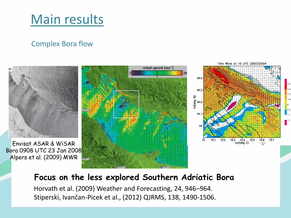
Complex Bora flow
Envisat ASAR & WiSAR Bora 0908 UTC 23 Jan 2008
Alpers et al. (2009) MWR
Focus on the less explored Southern Adriatic Bora Horvath et al. (2009) Weather and Forecasting, 24, 946–964. Stiperski, Ivančan-Picek et al., (2012) QJRMS, 138, 1490-1506.
Main results
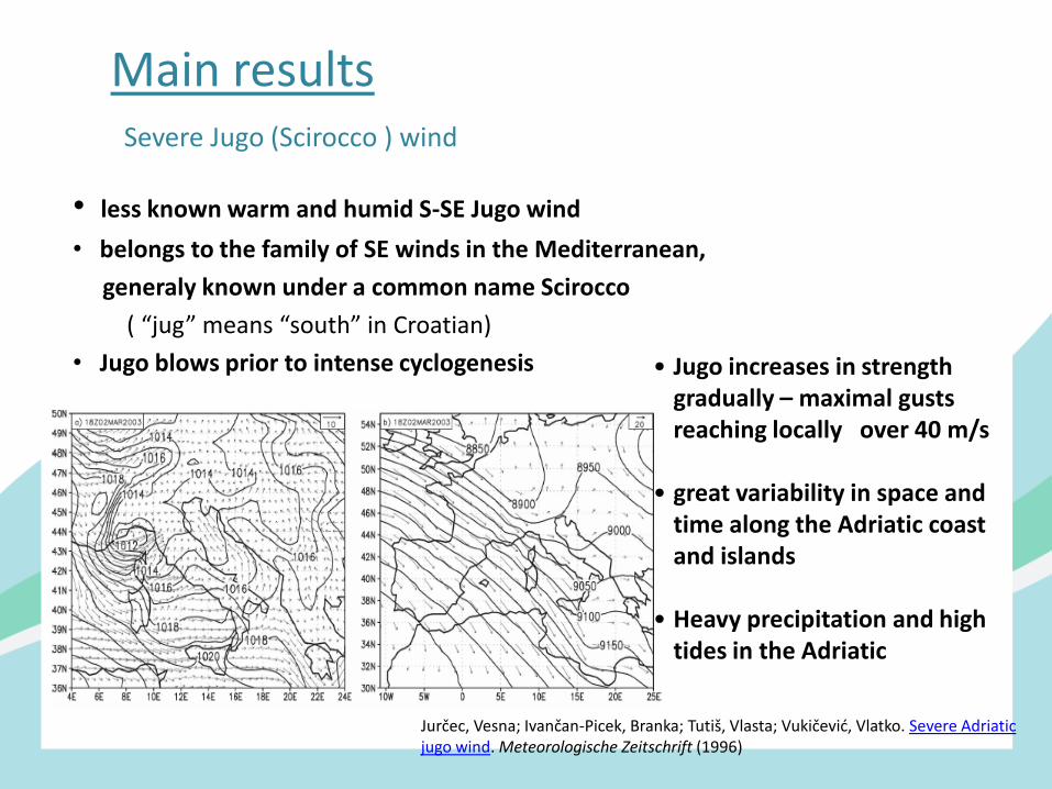
• less known warm and humid S-SE Jugo wind
• belongs to the family of SE winds in the Mediterranean,
generaly known under a common name Scirocco
( “jug” means “south” in Croatian)
• Jugo blows prior to intense cyclogenesis
• Jugo increases in strength gradually – maximal gusts reaching locally over 40 m/s
• great variability in space and
time along the Adriatic coast and islands
• Heavy precipitation and high
tides in the Adriatic
Main results Severe Jugo (Scirocco ) wind
Jurčec, Vesna; Ivančan-Picek, Branka; Tutiš, Vlasta; Vukičević, Vlatko. Severe Adriatic jugo wind. Meteorologische Zeitschrift (1996)
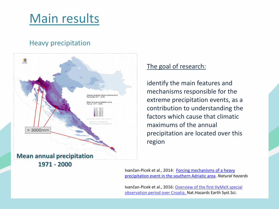
Heavy precipitation
The goal of research: identify the main features and mechanisms responsible for the extreme precipitation events, as a contribution to understanding the factors which cause that climatic maximums of the annual precipitation are located over this region
Main results
Mean annual precipitation
1971 - 2000
Ivančan-Picek et al., 2014: Forcing mechanisms of a heavy precipitation event in the southern Adriatic area. Natural hazards Ivančan-Picek et al., 2016: Overview of the first HyMeX special observation period over Croatia. Nat.Hazards Earth Syst.Sci.
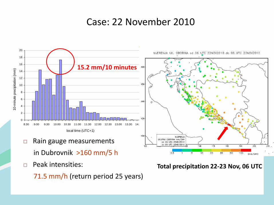
Case: 22 November 2010
Rain gauge measurements
in Dubrovnik >160 mm/5 h
Peak intensities:
71.5 mm/h (return period 25 years)
0
2
4
6
8
10
12
14
16
18
20
8.30 9.00 9.30 10.00 10.30 11.00 11.30 12.00 12.30 13.00 13.30 14.00
local time (UTC+1)
10-m
inute
pre
cip
itatio
n (
mm
) 15.2 mm/10 minutes
Total precipitation 22-23 Nov, 06 UTC
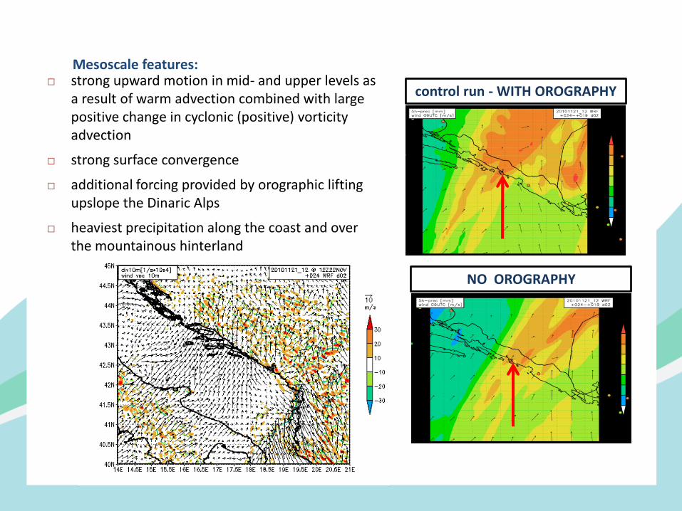
Mesoscale features:
control run - WITH OROGRAPHY
NO OROGRAPHY
strong upward motion in mid- and upper levels as a result of warm advection combined with large positive change in cyclonic (positive) vorticity advection
strong surface convergence
additional forcing provided by orographic lifting upslope the Dinaric Alps
heaviest precipitation along the coast and over the mountainous hinterland
Questions and challenges Better understand and predict precipitation variability - future research
adressing mesoscale phenomenon should deploy more remote sensing instruments (HyMeX, PANNEX ?); there is a demand of high-resolution real-time data, particularly radar data for operational data assimilation; improvements in data exchange policies
Air-sea-land interaction (trigerring of convection over the sea; role of SST and need for coupled ocean-atmosphere modeling .....)
Better understanding and future projection of extremes

Thank You