Embed Size (px)
Citation preview
MDOT Presentation at RUCUS September 26th, 2018
The Linear Referencing Systems are the Base of Road
Data• Physical Road (PR) and mile point(s), MDOT LRS standard for all roads• Control Section (CS) and mile point(s), are MDOT LRS only• Route – Third LRS in Roads and Highways, think mile marker signs on
Interstate• Future – Fourth LRS, unbuilt routes that have been FHWA approved as
federal-aid eligible. • Versions have historically been released annually (v15, v16, v17)• CSS has historically maintained the LRS and provided PR migration
tables to migrate our business data, i.e. projects, condition, crashes, etc.
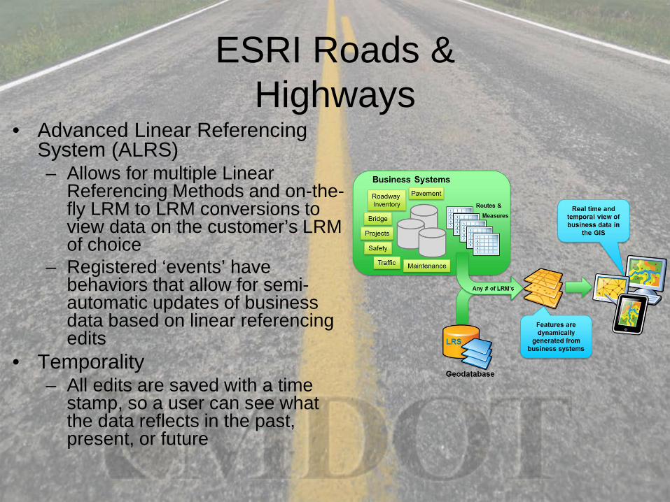
ESRI Roads & Highways
• Advanced Linear Referencing System (ALRS)– Allows for multiple Linear
Referencing Methods and on-the-fly LRM to LRM conversions to view data on the customer’s LRM of choice
– Registered ‘events’ have behaviors that allow for semi-automatic updates of business data based on linear referencing edits
• Temporality– All edits are saved with a time
stamp, so a user can see what the data reflects in the past, present, or future
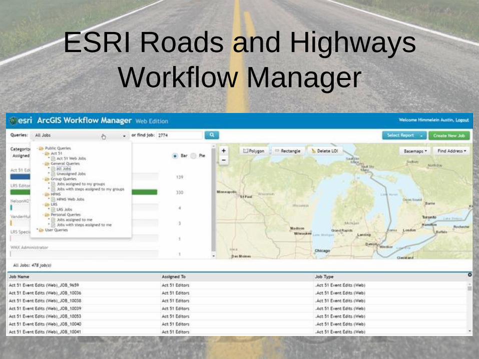
ESRI Roads and Highways Workflow Manager
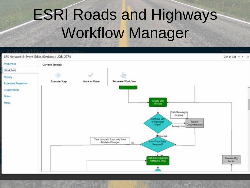
ESRI Roads and Highways Workflow Manager
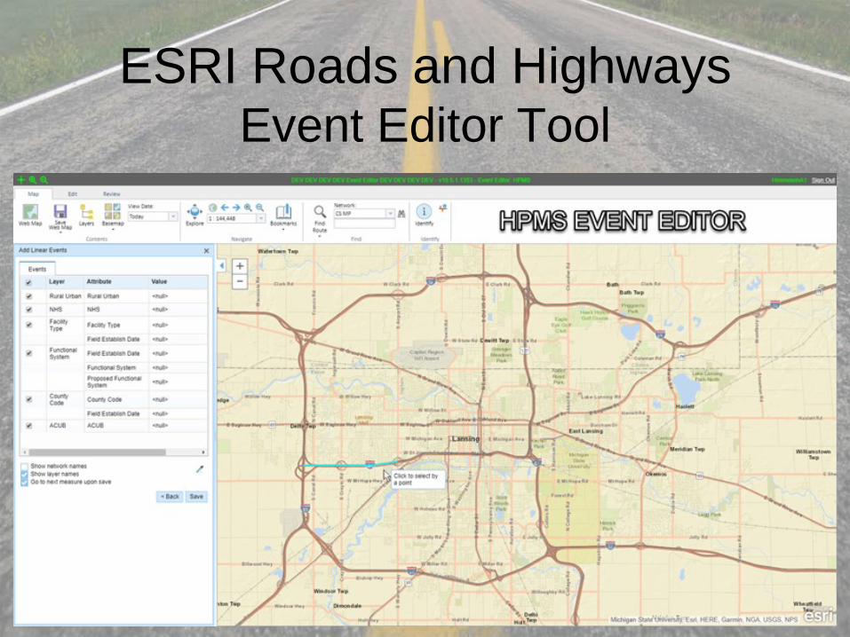
ESRI Roads and Highways Event Editor Tool
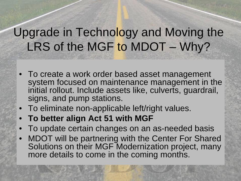
Upgrade in Technology and Moving the LRS of the MGF to MDOT – Why?
• To create a work order based asset management system focused on maintenance management in the initial rollout. Include assets like, culverts, guardrail, signs, and pump stations.
• To eliminate non-applicable left/right values.• To better align Act 51 with MGF• To update certain changes on an as-needed basis• MDOT will be partnering with the Center For Shared
Solutions on their MGF Modernization project, many more details to come in the coming months.
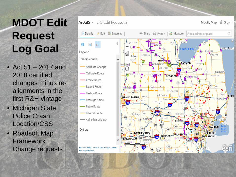
MDOT Edit Request Log Goal
• Act 51 – 2017 and 2018 certified changes minus re-alignments in the first R&H vintage
• Michigan State Police Crash Location/CSS
• Roadsoft Map Framework Change requests
Align Act 51 With MGF; the Role of Roadsoft
• A majority of Michigan Roadsoft users are road jurisdictional agencies – Act 51
• Act 51 agencies that are driving the roads for their business purposes, PASER collection, or other asset collection with a GPS are in the best position to report possible errors.
• What is the best way to get corrections into the next version of Roadsoft MGF?
• In Roadsoft “Tools”, go to “Create Framework Map Change Request”
Starting last month, the MDOT Act 51 Team now receives Roadsoft Map Framework Change
requests and starting November 2018, MDOT will be able to edit the corrections in MDOT Roads
and Highways.
CSS and MGF, will consume the MDOT Roads and Highways values. Do you need the same
MGF product you had in the past?
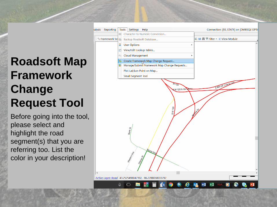
Roadsoft Map Framework Change Request ToolBefore going into the tool, please select and highlight the road segment(s) that you are referring too. List the color in your description!
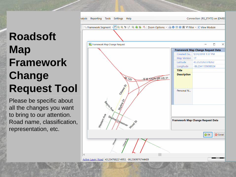
Roadsoft Map Framework Change Request ToolPlease be specific about all the changes you want to bring to our attention. Road name, classification, representation, etc.
Roadsoft Map Framework Change Request Tool
We have received a lot of good of corrections that our Act 51 team has verified.
We receive an email with a pdf map output from Roadsoft. The pdf we can attach to our workflow tools.
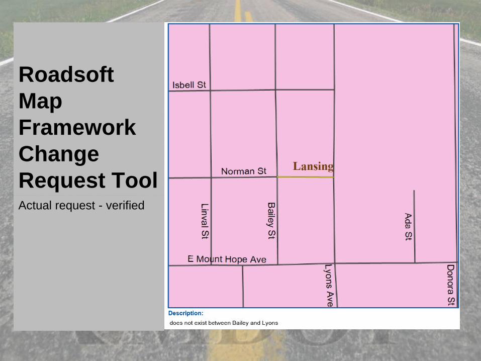
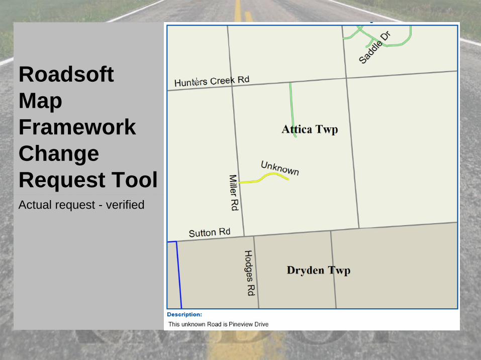
Roadsoft Map Framework Change Request ToolActual request - verified
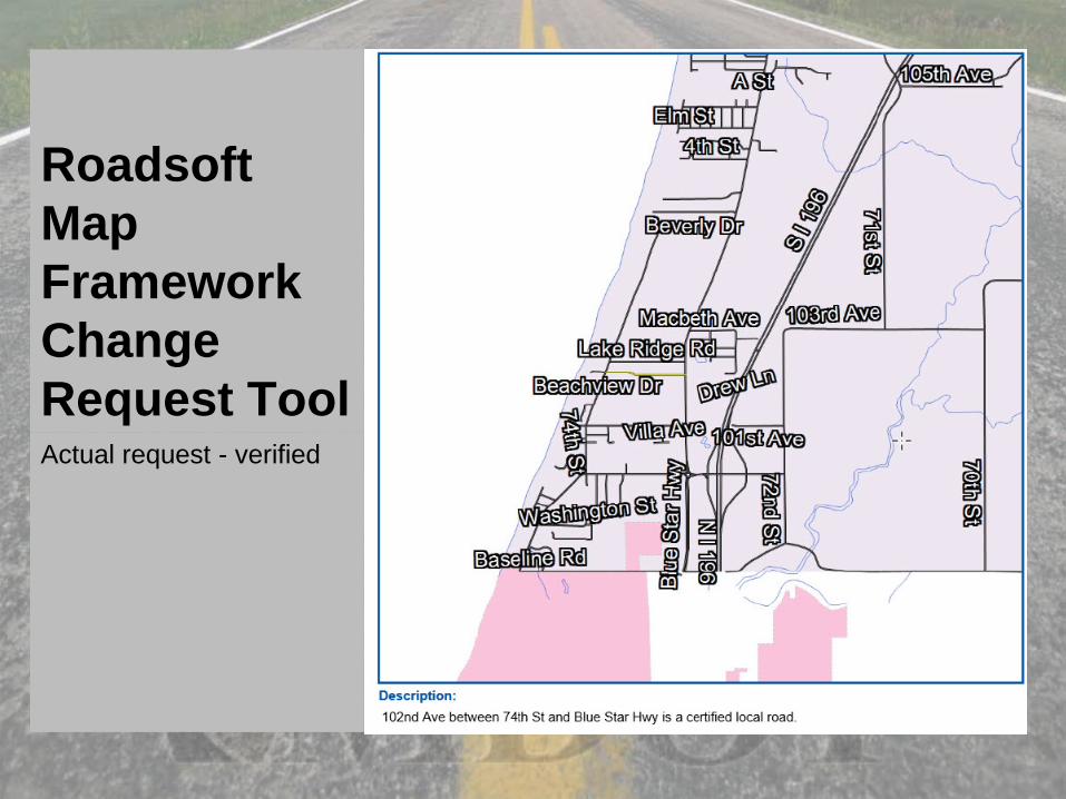
Roadsoft Map Framework Change Request ToolActual request - verified
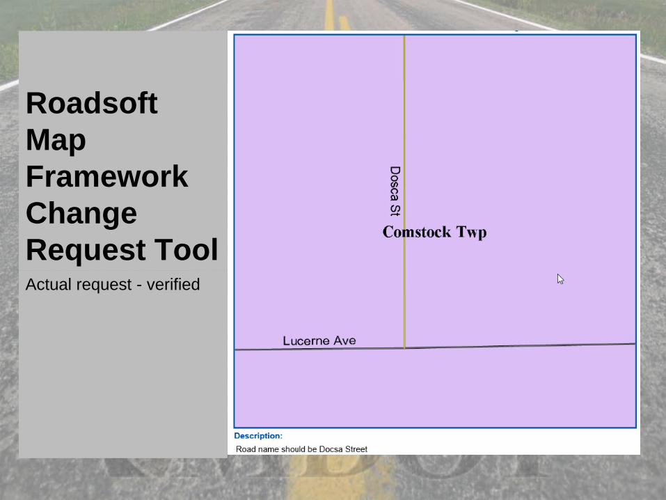
Roadsoft Map Framework Change Request ToolActual request - verified
Roadsoft Map Framework Change Request ToolActual request - verified
Roadsoft Map Framework Change Request Tool
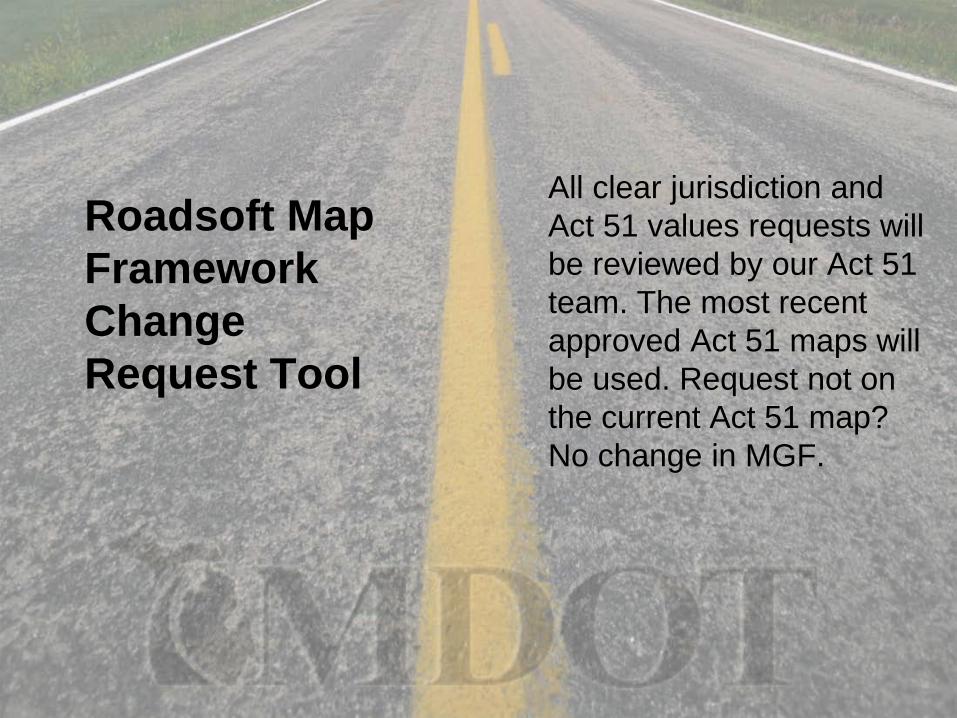
All clear jurisdiction and Act 51 values requests will be reviewed by our Act 51 team. The most recent approved Act 51 maps will be used. Request not on the current Act 51 map? No change in MGF.
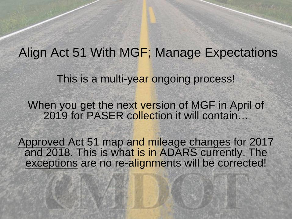
Align Act 51 With MGF; Manage Expectations
This is a multi-year ongoing process!
When you get the next version of MGF in April of 2019 for PASER collection it will contain…
Approved Act 51 map and mileage changes for 2017 and 2018. This is what is in ADARS currently. The exceptions are no re-alignments will be corrected!
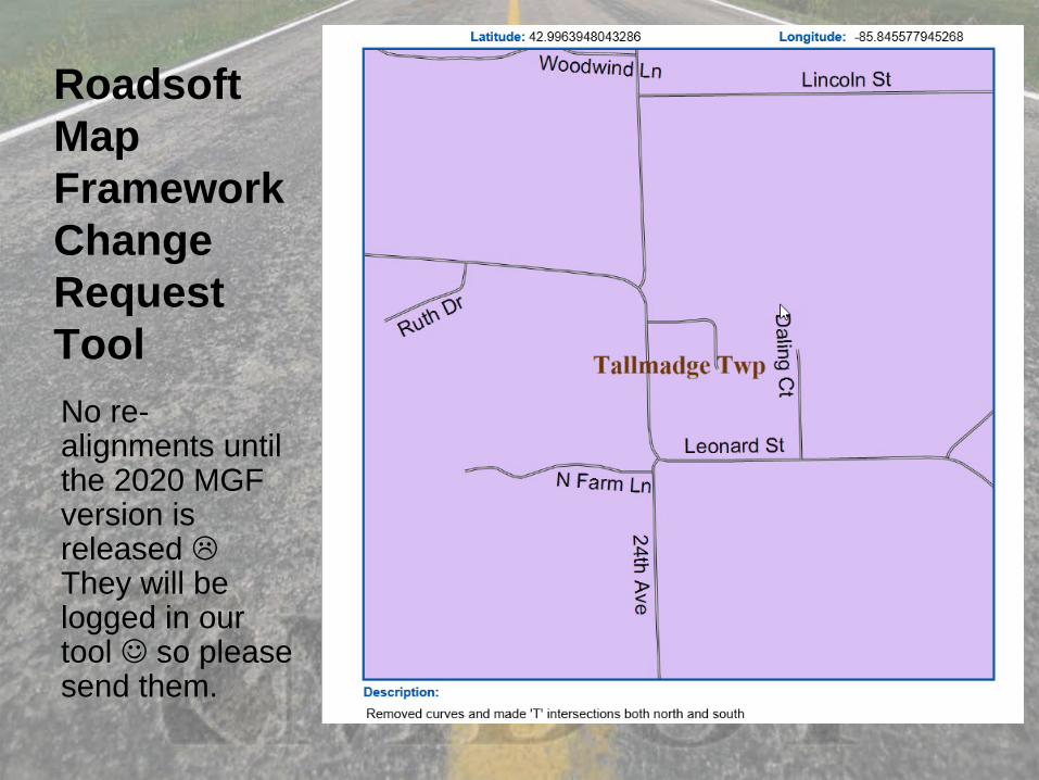
Roadsoft Map Framework Change Request ToolNo re-alignments until the 2020 MGF version is released They will be logged in our tool so please send them.
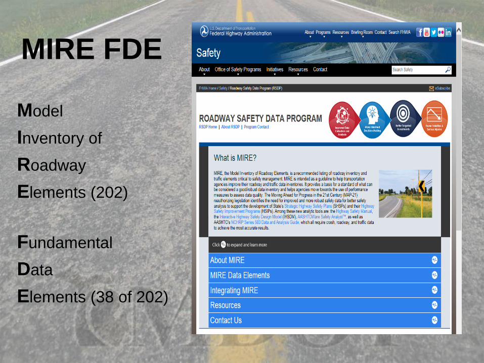
MIRE FDE
ModelInventory ofRoadway Elements (202)
FundamentalDataElements (38 of 202)
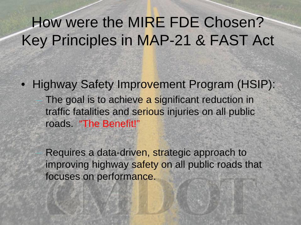
How were the MIRE FDE Chosen?Key Principles in MAP-21 & FAST Act
• Highway Safety Improvement Program (HSIP):– The goal is to achieve a significant reduction in
traffic fatalities and serious injuries on all public roads. “The Benefit!”
– Requires a data-driven, strategic approach to improving highway safety on all public roads that focuses on performance.
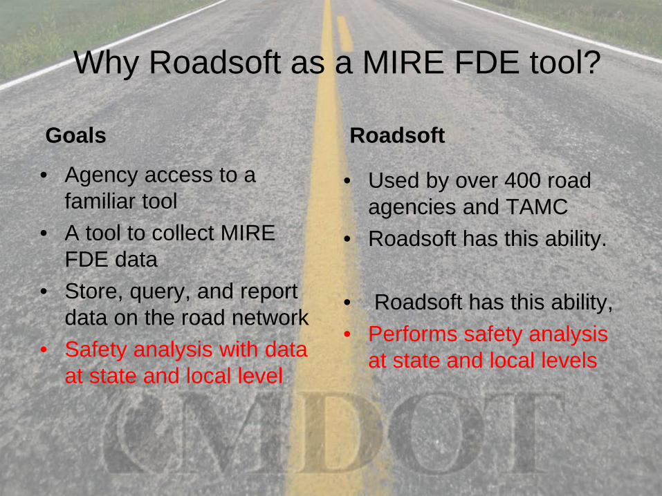
Why Roadsoft as a MIRE FDE tool?
Goals • Agency access to a
familiar tool• A tool to collect MIRE
FDE data• Store, query, and report
data on the road network• Safety analysis with data
at state and local level
Roadsoft
• Used by over 400 road agencies and TAMC
• Roadsoft has this ability.
• Roadsoft has this ability, • Performs safety analysis
at state and local levels
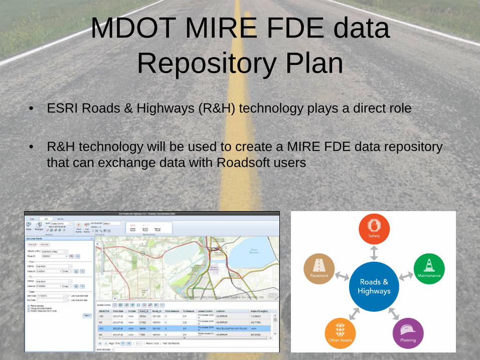
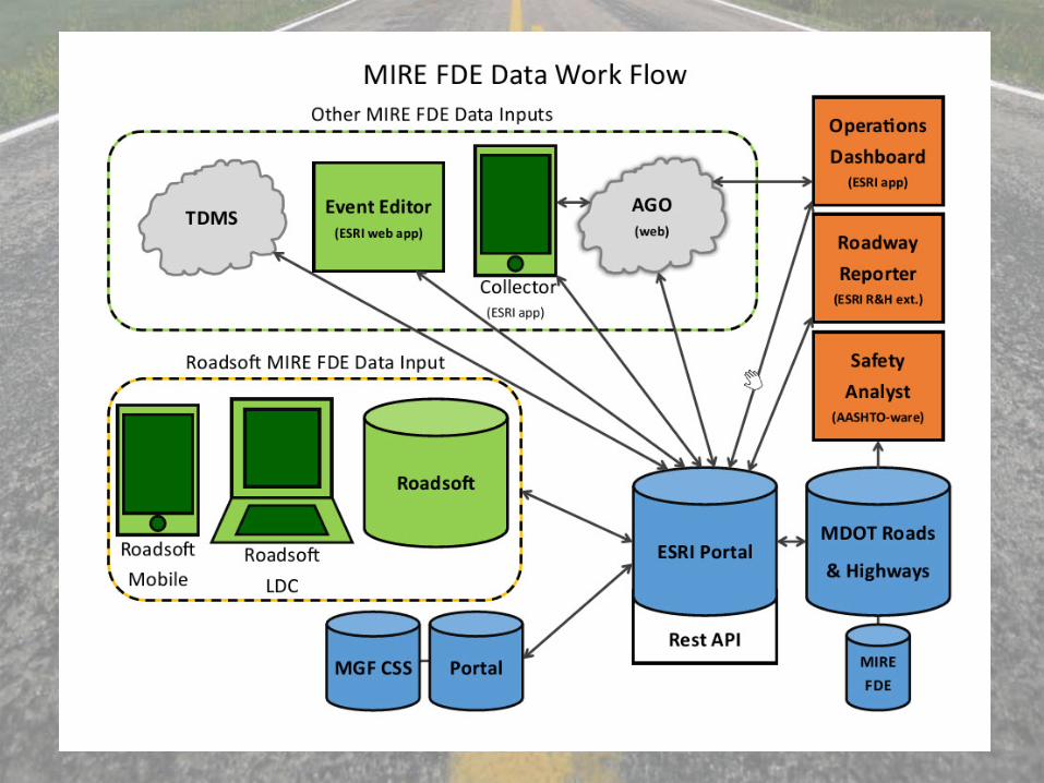
MDOT MIRE FDE data Repository Plan
• ESRI Roads & Highways (R&H) technology plays a direct role
• R&H technology will be used to create a MIRE FDE data repository that can exchange data with Roadsoft users

Questions?Thank you