Embed Size (px)
Citation preview


Executive Summary Page E-1
Kaw ConnectsTopeka/Lawrence/Kansas CityMajor Corridor Study
KAW CONNECTS EXECUTIVE SUMMARY
Introduction
The Kansas Department of Transportation (KDOT) and the Kansas Turnpike Authority (KTA)have both recognized the need to plan for the future transportation demands in the regionbetween Topeka and Kansas City. To develop this plan, the two agencies initiated a MajorCorridor Study (MCS) to identify and evaluate a wide variety of transportation investmentalternatives. The impetus for this joint study was twofold. First, both agencies are keenly awareof significant traffic increases in the study area and the need to provide their customers withadequate transportation facilities now and in the future. Second, any improvements made by oneagency will have direct impacts on the other and need to be studied in a comprehensive manner.
Study Area
As shown below, the study encompassed an area of approximately 50 miles by 26 miles andincluded portions of six counties in northeast Kansas: Johnson, Wyandotte, Leavenworth,Douglas, Jefferson, and Shawnee. Many communities within the study area rely on the existingtransportation system for commuting and for goods movement. Major activity centers in the studyarea include the City of Topeka, City of Lawrence, and the Kansas City metropolitan area. Thestudy area also contains several sizeable recreational areas and special event venues, includingPerry Lake, Clinton Lake, Heartland Park Raceway, Sandstone Amphitheater, and the Universityof Kansas. In addition, a NASCAR speedway is under construction in Wyandotte County, and a“Land of Oz” theme park is being proposed in Johnson County (on the former SunflowerAmmunition Plant site).
Study Area
Executive Summary Page E-2
Kaw ConnectsTopeka/Lawrence/Kansas CityMajor Corridor Study
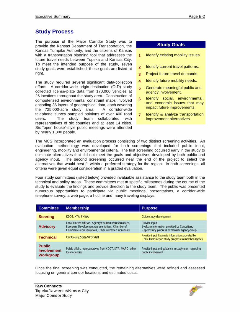
Study Goals
1 Identify existing mobility issues.
2 Identify current travel patterns.
3 Project future travel demands.
4 Identify future mobility needs.
5 Generate meaningful public andagency involvement.
6 Identify social, environmental,and economic issues that mayimpact future improvements.
7 Identify & analyze transportationimprovement alternatives.
Committee Membership Purpose
Steering KDOT, KTA, FHWA Guide study development
AdvisoryLocal elected officials, Agency/coalition representatives,Economic Development representatives, Chamber ofCommerce representatives, Other interested individuals
Provide input;Evaluate information provided by Consultant;Report study progress to member agency/group
Technical City/County/State/MPO Staff Provide input; Evaluate information provided byConsultant; Report study progress to member agency
PublicInvolvementWorkgroup
Public affairs representatives from KDOT, KTA, MARC, otherlocal agencies
Provide input and guidance to study team regardingpublic involvement
Study Process
The purpose of the Major Corridor Study was toprovide the Kansas Department of Transportation, theKansas Turnpike Authority, and the citizens of Kansaswith a transportation planning tool that addresses thefuture travel needs between Topeka and Kansas City.To meet the intended purpose of the study, sevenstudy goals were established; these goals are listed atright.
The study required several significant data-collectionefforts. A corridor-wide origin-destination (O-D) studycollected license-plate data from 170,000 vehicles at26 locations throughout the study area. Construction ofcomputerized environmental constraint maps involvedencoding 36 layers of geographical data, each coveringthe 725,000-acre study area. A corridor-widetelephone survey sampled opinions of over 400 roadusers. The study team collaborated withrepresentatives of six counties and at least 14 cities.Six “open house”-style public meetings were attendedby nearly 1,300 people.
The MCS incorporated an evaluation process consisting of two distinct screening activities. Anevaluation methodology was developed for both screenings that included public input,engineering, mobility and environmental criteria. The first screening occurred early in the study toeliminate alternatives that did not meet the goals and objectives developed by both public andagency input. The second screening occurred near the end of the project to select thealternatives that would best fit within a preferred strategy for the region. In both screenings, allcriteria were given equal consideration in a graded evaluation.
Four study committees (listed below) provided invaluable assistance to the study team both in thetechnical and policy areas. These committees met at specific milestones during the course of thestudy to evaluate the findings and provide direction to the study team. The public was presentednumerous opportunities to participate via public meetings, presentations, a corridor-widetelephone survey, a web page, a hotline and many traveling displays.
Once the final screening was conducted, the remaining alternatives were refined and assessedfocusing on general corridor locations and estimated costs.

Executive Summary Page E-3
Kaw ConnectsTopeka/Lawrence/Kansas CityMajor Corridor Study
Existing Conditions
The existing highway system within the study area includes several facility types, ranging fromurban interstate freeways to rural two-lane highways. The major east-west facility in the studyarea is I-70, which runs through Topeka, Lawrence, and Kansas City. In the study area, I-70 is atoll facility (Turnpike) operated and maintained by KTA. Other major east/west facilities include K-10, US-24, US-40, K-32, and 45th Street/Stull Rd. Major north/south routes in the study includeUS-75, US-59, K-4, and K-7. Public transportation within the study area is provided by severalindividual bus services. No commuter rail or light rail operations currently exist.
Both KDOT and KTA have experienced steady traffic growth in the study area. KDOT’s priorityformula has identified needs on several highways, including portions of K-4, US-24, US-40 andUS-59. K-10 has also experienced rapid traffic growth. At the same time, KTA has experiencedtraffic increases on I-70 that are exceeding projections and could result in some segmentsoperating at unacceptable levels of service within the next five years.
In addition to congestion, several other traffic-related issues are also of concern to the generalpublic, including safety, Turnpike access, Kansas River crossings, and the potential effects ofnew or improved highways.
The map below highlights current areas of congestion within the study area. Congestion wasmeasured using the Level of Service (LOS) concept based on daily traffic volumes, speeds androadway characteristics; facilities operating at LOS D or worse were considered congested.
Existing Areas of Congestion
Executive Summary Page E-4
Kaw ConnectsTopeka/Lawrence/Kansas CityMajor Corridor Study
Year 2025 Areas of Congestion
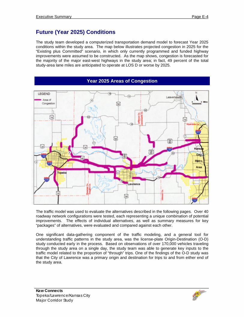
Future (Year 2025) Conditions
The study team developed a computerized transportation demand model to forecast Year 2025conditions within the study area. The map below illustrates projected congestion in 2025 for the“Existing plus Committed” scenario, in which only currently programmed and funded highwayimprovements were assumed to be constructed. As the map shows, congestion is forecasted forthe majority of the major east-west highways in the study area; in fact, 49 percent of the totalstudy-area lane miles are anticipated to operate at LOS D or worse by 2025.
The traffic model was used to evaluate the alternatives described in the following pages. Over 40roadway network configurations were tested, each representing a unique combination of potentialimprovements. The effects of individual alternatives, as well as summary measures for key“packages” of alternatives, were evaluated and compared against each other.
One significant data-gathering component of the traffic modeling, and a general tool forunderstanding traffic patterns in the study area, was the license-plate Origin-Destination (O-D)study conducted early in the process. Based on observations of over 170,000 vehicles travelingthrough the study area on a single day, the study team was able to generate key inputs to thetraffic model related to the proportion of “through” trips. One of the findings of the O-D study wasthat the City of Lawrence was a primary origin and destination for trips to and from either end ofthe study area.

Executive Summary Page E-5
Kaw ConnectsTopeka/Lawrence/Kansas CityMajor Corridor Study
Initial Screening Criteria
1 Meet traffic demands of theregion
2 Minimize engineering/construction impacts
3 Minimize negativeenvironmental effects
4 Minimize negative economic/social impacts
5 Maximize cost-effectiveness
Initial Screening of Alternatives
The study team initially developed 12 broad categories ofimprovements, ranging from multi-modal enhancementsto Intelligent Transportation System (ITS) strategies.Through an initial screening process involving the inputof key study committees and the general public, the listof categories was narrowed and refined. The initialscreening process involved rating each strategy’s abilityto satisfy the five evaluation criteria listed at right.
Below are listed the 12 initial strategies (plus the “NoBuild” option) and the results of the initial screening.Highway-related alternatives and the “No Build” optionwere retained for further analysis.
The phrase “dropped as ‘stand-alone’” indicates that the four strategies so named were notconsidered strong enough to meet the study goals by themselves. The study team decided thatthese alternatives would be most effective in combination with other, stronger alternatives.
Results of the Initial Screening
“Carried Forward” Strategies Strategies Dropped as“Stand-alone”
“Dropped”Strategies
No Build Transportation Systems Management (TSM)1 Non-Motorized
New Local Roadways Transportation Demand Management (TDM)2 Commuter Rail
Widen Existing Highways Intelligent Transportation Systems (ITS)3 Light Rail
New Interchanges Transit (Bus)
New Toll-Supported Highways
New Tax-Supported Highways
Notes:1 Transportation Systems Management (TSM) strategies include relatively low-cost enhancements to the existingtransportation network that can greatly improve operational efficiency. Examples include traffic signal improvements,geometric improvements, and pavement-marking improvements.
2 Transportation Demand Management (TDM) strategies are aimed at reducing the volume (demand) of vehicles onthe transportation network during peak periods. Examples include High-Occupancy-Vehicle (HOV) lanes, employeetrip-reduction programs (such as telecommuting), parking management, and ridesharing.
3 Intelligent Transportation Systems (ITS) can be defined as the application of technology to the transportation systemto increase efficiency and reduce motorists’ delays. Examples include automated incident detection/response,automated highways, and traveler information systems.
Executive Summary Page E-6
Kaw ConnectsTopeka/Lawrence/Kansas CityMajor Corridor Study
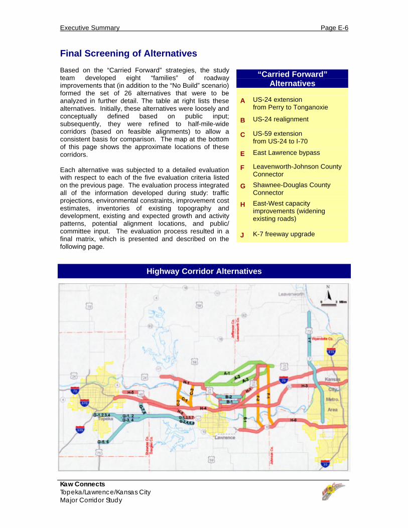
“Carried Forward”Alternatives
A US-24 extensionfrom Perry to Tonganoxie
B US-24 realignment
C US-59 extensionfrom US-24 to I-70
E East Lawrence bypass
F Leavenworth-Johnson CountyConnector
G Shawnee-Douglas CountyConnector
H East-West capacityimprovements (wideningexisting roads)
J K-7 freeway upgrade
Final Screening of Alternatives
Based on the “Carried Forward” strategies, the studyteam developed eight “families” of roadwayimprovements that (in addition to the “No Build” scenario)formed the set of 26 alternatives that were to beanalyzed in further detail. The table at right lists thesealternatives. Initially, these alternatives were loosely andconceptually defined based on public input;subsequently, they were refined to half-mile-widecorridors (based on feasible alignments) to allow aconsistent basis for comparison. The map at the bottomof this page shows the approximate locations of thesecorridors.
Each alternative was subjected to a detailed evaluationwith respect to each of the five evaluation criteria listedon the previous page. The evaluation process integratedall of the information developed during study: trafficprojections, environmental constraints, improvement costestimates, inventories of existing topography anddevelopment, existing and expected growth and activitypatterns, potential alignment locations, and public/committee input. The evaluation process resulted in afinal matrix, which is presented and described on thefollowing page.
Highway Corridor Alternatives


![Food security and nutrition: building a global narrative ... · EXECUTIVE SUMMARY EXECUTIVE SUMMARY EXECUTIVE SUMMARY EXECUTIVE SUMMAR Y [ 2 ] This document contains the Summary and](https://img.dokumen.tips/doc/110x75/5ff5433612d22125fb06e6b5/food-security-and-nutrition-building-a-global-narrative-executive-summary-executive.jpg)