Embed Size (px)
Citation preview
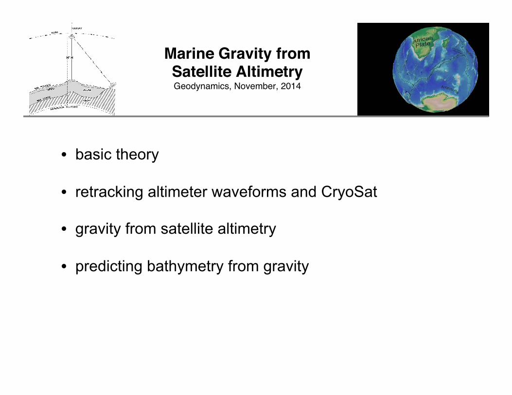
Marine Gravity from Satellite Altimetry Geodynamics, November, 2014
• basic theory • retracking altimeter waveforms and CryoSat
• gravity from satellite altimetry
• predicting bathymetry from gravity
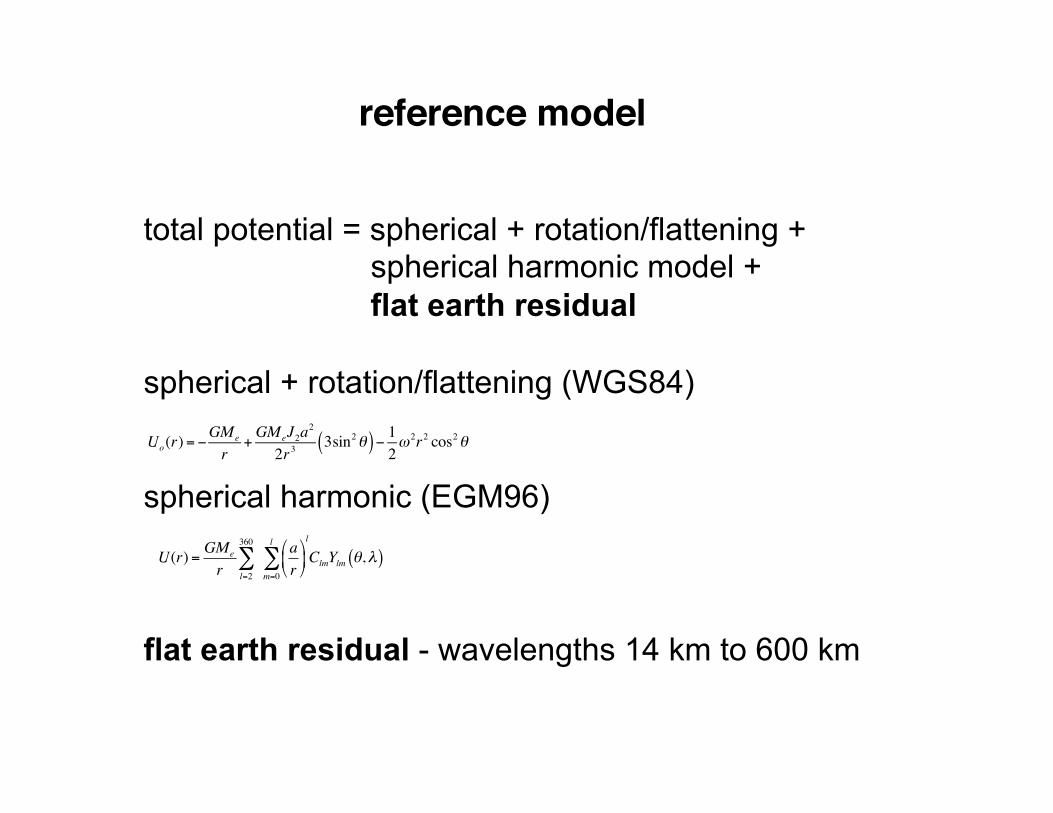
reference model
total potential = spherical + rotation/flattening + spherical harmonic model + flat earth residual
spherical + rotation/flattening (WGS84) spherical harmonic (EGM96) flat earth residual - wavelengths 14 km to 600 km
U(r) = GMe
r l=2
360
∑ ar"
#$%
&'
m=0
l
∑l
ClmYlm θ,λ( )
Uo(r)= −GMe
r+GMeJ2a
2
2r33sin2θ( )− 12ω
2r2 cos2θ
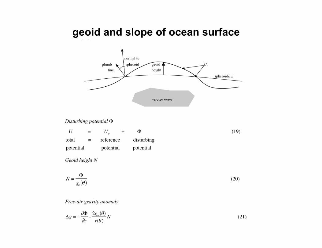
geoid and slope of ocean surface
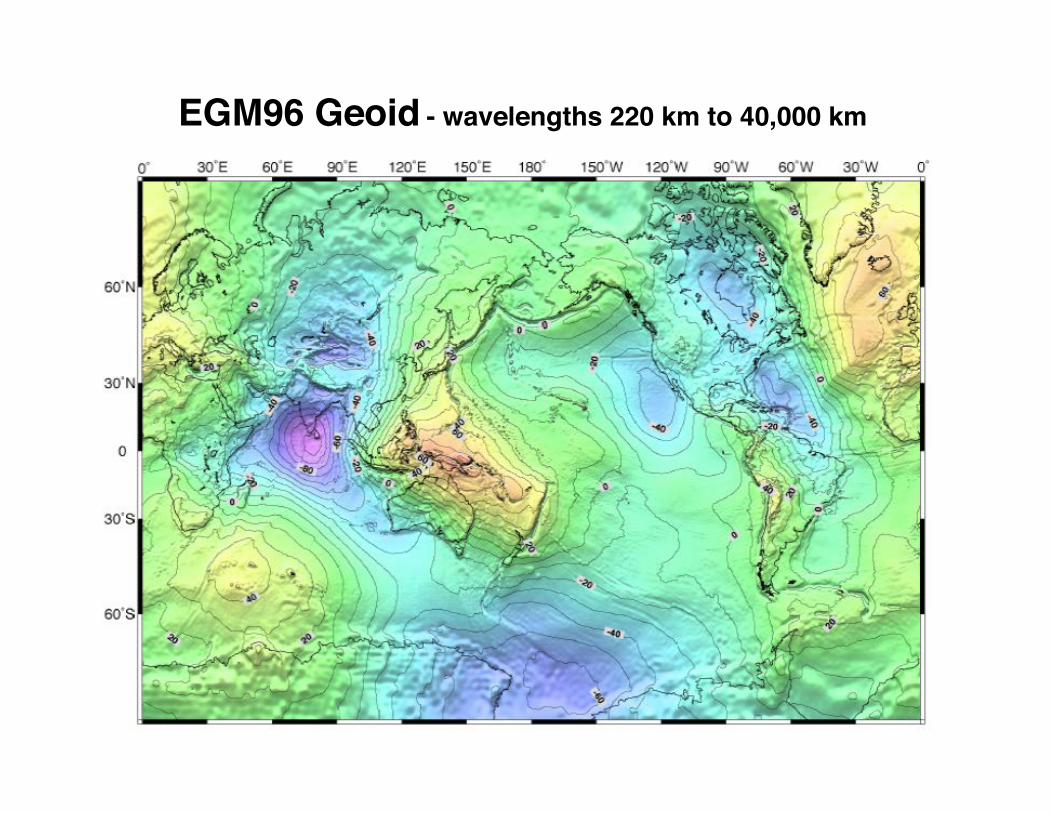
EGM96 Geoid - wavelengths 220 km to 40,000 km
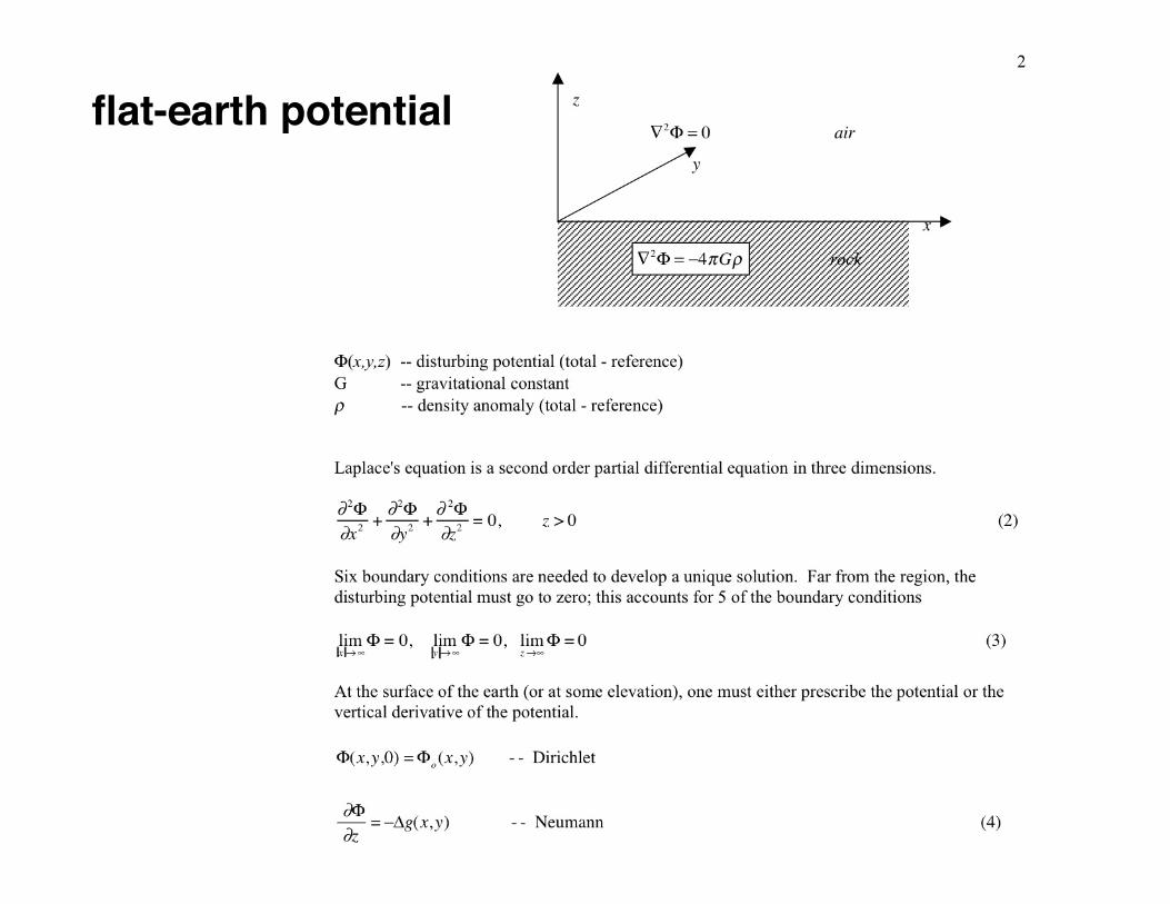
flat-earth potential
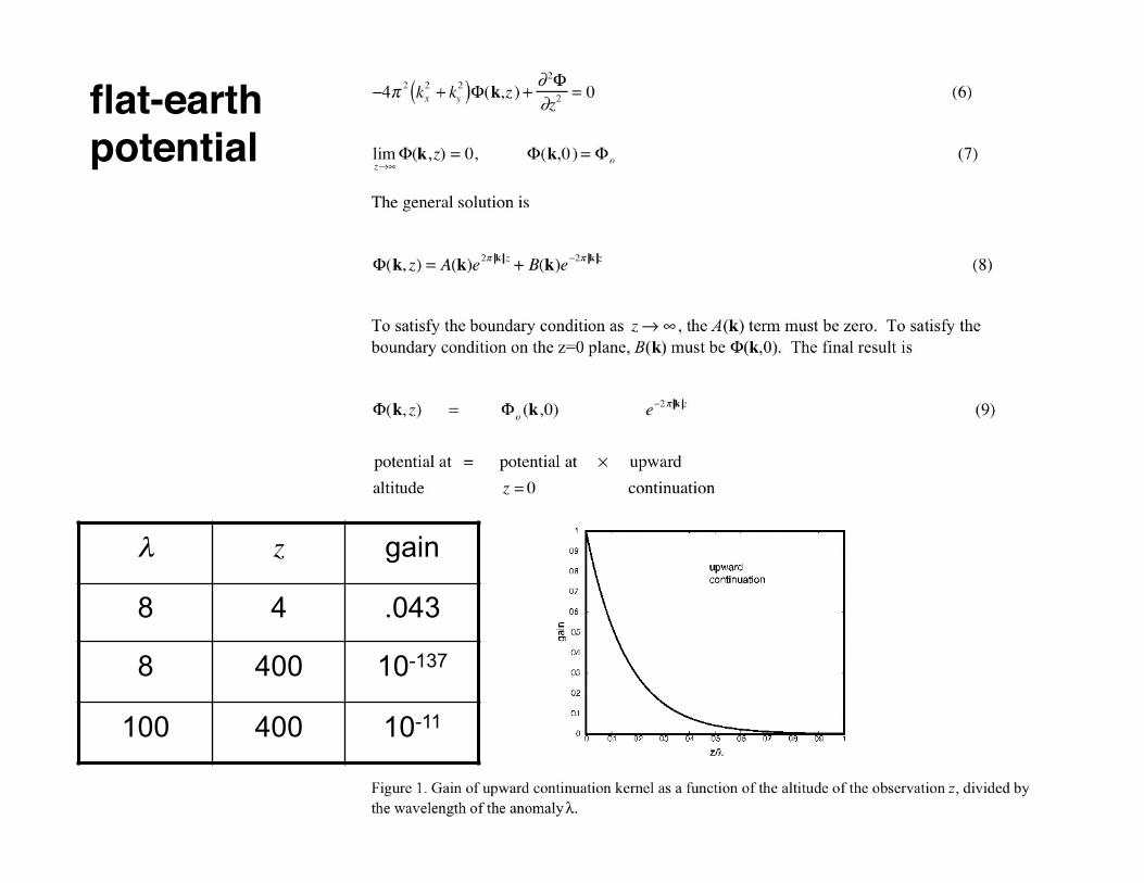
flat-earth potential
λ z gain
8 4 .043
8 400 10-137
100 400 10-11
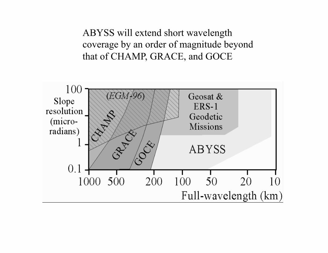
ABYSS will extend short wavelength coverage by an order of magnitude beyond that of CHAMP, GRACE, and GOCE
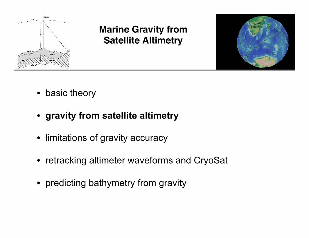
Marine Gravity from Satellite Altimetry
• basic theory
• gravity from satellite altimetry
• limitations of gravity accuracy
• retracking altimeter waveforms and CryoSat
• predicting bathymetry from gravity
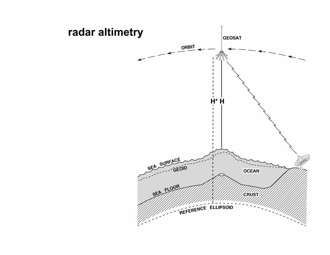
radar altimetry
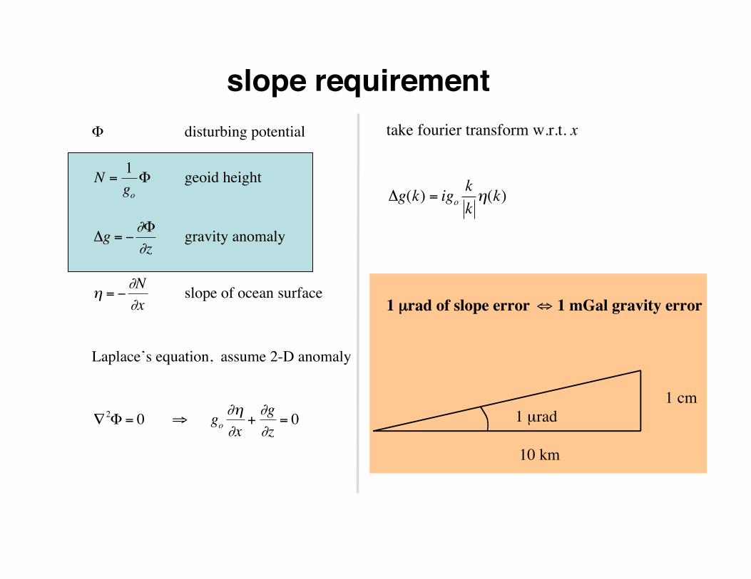
slope requirement Φ disturbing potential
€
N =1goΦ geoid height
€
Δg = −∂Φ∂z
gravity anomaly
€
η = −∂N∂x
slope of ocean surface
Laplace’s equation, assume 2-D anomaly
€
∇2Φ = 0 ⇒ go∂η∂x
+∂g∂z
= 0
take fourier transform w.r.t. x
€
Δg(k) = igokkη(k)
1 µrad of slope error
€
⇔ 1 mGal gravity error
1 cm 1 µrad
10 km
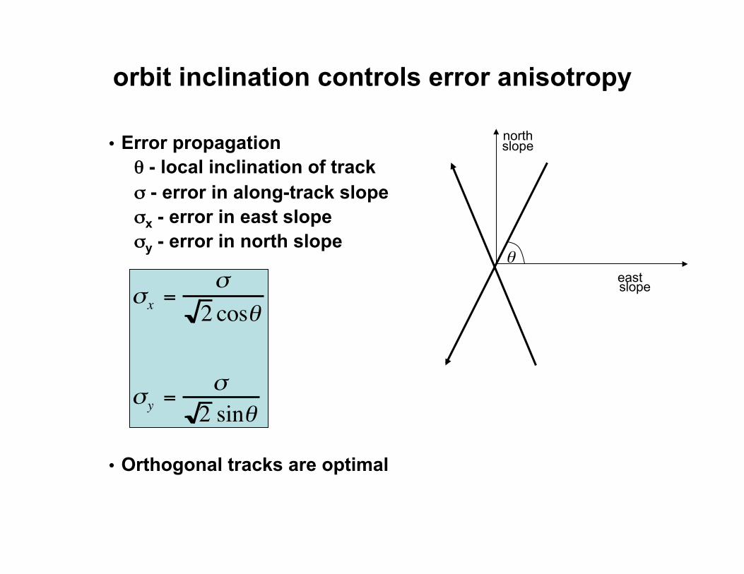
orbit inclination controls error anisotropy
• Error propagation θ - local inclination of track σ - error in along-track slope σx - error in east slope σy - error in north slope
• Orthogonal tracks are optimal
north slope θ east slopeσx =
σ2 cosθ
σy =σ2 sinθ
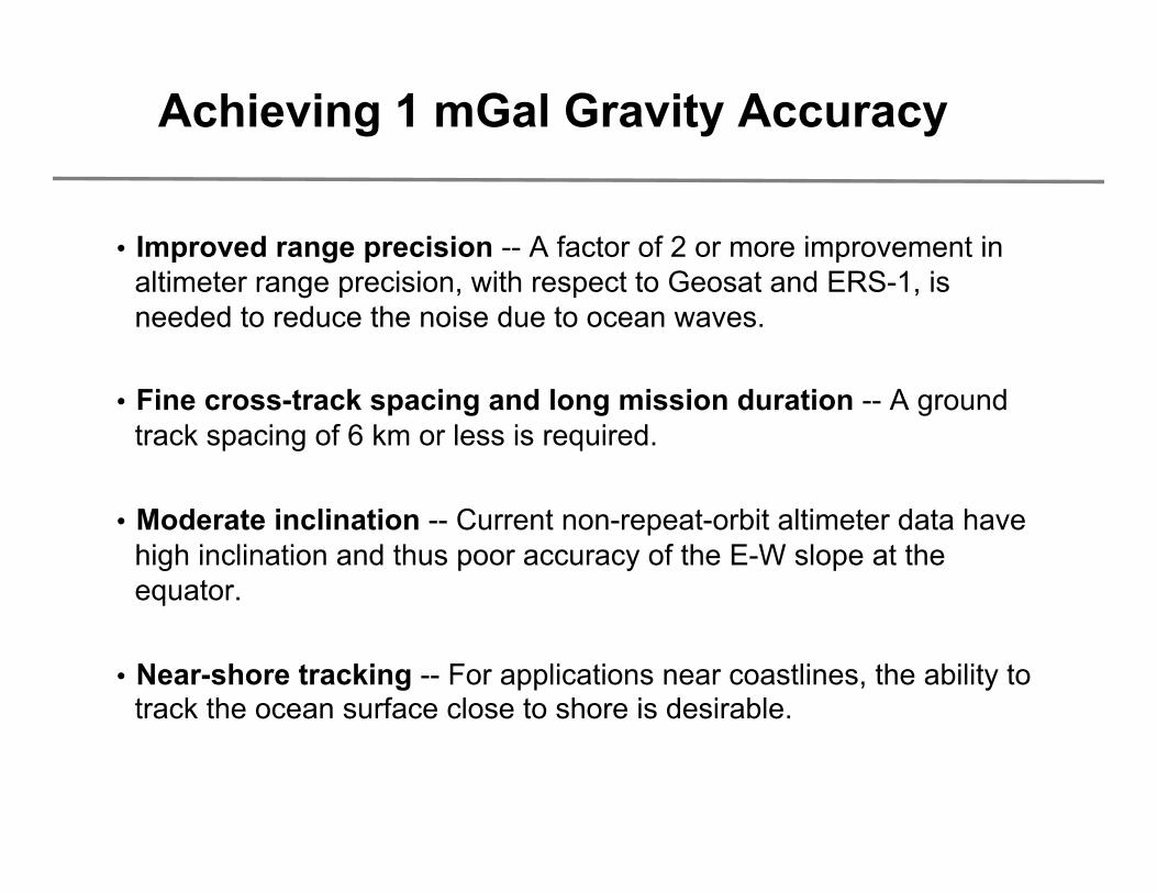
Achieving 1 mGal Gravity Accuracy
• Improved range precision -- A factor of 2 or more improvement in altimeter range precision, with respect to Geosat and ERS-1, is needed to reduce the noise due to ocean waves.
• Fine cross-track spacing and long mission duration -- A ground track spacing of 6 km or less is required.
• Moderate inclination -- Current non-repeat-orbit altimeter data have high inclination and thus poor accuracy of the E-W slope at the equator.
• Near-shore tracking -- For applications near coastlines, the ability to track the ocean surface close to shore is desirable.
Marine Gravity from Satellite Altimetry Geodynamics, November, 2014
• basic theory • retracking altimeter waveforms and CryoSat
• gravity from satellite altimetry
• predicting bathymetry from gravity
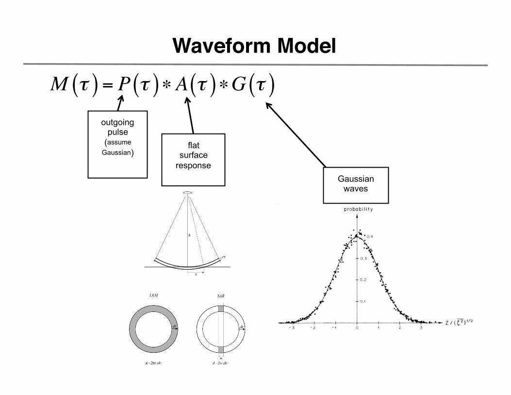
Waveform Model
M τ( ) = P τ( )∗A τ( )∗G τ( )outgoing
pulse (assume
Gaussian)
Gaussian waves
flat surface
response
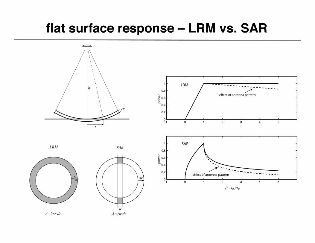
flat surface response – LRM vs. SAR
Estimate 3 parameters: arrival time (τ), rise time (σ), and power (A).
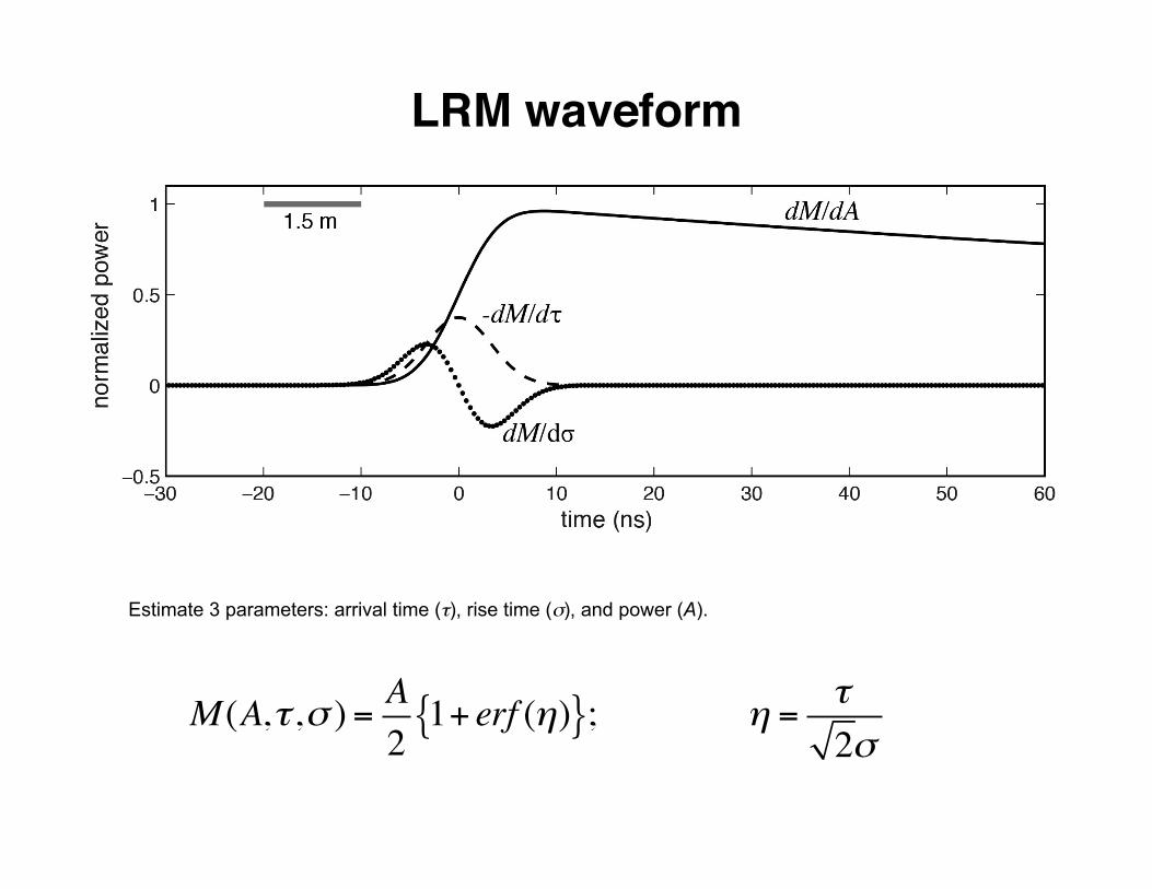
LRM waveform
M (A,τ ,σ ) = A2
1+ erf (η){ }; η = τ2σ

Estimate 3 parameters: arrival time (τ), rise time (σ), and power (A).
SAR waveform
M (A,τ ,σ )= A2exp −
14z2
$
%&
'
()D−1/2 z( ); z =
τσ
D – parabolic cylinder function
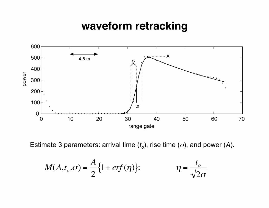
Estimate 3 parameters: arrival time (to), rise time (σ), and power (A).
waveform retracking
€
M(A,to,σ ) =A2
1+ erf (η){ }; η =to2σ
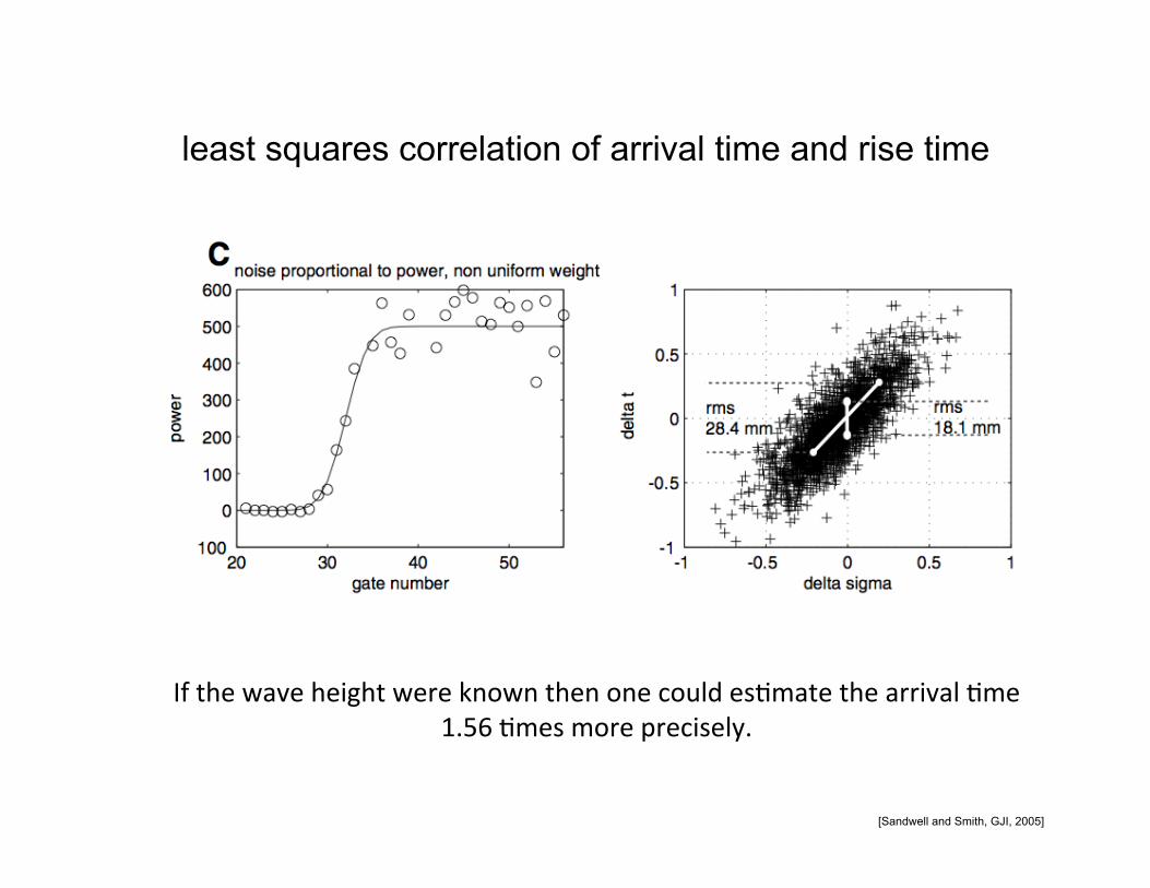
least squares correlation of arrival time and rise time
If the wave height were known then one could es5mate the arrival 5me 1.56 5mes more precisely.
[Sandwell and Smith, GJI, 2005]
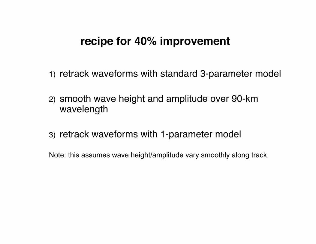
recipe for 40% improvement
1) retrack waveforms with standard 3-parameter model
2) smooth wave height and amplitude over 90-km wavelength
3) retrack waveforms with 1-parameter model
Note: this assumes wave height/amplitude vary smoothly along track.
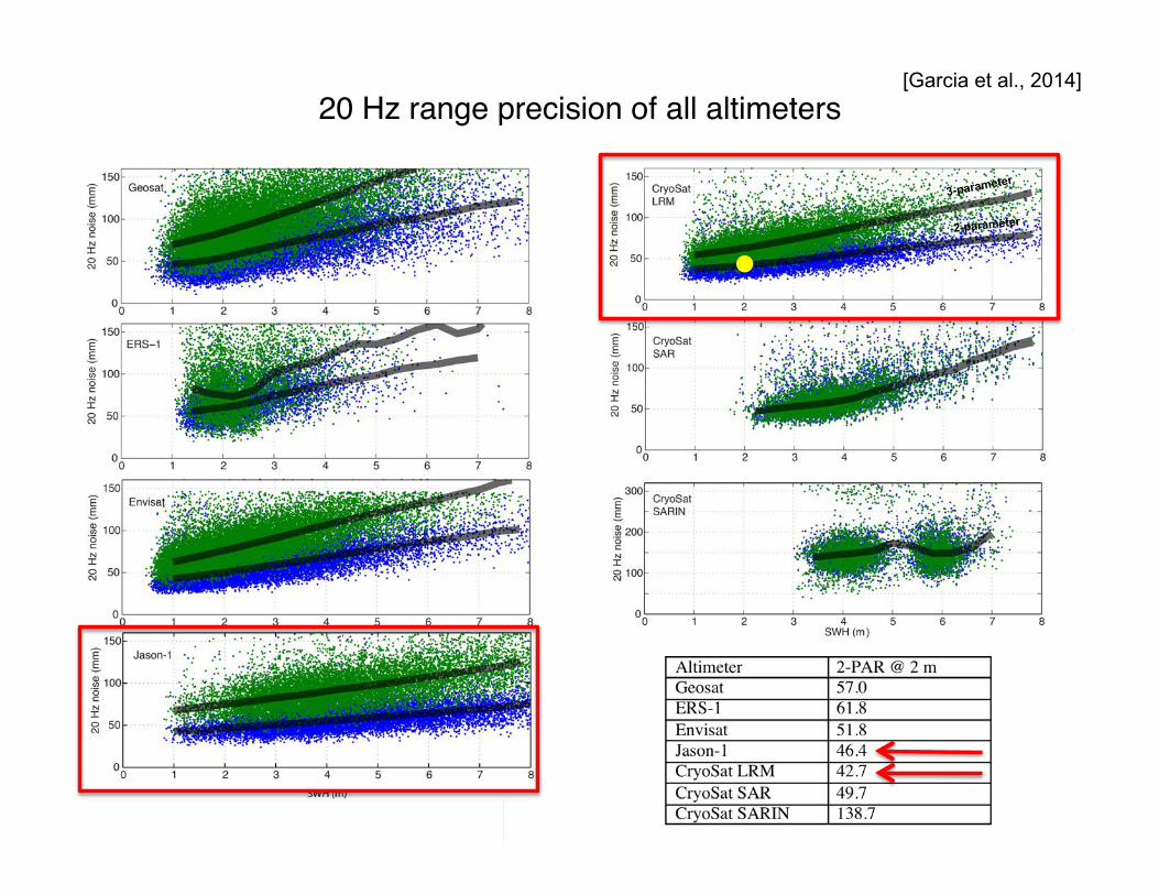
20 Hz range precision of all altimeters
3-parameter
2-parameter
[Garcia et al., 2014]
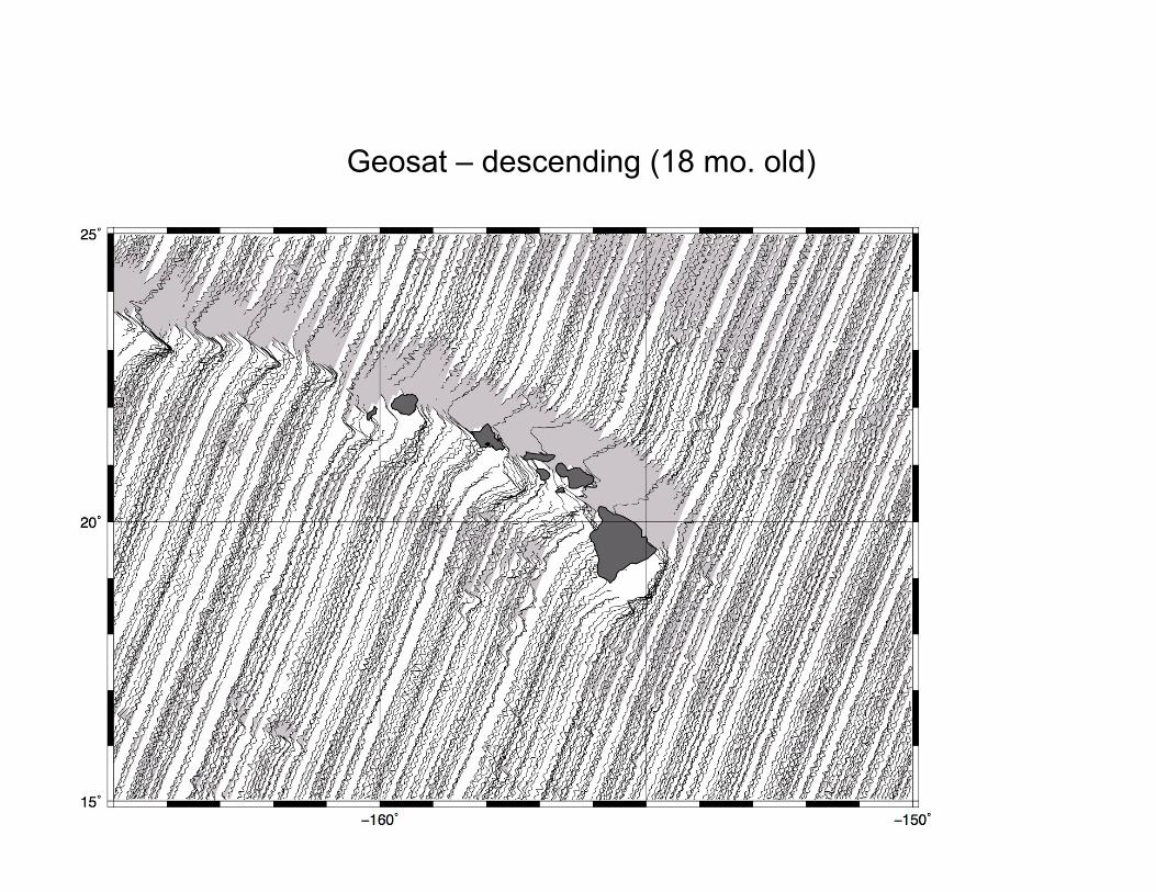
Geosat – descending (18 mo. old)
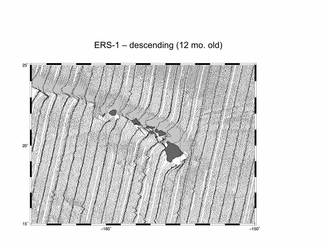
ERS-1 – descending (12 mo. old)
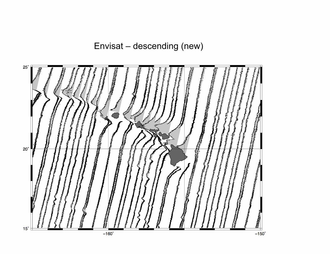
Envisat – descending (new)
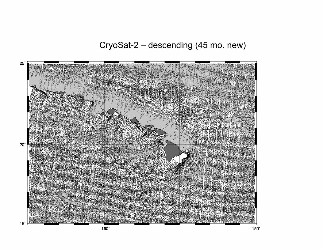
CryoSat-2 – descending (45 mo. new)
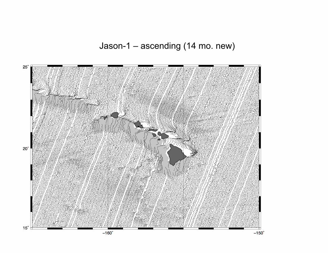
Jason-1 – ascending (14 mo. new)
Marine Gravity from Satellite Altimetry Geodynamics, November, 2014
• basic theory • retracking altimeter waveforms and CryoSat
• gravity from satellite altimetry
• predicting bathymetry from gravity
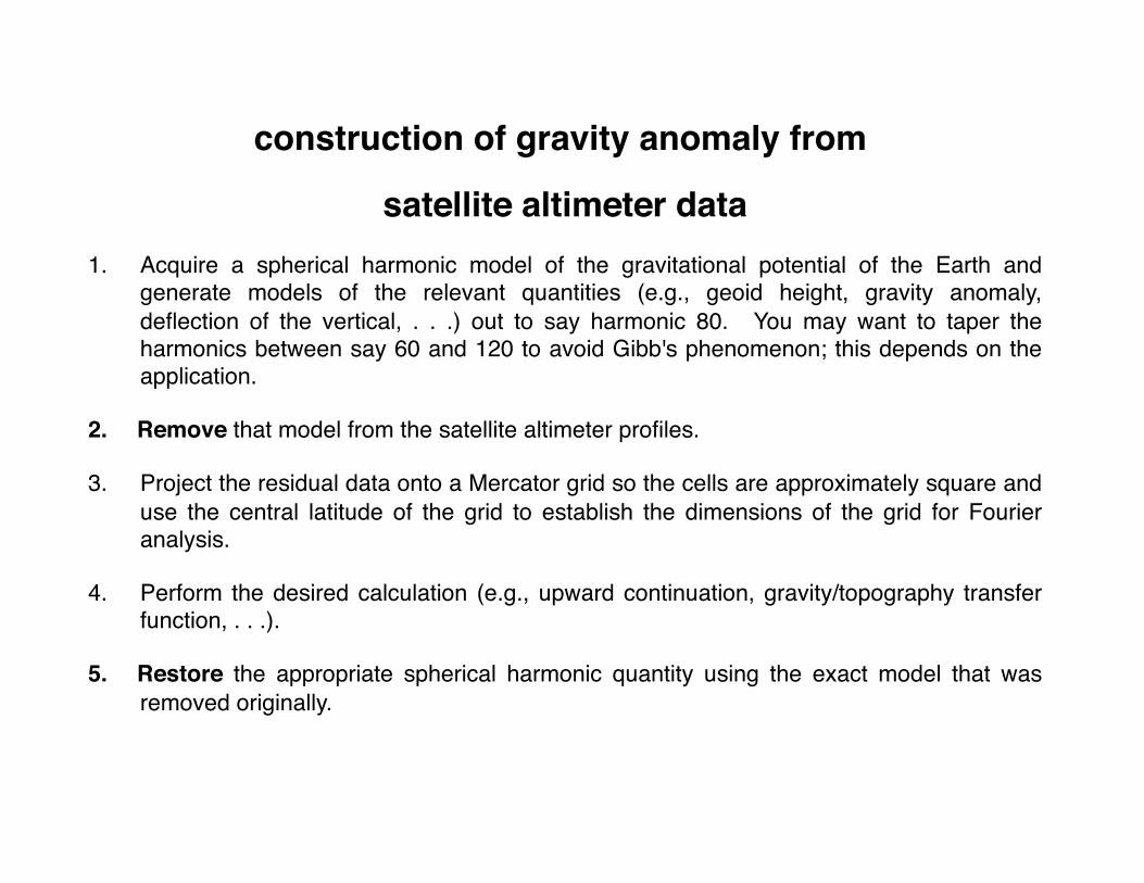
construction of gravity anomaly from
satellite altimeter data1. Acquire a spherical harmonic model of the gravitational potential of the Earth and
generate models of the relevant quantities (e.g., geoid height, gravity anomaly, deflection of the vertical, . . .) out to say harmonic 80. You may want to taper the harmonics between say 60 and 120 to avoid Gibb's phenomenon; this depends on the application.
2. Remove that model from the satellite altimeter profiles.
3. Project the residual data onto a Mercator grid so the cells are approximately square and use the central latitude of the grid to establish the dimensions of the grid for Fourier analysis.
4. Perform the desired calculation (e.g., upward continuation, gravity/topography transfer function, . . .).
5. Restore the appropriate spherical harmonic quantity using the exact model that was removed originally.
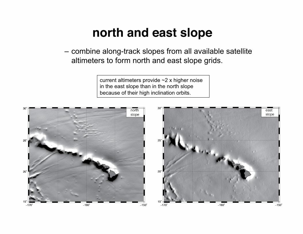
– combine along-track slopes from all available satellite altimeters to form north and east slope grids.
current altimeters provide ~2 x higher noise in the east slope than in the north slope because of their high inclination orbits.
north and east slope
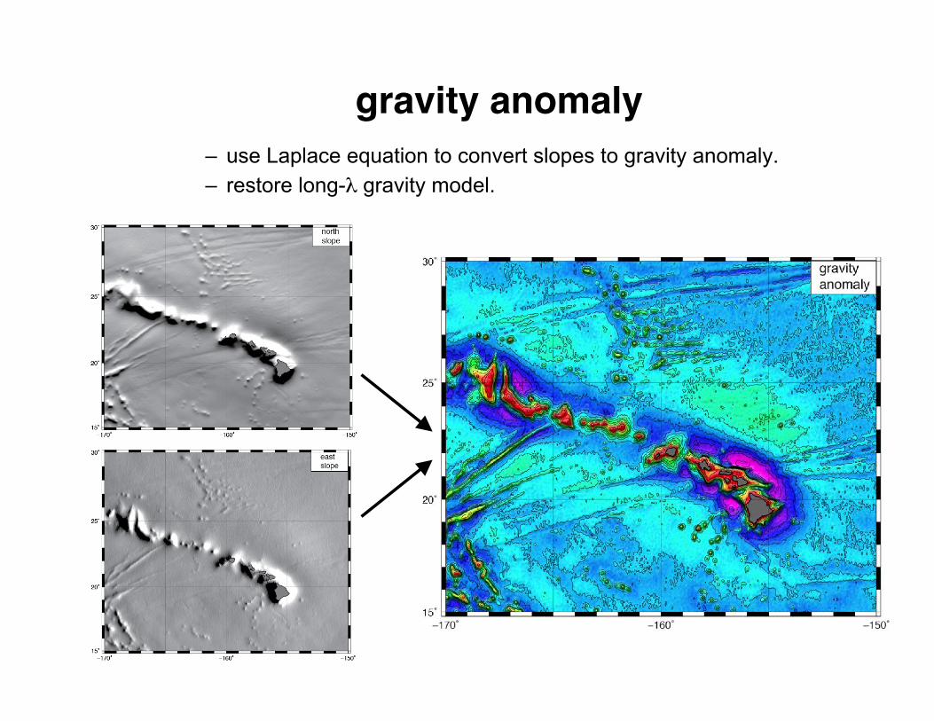
gravity anomaly
– use Laplace equation to convert slopes to gravity anomaly. – restore long-λ gravity model.
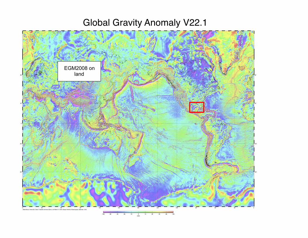
Global Gravity Anomaly V22.1
EGM2008 on land
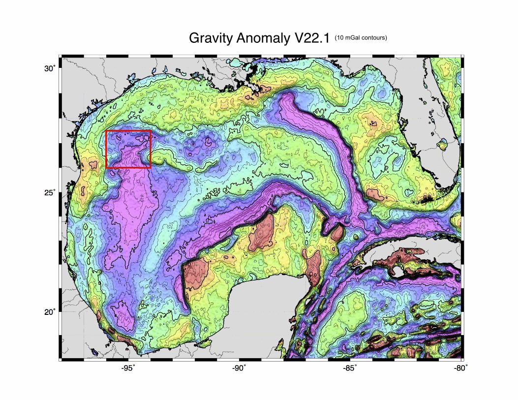
Gravity Anomaly V22.1 (10 mGal contours)

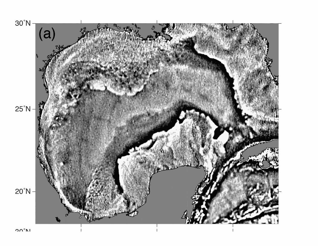
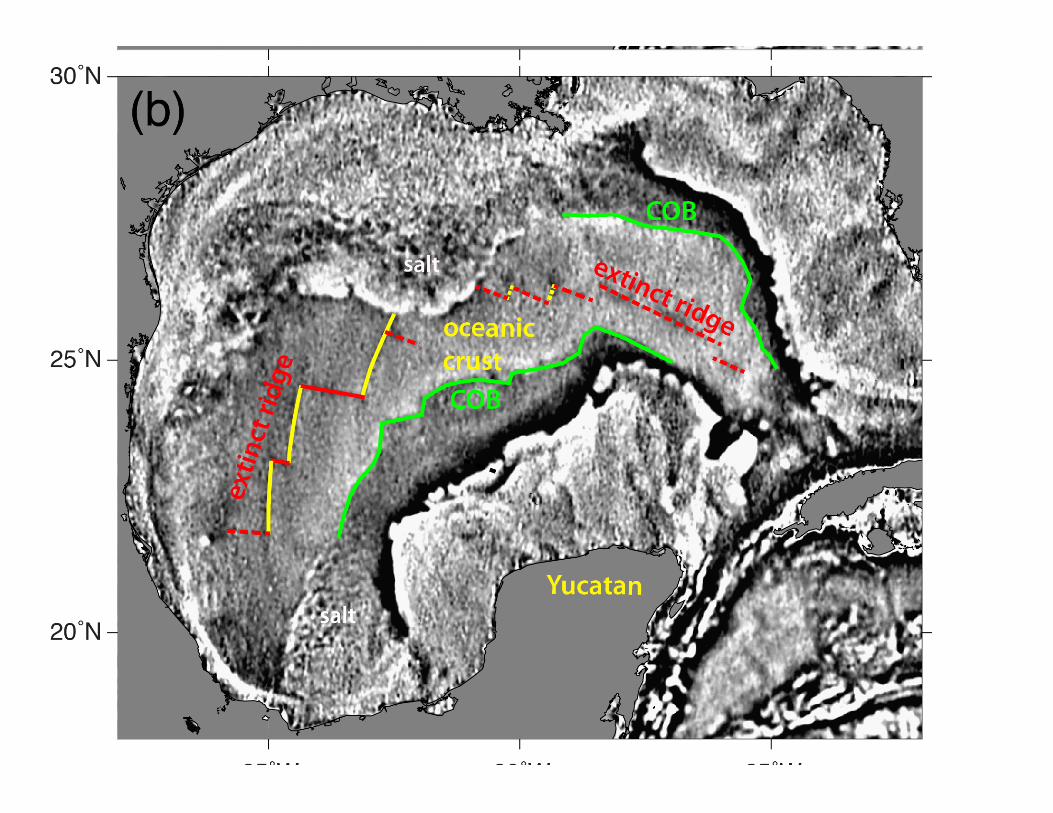
GPS Navigated Gravity survey of Alaminos Canyon (Alan Herring, personal communication, Dec. 2011.)
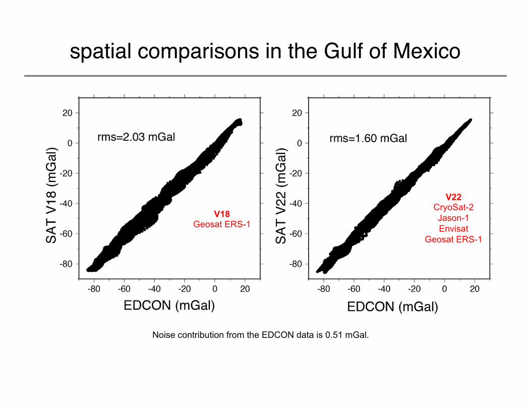
spatial comparisons in the Gulf of Mexico
Noise contribution from the EDCON data is 0.51 mGal.
V18 Geosat ERS-1
V22 CryoSat-2 Jason-1 Envisat
Geosat ERS-1
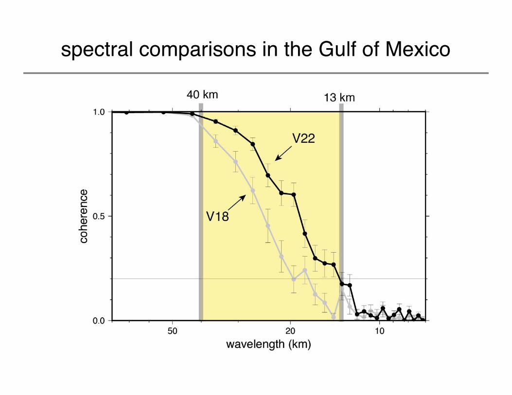
spectral comparisons in the Gulf of Mexico

Blind comparison of altimetry gravity (V22) with 30 million of NGA’s “BEST” shipboard gravity measurements.
Analysis performed by John Factor at NGA, February, 2014.
Shallow gravity errors 3.58 mGal >> deep ocean gravity errors 2.31 mGal.
NGA shipboard data has 1-2 mgal error so mean error of SSV22 is ~2 mGal.
NGA Accuracy Assessment
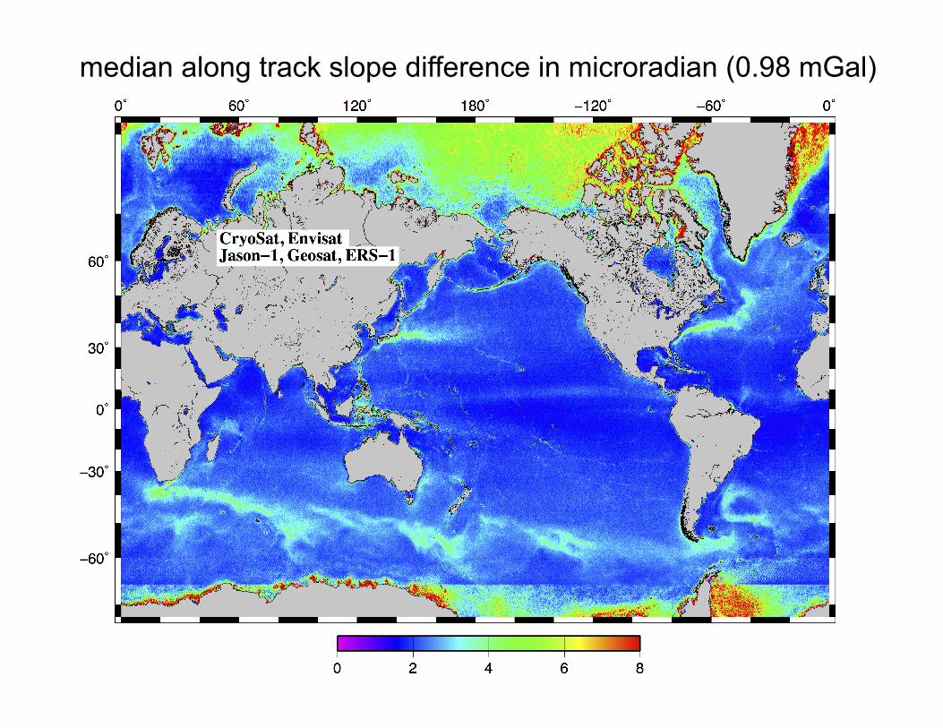
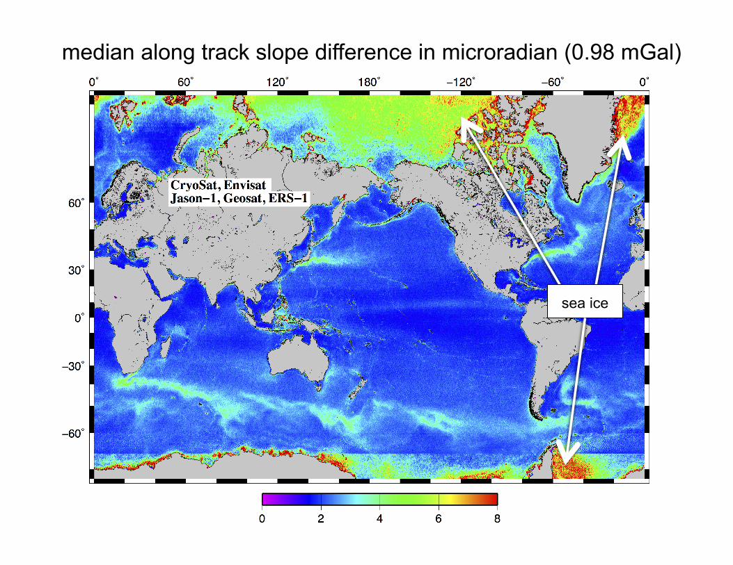
median along track slope difference in microradian (0.98 mGal)
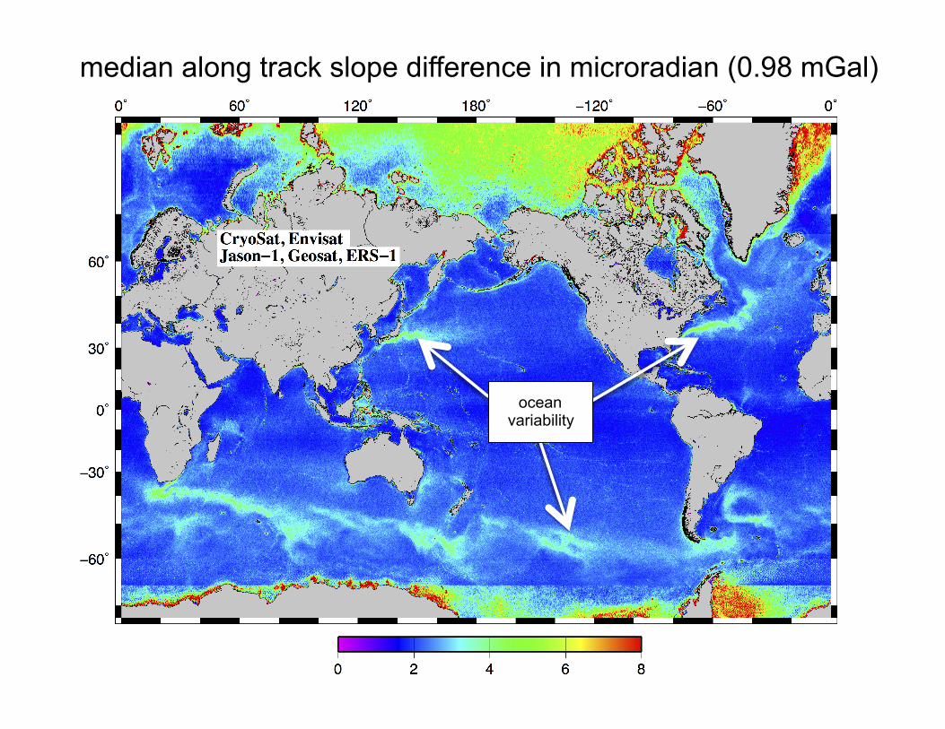
median along track slope difference in microradian (0.98 mGal)
sea ice
median along track slope difference in microradian (0.98 mGal)
ocean variability
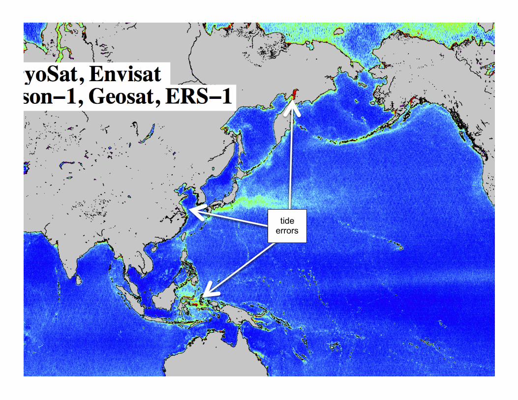
tide errors
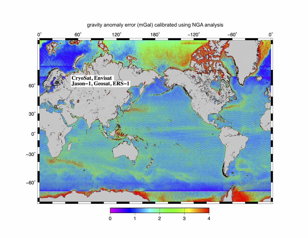
gravity anomaly error (mGal) calibrated using NGA analysis
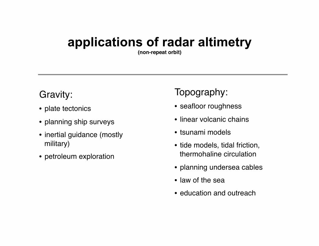
applications of radar altimetry(non-repeat orbit)
Gravity:• plate tectonics
• planning ship surveys• inertial guidance (mostly
military)• petroleum exploration
Topography:• seafloor roughness
• linear volcanic chains• tsunami models• tide models, tidal friction,
thermohaline circulation
• planning undersea cables• law of the sea• education and outreach

old V18
tectonics buried by sediments
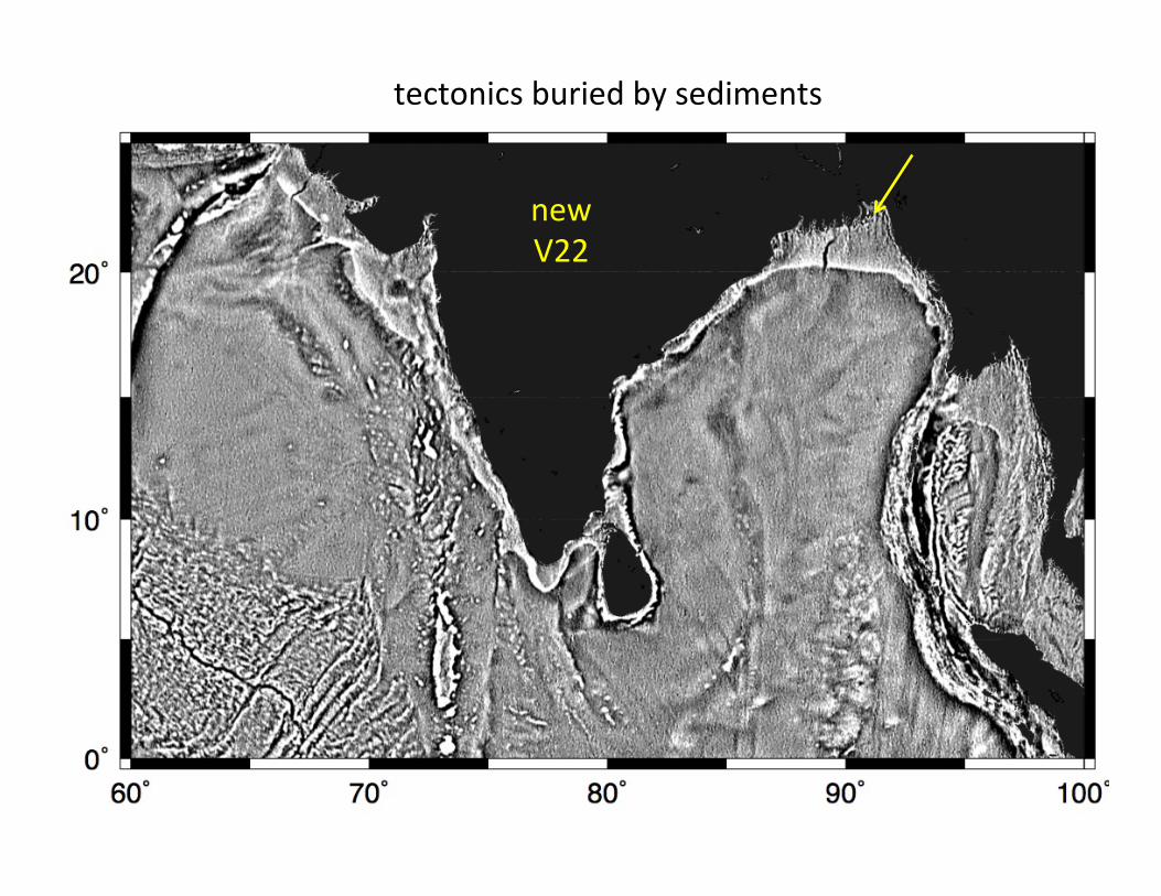
new V22
tectonics buried by sediments

new V22
tectonics buried by sediments
Marine Gravity from Satellite Altimetry Geodynamics, November, 2014
• basic theory • retracking altimeter waveforms and CryoSat
• gravity from satellite altimetry
• predicting bathymetry from gravity
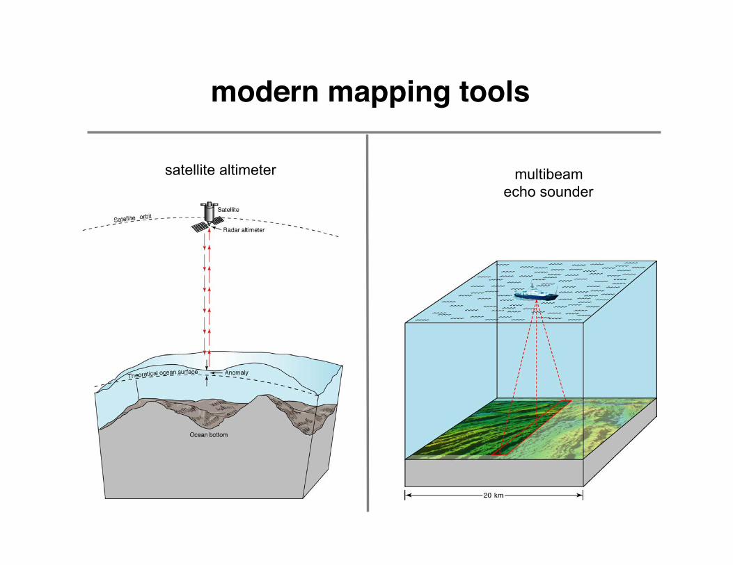
modern mapping tools
multibeam echo sounder
satellite altimeter
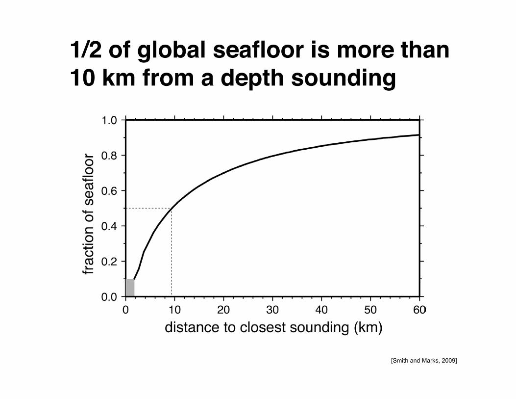
[Smith and Marks, 2009]
1/2 of global seafloor is more than 10 km from a depth sounding
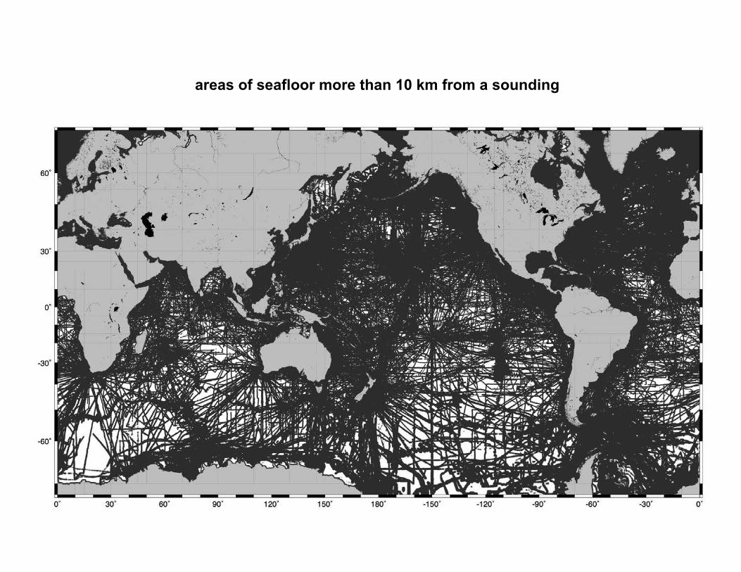
areas of seafloor more than 10 km from a sounding
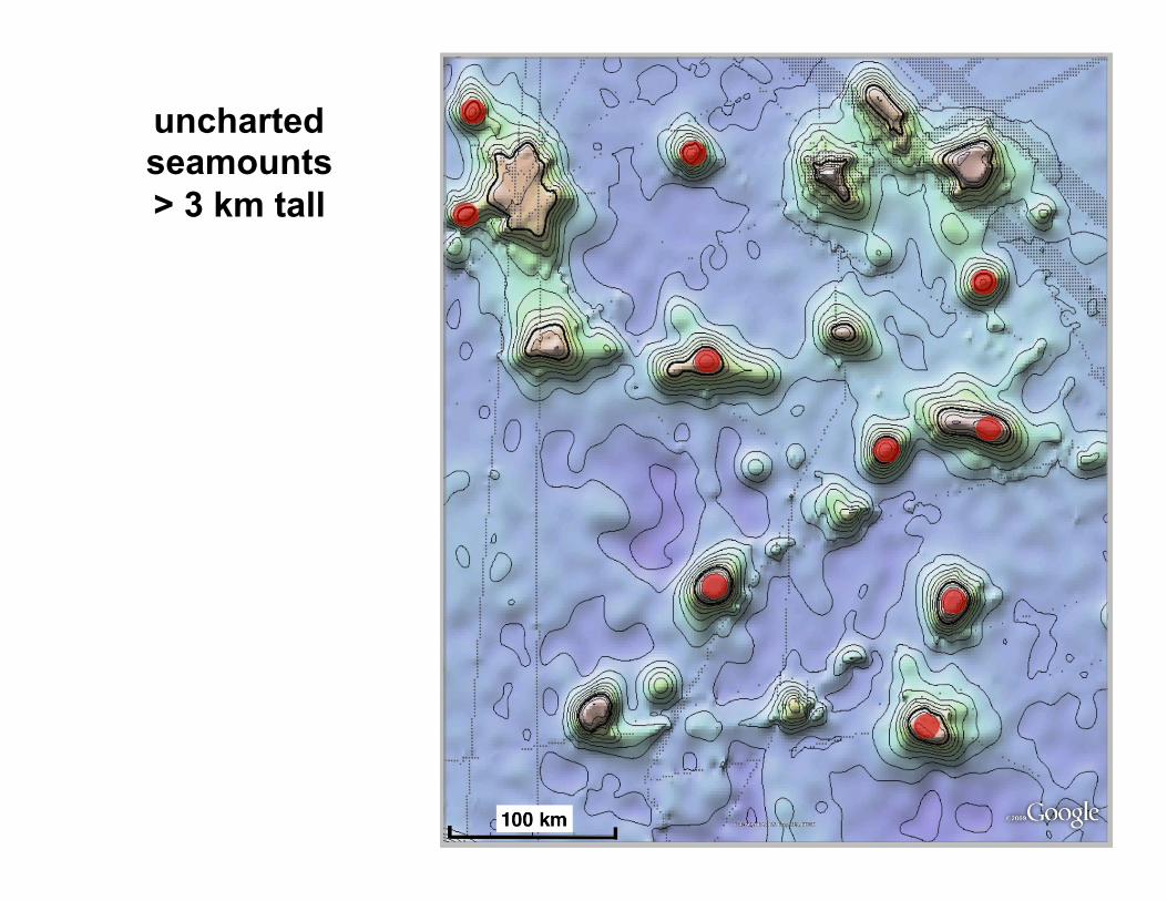
uncharted seamounts > 3 km tall
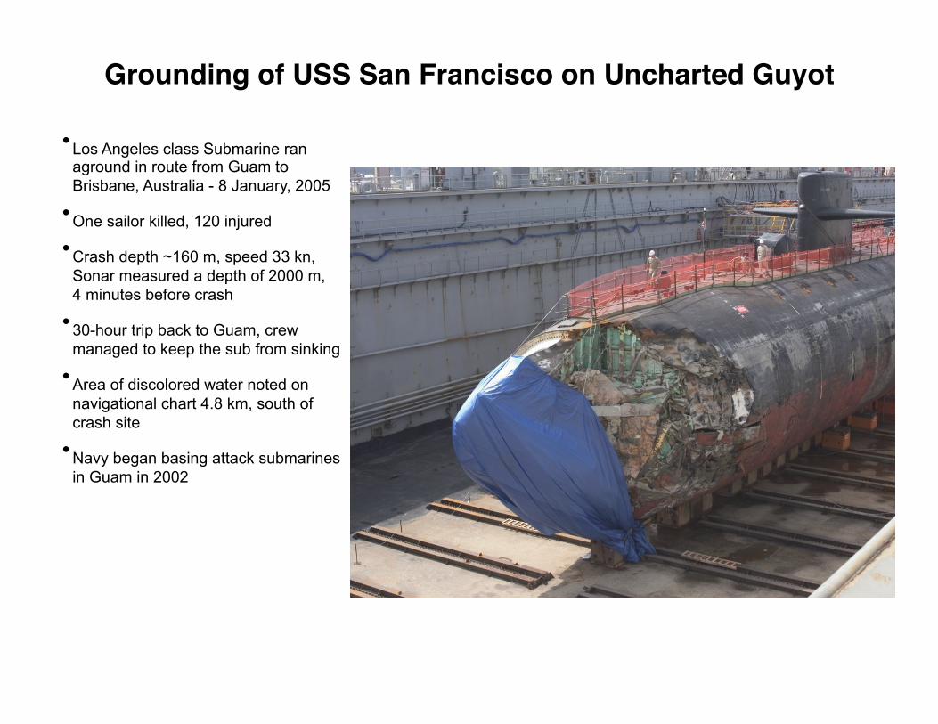
Grounding of USS San Francisco on Uncharted Guyot
• Los Angeles class Submarine ran aground in route from Guam to Brisbane, Australia - 8 January, 2005
• One sailor killed, 120 injured
• Crash depth ~160 m, speed 33 kn, Sonar measured a depth of 2000 m, 4 minutes before crash
• 30-hour trip back to Guam, crew managed to keep the sub from sinking
• Area of discolored water noted on navigational chart 4.8 km, south of crash site
• Navy began basing attack submarines in Guam in 2002
Google Earth

SRTM30_PLUS & sounding coverage
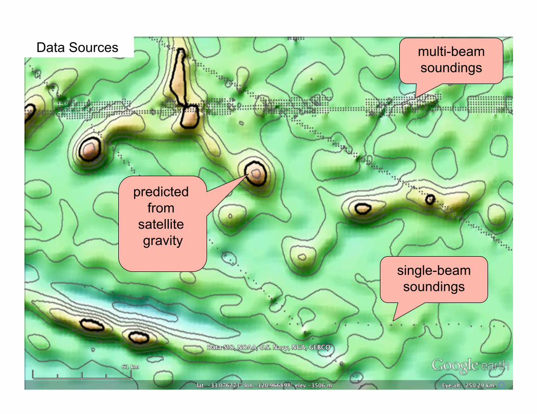
Data Sources multi-beam soundings
single-beam soundings
predicted from
satellite gravity

How can we do better?
• Improve public archives of bathymetry.
• Map the oceans with multibeam echosounders - ships of opportunity.
• Acquire new satellite altimeter data.
• Declassify US Navy bathymetry data.

Capetown to Punta Arenas - Melville – March, 2011
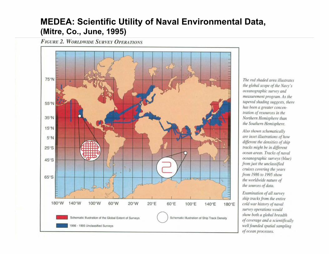
MEDEA: Scientific Utility of Naval Environmental Data, (Mitre, Co., June, 1995)
Conclusions
• “Newer” altimeters have 1.4 times better range precision and 2 times better coverage.
• 2-pass waveform retracking provides 1.5 times range precision for all altimeters.
• Marine gravity accuracy is currently 1.6 – 3.5 mGal with most improvement in the 13 – 40 km wavelength band.
• Gravity accuracy is now limited by sea ice, ocean variability, and coastal tides.
• 16% of seafloor has been mapped by ships.
• 50% of the seafloor lies more than 10 km from a depth sounding.