Embed Size (px)
Citation preview
Mapskills
How do we use maps?

Contents
What are maps? Compasses . . .
Using Direction Map symbols
4 Figure Grid Refs 6 Figure Grid Refs
Finding heights Distance & Scale
Describing Routes
Practice . . . .

What are maps?
What do you see on the cow? Maps are a way for us to see what the world looks like. It is a method that geographers use to locate different things and to help us find our way from one place to another

FACT: You have probably all used
maps at some time in your life!
Have a brainstorming session with a
partner to try and think where you have
used a map in the past
Look at the following 5 maps and write down what and where you think they show
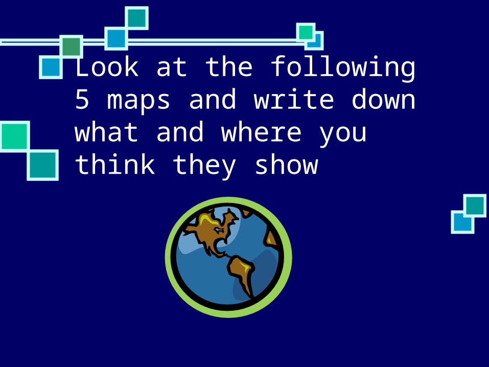
Map 1: Where is this and what does it show?

Map 2: Where is this and what does it show?
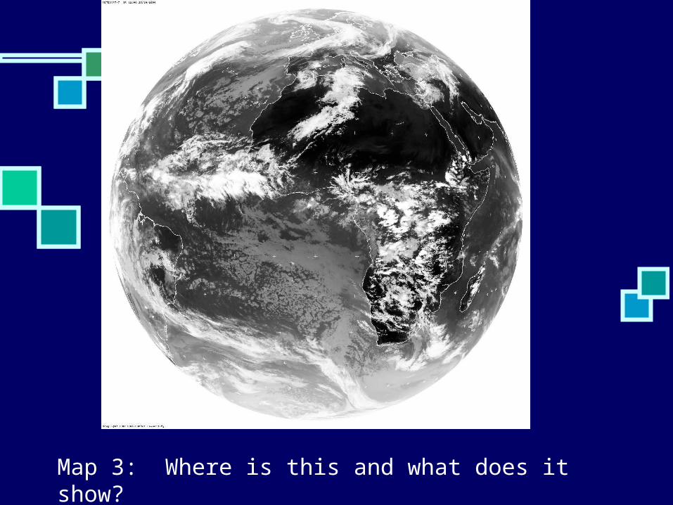
Map 3: Where is this and what does it show?
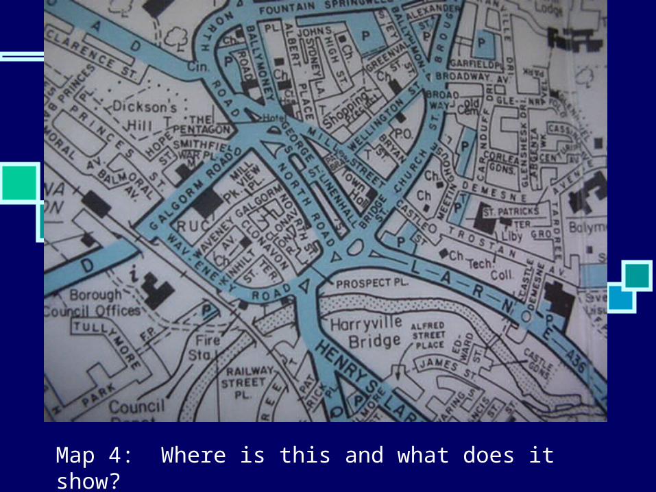
Map 4: Where is this and what does it show?
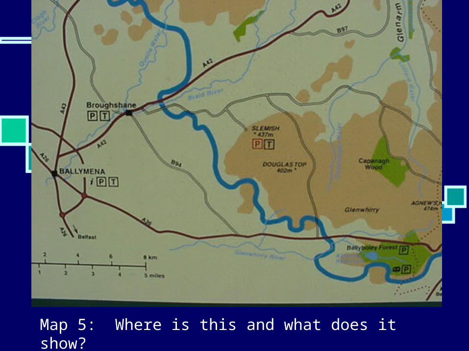
Map 5: Where is this and what does it show?

So where are those places? Map 1 is the Mappa
Geographica which is a map of the world and was drawn in 1703
Map 2 is Northern Ireland and the map shows the main towns and roads
Map 3 is a Satellite Image of the World taken in 2001
Map 4 is a street map of Ballymena, drawn in 1995
Map 5 is a map of the Ballymena area towards Slemish and shows some of the local physical features
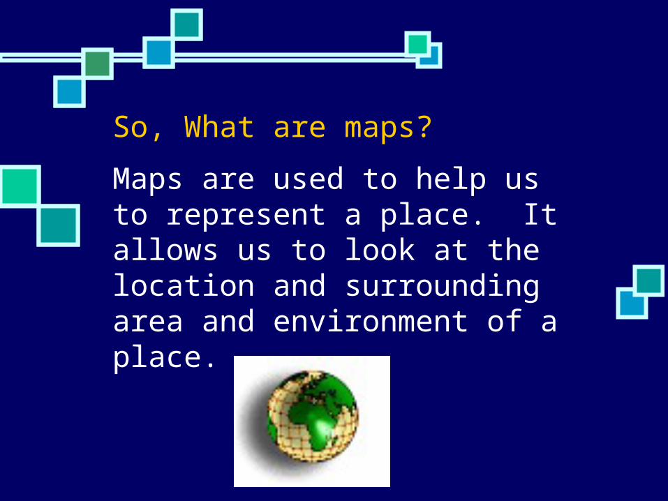
So, What are maps?Maps are used to help us to represent a place. It allows us to look at the location and surrounding area and environment of a place.

Compasses
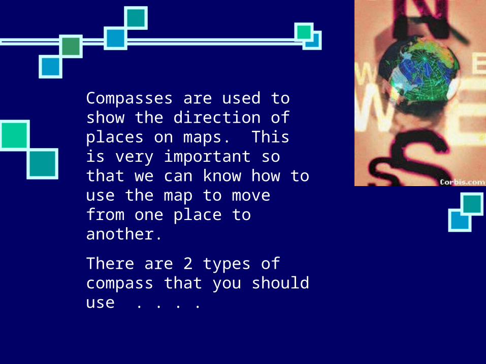
Compasses are used to show the direction of places on maps. This is very important so that we can know how to use the map to move from one place to another.
There are 2 types of compass that you should use . . . .
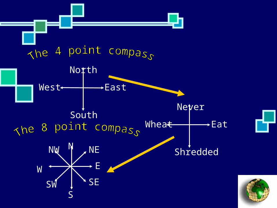
North
East
South
West
Never
Eat
Shredded
Wheat
N
E
S
W
NE
SESW
NW
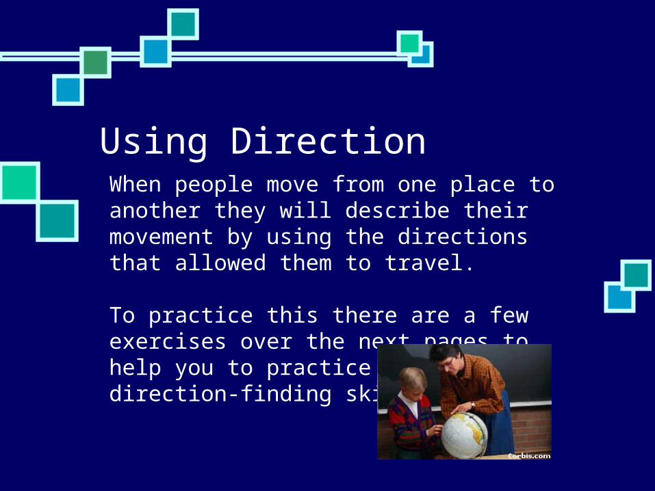
Using Direction When people move from one place to another they will describe their movement by using the directions that allowed them to travel.
To practice this there are a few exercises over the next pages to help you to practice your direction-finding skills.

Use Direction sheet 1 and answer the questions
North
East
South
West
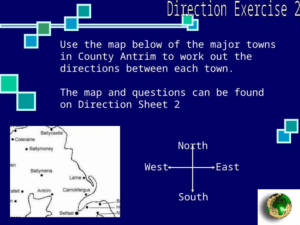
Use the map below of the major towns in County Antrim to work out the directions between each town.
The map and questions can be found on Direction Sheet 2
North
East
South
West

How do we use map symbols?
Page 112 and 113 in Key Geography – New Foundations

Why do we use symbols? When drawing a map to scale it is
important to include as much detail as possible – however not all the detail will fit on the map so we have to use a key of different symbols, abbreviations and letters to represent the main items on the map

Think about it this way . . . .
Imagine that you have to draw a map that shows the route from your house to the school – but you are not allowed any words . . .this means that we need to use symbols to show what we would pass on the way . . .
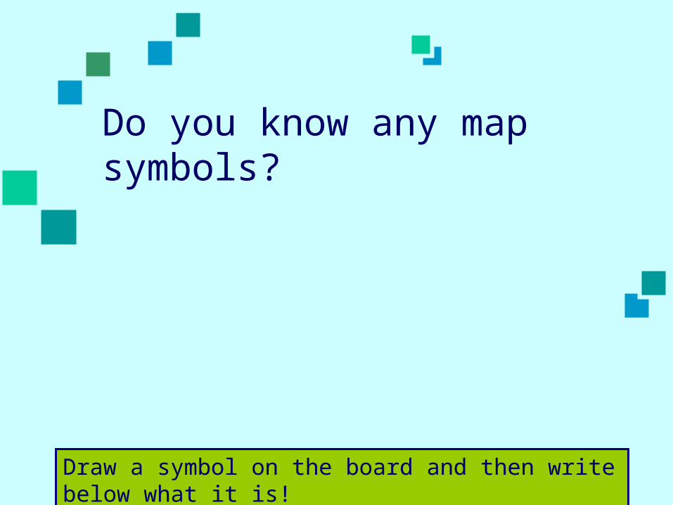
Do you know any map symbols?
Draw a symbol on the board and then write below what it is!

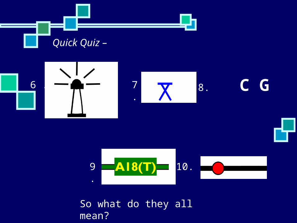
Quick Quiz – On a page at the back of your book - write down what you think of the following symbols means
There are 10 of these to guess – if you don’t have an idea - have a go! But do remember that you are trying to think of things that might be shown on a map!
1. 2. 3.
4.5.
Quick Quiz –
6 . 7. 8. C G
9. 10.
So what do they all mean?
. . .
1. 2. 3.
4.5.
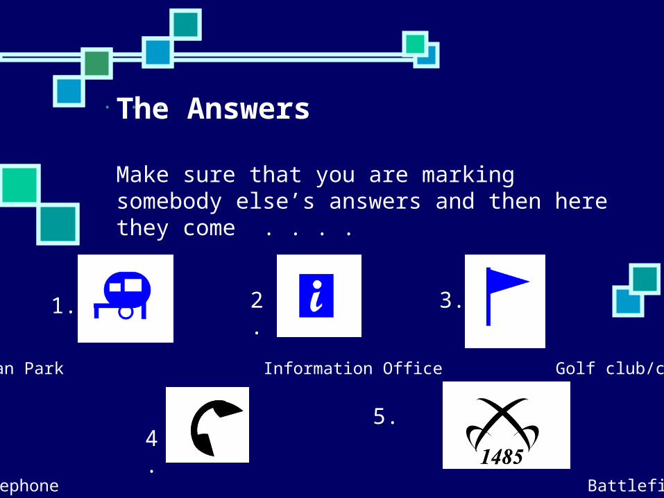
Caravan Park Information Office Golf club/course
Telephone Battlefield site
The Answers
Make sure that you are marking somebody else’s answers and then here they come . . . .
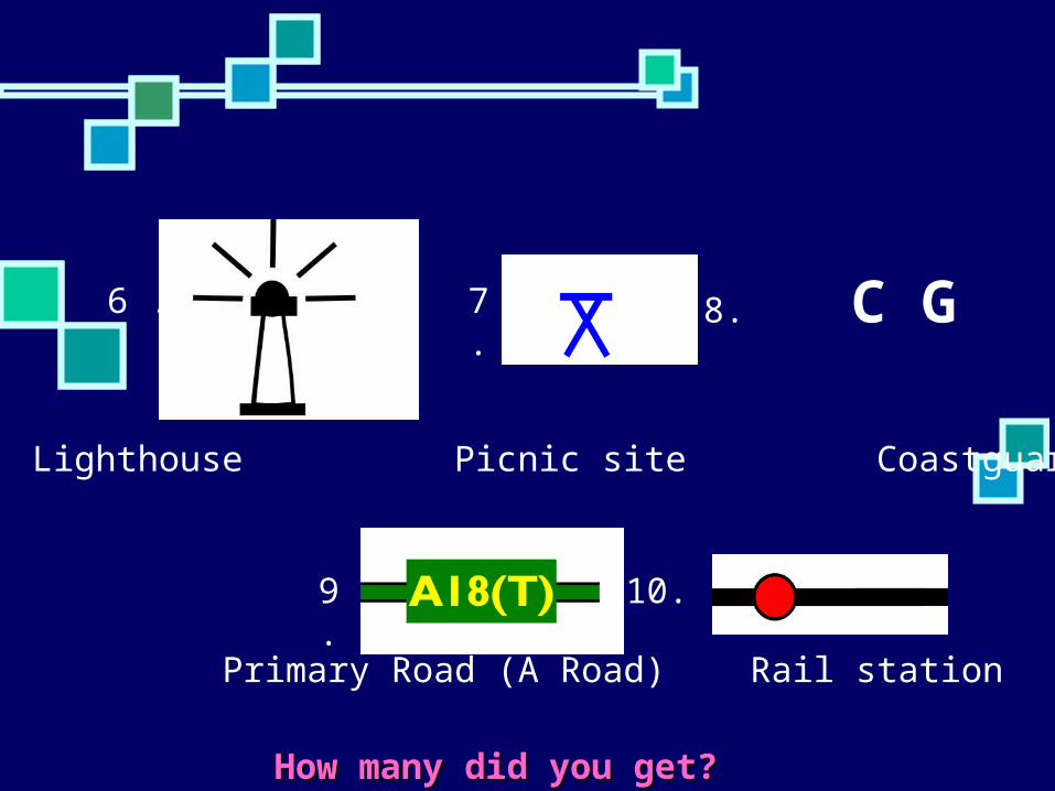
6 . 7. 8. C G
9. 10.
How many did you get?How many did you get?
Lighthouse Picnic site Coastguard
Primary Road (A Road) Rail station

Now you need to look at the list of the main map symbols These can be found at Page 124 in
your textbook They can be found on most OS maps Or you will be given a sheet with the
same symbols on it You need to learn some of the main
symbols for homework

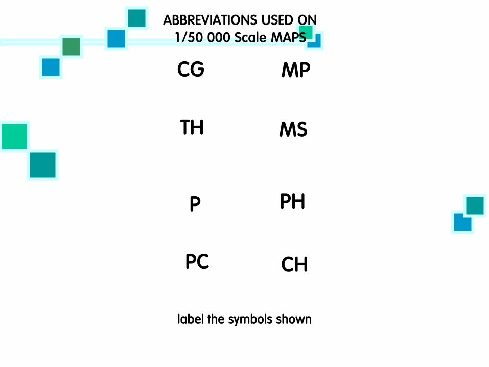
Homework for Learn 4 of the sections of the symbols Tourist Information Water features General Features Abbreviations & Antiquities

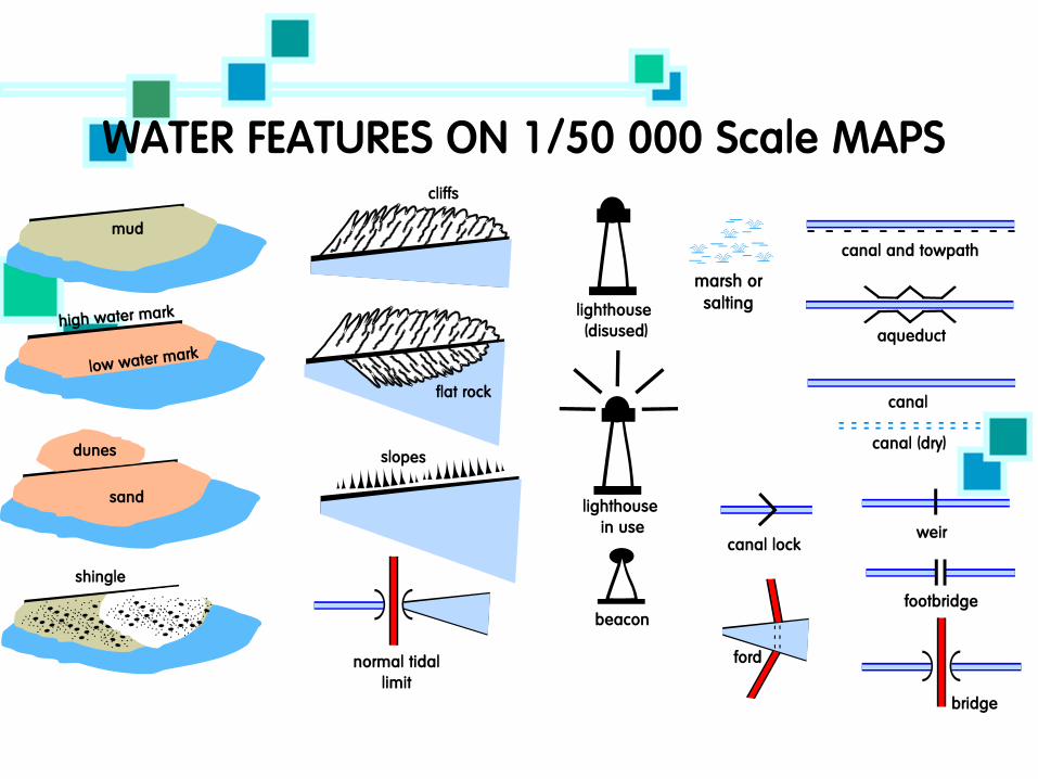
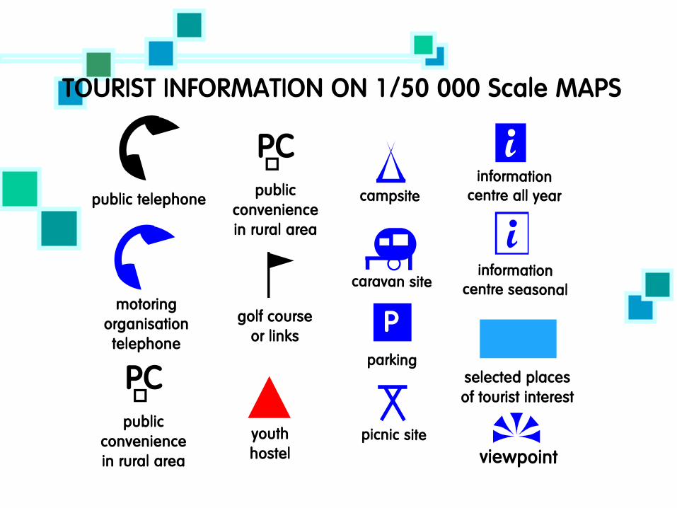


This is an Ordnance Survey map of the area around Ballymena. What different symbols can you see on this map?
Symbols Activity 1
Use the map from the previous slide and along with Symbols sheet 1, answer the questions about the use of symbols on local maps.

Symbols Activity 2 Draw a map of the area where you live on A3 paper and try to include as much detail as possible. You must note all of the key features in the area – phone boxes, buildings, roads, railway lines, bus stations etc.
The only problem is that you must draw this map using ONLY the symbols that you have learnt and been shown

How can we use 4 Figure Grid References?
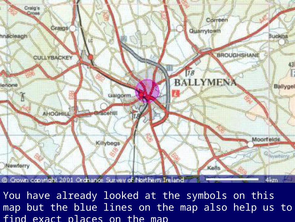
You have already looked at the symbols on this map but the blue lines on the map also help us to find exact places on the map

01 02 03 04 11
12
13
14
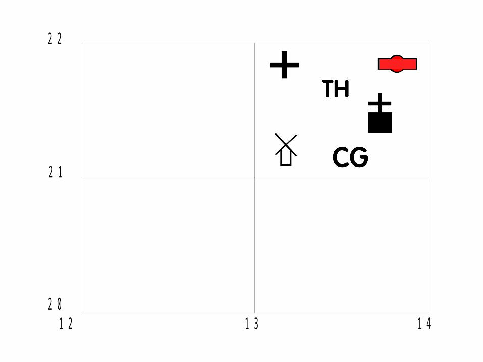
How can you describe where these places are using a Grid?
To find the grid square that each of the symbols are found in –
Go along the corridor and then up the stairs
ACROSS AND THEN UP
Along = 02
Up = 11 GR = 02 11

01 02 03 04 11
12
13
14
Answer these questions in your books
Is in square _____
Is in square _____
Is in square _____
Is in square _____
Is in square _____
Is in square _____
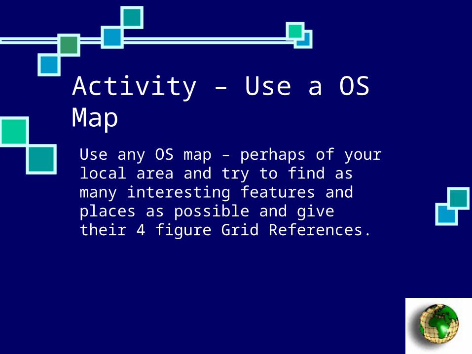
Activity – Use a OS Map Use any OS map – perhaps of your local area and try to find as many interesting features and places as possible and give their 4 figure Grid References.

How can we use 6 Figure Grid References?

12 13 1420
21
22

13 1421
22
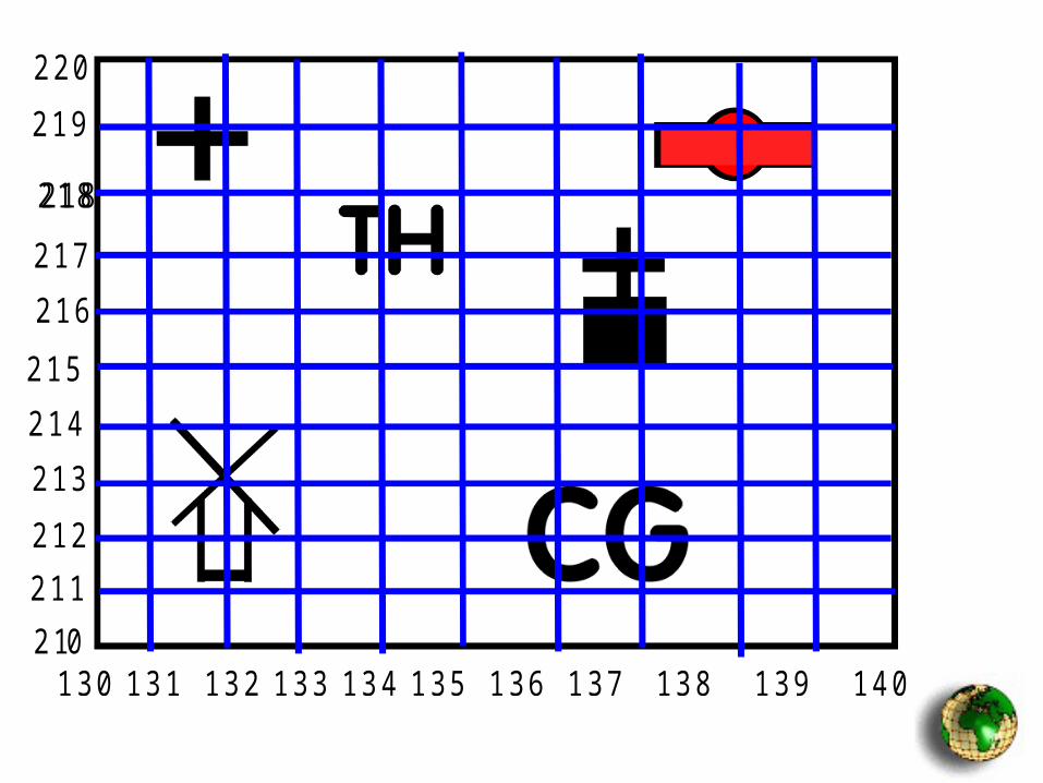
130 131 132 133 134 135 136 137 138 139 140 1421
220
0211212213214215216217218
219218

Lost Addresses
A Thinking skills Activity

Lost Addresses
Patrick has a problem. He works as a postman in Larne and he has just received a batch of parcels that he must deliver as quickly as possible. The problem is that before he goes out in his van to deliver the 10 parcels he must work out where the parcels will be delivered and mark the 6-figure grid reference in the space below.
When this is done, see if you can work out what the best route that Patrick might use to get his parcels delivered as quickly as possible.

Parcel 1 Tappagh TV Mast Station
Parcel 2 Olderfleet Castle
Parcel 3 Seacourt House
Parcel 4 Glynn School
Parcel 5 Larne Swimming Pool
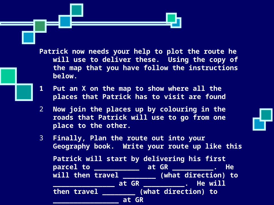
Patrick now needs your help to plot the route he will use to deliver these. Using the copy of the map that you have follow the instructions below.
1 Put an X on the map to show where all the places that Patrick has to visit are found
2 Now join the places up by colouring in the roads that Patrick will use to go from one place to the other.
3 Finally, Plan the route out into your Geography book. Write your route up like this
Patrick will start by delivering his first parcel to ___________ at GR __________. He will then travel ________ (what direction) to _______________ at GR __________. He will then travel ________ (what direction) to ________________ at GR __________________ . . . etc

Lost Addresses Homework Activity For Homework for ___________ Complete the Lost Addresses
Homework Activity (finding the places) and make sure that you write your own description of where you would live

Finding Heights How can we measure relief on a
map?

On this map – how are the heights of different places shown?
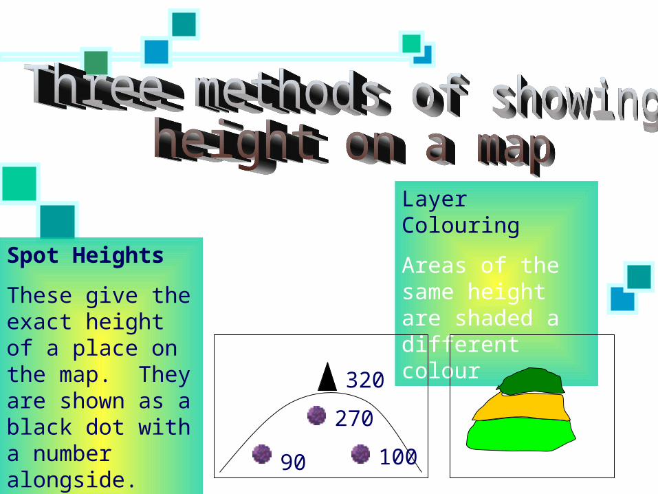
Spot Heights
These give the exact height of a place on the map. They are shown as a black dot with a number alongside. The heights are given in metres
Layer Colouring
Areas of the same height are shaded a different colour
320
270
90 100

300200100
Contours
These are lines that are drawn onto a map and they join up places that are the same height. The heights are given in metres

Height Activity 1 Use the map on the next page and the one on Height Sheet 1 to help you to answer a few questions


The more that you use the maps the more that you will be able to read the contours, heights and colours that are shown on a map
Take a look at a local map and try to see where the highest points are the be found and the places with the steepest slopes.
Height Activity 2

Distance and Scale How can we work out distances on a
map?

Maps cannot be the same size as the objects are in reality or they would not fit on the page! Therefore we use scale to show the real distances between places by making everything smaller.

If you want to find out the distance between two places on a map there are 2 methods to use. One method looks at the straight line distance (as the crow flies) and the other measures the actual distance, by road, river etc, and usually involves going down bendy lines.

Measuring a straight line distance
This is very simple to use.
1. Use your ruler to rule the distance between the 2 places
2. Then compare your answer to the scale of the map (This is usually in the bottom corner of the map and for most maps that you use this will be 1cm = 50,000cm (0.5Km)
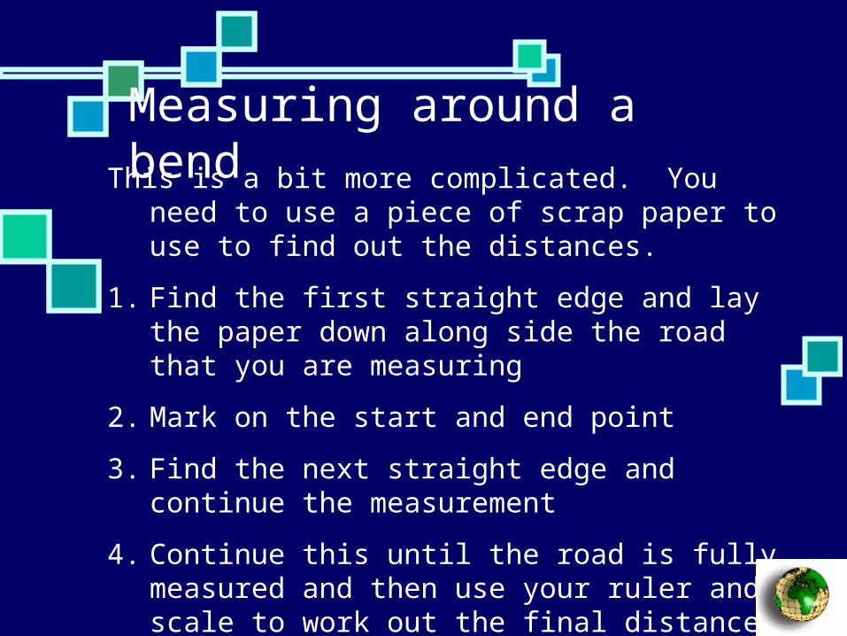
Measuring around a bend This is a bit more complicated. You need to use a
piece of scrap paper to use to find out the distances.
1. Find the first straight edge and lay the paper down along side the road that you are measuring
2. Mark on the start and end point
3. Find the next straight edge and continue the measurement
4. Continue this until the road is fully measured and then use your ruler and scale to work out the final distance

Describing Routes How did you get here?
It is very important that you learn to use all your skills in using maps to look at a map and think about all of the things that you will pass on your way from one place to another.
You must imagine that you are actually taking that route . . . . . .
The Fugitive The Fugitive is a Thinking skills exercise where you will hear a tape of a radio broadcast that takes place following the escape by a known criminal from the local prison. Your job is to use the descriptions o track down where he has got to . . . . .
Use ‘The Fugitive’ sheets