Embed Size (px)
Citation preview

XW
XW
³²1
City of Winnipeg
St. Malo
Riel
Joubert Creek
Rose
au River
United States of America
Red
River
WHITEMOUTHLAKE
Canada
ManningCanal
Assiniboine River Cooks Creek
Sein e Rive r
Rat River
LAKE MANITOBA PLAIN ECOREGION
AND PRAIRIE ECOZONE
INTERLAKE PLAIN ECOREGION AND
BOREAL PLAIN ECOZONE
LAKE OF THE WOODSECOREGION AND
BOREAL SHIELD ECOZONE
LAKEOF THE
WOODS
Grunthal
M602F
³²1
Dorsey
Altona
Anola
Arbakka
Arnaud
Aubigny
Badger
Barkfield
Beausejour
Brunkild
Caliento
Carey
Carlowrie Carrick
Cloverleaf
DeaconsCorner
Domain
Dufresne
Dufrost
Dugald
EastBraintree
Elma
Emerson
Fredensthal
Gardenton
Giroux
Glass
Glenlea
GrandePointe
Greenland
GreenRidge
Gretna
Grosse Isle
Hadashville
Hazelridge
Headingley
Horndean
Ile desChênes
Kleefeld La Broquerie
La CouléeLa Salle
Letellier
Linden
Lorette
LoweFarm
Marchand
McMunn
Molson
Morris
NewBothwell
Niverville
Oakbank
Oak Bluff
Osborne
Piney
PrairieGrove
Prawda
Randolph
Rennie
Richer
Ridgeville
Roseau River
Ross
Rosser
St.Adolphe
Ste. Agathe
Ste.Elizabeth
Ste-Geneviève
Ste. Rita
St. Joseph
St.Labre
St-Pierre-Jolys
Sandilands
Sanford
Sarto
SeddonsCorner
SouthJunction Sprague
Starbuck
Steinbach
StonyMountain
StuartburnSundown
Tolstoi
VassarVita
Vivian
Whitemouth
Woodridge
Roseau RiverAnishinabeFirst Nation
Ste.Anne
Ginew
Stonewall Selkirk
Zhoda
[\8 [\9
[\89
[\67
[\52
[\30
[\15
[\26
[\59
[\75
[\14
[\2
[\44
[\12
[\29
[\12
[\3
[\59
[\12
0 10 Kilometres
0 105 Miles 1:600,000
±Coordinate System: UTM Zone 14N NAD83Data Source: MBHydro, ProvMB, NRCANDate Created: July 30, 2015
Manitoba-MinnesotaTransmission Project
G:\_G
IS_P
rojec
t_Fold
er\00
_Hyd
ro\11
1420
050_
MMTP
_EA\
Figur
es\EA
Chap
ter\H
eritag
eRes
ource
s\12V
C01_
MMTP
_EA_
Herita
geAs
sess
mentA
rea_6
00K_
B_20
1507
30.m
xd
Project Infrastructure
XW Converter Station (Existing)
Final Preferred Route (FPR)
Heritage Resources Assessment Area
Infrastructure! ! ! Existing 500kV Transmission Line! ! Existing 230kV Transmission Line
Landbase! Community
RailwayTrans CanadaProvincial HighwayProvincial RoadCityFirst Nation Lands
³²1
[\12
UV301
Map 12-1
Ecological BoundariesInterlake Plain Ecoregion / Boreal Plain EcozoneLake Manitoba Plain Ecoregion / Prairie EcozoneLake of the Woods Ecoregion / Boreal Shield Ecozone

!(!(
!(
!(
!(!(
!(
!(!(!(
!(
!(!(!(
!(
!(!(!(
!(
!(!(
!(
!(!(!(
!(
!(
!(
!(
!(
!(
!(
!(
!(
!(
!(
!(!(
!(!(
!(!(!(
!(
!(
!(
!(!(
!(!(
!(!(
!(
!(
!(!(
!(!(
!(
²³
²³
²³
²³
²³
²³
²³
²³
²³
²³
²³
²³
²³
²³
²³
²³²³
²³²³
²³
²³
²³
#*
#*
#*
#*
#*
#*
#*
#*
#*
#*
#*
#*
#*
#*
æ
æ
æ
æ
æ
ææ
æ
æ
æ
æ
æ
æ
æ
æ
æ
æ
æ
æ
æ
æ
æ
æ
ææ
æ
æ
æ
æææ
æ
æ
ææ
æææ
æ
ææ
æææ
æ
æ
æ
æ
æ æ
ææ
æ
æ
æ
ææ
æ
")")
")
")")
")
")
XW
XW
!(
!(
³²1
City of Winnipeg
St. Malo
Riel
Joubert Creek
Rose
au River
United States of America
Red
River
WHITEMOUTHLAKE
Canada
ManningCanal
Assiniboine River Cooks Creek
Sein e Rive r
Rat River
M602F
R49R
R50M
WhiteshellProvincial
ParkBirds HillProvincial
Park
BeaudryProvincial
Park
BROKENHEAD
WHITEMOUTH
REYNOLDS
SPRINGFIELD
MACDONALD
TACHE
RITCHOTSTE. ANNE
HANOVERLA BROQUERIE
DE SALABERRYMORRIS
PINEY
MONTCALM STUARTBURN
FRANKLIN
ROSSER
ROCKWOODWOODLANDS
ST.ANDREWS
ST. CLEMENTS
RHINELAND
LAC DUBONNET
³²1
Dorsey
Altona
Anola
Arbakka
Arnaud
Aubigny
Badger
Barkfield
Beausejour
Brunkild
Caliento
Carey
Carlowrie Carrick
Cloverleaf
DeaconsCorner
Domain
Dufresne
Dufrost
Dugald
EastBraintree
Elma
Emerson
Fredensthal
Gardenton
Giroux
Glass
Glenlea
GrandePointe
Greenland
GreenRidge
Gretna
Grosse Isle
Hadashville
Hazelridge
Headingley
Horndean
Ile desChênes
Kleefeld La Broquerie
La CouléeLa Salle
Letellier
Linden
Lorette
LoweFarm
Marchand
McMunn
Molson
Morris
NewBothwell
Niverville
Oakbank
Oak Bluff
Osborne
Piney
PrairieGrove
Prawda
Randolph
Rennie
Richer
Ridgeville
Roseau River
Ross
Rosser
St.Adolphe
Ste. Agathe
Ste.Elizabeth
Ste-Geneviève
Ste.Rita
St. Joseph
St.Labre
St-Pierre-Jolys
Sandilands
Sanford
Sarto
SeddonsCorner
SouthJunction Sprague
Starbuck
Steinbach
StonyMountain
StuartburnSundown
Tolstoi
VassarVita
Vivian
Whitemouth
Woodridge
Roseau RiverAnishinabeFirst Nation
Ste.Anne
Ginew
Stonewall Selkirk
Zhoda
Grunthal
LAKEOF THE
WOODS
[\8 [\9
[\89
[\67
[\52
[\30
[\15
[\26
[\59
[\75
[\14
[\2
[\44
[\12
[\12
[\3
[\59
[\12
¾À100
¾À101
22 2321
201918
1716
1514
4 5
13
76
12
38 9 10
11
21
0 10 Kilometres
0 105 Miles 1:600,000
±Coordinate System: UTM Zone 14N NAD83Data Source: MBHydro, ProvMB, NRCANDate Created: August 06, 2015
Manitoba-MinnesotaTransmission Project
G:\_G
IS_P
rojec
t_Fold
er\00
_Hyd
ro\11
1420
050_
MMTP
_EA\
Figur
es\Te
chnic
alRep
orts\H
eritag
eRes
ource
s\1-10
0_MM
TP_E
A_He
ritage
Reso
urce
INDE
X_60
0K_B
_201
5073
0.mxd
Project Infrastructure
XW Converter Station (Existing)
Final Preferred Route (FPR)
Index of Map SeriesHeritage Resource Locations
Infrastructure! ! ! Existing 500kV Transmission Line! ! Existing 230kV Transmission Line
Heritage Resource Features!( Archaeological Siteæ Cemetery#* Centennial Farm") Provincial and Muncipal Designated Site²³ School
Map Series 12-100
Map Series Index - 1:150,000Map Series Tile
Landbase! Community
RailwayTrans CanadaProvincial HighwayProvincial RoadCityFirst Nation LandsEcological ReserveWildlife Management AreaProvincial ParkRural Municipality
³²1
[\12
UV301

UV221
UV334
Dorsey ConverterStation
Dorsey StationExpansion Dorsey 500kV
Switch Yard
Southern Loop Transmission Corridor
Sturgeon Creek
Rosser UV236
CANADIAN PACIFIC RAILWAY (CPR)
ST.FRANÇOIS
XAVIER
ROSSER
0 0.5 1 Kilometres
0 0.50.25 Miles 1:30,000
±Coordinate System: UTM Zone 14N NAD83Data Source: MBHydro, ProvMB, NRCANDate Created: July 30, 2015
Manitoba-MinnesotaTransmission Project
G:\_G
IS_P
rojec
t_Fold
er\00
_Hyd
ro\11
1420
050_
MMTP
_EA\
Figur
es\Te
chnic
alRep
orts\H
eritag
eRes
ource
s\1-10
0_MM
TP_E
A_He
ritage
Reso
urce
_30K
_B_2
0150
730.m
xd
Heritage Resource Locations
Infrastructure! Existing 500 kV Transmission Line!! Existing 230kV Transmission Line
XWXW
United States of AmericaCanada
Selkirk
Winnipeg
Piney
Steinbach
Winkler
Map 12-100-01
Landbase! Community
RailwayTrans CanadaProvincial HighwayProvincial RoadRural Municipality
³²1
[\12
UV301
Project InfrastructureFinal Preferred Route (FPR)Station ExpansionConverter Station Footprint
Assessment AreaProject Development Area (PDA)Heritage ResourcesLocal Assessment Area
1:3,000,000

!(
!(
!(
!(
!(
³²1
BeaudryProvincial
Park
Assiniboine R ive r
Headingley
Southern Loop Transmission Corridor
Swan LakeFirst Nation
Sturgeon Creek
³²1
UV334
UV425
UV334
UV241
BeaudryProvincial
Park
CANADIAN PACIFIC RAILWAY (CPR)
ST.FRANÇOIS
XAVIER
ROSSER
CARTIER
CARTIER CARTIER
HEADINGLEY
Site
0 0.5 1 Kilometres
0 0.50.25 Miles 1:30,000
±Coordinate System: UTM Zone 14N NAD83Data Source: MBHydro, ProvMB, NRCANDate Created: August 06, 2015
Manitoba-MinnesotaTransmission Project
G:\_G
IS_P
rojec
t_Fold
er\00
_Hyd
ro\11
1420
050_
MMTP
_EA\
Figur
es\Te
chnic
alRep
orts\H
eritag
eRes
ource
s\1-10
0_MM
TP_E
A_He
ritage
Reso
urce
_30K
_B_2
0150
730.m
xd
Heritage Resource Locations
Infrastructure!! Existing 230kV Transmission Line
XWXW
United States of AmericaCanada
Selkirk
Winnipeg
Piney
Steinbach
Winkler
Map 12-100-02
Project InfrastructureFinal Preferred Route (FPR)
1:3,000,000
Landbase! Community
RailwayTrans CanadaProvincial HighwayProvincial RoadFirst Nation LandsNational/Provincial ParkRural Municipality
³²1
[\12
UV301
Assessment AreaProject Development Area (PDA)Heritage ResourcesLocal Assessment Area
Heritage Resource Features!( Archaeological Site

"3E
UV427
BeaudryProvincial
Park
UV241
La VerendryeStation
Southern Loop Transmission Corridor
UV334
UV427
CANADIAN NATIONAL (CN) RAILWAY
CANADIA N PACIFIC RA
ILWAY
(CPR
)
ST.FRANÇOIS
XAVIER
CARTIER
CARTIER
WINNIPEG
HEADINGLEY
MACDONALD
City ofWinnipeg
0 0.5 1 Kilometres
0 0.50.25 Miles 1:30,000
±Coordinate System: UTM Zone 14N NAD83Data Source: MBHydro, ProvMB, NRCANDate Created: July 30, 2015
Manitoba-MinnesotaTransmission Project
G:\_G
IS_P
rojec
t_Fold
er\00
_Hyd
ro\11
1420
050_
MMTP
_EA\
Figur
es\Te
chnic
alRep
orts\H
eritag
eRes
ource
s\1-10
0_MM
TP_E
A_He
ritage
Reso
urce
_30K
_B_2
0150
730.m
xd
Heritage Resource Locations
Infrastructure"3E Electrical Station
!! Existing 230kV Transmission Line!! St. Vital Transmission Complex (Proposed)! Existing 115-230kV Transmission Line
XWXW
United States of AmericaCanada
Selkirk
Winnipeg
Piney
Steinbach
Winkler
Map 12-100-03
Landbase! Community
RailwayTrans CanadaProvincial HighwayProvincial RoadCity / TownNational/Provincial ParkRural Municipality
³²1
[\12
UV301
Project InfrastructureFinal Preferred Route (FPR)
Assessment AreaProject Development Area (PDA)Heritage ResourcesLocal Assessment Area
1:3,000,000

[\2
[\3
[\100
Southern Loop Transmission Corridor
OakBluff
[\3
[\2
UV330
CENTR
AL M
ANITO
BA RA
ILWAY
. INC.
(CEM
R)
CANA
DIAN
PAC
IFIC
RAI
LWAY
(CPR
)
MACDONALD
0 0.5 1 Kilometres
0 0.50.25 Miles 1:30,000
±Coordinate System: UTM Zone 14N NAD83Data Source: MBHydro, ProvMB, NRCANDate Created: July 30, 2015
Manitoba-MinnesotaTransmission Project
G:\_G
IS_P
rojec
t_Fold
er\00
_Hyd
ro\11
1420
050_
MMTP
_EA\
Figur
es\Te
chnic
alRep
orts\H
eritag
eRes
ource
s\1-10
0_MM
TP_E
A_He
ritage
Reso
urce
_30K
_B_2
0150
730.m
xd
Heritage Resource Locations
Infrastructure!! Existing 230kV Transmission Line!! St. Vital Transmission Complex (Proposed)! Existing 115-230kV Transmission Line
XWXW
United States of AmericaCanada
Selkirk
Winnipeg
Piney
Steinbach
Winkler
Map 12-100-04
Landbase! Community
RailwayTrans CanadaProvincial HighwayProvincial RoadRural Municipality
³²1
[\12
UV301
Project InfrastructureFinal Preferred Route (FPR)
Assessment AreaProject Development Area (PDA)Heritage ResourcesLocal Assessment Area
1:3,000,000

!(
!(!(
!(
UV330
RedRiver
[\100
LaSalleRiver
Red River Floodway
Southern Loop Transmission Corridor
[\75
[\75
UV607
Duff RoblinProvincial
Park
TrappistMonastery
Provincial ParkSt. NorbertProvincial
Park
CANADIANNATIONAL (CN) RA ILWAY
CANA
DIAN
PACI
FIC R
AILWA
Y (CP
R)
WINNIPEG
MACDONALD
RITCHOT
City ofWinnipeg
0 0.5 1 Kilometres
0 0.50.25 Miles 1:30,000
±Coordinate System: UTM Zone 14N NAD83Data Source: MBHydro, ProvMB, NRCANDate Created: July 30, 2015
Manitoba-MinnesotaTransmission Project
G:\_G
IS_P
rojec
t_Fold
er\00
_Hyd
ro\11
1420
050_
MMTP
_EA\
Figur
es\Te
chnic
alRep
orts\H
eritag
eRes
ource
s\1-10
0_MM
TP_E
A_He
ritage
Reso
urce
_30K
_B_2
0150
730.m
xd
Heritage Resource Locations
Infrastructure!! St. Vital Transmission Complex (Proposed)
XWXW
United States of AmericaCanada
Selkirk
Winnipeg
Piney
Steinbach
Winkler
Map 12-100-05
Landbase! Community
RailwayTrans CanadaProvincial HighwayProvincial RoadCity / TownNational/Provincial ParkRural Municipality
³²1
[\12
UV301
Project InfrastructureFinal Preferred Route (FPR)
Assessment AreaProject Development Area (PDA)Heritage ResourcesLocal Assessment Area
1:3,000,000
Heritage Resource Features!( Archaeological Site

!(
!(
!(!(
#*
Red River Floodway
[\100
Southern Loop Transmission Corridor
GrandePointe
[\59
[\59
[\59
[\59
UV300
CANA
DIAN
PACI
FIC R
AILW
AY (C
PR)
SPRINGFIELD
WINNIPEGTACHE
RITCHOT
City ofWinnipeg
0 0.5 1 Kilometres
0 0.50.25 Miles 1:30,000
±Coordinate System: UTM Zone 14N NAD83Data Source: MBHydro, ProvMB, NRCANDate Created: July 30, 2015
Manitoba-MinnesotaTransmission Project
G:\_G
IS_P
rojec
t_Fold
er\00
_Hyd
ro\11
1420
050_
MMTP
_EA\
Figur
es\Te
chnic
alRep
orts\H
eritag
eRes
ource
s\1-10
0_MM
TP_E
A_He
ritage
Reso
urce
_30K
_B_2
0150
730.m
xd
Heritage Resource Locations
Infrastructure!! St. Vital Transmission Complex (Proposed)! Existing 115-230kV Transmission Line
XWXW
United States of AmericaCanada
Selkirk
Winnipeg
Piney
Steinbach
Winkler
Map 12-100-06
Landbase! Community
RailwayTrans CanadaProvincial HighwayProvincial RoadCity / TownRural Municipality
³²1
[\12
UV301
Project InfrastructureFinal Preferred Route (FPR)
Assessment AreaProject Development Area (PDA)Heritage ResourcesLocal Assessment Area
1:3,000,000
Heritage Resource Features!( Archaeological Site#* Centennial Farm

"3E
!( !(²³
Riel Converter Station
³²1
³²1
Red River Floodway
GREATER WINNIPEG WATER DISTRICT AQUEDUCT
GREATER WINNIPEG WATER DISTRICT AQUEDUCT
St.VitalStation
Southern Loop Transmission Corridor
DeaconsCorner
[\59
[\59
UV101
UV101
UV207
CANADIAN NATIONAL (CN) RAILWAY
GREATER WINNIPEG WATER DISTRICT (GWWD) RAILWAY
SPRINGFIELD
WINNIPEG
City ofWinnipeg
BPIII
0 0.5 1 Kilometres
0 0.50.25 Miles 1:30,000
±Coordinate System: UTM Zone 14N NAD83Data Source: MBHydro, ProvMB, NRCANDate Created: July 30, 2015
Manitoba-MinnesotaTransmission Project
G:\_G
IS_P
rojec
t_Fold
er\00
_Hyd
ro\11
1420
050_
MMTP
_EA\
Figur
es\Te
chnic
alRep
orts\H
eritag
eRes
ource
s\1-10
0_MM
TP_E
A_He
ritage
Reso
urce
_30K
_B_2
0150
730.m
xd
Heritage Resource Locations
Infrastructure"3E Electrical Station
! Existing 500 kV Transmission Line!! Existing 230kV Transmission Line! Bipole III Transmission Line (Approved)!! St. Vital Transmission Complex (Proposed)! Existing 115-230kV Transmission Line
XWXW
United States of AmericaCanada
Selkirk
Winnipeg
Piney
Steinbach
Winkler
Map 12-100-07
Landbase! Community
RailwayTrans CanadaProvincial HighwayProvincial RoadCity / TownRural Municipality
³²1
[\12
UV301
Project InfrastructureFinal Preferred Route (FPR)Converter Station Footprint
Assessment AreaProject Development Area (PDA)Heritage ResourcesLocal Assessment Area
1:3,000,000
Heritage Resource Features!( Archaeological Site²³ School

!!
!!
!!
! ! ! ! ! ! ! ! ! ! ! ! ! ! !
!!
!!
!!
! ! ! ! ! ! ! ! ! ! ! ! ! ! ! ! ! ! ! ! ! ! ! ! ! ! ! ! ! ! ! ! ! ! ! ! ! ! ! ! ! ! ! ! ! ! ! ! ! ! ! ! ! ! ! ! ! ! ! ! ! ! ! ! ! ! ! ! ! ! ! ! ! ! ! ! ! ! ! ! ! ! ! ! ! ! ! ! ! ! ! ! ! ! ! ! ! ! ! ! ! ! ! ! ! ! ! ! ! ! ! ! ! ! ! ! ! ! ! ! ! ! ! ! ! ! ! ! ! ! ! ! ! ! ! ! ! ! ! ! ! ! ! ! ! ! ! ! ! ! ! ! ! ! ! ! ! ! ! ! ! ! ! ! ! ! ! ! ! ! ! ! ! ! ! ! ! ! ! ! ! ! ! ! ! ! ! ! ! ! ! ! ! ! ! ! ! ! ! ! ! ! ! ! ! ! ! ! ! ! ! ! ! ! ! ! ! ! ! ! ! ! ! ! ! ! ! ! ! ! ! ! ! ! ! ! ! ! ! ! ! ! ! ! ! ! ! ! ! ! ! ! ! ! ! ! ! ! ! ! ! ! ! ! ! ! ! ! ! ! ! ! ! ! ! ! ! ! ! ! ! ! ! ! ! ! ! ! ! ! ! ! ! ! ! ! ! ! ! ! ! ! ! ! !! !
!
²³
#*
[\15
UV206
GREATER WINNIPEG WATER DISTRICT AQUEDUCT
M602FRiel to Vivian (Existing Transmission Corridor)
M602F Salvage
New M602F
Dugald
UV206
CANADIAN NATIONAL (CN) RAILWAY
GREATER WINNIPEG WATER DISTRICT (GWWD) RAILWAY
SPRINGFIELD
BPIII
0 0.5 1 Kilometres
0 0.50.25 Miles 1:30,000
±Coordinate System: UTM Zone 14N NAD83Data Source: MBHydro, ProvMB, NRCANDate Created: July 30, 2015
Manitoba-MinnesotaTransmission Project
G:\_G
IS_P
rojec
t_Fold
er\00
_Hyd
ro\11
1420
050_
MMTP
_EA\
Figur
es\Te
chnic
alRep
orts\H
eritag
eRes
ource
s\1-10
0_MM
TP_E
A_He
ritage
Reso
urce
_30K
_B_2
0150
730.m
xd
Heritage Resource Locations
Infrastructure! Existing 500 kV Transmission Line!! Existing 230kV Transmission Line! Bipole III Transmission Line (Approved)! Existing 115-230kV Transmission Line
XWXW
United States of AmericaCanada
Selkirk
Winnipeg
Piney
Steinbach
Winkler
Map 12-100-08
Landbase! Community
RailwayTrans CanadaProvincial HighwayProvincial RoadRural Municipality
³²1
[\12
UV301
Project InfrastructureFinal Preferred Route (FPR)
! ! ! M602F Modification (Salvage)! ! ! M602F Modification (New)
Assessment AreaProject Development Area (PDA)Heritage ResourcesLocal Assessment Area
1:3,000,000
Heritage Resource Features#* Centennial Farm²³ School

!!
!!
!!
! ! ! ! ! ! ! ! ! ! ! ! ! ! !
!!
!!
!!
! ! ! ! ! ! ! ! ! ! ! ! ! ! ! ! ! ! ! ! ! ! ! ! ! ! ! ! ! ! ! ! ! ! ! ! ! ! ! ! ! ! ! ! ! ! ! ! ! ! ! ! ! ! ! ! ! ! ! ! ! ! ! ! ! ! ! ! ! ! ! ! ! ! ! ! ! ! ! ! ! ! ! ! ! ! ! ! ! ! ! ! ! ! ! ! ! ! ! ! ! ! ! ! ! ! ! ! ! ! ! ! ! ! ! ! ! ! ! ! ! ! ! ! ! ! ! ! ! ! ! ! ! ! ! ! ! ! ! ! ! ! ! ! ! ! ! ! ! ! ! ! ! ! ! ! ! ! ! ! ! ! ! ! ! ! ! ! ! ! ! ! ! ! ! ! ! ! ! ! ! ! ! ! ! ! ! ! ! ! ! ! ! ! ! ! ! ! ! ! ! ! ! ! ! ! ! ! ! ! ! ! ! ! ! ! ! ! ! ! ! ! ! ! ! ! ! ! ! ! ! ! ! ! ! ! ! ! ! ! ! ! ! ! ! ! ! ! ! ! ! ! ! ! ! ! ! ! ! ! ! ! ! ! ! ! ! ! ! ! ! ! ! ! ! ! ! ! ! ! ! ! ! ! ! ! ! ! ! ! ! ! ! ! ! ! ! ! ! ! ! ! ! !! ! !
!
!(
#*
æ
GREATER WINNIPEG WATER DISTRICT AQUEDUCT
R49R
Riel to Vivian (Existing Transmission Corridor)
Glass[\15CANADIAN NATIONAL (CN) RAILWAY
GREATER WINNIPEG WATER DISTRICT (GWWD) RAILWAY
SPRINGFIELD
BPIII
0 0.5 1 Kilometres
0 0.50.25 Miles 1:30,000
±Coordinate System: UTM Zone 14N NAD83Data Source: MBHydro, ProvMB, NRCANDate Created: July 30, 2015
Manitoba-MinnesotaTransmission Project
G:\_G
IS_P
rojec
t_Fold
er\00
_Hyd
ro\11
1420
050_
MMTP
_EA\
Figur
es\Te
chnic
alRep
orts\H
eritag
eRes
ource
s\1-10
0_MM
TP_E
A_He
ritage
Reso
urce
_30K
_B_2
0150
730.m
xd
Heritage Resource Locations
Infrastructure! Existing 500 kV Transmission Line!! Existing 230kV Transmission Line! Bipole III Transmission Line (Approved)! Existing 115-230kV Transmission Line
XWXW
United States of AmericaCanada
Selkirk
Winnipeg
Piney
Steinbach
Winkler
Map 12-100-09
Landbase! Community
RailwayTrans CanadaProvincial HighwayProvincial RoadRural Municipality
³²1
[\12
UV301
Project InfrastructureFinal Preferred Route (FPR)
! ! ! M602F Modification (New)
Assessment AreaProject Development Area (PDA)Heritage ResourcesLocal Assessment Area
1:3,000,000
Heritage Resource Features!( Archaeological Siteæ Cemetery#* Centennial Farm

!!
!!
!!
! ! ! ! ! ! ! ! ! ! ! ! ! ! !
!!
!!
!!
! ! ! ! ! ! ! ! ! ! ! ! ! ! ! ! ! ! ! ! ! ! ! ! ! ! ! ! ! ! ! ! ! ! ! ! ! ! ! ! ! ! ! ! ! ! ! ! ! ! ! ! ! ! ! ! ! ! ! ! ! ! ! ! ! ! ! ! ! ! ! ! ! ! ! ! ! ! ! ! ! ! ! ! ! ! ! ! ! ! ! ! ! ! ! ! ! ! ! ! ! ! ! ! ! ! ! ! ! ! ! ! ! ! ! ! ! ! ! ! ! ! ! ! ! ! ! ! ! ! ! ! ! ! ! ! ! ! ! ! ! ! ! ! ! ! ! ! ! ! ! ! ! ! ! ! ! ! ! ! ! ! ! ! ! ! ! ! ! ! ! ! ! ! ! ! ! ! ! ! ! ! ! ! ! ! ! ! ! ! ! ! ! ! ! ! ! ! ! ! ! ! ! ! ! ! ! ! ! ! ! ! ! ! ! ! ! ! ! ! ! ! ! ! ! ! ! ! ! ! ! ! ! ! ! ! ! ! ! ! ! ! ! ! ! ! ! ! ! ! ! ! ! ! ! ! ! ! ! ! ! ! ! ! ! ! ! ! ! ! ! ! ! ! ! ! ! ! ! ! ! ! ! ! ! ! ! ! ! ! ! ! ! ! ! ! ! ! ! ! ! ! ! !! !
! !
æ
[\12
GREATER WINNIPEG WATER DISTRICT AQUEDUCT
R49R
M602FRiel to Vivian (Existing Transmission Corridor)
M602F Salvage
New M602F
GREATER WINNIPEG WATER DISTRICT (GWWD) RAILWAY
SPRINGFIELD
0 0.5 1 Kilometres
0 0.50.25 Miles 1:30,000
±Coordinate System: UTM Zone 14N NAD83Data Source: MBHydro, ProvMB, NRCANDate Created: July 30, 2015
Manitoba-MinnesotaTransmission Project
G:\_G
IS_P
rojec
t_Fold
er\00
_Hyd
ro\11
1420
050_
MMTP
_EA\
Figur
es\Te
chnic
alRep
orts\H
eritag
eRes
ource
s\1-10
0_MM
TP_E
A_He
ritage
Reso
urce
_30K
_B_2
0150
730.m
xd
Heritage Resource Locations
Infrastructure! Existing 500 kV Transmission Line!! Existing 230kV Transmission Line! Existing 115-230kV Transmission Line
XWXW
United States of AmericaCanada
Selkirk
Winnipeg
Piney
Steinbach
Winkler
Map 12-100-10
Landbase! Community
RailwayTrans CanadaProvincial HighwayProvincial RoadRural Municipality
³²1
[\12
UV301
Project InfrastructureFinal Preferred Route (FPR)
! ! ! M602F Modification (Salvage)! ! ! M602F Modification (New)
M602F Extension and Salvage
Assessment AreaProject Development Area (PDA)Heritage ResourcesLocal Assessment Area
1:3,000,000
Heritage Resource Featuresæ Cemetery

æ
æ
æ
æ")
UV501
Ruisseau Creek
Ste-Genevieve
R49R
Cooks Creek
UV634
UV501
SPRINGFIELD
TACHE
0 0.5 1 Kilometres
0 0.50.25 Miles 1:30,000
±Coordinate System: UTM Zone 14N NAD83Data Source: MBHydro, ProvMB, NRCANDate Created: July 30, 2015
Manitoba-MinnesotaTransmission Project
G:\_G
IS_P
rojec
t_Fold
er\00
_Hyd
ro\11
1420
050_
MMTP
_EA\
Figur
es\Te
chnic
alRep
orts\H
eritag
eRes
ource
s\1-10
0_MM
TP_E
A_He
ritage
Reso
urce
_30K
_B_2
0150
730.m
xd
Heritage Resource Locations
Infrastructure!! Existing 230kV Transmission Line
XWXW
United States of AmericaCanada
Selkirk
Winnipeg
Piney
Steinbach
Winkler
Map 12-100-11
Landbase! Community
RailwayTrans CanadaProvincial HighwayProvincial RoadRural Municipality
³²1
[\12
UV301
Project InfrastructureFinal Preferred Route (FPR)
Assessment AreaProject Development Area (PDA)Heritage ResourcesLocal Assessment Area
1:3,000,000
Heritage Resource Featuresæ Cemetery") Provincial and Muncipal Designated Site
³²1
³²1
CottonwoodGolf
Course
R49R
La Coulée
TACHE
STE.ANNE
0 0.5 1 Kilometres
0 0.50.25 Miles 1:30,000
±Coordinate System: UTM Zone 14N NAD83Data Source: MBHydro, ProvMB, NRCANDate Created: July 30, 2015
Manitoba-MinnesotaTransmission Project
G:\_G
IS_P
rojec
t_Fold
er\00
_Hyd
ro\11
1420
050_
MMTP
_EA\
Figur
es\Te
chnic
alRep
orts\H
eritag
eRes
ource
s\1-10
0_MM
TP_E
A_He
ritage
Reso
urce
_30K
_B_2
0150
730.m
xd
Heritage Resource Locations
Infrastructure!! Existing 230kV Transmission Line
XWXW
United States of AmericaCanada
Selkirk
Winnipeg
Piney
Steinbach
Winkler
Map 12-100-12
Landbase! Community
RailwayTrans CanadaProvincial HighwayProvincial RoadRural Municipality
³²1
[\12
UV301
Project InfrastructureFinal Preferred Route (FPR)
Assessment AreaProject Development Area (PDA)Heritage ResourcesLocal Assessment Area
1:3,000,000

"3E
!(
²³
UV302
Richer
Richer South230kV Station
R49R
R50M
UV625
UV302
STE.ANNE
0 0.5 1 Kilometres
0 0.50.25 Miles 1:30,000
±Coordinate System: UTM Zone 14N NAD83Data Source: MBHydro, ProvMB, NRCANDate Created: July 30, 2015
Manitoba-MinnesotaTransmission Project
G:\_G
IS_P
rojec
t_Fold
er\00
_Hyd
ro\11
1420
050_
MMTP
_EA\
Figur
es\Te
chnic
alRep
orts\H
eritag
eRes
ource
s\1-10
0_MM
TP_E
A_He
ritage
Reso
urce
_30K
_B_2
0150
730.m
xd
Heritage Resource Locations
Infrastructure"3E Electrical Station
!! Existing 230kV Transmission Line
XWXW
United States of AmericaCanada
Selkirk
Winnipeg
Piney
Steinbach
Winkler
Map 12-100-13
Landbase! Community
RailwayTrans CanadaProvincial HighwayProvincial RoadRural Municipality
³²1
[\12
UV301
Project InfrastructureFinal Preferred Route (FPR)
Assessment AreaProject Development Area (PDA)Heritage ResourcesLocal Assessment Area
1:3,000,000
Heritage Resource Features!( Archaeological Site²³ School

!(
#*
æ
æ
")
UV210
UV302
UV302
Seine River
La Broquerie
R50M
UV210
STE.ANNE
LA BROQUERIE
0 0.5 1 Kilometres
0 0.50.25 Miles 1:30,000
±Coordinate System: UTM Zone 14N NAD83Data Source: MBHydro, ProvMB, NRCANDate Created: July 30, 2015
Manitoba-MinnesotaTransmission Project
G:\_G
IS_P
rojec
t_Fold
er\00
_Hyd
ro\11
1420
050_
MMTP
_EA\
Figur
es\Te
chnic
alRep
orts\H
eritag
eRes
ource
s\1-10
0_MM
TP_E
A_He
ritage
Reso
urce
_30K
_B_2
0150
730.m
xd
Heritage Resource Locations
Infrastructure!! Existing 230kV Transmission Line
XWXW
United States of AmericaCanada
Selkirk
Winnipeg
Piney
Steinbach
Winkler
Map 12-100-14
Landbase! Community
RailwayTrans CanadaProvincial HighwayProvincial RoadRural Municipality
³²1
[\12
UV301
Project InfrastructureFinal Preferred Route (FPR)
Assessment AreaProject Development Area (PDA)Heritage ResourcesLocal Assessment Area
1:3,000,000
Heritage Resource Features!( Archaeological Siteæ Cemetery#* Centennial Farm") Provincial and Muncipal Designated Site

!(
²³
UV210
UV210
UV302
UV302
Seine Ri v er
CANADIAN NATIONAL (CN) RAILWAY
LA BROQUERIE
0 0.5 1 Kilometres
0 0.50.25 Miles 1:30,000
±Coordinate System: UTM Zone 14N NAD83Data Source: MBHydro, ProvMB, NRCANDate Created: July 30, 2015
Manitoba-MinnesotaTransmission Project
G:\_G
IS_P
rojec
t_Fold
er\00
_Hyd
ro\11
1420
050_
MMTP
_EA\
Figur
es\Te
chnic
alRep
orts\H
eritag
eRes
ource
s\1-10
0_MM
TP_E
A_He
ritage
Reso
urce
_30K
_B_2
0150
730.m
xd
Heritage Resource Locations
XWXW
United States of AmericaCanada
Selkirk
Winnipeg
Piney
Steinbach
Winkler
Map 12-100-15
Landbase! Community
RailwayTrans CanadaProvincial HighwayProvincial RoadRural Municipality
³²1
[\12
UV301
Project InfrastructureFinal Preferred Route (FPR)
Assessment AreaProject Development Area (PDA)Heritage ResourcesLocal Assessment Area
1:3,000,000
Heritage Resource Features!( Archaeological Site²³ School

!(
!(!(
²³
UV302
Seine Ri v er
UV302
LA BROQUERIE
0 0.5 1 Kilometres
0 0.50.25 Miles 1:30,000
±Coordinate System: UTM Zone 14N NAD83Data Source: MBHydro, ProvMB, NRCANDate Created: July 30, 2015
Manitoba-MinnesotaTransmission Project
G:\_G
IS_P
rojec
t_Fold
er\00
_Hyd
ro\11
1420
050_
MMTP
_EA\
Figur
es\Te
chnic
alRep
orts\H
eritag
eRes
ource
s\1-10
0_MM
TP_E
A_He
ritage
Reso
urce
_30K
_B_2
0150
730.m
xd
Heritage Resource Locations
XWXW
United States of AmericaCanada
Selkirk
Winnipeg
Piney
Steinbach
Winkler
Map 12-100-16
Landbase! Community
RailwayTrans CanadaProvincial HighwayProvincial RoadRural Municipality
³²1
[\12
UV301
Project InfrastructureFinal Preferred Route (FPR)
Assessment AreaProject Development Area (PDA)Heritage ResourcesLocal Assessment Area
1:3,000,000
Heritage Resource Features!( Archaeological Site²³ School
²³
WATSON P.DAVIDSONWILDL IFE
MANAGEMENTAREA
WATSON P.DAVIDSONWILDLIFE
MANAGEMENT AREA
LA BROQUERIEPINEY
0 0.5 1 Kilometres
0 0.50.25 Miles 1:30,000
±Coordinate System: UTM Zone 14N NAD83Data Source: MBHydro, ProvMB, NRCANDate Created: July 30, 2015
Manitoba-MinnesotaTransmission Project
G:\_G
IS_P
rojec
t_Fold
er\00
_Hyd
ro\11
1420
050_
MMTP
_EA\
Figur
es\Te
chnic
alRep
orts\H
eritag
eRes
ource
s\1-10
0_MM
TP_E
A_He
ritage
Reso
urce
_30K
_B_2
0150
730.m
xd
Heritage Resource Locations
XWXW
United States of AmericaCanada
Selkirk
Winnipeg
Piney
Steinbach
Winkler
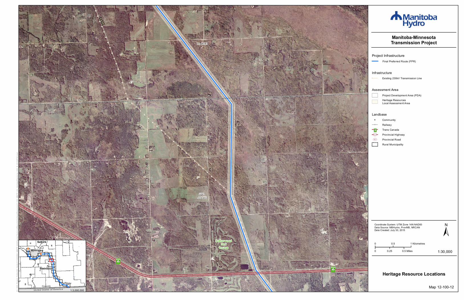
Map 12-100-17
Landbase! Community
RailwayTrans CanadaProvincial HighwayProvincial RoadWildlife Management AreaRural Municipality
³²1
[\12
UV301
Project InfrastructureFinal Preferred Route (FPR)
Assessment AreaProject Development Area (PDA)Heritage ResourcesLocal Assessment Area
1:3,000,000
Heritage Resource Features²³ School

!(
²³
æ
WATSON P.DAVIDSONWILDLIFE
MANAGEMENT AREA
[\12
[\12
UV203
UV404
LA BROQUERIEPINEY
STUARTBURN
0 0.5 1 Kilometres
0 0.50.25 Miles 1:30,000
±Coordinate System: UTM Zone 14N NAD83Data Source: MBHydro, ProvMB, NRCANDate Created: July 30, 2015
Manitoba-MinnesotaTransmission Project
G:\_G
IS_P
rojec
t_Fold
er\00
_Hyd
ro\11
1420
050_
MMTP
_EA\
Figur
es\Te
chnic
alRep
orts\H
eritag
eRes
ource
s\1-10
0_MM
TP_E
A_He
ritage
Reso
urce
_30K
_B_2
0150
730.m
xd
Heritage Resource Locations
XWXW
United States of AmericaCanada
Selkirk
Winnipeg
Piney
Steinbach
Winkler
Map 12-100-18
Landbase! Community
RailwayTrans CanadaProvincial HighwayProvincial RoadWildlife Management AreaRural Municipality
³²1
[\12
UV301
Project InfrastructureFinal Preferred Route (FPR)
Assessment AreaProject Development Area (PDA)Heritage ResourcesLocal Assessment Area
1:3,000,000
Heritage Resource Features!( Archaeological Siteæ Cemetery²³ School

[\12
RatRiv
er
STUARTBURN
0 0.5 1 Kilometres
0 0.50.25 Miles 1:30,000
±Coordinate System: UTM Zone 14N NAD83Data Source: MBHydro, ProvMB, NRCANDate Created: July 30, 2015
Manitoba-MinnesotaTransmission Project
G:\_G
IS_P
rojec
t_Fold
er\00
_Hyd
ro\11
1420
050_
MMTP
_EA\
Figur
es\Te
chnic
alRep
orts\H
eritag
eRes
ource
s\1-10
0_MM
TP_E
A_He
ritage
Reso
urce
_30K
_B_2
0150
730.m
xd
Heritage Resource Locations
XWXW
United States of AmericaCanada
Selkirk
Winnipeg
Piney
Steinbach
Winkler
Map 12-100-19
Landbase! Community
RailwayTrans CanadaProvincial HighwayProvincial RoadRural Municipality
³²1
[\12
UV301
Project InfrastructureFinal Preferred Route (FPR)
Assessment AreaProject Development Area (PDA)Heritage ResourcesLocal Assessment Area
1:3,000,000

!(
æ
æ
æ
[\12
Sundown Lake
Sund
own R
oad N
[\12
PINEY
STUARTBURN
0 0.5 1 Kilometres
0 0.50.25 Miles 1:30,000
±Coordinate System: UTM Zone 14N NAD83Data Source: MBHydro, ProvMB, NRCANDate Created: July 30, 2015
Manitoba-MinnesotaTransmission Project
G:\_G
IS_P
rojec
t_Fold
er\00
_Hyd
ro\11
1420
050_
MMTP
_EA\
Figur
es\Te
chnic
alRep
orts\H
eritag
eRes
ource
s\1-10
0_MM
TP_E
A_He
ritage
Reso
urce
_30K
_B_2
0150
730.m
xd
Heritage Resource Locations
XWXW
United States of AmericaCanada
Selkirk
Winnipeg
Piney
Steinbach
Winkler
Map 12-100-20
Landbase! Community
RailwayTrans CanadaProvincial HighwayProvincial RoadRural Municipality
³²1
[\12
UV301
Project InfrastructureFinal Preferred Route (FPR)
Assessment AreaProject Development Area (PDA)Heritage ResourcesLocal Assessment Area
1:3,000,000
Heritage Resource Features!( Archaeological Siteæ Cemetery

²³æ
æ
æ
UV201
UV201
UV210
PINEY
STUARTBURN
0 0.5 1 Kilometres
0 0.50.25 Miles 1:30,000
±Coordinate System: UTM Zone 14N NAD83Data Source: MBHydro, ProvMB, NRCANDate Created: July 30, 2015
Manitoba-MinnesotaTransmission Project
G:\_G
IS_P
rojec
t_Fold
er\00
_Hyd
ro\11
1420
050_
MMTP
_EA\
Figur
es\Te
chnic
alRep
orts\H
eritag
eRes
ource
s\1-10
0_MM
TP_E
A_He
ritage
Reso
urce
_30K
_B_2
0150
730.m
xd
Heritage Resource Locations
XWXW
United States of AmericaCanada
Selkirk
Winnipeg
Piney
Steinbach
Winkler
Map 12-100-21
Landbase! Community
RailwayTrans CanadaProvincial HighwayProvincial RoadRural Municipality
³²1
[\12
UV301
Project InfrastructureFinal Preferred Route (FPR)
Assessment AreaProject Development Area (PDA)Heritage ResourcesLocal Assessment Area
1:3,000,000
Heritage Resource Featuresæ Cemetery²³ School

!(
UV201
UV201
SPUR WOODSWILDL IFE
MANAGEMENTAREA
SPUR WOODSWILDLIFE
MANAGEMENTAREA
PINEY
0 0.5 1 Kilometres
0 0.50.25 Miles 1:30,000
±Coordinate System: UTM Zone 14N NAD83Data Source: MBHydro, ProvMB, NRCANDate Created: July 30, 2015
Manitoba-MinnesotaTransmission Project
G:\_G
IS_P
rojec
t_Fold
er\00
_Hyd
ro\11
1420
050_
MMTP
_EA\
Figur
es\Te
chnic
alRep
orts\H
eritag
eRes
ource
s\1-10
0_MM
TP_E
A_He
ritage
Reso
urce
_30K
_B_2
0150
730.m
xd
Heritage Resource Locations
XWXW
United States of AmericaCanada
Selkirk
Winnipeg
Piney
Steinbach
Winkler
Map 12-100-22
Landbase! Community
RailwayTrans CanadaProvincial HighwayProvincial RoadWildlife Management AreaRural Municipality
³²1
[\12
UV301
Project InfrastructureFinal Preferred Route (FPR)
Assessment AreaProject Development Area (PDA)Heritage ResourcesLocal Assessment Area
1:3,000,000
Heritage Resource Features!( Archaeological Site

!(
United States of AmericaPine Creek
Pineland ColonyPine Creek Diversion
WampumEcologicalReserve
WampumEcologicalReserve
[\89
PINEY
0 0.5 1 Kilometres
0 0.50.25 Miles 1:30,000
±Coordinate System: UTM Zone 14N NAD83Data Source: MBHydro, ProvMB, NRCANDate Created: August 06, 2015
Manitoba-MinnesotaTransmission Project
G:\_G
IS_P
rojec
t_Fold
er\00
_Hyd
ro\11
1420
050_
MMTP
_EA\
Figur
es\Te
chnic
alRep
orts\H
eritag
eRes
ource
s\1-10
0_MM
TP_E
A_He
ritage
Reso
urce
_30K
_B_2
0150
730.m
xd
Heritage Resource Locations
XWXW
United States of AmericaCanada
Selkirk
Winnipeg
Piney
Steinbach
Winkler
Map 12-100-23
Project InfrastructureFinal Preferred Route (FPR)
1:3,000,000
Landbase! Community
RailwayTrans CanadaProvincial HighwayProvincial RoadEcological ReserveRural Municipality
³²1
[\12
UV301
Assessment AreaProject Development Area (PDA)Heritage ResourcesLocal Assessment Area
Heritage Resource Features!( Archaeological Site

XW
XW
[\59
[\59
[\3
³²1
City of Winnipeg
St. Malo
Riel
Jou bert Creek
Rose
au River
United States of America
Red
River
WHITEMOUTHLAKE
Canada
ManningCanal
Assiniboine River Cooks Creek
Seine River
Rat River
[\15
[\27
[\75
[\52
[\44
[\89
[\67
[\14
[\12
[\30
[\11
[\44
[\12
[\12[\26
[\11
[\2UV100
UV101
M602F
R50M
R49R
Birds HillProvincial
Park
WhiteshellProvincial
Park
BeaudryProvincial
Park
³²1
Dorsey
Altona
Anola
Arbakka
Arnaud
Aubigny
Badger
Barkfield
Beausejour
Brunkild
Caliento
Carey
CarlowrieCarrick
Cloverleaf
DeaconsCorner
Domain
Dufresne
Dufrost
Dugald
EastBraintree
Elma
Emerson
Fredensthal
Gardenton
Giroux
Glass
Glenlea
GrandePointe
Greenland
GreenRidge
Gretna
Grosse Isle
Hadashville
Hazelridge
Headingley
Horndean
Ile desChênes
KleefeldLa Broquerie
La CouléeLa Salle
Letellier
Linden
Lorette
LoweFarm
Marchand
McMunn
Molson
Morris
NewBothwell
Niverville
Oakbank
Oak Bluff
Osborne
Piney
PrairieGrove
Prawda
Randolph
Rennie
Richer
Ridgeville
Roseau River
Ross
Rosser
St. Adolphe
Ste. Agathe
Ste.Elizabeth
Ste-Geneviève
Ste. Rita
St. Joseph
St.Labre
St-Pierre-Jolys
Sandilands
Sanford
Sarto
SeddonsCorner
SouthJunction Sprague
Starbuck
Steinbach
StonyMountain
StuartburnSundown
Tolstoi
VassarVita
Vivian
Whitemouth
Woodridge
Roseau RiverAnishinabeFirst Nation
Ste. Anne
Ginew
Stonewall Selkirk
Zhoda
Grunthal
0 5 10 Kilometres
0 105 Miles 1:500,000
±Coordinate System: UTM Zone 14N NAD83Data Source: MBHydro, ProvMB, NRCANDate Created: July 30, 2015
Manitoba-MinnesotaTransmission Project
G:\_G
IS_P
rojec
t_Fold
er\00
_Hyd
ro\11
1420
050_
MMTP
_EA\
Figur
es\EA
Chap
ter\H
eritag
eRes
ource
s\12V
C02_
MMTP
_EA_
Herita
geSe
snitiv
eAre
a_60
0k_B
_201
5073
0.mxd
Project Infrastructure
XW Converter Station (Existing)
Final Preferred Route (FPR)
Heritage Sensitive Area
Infrastructure! ! ! Existing 500kV Transmission Line! ! ! Existing 230kV Transmission Line
Heritage Sensitive AreaHeritage Sensitive Area
Map 12-2
Landbase! Community
RailwayTrans CanadaProvincial HighwayProvincial Road
CityFirst Nation LandsEcological ReserveWildlife Management AreaProvincial Park
³²1
[\12
UV301