Embed Size (px)
Citation preview

1
LONDON BOROUGH OF BARNET
CHIPPING BARNET AREA
PLANNING SUB-COMMITTEE
24th April 2007
Agenda Item No. 6
Report of the Director of Planning & Environmental Protection
BACKGROUND PAPERS – GENERAL STATEMENT The background papers to the reports contained in the agenda items which follow comprise the application and relevant planning history files, which may be identified by their reference numbers, and other documents where they are specified as a background paper in individual reports. These files and documents may be inspected at: CHIPPING BARNET AREA OFFICE Building 4, North London Business Park Oakleigh Road South New Southgate London N11 1NP Contact Officer: Mrs V Bell, 020 8359 4672

2
CHIPPING BARNET AREA PLANNING SUB-COMMITTEE
DATE:24th April 2007
INDEX to the Report DIRECTOR OF PLANNING & ENVIRONMENTAL PROTECTION ______________________________________________________________ N00076Q/07 Brunswick Park 5 - 24 43 Friern Barnet Road, London, N11 1ND. Demolition of the former Turrets PH and erection of part three, part four and part five storey mixed use development, comprising use of ground floor as Class A1/A2/A3/D1 and a total of 40no. residential self-contained flats on the upper levels, together with associated basement car-parking and changes to landscaping. APPROVE SUBJECT TO SECTION 106 AGREEMENT ______________________________________________________________ N15069A/07 Brunswick Park 25 - 35 Land at former Railway Sidings, Oakleigh Road South, London, N11 1HJ. Change of use of land from scrap yard to a waste transfer station and vehicle de-polluting facility. Erection of waste transfer building. Erection of vehicle de-pollution canopy/bay. Erection of perimeter walls and gates. Retention of part single, part two storey portable building. APPROVE SUBJECT TO CONDITIONS ______________________________________________________________ N00683C/07 Coppetts 36 - 41 57 Friern Barnet Road, London, N11 3EG. Change of use of basement/ground floor from A1 (shop) to A3/A5 (restaurant/hot food takeaway). Addition of extractor ducting to rear of building. APPROVE SUBJECT TO CONDITIONS ______________________________________________________________
3
N15416/06 Coppetts 42 - 47 Roof space above 5,6,7 HALLIWICK COURT PARADE, Woodhouse Road, London, N12 0NB. Formation of 3 flats within roofspace, including front and rear dormer windows. APPROVE SUBJECT TO CONDITIONS ______________________________________________________________ N00717T/07 High Barnet 48 - 53 Longwood House, Arkley Lane, Barnet, Hertfordshire, EN5 3JR. Single storey side extension to existing bungalow. REFUSE ______________________________________________________________ N05683G/07 High Barnet 54 - 71 Site at 109, 111 & 113 Leicester Road, Barnet, Hertfordshire, EN5 5EL. Demolition of existing buildings at 111-113 Leicester Road and construction of a four storey building containing 20 No. self contained bedsits, for use as a supported living service, and a two and three storey building containing 10 No. units within a registered service, using the front and rear gardens of 109 Leicester Road for amenity and parking for 6 No. car spaces. APPROVE SUBJECT TO CONDITIONS ______________________________________________________________ N15437/07 High Barnet 72 - 80 11 Cavendish Road, Barnet, Hertfordshire, EN5 4ED. Demolish existing bungalow and build detached house. APPROVE SUBJECT TO CONDITIONS ______________________________________________________________ N00466J/07 Oakleigh 81 - 92 16 Church Way, London, N20 0LA. Erection of a two storey five bedroom house with detached garage. APPROVE SUBJECT TO CONDITIONS

4
______________________________________________________________ N00189AN/07 Totteridge 93 - 105 NORTHWAY HOUSE, 1379 High Road, London, N20 9LP. Erection of single storey portable building in the rear of the car park to be used as nursery (Class D1). APPROVE SUBJECT TO SECTION 106 AGREEMENT ______________________________________________________________ N10150P/07 Totteridge 106 - 109 DOLPHINS, Totteridge Green, London, N20 8PE. Demolition of existing house. APPROVE SUBJECT TO CONDITIONS ______________________________________________________________ N10150Q/07 Totteridge 110 - 121 DOLPHINS, Totteridge Green, London, N20 8PE. Demolition of existing dwelling and erection of a part single, part two-storey dwelling house (with rooms in roofspace and basement) and attached double garage. APPROVE SUBJECT TO CONDITIONS ______________________________________________________________ N04448B/06 Underhill 122 - 131 54 Barnet Gate Lane, Barnet, Hertfordshire, EN5 2AD. Demolition of existing bungalow and erection of 2 No. two storey (plus rooms in the roofspace) detached houses. APPROVE SUBJECT TO CONDITIONS
5
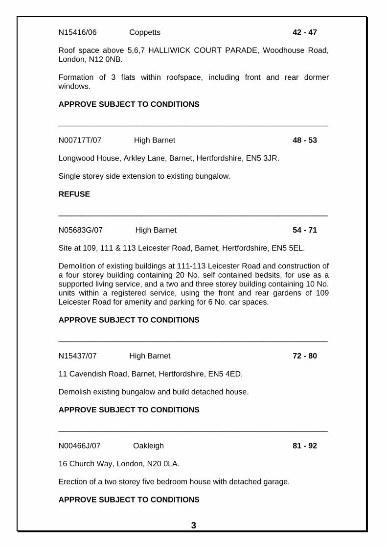
LOCATION: 43 Friern Barnet Road, London, N11 1ND.
REFERENCE: N00076Q/07 Received: 20 Feb 2007 Accepted: 5 Mar 2007WARD: Brunswick Park Expiry: 4 Jun 2007 Final Revisions:APPLICANT: Freshlead Ltd PROPOSAL: Demolition of the former Turrets PH and erection of
part three, part four and part five storey mixed use development, comprising use of ground floor as Class A1/A2/A3/D1 and a total of 40no. residential self-contained flats on the upper levels, together with associated basement car-parking and changes to landscaping.
RECOMMENDATION I: That the applicant and any other person having a requisite interest be invited to enter by way of an agreement into a planning obligation under Section 106 of the Town and Country Planning Act 1990 and any other legislation which is considered necessary for the purposes seeking to secure the following: i) a contribution of £29,552.32 index linked towards education provision in the borough; ii) a contribution of £90,000 index linked towards improvements and alterations to the highway in the vicinity of the site; iii) A contribution of £30,000 index linked towards open space improvements within the Borough; iv) The provision of 12 affordable housing units on the site, 9 of which would be for social rent (three 1-bed 2 person, two 2-bed 4 person, and four 3-bed 5 person) and 3 of which would be for shared ownership (one 1-bed and two 2-bed), and their transfer to a Registered Social Landlord nominated by the Council at 60% of TCI (Total Cost Indicators). Total Cost Indicators are stated in the council's Adopted SPD for Affordable Housing (2007). These costs are to be inclusive of the RSL's on-costs and any parking spaces provided on site. All affordable housing units to be built to the Housing Corporation's Published Scheme Development Standards necessary to secure Housing Grant. v) The scheme shall be included in the Notting Hill Construction Training Initiative. vi) A contribution of £6000 index linked towards monitoring of the S106 agreement; vii) all payments in i), ii), iii) and vi) above to become payable in their entirety within 28 days following a material start of the building implementing the planning permission with prior written notice to the Director of Planning and Environmental Protection 14 days before implementation of

6
development; viii) the paying of the council's legal and professional costs and preparing the agreement and any other enabling agreements. RECOMMENDATION II: That upon completion of such agreement the Director of Planning and Environmental Protection be instructed to approve planning application ref: N00076Q/07 under delegated powers subject to the following conditions:-
1. This development must be begun within three years from the date of this permission. Reason: To comply with Section 51 of the Planning and Compulsory Purchase Act, 2004.
2. Before the development hereby permitted commences, details of the materials to be used for the external surfaces of the building(s) and hard surfaced areas shall be submitted to and approved in writing by the Local Planning Authority. The development shall be implemented in accordance with such details as approved. Reason: To safeguard the visual amenities of the locality.
3. Before the development hereby permitted is brought into use or occupied the site shall be enclosed except at the permitted points of access in accordance with details previously submitted to and approved in writing by the Local Planning Authority. Reason: To ensure that the proposed development does not prejudice the appearance of the locality and/or the amenities of occupiers of adjoining residential properties and to confine access to the permitted points in the interest of the flow of traffic and conditions of general safety on the adjoining highway.
4. Before the development hereby permitted is occupied, parking spaces shall be provided and marked out within the site in accordance with a scheme to be submitted to and approved in writing by the Local Planning Authority and that area shall not thereafter be used for any purpose other than the parking and turning of vehicles. Reason: To ensure that parking and associated works are provided in accordance with the council's standards in the interests of pedestrian and highway safety and the free flow of traffic.
5. Notwithstanding the plans submitted, before development commences, details of the layout, gradient and design of the access ramp and basement car parking area and clearances along the ramp and within the parking area shall be submitted to and approved in writing by the Local Planning Authority. The development shall not be carried out nor shall it be subsequently operated otherwise than in accordance with the

7
approved details. Reason: In the interests of highway safety in accordance with Policies M11 and M13 of the London Borough of Barnet Adopted Unitary Development Plan 2006.
6. Before this development is commenced details of the design of the lay-by shall be submitted to and approved in writing by the Local Planning Authority. The development shall be implemented in accordance with such details as approved. Reason: To ensure that the lay by is provided to a suitable standard sufficient to accommodate vehicles clear of the highway in the interests of pedestrian and highway safety and the free flow of traffic.
7. Before the development is commenced details of the access point onto Friern Barnet Road shall be submitted to and approved in writing by the Local Planning Authority. The access point as approved shall be constructed in accordance with the approved details before the site is occupied. Reason: To ensure a safe form of development and to protect the amenities of the area.
8. Before the development hereby permitted is occupied, details of all boundary treatment shall be submitted to and approved in writing by the Local Planning Authority and the development shall be implemented in accordance with these details. Reason: To preserve the amenities of neighbouring occupiers and ensure that the development does not prejudice the character or appearance of the streetscene.
9. Before the development hereby permitted is occupied, details of all external lighting shall be submitted to and approved in writing by the Local Planning Authority and the development shall be implemented in accordance with these details. Reason: In the interests of operational needs, safety, and integrity of the railway and to ensure that the development does not prejudice the amenities of neighbouring occupiers.
10. Before this development is commenced, details of the levels of the building(s), road(s) and footpath(s) in relation to adjoining land and highway(s) and any other changes proposed in the levels of the site shall be submitted to and approved in writing by the Local Planning Authority. The development shall be implemented in accordance with such details as approved. Reason: To ensure that the work is carried out at suitable levels in relation to the highway and adjoining land having regard to drainage, gradient of access and the amenities of adjoining occupiers and the health of any trees on the site.

8
11. A scheme of hard and soft landscaping, including details of existing trees to be retained, shall be submitted to and agreed in writing by the Local Planning Authority before the development, hereby permitted, is commenced. Reason: To ensure a satisfactory appearance to the development.
12. All work comprised in the approved scheme of landscaping shall be carried out before the end of the first planting and seeding season following occupation of any part of the buildings or completion of the development, whichever is sooner, or commencement of the use. Reason: To ensure a satisfactory appearance to the development.
13. Any existing tree shown to be retained or trees or shrubs to be planted as part of the approved landscaping scheme which are removed, die, become severely damaged or diseased within five years of the completion of development shall be replaced with trees or shrubs of appropriate size and species in the next planting season. Reason: To ensure a satisfactory appearance to the development.
14. No construction work resulting from the planning permission shall be carried out on the premises at any time on Sundays, Bank or Public Holidays, before 8.00am or after 1.00pm on Saturdays, or before 8.00am or after 6.00pm on other days unless previously approved in writing by the Local Planning Authority. Reason: To safeguard the amenities of neighbouring residential properties.
15. Provisions shall be made within the site to ensure that all vehicles associated with the construction of the development hereby approved are properly washed and cleaned to prevent the passage of mud and dirt onto the adjoining highway. Reason: To ensure that the development does not cause danger and inconvenience to users of the adjoining pavement and highway.
16. The demolition and/or construction of the development hereby approved, shall be carried out in accordance with a method statement and Construction Management Plan, which shall have been previously submitted to and approved in writing by, the local planning authority. Any demolition shall be carried out in complete accordance with the approved scheme. Any details submitted in respect of the Construction Management Plan above shall control the hours, routes taken, means of access and security procedures for construction traffic to and from the site and the method statement shall provide for the provision of on-site wheel

9
cleaning facilities during demolition, excavation, site preparation and construction stages of the development, recycling of materials, the provision of on-site car parking facilities for contractors during all stages of development (excavation, site preparation and construction) and the provision on site of a storage /delivery area for all plant, site huts, site facilities and materials and a community liaison contact. Reason: In the interests of highway safety.
17. Before the locally listed building is demolished a detailed photographic record of the building shall be compiled and submitted to the Local Planning Authority. Reason: To retain a historic record of this locally important building.
18. Before development commences other than for investigative work: a) A desktop study shall be carried out which shall include the identification of previous uses, potential contaminants that might be expected, given those uses, and other relevant information. Using this information, a diagrammatical representation (Conceptual Model) for the site of all potential contaminant sources, pathways and receptors shall be produced. The desktop study and Conceptual Model shall be submitted to the Local Planning Authority. If the desktop study and Conceptual Model indicate no risk of harm, development shall not commence until approved in writing by the Local Planning Authority.- b) If the desktop study and Conceptual Model indicate any risk of harm, a site investigation shall be designed for the site using information obtained from the desktop study and Conceptual Model. This shall be submitted to, and approved in writing by, the Local Planning Authority prior to that investigation being carried out on site. The investigation must be comprehensive enough to enable:- * a risk assessment to be undertaken, * refinement of the Conceptual Model, and * the development of a Method Statement detailing the remediation requirements. The risk assessment and refined Conceptual Model shall be submitted, along with the site investigation report, to the Local Planning Authority. If the risk assessment and refined Conceptual Model indicate no risk of harm, development shall not commence until approved in writing by the Local Planning Authority. a) If the risk assessment and refined Conceptual Model indicate any risk of harm, a Method Statement detailing the remediation requirements, using the information obtained from the site investigation, and also detailing any post remedial monitoring shall be submitted to, and approved in writing by, the Local Planning Authority prior to that remediation being carried out on site. Reason: To ensure a satisfactory treatment of the site and to protect the amenities of the area.

10
19. Where remediation of contamination on the site is required completion of the remediation detailed in the method statement shall be carried out and a report that provides verification that the required works have been carried out, shall be submitted to, and approved in writing by the Local Planning Authority before the development is occupied Reason: To ensure a satisfactory treatment of the site and to protect the amenities of the area.
20. A scheme for air pollution mitigation measures shall be submitted to the LPA and agreed in writing prior to implementation. These measures should apply to the flats on the Friern Barnet Road facade up to and including those on the second floor. Reason: To ensure that the amenities of occupiers are protected from levels of poor air quality in the vicinity.
21. The level of noise emitted from the extraction and ventilation and substation plant hereby approved shall be at least 5dB (A) below the background level, as measured from any point 1 metre outside the window of any room of an existing neighbouring property at 39 Friern Barnet Road or St Paul's C of E Primary School at the time of this decision notice. If the noise emitted has a distinguishable, discrete continuous note (whine, hiss, screech, hum) and/or distinct impulses (bangs, clicks, clatters, thumps), then it shall be at least 10dB (A) below the background level, as measured from any point 1 metre outside the window of any room of an existing neighbouring property at 39 Friern Barnet Road or St Paul's C of E Primary School at the time of this decision notice. Reason: To ensure that the proposed development does not prejudice the amenities of occupiers of neighbouring properties.
22. Before development commences, a report should be carried out by a competent acoustic consultant and submitted to the LPA for approval that assesses the likely noise impacts from the development of the (ventilation/extraction plant, the car lift and the substation). The report shall also clearly outline mitigation measures for the development to reduce these noise impacts to acceptable levels. It should include all calculations and baseline data, and be set out so that the LPA can fully audit the report and critically analyse the contents and recommendations. Reason: To ensure that the amenities of neighbouring premises are protected from noise from the development.
23. The flats shall be constructed so as to provide sufficient sound insulation against externally generated noise and provided with double glazing and additional means of ventilation so that the windows and other openings can be kept closed. A scheme for the necessary measures is to be provided to the LPA and agreed in writing before

11
implementation. Reason: To ensure that the proposed development does not prejudice the enjoyment of the occupiers of their home.
24. The development is required to meet the "Excellent" standard in the BRE (Building Research Establishment) EcoHomes assessment (or equivalent standard in the Code for Sustainable Homes) and a high HQI (Housing Quality Indicator) for residential development. The applicant is required to submit, and have approved in writing by the Local Planning Authority, a certificate by a licensed EcoHomes assessor (or equivalent Code for Sustainable Homes assessor) to demonstrate that the development satisfactorily meets the Excellent (or equivalent Code for Sustainable Homes) rating. Reason: To ensure that the development is sustainable and complies with Strategic and Local Policies.
INFORMATIVE(S):-
1. The plans accompanying this application are: -F133/100/07; F133/101/07; F133/102/07; F133/103/07; F133/104/07; F133/105/07; F133/106/07; F133/200/07; F133/201/07; F133/202/07; F133/203/07; F133/207/07; F133/002/07; Traffic and Transport Assessment - Paul Mew Associates (February 2007); Planning Statement - Dalton Warner Davis (Dated February 2007); Sustainability Statement (Revision A) - RYB Konsult (14th February 2007); Carbon Reduction Strategy (Revision A) - RYB Konsult (14th February 2007); Preliminary Ecohomes Report (Revision A) - RYB Konsult (14th February 2007); Noise Assessment Report (Project No: 046158) - Sharps Redmore Partnership (7th February 2007); Air Quality Assessment Report - Temple (16th February 2007).
2. The reasons for this grant of planning permission or other planning related decision are as follows: - i) The proposed development accords with strategic planning guidance and policies as set out in the Mayor's London Plan (published 10 February 2004) and the Adopted Barnet Unitary Development Plan (UDP) (2006). In particular the following policies are relevant: London Borough of Barnet Adopted Unitary Development Plan 2006: GSD, GMixedUse, GEA, GEnergy, Gland, GBEnv1, GBEnv2, GBEnv3, GBEnv5, GParking, GLoc, GNonCar, GH1, GH2, GH3, ENV2, ENV7(A), Env13, ENV14, D1, D2, D3, D4, D5, D6, D7, D8, D9, D11, D22, D24, D25, HC14, HC15, M1, M2, M4, M5, M10, M11,M12, M13, M14, M17, H2, H4, H5, H13, H14, H16, H17, H18, H21, CS8, IMP1, IMP2 ii) The proposal is acceptable for the following reason(s): - The proposed redevelopment of the site would result in a more efficient

12
use of previously developed land in accordance with Government Guidance and will provide a high quality, sustainable, landmark building on this prominent corner site. The development is considered to provide a suitable level of amenity for future occupiers whilst preserving the amenities of existing nearby occupiers, whilst parking spaces are provided in accordance with the council's parking standards. The application is considered acceptable subject to the completion of a legal agreement to secure a financial contribution towards education and highways alterations.
3. Your attention is drawn to the fact that this decision is subject to a Section 106 Planning Obligation.
4. Please supply the following information for all extraction units (including air conditioning, refrigeration): 1. The proposed hours of use of the equipment. 2. The sound pressure levels of the ventilation/ extraction system to be installed in decibels dB(A) at a specified distance from the equipment. 3. Details of where the equipment will be placed i.e. within or outside of the building, marked on to a scale map. 4. Details of silencers to be fitted, and other sound insulation measures to reduce any noise impacts on neighbours including their noise reduction in dB(A). 5. Distance away from noise sensitive premises and the nature of these premises e.g.: offices, housing flats or storage.
5. In complying with the contaminated land condition parts 1 and 2: a. Use of current guidance Reference should be made at all stages to appropriate current guidance and codes of practice at January 2006 this would include: * The Environment Agency CLR Guidance documents; * Planning Policy Statement 23 Planning and Pollution Control; * PPS23 Annex 2 Development On Land Affected By Contamination; * BS10175:2001 Investigation of potentially contaminated sites - Code of Practice; * The Environment Agency (2001) Secondary Model Procedure for the Development of Appropriate Soil Sampling Strategies for Land Contamination; * And Guidance for the safe development of housing on land affected by contamination, Environment Agency R&D Publication 66. b. Maps Clear site maps should be included in the reports showing previous and future layouts of the site, potential sources of contamination, the locations of all sampling points, the pattern of contamination on site, and to illustrate the remediation strategy. c. Raw Data All raw data should be provided in a form that can be easily audited and assessed by the council. (e.g. trial pit logs and complete laboratory analysis reports) d. Decision Process

13
Details as to reasoning, how conclusions were arrived at and an explanation of the decisions made should be included. (e.g. the reasons for the choice of sampling locations and depths).
6. Thames Water requests that the Applicant should incorporate within their proposal, protection to the property by installing for example, a non-return valve or other suitable device to avoid the risk of backflow at a later date, on the assumption that the sewerage network may surcharge to ground level during storm conditions.
7. Method statements may be required to be submitted to Network Rail's Territory Outside Parties Engineer at the below address for approval prior to works commencing on site. Where any works cannot be carried out in a "fail-safe" manner, it will be necessary to restrict those works to periods when the railway is closed to rail traffic i.e. "possession" which must be booked via Network Rail's Territory Outside Parties Engineer and are subject to a minimum prior notice period for booking of 20 weeks. Generally if excavations/piling/buildings are to be located within 10m of the railway boundary a method statement should be submitted for NR approval. Network Rail's Territory Outside Parties Engineer 2nd Floor, George Stephenson House, Toft Green York Y01 6JT
8. All surface and foul water arising from the proposed works must be collected and diverted away from Network Rail property. In the absence of detailed plans all soakaways must be located so as to discharge away from the railway infrastructure.
9. All operations, including the use of cranes or other mechanical plant working adjacent to Network Rail's property, must at all times be carried out in a "fail safe" manner such that in the event of mishandling, collapse or failure, no materials or plant are capable of falling within 3.0m of the nearest rail of the adjacent railway line, or where the railway is electrified, within 3.0m of overhead electrical equipment or supports.
10. All excavations/ earthworks carried out in the vicinity of Network Rail property/ structures must be designed and executed such that no interference with the integrity of that property/ structure can occur.
11. Security of the railway boundary will require to be maintained at all times. If the works require temporary or permanent alterations to the mutual boundary the applicant must contact Network Rail's Territory Outside Parties Engineer.
12. Although the existing Network Rail (NR) fence is adequate in preventing trespass there will inevitably be pressure from the new residents to soften or even attempt to alter its appearance. It should be noted that the existing NR fence should not be altered or moved in any way and nothing should be put in place to prevent NR from maintaining our boundary fence as we are obliged to do so in law. It is Network Rail's experience that most developments seek to provide their own boundary

14
enclosure so as to avoid such future problems. It would also help to reduce the impact of railway noise. Network Rail advise that the developer should provide a trespass proof fence adjacent to Network Rail's boundary (minimum 1.8m high) and make provision for its future maintenance and renewal. Network Rail's existing fencing / wall must not be removed or damaged.
RECOMMENDATION III That if the above agreement has not been completed by the 2nd June 2007 the Director of Planning and Environmental Protection REFUSE the application ref N00076Q/07 under delegated powers for the following reasons:
1. The development lies within an area where there is currently a shortage of school places and no formal undertaking is given to meet the extra educational costs arising as a result of the development, contrary to Policy CS8 of the London Borough of Barnet Adopted Unitary Development Plan (2006).
2. The development would require works to improve and adapt the
highway in the vicinity of the site and no formal undertaking is given to meet the costs of these works to the detriment of the safety and free flow of traffic and contrary to Policies M13 and IMP1 of the London Borough of Barnet Adopted Unitary Development Plan (2006).
3. The development would require the provision of on-site units for
affordable housing and no formal undertaking is given to provide these units on site contrary to Policies H5 and IMP1 of the London Borough of Barnet Adopted Unitary Development Plan (2006).
1. MATERIAL CONSIDERATIONS National Planning Policy Framework and Guidance:
• Planning Policy Statement 1 (PPS1): Delivering Sustainable Development
− Draft Planning & Climate Change supplement to PPS1 • Planning Policy Statement 3 (PPS3): Housing • Planning Policy Statement 6 (PPS6): Planning for Town Centres • Planning Policy Guidance Note 13 (PPG13): Transport • Planning Policy Guidance Note 24 (PPG24): Noise
Regional Policy Framework The Mayor for London, The London Plan, Spatial development strategy for Greater London 2004: 3A.6, 3A.7, 3A.8, 3A.18, 3C.22, 3D.1, 3D.2, 3D.3, 4A.7, 4A.9, 4B.1, 4B.3, 4B.5, 4B.6, 4B.7, 4B.10 Mayor For London relevant SPGs:
− The Mayor’s Energy Strategy (2004)

15
London Borough of Barnet Adopted Unitary Development Plan 2006: GSD, GMixedUse, GEA, GEnergy, Gland, GBEnv1, GBEnv2, GBEnv3, GBEnv5, GParking, GLoc, GNonCar, GH1, GH2, GH3, ENV2, ENV7(A), Env13, ENV14, D1, D2, D3, D4, D5, D6, D7, D8, D9, D11, D22, D24, D25, HC14, HC15, M1, M2, M4, M5, M10, M11,M12, M13, M14, M17, H2, H4, H5, H13, H14, H16, H17, H18, H21, CS8, IMP1, IMP2 Supplementary Planning Guidance:
Draft Supplementary Planning Document (SPD) - Sustainable Design and Construction. • Affordable Housing SPD (Approved by Cabinet February 2007)
Contributions to Lifelong Learning from Development – Pre-Schooling and Education Draft Supplementary Planning Document • Contributions to Lifelong Learning from Development – Library
Services Draft Supplementary Planning Document • Planning Obligations for S106 Agreements Draft SPD
(September 2006) Corporate Documents:
− The Three Strands Approach − Corporate Plan
Relevant Planning History: N00076A Change of use of part ground/part first floor to office for brewery staff APPROVED 19.11.75 N00076C Formation of car park extension APPROVED 25.6.86 N00076L Erection of two storey ground and first floor rear extension, installation of external staircase to side elevation, alterations to front elevation and provision of on-site car parking APPROVED 13.3.01 N00076M Erection of detached single storey building for use as car wash r/o existing public house REFUSED 16.6.01 N00076N/05 Demolition of the former Turrets PH and erection of part four, part five, part six and part seven storey mixed use development, comprising use of ground floor as Class A1/A2/A3/D1 and a total of 44no. residential self-contained flats on the upper levels, together with associated basement car-parking and changes to landscaping. REFUSED 04-01-2006 for the following reasons:

16
1. The proposed development would, by reason of its mass, bulk, size, design and siting, be overbearing and visually obtrusive detrimental to the character and appearance of the area and the street scene in this prominent location contrary to policies G1, T1.1, H1.2 of the Adopted Barnet Unitary Development Plan (1991) and policies GBEnv1, GBEnv2, D1, D2, D3, D4 and H16 of the Barnet Unitary Development Plan revised Deposit Draft Modifications (June 2005).
2. The development lies within an area where there is currently a shortage of school places and no formal undertaking is given to meet the extra educational costs arising as a result of the development, contrary to policy EDN1.1 of the Barnet Adopted Unitary Development Plan (1991) and Policy CS8 of the Barnet Unitary Development Plan Revised Deposit Draft Modifications (June 2005).
3. The development would require works to improve and adapt the highway in the vicinity of the site and no formal undertaking is given to meet the costs of these works to the detriment of highway safety and the free flow of traffic and contrary to Policies Gparking, M8, M10, M11, M12, M13 and IMP1 of the Barnet Unitary Development Plan Revised Deposit Draft Modifications (June 2005).
4. The development would require the provision of on-site units for affordable housing and no formal undertaking is given to provide these units on site contrary to Policies H5 and IMP1 of the Barnet Unitary Development Plan Revised Deposit Draft Modifications (June 2005)
An Appeal against this refusal was DISMISSED on the 14-06-2006. Consultations and views Expressed: Neighbours Consulted: 158 Replies: 4 at the time of
writing The application was also advertised on site and in the local press. Views expressed by neighbours objecting to the proposal or making comments on the proposal are summarised as follows:
• Existing building is of outstanding character. Its demolition would destroy an important landmark of historic interest which is part of the character of the area
• Proposed building is overbearing and visually obtrusive to character and appearance
• Overdevelopment of a small site • Excessive commercial use of ground floor • Car parking provision would be inadequate • It will result in too much traffic • Extra cars will join the intense congestion that already exists at
this junction • Proposed lay-by would reduce pavement width and make it
unsafe for children • Existing housing stock is Victoria or 1930s and the proposed
development is completely out of scale • Loss of light to St Paul’s Primary School
17
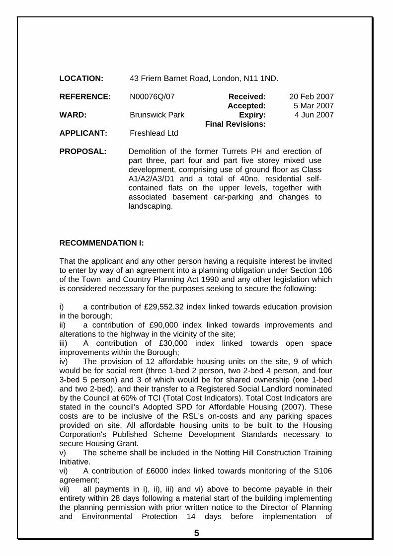
• Overlooking and privacy Other Consultations The Environment Agency - No objection Thames Water - No objection MET Police - No objection Network Rail - Network Rail’s Territory Outside Parties Engineer has raised no objections in principle to the development subject to the above informatives. Internal Consultations Urban Design and Heritage The council’s Urban Design and Heritage Officer advised that subject to conditions, the application is acceptable. The proposed new building successfully holds the corner and also steps up from the scale of the shopping parade echoing the scale and rhythm of the street-scene. The new building would successfully counter-balance the “arc” building at Betstyle Circus. Highways The Council’s Highways Group were consulted. They advised that proposal is recommended for approval on highways grounds, subject to conditions, the Section 106 Contribution of £90,000, a Section 278 and a Section 38 agreement for the provision of the lay-by and amendments to the footway on Friern Barnet Road in front of the site. Housing The Councils Housing section advised that as the minimum of 30% of the proposed new accommodation is proposed to be affordable it would need to be provided at 60% of TCI to an agreed Registered Social Landlord. The scheme would need to be provided to Scheme Development Standards. Environmental Health The Councils Environmental Health section has advised that the proposals, subject to a number of conditions with regards to noise and air quality, are acceptable. 2. PLANNING APPRAISAL Context of this Application A planning application for the development of this site was presented to the Planning and Environment Committee on the 4th January 2006 (Ref: N00076N/05) with a recommendation by planning officers for approval. This application was refused by Members. The primary reason for refusal related to the mass, bulk, size, design and siting of the building being overbearing, visually obtrusive and detrimental to the character and appearance of the area. The other three reasons for refusal related to the lack of a formal undertaking to provide financial contributions towards education provision, financial contributions to carry out the necessary highways alterations, and to

18
provide affordable housing units on the site (see detailed reasons for refusal for N00076N/05 in Relevant Planning History section above). A subsequent appeal against this refusal was dismissed by a Planning Inspector on the 14th June 2006. The Planning Inspector’s only reason for dismissing the appeal concerned the bulk of the building in relation to the surrounding townscape. The revised proposals therefore need to be considered against the previous reasons for refusal and having regard to the Planning Inspector’s comments. Site Description and Surroundings 43 Friern Barnet Road is a locally listed building that is currently vacant and sits on the junction of Friern Barnet road and Station Road. The last use of the building was as a public house, and is known locally as ‘The Turrets’. Levels drop slightly from front to rear of the site. It is flanked by St Paul’s Primary school to the north. A parade of shops with residential accommodation above adjoins the site to the east. The land immediately to the west of the site is the railway embankment. At the edge of this, the land falls away to the railway below. Proposals The proposal is for the demolition of the existing building and the erection of a part three, part four and part five storey mixed use development, comprising use of ground floor commercial unit and a total of 40no. residential flats on the upper levels, together with associated basement car-parking and landscaping. The building would be 10m high adjacent to 39 Friern Barnet Road and would step up to a height of 17m. The rear building line would be set 10m away from the rear boundary with St Paul’s School and approximately 12.9m away from the closest building on the school site. Material Planning Considerations The demolition of the Locally Listed building has previously been accepted subject to its replacement by a high quality ‘landmark’ building. The Planning Inspector stated that despite its ‘local listing’ he could see “no objections to the loss of the undistinguished building that occupies the site.” The application is considered to meet the tests of PPG15 and Policy HC14 of the Adopted UDP. The demolition of the existing building is therefore considered acceptable. The proposal represents an efficient use of previously developed land in accordance with national legislation (Planning Policy Guidance Note 3: Housing), the Mayor’s London Plan and policy H21 of the Adopted UDP (2006). It is considered that a retail or medical use on the ground floor of the proposed building would be appropriate in this location and would positively contribute to the adjoining established retail parade.
19
The proposed development will provide 547m2 of amenity space in the form of communal space on the ground floor and private space in the form of balconies and private terraces on the remaining floors. The applicant has agreed to make a contribution of £30,000 towards open space improvements in the Borough. Design, Mass and Bulk of New Building The development site occupies an important corner and therefore needs a bold treatment because of the amount of space adjacent to it with the wide void of the railway line, and the need to properly stop the view up Station Road, and balance the substantial Bank building on the opposite side of Friern Barnet Road. Furthermore, given that historically it has provided a major feature within the street scene it is considered that any new building should be of ‘landmark’ quality. In dismissing the appeal, the Planning Inspector stated that the “bulk of the building would not rest comfortably with the prevailing townscape” and would “adversely affect the visual amenities of the locality.” In light of the previous reasons for refusal and the Inspector’s decision, the mass, scale and bulk of the building has been reduced. The overall height has been reduced from a maximum of 7 storeys to a maximum of 5 storeys on the corner before stepping down through a series of terraces to 3 storeys at the point adjacent to the adjoining terrace, and 4 storeys along the elevation facing the railway. In addition the upper floors have been set back from the front building line so as to reduce the bulk of the building even further. The proposed new building successfully holds the corner adjacent to the railway lines but also steps down progressively to respect the scale of the adjacent shopping parade. The reduction in height and bulk is considered to satisfactorily overcome the previous reasons for refusal and address the inspector’s comments. The new building would successfully balance the wider streetscene of Friern Barnet Road with the “arc” building at Betstyle Circus to the east, and also successfully steps down to the Victorian School buildings (St.Paul’s) to the rear. In considering the appeal, the Planning Inspector stated that he had “no criticism of the appearance and detail of the proposed building.” Not withstanding these comments, the design of the proposed building now incorporates a mixture of stock brickwork and timber cladding to respect the rhythm and pattern of buildings in the existing terrace adjacent. The upper floors are proposed to be made from lighter, glazed structures further reducing the bulk of the building. Therefore the design and appearance of the building is considered to be appropriate for the location and the application is considered to be in line with Policies D1, D2, D3, D4, D5, D6 and D7 of the Adopted UDP (2006).

20
Highways Issues A total of 40 parking spaces are proposed on site. 2 parking spaces will be provided at ground level for the commercial unit and 38 parking spaces are proposed in a basement car park for the residential units. 24 covered cycle parking spaces are also provided at ground level. Vehicular access to the site would utilise the existing access from Friern Barnet Road. The basement car park would be accessed via a ramp from the north east side of the building. The ratio of proposed parking is similar to that of the previously submitted scheme. Given the particular circumstances of this development, including:
• Good public transport accessibility (PTAL score 4); • Location 200m from New Southgate Rail Station; • Location 800m from Arnos Grove Underground Station; • Double yellow lines adjacent to the site.
It is considered that the 40 parking spaces proposed would be acceptable in line with the parking standards set out in the Adopted UDP (2006). A ramp is proposed to access the basement car park instead of the car lifts proposed in the previous application. The site is located on a busy signalled controlled junction. In order to ensure the free flow of traffic at this junction it is considered necessary that right turns into and out of the site would be banned by installing a median strip along this part of Friern Barnet Lane. A lay-by has been proposed to the front of the building to enable refuse and service vehicles to stop without affecting the operation of the signal controlled junction. In order to integrate this development into the area and help improve the capacity of the junction the creation of a number of additional footway bays are required. All of these would need to be the subject of a Section 106 agreement and Section 38 and 278 agreements. Subject to the recommended conditions and the S106 agreement for highways alterations and improvement works, the proposal would not detrimentally affect the free flow of traffic in the locality or prejudice pedestrian/vehicular safety. Sustainable Design and Construction Policy GBEnv2 of the Adopted UDP (2006) states that the council will require high quality design in all new development in order to enhance the quality of the built and open environment, which utilises environmentally friendly methods of both design (including layout and orientation of buildings) and of construction, in order to meet the council’s objectives of sustainable development. In addition, since the appeal decision, the council has published a draft Supplementary Planning Document (SPD) for Sustainable Design and Construction. This SPD requires all development proposals to achieve a minimum standard of a ‘Very Good’ EcoHomes (or equivalent Code for Sustainable Homes) rating. The applicants have provided a Carbon Reduction Strategy, a Sustainability Statement and a provisional EcoHomes Assessment for the development. The development has been designed to achieve a ‘Very Good’ EcoHomes rating. Details have been provided to demonstrate how the development

21
meets the criteria set out in the council’s draft SPD on Sustainable Design and Construction. The following areas have been addressed:
• Urban Design Principles • Social Influences • Economic Influences on Design • Environmental Quality Design Standards
− Air Quality − Noise Quality − Water Quality − Biodiversity and Habitat Quality − Lighting and Light Pollution − Microclimate – wind and thermal conditions − Pollution Prevention
• Environmental Performance Design Standards − Energy –Transport − Energy – Buildings − Water Efficiency − Waste Strategy − Material Specification
The proposed development features the following renewable energy technologies:
• Solar hot water heating system to provide 50% of the annual domestic hot water demand of the residential units
• Ground source heat pumps to provide 100% of the annual heating and cooling demand of the commercial unit
• Photovoltaic cells to provide 3,400 kWh of on-site The proposal incorporates energy efficient building design that exceeds the requirements of Part L1A of Building Regulations for the residential element and Part L2A for the commercial element. A community heating system would be installed for the residential element of the building to provide efficient metered heating and hot water to each flat. A private wire network would also be proposed for the residential element in order to distribute the financial benefits of on-site electricity generation from the photovoltaic cells to tenants. The ground source heat pump system would produce all of the heat to meet the needs of the commercial unit.
The combination of technologies proposed for the development will result in a 10% reduction of the total carbon emissions of the site by renewable energy production. The proposed development therefore meets the council’s objectives of sustainable development set out in the draft SPD as well as the Mayor’s Energy Strategy. The application complies with Policies GSD, GEnergy, GBEnv2 and D1 of the Adopted UDP. The requirement for a ‘Very Good’ EcoHomes (or equivalent Code for Sustainable Homes) rating will be enforced by the condition recommended above. S106 Contributions Government Circular 05/05 and the Council’s adopted SPD for S.106 related planning obligations is applicable for this application in respect of policy areas:

22
Education The proposal would result in an increased child yield from the site. Policy IMP1 of the Adopted UDP (2006) advocates that in areas with existing shortages of school places or where the development will create such a shortage then a financial contribution will be sought, via a legal agreement to meet the extra additional costs that would result from this proposal. There are currently shortages for the provision of nursery and secondary education facilities in the area and a contribution of £29,552.32 is consistent with the formula contained within the Councils adopted Supplementary Planning Guidance. Affordable Housing The proposal comes above the 15 unit threshold advocated by Policy H5 of the emerging UDP and the Council’s Housing section have advised that 12 of the units to be provided on site at 60% of TCI to a Registered Social Landlord would be acceptable. It has been indicated that 9 of these would be for rent and 3 of these units would be in shared ownership. The units would be designed and built to the Housing Corporation’s Scheme Development Standards. Highways As outlined above a section 106 contribution for highways works is required. The Highways Group has advised that a contribution of £90,000 is required to amend the highway and pedestrian network in the vicinity of the site to facilitate a development of the size proposed in this location. The monies would be used on the following measures and mitigation requirements: * Amendment to the layout of Friern Barnet Road at the access point to
the development to facilitate a banned right turn into the development, including a Traffic Management Order, median strip in the carriageway, signing and lining.
* Review of waiting and loading restrictions and a traffic management order to implement loading bay restrictions and waiting restrictions;
* Review of the operation of the traffic signals; * Guard railing/bollards etc. * Amendments to lower and relocate the services in the footway out side
18-38 Friern Barnet Road to increase the number of footway parking bays and improve the capacity of the traffic signal junction.
Greenspaces The application site falls on the edge of an area designated in the Adopted UDP (2006) as an area of deficiency at local park level. Taking into consideration the location of the site, the council requires a contribution of £30,000 towards open space improvements within the Borough. Monitoring Contribution The delivery of the planning obligation from the negotiations stage to implementation can take considerable time and resources. As the Council is party to a large number of planning obligations, significant resources to project manage and implement schemes funded by planning obligation agreements are required. The Council therefore seeks the payment of £6000 towards the costs of undertaking the work relating to securing the planning obligations in

23
line with the adopted Supplementary Planning Document (SPD) for Planning Obligations (2007). The above contributions are being sought under Polices IMP1 and IMP2 of the Adopted UDP (2006). 3. COMMENTS ON THE GROUNDS OF OBJECTIONS Considered in the main report. 4. CONCLUSION The proposed redevelopment of the site would result in a more efficient use of previously developed land in accordance with Government Guidance and will provide a high quality, sustainable, landmark building on this prominent corner site. The reasons for the previous refusal and the Planning Inspector’s comments in dismissing the appeal are considered to have been addressed. The development is considered to provide a suitable level of amenity for future occupiers whilst preserving the amenities of existing nearby occupiers. Subject to the prior completion of a legal agreement to secure a financial contribution towards education, highways alterations, open space improvements and monitoring contribution, and to secure affordable housing on the site, APPROVAL is recommended.

24
Former Turrets Public House, 43 Friern Barnet Road, N11
N00076Q/07
LB
110
Boro Const Bdy
47
112
BM 62.39m
Shelter
CR 114
CW
61.0mPHUnd
38 236
FW 628
43Bank Parade
9
PH FRIERN BARNET ROAD
22
CR 20
Ward Bdy
18a
60.4m
18
39
LB33
31
Primary School
23St Pauls C of E THE AVENUE
17SP
1
El Sub Sta
Ward Bdy
CR
3
GROVE
COPPIES
House 9
Holmsdale 5
COPPIES GROVE
THE AVENUE
1 to 16
2
Based on the Ordnance Survey mapping with the permission of the Controller of Her Majesty’s Stationary Office Crown Copyright. Unauthorised reproduction infringes Crown Copyright and may lead to prosecution or civil proceedings.

25
LOCATION: Land at former Railway Sidings, Oakleigh Road
South, London, N11 1HJ.
REFERENCE: N15069A/07 Received: 9 Mar 2007 Accepted: 9 Mar 2007WARD: Brunswick Park Expiry: 8 Jun 2007 Final Revisions:APPLICANT: GBN Services Ltd PROPOSAL: Change of use of land from scrap yard to a waste
transfer station and vehicle de-polluting facility. Erection of waste transfer building. Erection of vehicle de-pollution canopy/bay. Erection of perimeter walls and gates. Retention of part single, part two storey portable building.
RECOMMENDATION: APPROVE SUBJECT TO CONDITIONS
1. This development must be begun within three years from the date of this permission. Reason: To comply with Section 51 of the Planning and Compulsory Purchase Act, 2004.
2. The premises shall be used for a waste transfer station and no other purpose (including any other purpose in Class B8 of the Schedule to the Town and Country Planning (Use Classes) Order, 1987, or in any provision equivalent to that Class in any statutory instrument revoking and re-enacting that Order, with or without modification). Reason: To enable the Local Planning Authority to exercise control of the type of use within the category in order to safeguard the amenities of the area.
3. The use hereby permitted shall not be operated and shall not be open to customers on Sundays or Bank and Public holidays, or before 07:00 or after 18:00 on Mondays to Fridays, or before 07:00 or after 12:00 on Saturdays. Reason: To prevent the use causing an undue disturbance to occupiers of nearby residential properties.
4. The proposed trommel shall not be operated on Sundays or Bank and Public holidays, or before 10:00 or after 17:00 on Mondays to Fridays, or before 10:00 or after 12:00 on Saturdays.

26
Reason: To prevent the use causing an undue disturbance to occupiers of nearby residential properties.
5. The door in the side elevation of the waste transfer building shall be kept closed at all times. Reason: To prevent the use causing an undue disturbance to occupiers of nearby residential properties.
6. There shall be no audible reversing alarms fitted to site plant. Reason: To prevent the use causing an undue disturbance to occupiers of nearby residential properties.
7. Acoustic fencing shall be installed on the boundary with the railway, this shall be at least 5m high and shall be continuous with no gaps in it. Reason: To prevent the use causing an undue disturbance to occupiers of nearby residential properties.
8. Heavy Goods Vehicles associated with the proposed development shall not use the following residential roads to or from the facility: Brunswick Avenue, Brunswick Crescent, Brunswick Gardens, Spencer Road and Park View Crescent, unless they are carrying out a local pick up from one of these roads. Reason: In order to safeguard highway and pedestrian safety and the free flow of traffic.
9. The construction of the foul and surface drainage system shall be carried out in accordance with details submitted to and approved in writing by the Planning Authority before the development commences. Reason: To prevent pollution of the water environment.
10. No soakaways shall be constructed in contaminated ground. Reason: To prevent pollution of groundwater.

27
11. Before the development hereby permitted commences, details of the materials to be used for the external surfaces of the building(s) and hard surfaced areas shall be submitted to and approved in writing by the Local Planning Authority. The development shall be implemented in accordance with such details as approved. Reason: To safeguard the visual amenities of the locality.
INFORMATIVE(S):-
1. The plans accompanying this application are:- E5518/PA/01, E5518/PA/02, E5518/PA/03, E5518/PA/04, E5518/PA/05, E5508/PA/06, Revised Traffic Report E5508/R2648, Revised Noise Assessment E5508/R2550, Agents Letters dated 31.3.2006 and 5.3.2007
2. The reasons for this grant of planning permission or other planning related decision are as follows: - i) The proposed development accords with strategic planning guidance and policies as set out in the Mayor's London Plan (published 10 February 2004) and the Adopted Barnet Unitary Development Plan (2006). In particular the following polices are relevant: Adopted Barnet Unitary Development Plan (2006): INF31A GEA, GWaste, GLand, GBEnv1, GBEnv2, GRoadNet, GParking, GEMP1, GEMP2, ENV3, ENV4, ENV7, ENV8, ENV11, ENV12, ENV14, D1, D2, D5, D7, M2, M8, M11, M12, M13, M14, M16 and M17 And, The proposed use of the site as a waste transfer station and vehicle de-pollution facility is considered to be in keeping with the general industrial character of the former railway sidings and is not considered to have a detrimental impact on the amenities of surrounding occupiers or users. It would not lead to levels of noise that would be harmful to the amenities of the occupiers of nearby residential properties. The proposed new building will be in keeping with the general industrial/warehousing accommodation in the vicinity. The proposal would not generate levels of traffic movements that would cause harm to highway and pedestrian safety and the free flow of traffic.
3. Under the Environmental Protection Act 1990, the proposed development may require a waste management licence if controlled waste is deposited, kept, treated or disposed of in or on the land. Certain activities do not require a waste management licence where the activities are part of a process registered or authorised under other legislation. Alternatively, the activity/proposal may be exempt from

28
waste licensing under the Waste Management Licensing Regulations 1994. You are advised to contact the Environment Agency on the telephone number below if you think the proposal requires a licence or is required to be registered as an exempt activity. Contact Rayhela Ahmed-Monju on 01707 632414 for further details. Should a Waste Management Licence be required, no development approved by this permission may commence until a Waste Management Licence has been issued for this site.
1. MATERIAL CONSIDERATIONS National Planning Policy Guidance PPS1 – Delivering Sustainable Development PPG4 – Industrial and Commercial Development and Small Firms PPG10 – Planning for Sustainable Waste Management Relevant policies in The London Plan Spatial Development Strategy for Greater London Relevant Unitary Development Plan Policies: GEA, GWaste, GLand, GBEnv1, GBEnv2, GRoadNet, GParking, GEMP1, GEMP2, ENV3, ENV4, ENV7, ENV8, ENV11, ENV12, ENV14, D1, D2, D5, D7, M2, M8, M11, M12, M13, M14, M16 and M17 Planning Brief for Development of Land at North London Business Park and Land Adjacent to Coppies Grove Relevant Planning History: N15069/06 – Change of use of land from scrap yard to a waste transfer station and vehicle de-polluting facility. Erection of waste transfer building. Erection of vehicle de-pollution canopy/bay. Erection of two-storey portable building and steel perimeter wall. WITHDRAWN 14.3.2007 N00481AA – Continued use as skip waste transfer station and retention of raised portakabin. Erection of portal frame building for sorting of waste material and overnight parking of skip vehicles, single storey portakabin and associated vehicle parking area – APPROVED 30.7.91

29
N00481AC – Erection of 10 ft high fencing and change of use to storage of plant and vehicle stacking with ancillary breaking and sales – APPROVED 19.7.95 Consultations and views Expressed: Neighbours Consulted: 53 Replies: 3 The application was advertised on site and in the local press. The occupiers of neighbouring properties and the operators of neighbouring businesses and their professional advisers have raised the following objections: • Increased pollution • Increased HGV traffic • Vehicles queueing in the slip road waiting to enter the Winters site can
cause delays for people wanting to gain access to the other businesses • Trade would be affected as customers may not visit due to being held up
waiting to gain access to their business • Air pollution caused by dust – a second waste transfer station would make
the situation intolerable as the existing operation causes problems • Substantial increases in noise, disturbance and environmental pollution • Traffic congestion within the site and on the adjacent highway • Limited width and geometry of the interior access road to cope with the
projected traffic • HGVs will not be able to pass on the access road this could cause
queueing back onto Oakleigh Road South restricting traffic flow and being detrimental to highway safety
• Vehicles would need to reverse causing a safety risk • Inadequate radius to accommodate the turning path for HGVs into and out
of the accessway at the junction with the spine road Any further replies received will be reported verbally at the Sub-Committee meeting. The Environment Agency has no objections in principle to the proposed development, subject to the imposition of conditions. The views of Railtrack will be reported verbally at the Sub-Committee meeting.

30
2. PLANNING APPRAISAL Site Description and Surroundings The application site is a parcel of land located on the former railway sidings on the south east side of Oakleigh Road South. It is located between an existing builders merchant and the railway lines themselves. Until recently, it has been used as a scrap yard. The site is accessed off Oakleigh Road South and the various businesses are served off a spine road within the site. The wider area is characterised by various commercial premises and their accompanying buildings. These businesses include two builders merchants, another waste transfer station and a scaffolding business. To the north east along Oakleigh Road South and on the far side of the railway tracks along Beaconsfield Road are residential properties. The site lies within the area covered by the Planning Brief for Development of Land at North London Business Park and Land Adjacent to Coppies Grove. Proposals It is proposed to use the site as a waste transfer station and a vehicle de-polluting facility. A series of structures and buildings are proposed within the site: A waste sorting building located at the north end of the site 26m wide, 15m deep and 11m high to the ridge. This would be open-sided to the south. It would contain a “trommel” a substantial mechanical device for screening the different materials. This building will also be used for the sorting and recovery by hand and mechanical grab of materials. There will be some storage of containers within it. An “End of Life Vehicle” canopy 14m wide, 5m deep and 4.5m high. This would be used for the dismantling of vehicles that have reached the end of their lives and the recovery of parts and de-pollution such as removing fuels, lubricants and batteries. This is located along the eastern boundary of the site. A “Materials Storage” canopy 9.5m wide, 5m deep and 5.5m high to be used for metals sorting and segregation. This is located at the southern end of the site. Part single, part two storey block of portacabins located along the western boundary. The tallest part of this block would be 5m in height. It would be used as offices for the site. Various bays would be used for storage of containers and materials.

31
It is proposed to erect a 5m high steel wall along the boundary with the railway lines and a 4.5m high steel and wood sleeper wall along the eastern boundary of the site. Access to the site would be gained from the existing access road leading off Oakleigh Road South which serves the existing operators on the site before turning off this to access the site at its southern end. Parking would be provided for 12 cars for visitors and employees. Material Planning Considerations There are a number of key considerations:
• The principle of the proposed use • Impact of the buildings on the character and appearance of the area • The impact upon the amenities of the users/occupiers of nearby and
adjoining businesses and residences • Traffic and highways issues
The Use PPG10 paragraph 39 states: “The planning system should enable adequate provision to be made for waste management facilities in appropriate locations, without undue adverse environmental effects or nuisance. “ Policy GWaste of the Adopted UDP (2006) states that the council will encourage waste management practices that are carried out in accordance with the following waste management principles: The waste management hierarchy – reduce, re-use, recover (recycling,
composting, energy recovery) and dispose; The best practical environmental option; and The proximity principle.
Policy Env3 of the Adopted UDP (2006) states that proposals for waste management facilities will be treated on their merits and be assessed against following criteria:
− The proximity of the facility to the source of waste; − The opportunity for access by rail to the waste management facility; − The impact of the proposal on environment and residential amenities; − The scale and design of plant and buildings; and − The inclusion of energy recovery and recycling facilities on the site
where possible. Policy Env4 of the Adopted UDP (2006) states that the recycling of waste will be promoted by ensuring an adequate network of recycling facilities in the borough. Furthermore, the adopted Planning Brief for Development of Land at North London Business Park and Land Adjacent to Coppies Grove recognises the importance of the continuing retention of the existing businesses on the site
32
and its neighbours it also makes provision for the expansion of the existing waste transfer station. The proposal is considered to comply with the general thrust of these policies and guidance insofar as it would increase the provision of facilities for the re-use and recycling of waste. Furthermore, it would provide a local facility for the applicant within the catchment area of this part of north London – currently, vehicles have to make longer journeys to the applicant’s other sites. The site is also located on the Borough’s strategic road network and is located a short distance from the North Circular Road. In view of the other uses that exist on the former railway sidings, such as another waste transfer station, builders merchants, scaffolding company, the site and its surroundings are industrial in character. Furthermore, the site was previously used as a scrap yard. On the basis of the foregoing, it is considered that the proposed use is acceptable in this location. Character and Appearance The proposed buildings are functional in design terms. The proposed buildings would be of a similar height to the adjacent warehouse buildings and would be largely concealed by the proposed boundary enclosures. The proposed waste sorting building is significantly taller than the other buildings on site. However, the existing waste transfer station has a building of similar scale. In view of the separation from residential properties and the site boundaries of the wider railway sidings site, the building would not be an overbearing or visually obtrusive structure. In view of the surrounding buildings, the proposed structures would not be harmful to the character and appearance of the area. Impact on Amenities The main issue relates to noise. A noise report has been prepared to assess the implications on the existing noise climate of the proposed change of use and then to consider the effectiveness of noise suppressing measures. The nearest noise-sensitive receptors, being the residential flats at Chaville Court, on the far side of the railway tracks. The site was previously a scrap yard, which is quite a noisy use. The proposed use may be noisier than the previous use. The applicants are proposing a number of measures to control and reduce this noise at the neighbouring residential premises. These include 5m high fencing on the railway side of the site to shield the residents in the flats the other side of the railway, the hours of use of the trommel would be limited to 10:00 - 17:00 Monday to Friday and 10:00 - 12:00 on Saturday and not at all on Sundays or bank holidays. They are also not going to have audible reversing alarms on the site plant and the hours of operation of the site will also be controlled.

33
The fencing and the waste sorting building on the north of the site will provide significant noise shielding around the site. The fence on the western side of the site by the railway would be 5m high and would assist in reducing the noise levels. Accurate ground levels and spot height information has not been provided and the 5m fence would ensure that there would be no line of sight from the windows in Chaville Court to the noisy work on site and the noise barrier would therefore be effective. The report predicts that, with a 5m fence in place, noise levels at the flats at Chaville Court, which face the site would be 2dBA above background noise levels at the ground floor, 4dBA above background at the first floor and 5dBA above background at the second floor. According to guidance at 5dBA above background the likelihood of complaints is of marginal significance. On this basis, it is considered that nearby residents’ amenities would not be harmed through noise and disturbance. Dust and Odour can also cause problems on sites of this nature. The main waste sorting process will be undertaken within the new building the proposed measures will mitigate any dust, fibres or particulates, which are generated by the proposed use. Further dust control measures include water spraying to control dust during dry weather. Similar measures are in place at the existing waste transfer station. Odorous material would be sealed within bags or containers. The proposed mitigation measures are considered adequate to control airborne pollution. Traffic and Highway Issues A traffic report has been submitted with the application to assess the impact that proposals would have on traffic conditions. The site was previously used as a scrap yard resulting in significant lorry movements to and from the site. It is understood that 6 vehicles used to operate from the site with approximately 10 return movements per vehicle per day throughout the week. An operator’s licence has been granted for 20 vehicles to operate from the site, but the applicant would not wish to operate so many vehicles from the site. It is estimated that the proposed use would rsult in 10 return lorry trips per day making a maximum of daily lorry movements from the site of 100 return trips. The traffic report estimates that there would be likely to be no more than 3 additional return HGV trips over that which took place from the scrap yard and an additional four to five return trips per hour during the day. Available traffic flow data relates to Oakleigh Road North rather than Oakleigh Road South, but the report uses this data as a guide to the traffic flows along Oakleigh Road South. Traffic flows show average hourly flows of up to 596 vehicles in the morning peak, up to 736 in the evening peak and up to 646 per hour during the day. The proposed increase in traffic movements would represent a small increase of between 1% to 1.5% on traffic using the road system. The proposed use will marginally increase the trips to and from the site. However, the increase in trips will be spread over the period of the day and it

34
is considered that the additional trips would not adversely affect the existing highway network. The applicant has confirmed that HGV vehicles connected with the development would use Oakleigh Road North and Oakleigh Road South to access the main road network. However, there are a number of local roads in the vicinity that would not be suitable for such traffic. The applicant has indicated their agreement to the imposition of a condition preventing HGVs from using certain residential roads (unless they are carrying out a local pick-up). 3. COMMENTS ON THE GROUNDS OF OBJECTIONS Considered to be addressed in appraisal. 4. EQUALITIES AND DIVERSITY ISSUES A disabled parking space would need to be provided as well as level access into the portacabin building. 5. CONCLUSION The proposed use of the site as a waste transfer station and vehicle de-pollution facility is considered to be in keeping with the general industrial character of the former railway sidings and is not considered to have a detrimental impact on the amenities of surrounding occupiers or users. It would not lead to levels of noise that would be harmful to the amenities of the occupiers of nearby residential properties. The proposed new building will be in keeping with the general industrial/warehousing accommodation in the vicinity. The proposal would not generate levels of traffic movements that would cause harm to highway and pedestrian safety and the free flow of traffic.

35
N15069A/07
Land at Former Railway Sidings, Oakleigh Road South, LONDON N11 1HJ
16
EAST
116
29
11
12
2CR
ESCE
NT
147
15
2024
Pavilion
1414
522
108
2618
9
75
1 to 29
Ne vill e House
LI NKROAD
31
1 to 16
BP
141 14
3
139
1 to 19
Peyt on Hou se
BEACO
NSFI ELD RO
AD
129
10211 6
OAKLE
IGH RO
AD SO
UTH
1 to 21Ch avil le Cour t
160
146
57. 6m
M P
1
Subway
Ai r Shaft
BEACO
NSFI ELD RO
AD
1 to
14
15 to 28
Cour t
St M ichael's
Builder 'sYar d
2
51. 5m
Tennis Cour t s
84
Builder 's Yar d
CR
SL
Ward B
dy
SL
44. 8m
BM 4
6.19m
New Sout hgat e Recr eat ion G r ound
Playgr ound
OAKLE
IGH RO
AD SO
UTH
Pavilion
New Sout hgat e Recr eat ion G r ound
G or don House
42. 1m
BM 42.5
5m
War ehouse
118
116c
Based on the Ordnance Survey mapping with the permission of the Controller of Her Majesty’s Stationary Office Crown Copyright. Unauthorised reproduction infringes Crown Copyright and may lead to prosecution or civil proceedings.

36
LOCATION: 57 Friern Barnet Road, London, N11 3EG.
REFERENCE: N00683C/07 Received: 7 Feb 2007 Accepted: 7 Feb 2007WARD: Coppetts Expiry: 4 Apr 2007 Final Revisions:APPLICANT: N. Vellos PROPOSAL: Change of use of basement/ground floor from A1
(shop) to A3/A5 (restaurant/hot food takeaway). Addition of extractor ducting to rear of building.
RECOMMENDATION: APPROVE SUBJECT TO CONDITIONS
1. This development must be begun within three years from the date of this permission. Reason: To comply with Section 51 of the Planning and Compulsory Purchase Act, 2004.
2. The use hereby permitted shall not be open to customers before 8am or after 11pm Monday - Saturday or before 10am or after 11pm on Sundays and Bank Holidays. Reason: To safeguard the amenities of occupies of adjoining residential properties.
3. Before the development hereby permitted commences, details of enclosures and screened facilities for the storage of recycling containers and wheeled refuse bins or other refuse storage containers where applicable, together with a satisfactory point of collection shall be submitted to and approved in writing by the Local Planning Authority and shall be provided at the site in accordance with the approved details before the development is occupied. Reason: To ensure a satisfactory appearance for the development and satisfactory accessibility; and to protect the amenities of the area.
4. The level of noise emitted from the (extraction and ventilation) plant hereby approved shall be at least 5dB(A) below the background level, as measured from any point 1 metre outside the window of any room of an existing neighbouring flat to 57, 57a, 55 and 55a Friern Barnet Road at the time of this decision notice. If the noise emitted has a distinguishable, discrete continuous note (whine, hiss, screech, hum) and/or distinct impulses (bangs, clicks,

37
clatters, thumps), then it shall be at least 10dB(A) below the background level, as measured from any point 1 metre outside the window of any room of an existing neighbouring flat to 57, 57a, 55 and 55a Friern Barnet Road at the time of this decision notice. No (extraction and ventilation plant) shall be operated on the premises between the hours of 8am and 11pm on weekdays and Saturdays and 10am and 11pm on Sundays and Bank Holidays. Reason: To ensure that the proposed development does not prejudice the amenities of occupiers of neighbouring properties.
INFORMATIVE(S):-
1. The plans accompanying this application are:- Amended Plan and rear elevation as proposed (1a) received 04/04/07.
2. The permission hereby granted for the change of use does not relate to any external changes or new signage to the application property, and if proposed, a separate application would be required.
3. The applicant should be advised that disabled facilities, including a level access point to the premises should be provided, and must comply with Building Regulations and the Disabilities and Discrimination Act.
4. The reasons for this grant of planning permission or other planning related decision are as follows: - i) The proposed development accords with strategic planning guidance and policies as set out in the Mayor's London Plan (published 10 February 2004) and the London Borough of Barnet Adopted Unitary Development Plan 2006. In particular the following polices are relevant: London Borough of Barnet Adopted Unitary Development Plan 2006: GBEnv1, GBEnv2, D1, D2, D5, D7, ENV12, ENV13, TCR19. ii) The proposal is acceptable for the following reason(s): - The proposed change of use is within a Class A use and would not result in a significant diminution of local shopping facilities. The development is not considered to have a detrimental impact on the visual or residential amenities of the neighbouring occupiers. Subject to the imposition of a noise condition, the proposed extractor ducting would not have any adverse impact on the amenities of neighbouring occupiers and the proposal is also in accordance with the aforementioned policies.

38
1. MATERIAL CONSIDERATIONS Relevant Policies: London Borough of Barnet Adopted Unitary Development Plan 2006: In particular the following polices are relevant: GBEnv1, GBEnv2, D1, D2, D5, D7, ENV12, ENV13, TCR19 Relevant Planning History: N00683B/06: 57 Friern Barnet Road N11: Change of use of basement/ground floor from A1 (shop) to A3/A5 (restaurant/hot food takeaway): Withdrawn: 25/01/2007 N01830F/03 55 Friern Barnet Road N11: Change of use from retail (class A1) to food and drink (Class A3) incorporating extractor ducting at rear: Conditional Approval: 30/04/2004. N01830G/04: 55 Friern Barnet Road N11: Variation of Condition 2 of planning permission N01830F/03 dated 30.04.2004, for change of use from A1 (retail) to A3 (food and drink). Change of opening hours to 7.30am to 23.00 weekdays and 7.30am to 22.00 Sundays: Conditional Approval: 28/10/2004. N07483E/04: 49 Friern Barnet Road N11: Change of use from retail (class A1) to take-away and restaurant (class A3) and installation of new extraction and ventilation to rear: Refuse: 21/07/2004. Consultations and Views Expressed: Neighbours Consulted: 11 Replies: 13
Summary of objections:
• Loss of retail space. • Ample A3 in the area, need more diversity in retail uses. • Impact on neighbours of noise, disturbance, litter, potential crime and
anti-social behaviour. • Effect on traffic, access and parking. • Negative effect on health of potential users. • Waste • External ducting and extractor
Internal/Other Consultations: None

39
2. PLANNING APPRAISAL Site Description and Surroundings The application site is 57 Friern Barnet Road, a mid terrace unit as part of a shopping parade to the north of Friern Barnet Road. It is at present a vacant unit with a previous A1 use on ground floor and residential above. Friern Barnet Road is characterised by numerous small free-standing shopping parades with predominantly residential units above. There is a residential development opposite the site at Princess Park Manor, and the surrounding area to the rear of the site is also residential. Proposals The proposal is for a change of use of basement/ground floor from A1 (Shop) to A3/A5 (Restaurant/ Hot Food Takeaway). An extractor duct is also proposed to the rear of the premises adjacent to the boundary with no. 55 Friern Barnet Road. Material Planning Considerations The shopping parade the application site forms part of consists of 45-61 Friern Barnet Road (61 being on the opposite corner of Beaconsfield Road and separated from the parade however still considered part of this shopping parade). There are currently 8 units in this parade and 6 of which are considered A1 use (including the application site and another vacant unit), bringing the total percentage of A1 uses to 75%. Although policy TCR19 does not define any required percentage of A1 units to be retained in local shopping parades, neighbourhood centres or isolated shops, it does state under part i) of the policy that there ‘will be no significant diminution of local shopping facilities as a result’ and under part ii) that ‘ it can be demonstrated that alternative shopping facilities are similarly accessible..’ It is considered that the loss of the A1 unit alone cannot be argued due to a number of other A1 units existing within the parade, and the location of the site being within easy access of local shopping facilities in the nearby local town centre of Friern Barnet. The proposal complies with part iii) of policy TCR19 as the use proposed is a restaurant/take away, and therefore within a Class A use. The applicants have supplied information to show the current A1 use has been marketed without success for at least 6 months. The applicant and marketing agents involved with the premises identify the issues with regard to the lack of interest in the unit as an A1 use, are concerning the location of the site and lack of parking to this area. The information submitted is considered to comply with part iv) of policy TCR19. A condition regarding hours of use is considered appropriate to limit the activity of the use and therefore protect the amenity of neighbouring occupiers to the site. A scheme for the refuse facilities in connection with the use must be submitted and approved prior to implementation of the development. Although there is no external area within the site to store the refuse facilities it is considered that this can be achieved internally.

40
An extractor duct is proposed to the rear elevation of the building. The plan has been annotated to show that the flue will be mounted on anti-vibration brackets and will contain a secondary filtration system. Flexible couplings will be provided between the fan and ducting to reduce noise and vibration, and the general information submitted with regards to the mitigation methods for reducing the noise to the extraction system are considered sufficient subject to compliance with the noise condition recommended to be imposed. The noise emitted from the extractor duct is required to be at least 5db(A) below the background level, as measured from any point 1 metre outside the window of any room of an neighbouring residential window. In 2004 permission was granted under N01830F/03 for the change of use of 55 Friern Barnet Road from A1 to A3, incorporating an extraction duct to the rear. This is the only other A3 use in the parade, and due to the proposed extraction duct being sited directly adjacent to the existing duct to 55, the noise emitted from the two ducts is considered to be reasonably contained. Due to the location of the application site being on a main road, the background noise levels are considered higher due to traffic, than further north of the site, further away from Friern Barnet Road. The proposal is not considered to be detrimental to the amenity of the occupiers of neighbouring premises, subject to compliance with the minimum noise levels The proposed development is considered acceptable and would not have a harmful impact on the vitality and viability of this shopping parade, nor would it have a harmful impact upon the residential amenity of neighbouring occupiers. Equalities and diversity issues Alterations to the ground floor unit with regards to the proposed access ramp and disabled toilet facilities must comply with the relevant section within Building Regulations to accord with the Disability Discrimination Act 2005. The entrance to this unit must also have a level access to allow for disabled access. 3. COMMENTS ON THE GROUNDS OF OBJECTIONS Covered mainly in the above appraisal. The points relating to other food outlets, anti-social behaviour and health impact on customers are not material planning considerations. 4. CONCLUSION The proposal is considered to comply with planning policies and is therefore recommended for approval.

41
N00683C/07 – 57 Friern Barnet Road N11 3EG
63.4m
83
8183c
Surgery
71 REGAL DR
IVE
62.5mTCB Posts
6159
LB2 PO
Boro Const Bdy
47
BM 62.39m1
CRBEACONSFIELD CL12
C2
13
CR
1 to
12
Ward Bdy
BEACONSFIELD RO
AD
21
CourtBeaconsfie ld
29 14
Based on the Ordnance Survey mapping with the permission of the Controller of Her Majesty’s Stationary Office Crown Copyright. Unauthorised reproduction infringes Crown Copyright and may lead to prosecution or civil proceedings.

42
LOCATION: Roof space above 5,6,7 HALLIWICK COURT
PARADE, Woodhouse Road, London, N12 0NB.
REFERENCE: N15416/06 Received: 21 Dec 2006 Accepted: 22 Jan 2007WARD: Coppetts Expiry: 19 Mar 2007 Final Revisions:APPLICANT: D K J Properties Ltd PROPOSAL: Formation of 3 flats within roofspace, including front
and rear dormer windows.
RECOMMENDATION: APPROVE SUBJECT TO CONDITIONS
1. This development must be begun within three years from the date of this permission. Reason: To comply with Section 51 of the Planning and Compulsory Purchase Act, 2004.
2. The materials to be used in the construction of the external surfaces of the building(s) shall match those used in the existing building(s). Reason: To safeguard the visual amenities of the building and the surrounding area.
3. Before the development hereby permitted commences, details of enclosures and screened facilities for the storage of recycling containers and wheeled refuse bins or other refuse storage containers where applicable, together with a satisfactory point of collection shall be submitted to and approved in writing by the Local Planning Authority and shall be provided at the site in accordance with the approved details before the development is occupied. Reason: To ensure a satisfactory appearance for the development and satisfactory accessibility; and to protect the amenities of the area.
INFORMATIVE(S):-
1. The plans accompanying this application are:- Design and Access Statement, 3394/01 and 3394/02 (received 21st December 2007).
2. The reasons for this grant of planning permission or other planning related decision are as follows: -

43
(i) The proposed development accords with strategic planning guidance and policies as set out in the Mayor's London Plan (published 10 February 2004) and the Adopted Barnet Unitary Development Plan (2006). In particular the following polices are relevant: Adopted Barnet Unitary Development Plan (2006): GBEnv1, GBEnv2, D1, D2, D5, D7, H16, H17, H26, H27, M11, M12, M14. (ii) The proposal is acceptable for the following reason(s): - The proposed development is considered acceptable and would not result in a significant increase in traffic congestion to the surrounding area. The development would have an acceptable impact on the amenity of neighbouring occupiers and the proposed roof extensions are appropriate in size, design and siting, such that they would not harm the character and appearance of the application building and surrounding area. The proposal is considered to comply with the aforementioned policies.
1. MATERIAL CONSIDERATIONS Relevant policies in the London Plan. Relevant Unitary Development Plan Policies: Adopted UDP (2006): GBEnv1, GBEnv2, D1, D2, D5, D7, H16, H17, H18, H26, H27, M11, M12, M14. Relevant Planning History: N14337/04 – Alteration to roof including front and rear dormers to provide two extra self-contained units in the loft – APPEAL ALLOWED 19.04.2005 Consultations and Views Expressed: Neighbours Consulted: 55 Replies: 6 The application was advertised on site The objections received can be summarised as follows:
• The building was not designed to accommodate the additional units and structure and fabric cannot support the proposal
• Concern over underpinning foundations due to additional loading of walls
• Soil pipes could not cope with additional waste • Parking facilities are inadequate • Halliwick Court is currently subject to a Notice of Dilapidation and
building works should not commence until restoration of the existing building is committed to.
• There will be increased stress on the already difficult parking situation • Scaffolding would obstruct access to customers to the retail units on
the ground floor

44
• Nearest underground station is over 30 min walk with no direct bus routes and overground station is 20 min away hence proving the need for a car in this area
• Roof extensions would be detrimental to the distinct architectural character of the building
• Overlooking will be possible to the balconies to the rear resulting in a loss of privacy
• Noise and disturbance resulting from young inhabitants • Loss of daylight to adjacent flats • Visually obtrusive
Internal/Other Consultations: Notwithstanding the Inspectors appeal decision, the Highways Group recommended that the current application be refused for the following reason: The proposal fails to provide adequate off-street parking which would increase parking pressure in the area detrimental to free flow of traffic and highway and pedestrian safety contrary to Policy GParking,M11, M12 and M14 of the London Borough of Barnet Adopted Unitary Development Plan 2006. 2. PLANNING APPRAISAL
Site Description and Surroundings The application site is located on the south eastern side of Woodhouse Road. The property is known as Halliwick Court Parade and is a substantial building wrapping around the corner of Colney Hatch Lane and Woodhouse Road. The parade currently consists of shop units on the ground floor and residential units on the first and second floors. The general area around the application site is Friern Barnet local town centre and consists of a variety of different uses including residential and commercial. The busy junction of Woodhouse Road, Colney Hatch Lane, Friern Barnet Road and Friern Barnet Lane dominates the area. Proposal
Planning permission is sought for the conversion of the existing roof-space above existing units 5, 6 and 7 Halliwick Court Parade, into 3 studio units. The proposal incorporates front and rear dormer windows and bulkheads to the rear elevation to provide headroom above the new staircases. The proposed floor areas for the new units measure approximately 35.8m2, 41.5m2 and 35.5m2. Two of the front dormer window extensions will measure approximately 1m in width and 1.6m in height whereas the remaining two will be slightly wider at 1.3m in width and 1.5m in height. To the rear, the middle two dormers will be wider, at 1.85m in width and 1.5m in height. The stairwell projections either side of these dormers will be in line with the existing staircases. The stairwell extensions would continue flush with the rear building line and have a slight pitched roof that would adjoin the main roof.

45
The outermost dormer windows would measure 1.8m in width and 1.5m in height. Material Planning Considerations A similar planning application was previously submitted to and refused by the Local Planning Authority for the conversion of adjacent roof space to the same building above 7 and 8 Halliwick Court Parade (reference N14337/04). The principle reasons for refusal were firstly the visual impact of the roof extensions with relation to the street scene, and secondly whether the lack of on-site parking would cause unacceptable harm to the free flow of traffic and road safety in nearby streets. However, this proposal was subsequently allowed at appeal. The current application proposes three units as opposed to the scheme that was allowed at appeal (outlined above) which only proposed two units. However the comments made in the Inspector’s report for that application (N14337/04) are material considerations in assessing this development. Notwithstanding the approval at appeal to convert the roof space above 7 & 8 Halliwick Court Parade, which has not yet been implemented, it is not considered that the proposed dormer window roof extensions would have a harmful impact on the character and appearance of the application building either to the front or rear. The surrounding area is varied in its style and character and there is a mixture of uses as is similar in all town centres. Therefore although the building is a prominent corner property on the bend in the road between Woodhouse Road and Colney Hatch Lane, it is not considered that the front dormers would be out of keeping with the surrounding area. The four roof extensions to the front are considered to be subordinate features of the roof slope that would be appropriately positioned and would not detract from the existing features or dominate the appearance of the building. To the rear of the building where the visual impact would be less prominent, the roof extensions are considered to have an acceptable impact on the elevation which the Inspector deemed to have ‘a utilitarian appearance and, in contrast to the front elevation, is of no particular architectural merit’. The Inspector noted a number of issues regarding parking in his report, the main points have been summarised as follows: ♦ PPG3 para. 60 says that developers should not be required to provide
more car parking than they or potential occupiers might want, or to provide off-street parking where there is no need
♦ The London Plan says that flat developments in areas of good public transport accessibility and or/town centres should aim for less than 1 space per unit
♦ The appeal proposal is for two small studio apartments on the third floor of a building without any lifts
♦ Future occupiers would be young people who would be able and willing to use public transport, walking or cycling for most trips
♦ The appeal site is not close to a train station and is within a ‘medium accessibility’ area, and considered that this modest proposal would generate an insignificant increase in demand for street parking
46
♦ The results of the parking surveys are somewhat inconclusive carried out at different times and within different distances from the appeal site
♦ Observations in the early afternoon showed plenty of parking spaces in Lyndhurst Avenue within a short distance from the premises and the evidence indicates no shortage of spaces during the daytime and evening
♦ Limited parking demand is likely to be generated by the proposal ♦ The development would not cause undue congestion, harm to the free flow
of traffic or to the road safety interests. Since the appeal decision, no further parking surveys have been carried out to show that the parking situation in the area has altered. Although the current scheme is for an increase in units compared to the scheme allowed at appeal, comments made by the Inspector are still considered to be material considerations, in particular those relating to the limited additional parking demand likely to be generated from the limited amount and size of the units proposed. On this basis, it is considered that the proposal would not result in harmful levels of on-street parking that would cause harm to highway and pedestrian safety and the free flow of traffic. 3. COMMENTS ON THE GROUNDS OF OBJECTIONS These have mainly been dealt with in the main body of the report, additional comments are as follows: ♦ Concerns over structural issues and issues arising from the construction
are not material planning considerations and cannot be taken into account in the determination of the application.
♦ It is not considered that the level of overlooking resulting from the rear dormer windows would be significantly greater than already results from the existing windows on the rear of the building.
♦ The level of noise and disturbance generated from the new units is not considered to be significantly detrimental to the level of amenity currently enjoyed by occupiers of the building.
♦ Sound insulation in residential developments is covered by Document E of Building Regulations, which comes under jurisdiction of the Building Control Section of the Council.
♦ The proposal is not considered to result in any loss of light to residential units within or adjoining the site.
1. EQUALITIES AND DIVERSITY ISSUES
The alterations made to the building to incorporate the proposed units should comply with the relevant section in Building Regulations with regard to residential development, to comply with the Disability Discrimination Act 2005. 5. CONCLUSIONS In conclusion, the proposed roof extensions are not considered to detract from the character and appearance of the application property or affect the residential amenity of neighbouring occupiers. The lack of parking provided for the additional units is not considered to cause undue congestion, harm the free flow of traffic or lead to adverse impacts on highway and pedestrian safety issues. The proposal is considered acceptable and is therefore recommended for APPROVAL.

47
Roof space above 5,6,7 HALLIWICK COURT PARADE, Woodhouse Road, N12
0NB
N15416/06
Based on the Ordnance Survey mapping with the permission of the Controller of Her Majesty’s Stationary Office Crown Copyright. Unauthorised reproduction infringes Crown Copyright and may lead to prosecution or civil proceedings.

48
LOCATION: Longwood House, Arkley Lane, Barnet, Hertfordshire,
EN5 3JR.
REFERENCE: N00717T/07 Received: 9 Jan 2007 Accepted: 9 Jan 2007WARD: High Barnet Expiry: 6 Mar 2007 Final Revisions:APPLICANT: Mr & Mrs Mindel PROPOSAL: Single storey side extension to existing bungalow.
RECOMMENDATION: REFUSE
1. The proposed extension would result in a disproportionate addition to the property, detrimental to the open character of the Green Belt land and would have a visually obtrusive impact on the rural character of the area and the character and appearance of the property, contrary to policies GGreenBelt, GBEnv1, GBEnv4, O1, O3, D1, D2, D7 & H27 of the Adopted Unitary Development Plan 2006, PPG2 (Green Belt) and Design Guidance Note 5 - Extensions to Houses.
INFORMATIVE(S):-
1. The plans accompanying this application are:- Site Location Plan (unnumbered), 330506/1, CRNSV03.
1. MATERIAL CONSIDERATIONS National Planning Policy Guidance PPG 2 – Green Belts Relevant policies in The London Plan Spatial Development Strategy for Greater London Relevant Unitary Development Plan Policies: GBEnv1, GBEnv2, GGreenBelt, GBEnv4, GBEnv5, D1, D2, D5, D7, D8, O1, O3, H27. Relevant Planning History: N00717S/06 – Single storey side extension. Withdrawn 20/12/06.

49
N00717R/05 – Retention of residential garden cartilage, summer house and storage shed. Approved 30/09/05. subject to the following conditions: 1. The land outlined in red on Plan no. CF01 shall be used as residential garden space only, incidental to the enjoyment of the dwellinghouse (issued lawful under certificate reference N00717Q/05) and for no other purpose (including any other purpose in Class C3 of the Schedule to the Town and Country Planning (Use Classes) Order, 1987, or in any provision equivalent to that Class in any statutory instrument revoking and re-enacting that Order with or without modification). Reason: To enable the Local Planning Authority to exercise control of the type of use within the category in order to safeguard the amenities of the area. 2. Notwithstanding the provisions of any development order made under Section 59 of the Town and Country Planning Act 1980 (or any Order revoking and re-enacting that Order) Classes E & F - Permitted Development of Part 1 of Schedule 2 and Class A of Part 2 of Schedule 2 of the Town and Country Planning (General Permitted Development) Order 1995 are hereby withdrawn. Reason: To ensure that the development does not prejudice the character of the locality and the enjoyment by existing and/or neighbouring occupiers of their properties. N00717Q/05 – Retention of dwelling house, curtilage of dwelling house and garage. Certificate of Lawfulness application, deemed lawful 26/07/05. N00717M/04 – Retention of dwelling house, curtilage of dwelling house and garage. Certificate of Lawfulness application. Deemed unlawful, 04/06/04 for the following reason: It is considered that insufficient evidence has been provided to satisfactorily demonstrate the proposal is lawful. Consultations and views Expressed: Neighbours Consulted: 4 Replies: 0 Although no replies received to this application the agent acting on behalf of the applicant has supplied three replies received in connection with the previously withdrawn scheme that support the proposal. 2. PLANNING APPRAISAL Site Description and Surroundings The application site is a detached residential property situated on the south west side of Arkley Lane. The site is situated between Woodlands Farm to the west, approximately 3m away and Carnetine Farm to the east, with a distance of just over 20m from the farm buildings. The site is within a rural setting, designated as Green Belt.

50
The application property sits within a generous plot, which includes a detached garage 4m to the north west of the property and swimming pool and storage shed to the south east of the property. The habitable living area to the property is mainly situated at ground floor level, however the addition of two dormer windows to the rear roofslope provides additional bedrooms in the roof space. The current property measures 19m in width and 14.5m depth on the eastern side of the property and 10.3m in depth to the western side. The ground floor has an internal floor area of 184.72m2. The internal floor area of the first floor is approximately 7.31m2. Proposals The proposed single storey side extension would be on the south east side of the dwelling and would measure 9.1m wide, 9m deep, being set back 1.8m from the front main wall. The roof of the main house would be continued over with the same eaves and ridge height. The extension is proposed to provide accommodation for a disabled person and her two live-in carers, letters of support from her doctors have been submitted with the application. The proposed extension would provide a kitchen and TV room, three bedrooms (two for the carers and one disabled persons bedroom), one bathroom and one shower room. Material Planning Considerations
The application site is within the Metropolitan Green Belt and as such the government advice as set out in PPG2 ‘Green Belts’ is particularly relevant as are the Unitary Development Plan Policies in respect of development in the Green Belt. The Council’s Three Strands Approach (Approved by Cabinet in September 2004) places the site within Strand 1 (Protection), which specifies “absolute protection for green belt and protected open green spaces”. PPG2 advises that there is presumption against inappropriate development within the Green Belt and that such development should not be approved except in very special circumstances. Paragraph 3.2 goes on to say “Inappropriate development is, by definition harmful to the green belt. It is for the applicant to show why permission should granted. Very special circumstances to justify inappropriate development will not exist unless the harm by reasons of its inappropriateness, and any other harm, is clearly outweighed by other considerations. In view of the presumption against inappropriate development, the Secretary of State will attach significant weight to the harm to the Green Belt when considering any planning application or appeal concerning any such development.”
PPG2 at Paragraph 3.6 explains “Provided that it does not result in disproportionate additions over and above the size of the original building, the extension or alteration of dwellings is not inappropriate in Green Belts. The replacement of existing dwellings need not be inappropriate, providing the new dwelling is not materially larger than the dwelling it replaces. Development plans should make clear the approach local planning authorities

51
will take, including the circumstances (if any) under which replacement dwellings are acceptable.”
The Council’s Unitary Development Plan, at policy O3 makes provision for limited extensions to existing buildings in the Green Belt and states as follows: “The council will only permit the limited extensions of buildings within the Green Belt or Metropolitan Open Land where this would not result in a disproportionate addition over and above the size of the original building, an over-intensification of use, or harm to the open character of the land and its purposes and objectives. The proposed extension would result in a footprint increase of some 44% and, based on the information submitted, a volume increase of approximately 30%. This is considered to be a substantial increase in the size of the dwelling. An extension of this size is considered to be a disproportionate addition to the original dwelling. The design and siting of the proposed extension do little to minimize the visual impact of the extension and it would detract from the openness of the Green Belt. The proposed extension by reason of its size is not considered to be a limited extension to the dwelling as provided for in PPG2 and UDP policy O3. In these circumstances it is considered to be inappropriate development in the Green Belt.
It is acknowledged that the proposed extension would provide facilities for a disabled person already living at the premises. Whilst the house currently remains unaltered for disabled access a disabled facilities grant was approved in May 2006 in respect of providing disabled access and other provisions to meet the needs as identified by Occupational Therapy and the Environmental Health Section. These included creation of a new access ramp to the main entrance, ceiling track hoists for bedroom and bathroom and separate habitable area for a live-in carer. With the exception of the entrance ramp these provisions would be achieved by internal alterations. In view of the policy position in respect of ‘limited extensions’ amendments have been suggested to try to reduce the impact of the development on the Green Belt. In particular it has been suggested that the existing garage could be converted to provide additional habitable floor area, and that the area between the house and the garage could also afford some limited opportunity to provide floor space without adversely impacting on the openness of the Green Belt. The applicant has nevertheless requested that the application be determined as it stands. Whilst the circumstances surrounding the application are acknowledged it is nevertheless considered that very special circumstances do not exist that would outweigh the harm caused to the Green Belt and the proposal is unacceptable

52
Equalities and diversity issues The main disability access issues are covered in the appraisal above, however if the applicants are intending to meet the original Occupational Therapy specifications, any resubmission should include all alterations noted i.e. external access ramp to main entrance. 3. COMMENTS ON THE GROUNDS OF OBJECTIONS Although no comments were received on the current proposals, letters from neighbours in support were received for the previous application N00717S/06. The Agent has submitted these same letters in support of the current application. 4. CONCLUSION The proposal seeks to provide a substantial extension to the property, which is within the Green Belt, to provide accommodation for a disabled person and her live-in carers. The size and siting of the extension is such that it would be inappropriate development in the green belt. Whilst the personal circumstances of the application are recognised it is noted that other planning options that would, in planning terms, provide appropriate facilities, supported by Environmental Health and Occupational Therapy, without damaging the openness of the Green Belt are available. It is considered that very special circumstances do not exist that outweigh the harm caused by the proposal and accordingly refusal is recommended.
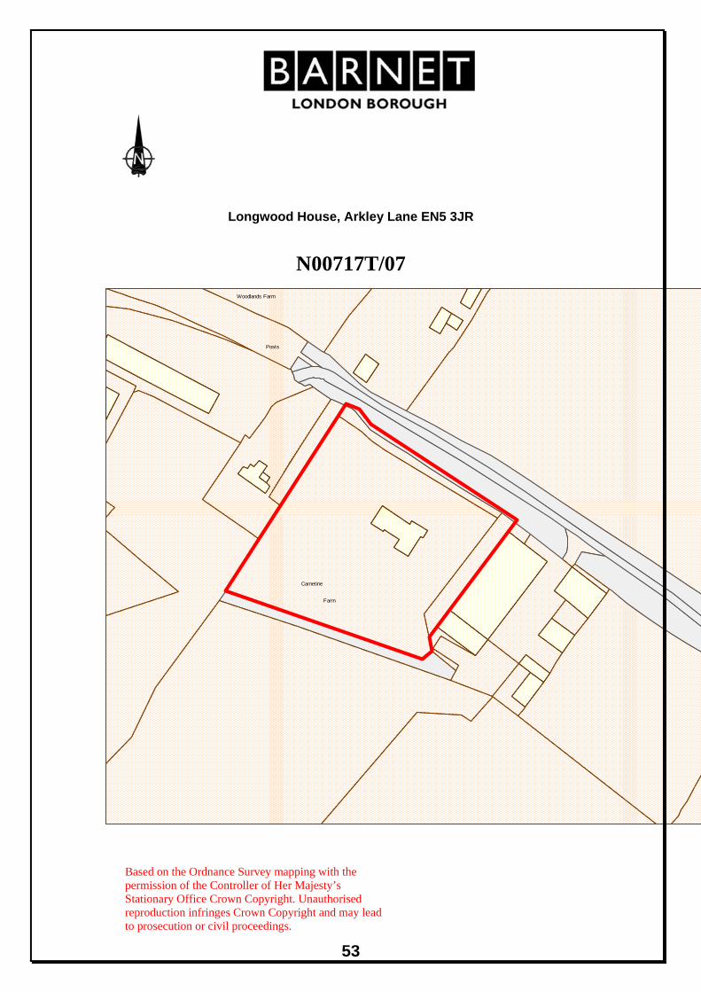
53
Longwood House, Arkley Lane EN5 3JR
N00717T/07
Woodlands Farm
Posts
Carnetine
Farm
Based on the Ordnance Survey mapping with the permission of the Controller of Her Majesty’s Stationary Office Crown Copyright. Unauthorised reproduction infringes Crown Copyright and may lead to prosecution or civil proceedings.

54
LOCATION: Site at 109, 111 & 113 Leicester Road, Barnet,
Hertfordshire, EN5 5EL.
REFERENCE: N05683G/07 Received: 12 Feb 2007 Accepted: 12 Feb 2007WARD: High Barnet Expiry: 14 May 2007 Final Revisions:APPLICANT: Sanctuary Housing Association PROPOSAL: Demolition of existing buildings at 111-113 Leicester
Road and construction of a four storey building containing 20 No. self contained bedsits, for use as a supported living service, and a two and three storey building containing 10 No. units within a registered service, using the front and rear gardens of 109 Leicester Road for amenity and parking for 6 No. car spaces.
RECOMMENDATION: APPROVE SUBJECT TO CONDITIONS
1. This development must be begun within three years from the date of this permission. Reason: To comply with Section 51 of the Planning and Compulsory Purchase Act, 2004.
2. Before the development hereby permitted commences, details and samples of the materials to be used for the external surfaces of the buildings shall be submitted to and approved in writing by the Local Planning Authority. The development shall be implemented in accordance with such details as approved. Reason: To safeguard the visual amenities of the locality and the appearance of the surrounding area.
3. Prior to the commencement of the development hereby permitted, the following details of the new buildings (at the stated scale) shall be submitted to and approved in writing by the Local Planning Authority: i. Windows (1:10). ii. Balconies and balustrades (1:10). iii. Boundary fence (1:10) Reason: To safeguard the character and appearance of the surrounding area

55
4. Before the development hereby permitted is commenced, details of the timber covered pergola over the disabled parking bay on the west side of Block A as shown on plan 150.PL2 shall be submitted to and approved in writing by the Local Planning Authority and the development shall be implemented in accordance with these details. Reason: To ensure that the development does not prejudice the character or appearance of the surrounding Area.
5. Before the development hereby permitted is occupied the parking spaces/garages shown on Plan 050.PL2 and 150.PL2 shall be provided and shall not be used for any purpose other than the parking of vehicles in connection with the approved development. Reason: To ensure that parking is provided in accordance with the council's standards in the interests of pedestrian and highway safety, the free flow of traffic and in order to protect the amenities of the area.
6. Before this development is commenced, details of the levels of the building(s), road(s) and footpath(s) in relation to adjoining land and highway(s) and any other changes proposed in the levels of the site shall be submitted to and approved in writing by the Local Planning Authority. The development shall be implemented in accordance with such details as approved. Reason: To ensure that the work is carried out at suitable levels in relation to the highway and adjoining land having regard to drainage, gradient of access and the amenities of adjoining occupiers and the health of any trees on the site.
7. Before the development hereby permitted is brought into use or occupied the site shall be enclosed except at the permitted points of access in accordance with details previously submitted to and approved in writing by the Local Planning Authority. Reason: To ensure that the proposed development does not prejudice the appearance of the locality and/or the amenities of occupiers of adjoining residential properties and to confine access to the permitted points in the interest of the flow of traffic and conditions of general safety on the adjoining highway.
8. Before the development hereby permitted is occupied, details of all boundary treatment shall be submitted to and approved in writing by the Local Planning Authority and the development shall be implemented in accordance with these details. Reason: To preserve the amenities of neighbouring occupiers and ensure that the development does not prejudice the character or appearance of the streetscene.

56
9. Before the development hereby permitted commences, details of
enclosures and screened facilities for the storage of recycling containers and wheeled refuse bins or other refuse storage containers where applicable, together with a satisfactory point of collection shall be submitted to and approved in writing by the Local Planning Authority and shall be provided at the site in accordance with the approved details before the development is occupied. Reason: To ensure a satisfactory appearance for the development and satisfactory accessibility; and to protect the amenities of the area.
10. Before the development hereby permitted is commenced, details of privacy screens to the first floor terrace on Block A and the first and second floor terraces on Block B shown on plan numbers 151.PL2 and 152.PL2, and details of balustrade to the third floor terrace on Block B shown on plan number 153.PL2 shall be submitted to and approved in writing by the Local Planning Authority and the development shall be implemented in accordance with these details. Reason: To ensure that the amenities of the occupiers of adjoining properties are not prejudiced by overlooking.
11. No construction work resulting from the planning permission shall be carried out on the premises at any time on Sundays, Bank or Public Holidays, before 8.00 am or after 1.00 pm on Saturdays, or before 8.00 am or after 6.00pm on other days unless previously approved in writing by the Local Planning Authority. Reason: To ensure that the proposed development does not prejudice the amenities of occupiers of adjoining residential properties.
12. A scheme of hard and soft landscaping, including details of existing trees to be retained, shall be submitted to and agreed in writing by the Local Planning Authority before the development, hereby permitted, is commenced. Reason: To ensure a satisfactory appearance to the development.
13. All work comprised in the approved scheme of landscaping shall be carried out before the end of the first planting and seeding season following occupation of any part of the buildings or completion of the development, whichever is sooner, or commencement of the use. Reason: To ensure a satisfactory appearance to the development.
14. Any existing tree shown to be retained or trees or shrubs to be planted as part of the approved landscaping scheme which are removed, die, become severely damaged or diseased within five years of the
57
completion of development shall be replaced with trees or shrubs of appropriate size and species in the next planting season. Reason: To ensure a satisfactory appearance to the development.
15. Before this development is commenced details of the location, extent and depth of all excavations for drainage and other services in relation to trees on the site shall be submitted and approved in writing by the Local Planning Authority and the development carried out in accordance with such approval. Reason: To safeguard the health of existing tree(s) which represent an important amenity feature.
16. No site works or works on this development shall be commenced before temporary fencing has been erected around existing tree(s) in accordance with details to be submitted and approved in writing by the Local Planning Authority. This fencing shall remain in position until after the development works are completed and no material or soil shall be stored within these fenced areas. Reason: To safeguard the health of existing tree(s) which represent an important amenity feature.
17. No site works or works on this development shall be commenced before a method statement detailing precautions to minimise damage to trees, expanding upon the principles raised in the Arboricultural Implications study and Tree Protection Strategy by Honey Brothers, including precautions to be taken during demolition of the existing buildings, storage of materials, movement of vehicles, location of site accommodation, construction works, details of foundations, method of locating piles, construction phasing and construction of footpath(s), and in accordance with BS5837: 2005 'Trees in relation to construction - Recommendations' (especially section 7), is submitted to and approved in writing by the Local Planning Authority and the development shall be carried out in accordance with such approval. Reason: To safeguard the health of existing trees which represent an important amenity feature.
18. No development or other operations shall commence on site in connection with the development hereby approved until a detailed tree pruning specification has been submitted to and approved in writing by the Local Planning Authority. All tree pruning works shall be carried out in full accordance with the approved specification and the requirements of British Standards 3998 (1989) recommendation for Tree Works (as amended). Reason: To safeguard the health of existing tree(s) which represent an important

58
amenity feature.
19. Provisions shall be made within the site to ensure that all vehicles associated with the construction of the development hereby approved are properly washed and cleaned to prevent the passage of mud and dirt onto the adjoining highway. Reason: To ensure that the development does not cause danger and inconvenience to users of the adjoining pavement and highway.
20. The level of noise emitted from any plant rooms, communal extraction and ventilation equipment, and laundry plant hereby approved shall be at least 5dB(A) below the background level, as measured from any point 1 metre outside the window of any room of an existing neighbouring property at (address) at the time of this decision notice. If the noise emitted has a distinguishable, discrete continuous note (whine, hiss, screech, hum) and/or distinct impulses (bangs, clicks, clatters, thumps), then it shall be at least 10dB(A) below the background level, as measured from any point 1 metre outside the window of any room of an existing neighbouring property at (address) at the time of this decision notice. Reason: To ensure that the proposed development does not prejudice the amenities of occupiers of neighbouring properties.
21. Before development commences, a report shall be carried out by a qualified acoustic consultant and submitted to the LPA for approval, which assesses the likely noise impacts from the development of any plant rooms, communal extraction and ventilation equipment, and laundry plant. The report shall also clearly outline mitigation measures for the development to reduce these noise impacts to acceptable levels. It should include all calculations and baseline data, and be set out so that the LPA can fully audit the report and critically analyse the contents and recommendations. The approved mitigation measures shall be implemented in their entirety before (any of the units are occupied / the use commences). Reason: To ensure that the amenities of neighbouring premises are protected from noise from the development.
22. Before the development hereby approved is occupied, the first and second floor windows in the north-east elevation of the flat roofed rear projection of Block B, shall be glazed with obscure glazing only and shall be fitted with fanlight openings only and permanently retained as such. Reason: To preserve the amenities and privacy of the neighbouring occupiers.
23. Notwithstanding the provisions of any development order made under

59
Section 59 of the Town and Country Planning Act 1990 (or any order revoking and re-enacting that Order) the building(s) hereby permitted shall not be extended in any manner whatsoever without the prior specific permission of the Local Planning Authority. Reason: To ensure that the development does not prejudice the character of the locality and the enjoyment by existing and/or neighbouring occupiers of their properties.
24. Notwithstanding the provisions of any development order made under Section 59 of the Town and Country Planning Act 1990 (or any Order revoking and re-enacting that Order), the following operation(s) shall not be undertaken without the prior specific permission of the Local Planning Authority - Insertion of any windows or doors Reason: To ensure that the development does not prejudice the character of the locality and the enjoyment by existing and/or neighbouring occupiers of their properties.
25. The premises shall be used as a registered care facility for a maximum of 30 people with learning disabilities Down Syndrome, and Down Syndrome and dementia, and for no other purpose (including any other purpose in Class C2 of the Schedule to the Town and Country Planning (Use Classes) Order, 2005, or in any provision equivalent to that Class in any statutory instrument revoking and re-enacting that Order with or without modification). Reason: To enable the Local Planning Authority to exercise control of the type of use within the category in order to safeguard the amenities of the area.
26. The development is required to meet the "Excellent" standard in the BRE (Building Research Establishment) EcoHomes assessment (or equivalent standard in the Code for Sustainable Homes) and a high HQI (Housing Quality Indicator) for residential development. The applicant is required to submit, and have approved in writing by the Local Planning Authority, a certificate by a licensed EcoHomes assessor (or equivalent Code for Sustainable Homes assessor) to demonstrate that the development satisfactorily achieves the 'Excellent' (or equivalent Code for Sustainable Homes) rating. Reason: To ensure that the development is sustainable and complies with Strategic and Local Policies.
27. Before the development commences details of the solar hot water heating panels and district heating system referred to in the sustainability statement shall be shall be submitted to and approved in

60
writing by the Local Planning Authority. The systems shall be installed and fully operational prior to the occupation of the building and thereafter permanently maintained. Reason: To ensure that the development is sustainable and complies with Strategic and Local Policies.
INFORMATIVE(S):-
1. The plans accompanying this application are:- Site Location Plan; 001.E; L120.E; 050.PL2; 150.PL2; 151.PL2; 152.PL2; 153.PL2; 160.PL2; 170.PL3; 171.PL2; 172.PL2; Strategy For Achieving EcoHomes 2006 'Excellent' (dated March 2007); Arboricultural Implications Study and Tree Protection Strategy (Reference: MPH6235/AS dated 11th November 2005)
2. The reasons for this grant of planning permission or other planning related decision are as follows: - i) The proposed development accords with strategic planning guidance and policies as set out in the Mayor's London Plan (published 10 February 2004) and the Adopted Barnet Unitary Development Plan (UDP) (2006). In particular the following policies are relevant: London Borough of Barnet Adopted Unitary Development Plan 2006: GSD, GEnergy, GLand, GBEnv1, GBEnv2, GBEnv3, GBEnv4, GBEnv5, GParking, GNonCar, GCS1, ENV1, ENV2, D1, D2, D3, D4, D5, D6, D7, D8, D11, D12, D13, M5, M6, M11, M12, M13, M14, H12. ii) The proposal is acceptable for the following reason(s): - The proposal will provide high quality, sustainable buildings that are compatible with the surrounding residential area and preserve the amenities of existing nearby occupiers. The development complies with Local and Regional policies for sustainability and energy efficiency and will create a modern facility for people with learning disabilities, Down Syndrome, and Down Syndrome with dementia. The development would meet Council parking and amenity standards.
3. If the development is carried out it will be necessary for the existing crossovers on the footway to be modified by the Highway Authority at the applicant's expense. Any street furniture, lighting columns or parking bays affected by the proposed works will be relocated under a rechargeable works agreement by the Council's term contractor for Highway Works. This will be subject to a detailed survey by the Crossover Team in the Highways Group as part of the application for crossover under Highways Act 1980 and would be carried out at the applicant's expense. An estimate for this work can be obtained from the Chief Highways Officer, North London Business Park (NLBP), Building 4, 2 nd Floor, Oakleigh Road South, London N11 1NP.
4. If the development is carried out it will be necessary for the existing

61
redundant vehicular crossover(s) to be reinstated to footway by the Highway Authority at the applicant's expense. You may obtain an estimate for this work from the Chief Highways Officer, Building 4, North London Business Park (NLBP), Oakleigh Road South, London N11 1NP.
5. The applicant advised that if the development is carried out, where possible, the applicant should seek to improve the existing pedestrian visibility splays at either side of the vehicular crossover.
6. The Yew tree located on site is within a Tree Preservation Order. If any treatment is proposed to this tree then an application in accordance with the Tree Preservation Legislation will be required.
7. You are advised to engage a qualified acoustic consultant to advise on the scheme, including the specifications of any materials, construction, fittings and equipment necessary to achieve satisfactory internal noise levels in this location. In addition to the noise control measures and details the scheme needs to clearly set out the target noise levels for the habitable rooms, including for bedrooms at night, and the levels that the sound insulation scheme would achieve. The details of acoustic consultants can be obtained from the following contacts: Institute of Acoustics: telephone number 01727 848195 Association of Noise Consultants: telephone number 01763 852958 The assessment and report on the noise impacts of a development should use methods of measurement, calculation, prediction and assessment of noise levels and impacts that comply with the following standards, where appropriate: * Dept of Environment: PPG 24 (1994) Planning Policy Guidance - Planning & Noise. * BS 7445 (1991) Pts 1, 2 & 3 (ISO 1996 pts 1-3) - Description & measurement of environmental noise. * BS 4142:1997 - Method of rating industrial noise affecting mixed residential and industrial areas. * BS 8223 :1999 - Sound insulation and noise reduction for buildings: code of practice. * Dept of Transport: Calculation of Road Traffic Noise (1988). * Dept of Transport: Calculation of Railway Noise (1995). * Dept of Transport: Railway Noise & Insulation of Dwellings
8. Please supply the following information: 1. The proposed hours of use of the equipment. 2. The sound pressure levels of the ventilation/ extraction system to be installed in decibels dB(A) at a specified distance from the equipment. 3. Details of where the equipment will be placed i.e. within or outside of the building, marked on to a scale map. 4. Details of silencers to be fitted, and other sound insulation measures

62
to reduce any noise impacts on neighbours including their noise reduction in dB(A). 5. Distance away from noise sensitive premises and the nature of these premises e.g.: offices, housing flats or storage. The following should be noted: * Flues should be sited to minimise effects of vibration transmission and noise to any adjacent façade. * Flues must incorporate anti-vibration mounts, flexible couplings and silencers. * The height of the flue (must be minimum 1.5m above the highest eves of the building and adjacent buildings) and a reasonable distance approximately 20 metres from any open able residential windows unless there is suitable level of filtration and odour abatement equipment. * The final discharge must be vertically upwards. * There should be no Chinese hat or cowl on the top of the flue.
1. MATERIAL CONSIDERATIONS National Planning Policy Framework and Guidance:
• Planning Policy Statement 1 (PPS1): Delivering Sustainable Development − Draft Planning & Climate Change supplement to PPS1
• Planning Policy Statement 3 (PPS3): Housing • Planning Policy Guidance Note 13 (PPG13): Transport
Regional Policy Framework The Mayor of London; The London Plan - Spatial development Strategy for Greater London 3A.10, 3A.15, 4A.7, 4A.9, 4B.6, 4B.7 Mayor For London relevant SPGs:
− The Mayor’s Energy Strategy (2004) London Borough of Barnet Adopted Unitary Development Plan 2006: GSD, GEnergy, GLand, GBEnv1, GBEnv2, GBEnv3, GBEnv4, GBEnv5, GParking, GNonCar, GCS1, ENV1, ENV2, D1, D2, D3, D4, D5, D6, D7, D8, D11, D12, D13, M5, M6, M11, M12, M13, M14, H12. Supplementary Planning Guidance: − Draft Supplementary Planning Document (SPD) - Sustainable
Design and Construction Corporate Documents: − The Three Strands Approach − Corporate Plan
Relevant Planning History: N05683 Land adjoining 113 Leicester Road – Detached house and
garage. APPROVED (1978) N05683A 111-113 Leicester Road - Conversion of houses to home for
retarded children. APPROVED (1978)

63
N05683B 111-113 Leicester Road – Conversion of existing houses into home for retarded persons incorporating 2-storey side extension and part single part and part 2-storey rear extension, together with parking spaces for 6 vehicles. APPROVED (1st November 1978)
N05683D 111-113 Leicester Road – Open swimming pool at rear. APPROVED (1981)
N05683E 111-113 Leicester Road – Inflatable cover for swimming pool. APPROVED (1981)
N05683F 113 Leicester Road – Detached garage and store at rear. APPROVED (1985)
Consultations and views Expressed: Neighbours Consulted: 204 Replies: 41 at the time of writing of
report The comments and objections raised in the letters received can be summarised as follows:
− Leicester Road already suffers from parking problems − Insufficient parking - 6 parking spaces will not be adequate for 20
bedsits − Increased access of staff traffic, day trip vehicles, deliveries, and
visitors − Demolition of perfectly decent dwellings of some charm and character
would be a considerable loss to the immediate area and heritage of Barnet
− It would be more suitable to adapt the existing houses on both sides of the roads to provide the required upgrading to the site
− Overdevelopment of the site – proposal would overcrowd these buildings onto a very narrow site whilst destroying the existing garden amenities
− Out of character with the area which is predominantly single family homes
− Visual change to the appearance of the street – out of keeping, scale and character with other properties in Leicester Road and inappropriate
− The appearance of the area would be considerably affected by the proposals
− The proposed dwellings will dominate the area and will make a huge impact on the neighbourhood
− 3 and 4 storeys will look completely out of character with surrounding properties
− Out of proportion and would have a generally detrimental effect on the local area
− Overlooking, loss of privacy − Concern that the Tamarisk Trust may attempt to sell off its property on
the North side of Leicester Road in order to fund this development

64
Internal/Other Consultation: Highways
The Highways Group have no objections on highways grounds. The parking provision is in accordance with the parking standards in the London Borough of Barnet Adopted Unitary Development Plan 2006.
Trees and Landscaping section have no objection to the proposed
development subject to the detailed conditions recommended above requiring a method statement detailing measures to minimise impact on the TPO Yew tree on the site.
2. PLANNING APPRAISAL Site Description and Surroundings The application site is made up of 109, 111 and 113 Leicester Road. The properties are located on the south side of Leicester Road on it’s corner with Warwick Road. 111 and 113 Leicester Road are converted Victorian houses occupied by the Tamarisk Trust Ltd, a charity based in Barnet that support adults who have learning disabilities to be able to live within their local community. The Tamarisk Trust has operated on this site for nearly 30 years and has been operating in the Borough for nearly 50 years. The buildings have undergone a number of extensions and alterations since then and there is a swimming pool in the rear garden with a plastic poly tunnel cover. A large Yew tree is positioned on the corner of Leicester Road / Warwick Road and is covered by a Tree Preservation Order. 109 Leicester Road is a ground floor maisonette adjacent to the existing site, the freehold of which is also owned by the Tamarisk Trust. The main frontage of the existing buildings on the site is onto Leicester Road, whilst the side boundary of the existing garden faces onto Warwick Road. The surrounding area is made up of a variety of properties of different periods, heights and styles. Whilst Leicester Road is predominantly two-storey houses there are several 3-storey blocks of flats within close proximity to the site including Windermere House (3-storeys) on the opposite corner of the junction, Gainsborough Court (3-storeys), Christopher Court and Bowmar Lodge (both 3 storeys). There are also several 4 storey blocks of flats to the south of the site located on Warwick Road and Station Road including Lysander Court, South Lodge and Hockington Court. A plan is appended to this report identifying the locations of these blocks. The site is less than 800m from New Barnet train station and there are several good bus routes along Station Road which is 100m to the south east. Proposals The application proposes the demolition of 111 and 113 Leicester Road and the construction of two new facilities: a two and three storey building to provide a registered care facility for 10 people with Down Syndrome and dementia (Block A), and a four-storey building providing a supported housing unit containing self-contained bed-sits for 20 people with learning disabilities, some of whom also have Down Syndrome (Block B). The ground floor of 109

65
Leicester Road will be operated as a separate supported housing facility, but part of the rear garden will be used as amenity space for the new buildings. The Tamarisk Trust are working in partnership with Sanctuary Housing Association on the development proposals. The registered housing unit (Block A) occupies the corner of the site and will have two frontages, one facing Leicester Road and one facing Warwick Road. The building is split in height giving the appearance of two buildings. The smaller building adjacent to 109 Leicester Road will present a gable end onto Leicester Road and will be two-storeys in height. This then steps up to three storeys on the corner of Leicester Road and Warwick Road. The three storey part of the building presents its main elevation to Warwick Road whilst the side elevation facing Leicester Road is set back from the footpath on Leicester Road and back from the Yew tree on the corner. A courtyard separates Block A from the Supported Housing unit (Block B) which is a four storey building and steps down to a three storey, flat roofed element at its rear. This building has a main frontage addressing Warwick Road. Both blocks will be finished in a mixture of brickwork and timber cladding with copper clad roofs. The flat roof areas at the back of the buildings will be planted as sustainable green roofs. Windows will be timber framed and balconies will be finished with timber and metal railings. A new timber and metal boundary fence is proposed. Material Planning Considerations There are six main issues to consider with this application:
− Use as a registered care service and supported living unit − Demolition of existing buildings − Scale and design of new buildings − Sustainable design and construction − Parking and access − Trees and Landscaping
Use as a registered care service and supported living unit Policy 3A.10 states that UDP policies should provide for special needs housing, including sheltered housing with care support and residential care homes. Policy H12 of the Adopted UDP (2006) states: The council recognises the requirement in the borough for supported housing for people with special needs, and will encourage proposals for residential care homes, hostels, shared houses and flats and other accommodation where an element of care is provided. Planning permission for special needs accommodation will be granted where the proposal:
• Helps meet an identified need; • Does not have a demonstrably harmful impact on the character or
amenities of the surrounding area; and • Is easily accessible by public transport and where appropriate, walking
and cycling.

66
Planning consent was granted in 1978 for the conversion of the original houses at 111 and 113 Leicester Road into a home for people with Down Syndrome and learning disabilities (ref: N05683B). The site has been in use as a care facility for nearly 30 years, therefore the facility meets an identified need and the principle of the use is established. The existing facility has successfully blended with the surrounding residential area for this period of time without adversely affecting neighbouring amenity. The site is within walking distance of New Barnet Train Station and good bus links and is therefore considered to be accessible by public transport. The proposed facility is therefore considered to meet the requirements of Policy H12 of the Adopted UDP. As well as 111-113 Leicester Road, the Tamarisk Trust also operate from 2 Warwick Road which is opposite the site. The site at 2 Warwick Road has 19 single bedrooms and a self-contained, 3-bedroom flat in the adjoining building 102 Leicester Road (22 rooms in total). The site at 111-113 Leicester Road also has 19 single bedrooms and a self-contained, 3-bedroom flat, providing a total of 22 rooms. Overall the current service provision is for 44 people. The existing buildings at 111 and 113 Leicester Road are considered to be in need of refurbishment in order that the Tamarisk Trust can provide modern and fit for purpose accommodation for their residents. The proposed new facility at 111-113 Leicester Road will have provision for a maximum of 30 people. This represents an increase of 8 people on the site over the existing facility, however the proposed staffing of the facilities will remain similar to the existing level of 8-10 people at any one time. The principle of the redevelopment of the site to provide a new, high quality, sustainable building is considered to be acceptable. Scale and design of new buildings The layout of Leicester Road is defined by strong building lines of houses on each side of the street. In contrast, buildings along Warwick Road face a variety of directions and the building line is fragmented by back gardens, lawns and private parking courts. Policy D2 of the Adopted UDP encourages development proposals that are based on an understanding of local characteristics in terms of scale, bulk and height of surrounding buildings. Block A is two-storeys in height adjacent to 109 Leicester Road before stepping up to 3-storeys on the corner of Leicester Road and Warwick Road in response to the 3-storey block of flats on the opposite corner. Block B is 4-storeys in height where it fronts onto Warwick Road in response to the larger blocks along Station Road, but it also steps down to 3-storeys at the rear. The development provides a transition between the 2-storey domestic scale of Leicester Road and the 4-storey blocks on Station Road. Leicester Road slopes upwards from north-east to south-west. Warwick Road also slopes upwards towards Station Road. As a result, the floor level of the proposed buildings has been set 0.7m below street level thus reducing their overall height when viewed in the streetscene. The proposed development is

67
therefore considered to be of an acceptable scale in relation to the existing buildings in the vicinity. Policy D1 of the Adopted UDP (2006) states that all new development should represent high quality design and should be in keeping with the council’s objectives for achieving sustainable development and ensuring community safety. The scale, period, style and material finish of the buildings in the immediate area differ greatly, with a mixture of brick, painted render and hung tile finishes. The proposed building represents a contemporary response to the site however the design draws on traditional suburban aesthetics using pitched roofs and gable ends to reflect the domestic typology of the surrounding buildings. This is further expressed by using brick on the ground floor of the buildings, but the timber and copper cladding represent modern contemporary finish. Therefore the proposed buildings are considered to represent a high quality, contemporary design in line with the aims of policy D1 whilst respecting key characteristics of the immediate area. Policy D6 of the Adopted UDP seeks to ensure that new development creates attractive and safe streets by providing visual interest at street level. The proposed buildings will wrap the corner and create a new frontage along Warwick Road. The proposal locates all living accommodation along the street edge of the buildings including pedestrian entrances, windows and balconies, thus maintaining natural surveillance of the street. The proposal is considered to be in line with Policies D1, D2, and D6 of the Adopted UDP (2006). Policy D5 states that new developments should be designed to allow for adequate daylight, sunlight, privacy and outlook for adjoining and potential occupiers and users. The proposed buildings are designed so that they will not impact on light or overshadow surrounding buildings. The two-storey element of Block A will be of similar scale and bulk as the existing building while Block B will be located adjacent to the car park for Lysander Court which is a block of flats to the south. There are no main habitable room windows in the north elevation of Lysander Court, therefore the proposed building is not considered to unduly affect the outlook of the neighbouring occupants. Given the orientation of the site and location, scale and design of the buildings, it is not considered that the proposed development will unduly affect the residential amenities of the occupiers of the surrounding properties. The application is considered to comply with Policy D5 of Adopted UDP (2006). Sustainable Design and Construction Policy GBEnv2 of the Adopted UDP (2006) states that the council will require high quality design in all new development in order to enhance the quality of the built and open environment, which utilises environmentally friendly methods of both design (including layout and orientation of buildings) and of construction, in order to meet the council’s objectives of sustainable development. In addition, the council’s draft Supplementary Planning Document (SPD) for Sustainable Design and Construction requires all development proposals to achieve a minimum standard of a ‘Very Good’ EcoHomes (or equivalent Code for Sustainable Homes) rating.
68
The Tamarisk Trust and Sanctuary Housing Association have agreed to achieve an EcoHomes ‘Excellent’ sustainability rating for the proposed development. The applicants have submitted a strategy for achieving this rating which identifies the need to reduce the energy demand and resource use of the proposed building both during construction and when the building is complete and in operation. Details have been provided for each of the following EcoHomes assessment criteria:
− Energy − Transport − Pollution − Materials − Water − Land Use & Ecology − Health and Wellbeing − Management
The building is designed to minimise loss of heat and thus reduce the need to generate heat. The proposed design allows for high thermal efficiency in wall, floor and roof constructions to meet U-values 15% better than current Building Regulations requirements. The development also uses a solar hot water heating system to provide a portion of the building’s hot water demands. A high efficiency / low emission boiler will provide the remaining energy within a district heating system. Green roofs and significant areas of soft landscaping around the perimeter of the site will reduce surface water runoff. Rainwater collection systems will also be used to irrigate the landscape. The proposed development is considered to meet the council’s objectives of sustainable development and comply with Policies GSD, GEnergy, GBEnv2 and D1 of the Adopted UDP and the draft SPD. The requirement for an ‘Excellent’ EcoHomes (or equivalent) rating will be enforced by the condition recommended above. Parking and Access There are two existing vehicular access points into the site: one from Leicester Road and one from Warwick Road. The Leicester Road crossover is essentially being maintained in the same location, whilst the crossover from Warwick Road will be moved to be positioned at the point between the two proposed buildings. The site is within 800m of New Barnet Train Station and there are good bus routes on Station Road and the Great North Road. The existing site has space for 6 cars to park off-street. Parking for 6 vehicles will be provided in the new development, 5 spaces including 2 spaces for disabled use, accessed from Leicester Road and 1 space large enough for a mini bus to be access via Warwick Road. A separate parking space is provided for 109 Leicester Road. Cycle parking is also provided. There is a car pool on the site of three cars which all staff members are insured to use for food shopping or for transporting residents as necessary. Residents do not drive. It is not considered that visitor parking would be of a level that would cause detrimental harm to the surrounding streets given there are no parking
69
restrictions in the immediate vicinity. Given the proposed use and location of the site, the council’s Highways Group consider the parking provision to be acceptable. Trees and Landscaping There is a Yew tree on the corner of Leicester Road and Warwick Road which is included in a Tree Preservation Order at 113 Leicester Road. The applicant has submitted an arboricultural implications study and tree protection strategy in relation to this, and other trees on the site. The Yew is graded A under the guidelines of British Standard 5837: 2005 and is described in the report as a “good specimen prominent to street and local landscape”. The design of the proposed development has taken this into account in order to retain and protect the Yew tree. The footprint of the existing building on the site encroaches into the Root Protection Area (RPA) of the tree. The footprint and position of the proposed building has therefore been stepped away from the tree so as to reduce and minimise any possible impact. The design has taken a 10m radius from the tree as an area that should not be built on (the RPA) in accordance with BS5837: 2005. The only exception is the small area within this radius which is currently occupied by the existing building. Although a small part of the footprint of the proposed building will still be within the RPA of the tree, this will be a smaller amount than the existing building. Therefore, subject to further tree protection fencing and methodology details to be submitted under condition, the proposed development is not considered to have and detrimental impacts on the TPO protected Yew tree. Equality and Diversity Issues The proposal will provide a modern, contemporary facility for people with learning disabilities, Down Syndrome and Down Syndrome with dementia so that they can live within their local community. All of the units within the development have been designed in order that they could be adapted for wheelchair users in the future. The buildings have been designed to meet part M of the Building Regulations as well as Lifetime Homes requirements and the Housing Corporation’s Scheme Development Standards for wheelchair housing. The development therefore complies with council policies and requirements for accessibility and equality. 3. COMMENTS ON THE GROUNDS OF OBJECTIONS Speculation about the Tamarisk Trust’s property at 2 Warwick Road is not a material planning consideration within this application. The current planning application relates solely to 111-113 Leicester Road. Concerns raised over Star Bus vehicles parking in Warwick Road and Leicester Road are not planning considerations linked to the proposed development. Star Bus vehicles do not park in conjunction with the facility at 111-113 Leicester Road.

70
4. CONCLUSION The following issues have been addressed in the appraisal above:
− Use as a registered care service and supported living unit − Demolition of existing buildings − Scale and design of new buildings − Sustainable design and construction − Parking and access − Trees and Landscaping
The principle of the demolition of the existing buildings and the erection of a new 2 and 3-storey building to provide a registered care facility for 10 people with Down Syndrome and dementia, and a 4-storey building providing a supported housing unit containing self-contained bed-sits for 20 people with learning disabilities is considered to be acceptable. The proposed development is will provide high quality, highly sustainable buildings which enhance the local streetscape and provide a modern facility for people with learning disabilities to live within their local community. All relevant policies contained within the adopted UDP, the Mayor’s London Plan and Supplementary Planning Documents, have been fully considered and taken into account by the Local Planning Authority. Accordingly, subject to the conditions detailed in the recommendation, APPROVAL is recommended.

71
109, 111, and 113 Leicester Road, N11 N05683G/07
131
1 to
Ba
C
11
House
1 to 11
Glenwood
13
11
House
Windermere
Glenwood
108
House
1 to 12
Oxford Court
1
9a
4
115
CroftNeville
2
75.0m
9
BM 75.62m
Neville Croft
6to
1 to 6
1
100
113111
LEICESTER ROAD
92
109107
WARW
ICK R
OAD
105
LysanderCourt
1 to 6
87
Hockington Ct
Merton Court
1 to 14
21
AshwoodLodge
82
8to
1
97
80
80
93
ThornbridgeCourt
71.6m
78
InvergarryCourt
89
1 to 12
Invergarry46
to 5
1
74
74
1 to 8
79
1 to 8
Court40
to 4
5
Based on the Ordnance Survey mapping with the permission of the Controller of Her Majesty’s Stationary Office Crown Copyright. Unauthorised reproduction infringes Crown Copyright and may lead to prosecution or civil proceedings.

72
LOCATION: 11 Cavendish Road, Barnet, Hertfordshire, EN5 4ED.
REFERENCE: N15437/07 Received: 18 Jan 2007 Accepted: 31 Jan 2007WARD: High Barnet Expiry: 28 Mar 2007 Final Revisions:APPLICANT: Mr C Lam PROPOSAL: Demolish existing bungalow and build detached
house.
RECOMMENDATION: APPROVE SUBJECT TO CONDITIONS
1. This development must be begun within three years from the date of this permission. Reason: To comply with Section 51 of the Planning and Compulsory Purchase Act, 2004.
2. Before development hereby permitted is occupied, turning space and parking spaces shall be provided and marked out within the site in accordance with a scheme to be submitted to and approved in writing by the Local Planning Authority and that area shall not thereafter be used for any purpose other than the parking and turning of vehicles. Reason: To ensure that parking and associated works are provided in accordance with the council's standards in the interests of pedestrian and highway safety and the free flow of traffic.
3. No structure or erection with a height exceeding 1.05m above footway level shall be placed along the frontage(s) of Cavendish Road from a point 2.5m from the highway boundary for a distance of 2.5m on both sides of the vehicular access(es). Reason: To prevent danger, obstruction and inconvenience to users of the adjoining highway and the premises.
4. Before this development is commenced, details of the levels of the building(s), road(s) and footpath(s) in relation to adjoining land and highway(s) and any other changes proposed in the levels of the site shall be submitted to and approved in writing by the Local Planning Authority. The development shall be implemented in accordance with such details as approved.

73
Reason: To ensure that the work is carried out at suitable levels in relation to the highway and adjoining land having regard to drainage, gradient of access and the amenities of adjoining occupiers and the health of any trees on the site.
5. Before the development hereby permitted commences, details of the materials to be used for the external surfaces of the building(s) and hard surfaced areas shall be submitted to and approved in writing by the Local Planning Authority. The development shall be implemented in accordance with such details as approved. Reason: To safeguard the visual amenities of the locality.
6. Before the development hereby permitted is brought into use or occupied the site shall be enclosed except at the permitted points of access in accordance with details previously submitted to and approved in writing by the Local Planning Authority. Reason: To ensure that the proposed development does not prejudice the appearance of the locality and/or the amenities of occupiers of adjoining residential properties and to confine access to the permitted points in the interest of the flow of traffic and conditions of general safety on the adjoining highway.
7. Before the development hereby permitted commences, details of enclosures and screened facilities for the storage of recycling containers and wheeled refuse bins or other refuse storage containers where applicable, together with a satisfactory point of collection shall be submitted to and approved in writing by the Local Planning Authority and shall be provided at the site in accordance with the approved details before the development is occupied. Reason: To ensure a satisfactory appearance for the development and satisfactory accessibility; and to protect the amenities of the area.
8. The flat roof hereby permitted shall only be used in connection with the repair and maintenance of the building and shall at no time be used as a balcony, roof garden or similar amenity or sitting out area without the benefit of the grant of further specific permission in writing from the Local Planning Authority. Reason: To ensure that the amenities of the occupiers of adjoining properties are not prejudiced by overlooking.
9. Before the building hereby permitted is occupied the proposed window(s) in the north and south elevations of the dwelling facing towards No's 13 and 9 Cavendish Road shall be glazed with obscure glass only and shall be permanently retained as such thereafter and shall be permanently fixed shut with only a fanlight opening, unless otherwise agreed in writing by the Local Planning Authority.

74
Reason: To safeguard the privacy and amenities of occupiers of adjoining residential properties.
10. Notwithstanding the provisions of any development order made under Section 59 of the Town and Country Planning Act 1990 (or any order revoking and re-enacting that Order) the building(s) hereby permitted shall not be extended in any manner whatsoever without the prior specific permission of the Local Planning Authority. Reason: To ensure that the development does not prejudice the character of the locality and the enjoyment by existing and/or neighbouring occupiers of their properties.
11. No construction work resulting from the planning permission shall be carried out on the premises at any time on Sundays, Bank or Public Holidays, before 8.00 am or after 1.00 pm on Saturdays, or before 8.00 am or after 6.00pm on other days unless previously approved in writing by the Local Planning Authority. Reason: To ensure that the proposed development does not prejudice the amenities of occupiers of adjoining residential properties.
12. A scheme of hard and soft landscaping, including details of existing trees to be retained, shall be submitted to and agreed in writing by the Local Planning Authority before the development, hereby permitted, is commenced. Reason: To ensure a satisfactory appearance to the development.
13. All work comprised in the approved scheme of landscaping shall be carried out before the end of the first planting and seeding season following occupation of any part of the buildings or completion of the development, whichever is sooner, or commencement of the use. Reason: To ensure a satisfactory appearance to the development.
14. Any existing tree shown to be retained or trees or shrubs to be planted as part of the approved landscaping scheme which are removed, die, become severely damaged or diseased within five years of the completion of development shall be replaced with trees or shrubs of appropriate size and species in the next planting season. Reason: To ensure a satisfactory appearance to the development.
15. Provisions shall be made within the site to ensure that all vehicles associated with the construction of the development hereby approved

75
are properly washed and cleaned to prevent the passage of mud and dirt onto the adjoining highway. Reason: To ensure that the development does not cause danger and inconvenience to users of the adjoining pavement and highway.
16. Notwithstanding the provisions of the Town and Country Planning (General Permitted Development) Order 1995, (or any order revoking and re-enacting that Order with or without modification), no additional windows shall be placed on the flank elevations of the dwelling facing towards No. 9 and No. 13 Cavendish Road without the prior permission in writing of the Local Planning Authority. Reason: To safeguard the privacy and amenities of occupiers of adjoining residential properties.
17. The development will be required to meet the "Very Good" standard in the BRE (Building Research Establishment) Eco-Homes assessment and a high HQI (Housing Quality Indicator) for residential development or as may be agreed by the Local Planning Authority. Reason To ensure that the development is sustainable and complies with Strategic and Local Policies.
INFORMATIVE(S):-
1. The plans accompanying this application are:- JH/06/CL/01, JH/06/CL/02 (received 18th January 2007), JH/06/CL/03 A, JH/06/CL/04 A, JH/06/CL/05 A, JH/06/CL/06 A (as amended received 22nd March 2007).
2. The reasons for this grant of planning permission or other planning related decision are as follows: - (i) The proposed development accords with strategic planning guidance and policies as set out in the Mayor's London Plan (published 10 February 2004) and the Adopted Barnet Unitary Development Plan (2006). In particular the following polices are relevant: Adopted Barnet Unitary Development Plan (2006): GBEnv1 (Character), GBEnv2 (Design), D1 (High quality design), D2 (Built Environment / Character), D3 (Spaces), D4 (Over development), D5 (Outlook) D7 (Local Townscape and Landscape), D11 (Landscaping), M14 (Parking Standards) H16 (Residential Character) H17 (Privacy Standards), H18 (Amenity Space Standards) H27 (Extensions to houses and detached buildings). (ii) The proposal is acceptable for the following reason(s): - The development is considered to have an acceptable impact on the visual and residential amenities of the neighbouring occupiers. The scale and design proposed is considered in keeping with the character of the area
76
and would not have a harmful impact upon the street scene or highway and pedestrian safety. The proposal is also in accordance with the aforementioned policies.
1. MATERIAL CONSIDERATIONS Relevant Unitary Development Plan Policies: Adopted UDP (2006): GBEnv1 (Character), GBEnv2 (Design), D1 (High quality design), D2 (Built Environment / Character), D3 (Spaces), D4 (Over development), D5 (Outlook) D7 (Local Townscape and Landscape), D11 (Landscaping), M14 (Parking Standards) H16 (Residential Character) H17 (Privacy Standards), H18 (Amenity Space Standards) H27 (Extensions to houses and detached buildings). Relevant Planning History: None Consultations and Views Expressed: Neighbours Consulted: 19 Replies: 3 plus a joint letter
with 8 signatures The application was advertised on site. The objections received can be summarised as follows:
• Proposal is out of scale with neighbouring properties detrimental to the surrounding area
• Concern over number of cars that would be associated with a four bedroomed property and the impact this will have on parking
• Infrastructure cannot accommodate large lorries without severe disruption to residents
• Entrance to site is not wide enough to allow demolition • Application is inaccurate, property is only currently a two-bedroom
bungalow, not 3 as the application form states • Modern appearance will be out of keeping with the surrounding
properties • Loss of sunlight to No. 34 Cavendish Road • Overlooking into ground and first floor of No. 34 Cavendish Road • Noise and disturbance resulting from possible increase in residents • The second storey by reason of its size, siting and proximity to the
boundary with No. 9 would cause a significant amount of loss of light and outlook to this property
• A terracing effect will be created due to the proximity of the flank wall to No. 9 Cavendish Road
• Loss of privacy to No. 9 • Noise and dust resulting from construction • Overlooking to No. 7 Cavendish Road

77
3. PLANNING APPRAISAL
Site Description and Surroundings The application site is currently occupied by a detached bungalow situated on the western side of Cavendish Road which is residential in nature and consists of properties of varying designs and sizes. The current house has an L-shaped footprint with a width of 7.3 metres to Cavendish Road and a depth of 14 metres. There is a garage to the south of the property that infills the gap between the bungalow itself and the boundary with the adjoining site, No. 9 Cavendish Road. There is also off-street parking to the front of the property. The neighbouring sites are both occupied by detached two-storey properties of differing designs. Proposal Planning permission is sought for the demolition of the existing bungalow and the erection of a two-storey detached house. The depth would remain the same as the existing property at 14 metres and a distance of 7 metres to the footway would be retained. The property would have a width of 9.1 metres; a distance of 1 metre would be left between the flank wall of the property and the boundary with No. 13 Cavendish Road. The proposal is to build up to the boundary with No. 9 Cavendish Road at ground floor level and stepping away to leave 1 metre at first floor level. The roof would be pitched and hipped to both sides. Material Planning Considerations Council policy and design guidance seeks to encourage development that is understanding of local characteristics, preserve or enhance local character and respect the appearance, scale, bulk, height and pattern of surrounding buildings and the rest of the locality. The proposal is considered to be in accordance with this. Despite the proposed dwelling being larger in mass and size than the existing bungalow it is considered to have an acceptable visual impact on the street scene and on residential amenity of neighbouring sites. The spacing between the buildings is considered to be appropriate and in keeping with the general street scene. Although it is of a design dissimilar to any other properties in the street, Cavendish Road consists of many different types of properties and the introduction of an additional style of property is not considered to detract from the varied character of the street scene or the general locality. The existing bungalow is not of any special architectural or historic merit and its demolition is not considered to detract from the street scene or general locality. The dwelling has been designed to take account of neighbouring building lines so as to limit the impact on neighbouring amenity. The rear wall of the proposed dwelling is proposed to be a similar depth to the rear building line of No. 13 Cavendish Road, the property to the north. This is considered to significantly limit the impacts to this property in terms of loss of light and the visual impact of the dwelling as viewed from No. 13. Due to the difference in building lines between the application site and No. 9 Cavendish Road the scheme has been amended to reduce the impact on the amenities of the occupiers of this property. Where the second storey is closest to the boundary with No. 9 it has been reduced in depth by 2 metres

78
and at a distance of 3 metres from the boundary line, it would step out by 2 metres to come in line with the ground floor element. This has in turn created a secondary pitched roof to the rear which is lower to the main roof thus reducing the bulk and mass of the dwelling and further reducing its impact on the adjoining residents. Although the dwelling is proposed to project beyond the rear wall of No. 9 the reduction in depth of the part nearest the boundary and the orientation of the site are considered to limit any adverse impacts in terms of perceived sense of enclosure and loss of light. The building at two stories would project 1.7 metres beyond the rear wall of No. 9 at a distance of 1 metre from the boundary and 2 metres to the flank wall. The amendments proposed show that the further rearward projection at 2 stories would be at a distance of 3 metres from the adjoining boundary and 4 metres from the main flank wall. No. 9 Cavendish Road is also at a higher level than the application site which is considered to further reduce any adverse impacts. Due to the distance of the flank wall from the boundary and its limited projection beyond the rear wall of No. 9 it is not considered that any significant loss of light would occur. It is considered to be an acceptable relationship and the proposed dwelling is not considered to cause a significant sense of enclosure or loss of light to this property. At ground floor level the proposed dwelling is proposed to be built up to the boundary with No. 9 and would project approximately 3.7 metres beyond the main rear wall of this property. However, No. 9 has existing single storey extensions to the rear which would limit the impacts. Furthermore there are existing outbuildings and a garage along this boundary and the impact from the proposal is not considered to be significantly greater than the existing situation. The proposal to build up to this boundary is not considered to be harmful or unduly overbearing to the occupiers of No. 9. The access to the property is to remain unchanged and as indicated on the block plan there is sufficient space to accommodate off-street parking for the property that would be in excess of requirements of the parking standards set out in the Adopted Barnet Unitary Development Plan 2006. A condition has been imposed for details of the parking layout and landscaping to be submitted to the council for approval to ensure that the amount of parking is sufficient and the appearance of the forecourt is in keeping with the street. 3. COMMENTS ON THE GROUNDS OF OBJECTIONS These have mainly been dealt with in the main body of the report, additional comments are as follows:
• A condition has been imposed to ensure that the windows on the flank elevations of the property are obscure glazed so as to protect the privacy of adjoining residential properties and avoid overlooking.
• Concerns over the methods of construction and problems associated with this are not material planning considerations and cannot be taken into account.
• Although it is appreciated that there will be an increase in the possible number of residents the new dwelling can occupy a four bedroom property in this location is not unusual in this street or in the general area it is not considered that the noise and disturbance resulting from a residential premises of this size would be of undue nuisance.

79
• Despite the number of bedrooms in the existing premises being inaccurate the proposal in terms of its scale, bulk, mass and impact on the street scene and neighbouring residents is considered to be acceptable.
• There is not considered to any significant loss of light to No. 34 Cavendish Road which lies on the opposite side of the road from the application site and some 26 metres away
• Although it is appreciated that some overlooking into the properties opposite may occur the street is lined by two-storey properties on both sides and is common to all residential roads and is not considered to adversely impact residential amenity.
4. EQUALITIES AND DIVERSITY ISSUES The access to the site is to remain as existing and proposals should accord with Building Regulations Standards in regards to new residential development. 5. CONCLUSIONS The proposed dwelling is considered to be in keeping with the character and appearance of the street scene and general locality. The mass, siting, design and spaces around the building are considered to be acceptable and would not adversely harm the residential or visual amenities of the neighbouring residents. The proposal accords with council policy and guidance and is therefore recommended for approval.

80
N15437/07 11 Cavendish Road EN5 4ED
44a
Drain
55
56
5
65
6673
50
13
8
38
Heroncroft
CAVENDISH RO
AD
Bellahoy
1
26
20
12
10a
10
Bui lde
Based on the Ordnance Survey mapping with the permission of the Controller of Her Majesty’s Stationary Office Crown Copyright. Unauthorised reproduction infringes Crown Copyright and may lead to prosecution or civil proceedings.

81
LOCATION: 16 Church Way, London, N20 0LA.
REFERENCE: N00466J/07 Received: 18 Jan 2007 Accepted: 19 Feb 2007WARD: Oakleigh Expiry: 16 Apr 2007 Final Revisions:APPLICANT: J.P Kennedy PROPOSAL: Erection of a two storey five bedroom house with
detached garage.
RECOMMENDATION: APPROVE SUBJECT TO CONDITIONS
1. This development must be begun within three years from the date of this permission. Reason: To comply with Section 51 of the Planning and Compulsory Purchase Act, 2004.
2. Before the development hereby permitted is occupied the parking spaces/garages shown on Plan 203/03 shall be provided and shall not be used for any purpose other than the parking of vehicles in connection with the approved development. Reason: To ensure that parking is provided in accordance with the council's standards in the interests of pedestrian and highway safety, the free flow of traffic and in order to protect the amenities of the area.
3. Before the development is commenced details of the access road shall be submitted to and approved in writing by the Local Planning Authority. The access road as approved shall be constructed in accordance with the approved details before the site is occupied. Reason To ensure a safe form of development and to protect the amenities of the area.
4. Before the development is commenced details of the boundary treatment to the front of the site and the siting and design of any gates proposed to the access road shall be submitted to and approved in writing by the Local Planning Authority. The development shall be implemented in accordance with such details as approved.

82
Reason To safeguard the visual amenity and character of the area
5. Before this development is commenced, details of the levels of the building(s), road(s) and footpath(s) in relation to adjoining land and highway(s) and any other changes proposed in the levels of the site shall be submitted to and approved in writing by the Local Planning Authority. The development shall be implemented in accordance with such details as approved. Reason: To ensure that the work is carried out at suitable levels in relation to the highway and adjoining land having regard to drainage, gradient of access and the amenities of adjoining occupiers and the health of any trees on the site.
6. Before the development hereby permitted commences, details of the materials to be used for the external surfaces of the building(s) and hard surfaced areas shall be submitted to and approved in writing by the Local Planning Authority. The development shall be implemented in accordance with such details as approved. Reason: To safeguard the visual amenities of the locality.
7. Before the development hereby permitted commences, details of the design and materials for front and rear garage door shall be submitted to and approved in writing by the Local Planning Authority. The development shall be implemented in accordance with such details as approved. Reason To safeguard the visual amenities of the locality.
8. Before the development hereby permitted is brought into use or occupied the site shall be enclosed except at the permitted points of access in accordance with details previously submitted to and approved in writing by the Local Planning Authority. Reason: To ensure that the proposed development does not prejudice the appearance of the locality and/or the amenities of occupiers of adjoining residential properties and to confine access to the permitted points in the interest of the flow of traffic and conditions of general safety on the adjoining highway.
9. Before the development hereby permitted commences, details of enclosures and screened facilities for the storage of recycling containers and wheeled refuse bins or other refuse storage containers where applicable, together with a satisfactory point of collection shall be submitted to and approved in writing by the Local Planning Authority and shall be provided at the site in accordance with the approved
83
details before the development is occupied. Reason: To ensure a satisfactory appearance for the development and satisfactory accessibility; and to protect the amenities of the area.
10. Before the building hereby permitted is occupied the proposed window(s) in the north east and south west elevations facing the rear gardens of properties in Church Way and Friern Barnet Lane shall be glazed with obscure glass only and shall be permanently retained as such thereafter and shall be permanently fixed shut with only a fanlight opening, unless otherwise agreed in writing by the Local Planning Authority. Reason: To safeguard the privacy and amenities of occupiers of adjoining residential properties.
11. Prior to the commencement of development details of any outdoor lighting and fencing necessary for the use of the swimming pool and tennis court and any powered equipment necessary for the operation of the swimming pool shall be submitted and approved in writing by the Local Planning Authority and the development shall be carried out in accordance with these details. Reason To safeguard the residential and visual amenities of adjoining occupiers.
12. Notwithstanding the provisions of any development order made under Section 59 of the Town and Country Planning Act 1980 (or any Order revoking and re-enacting that Order) the dwellinghouse hereby permitted shall not benefit from permitted development rights conveyed by Class A, B, C, D & E of Part 1 of Schedule 2 of the Town and Country Planning (General Permitted Development) Order 1995. Reason To ensure that the development does not prejudice the character of the locality and the enjoyment by existing and/or neighbouring occupiers of their properties.
13. Notwithstanding the provisions of the Town and Country Planning (General Permitted Development) Order 1995, (or any order revoking and re-enacting that Order with or without modification), no additional windows shall be placed on the northeast or southwest flank elevations of the dwelling without the prior permission in writing of the Local Planning Authority. Reason: To safeguard the privacy and amenities of occupiers of adjoining residential properties.
14. No construction work resulting from the planning permission shall be carried out on the premises at any time on Sundays, Bank or Public Holidays, before 8.00 am or after 1.00 pm on Saturdays, or before 8.00

84
am or after 6.00pm on other days unless previously approved in writing by the Local Planning Authority. Reason: To ensure that the proposed development does not prejudice the amenities of occupiers of adjoining residential properties.
15. Development shall not begin until drainage works have been carried out in accordance with details to be submitted to and approved in writing by the Local Planning Authority. Reason: To ensure that the foul and/or surface water discharge from the site shall not be prejudicial to the existing sewerage system and the amenities of the area.
16. A scheme of hard and soft landscaping, including details of existing trees to be retained, shall be submitted to and agreed in writing by the Local Planning Authority before the development, hereby permitted, is commenced. Reason: To ensure a satisfactory appearance to the development.
17. All work comprised in the approved scheme of landscaping shall be carried out before the end of the first planting and seeding season following occupation of any part of the buildings or completion of the development, whichever is sooner, or commencement of the use. Reason: To ensure a satisfactory appearance to the development.
18. Any existing tree shown to be retained or trees or shrubs to be planted as part of the approved landscaping scheme which are removed, die, become severely damaged or diseased within five years of the completion of development shall be replaced with trees or shrubs of appropriate size and species in the next planting season. Reason: To ensure a satisfactory appearance to the development.
19. Before this development is commenced details of the location, extent and depth of all excavations for drainage and other services in relation to trees on the site shall be submitted and approved in writing by the Local Planning Authority and the development carried out in accordance with such approval. Reason: To safeguard the health of existing tree(s) which represent an important amenity feature.
20. No site works or works on this development shall be commenced before temporary fencing has been erected around existing tree(s) in accordance with details to be submitted and approved in writing by the

85
Local Planning Authority. This fencing shall remain in position until after the development works are completed and no material or soil shall be stored within these fenced areas. Reason: To safeguard the health of existing tree(s) which represent an important amenity feature.
21. No siteworks or works on this development shall take place until a method statement detailing precautions to minimise damage to trees in accordance with Section 7 of BS5837: 2005 "Trees in relation to construction - Recommendations" has been submitted to and approved in writing by the local planning authority and the demolition and construction shall be carried out in accordance with such statement. Reason: To safeguard the health and appearance of existing trees of special amenity value.
22. The development will be required to meet the "Very Good" standard in the BREEAM (Building Research establishment Environmental Assessment Method) or as may be agreed by the Local Planning Authority. Reason: To ensure that the development is sustainable and complies with Strategic and Local Policies.
INFORMATIVE(S):-
1. The plans accompanying this application are:- Site Plan, 203/1, 2, 3, 4A and 5
2. The reasons for this grant of planning permission or other planning related decision are as follows: - i) The proposed development accords with strategic planning guidance and policies as set out in the Mayor's London Plan (published 10 February 2004) and the Adopted Barnet Unitary Development Plan (UDP) (2006). In particular the following policies are relevant: Adopted UDP 2006: GBEnv1, GBEnv2, GSD, GEnergy, GParking, D1, D2, D3, D4, D5, D6, D7, D11, D12, D13, M11, M12, M14, H2, H16, H17, H18. Reason: This revised application is considered to successfully address the concerns raised by the Inspector in relation to application reference N004664F/04. It is considered to have an acceptable impact on the character and appearance of the area, the living conditions of adjoining occupiers and on trees of special amenity value.
3. Trees at the site are included in a Tree Preservation Order. If any treatment to protected trees is proposed an application would be required in accordance with the tree preservation legislation.
86
4. Any and all works carried out in pursuance of this consent / notice will be esubject to the duties, obligations and criminal offences contained in the iWildlife and Countryside Act 1981 (as amended). Failure to comply with
provisions of the Wildlife and Countryside Act 1981 (as amended) may tresult in a criminal prosecution.
Relevant Policies: National Planning Policy Guidance: PPS1 – Delivering Sustainable Development PPG3 - Housing Adopted UDP (2006): GBEnv1, GBEnv2, GSD, GEnergy, GParking, D1, D2, D3, D4, D5, D6, D7, D11, D12, D13, M11, M12, M14, H2, H16, H17, H18. 1. MATERIAL CONSIDERATIONS Relevant Planning History: N00466B/94 Demolition of existing house and erection of four detailed houses (Outline Application) APPEAL DISMISSED 14/02/95 N00466C/95 Erection of 3 two storey detached houses and one detached double garage APPEAL DISMISSED 01/96 N00466D/03 Demolition of existing house, erection of replacement 3 bedroom dwelling house with detached garage to rear; erection of 2 x 3 bedroom bungalows on land to rear; widening of access to enable vehicular access thereto APPEAL DISMISSED 23/12/97 N00466E/03 Construction of detached two-storey dwelling house with
detached garage and outdoor swimming pool. Creation of undercroft access and driveway at 16 Church Way.
APPEAL DISMISSED 11/03/04 N00466F/04 Construction of detached two-storey dwelling house with detached garage and outdoor swimming pool. Creation of undercroft access and driveway at 16 Church Way. APPEAL DISMISSED 24/03/05
Consultations and Views Expressed: Neighbours Consulted: 22 Replies: 7 at time of writing
report (1 in support)
The application was advertised on site.

87
The objections raised can be summarized as follows :
• Inaccuracies to plans submitted • Suitable fencing to tennis court should be proposed • Close boarded fencing to boundary should be at least 1.8m in height • Concerns with regards to the felling of trees on site and potential
damage via construction • Impact on protected trees. • Detrimental effect on character and appearance of area • Back-land development is unacceptable • Suggestion that a rebuild of a property in the same position as the
previous property would be more appropriate • Proposed access gates and railings to front of site are unacceptable
and out of keeping with the pattern and character of properties along Church Way
• Gap between 14 and 18 Church Way will make other houses less secure and more exposed.
• Overlooking issues • Noise and disturbance from swimming pool use • The siting and bulk of main house and impact on neighbouring
occupiers • Impact on enjoyment and use of neighbouring gardens • Approval of development could eventually lead to the multiple housing
on the site • Permission could lead to other similar schemes being submitted
thereby destroying the existing arrangement Any further replies received will be reported verbally at the Sub-Committee meeting.
Highways Group: Subject to a condition for the submission of a suitable scheme to show proposed railings and gates at the front of the site, to access the positioning of the gates with relation to Chruch Way, there are no Highway objections to the scheme.
2. PLANNING APPRAISAL Site description The application site is an irregular T-shaped area of land incorporating the site of 16 Church Way and land to the rear, which is located between the rear gardens of properties along Church Way and Friern Barnet Lane. The previously existing house has been demolished. The area is characterised by substantial detached and semi-detached properties on spacious plots with long rear gardens. There is also an abundance of trees and vegetation within the front and rear gardens of the majority properties. Two of the mature trees on and adjoining the site are subject to Tree Preservation Orders, an Oak tree on the south western boundary and a lime tree situated within the rear garden of 193 Friern Barnet Lane.

88
Proposal The applicant seeks permission for the construction of a detached two-storey dwelling house with detached garage, outdoor swimming pool and tennis courts. The dwelling would be located on the part of the site between the rear gardens of properties in Church Way and Friern Barnet Lane at the widest part of the site and would be set in some distance form the common boundaries of adjoining properties. Changes to the site since the previous appeal scheme N00466F/04, include the demolition of the property after the submission of a method of demolition of the property was submitted and determined under a Lawful Development Certificate application (N00466H/05). The only changes to the current scheme since the appeal decision for refusal N00466F/04 are that the proposed scheme now incorporates an access road in place of the previous property between the properties14 & 18 Church Way. The siting, design, footprint and size of the new dwelling, garage, swimming pool and tennis court all remain the same as the previous application N00466F/04. The dwelling house would have a footprint of 163.9 square metres, with the ground floor consisting of a breakfast room, kitchen, living room, dining room, study and utility room and the first floor comprising of 5 bedrooms and four bathrooms. It would have a frontage of 13.9 metres and a depth of 14 metres. There would be a distance of 4.5 metres from the east flank wall to the boundary with the rear of properties on Church Way and 8 metres between the western flank wall and the rear boundaries of properties on Friern Barnet Lane. The dwelling would have a pitched roof with a height of 8.4 metres to the ridgeline.
Material Planning Considerations
The views of the Inspector who determined the previous appeal are material planning considerations and the Council is bound to take these into account when determining the current application.
The Barnet Unitary Development Plan (Adopted 2006) seeks to provide residential housing within residential areas in a manner, which is compatible with the character, density and design of the surrounding area.
The Inspector who determined the previous appeal concluded that he concurred with the previous Planning Inspectorate with regards to the view that ‘a single house would not unacceptably erode the spatial qualities of the townscape.’
The main points to the Inspectors report considered relevant in this application are summarised below:
The dwelling was considered to sit comfortably on the site and although it was noted that the scale and the design of the proposed dwelling was more in keeping with properties on Friern Barnet Lane than those on Church Way, it would not be viewed from the Church Way street scene and so it’s impact on the visual amenity of the street scene is limited.
Although it is appreciated that the dwelling would be noticeable from rear gardens and rear windows of properties on Church Way and Friern Barnet Lane, the Inspector considered that due to the depth of the rear gardens it

89
was not considered that the dwelling would dominate the outlook from adjoining properties or be harmful to their living conditions.
The overall size, scale and bulk of the proposed dwelling is considered to be acceptable given the distances between the rear elevations of properties in both Church Way and Friern Barnet Lane and together with the height of the new dwelling it would not appear intrusive or overbearing when viewed from adjoining properties as outlined by the Inspector.
With regard to overlooking and loss of privacy as with the previous scheme no habitable room windows have been proposed on the first floor flank elevations thus limiting loss of privacy to adjoining occupants. The windows proposed serve bathrooms and a condition has been imposed to ensure these windows are fitted with obscure glass so as to further restrict the level of overlooking. The inspector conceded that although the front and rear windows to the dwelling would overlook some rear gardens, these views would be oblique and the level of overlooking that would be possible is commonly found in residential developments and would not warrant the refusal of planning permission.
Given that the application site is located within a residential area the noise generated by the day to day living would have no adverse impact on the living conditions of surrounding residents. Subject to the relevant conditions imposed, in particular to restrict permitted development rights, the development would be compatible in this setting and would not have an unacceptable adverse impact on surrounding residents.
In relation to refuse, the Inspector noted that it is considered reasonable to expect residents of the proposed dwelling to take their rubbish to Church Way and therefore access for refuse vehicles is not considered necessary.
The main reason for the dismissal of the appeal of the previous scheme largely related to the access through the ground floor of No. 16 Church Way and the impact this would have on the character and appearance of the Church Way. The current scheme is considered to have overcome this issue by demolishing the existing detached dwelling at No. 16 and the creation of access via a conventional roadway. The spacing and access proposed is not considered to have a detrimental impact on the character or appearance of the area.
With relation to neighbours concerns about the proposed gates to the front of the site being considered out of keeping with the area, further details relating to the siting and design of the boundary treatment to the front access are to be submitted to and formally agreed by the Local Planning Authority prior to implementation of the development so as to protect the visual amenity of the surrounding area. Trees at the above site are included in the Tree Preservation Order, TPO/CA/291 and the Oak, T3 of the TPO may be affected by the construction of the proposed development. No accurate tree survey (in accordance with the recommendations in the British Standard BS5837: 2005 Trees in relation to construction –

90
Recommendations) was submitted with the application, nor has information about existing and proposed levels been provided. A note on the site plan suggests that the TPO Oak is 13m in height and has a ‘Tree Spread Line 10m’, but there was no indication of the trunk size, which would be necessary to establish the root protection area.
Especially when construction working space has been taken into account, it would be likely that to construct the proposed new development as indicated, works would take place within the root protection areas (as recommended in BS5837: 2005), which would result in damage to tree(s) of special amenity value, which may be severe enough to result in their loss. However, insufficient information was initially submitted to establish the extent, or to accurately assess the potential impact of the proposal on the tree. Damage to roots may result in several ways, the most likely in this case being from direct cutting or by compaction e.g. from level changes. Damage to, or death of the root system affects the health, growth, life expectancy and safety of the entire tree. Especially given damage directly affecting the stability of the tree(s) there would be inevitable pressure for removal given proximity to the publicly accessible park, as well as built form. Since the consideration of the previous application at appeal, the British Standard dealing with trees in relation to construction, BS5837, has been updated. The previous standard is likely to have indicated a root protection area (RPA) of 6m for the Oak – RPAs as recommended in the British Standard BS5837: 2005 Trees in relation to construction – Recommendations are now calculated based on a multiplier of the trunk diameter measured at 1.5m above ground level – which effectively means that for trees greater than 500mm diameter now have a greater RPA than under the previous standard. As both the proposed garage and house come to within 8m of the tree (when scaled from the site plan), that when construction working space is allowed for, the RPA may be encroached within to the extent that root damage would be caused. There would be limited space on site for construction accommodation, equipment, storage, materials etc. Although the TPO Lime (T2 of the Order) is far enough away from the proposed footprints, it is at risk of collateral damage during the construction phase unless adequately protected. The previous Appeal Inspector did not raise concerns about the potential impact on trees, but such judgement was based on the BS5837: 1991 guidance in force at the time. Given the acknowledged importance of the trees at the site, any current decision should be based on the current British Standard (BS5837: 2005) recommendations.
Further information has now been provided by the agent regarding the protected oak and lime trees on the site as indicated on drawing No. 203/3. The information confirms that the trunk diameter of the TPO Oak tree

91
measured at 1.5 metres above ground level is 450mm, i.e. less than 500mm. In view of the fact that the diameter of the trunk measured at 1.5m above ground level is less than 500mm, the impact on the protected oak tree from the development, based on the information provided, is considered to be acceptable and subject to certain conditions being imposed on the grant of planning permission it is not justifiable to recommend refusal on tree grounds.
Equalities and diversity issues The proposed development should comply with relevant section within Building Regulations to accord with the Disability Discrimination Act 2005. 3. COMMENTS ON THE GROUNDS OF OBJECTIONS These have been dealt with in the main body of the report. 4. CONCLUSION The proposal would be an appropriate form of development on the site that would have a minimal impact on the residential and visual amenities of future and neighbouring occupiers and would have a limited impact on the character and appearance of the general locality. It is also considered to overcome the Inspectors’ reasons for dismissing the previous scheme at appeal. The application is therefore recommended for APPROVAL subject to conditions.

92
16 Church Way N20 0LA N00466J/07
46
87.5m
59
189
49
2
6
7
16
1
2
26
23
CHURC
H WAY
12
36
35
42
Based on the Ordnance Survey mapping with the permission of the Controller of Her Majesty’s Stationary Office Crown Copyright. Unauthorised reproduction infringes Crown Copyright and may lead to prosecution or civil proceedings.

93
LOCATION: NORTHWAY HOUSE, 1379 High Road, London, N20
9LP.
REFERENCE: N00189AN/07 Received: 15 Feb 2007 Accepted: 15 Feb 2007WARD: Totteridge Expiry: 12 Apr 2007 Final Revisions:APPLICANT: Meade Investments Ltd PROPOSAL: Erection of single storey portable building in the rear of
the car park to be used as nursery (Class D1).
RECOMMENDATION I: That the applicant and any other person having a requisite interest be invited to enter by way of an agreement into a planning obligation under Section 106 of the Town and Country Planning Act 1990 and any other legislation which is considered necessary for the purposes seeking to secure the following: A financial contribution of £1,500, index-linked to monitor the implementation of the Travel Plan produced as a condition of the approval. RECOMMENDATION II: That upon completion of such agreement the Director of Planning and Environmental Protection be instructed to approve planning application ref: N00189AN/07 under delegated powers subject to the following conditions:-
1. This development must be begun within three years from the date of this permission. Reason: To comply with Section 51 of the Planning and Compulsory Purchase Act, 2004.
2. The premises shall be used for a nursery a school and no other purpose (including any other purpose in Class D1 of the Schedule to the Town and Country Planning (Use Classes) Order, 1987, or in any provision equivalent to that Class in any statutory instrument revoking and re-enacting that Order, with or without modification). Reason: To enable the Local Planning Authority to exercise control of the type of use within the category in order to safeguard the amenities of the area.
3. The use hereby permitted shall not be open at any time on Saturdays, Sundays or public holidays and not before 7.00am or after 8.00pm. Reason: To safeguard the amenities of the occupiers of adjoining residential properties.

94
4. No more than 52 children shall be registered at the nursery school at
any one time. Reason: To safeguard the amenities of the occupiers of adjoining residential properties.
5. Before the development hereby permitted is brought into use or occupied the building shall be enclosed in accordance with details previously submitted to and approved in writing by the Local Planning Authority. Reason: To ensure to confine access in the interests of the general safety of nursery attendees, employees and visitors and the flow of traffic and conditions of general safety in the adjoining car park, and to ensure that the proposed development does not prejudice the appearance of the locality and/or the amenities of the occupiers of adjoining properties.
6. The completed Travel Plan shall be submitted to and approved in writing by the Local Planning Authority within six months of the use hereby permitted commencing. The use hereby permitted shall be carried out in accordance with the Travel Plan as approved. Reason: To ensure the minimum of vehicle movements into and out of the site in the interests of sustainability and highway safety.
7. A scheme of hard and soft landscaping, including details of existing trees to be retained, shall be submitted to and agreed in writing by the Local Planning Authority before the development, hereby permitted, is commenced. Reason: To ensure a satisfactory appearance to the development.
8. All work comprised in the approved scheme of landscaping shall be carried out before the end of the first planting and seeding season following occupation of any part of the buildings or completion of the development, whichever is sooner, or commencement of the use. Reason: To ensure a satisfactory appearance to the development.
9. Any existing tree shown to be retained or trees or shrubs to be planted as part of the approved landscaping scheme which are removed, die, become severely damaged or diseased within five years of the completion of development shall be replaced with trees or shrubs of appropriate size and species in the next planting season. Reason: To ensure a satisfactory appearance to the development.

95
10. Before the development hereby permitted commences, details of enclosures and screened facilities for the storage of recycling containers and wheeled refuse bins or other refuse storage containers where applicable, together with a satisfactory point of collection shall be submitted to and approved in writing by the Local Planning Authority and shall be provided at the site in accordance with the approved details before the development is occupied. Reason: To ensure a satisfactory appearance for the development and satisfactory accessibility; and to protect the amenities of the area.
11. Before development hereby permitted commences, a scheme of proposed noise mitigation measures to achieve a level of 30dBA in the sleep/quiet rooms shall be submitted to and approved in writing by the LPA. The approved mitigation scheme shall be implemented in its entirety before the use commences. CON00 Reason: To ensure that the amenities of occupiers/users of the building are not prejudiced by noise in the immediate surroundings.
12. The level of noise emitted from the (specify machinery) plant hereby approved shall be at least 5dB(A) below the background level, as measured from any point 1 metre outside the window of any room of an existing neighbouring property at (address) at the time of this decision notice. If the noise emitted has a distinguishable, discrete continuous note (whine, hiss, screech, hum) and/or distinct impulses (bangs, clicks, clatters, thumps), then it shall be at least 10dB(A) below the background level, as measured from any point 1 metre outside the window of any room of any existing neighbouring property at the time of this decision notice. Reason: To ensure that the proposed development does not prejudice the amenities of occupiers of neighbouring properties.
13. Before development commences, a scheme for acoustic fencing along the southern boundary with properties in St. Margarets Avenue shall be submitted to and approved in writing by the Local Planning Authority. The approved fencing shall be implemented in its entirety before the use commences. Reason: To ensure that the proposed development does not prejudice the amenities of occupiers of neighbouring properties.
14. Before development commences other than for investigative work: a) A desktop study shall be carried out which shall include the identification of previous uses, potential contaminants that might be
96
expected, given those uses, and other relevant information. Using this information, a diagrammatical representation (Conceptual Model) for the site of all potential contaminant sources, pathways and receptors shall be produced. The desktop study and Conceptual Model shall be submitted to the Local Planning Authority. If the desktop study and Conceptual Model indicate no risk of harm, development shall not commence until approved in writing by the Local Planning Authority.- b) If the desktop study and Conceptual Model indicate any risk of harm, a site investigation shall be designed for the site using information obtained from the desktop study and Conceptual Model. This shall be submitted to, and approved in writing by, the Local Planning Authority prior to that investigation being carried out on site. The investigation must be comprehensive enough to enable:- * a risk assessment to be undertaken, * refinement of the Conceptual Model, and * the development of a Method Statement detailing the remediation requirements. The risk assessment and refined Conceptual Model shall be submitted, along with the site investigation report, to the Local Planning Authority. If the risk assessment and refined Conceptual Model indicate no risk of harm, development shall not commence until approved in writing by the Local Planning Authority. c) If the risk assessment and refined Conceptual Model indicate any risk of harm, a Method Statement detailing the remediation requirements, using the information obtained from the site investigation, and also detailing any post remedial monitoring shall be submitted to, and approved in writing by, the Local Planning Authority prior to that remediation being carried out on site. Reason: To ensure a satisfactory treatment of the site and to protect the amenities of the area.
15. Where remediation of contamination on the site is required completion of the remediation detailed in the method statement shall be carried out and a report that provides verification that the required works have been carried out, shall be submitted to, and approved in writing by the Local Planning Authority before the development is occupied. Reason: To ensure a satisfactory treatment of the site and to protect the amenities of the area.
16. The proposed outdoor play areas shall only be used between the hours of 10:00 - 12:00 and 14:00 - 16:30 and not at any time on Saturdays, Sundays or public holidays.

97
Reason: To safeguard the amenities of the occupiers of adjoining residential properties.
17. The development will be required to meet the "Very Good" standard in the BRE (Building Research Establishment) EcoHomes assessment and a high HQI (Housing Quality Indicator) for residential development or as may be agreed by the Local Planning Authority. Reason: To ensure that the development is sustainable and complies with Strategic and Local Policies.
INFORMATIVE(S):-
1. The plans accompanying this application are:- 234-EX01, 234-PL06 Revision A, 234-PL05 Revision A, 234-PL04 Revision B, 234-PL03 Revision A, 234-PL02 Revision A, 234-PL01, Planning Design and Access Statement, Transport Statement and Green Travel Plan, Environmental Noise Assessment
2. The reasons for this grant of planning permission or other planning related decision are as follows: - i) The proposed development accords with strategic planning guidance and policies as set out in the Mayor's London Plan (published 10 February 2004) and the Adopted Barnet Unitary Development Plan (2006). In particular the following polices are relevant: Adopted Barnet Unitary Development Plan (2006): GBEnv1, GBEnv2, GBEnv3, GBEnv5, GParking, GCS1, Env12, Env13, D1, D2, D3, D4, D5, D7, M1, M2, M3, M5, M11, M12, M14, CS4, and The proposal is considered to be acceptable with regard to development plan policies subject to appropriate planning conditions. The proposal is considered to provide a beneficial education facility that would not lead to additional traffic generation and would ensure adequate parking provision is retained at the site, such that it would not have a harmful impact on highway and pedestrian safety and the free flow of traffic. The proposal would not result in undue restrictions being placed on the existing and future operations of adjoining businesses. Furthermore, neighbours amenities would be preserved.
3. In complying with the contaminated land condition parts 1 and 2: a. Use of current guidance Reference should be made at all stages to appropriate current guidance and codes of practice at January 2006 this would include: The Environment Agency CLR Guidance documents;

98
Planning Policy Statement 23 Planning and Pollution Control; PPS23 Annex 2 Development On Land Affected By Contamination; BS10175:2001 Investigation of potentially contaminated sites - Code of Practice; The Environment Agency (2001) Secondary Model Procedure for the Development of Appropriate Soil Sampling Strategies for Land Contamination; And Guidance for the safe development of housing on land affected by contamination, Environment Agency R&D Publication 66. b. Maps Clear site maps should be included in the reports showing previous and future layouts of the site, potential sources of contamination, the locations of all sampling points, the pattern of contamination on site, and to illustrate the remediation strategy. c. Raw Data All raw data should be provided in a form that can be easily audited and assessed by the council. (e.g. trial pit logs and complete laboratory analysis reports) d. Decision Process Details as to reasoning, how conclusions were arrived at and an explanation of the decisions made should be included. (e.g. the reasons for the choice of sampling locations and depths).
1. MATERIAL CONSIDERATIONS Relevant Unitary Development Plan Policies: GBEnv1, GBEnv2, GBEnv3, GBEnv5, GParking, GCS1, Env12, Env13, D1, D2, D3, D4, D5, D7, M1, M2, M3, M5, M11, M12, M14, CS4. Relevant Planning History: N00189X – Alterations to existing multi-storey car park and construction of parking courtyard to provide 37 additional ancillary car parking spaces – APPROVED 10.11.95 N00189AC – Alteration to landscaped area to form 32 additional car parking spaces – REFUSED 9.2.99 N00189AH/06 – Erection of single storey portable building in the rear of the car park to be used as nursery (class D1) for 18 children between the ages of 3 months and 2 years and 24 children between the ages of 2 to 5 years (ancillary to main office building). Opening hours of nursery from 7:30am to 7:00pm. – APPROVED 21.3.2006

99
N00189AL/06 – Erection of single storey portable building in the rear of the car park to be used as nursery (Class D1) for children aged 3 months to 5 years (ancillary to main office building). Opening hours of nursery from 7:00am to 8:00pm. – WITHDRAWN 12.12.2006 Consultations and views Expressed: Neighbours Consulted: 23 Replies: 4 The application was advertised on site. The occupiers of business premises adjacent to the site have raised the following objections:
• Problems with the way details were posted on the Council’s web site • Similar to previously withdrawn application • Commercial/industrial and schools/nurseries should not be located
close to one another as the activities would be brought into conflict • Loss of amenity to commercial developments as future activities, hours
of operation and intensity of use could be restricted on noise or safety grounds due to nursery’s proximity, jeopardising the viability of the adjacent industrial/commercial site
• Scale, shape, size and location are out of character with the locality • No provision for refuse storage and lack of space for refuse vehicle to
turn • Car park located next to entrance represents a danger to users of
nursery • Entrance will be isolated outside operating hours becoming a target for
vandalism and arson • New access could also lead to theft, vandalism, and arson hazards as
it is not overlooked and is also unlit • Nursery playground can be overlooked from car park • Health and safety issues raised by locating nursery adjacent to car park • Not necessary – an approved planning application already exists • Transport arrangements are dangerous due to directions of traffic flow,
poor visibility existing the car park causing conflict with pedestrians • “Sleep Room”, “Massage/Quiet Room” and younger children’s areas
are closest to the boundaries. Fork lift trucks with flashing lights and beepers move in and around the adjacent storage shed
• Peak traffic times coincide with those for Northway House • Inadequate parking provision • Impact on available parking spaces when vacant office space is
occupied • Where will school bus be parked • Visual impact of adjoining buildings on proposed nursery building • Would adequate daylight be provided as there adjacent large buildings,
which are in close proximity • Overlooking from CCTV systems • Steep access would restrict a viable second use

100
• Failure to comply with Part M of Building Regulations, principally due to length and gradient of access ramp
• The site is large and the nursery could be accommodated elsewhere without raising objections
• Increased potential for accidents due to turning movements in High Road
Councillor Coleman objects to the proposals on the following grounds:
• Design is at odds with neighbouring buildings and not in keeping with its surroundings
• Nearby industrial/commercial premises could find themselves in conflict with the nursery due to the normal noise arising from their businesses
• Overly optimistic assessment of volume of car traffic generated • Insufficient parking provision • Plans show “Sleep Room”, “Massage/Quiet Room” and younger
children’s areas located very near to the commercial premises behind, where there are frequent movements of vehicles and forklift trucks with attendant noise that such activity creates
2. PLANNING APPRAISAL Site Description and Surroundings Northway House is a substantial office building located on the west side of High Road, to the north of Whetstone town centre. It has a multi-storey car park at the rear and two other areas of car parking around the building. Proposals The proposal is to site a building approximately 24.1m deep, 12.5m wide and 4.1m high on an area of land at the rear of the site between the existing multi-storey car park and the boundary with the industrial/commercial premises in Downland Close. This would be used as a nursery open to members of the public. The nursery would operate between the hours of 7.00am and 8.00pm and would accommodate 52 children. The building would be constructed in timber cladding with a steel profiled roof. A play area would be provided alongside the building. An access ramp would lead from High Road down alongside Northway House to the proposed building. 10 car parking spaces, including a disabled parking space and “mother and baby spaces” would be provided adjacent to the building and staff would be allocated spaces within the adjoining staff car park at Northway House. Material Planning Considerations There is general policy support for additional educational facilities and the proposal is acceptable in principal.

101
However, there are three other aspects that must be assessed in order to establish if the proposed nursery is acceptable in this location. These being: traffic generation and parking provision; noise impacts, and the impact of the building on the character and appearance of the locality and the amenities of adjoining occupiers. Traffic and Parking National planning policy guidance and development plan policy both seek to reduce the reliance on the private car for travel. Furthermore, uses such as that proposed should be located in town centre locations that are accessible by a choice of means of transport. The London Plan requires that day nurseries be provided with drop-off/pick-up areas rather than parking spaces. 10 parking spaces and a dropping-off area are proposed for use by the nursery and the proposal would not result in a loss of parking for the main office building. Furthermore, the there are significant numbers of unoccupied parking spaces at the site and the existing parking provision is in excess of the current parking requirements. The overall parking provision is in accordance with the parking standards set out in the development plan. The site is located on High Road, a very busy strategic road within the Borough with a high level of traffic and a number of bus routes. The road is controlled by waiting restrictions including double yellow lines and bus stop clearways. The applicant has submitted a Transport Statement and a “Green Travel Plan”. The former indicates that arrivals will be between 7.00am and 9.00am (peak time 7.45am to 8.30am) and pick-up spread between 5.00pm and 8.00pm with the busiest time between 5.30pm and 6.30pm. There would be a change over period at munch time. It suggests that a significant proportion of parents would drop-off children and continue their journeys by public transport. Car use for customers is anticipated to be about 45%. It is expected that parental vehicular trips would be approximately 20 per day at both drop-off and pick-up times. The travel plan indicates that an electric shuttle bus would be purchased to facilitate child collections in the morning. Public transport information would also be supplied to all parents and potential parents. In its current form, the travel plan is considered to be acceptable. However, it is considered necessary to impose a condition requiring a completed version to be submitted to the Local Planning Authority for approval. The implementation of its provisions would reduce the number of vehicular trips to the site. This, in conjunction with the aforementioned S106 agreement to fund the monitoring of the provisions of the travel plan would ensure that there would not be an adverse impact upon the local road network and hence the use would not cause harm to pedestrian and highway safety and the free flow of traffic. Noise There are three aspects to this:
• The impact of the existing noise climate on the proposed nursery

102
• Whether the provision of a nursery at this location would have implications for the future activities of adjoining commercial operators, in terms of activities undertaken, hours of use and intensity of activities
• The impact of noise generated by the nursery on adjoining occupiers In order to assess the first two of these, a noise survey has been undertaken to establish existing noise levels at the site. The survey was undertaken over a 48-hour period at a time when the adjoining removals/storage operation was advised to be at its busiest, namely the end of the month. The main noise affecting the site would be vehicles carrying goods in and out of the storage facility and the shielded road traffic noise from High Road. Further discussion with the applicant’s noise consultant indicate that the predominant noise sources were the traffic on High Road and noise from within the Northway house site, rather than noise emanating from the adjoining premises at the rear of the site. The report suggests that current noise levels on the site meet World Health Organisation guidance, both outside the building and inside it with standard double glazing and trickle vents. The “Sleep” and “Massage/Quiet Rooms”, which have windows facing the storage and removals premises to the rear of the site would need to meet the quieter level of 30dBA. This will only be met with the windows closed and additional ventilation may therefore be necessary in these areas. Consequently, it is recommended that a condition is imposed to address this. The imposition of such a condition would ensure that noise levels inside the building would not result in noise and disturbance being caused to occupiers/users. This assessment is based upon the noise climate at the time of the consideration of the application. Noise emanating from the adjoining commercial premises at the rear of the site is not the predominant noise source at the site. On this basis, it is considered that noise generated by the premises at the rear could increase without occupiers/users of the nursery experiencing noise and disturbance. Consequently, it is considered that the nursery would not be likely to place undue restrictions on the future activities of the premises at the rear of the site. There are residential properties to the south of the site in St. Margarets Avenue and these share boundaries with the application site. Consequently, noise from the proposed development could affect the amenities of these neighbouring residential properties. However, it is considered that any adverse noise impacts caused by the proposed development could be overcome by conditions: including the provision of an acoustic fence; controlling the times at which the outside play area is used; limiting the number of children, and the hours of operation. An acoustic fence will reduce the noise levels at neighbouring residential properties and the proposed hours of use of the outside play areas allows for a quiet period between 12pm and 2pm. Impact On The Character and Appearance of The Area and Neighbours’ Amenities There are a variety of building designs in the area ranging from domestic two storey houses, through the tall adjacent office building to substantial storage sheds on the adjoining site.

103
The proposed building would be of a lightweight appearance, being clad in timber with a profiled sheet roof. Its design would be appropriate to its purpose and would not be harmful to the character and appearance of the locality. Although a substantial building, it would be located a minimum of 6m from the boundaries of the rear gardens of the St. Margarets Avenue houses. Consequently, it could not be said to have an overbearing or visually obtrusive impact upon these properties. Nor would it result in significant loss of light or overshadowing, being located to the north of those gardens. Section 106 Items The applicant and the agent have indicated a willingness to enter into an agreement involving a financial contribution to monitor the Travel Plan produced as a condition of the approval. 3. COMMENTS ON THE GROUNDS OF OBJECTIONS Largely considered to be addressed in appraisal and by recommended conditions. Otherwise, the following comments are given. In respect of the problems with details being posted on the web site, additional time was given for responding to the proposals. It is true that the proposal is similar to the proposals in application ref. N00189AL/06. However, this application includes additional supporting information, in terms of noise and traffic reports. The matters relating to crime, overlooking of the building and playground are not material planning considerations. Whilst it is acknowledged that the building would be adjacent to a substantial building, the visual impact of that structure and any overshadowing or restriction of light that it may cause to the proposed nursery would not justify refusal on those grounds alone. Adequate parking is proposed to accommodate the school bus. It is noted that the ramp leading from the street is long; however, an alternative means of disabled access is available from the car park. The impact of the ramp from High Road on future uses is not a material planning consideration. The existence of another planning permission and alternative locations being available at the site are not reasons to refuse planning permission.

104
4. EQUALITIES AND DIVERSITY ISSUES The application proposal includes one disabled parking space and an access ramp leading from the car park into the building. It would also be necessary for the proposed building to be laid out internally to comply with Part M of the Building Regulations. 5. CONCLUSION The proposal is considered to be acceptable with regard to development plan policies subject to appropriate planning conditions. The proposal is considered to provide a beneficial education facility that would not lead to additional traffic generation and would ensure adequate parking provision is retained at the site, such that it would not have a harmful impact on highway and pedestrian safety and the free flow of traffic. The proposal would not result in undue restrictions being placed on the existing and future operations of adjoining businesses. Furthermore, neighbours amenities would be preserved.
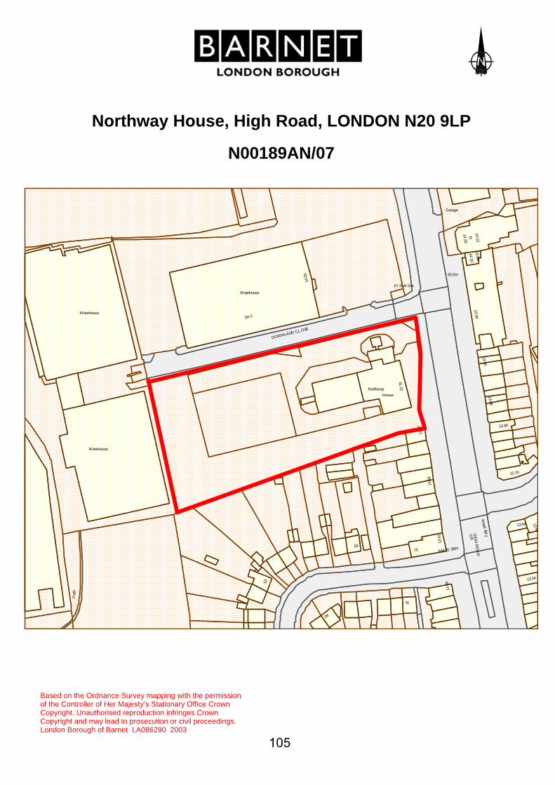
Northway House, High Road, LONDON N20 9LP
N00189AN/07
Pat
h
Warehouse
Warehouse
Warehouse
1to 2
53
DOWNLAND CL OSE
1403
60
65
NorthwayHouse
El Sub Sta
1379
70
75
1377
1369
BM 92 .88m
1361
Garage
92.0m
1359
1420
1410
toC
RH
IGH
RO
AD
1394
1404
1412
Ward
Bdy
1392
1386
13 80
13 70
13 64
13 54
1368
Based on the Ordnance Survey mapping with the permission of the Controller of Her Majesty’s Stationary Office Crown Copyright. Unauthorised reproduction infringes Crown Copyright and may lead to prosecution or civil proceedings. London Borough of Barnet LA086290 2003
105
106
LOCATION: DOLPHINS, Totteridge Green, London, N20 8PE.
REFERENCE: N10150P/07 Received: 9 Feb 2007 Accepted: 9 Feb 2007WARD: Totteridge Expiry: 6 Apr 2007 Final Revisions:APPLICANT: Mr A Soteriou PROPOSAL: Demolition of existing house.
RECOMMENDATION: APPROVE SUBJECT TO CONDITIONS
1. This work must be begun not later than three years from the date of this consent. Reason: To comply with Section 18 of the Planning (Listed Buildings and Conservation Areas) Act 1990 (as amended).
2. The demolition works hereby permitted shall not be undertaken before a contract for the carrying out of the works of redevelopment of the site has been executed and planning permission has been granted for the redevelopment for which the contract provides. Evidence that this contract has been executed shall be submitted to the Local Planning Authority and approved in writing by the Local Planning Authority prior to any demolition works commencing. Reason: To preserve the established character of the Conservation Area pending satisfactory redevelopment of the site.
INFORMATIVE(S):-
1. The plans accompanying this application are:- 09P, Existing Plans and Section (unnumbered), Existing Elevations (unnumbered), Lev 1P, Lev 2P, 01P, 02P, 03P, 04P, 05P, 06P, 07P, 10P, 11P
1. MATERIAL CONSIDERATIONS Relevant Unitary Development Plan Policies: GBEnv4, HC1, HC3 and HC4

107
Relevant Planning History: N10150D/05 – Demolition of existing dwelling and erection of new two-storey house (plus rooms in roofspace and basement) attached triple garage – WITHDRAWN 7.7.05 N10150E/05 – Demolition of existing dwelling (Conservation Area Consent) – WITHDRAWN 8.7.2005 N10150F/06 – Demolition of existing dwelling and erection of a part single, part two-storey dwellinghouse (with rooms in roofspace and basement) and attached double garage – APPROVED 25.4.2006 N10150G/06 – Demolition of existing house (Conservation Area Consent) – APPROVED 24.7.2006 Consultations and views Expressed: Neighbours Consulted: N/A Replies: Nil Totteridge Conservation Area Advisory Committee considers that the revised proposals for the replacement house are a significant improvement on the previous planning consent. However, no demolition should take place until plans for a suitable replacement dwelling have been approved. 2. PLANNING APPRAISAL Site Description and Surroundings The application site is located on Totteridge Green, which is located within Totteridge Conservation area. The green comprises formal areas of open grassland to the north, scattered trees and several small pockets of shrubby woodland to the south. The area of the application site is characterised by established woodland with properties well separated, set back from the road and set within substantial grounds. There are many architecturally important properties in the area and a number of properties are listed. The application site itself currently contains a modern house built in the late 1960’s and is of little architectural merit. The current property has a floor area of 197m² and is arranged over three levels including a basement. The site has a frontage of 50m and a depth of 115m, the site slopes away from the property and the plot is generally open, however the boundaries and land closer to the property are defined by denser established trees and shrubs many with preservation orders.

108
Proposals Planning permission is sought for the demolition of the existing property. The erection of a replacement detached house on the site is subject of planning application N10150Q/07, which is the subject of a report elsewhere on this agenda. Material Planning Considerations The existing building is a modern house built in the late 1960’s and is of little architectural merit and does not make a positive contribution to the character or appearance of the conservation area. The principle of the demolition is considered to be acceptable subject to proposals being received for an appropriate replacement dwelling. The proposed replacement dwelling is of a design and form that is considered appropriate within Totteridge Conservation Area, would have an acceptable impact upon trees of amenity value and an acceptable impact upon neighbours’ amenities. Therefore the proposed demolition of the existing dwelling is considered to be acceptable. The proposals for the replacement dwelling are considered to be acceptable and are the subject of a report elsewhere on this agenda. 3. COMMENTS ON THE GROUNDS OF OBJECTIONS Considered to be addressed in appraisal and by recommended condition. 4. EQUALITIES AND DIVERSITY ISSUES The demolition of an existing dwelling raises no equalities or diversity issues. 5. CONCLUSION The proposed demolition of the existing building is considered to be acceptable.

109
Dolphins, Totteridge Green, N20 8PE
N10150P/07
Issues
The Croft
103.35mBM
Highfield
Dolphins
The Croft
StrathearnCottages
Posts
Fairspeir
21
Fairspeir
102.7m
Posts
Dra
in
98.8m
Cottage
Pavilion
The
12
Totteridge Cricket Club
BeaconsfieldCottages
Based on the Ordnance Survey mapping with the permission of the Controller of Her Majesty’s Stationary Office Crown Copyright. Unauthorised reproduction infringes Crown Copyright and may lead to prosecution or civil proceedings.

110
LOCATION: DOLPHINS, Totteridge Green, London, N20 8PE.
REFERENCE: N10150Q/07 Received: 9 Feb 2007 Accepted: 9 Feb 2007WARD: Totteridge Expiry: 6 Apr 2007 Final Revisions:APPLICANT: Mr A Soteriou PROPOSAL: Demolition of existing dwelling and erection of a part
single, part two-storey dwelling house (with rooms in roofspace and basement) and attached double garage.
RECOMMENDATION: APPROVE SUBJECT TO CONDITIONS
1. This development must be begun within three years from the date of this permission. Reason: To comply with Section 51 of the Planning and Compulsory Purchase Act, 2004.
2. Before this development is commenced, details of the levels of the building(s), road(s) and footpath(s) in relation to adjoining land and highway(s) and any other changes proposed in the levels of the site shall be submitted to and approved in writing by the Local Planning Authority. The development shall be implemented in accordance with such details as approved. Reason: To ensure that the work is carried out at suitable levels in relation to the highway and adjoining land having regard to drainage, gradient of access and the amenities of adjoining occupiers and the health of any trees on the site.
3. Before the development hereby permitted is brought into use or occupied the site shall be enclosed except at the permitted points of access in accordance with details previously submitted to and approved in writing by the Local Planning Authority. Reason: To ensure that the proposed development does not prejudice the appearance of the locality and/or the amenities of occupiers of adjoining residential properties and to confine access to the permitted points in the interest of the flow of traffic and conditions of general safety on the adjoining highway.
4. Before the development hereby permitted commences, details of enclosures and screened facilities for the storage of recycling

111
containers and wheeled refuse bins or other refuse storage containers where applicable, together with a satisfactory point of collection shall be submitted to and approved in writing by the Local Planning Authority and shall be provided at the site in accordance with the approved details before the development is occupied. The details submitted shall include the design, materials and external appearance of any refuse enclosure. Reason: To ensure a satisfactory appearance for the development and satisfactory accessibility; and to protect the amenities of the area.
5. Before the development hereby permitted is approved full details of the following elements of the proposal's fenestration at 1:10 scale shall be submitted to, and approved in writing by the Local Planning Authority. The development shall be implemented in accordance with such details as approved. i) All external doors (including garage doors) and windows ii) Chimneys iii) 1st floor balcony iv) Roof lights v) Brickwork detailing vi) Eaves detailing, cornice and guttering Reason: To safeguard the character and appearance of the building and conservation area.
6. Full details of all external pipe work, ductwork or timberwork shall be submitted to and approved in writing by the Local Planning Authority. The development shall be implemented in accordance with such details as approved. Reason: To safeguard the character and appearance of the building and conservation area.
7. No site works or works on this development shall be commenced before a method statement detailing precautions to minimise damage to trees, in particular from vehicular movements, services and construction works, is submitted to and approved in writing by the Local Planning Authority and the development shall be carried out in accordance with such approval. Reason: To safeguard the health of existing tree(s) which represent an important amenity feature.
8. Before the development hereby permitted commences full details of entrance gates; and front boundary treatments associated with the development shall be submitted at 1:50 scale and approved in writing

112
by the Local Authority. The development shall be implemented in accordance with such details as approved. Reason: To safeguard the visual amenities of the building and surrounding Conservation Area.
9. Before the development hereby permitted commences 1m high material sample panels are to be erected on site for inspection and approval by the Local Planning Authority and shall be retained on site during the works. Reason: To safeguard the character and appearance of the building and conservation area.
10. Once the floor slab has been laid it shall be checked and approved by the Local Planning Authority before any construction work takes place above damp proof course level. Reason: To ensure the proposed development is built in accordance with the approved drawings.
11. No construction work resulting from the planning permission shall be carried out on the premises at any time on Sundays, Bank or Public Holidays, before 8.00 am or after 1.00 pm on Saturdays, or before 8.00 am or after 6.00pm on other days unless previously approved in writing by the Local Planning Authority. Reason: To ensure that the proposed development does not prejudice the amenities of occupiers of adjoining residential properties.
12. Before any plant or machinery is used on the premises, it shall be enclosed with sound-insulating material and mounted in a way which will minimise transmission of structure borne sound in accordance with a scheme to be approved in writing by the Local Planning Authority. Reason: To ensure that the proposed development does not prejudice the amenities of occupiers of adjoining residential properties.
13. The dwelling shall not be occupied until works for the disposal of sewage have been provided on the site to serve the development hereby permitted, in accordance with details to be submitted to and approved in writing by the Local Planning Authority. Reason: To ensure that the foul water discharge from the site shall not be prejudicial to the existing sewerage system and the amenities of the

113
area.
14. Development shall not begin until drainage works have been carried out in accordance with details to be submitted to and approved in writing by the Local Planning Authority. Reason: To ensure that the foul and/or surface water discharge from the site shall not be prejudicial to the existing sewerage system and the amenities of the area.
15. A scheme of hard and soft landscaping including details of existing trees to be retained and details of trees to replace those recently lost shall be submitted to and agreed in writing by the Local Planning Authority before the development hereby permitted, is commenced. Reason: To ensure a satisfactory appearance to the development.
16. All work comprised in the approved scheme of landscaping shall be carried out before the end of the first planting and seeding season following occupation of any part of the buildings or completion of the development, whichever is sooner, or commencement of the use. Reason: To ensure a satisfactory appearance to the development.
17. Any existing tree shown to be retained or trees or shrubs to be planted as part of the approved landscaping scheme which are removed, die, become severely damaged or diseased within five years of the completion of development shall be replaced with trees or shrubs of appropriate size and species in the next planting season. Reason: To ensure a satisfactory appearance to the development.
18. Before this development is commenced details of the location, extent and depth of all excavations for drainage and other services in relation to trees on the site shall be submitted and approved in writing by the Local Planning Authority and the development carried out in accordance with such approval. Reason: To safeguard the health of existing tree(s) which represent an important amenity feature.
19. No site works or works on this development shall be commenced before temporary fencing has been erected around existing tree(s) in accordance with details to be submitted and approved in writing by the Local Planning Authority. This fencing shall remain in position until after the development works are completed and no material or soil shall be stored within these fenced areas.

114
Reason: To safeguard the health of existing tree(s) which represent an important amenity feature.
20. The species, size and siting of replacement tree(s) shall be agreed in writing by the Local Planning Authority and the tree(s) shall be planted within 3 months (or as otherwise agreed in writing) of the completion of the development hereby approved. Reason: To ensure a satisfactory appearance to the development.
21. Provisions shall be made within the site to ensure that all vehicles associated with the construction of the development hereby approved are properly washed and cleaned to prevent the passage of mud and dirt onto the adjoining highway. Reason: To ensure that the development does not cause danger and inconvenience to users of the adjoining pavement and highway.
22. Notwithstanding the provisions of the Town and Country Planning (General Permitted Development) Order 1995 (or any order revoking and re-enacting that Order with or without modification), no development otherwise permitted by any of Classes A, B, C, D, E, F of Part 1 to Schedule 2 of that Order shall be carried out within the area of the dwelling hereby approved without the prior written permission of the local planning authority. Reason: To safeguard the amenities of neighbouring occupiers and the general locality.
23. Notwithstanding the information already submitted in connection with arboricultural methodology no work on the development (including site clearance) shall commence until a detailed Arboricultural Method Statement has been submitted to and formally approved in writing by the Local Planning Authority. This Arboricultural Method Statement shall detail precautions to minimise damage to trees, be site specific and include the following issues:- Summary of tree stock including method of tree categorisation, species diversity, age distribution, summary of tree stock categories, tree constraint advice, proposed tree loss, retention and justifications. Arboricultural implications including tree constraints and layout design, above and below ground constraints, protected species. Phasing of development including site preparation, demolition, construction, landscaping.

115
Existing and proposed site levels including existing and proposed buildings and hard surfaced areas relative to trees. Specific details of protection of all trees on site. Arboricultural data and site plans Arboricultural site considerations Tree work specifications (site specific) Removal and/or of hard surfaces in close proximity to trees Utilities services connections Foundation specifications Landscape design plans and specifications Plans submitted with this statement must be accurately drawn to scale and be clearly legible and the development shall be carried out strictly in accordance with the approved details. Reason: To safeguard the health of existing trees on the site which represent an important amenity feature.
24. Notwithstanding any information already submitted in connection with construction management, no work on the development (including site clearance) shall commence until a Construction Method Statement has been submitted to and formally approved in writing by the Local Planning Authority. The Construction Method Statement shall be site specific and take into account the precautions approved in the Arboricultural Method Statement and deal, inter alia with following: site compounds, site huts, protective fencing, site screening, storage of materials on site, contractors parking, delivery of materials to and from site (including hours of delivery which should be timed to avoid conflict with the dropping off and collection of children at schools in the vicinity). Reason: To safeguard the free flow of traffic, pedestrian and public safety and the health of existing trees which represent an important amenity feature.
25. The development will be required to meet the "Very Good" standard in the BRE (Building Research Establishment) EcoHomes assessment and a high HQI (Housing Quality Indicator) for residential development or as may be agreed by the Local Planning Authority. Reason: To ensure that the development is sustainable and complies with Strategic and Local Policies.

116
INFORMATIVE(S):-
1. The plans accompanying this application are:- 09P, Lev 1P, Lev 2P, 01P, 02P, 03P, 04P, 05P, 06P, 07P, 10P, 11P, 06hd, 07hd, "Front view of proposed replacement dwelling" (unnumbered) "View of replacement dwelling from road" (unnumbered), A2 Rev. A, A3 Rev. A, A4 Rev. A, A5 Rev. A, A6 Rev. A, A7 Rev. A, A8 Rev. A, A9 Rev. A, A10 Rev. A, F1 Rev. A, L1 Rev. A, AE/AS/DW/07/04-02/A11, Arboricultural Method Statement, Implementation Report on Phase 1 of Arboricultural Method Statement
2. The reasons for this grant of planning permission or other planning related decision are as follows: - i) The proposed development accords with strategic planning guidance and policies as set out in the Mayor's London Plan (published 10 February 2004) and the Adopted Barnet Unitary Development Plan (2006). In particular the following polices are relevant: Adopted Barnet Unitary Development Plan (2006): Policies: GLand, GBEnv1, GBEnv2, GBEnv4, GParking, GH1, GH2, D1, D2, D3, D4, D5, D6, D7, D11, D13, HC1, HC3, HC4, HC5, M11, M12, M13, M14, H16, H17, H18 And, This revised application is considered to be an enhancement of the scheme approved under planning permission ref. N10150G/05 dated 25.4.2006. It is of a design that is considered to preserve and enhance the conservation area. The proposal is considered to have an acceptable impact on trees of special amenity value and on the amenities of adjoining occupiers and these impacts would not materially worse than the approved scheme.
1. MATERIAL CONSIDERATIONS Relevant Unitary Development Plan Policies: GLand, GBEnv1, GBEnv2, GBEnv4, GParking, GH1, GH2, D1, D2, D3, D4, D5, D6, D7, D11, D13, HC1, HC3, HC4, HC5, M11, M12, M13, M14, H16, H17, H18 Relevant Planning History: N10150D/05 – Demolition of existing dwelling and erection of new two-storey house (plus rooms in roofspace and basement) attached triple garage – WITHDRAWN 7.7.05

117
N10150E/05 – Demolition of existing dwelling (Conservation Area Consent) – WITHDRAWN 8.7.2005 N10150F/06 – Demolition of existing dwelling and erection of a part single, part two-storey dwellinghouse (with rooms in roofspace and basement) and attached double garage – APPROVED 25.4.2006 N10150G/06 – Demolition of existing house (Conservation Area Consent) – APPROVED 24.7.2006 Consultations and views Expressed: Neighbours Consulted: 15 Replies: 4 The application was advertised on site and in the local press. The occupiers of adjoining and nearby properties and their professional advisers have raised the following objections: • Increase in floorspace compared with existing dwelling is very large
resulting in an unacceptable intensification and overdevelopment of the site
• Out of keeping with the conservation area • Failure to consider the character of surrounding properties • Property has moved closer to The Croft compared to the existing house
affecting gaps between properties and the character of the conservation area
• Loss of privacy • Trees lost and the proposed house in the previous position of these trees • Design and massing is inappropriate in the conservation area • It will have an adverse effect on local amenity • Appears squashed onto a small site • Bulk is massive • Underground structure could disrupt the watercourse • Goes further towards Totteridge Valley which is an intrusion • Will overwhelm the vista of the conservation area The occupier of Highfield requested that conditions be imposed upon any grant of planning permission, particularly in relation to: obscure glazing to windows side windows/glazing in doors facing Highfield; protection of trees during construction; trees along the common boundary being retained; landscaping scheme to mitigate visibility of proposed new house; all mature trees that have been lost should be replaced with mature trees, and that previously imposed conditions should be repeated. Totteridge Conservation Area Advisory Committee considers that the revised proposals for the replacement house are a significant improvement on the previous planning consent. However, no demolition should take place until plans for a suitable replacement dwelling have been approved. Neither Totteridge Manor Association nor Totteridge Residents Association has made any representations on the application.

118
Highways Group raises no objections on highways grounds. 2. PLANNING APPRAISAL Site Description and Surroundings The application site is located on Totteridge Green, which is located within Totteridge Conservation area. The green comprises formal areas of open grassland to the north, scattered trees and several small pockets of shrubby woodland to the south. The area of the application site is characterised by established woodland with properties well separated, set back from the road and set within substantial grounds. There are many architecturally important properties in the area and a number of properties are listed. The application site itself currently contains a modern house built in the late 1960’s and is of little architectural merit. The current property has a floor area of 197m² and is arranged over three levels including a basement. The site has a frontage of 50m and a depth of 115m, the site slopes away from the property and the plot is generally open, however the boundaries and land closer to the property are defined by denser established trees and shrubs many with preservation orders. Proposals Planning permission is sought for the demolition of the existing property and the erection of a replacement detached house with attached garage. An application seeking Conservation Area Consent for the demolition of the existing buildings, ref. N10150P/07, is the subject of a report elsewhere on this agenda. The proposed property has a floor area of 359m² including the garage building. The proposed building is set centrally within the plot being set 7.4m off the southern boundary and 8.2m off the northern boundary. The proposed building is substantial, being of two storeys, with basement and attic accommodation. The building is roughly L-shaped with the attached double garage being contained within a wing that projects forward of the main bulk of the house, towards Totteridge Green. The main bulk of the house is two storeys, but the part nearest the boundary with Highfield is single storey. It would be of an Arts and Crafts design, finished in render and brickwork, with clay roof tiles and timber joinery. Material Planning Considerations This is a revised application that makes a series of elevational changes to the building. However, the footprint of the proposed building is effectively unchanged from that of the previously approved scheme and its position on the site is unchanged from the previously approved scheme.

119
The main amendment to the proposed house relates to the elevations and roof. The previously approved house had a ridged roof, but the roof pitches were not the same on each roofslope. Furthermore, the elevations facing The Croft and to the rear had the first floor partly set within the roof slope, with windows breaking the eaves line. In this revised scheme a standard 45-degree roof pitch has been adopted. Were these to have been carried through to a ridge, it would have been 0.7m higher than that previously approved. However, to avoid an excessively bulky roof, a crown roof form has been adopted that is 0.5m lower than the previously approved ridge height. Furthermore, all elevations are now two storeys, with a continuous eaves line sitting on top of the first floor windows. These proposed changes are beneficial and would make for a simpler, more pleasing building, with consequent benefit to the character and appearance of the conservation area. Whilst these changes would involve limited increases to the bulk of the building, as compared with the previously approved scheme, in view of the distances from the boundaries and the adjoining properties, these changes would not result in an overbearing or visually obtrusive structure that would harm neighbours’ amenities. The other changes are more minor and are listed below: Front Elevation • Front entrance feature reduced in height to maintain relationship to ridge • Pair of two casement windows with central panel on first floor, replaced by
a three casement unit • New window on right hand side to match • Rooflights deleted • Timber posts to porch corners deleted • Roof link between garage and house continued to intersect with entrance
porch Side Elevation to Highfield • Roof link between garage and house lowered by the introduction of crown
roof detail • Window to link between house and garage replaced by a door • Two conservation rooflights in main roofslope Rear Elevation • Inset balconies and French doors at attic level deleted and replaced by two
conservation rooflights • One set of French doors replaced by casement window

120
• Reduced garden level to form light well for basement doors and windows deleted and existing sloping ground levels retained and basement windows and doors deleted
Side Elevation to The Croft • One rooflight deleted • First floor windows/semi-dormers deleted • Roof link between garage and house lowered by the introduction of crown
roof detail • Ground floor doors replaced by windows • Open-sided canopy roof added with timber post supports These changes result in an improved appearance to the proposed replacement house. It is of a design that is considered to preserve and enhance the conservation area. The proposed dwelling is of a design that is considered to have a positive impact on the conservation area due to the quality of the design. As has been previously stated in this report, the footprint of the building and its position on the site are not materially different from the approved scheme. This revised scheme would have a limited additional impact upon the amenities of adjoining occupiers and raise no further implications for the trees at the site. 3. COMMENTS ON THE GROUNDS OF OBJECTIONS Considered to be addressed by the previous planning permission and suggested conditions. 4. EQUALITIES AND DIVERSITY ISSUES The proposed house would be required to meet the provisions of Part M of the Building Regulations. 5. CONCLUSION This revised application is considered to be an enhancement of the scheme approved under planning permission ref. N10150G/05 dated 25.4.2006. It is of a design that is considered to preserve and enhance the conservation area. The proposal is considered to have an acceptable impact on trees of special amenity value and on the amenities of adjoining occupiers and these impacts would not materially worse than the approved scheme.

121
Dolphins, Totteridge Green, N20 8PE
N10150Q/07
Issues
The Croft
103.35mBM
Highfield
Dolphins
The Croft
StrathearnCottages
Posts
Fairspeir
21
Fairspeir
102.7m
Posts
Dra
in
98.8m
Cottage
Pavilion
The
12
Totteridge Cricket Club
BeaconsfieldCottages
Based on the Ordnance Survey mapping with the
permission of the Controller of Her Majesty’s Stationary Office Crown Copyright. Unauthorised reproduction infringes Crown Copyright and may lead to prosecution or civil proceedings.

122
LOCATION: 54 Barnet Gate Lane, Barnet, Hertfordshire, EN5
2AD.
REFERENCE: N04448B/06 Received: 21 Nov 2006 Accepted: 8 Dec 2006WARD: Underhill Expiry: 2 Feb 2007 Final Revisions:APPLICANT: Millennium Developments Ltd PROPOSAL: Demolition of existing bungalow and erection of 2 No.
two storey (plus rooms in the roofspace) detached houses.
RECOMMENDATION: APPROVE SUBJECT TO CONDITIONS
1. This development must be begun within three years from the date of this permission. Reason: To comply with Section 51 of the Planning and Compulsory Purchase Act, 2004.
2. Before the development hereby permitted is occupied the garages shown on Plan 332706 Rev.A, 332706/2 shall be provided and shall not be used for any purpose other than the parking of vehicles in connection with the approved development. Reason: To ensure that parking is provided in accordance with the council's standards in the interests of pedestrian and highway safety, the free flow of traffic and in order to protect the amenities of the area.
3. Before this development is commenced, details of the levels of the building(s), road(s) and footpath(s) in relation to adjoining land and highway(s) and any other changes proposed in the levels of the site shall be submitted to and approved in writing by the Local Planning Authority. The development shall be implemented in accordance with such details as approved. Reason: To ensure that the work is carried out at suitable levels in relation to the highway and adjoining land having regard to drainage, gradient of access and the amenities of adjoining occupiers and the health of any trees on the site.
4. Before the development hereby permitted commences, details of the materials to be used for the external surfaces of the building(s) and hard surfaced areas shall be submitted to and approved in writing by

123
the Local Planning Authority. The development shall be implemented in accordance with such details as approved. Reason: To safeguard the visual amenities of the locality.
5. Before the development hereby permitted is brought into use or occupied the site shall be enclosed except at the permitted points of access in accordance with details previously submitted to and approved in writing by the Local Planning Authority. Reason: To ensure that the proposed development does not prejudice the appearance of the locality and/or the amenities of occupiers of adjoining residential properties and to confine access to the permitted points in the interest of the flow of traffic and conditions of general safety on the adjoining highway.
6. No construction work resulting from the planning permission shall be carried out on the premises at any time on Sundays, Bank or Public Holidays, before 8.00 am or after 1.00 pm on Saturdays, or before 8.00 am or after 6.00pm on other days unless previously approved in writing by the Local Planning Authority. Reason: To ensure that the proposed development does not prejudice the amenities of occupiers of adjoining residential properties.
7. A scheme of hard and soft landscaping, including details of existing trees to be retained, shall be submitted to and agreed in writing by the Local Planning Authority before the development, hereby permitted, is commenced. Reason: To ensure a satisfactory appearance to the development.
8. All work comprised in the approved scheme of landscaping shall be carried out before the end of the first planting and seeding season following occupation of any part of the buildings or completion of the development, whichever is sooner, or commencement of the use. Reason: To ensure a satisfactory appearance to the development.
9. Any existing tree shown to be retained or trees or shrubs to be planted as part of the approved landscaping scheme which are removed, die, become severely damaged or diseased within five years of the completion of development shall be replaced with trees or shrubs of appropriate size and species in the next planting season. Reason: To ensure a satisfactory appearance to the development.
10. No site works or works on this development shall be commenced

124
before temporary fencing has been erected around existing tree(s) in accordance with details to be submitted and approved in writing by the Local Planning Authority. This fencing shall remain in position until after the development works are completed and no material or soil shall be stored within these fenced areas. Reason: To safeguard the health of existing tree(s) which represent an important amenity feature.
11. Provisions shall be made within the site to ensure that all vehicles associated with the construction of the development hereby approved are properly washed and cleaned to prevent the passage of mud and dirt onto the adjoining highway. Reason: To ensure that the development does not cause danger and inconvenience to users of the adjoining pavement and highway.
12. Notwithstanding the provisions of the Town and Country Planning (General Permitted Development) Order 1995 (or any order revoking and re-enacting that Order with or without modification), no development otherwise permitted by any of Classes A, B, C, D, E and F of Part 1 to Schedule 2 of that Order shall be carried out within the area of the dwellings hereby approved without the prior written permission of the local planning authority. Reason: To preserve the character and appearance of the dwelling and the locality, to safeguard the health of existing trees and hedges, which represent an important amenity feature and to safeguard the amenities of neighbouring occupiers.
13. The development will be required to meet the "Very Good" standard in the BRE (Building Research Establishment) EcoHomes assessment and a high HQI (Housing Quality Indicator) for residential development or as may be agreed by the Local Planning Authority. Reason: To ensure that the development is sustainable and complies with Strategic and Local Policies.
14. Before the building hereby permitted is occupied the proposed side bathroom windows in both elevations of the dwellings hereby approved shall be glazed with obscure glass only and shall be permanently retained as such thereafter and shall be permanently fixed shut with only a fanlight opening, unless otherwise agreed in writing by the Local Planning Authority. Reason: To safeguard the privacy and amenities of occupiers of adjoining residential properties.
15. The roofs of the rear projections to the houses hereby permitted shall only be used in connection with the repair and maintenance of the building and shall at no time be converted to or used as a balcony, roof

125
garden or similar amenity or sitting out area, without the benefit of the grant of further specific permission in writing from the Local Planning Authority. Reason: To ensure that the amenities of the occupiers of adjoining properties are not prejudiced by overlooking.
16. Notwithstanding the provisions of any development order made under Section 59 of the Town and Country Planning Act 1990 (or any Order revoking and re-enacting that Order), the following operation(s) shall not be undertaken without the prior specific permission of the Local Planning Authority The insertion of additional windows in any elevation of the building hereby permitted. Reason: To ensure that the amenities of the occupiers of adjoining properties are not prejudiced by overlooking.
INFORMATIVE(S):-
1. The plans accompanying this application are:- Location Plan (unnumbered), 332706 Rev. A, 332706/2
2. The reasons for this grant of planning permission or other planning related decision are as follows: - i) The proposed development accords with strategic planning guidance and policies as set out in the Mayor's London Plan (published 10 February 2004) and the Adopted Barnet Unitary Development Plan (2006). In particular the following polices are relevant: Adopted Barnet Unitary Development Plan (2006): GLand, GBEnv1, GBEnv2, GBEnv4, GGreenBelt, GParking, GH1, GH2, D1, D2, D3, D4, D5, D7, D11, D13, HC5, O7, M11, M12, M13, M14, H16, H17, H18, CS8, IMP1, IMP2 And, The proposal would safeguard the character and appearance of the street scene, the locality and this part of the North Barnet/Arkley/Totteridge (with North Enfield and Harrow Weald) Area of Special Character. It would not cause material harm to the amenities of adjoining occupiers. It would not harm the open character or the visual amenity of the Green Belt. It would not cause harm to highway and pedestrian safety and the free flow of traffic.
3. Any modifications to the existing vehicular crossover must be carried out by the Highway Authority at the applicant's expense. You may obtain an estimate for this and any associated work on public highway

126
from the Chief Highways Officer, London Borough of Barnet Building 4, North London Business Park, Oakleigh Road South, LONDON N11 1NP.
4. The applicant is advised that if the development is carried out, where possible, the applicant should seek to improve the existing pedestrian visibility splays either side of the vehicular crossover.
1. MATERIAL CONSIDERATIONS GLand, GBEnv1, GBEnv2, GBEnv4, GGreenBelt, GParking, GH1, GH2, D1, D2, D3, D4, D5, D7, D11, D13, HC5, O7, M11, M12, M13, M14, H16, H17, H18, CS8, IMP1, IMP2 Relevant Planning History: N04448 – Single storey side and rear extension – APPROVED 13.5.74 N04448A – Single storey rear extension – APPROVED 2.10.80 Consultations and views Expressed: Neighbours Consulted: 7 Replies: 3 The occupiers of adjoining properties have raised the following objections: • Rear bedroom windows would cause overlooking particularly due to the
slope to the rear • Slope will cause building to appear as 3½ storeys from rear • Loss of light • Overlooking and loss of privacy • New property should not extend beyond No. 56 • Side elevation should be a similar distance from the boundary with No. 56
as the distance between the two proposed houses • Maintenance and access to the side of No. 56 would become impossible • Drainage problems could be worsened • Is sufficient parking proposed • Will trees be lost • Object to any works to cut or remove boundary hedge • Proposed house is too close to No. 56 Highways Group recommends the application for approval.

127
2. PLANNING APPRAISAL Site Description and Surroundings No. 54 is a detached bungalow located on the west side of Barnet Gate Lane. The property has been extended at the rear and there is also a raised terrace at the rear. This part of Barnet Gate Lane largely comprises detached houses of varying sizes and storey heights and there are some replacement dwellings. Levels fall from north to south along the street and fall across the site towards the rear, with a steeper fall beyond the rear boundary towards properties in Hendon Wood Lane, whose ground floors are effectively 1 storey below the application site. The site is located within the North Barnet/Arkley/Totteridge (with North Enfield and Harrow Weald) Area of Special Character. Whilst the open land opposite the site is designated as Green Belt. Proposals It is proposed to demolish the existing bungalow and erect two detached houses in its place. They would be of identical design and size, albeit handed and with the northern unit set forward of the southern unit. They would be of two storeys with crown roofs containing habitable rooms served by a rear dormer window and a rooflight in each side roof. The houses would be a maximum of 11.8m deep (including a front projecting element 1.2m in depth) and 7.5m wide. Each house would be a maximum of 6.1m high to eaves (due to the sloping levels) with the roof being a further 2.5m high. The side elevations would be a minimum of 1m from the side boundaries and there would be a gap of 1.4m between the proposed houses. Each house would have a 3m deep single storey rear projection across part of the rear elevation, but positioned on the inner part of the elevation so that the projections are adjacent to one another rather than the adjoining houses. The proposed houses are of a traditional, pitched roof design. Each house would have an integral garage and a front driveway/turning area would be provided. Material Planning Considerations Character and Appearance This part of Barnet Gate Lane largely comprises detached houses of varying sizes and storey heights and there are some replacement dwellings. The adjacent houses, Nos. 50 and 52 are modestly sized detached houses. Whilst the proposed houses are wider at the upper floor level than those that would adjoin them, the proposed houses would reflect the general scale and plot widths of adjacent properties. Their positioning and on the site and staggered relationship to one another would respect the gentle curve in the

128
street at this point. Furthermore, the proposed roof heights would sit comfortably between the existing properties at Nos. 52 and 56 and would follow the pattern of ridge lines that follow the falling street levels. The proposed houses would retain adequate space around and between them and this, together with the stepping-down of existing houses and the proposed houses, would prevent a terracing effect being produced in the street scene. It is considered, therefore, that the proposed houses could be accommodated in the street scene without having a harmful impact upon the character and appearance of the street scene, the locality and this part of the North Barnet/Arkley/Totteridge (with North Enfield and Harrow Weald) Area of Special Character. The Impact Upon Adjoining Properties No. 52 is set at a level approximately 1m above the application site. It has a ground floor rear extension and there are no windows (apart from side windows in the extension) in the side elevation. At the rear, the proposed house nearest to No. 52 would be a similar depth to the extension at No. 52, meaning it would be approximately 3m deeper than the 1st floor rear elevation at No. 52, which has rear-facing windows. Whilst there would be an increase in mass and bulk, visible from the rear first floor windows in No. 52, as the proposed house would not project materially beyond the extension at No. 52, it is considered that the proposed house would not have an overbearing or visually obtrusive impact on No. 52. No. 52 lies to the north and it is likely that there would be some reduction in light reaching the first floor rear room nearest the boundary and the room in the existing extension. The former is in excess of 3m from the flank wall of the proposed house, whilst the latter has other windows that serve it. On this basis, it is considered that the proposed house would not cause a harmful loss of light or overshadowing to No. 52. No. 56 is set approximately 1m below the application site. It has a part-glazed side addition with a glazed roof and first floor windows and a rooflight, that are understood to serve a bathroom and bedroom. The main two-storey rear elevation of the proposed house would not project beyond the rear elevation of No. 56. Whilst the proposed house would be at a higher level, it would not have an overbearing or visually obtrusive impact when viewed from No. 56. The proposed single storey rear projection would project beyond No. 56 by approximately 2.7m. However, it would be a minimum of 4.5m from the boundary with No. 56 and with this separation, the visual impact would not be harmful. The proposed house lies to the north of No. 56, and this, together with the fact that the windows affected are a bathroom, a secondary source of light to a bedroom and the side addition with its large glazed roof, is such there would not be a harmful loss of light or overshadowing to No. 56. Levels fall across the site towards the rear, with a steeper fall beyond the rear boundary towards properties in Hendon Wood Lane, notably “Ambleside”, whose ground floors are effectively 1 storey below the application site. However, the main rear elevations of the proposed houses would be a minimum of 21m from the rear boundary, with the houses in Hendon Wood Lane, being a similar distance away from the boundary. It is considered that
129
this degree of separation would ensure that the proposed houses would not appear overbearing or visually obtrusive from the properties behind. The proposed houses would introduce greater numbers of windows and at higher levels than currently exist. The only proposed side-facing windows are bathrooms and it is recommended that a condition be imposed requiring these to be obscure glazed. The rear windows would have views into the rear gardens of the adjoining properties, but views would be towards the rear part of the gardens. The level of overlooking would not be so great as to cause a harmful loss of privacy. To the rear, the levels are such that the windows are effectively one storey higher than their equivalents in the properties in Hendon Wood Lane. Normally development plan policy requires a separation distance of 21m between facing windows. However, the level change and rear attic floor window would mean that distances of 24m and 27m respectively would be required between the first floor and attic windows and the houses in Hendon Wood Lane. The achieved distance would be in the order of 40m. As such a harmful level of overlooking would not be caused to properties at the rear. Other Matters This part of Barnet Gate Lane has houses on one side only. The land on the east side is Green Belt. Development plan policy states that proposals on land adjacent to Green Belt land that have a detrimental effect on visual amenity or openness of the Green Belt or the purposes and objectives of Green Belt will be resisted. Whilst the proposals would increase the amount of built form in this part of the street, they would occupy space in a continuous built frontage and as such would not harm the openness or visual amenity of the adjoining Green Belt. Integral garages and parking is proposed using the existing carriage driveway. The parking provision is in accordance with the parking standards in the development plan. The proposal provides adequate amenity space in the form of private rear gardens for both proposed houses. Section 106 Items New residential developments may result in additional demand for school places and development plan policies suggest that, in places where a shortage of school places exist, a financial contribution towards the cost of providing additional school places may be sought through a S106 agreement. The proposed development contains two 4-bed units. However, there is an existing dwelling at the site. It is considered that the resultant child yield from the proposed development would not be so much greater than that of the exiting unit to justify seeking a financial contribution towards educational needs.

130
3. COMMENTS ON THE GROUNDS OF OBJECTIONS Largely considered to be addressed in appraisal. Otherwise: A minimum 1m gap is maintained to the side elevation of No. 56, which is considered to be acceptable to allow maintenance Drainage matters are dealt with under the Building Regulations Some trees will be removed; however no trees at the site are protected by Tree Preservation Orders. Matters relating to the boundary hedge are a private matter between the adjoining owners 4. EQUALITIES AND DIVERSITY ISSUES The design and access statement states that disabled access will be provided in accordance with Approved Document M of the Building Regulations. 5. CONCLUSION The proposed development would involve a more efficient use of a previously developed residential site. It has been designed in such a way that it would safeguard the character and appearance of the street scene, the locality and this part of the North Barnet/Arkley/Totteridge (with North Enfield and Harrow Weald) Area of Special Character. It would not cause material harm to the amenities of adjoining occupiers. It would not harm the open character or the visual amenity of the Green Belt. It would not cause harm to highway and pedestrian safety and the free flow of traffic. The proposal is recommended for approval.

131
N04448B/06 – 54 Barnet Gate Lane, BARNET EN5 2AD
59
CH
ANT
RY CL
OSE
1
3
Zero
HabendumThe
CottageBerbell
Boro Const Bdy
Edera
WoodviewLodge
Sunbeams
Cedar Cottage
Ambleside
36
CR
Gre en Ridg
e
38
Lee
Milander
42
Verona
Decameron
52
Pinewood
House
125.0m
BAR
NE
T GAT
E LAN
E
62
62a
66
Based on the Ordnance Survey mapping with the permission of the Controller of Her Majesty’s Stationary Office Crown Copyright. Unauthorised reproduction infringes Crown Copyright and may lead to prosecution or civil proceedings.