Embed Size (px)
Citation preview

Stories of ResilienceListening to our Land


Listening to our LandStories of Resilience

UNDP partners with people at all levels of society to help build nations that can withstand crisis, and drive and sustain the kind of growth that improves the quality of life for everyone. On the ground in more than 170 countries and territories, we offer global perspective and local insight to help empower lives and build resilient nations. www.undp.org
The Global Environment Facility (GEF) was established on the eve of the 1992 Rio Earth Summit to help tackle our planet’s most pressing environmental problems. Since then, the GEF has provided over $17 billion in grants and mobilized an additional $88 billion in financing for more than 4000 projects in 170 countries. Today, the GEF is an international partnership of 183 countries, international institutions, civil society organizations and the private sector that addresses global environmental issues. www.thegef.org
The United Nations Convention to Combat Desertification (UNCCD) is the only legally binding international agreement on land issues. The Convention promotes good land stewardship. Its 196 Parties aim, through partnerships, to
implement the Convention and achieve Sustainable Development Goals. The end goal is to protect our land from over-use and drought, so it can continue to provide us all with food, water and energy. By sustainably managing land and striving to achieve land degradation neutrality, now and in the future, we will reduce the impacts of climate change, avoid conflict over natural resources and help communities thrive. www2.unccd.int
Published by:UNDP – Global Environmental FinanceSustainable Development ClusterBureau for Policy and Programme SupportUnited Nations Development Programme304 East 45th Street, 9th Floor, New York, NY 10017, USA
Disclaimer: The personal views reflected in the stories in this book are those of the contributors and do not necessarily represent those of the GEF or the United Nations, including UNDP, or their Member States.
Executive Producer: Adriana DinuProject Leader: Midori PaxtonManaging Editor: Mandy CadmanLead writers , compilation and editing: Mandy Cadman, Phemo Kgomotso, Midori Paxton and Inela WeeksDesign: InkDesign Publishing Solutions, Cape Town, South Africa. www.inkdesign.co.zaPrinting: Pornsup Printing Company Ltd, Bangkok, Thailand. http:// www.pornsupprint.comCover image: Woman tending fields in Mali. Credit: Imen Meliane/UNDP Climate Change Adapatation FlikrTitle page: Aerial view of small village, Africa. Credit: fivespointsix/Shuttterstock.comContents page: Desert landscape, Ustyurt Plateau, Uzbekistan. Credit: Pilgrim-Andy/Shutterstock.comThis page: Farmer in rice field, Magelang, Central Java. Credit: em faeis/Shutterstock.comOther photographs: See page 65 for a full list of photographer credits
We would like to thank the many people in UNDP country offices around the world, and in partner institutions, who have assisted with collating information, drafting sections of text, assisting with sourcing or supply of photographs, and reviewing draft material. A full list of acknowledgements is provided on page 65, at the back of the book.


ContentsForeword . . . . . . . . . . . . . . . . . . . . . . . . . . . . . . . . . . . . . . . . . . . . . . . . . . . . . . . . . . . . . . . . . . . . . . . . . . . . . . . . . . . . . . . . . . . . . . . . . . . . . . . . . . . . . . . . . . . . . . . . . . . . . vi
IntroductionLand: our home, our future . . . . . . . . . . . . . . . . . . . . . . . . . . . . . . . . . . . . . . . . . . . . . . . . . . . . . . . . . . . . . . . . . . . . . . . . . . . . . . . . . . . . . . . . . . . . . . . 1
NamibiaBeating the bush . . . . . . . . . . . . . . . . . . . . . . . . . . . . . . . . . . . . . . . . . . . . . . . . . . . . . . . . . . . . . . . . . . . . . . . . . . . . . . . . . . . . . . . . . . . . . . . . . . . . . . . . . . . . . . . . . 7
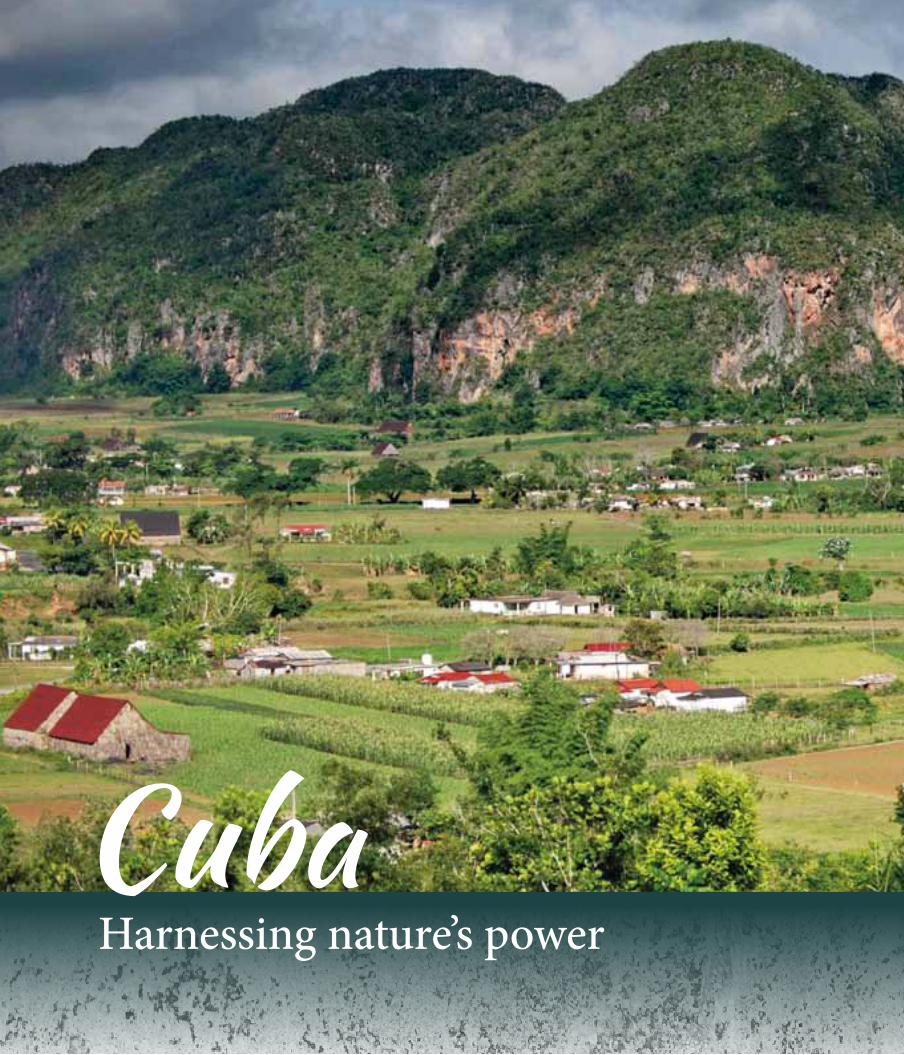
CubaHarnessing nature’s power . . . . . . . . . . . . . . . . . . . . . . . . . . . . . . . . . . . . . . . . . . . . . . . . . . . . . . . . . . . . . . . . . . . . . . . . . . . . . . . . . . . . . . . . . . . . . . 13
TanzaniaRestoring Kilimanjaro one step at a time . . . . . . . . . . . . . . . . . . . . . . . . . . . . . . . . . . . . . . . . . . . . . . . . . . . . . . . . . . . . . . . . . . . . . . 19
KazakhstanPushing back the shifting sands . . . . . . . . . . . . . . . . . . . . . . . . . . . . . . . . . . . . . . . . . . . . . . . . . . . . . . . . . . . . . . . . . . . . . . . . . . . . . . . . . . . . . 25
EritreaLand of dust and dreams . . . . . . . . . . . . . . . . . . . . . . . . . . . . . . . . . . . . . . . . . . . . . . . . . . . . . . . . . . . . . . . . . . . . . . . . . . . . . . . . . . . . . . . . . . . . . . . . . 31
MongoliaA balancing act . . . . . . . . . . . . . . . . . . . . . . . . . . . . . . . . . . . . . . . . . . . . . . . . . . . . . . . . . . . . . . . . . . . . . . . . . . . . . . . . . . . . . . . . . . . . . . . . . . . . . . . . . . . . . . . . . 37
Burkina FasoSocial networks for sustainability . . . . . . . . . . . . . . . . . . . . . . . . . . . . . . . . . . . . . . . . . . . . . . . . . . . . . . . . . . . . . . . . . . . . . . . . . . . . . . . . . . . 43
LebanonProtect, restore, reduce – working towards land degradation neutrality . . . . . . . . . . . . . . . . . 49
Advancing the Sustainable Development Goals . . . . . . . . . . . . . . . . . . . . . . . . . . . . . . . . . . . . . . . . . . . . . . . . . . . . . . . . . . 55
Acknowledgements . . . . . . . . . . . . . . . . . . . . . . . . . . . . . . . . . . . . . . . . . . . . . . . . . . . . . . . . . . . . . . . . . . . . . . . . . . . . . . . . . . . . . . . . . . . . . . . . . . . . . . . . . . 65
Photographer credits . . . . . . . . . . . . . . . . . . . . . . . . . . . . . . . . . . . . . . . . . . . . . . . . . . . . . . . . . . . . . . . . . . . . . . . . . . . . . . . . . . . . . . . . . . . . . . . . . . . . . . . . 65
vi Listening to our Land: STOriES Of rESiLiEnCE
Foreword
Productive land is a critical natural asset for rural communities in developing
nations, providing them with a wide range of ecosystem resources, such as
water, fertile soils, plant and genetic diversity – on which they depend daily
for survival. For many communities, the land is also an integral part of their
cultural identity, helping to maintain social cohesion and stability, in addition
to building resilience to socio-ecological shocks and risks such as those caused
by climate change. But land is a vulnerable resource that must be managed
and restored to ensure a sustainable future.
Globally, land degradation adversely affects approximately two billion
hectares of land – about one quarter of all landscapes that are under human
use. The deterioration of soil fertility, loss of forest cover, and erosion of
rangelands causes biodiversity loss and compromises the flow of ecosystem
services that enable food production and support the livelihoods of millions
of people. If current trends in land degradation are not reversed, an estimated
135 million people may be displaced by 2045 because of desertification, with
cascading social, economic, and environmental consequences.
The scale of the problem is immense, but so is our determination and
commitment to address it. We believe that the tools we have at our disposal
for addressing land degradation are better now than ever before – the stories
in this book are evidence of that.
The Global Environment Facility (GEF) is a financial mechanism for
implementation of the UN Convention to Combat Desertification (UNCCD).
Since 2006, the GEF has invested more than US$876 million in over 190
programmes and projects that encourage Sustainable Land Management
(SLM) as a comprehensive and socially-inclusive way to improve land
stewardship in support of achieving multiple goals of the 2030 Agenda for
Sustainable Development. In particular, SDG target 15.3, to combat
desertification and restore degraded land and soil, provides the core vehicle
for this effort. As an implementing agency of the GEF, and as a key partner for
Dr Naoko Ishii(CEO, Global Environment Facility
Achim Steiner(Administrator, UNDP)
Monique Barbut (Executive Secretary, UNCCD)
fOrEwOrD vii
the UNCCD, UNDP currently provides support to implement 85
SLM projects in 53 countries, with a total resource envelope of
about US$357 million and leveraging co-financing in the order
of US$1.38 billion. This work is complemented by local and
community-led efforts, supported by the UNDP-managed
Equator Initiative and the GEF Small Grants Programme (SGP).
This publication tells stories of people’s work on the land.
Through descriptions of their relationship with their land and
their efforts to improve its quality through sustainable land
management practices, this book highlights the impacts of SLM
projects supported by UNDP and funded by the GEF in eight
selected countries. Each story has been chosen to demonstrate
the effectiveness of a particular approach to SLM, reflected
through the personal perspectives of project beneficiaries.
These accounts present evidence that investing in improved land
stewardship is an effective tool for restoring and maintaining
productivity and resilience of the land, strengthening
adaptation to climate change, reducing conflict over natural
resources, and helping communities thrive.
These stories also show that SLM ensures that meeting future
needs for fuel, food and fibre is possible without degrading the
finite land resource base. This is the concept of Land Degradation
Neutrality, to which parties to the UNCCD committed in 2016.
UNDP has recently formed a partnership with the Global
Mechanism of the UNCCD, to provide technical support for
reducing or reversing land degradation through the newly
established Land Degradation Neutrality Fund.
UNDP and the GEF are fully committed to continue the
collaboration with all our partners to combat desertification,
restore degraded land and soil, and strive to achieve a land
degradation-neutral world.

Land: our home, our futureIntroduction
3 Listening to our Land: STOriES Of rESiLiEnCE
Since the earliest times, people have depended on land, and the
resources it provides, to meet their basic needs and support
productive and peaceful lives. In turn, human activities have
played an integral part in shaping landscapes and ecosystems –
even some landscapes considered wild and ‘pristine’ bear hidden
evidence of past human settlement or use, such as ancient ruins,
stone tools, shards of pottery, and iron-smelting sites.
In the modern context, land resources are the basis of production
activities that contribute to food security, provide employment,
and shape the development path of a country. People are potent
agents of change, and their development choices and land-use
practices inevitably impact, to some extent or another, on
biodiversity and the capacity of ecosystems to provide the
goods and services on which a sustainable future depends.
Today, the impact of human activities on the Earth’s ecosystems
is all too evident. Burgeoning population growth, over-
consumption, intensive agricultural practices, the use of
damaging extractive technologies, growing conflict over rights
to land, forced migration of people, and increasingly
unpredictable and extreme climatic patterns, are pushing the
planet to its limits, causing land degradation on a vast scale.
Land degradation: a barrier to sustainable developmentLand degradation now affects about one quarter of the world’s
land area, with direct impacts on the health, well-being and
livelihoods of an estimated 1.5 billion people – many of whom
are rural, poor and directly dependent on nature to meet their
daily subsistence and livelihood needs. Land degradation also
leads to loss of biological diversity, which, itself, holds enormous
value for all societies.
Historically, many rural communities have a deep connection
with their land, and have evolved traditional systems of land
stewardship that are sensitive to the environment. But,
balancing consumption of natural resources with the capacity
of the Earth to provide them, is growing increasingly difficult –
Land degradation: global trends
� During the last 40 years, nearly one third of the world’s fertile topsoil has been lost to erosion, and top soil loss continues at a rate of more than 10 million hectares per year
� Up to 40 percent of the world’s agricultural land is seriously degraded
� Two thirds of land in Africa is impacted by land degradation (affecting at least 485 million people, or 65% of the population of the continent)
� Globally, up to 5% of potential agricultural gross domestic product (GDP) is being lost due to land degradation
Sources: www.thegef.org; www2.unccd.int

inTrODuCTiOn 4
especially as changing lifestyles, altered market forces, and
pervasive poverty drives people to adopt coping responses
that cause biodiversity loss and damage to ecosystems, and
deplete the productive capacity of land.
Land degradation is a barrier to sustainable development that
destabilizes communities by causing food shortages and social
insecurity, making people vulnerable to environmental and
economic shocks and disturbances, including those caused by
climate change. Land degradation is also a driver of forced
migration, when people abandon lands that have become
unproductive. In turn, it is worsened by large-scale movement
and re-settlement of people linked to natural and social
disasters, such as famine, floods and civil war.
Society can choose how to respond to these challenges.
Finding practical solutionsCurrently, the global cost of land degradation reaches about
US$490 billion per year – much higher than the cost of action to
prevent it. Despite concerted efforts by the international
community and national governments, degradation of the
world’s ecosystems continues apace and there is an urgent
need to scale-up corrective action and make it more effective.
For many countries, the challenge of preventing and reducing
land degradation comes down to a trade-off between meeting
people’s immediate needs (or the country’s short term goals for
economic growth), and investing in long-term sustainability (of
both the environment and social well-being). Sustainable Land
Management (SLM) offers a comprehensive approach to the
management and governance of land resources that makes
significant and lasting differences in the near future and over
the long term. SLM provides a diversity of practical tools for
managing soil, water, vegetation and animal resources in ways
that are ecologically sound, socially and culturally sensitive, and
cost-effective. It also promotes a land stewardship mindset that
aims to integrate people’s co-existence with nature over the
long term, so that the provisioning, regulating, cultural and
supporting services of ecosystems are ensured.
Impacts on People
� About 40% of the world’s degraded lands are found in areas with the highest incidence of poverty
� Many of the world’s 836 million people living in extreme poverty depend directly on land and its resources for food, water, fuel, shelter and reduced vulnerability to climate change
� Over 250 million people are directly affected by desertification and another one billion are at risk
� An estimated 135 million people may be displaced by 2045 as a result of desertification if current trends in land degradation are not halted and reversed
Sources: www2.unccd.int; www.undp.org (various publications)

5 Listening to our Land: STOriES Of rESiLiEnCE
In most developing countries, SLM opens up multiple opportunities, both for restoring health to the environment and bolstering the livelihoods and quality of life of the people who depend on it. SLM enables farmers to enhance the productivity of their land and maximise yields, without degrading land and water resources, or causing negative downstream impacts. It also ensures improved management of agro-ecosystem services across production systems, reduces pressure on land resources, and helps improve and sustain economic productivity. Many countries are willing and ready to adopt SLM approaches, but face economic, institutional or other kinds of barriers to doing so, and lack the knowledge and technological innovations to overcome them.
UNDPs support for Sustainable Land ManagementPromoting SLM is a key strategy identified in UNDPs Biodiversity
and Ecosystems Global Framework (2012 -2020), which guides
its work to harness the potential of well-managed ecosystems to
support sustainable development. Under Signature Programme 1,
UNDP is committed to stepping-up efforts to integrate
sustainable ecosystem management into development
planning and production activities, in order to maintain
ecosystem services, safeguard biodiversity and sustain societies.
As part of this process, UNDP, in partnership with the GEF, helps
countries to implement the UN Convention to Combat
Desertification (UNCCD) to achieve simultaneous environmental
and social benefits.
Listening to our Land: Stories of ResilienceThis publication features eight stories drawn from countries
across the world, to demonstrate how addressing land
degradation through SLM promotes the objectives of the
UNCCD and contributes to achievement of multiple Sustainable
Development Goals (SDGs). Through the experiences of people
who earn their livelihoods by tending the land, the stories
inTrODuCTiOn 6
* Source: www.CreativeSpirits.info
Aboriginal culture - Land - Meaning of land to Aboriginal people, August 2017
“ … Land needs to be remembered, needs to be listened to, needs to know we can still speak its language.”
– ABoRIGINAL ELDER, AUSTRALIA*
reflect how SLM is improving living conditions of
communities and strengthening environmental
resilience. They also highlight the importance of
improved land stewardship in striving to achieve land
degradation neutrality (LDN), by restoring productivity
and fertility to degraded land and preventing future
degradation. This is the essence of target 15.3 under SDG
15 (Life on Land), which works towards meeting growing
demands for food, water and other land resources,
without depleting the systems that provide them.
The common thread running through these ‘Stories of
Resilience’ is that SLM has wide scope to provide multiple
benefits that empower people and nations to restore life
to their land, accelerate inclusive social transformation,
reduce resource-use conflicts, and cope with the
disturbances created by natural disasters and socio-
political crises. These benefits are presented at the back of
the book in ‘balance sheets’ that reflect how the featured
projects contribute to achieving targets under SDG 15 and
other SDGs, and build strong partnerships for attaining
‘the Future we Want.’

NamibiaBeating the bush
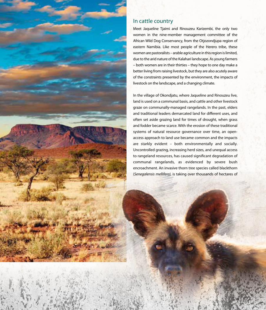
In cattle countryMeet Jaqueline Tjaimi and Rinouzeu Karizembi, the only two
women in the nine-member management committee of the
African Wild Dog Conservancy, from the otjozondjupa region of
eastern Namibia. Like most people of the Herero tribe, these
women are pastoralists – arable agriculture in this region is limited,
due to the arid nature of the Kalahari landscape. As young farmers
– both women are in their thirties – they hope to one day make a
better living from raising livestock, but they are also acutely aware
of the constraints presented by the environment, the impacts of
livestock on the landscape, and a changing climate.
In the village of okondjatu, where Jaqueline and Rinouzeu live,
land is used on a communal basis, and cattle and other livestock
graze on communally-managed rangelands. In the past, elders
and traditional leaders demarcated land for different uses, and
often set aside grazing land for times of drought, when grass
and fodder became scarce. With the erosion of these traditional
systems of natural resource governance over time, an open-
access approach to land use became common and the impacts
are starkly evident – both environmentally and socially.
Uncontrolled grazing, increasing herd sizes, and unequal access
to rangeland resources, has caused significant degradation of
communal rangelands, as evidenced by severe bush
encroachment. An invasive thorn tree species called blackthorn
(Senegalensis mellifera), is taking over thousands of hectares of

9 Listening to our Land: STOriES Of rESiLiEnCE
land and out-competing the local tree and grass species, with
disastrous consequences for pastoralists. Bush encroachment
also impacts on scarce water resources, as infiltration of rainwater
into the soil and groundwater is reduced on degraded lands.
“These bushes choke up the landscape, and stop cattle from
accessing grazing land,” says Rinouzeu. When asked what she
thinks causes the encroachment by thorn bushes and what can
be done about it, Jaqueline hesitates to link land degradation
directly to livestock management practices, but points out, “In
my experience, there tends to be less grass if there’s a lot of livestock,
especially cattle; and, where the cattle are fewer, the rangelands
are much healthier. I think it’s better to sell off some cattle and put
the money in the bank, that way you can buy more land elsewhere
if you want to increase the size of your cattle herd.”
Striking this balance is a lot more complex than this, as
pastoralism and cattle ownership go beyond simple economics
– cattle are also a cultural status symbol in Namibia, and men
with a lot of cattle are respected as community leaders. Cattle
are also considered an ‘insurance policy’, so selling them off for
no reason other than to put money in the bank, is hardly an
option most pastoralists would consider.
Knowledge and understanding of the interactions between
livestock husbandry and land degradation is, however,
increasing, and pastoralists like Jaqueline and Rinouzeu are
aware that for pastoralism to remain viable as a livelihood, the
‘old way of doing things’, as they say, has to change. Deliberate
and urgent action needs to be taken to reduce and avoid the
impacts of current land-use practices on the environment.
Finding communal solutionsThe response to bush encroachment nationally has been to
undertake mechanical clearing of large areas, especially on
commercial cattle farms, using the cleared biomass for
economically productive purposes. This strategy for restoring
and rehabilitating degraded rangelands is, however, an
expensive exercise, and tools and technical skills on how to do
it properly are limited at the local community level.
Building on the highly successful wildlife conservancy model,
the government has invested in establishing Community
Forests, and work is under way to harmonize forest and
wildlife-based conservancy systems. This includes establishing
mechanisms to compensate people for stock and crop losses
due to drought, flood, and wildlife damage. The African Wild
Dog Community Forest, located in otjozondjupa region – with
a conservancy group of the same name – covers an area of
473,244 hectares. once the Community Forest has been
legally proclaimed, the African Wild Dog Conservancy will
have legal control over a much larger area than they do
currently (38,192 hectares).
The dry forest resources of the African Wild Dog Community
Forest are largely used as communal rangelands for 112 villages
and settlements. Much of the area is currently affected by bush
encroachment caused by unregulated grazing, and conflict
over access to grazing land. Even prior to the legal recognition
of the Community Forest, the African Wild Dog Conservancy is
working proactively to pilot sustainable land and forestry
management practices – the key pilot program is on de-bushing
the degraded area and turning the harvested material into
fodder for livestock.
Jaqueline Tjaimi
BEaTing ThE BuSh 10
Nam
ibia
“The quality of the rangelands is already improving, so even
though at the moment we’re still at a trial stage, it is clear that the
potential benefits of de-bushing are great, and once we get official
clearance for our Community Forest, we will roll this programme
out,” says Jaqueline.
The primary rangeland management practice that the African
Wild Dog Conservancy plans to introduce is the regulation and
control of grazing. The current practice is such that anyone can
demarcate and fence off a portion of the communal grazing land
to create an ‘enclosure’ for their livestock, excluding others from
accessing and using the fenced area. This has resulted in conflicts
over communal grazing land and has marginalized, in particular,
poorer members of the community, including unmarried women
and poorer men, who lack the financial muscle and political
influence to gain control over communal land resources.
“Smallholder farmers like us suffer, because we cannot afford to
sell any of our already-few cattle to fence off land for grazing, so
during times when grazing is scarce, our cattle die. When the
Community Forest comes under our legal control, we will be able to
put in place a fairer system for allocating use of our communal
rangelands – everyone will have some access to grazing resources.
Ensuring fairer access to grazing land might also help persuade
cattle owners to rethink the size of their herds, and could be a
useful incentive for them to reduce their stock numbers – stock
owners with large herds would otherwise have to spend more
money on purchasing supplementary feed, as our rangelands are
not big enough to support large herds,” Rinouzeu argues.
Wild futuresWith the legal declaration of the Community Forest, the African
Wild Dog Conservancy will be empowered not only to manage
their rangelands more sustainably, but also to implement
alternative income-generating initiatives that can create
employment and help communities diversify their income
streams and reduce their dependency on cattle production.
This area is home to the endangered African Wild Dog (Lycaon
pictus) – hence the name of the Community Conservancy and
the Community Forest. Among the plans for the area is to
integrate wild dog conservation into sustainable use and
management of forest resources, as part of an eco-tourism
strategy and a long-term income-generation plan for the
communities in the catchment area.
Capacity building initiatives implemented by the Namibian
government, with support from UNDP and the GEF, are key to
facilitating the realization of these ambitious plans. “With the
knowledge we’re gaining from the nine-step process of
establishing the Community Forest, we will become better land
and natural resource managers, because we’re understanding
how we need to treat our land and the trees and animals on it,”
says Rinouzeu – and Jaqueline agrees. These pioneering
women envision the African Wild Dog Community Forest as a
diversified, communally-managed landscape that supports
sustainable use of local natural resources for subsistence
livelihoods, and protects biodiversity and wildlife for the
benefit of people and the land.
Rinouzeu Karizembi
“… we will become better land and natural resource managers, because we’re understanding how we need to treat our land .”– RINoUzEU KARIzEMBI
11 Listening to our Land: STOriES Of rESiLiEnCE
Background to the story
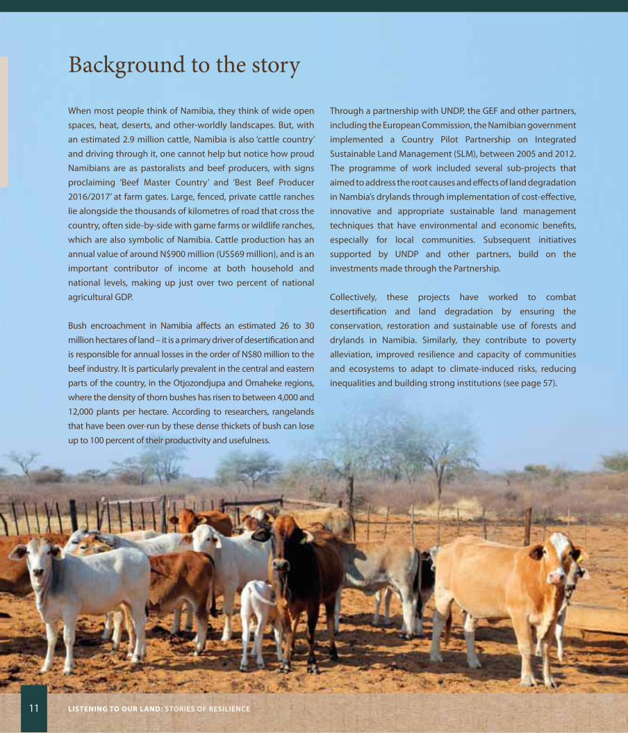
When most people think of Namibia, they think of wide open
spaces, heat, deserts, and other-worldly landscapes. But, with
an estimated 2.9 million cattle, Namibia is also ‘cattle country’
and driving through it, one cannot help but notice how proud
Namibians are as pastoralists and beef producers, with signs
proclaiming ‘Beef Master Country’ and ‘Best Beef Producer
2016/2017’ at farm gates. Large, fenced, private cattle ranches
lie alongside the thousands of kilometres of road that cross the
country, often side-by-side with game farms or wildlife ranches,
which are also symbolic of Namibia. Cattle production has an
annual value of around N$900 million (US$69 million), and is an
important contributor of income at both household and
national levels, making up just over two percent of national
agricultural GDP.
Bush encroachment in Namibia affects an estimated 26 to 30
million hectares of land – it is a primary driver of desertification and
is responsible for annual losses in the order of N$80 million to the
beef industry. It is particularly prevalent in the central and eastern
parts of the country, in the otjozondjupa and omaheke regions,
where the density of thorn bushes has risen to between 4,000 and
12,000 plants per hectare. According to researchers, rangelands
that have been over-run by these dense thickets of bush can lose
up to 100 percent of their productivity and usefulness.
Through a partnership with UNDP, the GEF and other partners,
including the European Commission, the Namibian government
implemented a Country Pilot Partnership on Integrated
Sustainable Land Management (SLM), between 2005 and 2012.
The programme of work included several sub-projects that
aimed to address the root causes and effects of land degradation
in Nambia’s drylands through implementation of cost-effective,
innovative and appropriate sustainable land management
techniques that have environmental and economic benefits,
especially for local communities. Subsequent initiatives
supported by UNDP and other partners, build on the
investments made through the Partnership.
Collectively, these projects have worked to combat
desertification and land degradation by ensuring the
conservation, restoration and sustainable use of forests and
drylands in Namibia. Similarly, they contribute to poverty
alleviation, improved resilience and capacity of communities
and ecosystems to adapt to climate-induced risks, reducing
inequalities and building strong institutions (see page 57).

BEaTing ThE BuSh 12
Nam
ibia
Digging DeeperThinking ‘outside the box’About 70 percent of Namibia’s population is directly dependent
on subsistence agriculture and livestock husbandry for their
daily survival. Such reliance, combined with unsustainable
harvesting of wood for energy, building and fencing needs, has
led to pervasive land degradation, posing an acute challenge to
rural livelihoods. Soon after independence, the Government of
Namibia identified land degradation as a serious problem
requiring remedial intervention, and recognized that integrated
ecosystem management strategies were needed to address the
underlying causes.
Building on the achievements of the Country Pilot Partnership for
SLM, another GEF-financed project, ‘Sustainable Management of
Namibia’s Forested Lands’ (known as the NAFoLA project), is
supporting the government’s efforts to establish Community
Forests and Conservancies across the country, and build the
capacity of local communities to manage these Community
Forests sustainably. The underlying principle of the Community
Forest model is that if local people have the legal right to use,
access and benefit from sustainable management of community
forests or woodlands, pressure on these resources will be reduced.
Empowered communities will be incentivized to adopt improved
landscape management practices, and adopt alternative income-
generation opportunities that can improve their quality of life
while maintaining the integrity of these ecosystems.
A ‘bush-to-fodder’ programme is being piloted in okondjatu
village to produce dry season fodder from encroacher species,
using mechanical equipment. In this pilot, different feed rations
are being tested on livestock in a communal setting. The aim is
to promote the use of locally-produced feed for rural
communities – and, eventually, for the larger Namibian market
– whilst restoring the grazing capacity and biodiversity of the
rangelands. This practice holds significant potential to generate
income for communities from wood and fodder production,
and to provide supplementary feed for livestock – with proven
benefits for the condition and productivity of the animals that
have taken part in the feeding trials. Although in its early stages,
the initiative is popular with community members who are
keen to expand the programmme once the Community Forest
has been legally proclaimed.
Wildlife conservation and eco-tourism programmes centred on
the iconic African Wild Dog, and sustainable harvesting of non-
timber forest products such as Devil’s Claw (an indigenous plant
with medicinal properties), are currently under discussion as
alternative, nature-based income-generating opportunities.
Harnessing nature’s powerCuba

15 Listening to our Land: STOriES Of rESiLiEnCE
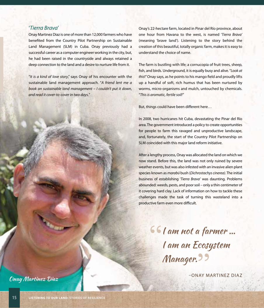
‘Tierra Brava’onay Martinez Diaz is one of more than 12,000 farmers who have
benefited from the Country Pilot Partnership on Sustainable
Land Management (SLM) in Cuba. onay previously had a
successful career as a computer engineer working in the city, but,
he had been raised in the countryside and always retained a
deep connection to the land and a desire to nurture life from it.
“It is a kind of love story,” says onay of his encounter with the
sustainable land management approach. “A friend lent me a
book on sustainable land management – I couldn’t put it down,
and read it cover-to-cover in two days.”
onay’s 22-hectare farm, located in Pinar del Río province, about
one hour from Havana to the west, is named ‘Tierra Brava’
(meaning ‘brave land’). Listening to the story behind the
creation of this beautiful, totally organic farm, makes it is easy to
understand the choice of name.
The farm is bustling with life; a cornucopia of fruit trees, sheep,
fish, and birds. Underground, it is equally busy and alive. “Look at
this!” onay says, as he points to his mango field and proudly lifts
up a handful of soft, rich humus that has been nurtured by
worms, micro-organisms and mulch, untouched by chemicals.
“This is aromatic, fertile soil!”
But, things could have been different here…
In 2008, two hurricanes hit Cuba, devastating the Pinar del Río
area. The government introduced a policy to create opportunities
for people to farm this ravaged and unproductive landscape,
and, fortunately, the start of the Country Pilot Partnership on
SLM coincided with this major land reform initiative.
After a lengthy process, onay was allocated the land on which we
now stand. Before this, the land was not only ruined by severe
weather events, but was also infested with an invasive alien plant
species known as marabύ bush (Dichrostachys cinerea). The initial
business of establishing ‘Tierra Brava’ was daunting. Problems
abounded: weeds, pests, and poor soil – only a thin centimeter of
it covering hard clay. Lack of information on how to tackle these
challenges made the task of turning this wasteland into a
productive farm even more difficult.
“ I am not a farmer … I am an Ecosystem Manager.”
–oNAy MARTINEz DIAzOnay Martinez Diaz
harnESSing naTurE’S POwEr 16
CUBA
Nature’s poweronay’s first thought was to request a large amount of diesel
from the state enterprise, but he felt troubled by the idea of
drenching his farm in poison, and was concerned about the
cost. “I had big problems,” onay recounts, “and I realized that I
needed big solutions!” The Country Pilot Partnership provided
much of the information and many of the tools to generate the
‘big solutions’ through local support institutions, such as the
National Association of Small Agricultural Producers and the
Cuban Association of Agricultural and Forestry Technicians.
Three hectares of the farm are now planted with soursop, which
originates from the Caribbean region and is well-suited to the
local climatic conditions. This plant has medicinal properties (it
is used for hypertension and diabetes and holds potential for
cancer treatment), in addition to being delicious to eat. Soursop
is pollinated by a beetle which spends part of its lifecycle
underground. If insecticide is used on the farm, it kills the
pollinators, which would mean that people need to be hired to
pollinate the flowers by hand – an extremely time-consuming
(and expensive!) task. onay quips, “I told you I have only four
family members working on this farm. But, actually, I have millions
of insects and worms working for me. I consider myself an
ecosystem manager rather than a farmer!’’
Strength in diversityThe biggest crop on ‘Tierra Brava’ is mango, of which seven
varieties are grown. This enables onay to supply the market
over much longer periods in the year, as the different varieties
fruit at different times. In the mango fields, mixed silvo-pastoral
approaches – using about 80 sheep – are being used, yielding
an annual return of some 2.7 tons of lamb and mutton. “I rotate
sheep grazing areas so that they eat the dropped mangos and this
interrupts the fruit fly pest life-cycle,” onay explains. “Sheep also
eat weeds and browse on the lower branches, which controls fungi
and reduces the need for fungicides.” Previously, onay used 200
litres of diesel per month for cutting grass and other farm
activities, but, since the introduction of sustainable silvo-
pastoral techniques, diesel consumption on this farm has been
reduced to a mere 60 litres per year. The mango fields also
supply squash and vegetables for the table for onay, his wife
and two daughters, and his brother’s family. Leguminous plants
are grown under the trees to fix nitrogen in the soil and grass is
crushed and left to decompose to add organic matter.
Looking at the plump fruits that festoon the trees, it is hard to
believe that this is an entirely rain-fed farm. onay’s secret is a
small rainwater-harvesting dam, which is designed to collect
rainwater and force seepage through the soil on one side, to
feed water underground to the cultivated fields. The dam is
well-stocked with fish, which add nutrients to the water and
provide food for the family to eat.
“After only one year of adopting sustainable land management
practices, I started noticing the changes,” onay says. “The first
change was that birds started coming here in greater numbers.
And as the birds came, the number of pests decreased.”
Forewarned and forearmed, for the future With support from the Country Pilot Partnership, an early
warning system has been installed to help farmers plan their
agricultural activities to coincide with optimal weather
conditions – and to reduce risks caused by severe weather
events. Weather data from the provincial meteorological centre
is ‘translated’ into information that is useful for farmers, and
relayed to them regularly through text messages on their
mobile telephones. onay explains, “For example, if rain is
predicted to fall in three days’ time, even if it is before the planned
harvesting date, I can decide to harvest early to reduce fruit
spoilage as after the rain mangos can quickly rot.”
“What inspired me?” onay beams. “It was the awareness of the fact
that we have the choice to farm our land in a sustainable way,
instead of simply going after short term gain. If I don’t
produce in an environmentally
healthy way, I would be deceiving
my children and leaving
them a depleted piece
of land.”

17 Listening to our Land: STOriES Of rESiLiEnCE
Background to the storyCuba is one of the so-called Small Island Developing States,
but, when it comes to environmental sustainability, this
country is growing into a giant. Despite 60 years of isolation
and hardship caused by economic embargoes, followed by
the later Soviet collapse, Cuba’s creative and indomitable
spirit has led it to walk an alternative path, seeking innovative
solutions that turn challenges into opportunities. one of these
challenges is land degradation, which affects three quarters of
the land surface of the country, with serious impacts for the
economy and food security.
In 2011, the Government of Cuba initiated a process to update
its economic and social model, in order to promote development
and improve people’s standard of living, within environmentally
sustainable limits. Farmlands and mixed cropland-natural
vegetation mosaics cover
just over half of Cuba’s land surface, so revitalizing the
agricultural sector was a critical part of this process. Borne
partly out of need (due to previous isolation and the lack of
availability of imported agricultural inputs), and driven by
Government’s inspired vision to link farmers to the land and
‘harness nature’s power’, a national effort developed to shift
towards low-input, sustainable farming methods.
The GEF-financed Country Pilot Partnership on SLM, which is
supported by UNDP working in partnership with UN
Environment and the UN Food and Agriculture organization, is
building capacity in Cuba to make these shifts. This initiative is
fully aligned with the National Action Plan to Combat
Desertification and Drought, and the National Programme on
Soil Conservation and Amelioration. It serves as an effective
vehicle for restoring degraded land, promoting transformative
economic growth, strengthening food security, and building
partnerships for achieving the Sustainable Development Goals
(see page 58).

harnESSing naTurE’S POwEr 18
CUBA
Digging DeeperSpeaking a common language – Sustainable Land Management The Country Pilot Partnership comprises five projects to be
implemented over 15 years, and lies at the core of Cuba’s efforts
to achieve land degradation neutrality. The programme has a
two-pronged approach: the first is aimed at mainstreaming
sustainable land management principles into policies in the
agriculture, forestry, water, and economic planning sectors;
whilst the second develops knowledge and builds hands-on
capacity for implementing sustainable land management
practices at farm level.
Central to these efforts has been the adoption of practices to
return fertility to the soil and address related issues such as
erosion, salinity, compaction, low organic content, and pollution
from previous over-use of inorganic fertilizers – these are some
of the ‘big problems’ described by onay Martinez Diaz. Amongst
the ‘big solutions’ the Partnership has helped develop are a shift
from high-input monoculture to low-input, organic methods
of growing a diversity of crops using mixed crop-livestock
systems, green manuring, mulching, bio-fertilizers, bio-pesticides,
intercropping, and mixed agro-forestry.
In Cuba, commitment to SLM is
high, but uptake of best practices was initially impeded by
limited knowledge of the drivers of land degradation, and weak
ability to meet the costs of shifting land use practices to more
sustainable alternatives. The first enabling step to overcome
these obstacles was to build strong partnerships between
government departments in all key sectors (agriculture,
forestry, water management, spatial planning, economic and
investment planning, education, science, technology and
environment), and then to get government, scientists, civil
society organizations, and farmers all talking the same language
– Sustainable Land Management! This has been achieved
through intensive awareness-raising, education, and practical
skills-development programmes involving high-level decision-
makers, production-sector role-players, farmers, technicians,
teachers, and students. Sustainable land management principles
have been incorporated into the national school curriculum and
a master’s-level university course has been developed. Through
these enabling activities, and by demonstrating the real benefits
of shifting to SLM at pilot sites, the Country Pilot Partnership has
helped communities develop diverse approaches to sustainable
farming – or, rather, ecosystem management – in support of the
country’s long-term vision to build a resilient and sustainable
economy.
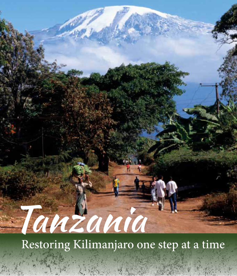
TanzaniaRestoring Kilimanjaro one step at a time
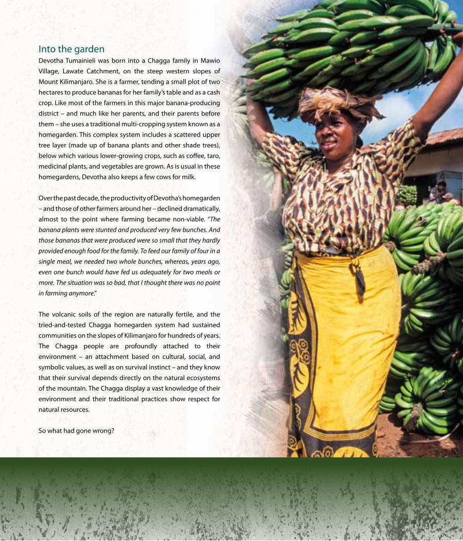
Into the gardenDevotha Tumainieli was born into a Chagga family in Mawio
Village, Lawate Catchment, on the steep western slopes of
Mount Kilimanjaro. She is a farmer, tending a small plot of two
hectares to produce bananas for her family’s table and as a cash
crop. Like most of the farmers in this major banana-producing
district – and much like her parents, and their parents before
them – she uses a traditional multi-cropping system known as a
homegarden. This complex system includes a scattered upper
tree layer (made up of banana plants and other shade trees),
below which various lower-growing crops, such as coffee, taro,
medicinal plants, and vegetables are grown. As is usual in these
homegardens, Devotha also keeps a few cows for milk.
over the past decade, the productivity of Devotha’s homegarden
– and those of other farmers around her – declined dramatically,
almost to the point where farming became non-viable. “The
banana plants were stunted and produced very few bunches. And
those bananas that were produced were so small that they hardly
provided enough food for the family. To feed our family of four in a
single meal, we needed two whole bunches, whereas, years ago,
even one bunch would have fed us adequately for two meals or
more. The situation was so bad, that I thought there was no point
in farming anymore.”
The volcanic soils of the region are naturally fertile, and the
tried-and-tested Chagga homegarden system had sustained
communities on the slopes of Kilimanjaro for hundreds of years.
The Chagga people are profoundly attached to their
environment – an attachment based on cultural, social, and
symbolic values, as well as on survival instinct – and they know
that their survival depends directly on the natural ecosystems
of the mountain. The Chagga display a vast knowledge of their
environment and their traditional practices show respect for
natural resources.
So what had gone wrong?
21 Listening to our Land: STOriES Of rESiLiEnCE
Steps to sustainabilityA complex set of factors relating to rapid population growth,
structural market issues, and changed patterns of land use, had
caused extensive deforestation, resulting in worsening soil
erosion, declining soil fertility, and an increase in damaging
surface run-off. For farmers like Devotha, this translated into
decreased land productivity, greater food insecurity, and
hardship. With support from a UNDP-supported and GEF-
financed Sustainable Land Management (SLM) project (known as
the Kilimanjaro SLM Project), the regional government provided
training to farmers in sustainable farming practices to address
these issues. Devotha Tumainieli jumped at the opportunity to
enhance her traditional practices with new land management
technologies that would enable her to restore the productivity of
her homegarden. She describes what she learnt, “I was trained to
use bench terraces – which we call ‘fanya juu’ – to conserve soil and
water. The terraces help to reduce the slope length and steepness
and prevent the loss of soil downhill. We were also taught to grow
grass along the terraces to hold the soil in place. Since I started this, I
have gone back to farming with bananas. I have terraced an area of
two hectares from which I expect to harvest about one ton of
bananas – this yield is four times greater than before. The banana
bunches are bigger than those grown in unterraced plots, and the
fruit reaches double the price at the market. Depending on the
season, I can sell a bunch of bananas from a terraced plot for
between TZS 2,000 and 10,000 (about US$1 to US$5). People selling
bananas grown in unterraced plots only get about TZS 2,000 to
5,000 for a bunch, so I can see that farming with terraces has given
me a great competitive advantage.”
Since the adoption of sustainable land management measures,
Devotha has diversified her crops to include vegetables such as
beans and potatoes, and the grass she plants to stabilize the
terraces provides fodder for her cattle. This represents an
important cost saving to her, as previously she had to buy grass
from the lowlands at great cost. Devotha’s family is now more
food secure and hers has become one of the most productive
farms in the Lawate catchment. She was elected by her
community to the local Environmental Conservation Committee,
through which she champions SLM and advises other farmers
on the use of soil and water conservation measures. With a
sparkle in her eye, she says, “I am optimistic that everyone in my
area will soon adopt these practices – it will secure our income and
food supply, and is better for the land.”
Spreading the benefitThe benefits of adopting sustainable land management
practices are not only being felt in the highlands of Kilimanjaro,
but also in the woodlands and savannas of the surrounding
plains. Lower down in the catchment of the Mawoi Stream, in
the semi-arid district of Hai, a group of elders in the vicinity of
Roo Sinde village has taken decisive action to reverse the
extensive degradation that has affected their area. Previously,
these plains were watered by numerous perennial streams
flowing down from the highlands, but five years ago, most of
these had dried up. This was partly due to deforestation and
desertification higher up in the catchment, but also because of
local overgrazing, removal of natural forest along waterways,
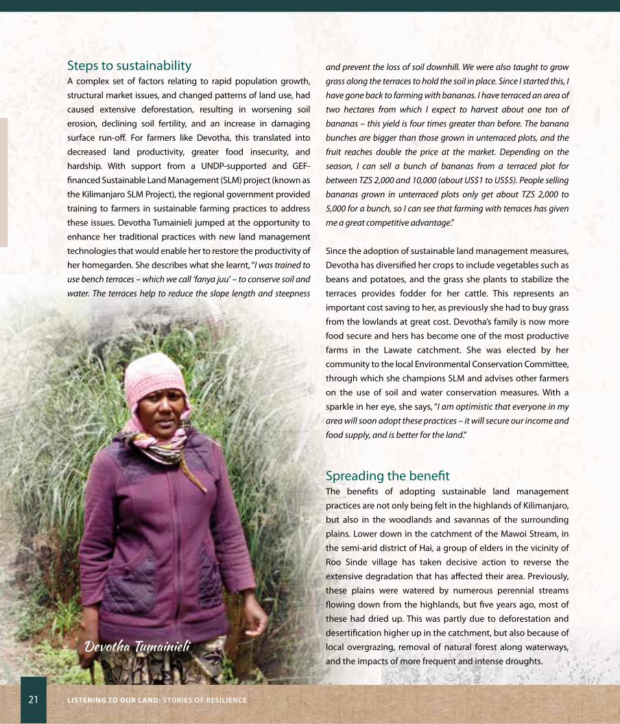
and the impacts of more frequent and intense droughts. Devotha Tumainieli
rESTOring KiLiManjarO OnE STEP aT a TiME 22
Tan
zan
ia
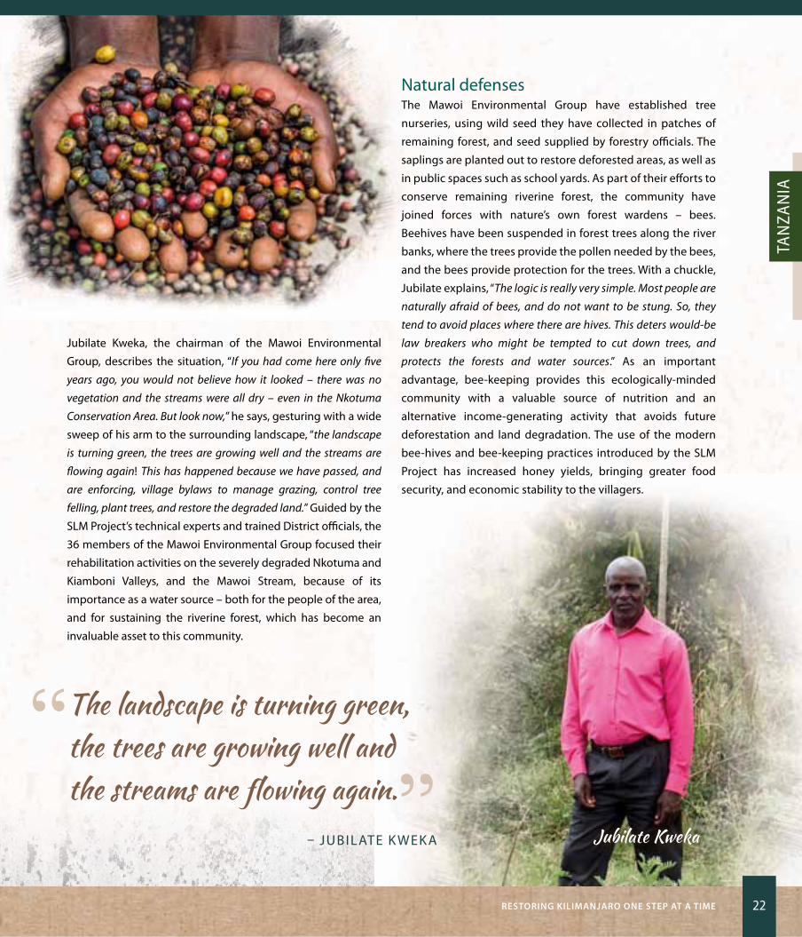
Jubilate Kweka, the chairman of the Mawoi Environmental
Group, describes the situation, “If you had come here only five
years ago, you would not believe how it looked – there was no
vegetation and the streams were all dry – even in the Nkotuma
Conservation Area. But look now,” he says, gesturing with a wide
sweep of his arm to the surrounding landscape, “the landscape
is turning green, the trees are growing well and the streams are
flowing again! This has happened because we have passed, and
are enforcing, village bylaws to manage grazing, control tree
felling, plant trees, and restore the degraded land.” Guided by the
SLM Project’s technical experts and trained District officials, the
36 members of the Mawoi Environmental Group focused their
rehabilitation activities on the severely degraded Nkotuma and
Kiamboni Valleys, and the Mawoi Stream, because of its
importance as a water source – both for the people of the area,
and for sustaining the riverine forest, which has become an
invaluable asset to this community.
Natural defenses The Mawoi Environmental Group have established tree
nurseries, using wild seed they have collected in patches of
remaining forest, and seed supplied by forestry officials. The
saplings are planted out to restore deforested areas, as well as
in public spaces such as school yards. As part of their efforts to
conserve remaining riverine forest, the community have
joined forces with nature’s own forest wardens – bees.
Beehives have been suspended in forest trees along the river
banks, where the trees provide the pollen needed by the bees,
and the bees provide protection for the trees. With a chuckle,
Jubilate explains, “The logic is really very simple. Most people are
naturally afraid of bees, and do not want to be stung. So, they
tend to avoid places where there are hives. This deters would-be
law breakers who might be tempted to cut down trees, and
protects the forests and water sources.” As an important
advantage, bee-keeping provides this ecologically-minded
community with a valuable source of nutrition and an
alternative income-generating activity that avoids future
deforestation and land degradation. The use of the modern
bee-hives and bee-keeping practices introduced by the SLM
Project has increased honey yields, bringing greater food
security, and economic stability to the villagers.
“ The landscape is turning green, the trees are growing well and the streams are flowing again.”
– JUBILATE K WEKA Jubilate Kweka

23 Listening to our Land: STOriES Of rESiLiEnCE
Background to the story
Towering above the bustling town of Moshi in northern
Tanzania, is the iconic, ice-capped peak of Mount Kilimanjaro
– one of the most defining features of Tanzania’s landscape,
and the pivot on which a thriving tourism industry turns.
Peaking at 5,895 metres above sea level, this volcanic
massif is both the highest mountain in Africa, and the
highest free-standing peak on Earth. It’s diversity of
ecosystems is exceptional, ranging from glaciers and alpine
moorlands, through montane grasslands and rain forests
on upper slopes, to woodlands on the foothills, and dry,
open savanna on the surrounding plains.
Mount Kilimanjaro is the primary source of water for much
of north-central and eastern Tanzania, and parts of Kenya.
It also holds cultural and spiritual significance and provides
food, fuel, and building materials for the local communities
of Kilimanjaro Region. The capacity of the mountain to
continue to provide these vital resources and ecosystem
services is, increasingly, being compromised by extensive
land degradation. The causes are complex and interrelated,
including large-scale deforestation, rapid human
population growth, shifts in land use and agricultural
practices, changing market forces, and the impacts of
climate change.
With support from the Kilimanjaro SLM Project, the
Kilimanjaro Regional Government has worked to address
land degradation through the adoption of sustainable land
management practices and the creation of alternative
income generating activities that do not cause deforestation.
The project served to enhance local economic development,
food security, and sustainable livelihoods, whilst combatting
desertification in forest and woodland ecosystems in the
Kilimanjaro Region (see page 59).
SLM is being scaled-up through ongoing GEF investments
in UNDP- supported projects in the miombo woodlands of
the Tabora and Katavi Regions, and the Uluguru and East
Usambara Mountains.
rESTOring KiLiManjarO OnE STEP aT a TiME 24
Tan
zan
ia
Digging DeeperRestoring productivity to traditional land-use systemsThe Chagga people have been cultivating homegardens on the
slopes of Mount Kilimanjaro for centuries. This traditional
agroforestry system has been one of the most productive forms
of agriculture in Tanzania, and is well suited to the soil,
topography, climate, and traditional systems of land tenure and
management. The multi-layer system maximizes both the use of
limited land resources – especially in areas of high population
density (on average 650 people/km2 in the Kilimanjaro
Highlands) – and returns from a diversity of crops. Minimal
external inputs are needed, and soil cover is maintained, which
helps to protect the environment. In some cases, an area of land
is also used for traditional livestock rearing.
Traditionally, coffee was the main cash crop in these homegardens,
with other crops grown largely to meet subsistence needs or for
sale at local markets. In the 1970s, a combination of failing health
of the ageing coffee plants, a decline in world coffee prices, and
inherent structural weaknesses in the national coffee market,
plunged local farmers into a downward spiral of poverty. This was
aggravated by rapid population growth (about three percent per
annum), which triggered large-scale changes in land-use
practices, with devastating effects.
In the Kilimanjaro region, the SLM Project facilitated widespread
uptake of practical technologies to improve average
productivity of degraded land, reduce seasonal fluctuations in
yields, underpin diversified production and improved income,
and restore the capacity of agro-ecological systems to provide
ecosystem goods and services. This includes measures to
improve soil and water management (such as bench terracing,
mulching, and improved efficiency of water furrows); improved
coffee management (by replacing unproductive trees, training
farmers in more sustainable and productive farming methods,
and certification of production as organic and FairTrade to
improve access to markets); and diversification of production
(by including a variety of suitable fruits and vegetables, using
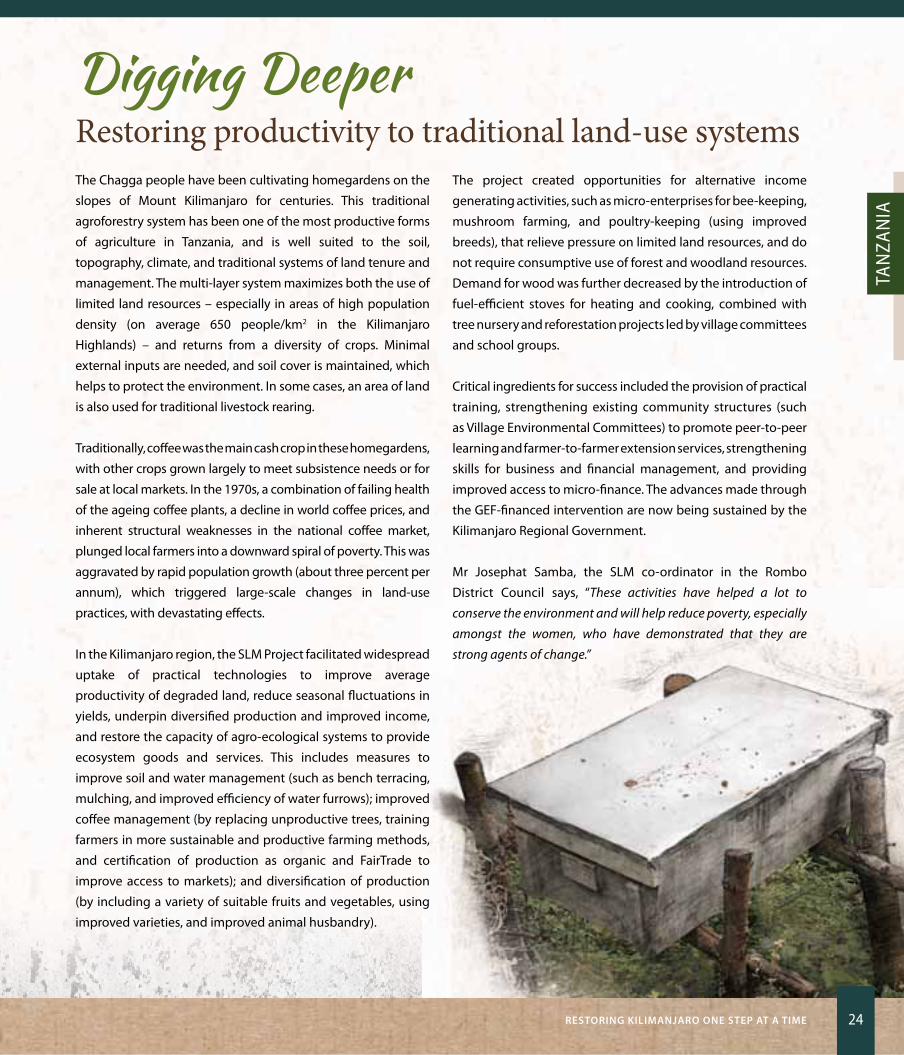
improved varieties, and improved animal husbandry).
The project created opportunities for alternative income
generating activities, such as micro-enterprises for bee-keeping,
mushroom farming, and poultry-keeping (using improved
breeds), that relieve pressure on limited land resources, and do
not require consumptive use of forest and woodland resources.
Demand for wood was further decreased by the introduction of
fuel-efficient stoves for heating and cooking, combined with
tree nursery and reforestation projects led by village committees
and school groups.
Critical ingredients for success included the provision of practical
training, strengthening existing community structures (such
as Village Environmental Committees) to promote peer-to-peer
learning and farmer-to-farmer extension services, strengthening
skills for business and financial management, and providing
improved access to micro-finance. The advances made through
the GEF-financed intervention are now being sustained by the
Kilimanjaro Regional Government.
Mr Josephat Samba, the SLM co-ordinator in the Rombo
District Council says, “These activities have helped a lot to
conserve the environment and will help reduce poverty, especially
amongst the women, who have demonstrated that they are
strong agents of change.”

Pushing back the shifting sandsKazakhstan

The disappearing sea There were once over 1,100 islands scattered across the extensive
waters of the Aral Sea. “I remember it very well,” recalls zhandos
Moldagulov, who came to live in the Aral district with his family in
1967. “Aral was formerly a harbour and fishing port on the banks of
the Aral Sea, supplying fish to most of the neighbouring countries. My
parents were proud to live in this place, with its abundant water,
promising jobs, prosperous neighbourhoods, and fertile land”, he says.
During the 1960s, the main rivers that flowed into the Aral Sea were
diverted for massive irrigation of vast cotton and wheat fields, and
the Aral Sea started retreating – with devastating economic, social,
and environmental consequences. The Aral district is now
completely landlocked, suffering from high unemployment and
declining socio-economic conditions. over the last few decades,
the population shrank by 85 percent, as people drifted away to
seek a better life elsewhere. The remaining residents are facing
serious health problems caused by airborne particles of toxic
residues from fertilizers and pesticides, and highly saline sands that
have been exposed to the winds by the retreating waters.
“Back then, I could almost jump out of my house and straight into the
greenest sea ever. Now, I can only dream about it. For 25 years now, it
has been impossible to see the waters of the Aral Sea from the house
where I grew up. Due to the shrinking Aral, we lost our homes, jobs,
fertile land, and our neighbours,” zhandos observes, sadly.

27 Listening to our Land: STOriES Of rESiLiEnCE
Shifting sands With the fishing industry lost, and other livelihood opportunities
being limited, agriculture remains the main source of income
and employment for many in the Aral region. But, limited
availability of water, high climate variability, and unsustainable
land-use practices, were damaging the fragile soils. In addition,
productive land was slowly being swallowed by the relentless
onslaught of the shifting sands, pollution, and dust blowing in
from the drying bed of the Aral Sea.
zhandos Moldagulov’s father had 142 hectares of land on which
he grew fruit and vegetables. zhandos remembers that his
father grew big melons, water melons, and apricots that were
sweet and delicious. “Since the Sea began retreating, a lack of
water for irrigation, and the moving sands, resulted in us losing our
lands and our garden. Our trees have dried out.” It was clear to
zhandos that a new way of working on the land was needed.
Many of the other local farmers were also keen to gain new
knowledge of modern land-use practices suited to drylands
and the harsh climate, and gladly took the opportunity to
participate in Sustainable Land Management (SLM) training
courses and demonstration activities offered by the ‘Kyzylorda’
Extension Centre. This training formed part of the GEF-financed,
UNDP-supported Sustainable Land Management project being
implemented in the Aral-Syrdarya district.
zhandos attended thematic and ‘hands-on’ courses on how to
run a farming business, manage seed banks, conserve soil and
water, rehabilitate degraded or abandoned land, and grow
suitable crops. “By the end of the training, I knew which specific
practices to apply to restore my father’s lost garden.” This was
important to zhandos. “It is my life’s dream to be a worthy son to
my father, to keep the farm I inherited from him productive, the
trees alive, and then to leave a healthy farm to my sons.”
Revival over several seasons, through the application of agroforestry,
improved soil and water management, and other sustainable
land management practices, the farmers of the Aral region
slowly began to transform their lands, enrich the soils, and
improve their productivity and yields.
“ It is my life’s dream to be a worthy son to my father, to keep the farm I inherited from him productive, the trees alive, and then to leave a healthy farm to my sons.”
– zHANDoS MoLDAGULoV
Zhandos Moldagulov
PuShing BaCK ThE ShifTing SanDS 28
Kaza
Khst
an
By applying what he had learnt, zhandos has successfully
rehabilitated 101 hectares of land. He started the process of
reviving his land by introducing crop rotation and intercropping
as measures to improve soil fertility. He increased the moisture
content of the soil by covering it with plastic sheets, and on
salinized soil, where the water table was raised, he improved
soil drainage by planting salt-tolerant trees – here, he applies
irrigation only sparingly to prevent any further rise in soil
salinity. To protect the upper layers of soil from wind erosion
and incursion by moving sand, zhandos has planted a
shelterbelt of White Poplar trees.
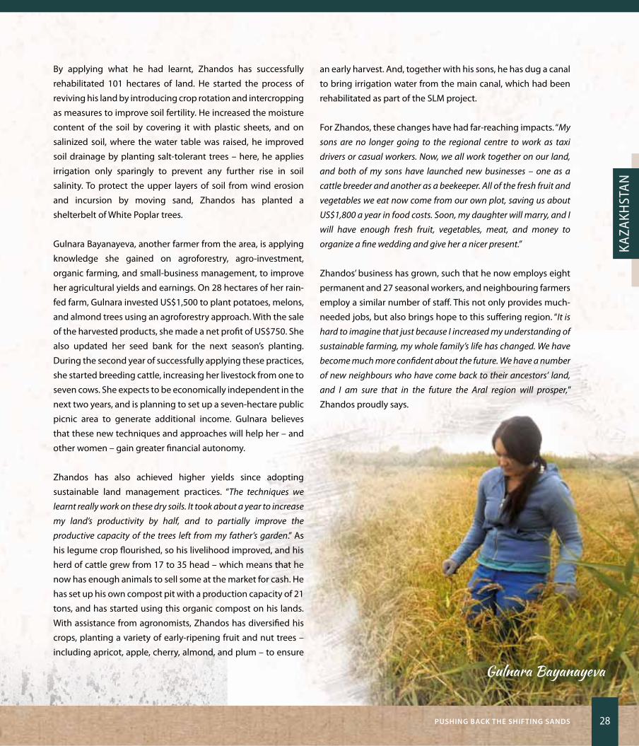
Gulnara Bayanayeva, another farmer from the area, is applying
knowledge she gained on agroforestry, agro-investment,
organic farming, and small-business management, to improve
her agricultural yields and earnings. on 28 hectares of her rain-
fed farm, Gulnara invested US$1,500 to plant potatoes, melons,
and almond trees using an agroforestry approach. With the sale
of the harvested products, she made a net profit of US$750. She
also updated her seed bank for the next season’s planting.
During the second year of successfully applying these practices,
she started breeding cattle, increasing her livestock from one to
seven cows. She expects to be economically independent in the
next two years, and is planning to set up a seven-hectare public
picnic area to generate additional income. Gulnara believes
that these new techniques and approaches will help her – and
other women – gain greater financial autonomy.
zhandos has also achieved higher yields since adopting
sustainable land management practices. “The techniques we
learnt really work on these dry soils. It took about a year to increase
my land’s productivity by half, and to partially improve the
productive capacity of the trees left from my father’s garden.” As
his legume crop flourished, so his livelihood improved, and his
herd of cattle grew from 17 to 35 head – which means that he
now has enough animals to sell some at the market for cash. He
has set up his own compost pit with a production capacity of 21
tons, and has started using this organic compost on his lands.
With assistance from agronomists, zhandos has diversified his
crops, planting a variety of early-ripening fruit and nut trees –
including apricot, apple, cherry, almond, and plum – to ensure
an early harvest. And, together with his sons, he has dug a canal
to bring irrigation water from the main canal, which had been
rehabilitated as part of the SLM project.
For zhandos, these changes have had far-reaching impacts. “My
sons are no longer going to the regional centre to work as taxi
drivers or casual workers. Now, we all work together on our land,
and both of my sons have launched new businesses – one as a
cattle breeder and another as a beekeeper. All of the fresh fruit and
vegetables we eat now come from our own plot, saving us about
US$1,800 a year in food costs. Soon, my daughter will marry, and I
will have enough fresh fruit, vegetables, meat, and money to
organize a fine wedding and give her a nicer present.”
zhandos’ business has grown, such that he now employs eight
permanent and 27 seasonal workers, and neighbouring farmers
employ a similar number of staff. This not only provides much-
needed jobs, but also brings hope to this suffering region. “It is
hard to imagine that just because I increased my understanding of
sustainable farming, my whole family’s life has changed. We have
become much more confident about the future. We have a number
of new neighbours who have come back to their ancestors’ land,
and I am sure that in the future the Aral region will prosper,”
zhandos proudly says.
Gulnara Bayanayeva

29 Listening to our Land: STOriES Of rESiLiEnCE
Background to the story
Kazakhstan’s rugged, glaciated mountains are spectacularly
beautiful; soaring to great heights in the north of the country,
they form part of the great mountain ranges of Central Asia. The
soils in these montane areas are fertile and well-suited to
livestock and grain production. In the south, the landscapes of
Kazakhstan are dominated by seemingly endless expanses of
rolling steppes, scrubby drylands, and deserts. Here, rain is
scarce, conditions are naturally harsh and arid, and the landscape
is highly vulnerable to land degradation – a situation aggravated
by years of unsustainable land use and protracted drought.
Before Kazakhstan’s independence, industrial-scale commercial
agriculture was widespread in the south. This has taken a heavy
toll, as evidenced by the compacted soil, extensive wind and
water erosion, soils polluted with toxic residues, and the
formation of ‘solonchak’ (salinized) lands. To make matters
worse for local communities, the Aral Sea, situated between
Kazakhstan and Uzbekistan to the south, is rapidly drying out
– what was once was the world’s fourth largest lake, might soon
become a desert. The shrinking of the Aral Sea and the ensuing
desertification of the adjacent land, has impacted negatively on
the health, well-being, and livelihoods of the surrounding
communities, in what is widely acknowledged as one of the
world’s most significant environmental and human disasters.
UNDP is helping the Government of Kazakhstan through a GEF-
funded project, ‘Supporting sustainable land management in steppe
and semi-arid zones through integrated territorial planning and agro-
environmental incentives,’ to combat the effects of desertification,
restore productivity to the land, and uplift the impoverished
communities of southern Kazakhstan. Implementation began in
2015 and the project will run for five years, targeting six different
regions, including Kyzylorda, and its Aral-Syrdarya district. The
project is working to combat desertification and restore degraded
lands through adoption of SLM, with contributions to poverty
reduction, improved food security and access to water, better
health and well-being, and greater resilience to climate-induced
risks and disasters (see page 60).
PuShing BaCK ThE ShifTing SanDS 30
Kaza
Khst
an
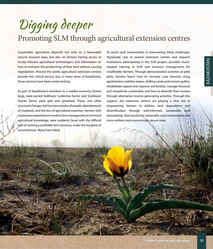
Digging deeperPromoting SLM through agricultural extension centres Sustainable agriculture depends not only on a favourable
natural resource base, but also on farmers having access to
locally-relevant agricultural technologies, and information on
how to maintain the productivity of their land without causing
degradation. Around the world, agricultural extension centres
provide this critical service, but, in many areas of Kazakhstan,
these services have been sorely lacking.
As part of Kazakhstan’s transition to a market economy, former
large, state-owned ‘kolkhozes’ (collective farms) and ‘Sovkhozes’
(Soviet farms) were split and privatised. These, and other
structural changes, led to a mass exodus of people, abandonment
of croplands, and the loss of agricultural expertise. Farmers with
no previous experience in modern farm management or technical
agricultural knowledge, were suddenly faced with the difficult
task of running a profitable farm business, under the toughest of
circumstances. Many have failed.
To assist rural communities in overcoming these challenges,
‘Kyzylorda’, one of several extension centres and research
institutions participating in the SLM project, provides much-
needed training in SLM and business management for
smallholder farmers. Through demonstration activities at pilot
plots, farmers learnt how to: increase crop diversity using
agroforestry; stabilize slopes, shifting sands and erosion gullies;
rehabilitate topsoil and improve soil fertility; manage livestock
and rangelands sustainably; and how to diversify their income
through alternative income generating activities. Through this
support, the extension centres are playing a vital role in
empowering farmers to address land degradation and
desertification through well-informed, sustainable land
stewardship, that transforms vulnerable rural communities into
more resilient and economically secure ones.

EritreaLand of dust and dreams
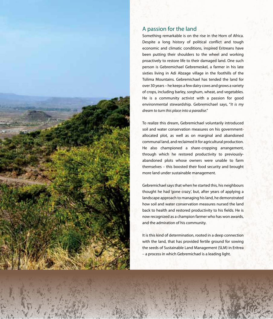
A passion for the landSomething remarkable is on the rise in the Horn of Africa.
Despite a long history of political conflict and tough
economic and climatic conditions, inspired Eritreans have
been putting their shoulders to the wheel and working
proactively to restore life to their damaged land. one such
person is Gebremichael Gebremeskel, a farmer in his late
sixties living in Adi Abzage village in the foothills of the
Tsilima Mountains. Gebremichael has tended the land for
over 30 years – he keeps a few dairy cows and grows a variety
of crops, including barley, sorghum, wheat, and vegetables.
He is a community activist with a passion for good
environmental stewardship. Gebremichael says, “It is my
dream to turn this place into a paradise.”
To realize this dream, Gebremichael voluntarily introduced
soil and water conservation measures on his government-
allocated plot, as well as on marginal and abandoned
communal land, and reclaimed it for agricultural production.
He also championed a share-cropping arrangement,
through which he restored productivity to previously-
abandoned plots whose owners were unable to farm
themselves – this boosted their food security and brought
more land under sustainable management.
Gebremichael says that when he started this, his neighbours
thought he had ‘gone crazy’, but, after years of applying a
landscape approach to managing his land, he demonstrated
how soil and water conservation measures nursed the land
back to health and restored productivity to his fields. He is
now recognized as a champion farmer who has won awards,
and the admiration of his community.
It is this kind of determination, rooted in a deep connection
with the land, that has provided fertile ground for sowing
the seeds of Sustainable Land Management (SLM) in Eritrea
– a process in which Gebremichael is a leading light.
33 Listening to our Land: STOriES Of rESiLiEnCE
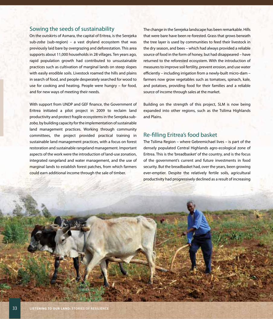
Sowing the seeds of sustainabilityon the outskirts of Asmara, the capital of Eritrea, is the Serejeka
sub-zoba (sub-region) – a vast dryland ecosystem that was
previously laid bare by overgrazing and deforestation. This area
supports about 11,000 households in 28 villages. Ten years ago,
rapid population growth had contributed to unsustainable
practices such as cultivation of marginal lands on steep slopes
with easily erodible soils. Livestock roamed the hills and plains
in search of food, and people desperately searched for wood to
use for cooking and heating. People were hungry – for food,
and for new ways of meeting their needs.
With support from UNDP and GEF finance, the Government of
Eritrea initiated a pilot project in 2009 to reclaim land
productivity and protect fragile ecosystems in the Serejeka sub-
zoba, by building capacity for the implementation of sustainable
land management practices. Working through community
committees, the project provided practical training in
sustainable land management practices, with a focus on forest
restoration and sustainable rangeland management. Important
aspects of the work were the introduction of land-use zonation,
integrated rangeland and water management, and the use of
marginal lands to establish forest patches, from which farmers
could earn additional income through the sale of timber.
The change in the Serejeka landscape has been remarkable. Hills
that were bare have been re-forested. Grass that grows beneath
the tree layer is used by communities to feed their livestock in
the dry season, and bees – which had always provided a reliable
source of food in the form of honey, but had disappeared – have
returned to the reforested ecosystem. With the introduction of
measures to improve soil fertility, prevent erosion, and use water
efficiently – including irrigation from a newly-built micro-dam –
farmers now grow vegetables such as tomatoes, spinach, kale,
and potatoes, providing food for their families and a reliable
source of income through sales at the market.
Building on the strength of this project, SLM is now being
expanded into other regions, such as the Tsilima Highlands
and Plains.
Re-filling Eritrea’s food basketThe Tsilima Region – where Gebremichael lives – is part of the
densely populated Central Highlands agro-ecological zone of
Eritrea. This is the ‘breadbasket’ of the country, and is the focus
of the government’s current and future investments in food
security. But the breadbasket had, over the years, been growing
ever-emptier. Despite the relatively fertile soils, agricultural
productivity had progressively declined as a result of increasing
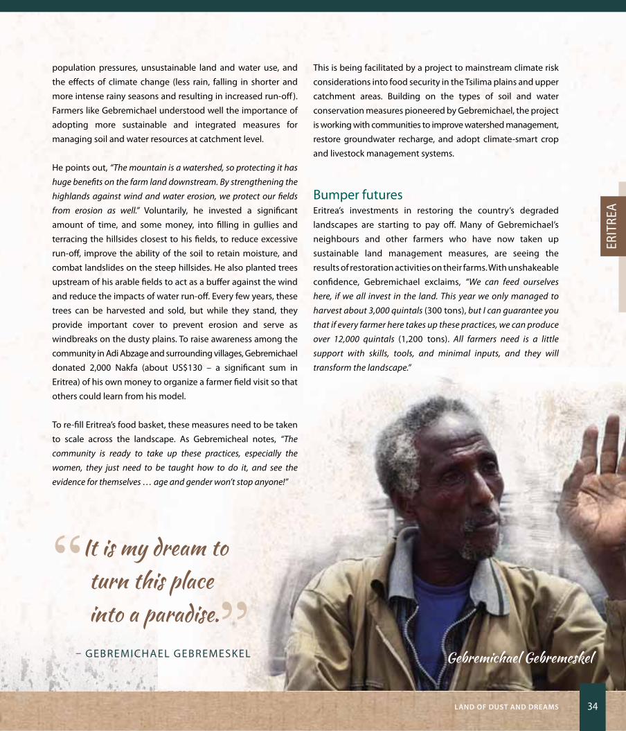
Gebremichael Gebremeskel
LanD Of DuST anD DrEaMS 34
Erit
rEa
population pressures, unsustainable land and water use, and
the effects of climate change (less rain, falling in shorter and
more intense rainy seasons and resulting in increased run-off).
Farmers like Gebremichael understood well the importance of
adopting more sustainable and integrated measures for
managing soil and water resources at catchment level.
He points out, “The mountain is a watershed, so protecting it has
huge benefits on the farm land downstream. By strengthening the
highlands against wind and water erosion, we protect our fields
from erosion as well.” Voluntarily, he invested a significant
amount of time, and some money, into filling in gullies and
terracing the hillsides closest to his fields, to reduce excessive
run-off, improve the ability of the soil to retain moisture, and
combat landslides on the steep hillsides. He also planted trees
upstream of his arable fields to act as a buffer against the wind
and reduce the impacts of water run-off. Every few years, these
trees can be harvested and sold, but while they stand, they
provide important cover to prevent erosion and serve as
windbreaks on the dusty plains. To raise awareness among the
community in Adi Abzage and surrounding villages, Gebremichael
donated 2,000 Nakfa (about US$130 – a significant sum in
Eritrea) of his own money to organize a farmer field visit so that
others could learn from his model.
To re-fill Eritrea’s food basket, these measures need to be taken
to scale across the landscape. As Gebremicheal notes, “The
community is ready to take up these practices, especially the
women, they just need to be taught how to do it, and see the
evidence for themselves … age and gender won’t stop anyone!”
This is being facilitated by a project to mainstream climate risk
considerations into food security in the Tsilima plains and upper
catchment areas. Building on the types of soil and water
conservation measures pioneered by Gebremichael, the project
is working with communities to improve watershed management,
restore groundwater recharge, and adopt climate-smart crop
and livestock management systems.
Bumper futures Eritrea’s investments in restoring the country’s degraded
landscapes are starting to pay off. Many of Gebremichael’s
neighbours and other farmers who have now taken up
sustainable land management measures, are seeing the
results of restoration activities on their farms. With unshakeable
confidence, Gebremichael exclaims, “We can feed ourselves
here, if we all invest in the land. This year we only managed to
harvest about 3,000 quintals (300 tons), but I can guarantee you
that if every farmer here takes up these practices, we can produce
over 12,000 quintals (1,200 tons). All farmers need is a little
support with skills, tools, and minimal inputs, and they will
transform the landscape.”
“I t is my dream to turn this place into a paradise.”
– GEBREMICHAEL GEBREMESKEL
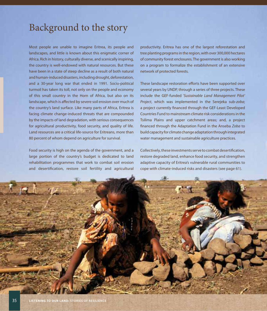
35 Listening to our Land: STOriES Of rESiLiEnCE
Background to the story
Most people are unable to imagine Eritrea, its people and
landscapes, and little is known about this enigmatic corner of
Africa. Rich in history, culturally diverse, and scenically inspiring,
the country is well-endowed with natural resources. But these
have been in a state of steep decline as a result of both natural
and human-induced disasters, including drought, deforestation,
and a 30-year long war that ended in 1991. Socio-political
turmoil has taken its toll, not only on the people and economy
of this small country in the Horn of Africa, but also on its
landscape, which is affected by severe soil erosion over much of
the country’s land surface. Like many parts of Africa, Eritrea is
facing climate change-induced threats that are compounded
by the impacts of land degradation, with serious consequences
for agricultural productivity, food security, and quality of life.
Land resources are a critical life-source for Eritreans, more than
80 percent of whom depend on agriculture for survival.
Food security is high on the agenda of the government, and a
large portion of the country’s budget is dedicated to land
rehabilitation programmes that work to combat soil erosion
and desertification, restore soil fertility and agricultural
productivity. Eritrea has one of the largest reforestation and
tree planting programs in the region, with over 300,000 hectares
of community forest enclosures. The government is also working
on a program to formalize the establishment of an extensive
network of protected forests.
These landscape restoration efforts have been supported over
several years by UNDP, through a series of three projects. These
include the GEF-funded ‘Sustainable Land Management Pilot’
Project, which was implemented in the Serejeka sub-zoba;
a project currently financed through the GEF-Least Developed
Countries Fund to mainstream climate risk considerations in the
Tsilima Plains and upper catchment areas; and, a project
financed through the Adaptation Fund in the Anseba Zoba to
build capacity for climate change adaptation through integrated
water management and sustainable agriculture practices.
Collectively, these investments serve to combat desertification,
restore degraded land, enhance food security, and strengthen
adaptive capacity of Eritrea’s vulnerable rural communities to
cope with climate-induced risks and disasters (see page 61).
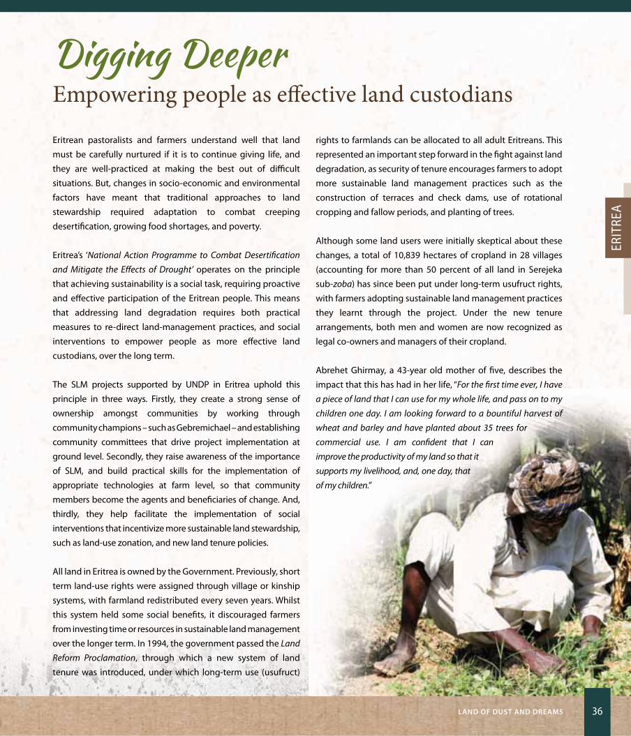
LanD Of DuST anD DrEaMS 36
Erit
rEa
Digging DeeperEmpowering people as effective land custodians
Eritrean pastoralists and farmers understand well that land
must be carefully nurtured if it is to continue giving life, and
they are well-practiced at making the best out of difficult
situations. But, changes in socio-economic and environmental
factors have meant that traditional approaches to land
stewardship required adaptation to combat creeping
desertification, growing food shortages, and poverty.
Eritrea’s ‘National Action Programme to Combat Desertification
and Mitigate the Effects of Drought’ operates on the principle
that achieving sustainability is a social task, requiring proactive
and effective participation of the Eritrean people. This means
that addressing land degradation requires both practical
measures to re-direct land-management practices, and social
interventions to empower people as more effective land
custodians, over the long term.
The SLM projects supported by UNDP in Eritrea uphold this
principle in three ways. Firstly, they create a strong sense of
ownership amongst communities by working through
community champions – such as Gebremichael – and establishing
community committees that drive project implementation at
ground level. Secondly, they raise awareness of the importance
of SLM, and build practical skills for the implementation of
appropriate technologies at farm level, so that community
members become the agents and beneficiaries of change. And,
thirdly, they help facilitate the implementation of social
interventions that incentivize more sustainable land stewardship,
such as land-use zonation, and new land tenure policies.
All land in Eritrea is owned by the Government. Previously, short
term land-use rights were assigned through village or kinship
systems, with farmland redistributed every seven years. Whilst
this system held some social benefits, it discouraged farmers
from investing time or resources in sustainable land management
over the longer term. In 1994, the government passed the Land
Reform Proclamation, through which a new system of land
tenure was introduced, under which long-term use (usufruct)
rights to farmlands can be allocated to all adult Eritreans. This
represented an important step forward in the fight against land
degradation, as security of tenure encourages farmers to adopt
more sustainable land management practices such as the
construction of terraces and check dams, use of rotational
cropping and fallow periods, and planting of trees.
Although some land users were initially skeptical about these
changes, a total of 10,839 hectares of cropland in 28 villages
(accounting for more than 50 percent of all land in Serejeka
sub-zoba) has since been put under long-term usufruct rights,
with farmers adopting sustainable land management practices
they learnt through the project. Under the new tenure
arrangements, both men and women are now recognized as
legal co-owners and managers of their cropland.
Abrehet Ghirmay, a 43-year old mother of five, describes the
impact that this has had in her life, “For the first time ever, I have
a piece of land that I can use for my whole life, and pass on to my
children one day. I am looking forward to a bountiful harvest of
wheat and barley and have planted about 35 trees for
commercial use. I am confident that I can
improve the productivity of my land so that it
supports my livelihood, and, one day, that
of my children.”
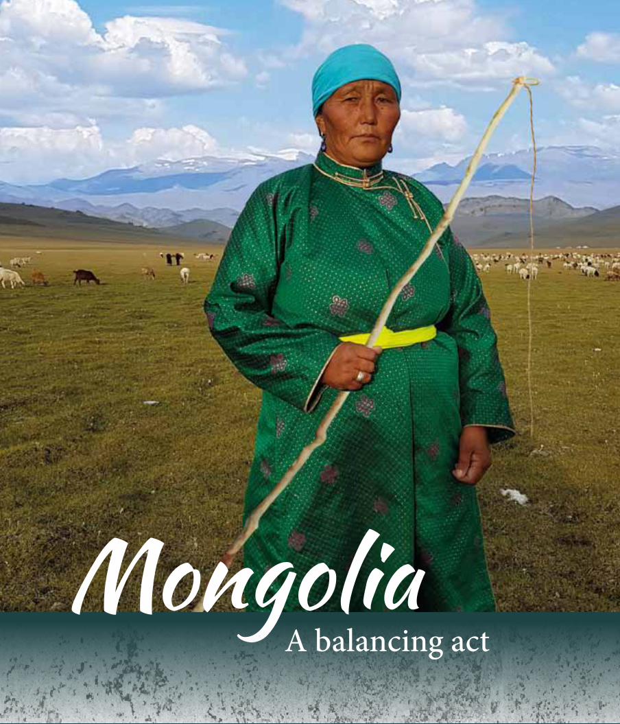
MongoliaA balancing act
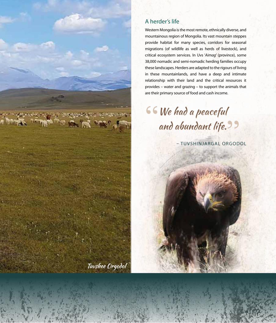
A herder’s lifeWestern Mongolia is the most remote, ethnically diverse, and
mountainous region of Mongolia. Its vast mountain steppes
provide habitat for many species, corridors for seasonal
migrations (of wildlife as well as herds of livestock), and
critical ecosystem services. In Uvs ‘Aimag’ (province), some
38,000 nomadic and semi-nomadic herding families occupy
these landscapes. Herders are adapted to the rigours of living
in these mountainlands, and have a deep and intimate
relationship with their land and the critical resources it
provides – water and grazing – to support the animals that
are their primary source of food and cash income.
“ We had a peaceful and abundant life.”
– TUVSHINJARGAL oRGoDoL
Tuvshee Orgodol

39 Listening to our Land: STOriES Of rESiLiEnCE
Tuvshinjargal orgodol (who is known as ‘Tuvshee’) is a 57-year
old herder who lives in Gurvan Jigertei (‘Three Jigertei’) in
the Bukhmurun ‘Soum’ (district), close to the Mongolian-
Russian border. She, like her ancestors before her, is a sheep
herder with a deep love of her homeland, “My ancestors lived
here for a very long time as herders, and I have lived this life
since I was born – I have never been to school or university. I
have raised eight children here. Four of them are herders, but
the others have gone away to live in Ulaanbaatar (the capital
city). When I was young, the landscape of Gurvan Jigertei was
really beautiful. In summer the area was covered with dark
green grass and throughout the seasons the steppes provided
abundant grass and water. Many herds of cattle from
surrounding areas used to come here, and our livestock grazed
alongside black-tailed gazelles. We had a peaceful and
abundant life.”
Changing timesover the past decade, this picture has been changing, with
rapidly intensifying land degradation and desertification
placing the future of traditional herders – and the integrity of
the mountain and desert steppe ecosystems that support
them – at risk. Below the surface of the steppes lies a vast
repository of mineral deposits – coal, copper, and gold – and
mining exploration and exploitation is increasing rapidly,
restricting the amount of land available for herders and
affecting water supplies. Tuvshee describes the situation, as
she sees it, “Gurvan Jigertei has been degraded by coal mining
operations and poor land management in recent times. Our
pastureland is being damaged and is disappearing and even
small springs, ponds, and hand-wells are drying up. The
vegetation was so scarce between 2012 and 2014 that our
animals could not lay on enough fat to survive the harsh winter,
and we lost many livestock. This brings such misery to nomadic
herders like us whose livelihoods depend directly on nature’s
resources and the weather.”
With increasing competition for land between different land
users, herders and wildlife can no longer move unfettered
across the landscape, leading to overcrowding and
overgrazing. Increased herd sizes, changed grazing regimes,
and land tenure arrangements, have resulted in declining
availability and health of pastures, reduced herd fitness, soil
erosion, degradation of water sources, and loss of biodiversity
– with all of these impacts worsened by the effects of an
increasingly unpredictable climate.
The herders show great awareness of the problem, but did
not know how to solve it. Tuvshee explains, “We are heavily
dependent on pasture condition. Many herders are trying to live
close to the border region where grazing is still available, and
some of them have even settled there. We are aware that this
small area cannot provide enough pasture and water for all of
our livestock – and the animals of nearby herders – as there is
not enough rain and there are no more springs. But we have no
other choice.”
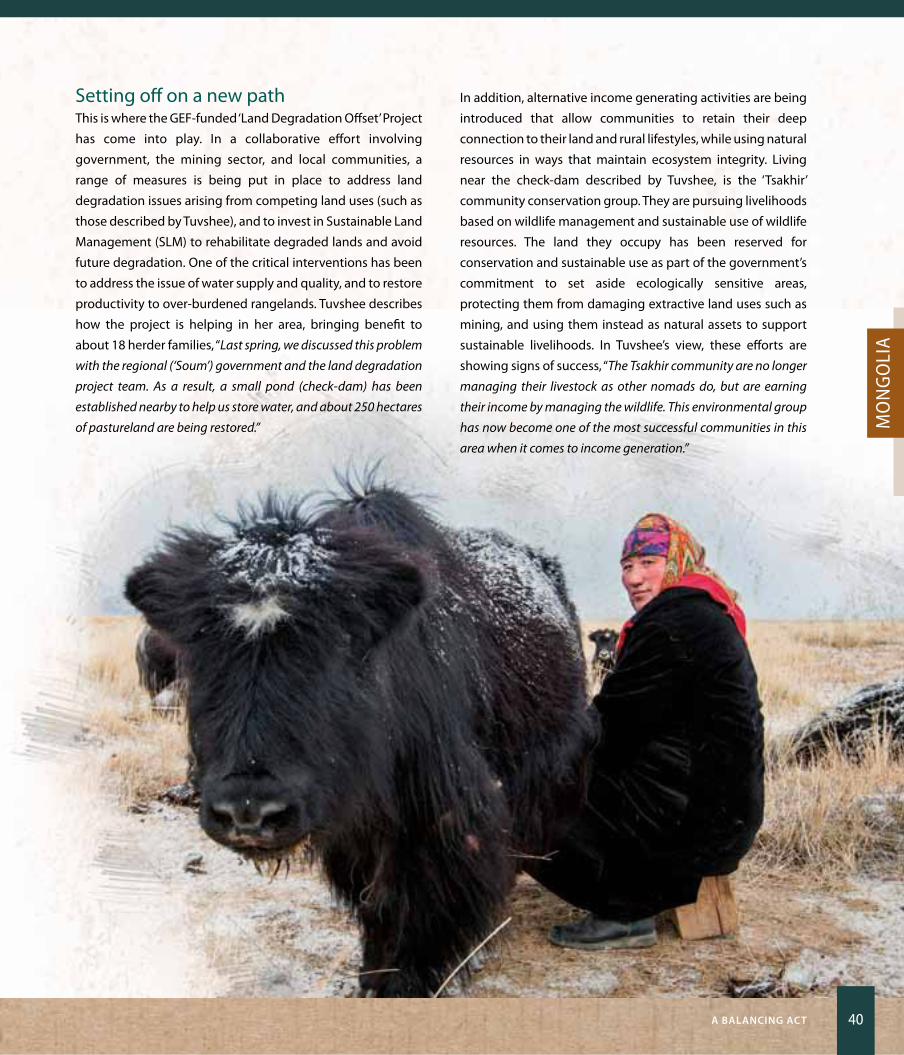
a BaLanCing aCT 40
Mo
ng
oli
a
Setting off on a new pathThis is where the GEF-funded ‘Land Degradation offset’ Project
has come into play. In a collaborative effort involving
government, the mining sector, and local communities, a
range of measures is being put in place to address land
degradation issues arising from competing land uses (such as
those described by Tuvshee), and to invest in Sustainable Land
Management (SLM) to rehabilitate degraded lands and avoid
future degradation. one of the critical interventions has been
to address the issue of water supply and quality, and to restore
productivity to over-burdened rangelands. Tuvshee describes
how the project is helping in her area, bringing benefit to
about 18 herder families, “Last spring, we discussed this problem
with the regional (‘Soum’) government and the land degradation
project team. As a result, a small pond (check-dam) has been
established nearby to help us store water, and about 250 hectares
of pastureland are being restored.”
In addition, alternative income generating activities are being
introduced that allow communities to retain their deep
connection to their land and rural lifestyles, while using natural
resources in ways that maintain ecosystem integrity. Living
near the check-dam described by Tuvshee, is the ‘Tsakhir’
community conservation group. They are pursuing livelihoods
based on wildlife management and sustainable use of wildlife
resources. The land they occupy has been reserved for
conservation and sustainable use as part of the government’s
commitment to set aside ecologically sensitive areas,
protecting them from damaging extractive land uses such as
mining, and using them instead as natural assets to support
sustainable livelihoods. In Tuvshee’s view, these efforts are
showing signs of success, “The Tsakhir community are no longer
managing their livestock as other nomads do, but are earning
their income by managing the wildlife. This environmental group
has now become one of the most successful communities in this
area when it comes to income generation.”
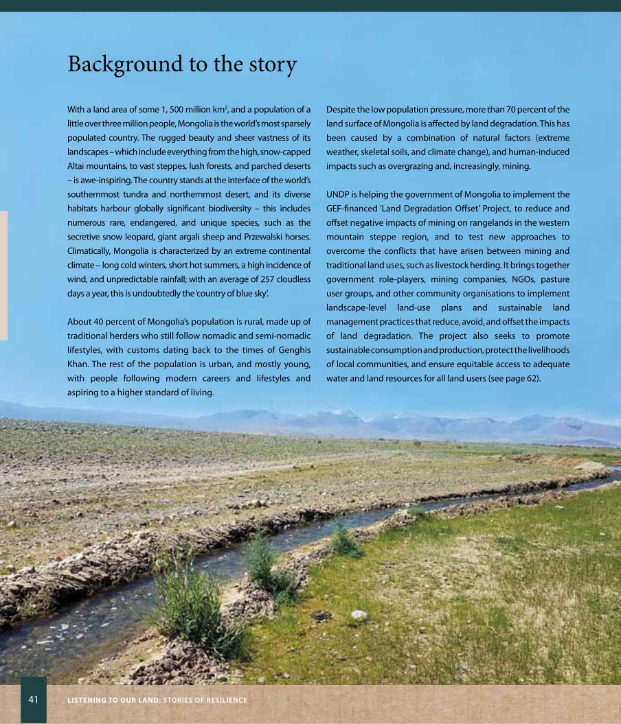
41 Listening to our Land: STOriES Of rESiLiEnCE
Background to the story
With a land area of some 1, 500 million km2, and a population of a
little over three million people, Mongolia is the world’s most sparsely
populated country. The rugged beauty and sheer vastness of its
landscapes – which include everything from the high, snow-capped
Altai mountains, to vast steppes, lush forests, and parched deserts
– is awe-inspiring. The country stands at the interface of the world’s
southernmost tundra and northernmost desert, and its diverse
habitats harbour globally significant biodiversity – this includes
numerous rare, endangered, and unique species, such as the
secretive snow leopard, giant argali sheep and Przewalski horses.
Climatically, Mongolia is characterized by an extreme continental
climate – long cold winters, short hot summers, a high incidence of
wind, and unpredictable rainfall; with an average of 257 cloudless
days a year, this is undoubtedly the ‘country of blue sky’.
About 40 percent of Mongolia’s population is rural, made up of
traditional herders who still follow nomadic and semi-nomadic
lifestyles, with customs dating back to the times of Genghis
Khan. The rest of the population is urban, and mostly young,
with people following modern careers and lifestyles and
aspiring to a higher standard of living.
Despite the low population pressure, more than 70 percent of the
land surface of Mongolia is affected by land degradation. This has
been caused by a combination of natural factors (extreme
weather, skeletal soils, and climate change), and human-induced
impacts such as overgrazing and, increasingly, mining.
UNDP is helping the government of Mongolia to implement the
GEF-financed ‘Land Degradation offset’ Project, to reduce and
offset negative impacts of mining on rangelands in the western
mountain steppe region, and to test new approaches to
overcome the conflicts that have arisen between mining and
traditional land uses, such as livestock herding. It brings together
government role-players, mining companies, NGos, pasture
user groups, and other community organisations to implement
landscape-level land-use plans and sustainable land
management practices that reduce, avoid, and offset the impacts
of land degradation. The project also seeks to promote
sustainable consumption and production, protect the livelihoods
of local communities, and ensure equitable access to adequate
water and land resources for all land users (see page 62).

a BaLanCing aCT 42
Mo
ng
oli
a
Digging DeeperPiloting land degradation offsets in MongoliaMongolia’s economy has shown rapid economic growth in recent
times, driven largely by exploitation of the country’s vast mineral
resources, but this has carried high costs: erosion of cultural values
and traditional lifestyles, and increasing land degradation. The
result has been decreased land productivity, with serious
implications for vulnerable rural communities, national productivity,
and the quest for equitable and sustainable development. Three
years ago, some 2,768 mining exploration and exploitation licenses
had been granted, covering about 11 million hectares (representing
about 7.5 percent of the total land area). Exploitation of mineral
resources is essential for sustaining the type of economic growth
needed to meet the aspirations of an increasingly urban population
and a rapidly-growing market economy. But, a balance needs to be
struck between this and other land uses – especially livestock
husbandry, which is the second largest economic sector in the
country and the mainstay of rural communities – and managing
Mongolia’s unique ecosystems sustainably.
It is for this reason that the Government has embraced the
concept of a green development programme which includes
measures to rehabilitate degraded land and water resources,
reduce and avoid future degradation, and offset the negative
impacts of mining operations where they do occur.
The concept of offsets is new in Mongolia, with the first ever
biodiversity offset programme introduced as recently as 2012. For
this reason, training and capacity building has been an important
aspect of the ‘Land Degradation offset’ Project. Amankeldi
Mektihani, who works as a mine engineer at the Khotgor coal mines
in Uvs Province, describes the benefit of the training provided
through the project, “The main outcome of the training was not only
increased awareness of and capacity for implementing land
degradation offsets, but also improved cooperation between local
government organisations, private mining companies, and civil society
groups. We have recently concluded the development of an offsets plan
and our company has increased its budget for implementation of
environmental management actions by 74 percent.”
At ground level, mining companies are working alongside pasture
users groups to rehabilitate degraded land and support alternative
income generating activities, such as sustainable wildlife
management and use, and harvesting, sale, and marketing of
natural products such as sea-buckthorn (a wild berry used as food
for people and animals in the dry, eastern parts of Mongolia).
Work has only recently begun, but, already, local communities,
government and mining companies are seeing progress as
Mongolia embarks on its green development pathway.
‘Gaaya’ Galsandondog, who is the Governor of Khovd Province,
sums up their ambitions, “We have set forward four objectives to
reduce, offset, and prevent land degradation. These include taking
more land under state protection, rehabilitating degraded pastures
and introducing sustainable livestock management plans,
adopting best practices in the mining industry and implementing
an offsets policy, and placing more land under afforestation. We are
committed to achieving green development through multi-
stakeholder collaboration and effective public-private partnerships.
I have no doubt that if we meet these objectives, we will make great
strides to achieving our goals for sustainable development.”

Burkina FasoSocial networks for sustainability
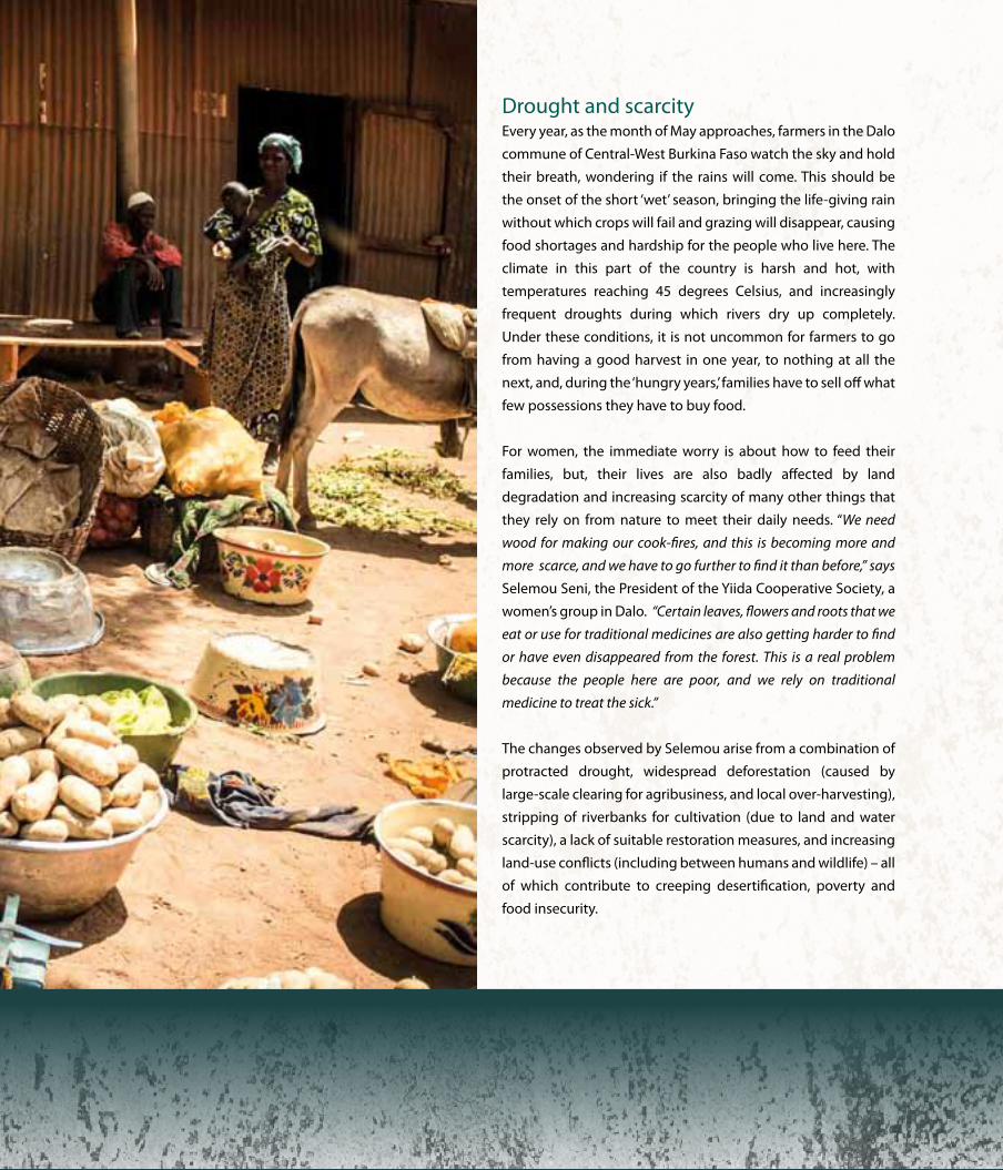
Drought and scarcity Every year, as the month of May approaches, farmers in the Dalo
commune of Central-West Burkina Faso watch the sky and hold
their breath, wondering if the rains will come. This should be
the onset of the short ‘wet’ season, bringing the life-giving rain
without which crops will fail and grazing will disappear, causing
food shortages and hardship for the people who live here. The
climate in this part of the country is harsh and hot, with
temperatures reaching 45 degrees Celsius, and increasingly
frequent droughts during which rivers dry up completely.
Under these conditions, it is not uncommon for farmers to go
from having a good harvest in one year, to nothing at all the
next, and, during the ‘hungry years,’ families have to sell off what
few possessions they have to buy food.
For women, the immediate worry is about how to feed their
families, but, their lives are also badly affected by land
degradation and increasing scarcity of many other things that
they rely on from nature to meet their daily needs. “We need
wood for making our cook-fires, and this is becoming more and
more scarce, and we have to go further to find it than before,” says
Selemou Seni, the President of the yiida Cooperative Society, a
women’s group in Dalo. “Certain leaves, flowers and roots that we
eat or use for traditional medicines are also getting harder to find
or have even disappeared from the forest. This is a real problem
because the people here are poor, and we rely on traditional
medicine to treat the sick.”
The changes observed by Selemou arise from a combination of
protracted drought, widespread deforestation (caused by
large-scale clearing for agribusiness, and local over-harvesting),
stripping of riverbanks for cultivation (due to land and water
scarcity), a lack of suitable restoration measures, and increasing
land-use conflicts (including between humans and wildlife) – all
of which contribute to creeping desertification, poverty and
food insecurity.

45 Listening to our Land: STOriES Of rESiLiEnCE
Cultivating women’s powerAgriculture is the mainstay of the subsistence and commercial
economy in the Central-West Region. Traditionally, women do
not own land, but participate in farm activities on land owned
by their husbands or male relatives, according to ethnically-
and culturally-defined rules. If women want to cultivate land
independently, they have to borrow or rent it from those who
own it, and their land-use tenure arrangements can change at
any time. As individuals, women also find it difficult to access
adequate finance and agricultural resources, which limits their
land-management options, productivity, and earning potential,
and leaves them vulnerable and disempowered.
Although women generally do not participate in village-level
governance, they occupy a prominent place in the community
in their role as mothers and home-keepers, and influence
decision-making in subtle ways. Social networks have for a long
time played an important role in Burkina Faso, to optimize use
of limited land, share equipment and labour, manage access to
rangelands, and facilitate access to cash. Although women’s
‘natal’ groups (based on ties with their paternal family) have
brought some land-use benefits, these have been limited.
With the advent of the Country Partnership Programme on
Sustainable Land Management (SLM) in Burkina Faso, this
picture is changing. Women’s associations are benefitting from
support provided through this UNDP-supported, GEF-financed
initiative to introduce SLM, with benefits for livelihood and food
security, and the condition of farmland and natural habitats on
which these depend. In the commune of Dalo, the project is
helping the 30-strong yiida Cooperative Society, to improve
their socio-economic conditions through the application of
sustainable land- and water-management practices, and
diversified income-generation strategies.
Small steps, big stridesone of the most important impacts this has had, is to increase
the earning power of women, and their ability to provide
enough food to meet daily needs. “We were helped to develop an
irrigated field to produce rice at a site that was previously degraded
and unsuitable for any sort of production. We were also trained in
dry-season production techniques using other crops, and were
supplied with inputs such as seeds, and organic and mineral
fertilizers of good quality,” says zenabou Kanyili, a member of the
yiida Cooperative Society. “As a result, we have produced over
600 kilograms of bulbous onion, and, in the dry season, I harvested
a significant quantity of onion, sorrel and bean leaves and okra,
which we use in the preparation of sauces that accompany our
different local dishes. This has meant that I am spending less
money on buying food, and, with the sale of surplus produce, I can
save a little money for use in the dry season.”
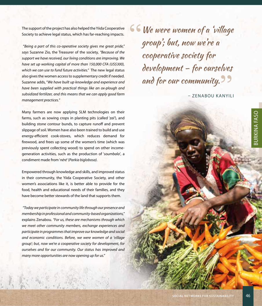
SOCiaL nET wOrKS fOr SuSTainaBiLiTy 46
Burk
ina
Faso
The support of the project has also helped the yiida Cooperative
Society to achieve legal status, which has far-reaching impacts.
“Being a part of this co-operative society gives me great pride,”
says Suzanne zio, the Treasurer of the society, “Because of the
support we have received, our living conditions are improving. We
have set up working capital of more than 150,000 CFA (US$300),
which we can use to fund future activities.” The new legal status
also gives the women access to supplementary credit if needed.
Suzanne adds, “We have built up knowledge and experience and
have been supplied with practical things like an ox-plough and
subsidized fertilizer, and this means that we can apply good farm
management practices.”
Many farmers are now applying SLM technologies on their
farms, such as sowing crops in planting pits (called ‘zaï’), and
building stone contour bunds, to capture runoff and prevent
slippage of soil. Women have also been trained to build and use
energy-efficient cook-stoves, which reduces demand for
firewood, and frees up some of the women’s time (which was
previously spent collecting wood) to spend on other income-
generation activities, such as the production of ‘soumbala’, a
condiment made from ‘néré ‘(Parkia biglobosa).
Empowered through knowledge and skills, and improved status
in their community, the yiida Cooperative Society, and other
women’s associations like it, is better able to provide for the
food, health and educational needs of their families, and they
have become better stewards of the land that supports them.
“Today we participate in community life through our presence and
membership in professional and community-based organizations,”
explains zenabou. “For us, these are mechanisms through which
we meet other community members, exchange experiences and
participate in programmes that improve our knowledge and social
and economic conditions. Before, we were women of a ‘village
group’; but, now we’re a cooperative society for development, for
ourselves and for our community. Our status has improved and
many more opportunities are now opening up for us.”
“ We were women of a ‘village group’; but, now we’re a cooperative society for development – for ourselves and for our community.”
– zENABoU KANyILI
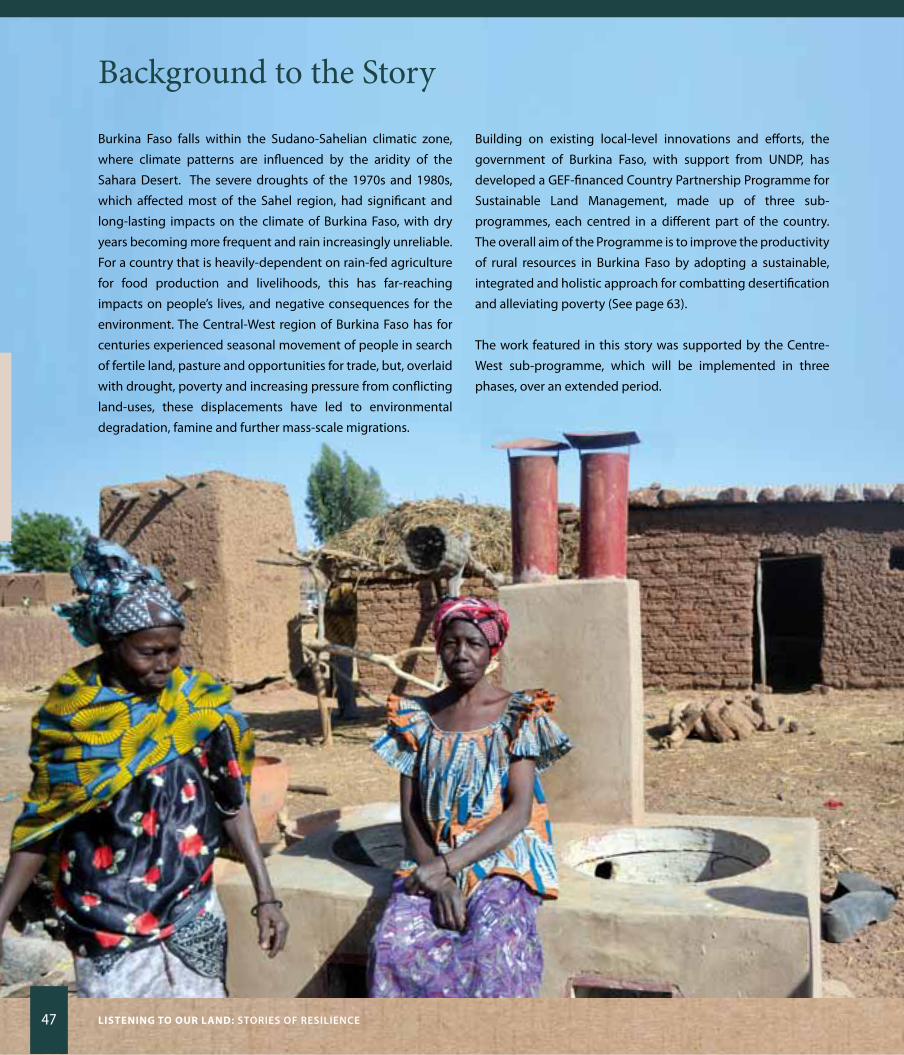
47 Listening to our Land: STOriES Of rESiLiEnCE
Background to the Story
Burkina Faso falls within the Sudano-Sahelian climatic zone,
where climate patterns are influenced by the aridity of the
Sahara Desert. The severe droughts of the 1970s and 1980s,
which affected most of the Sahel region, had significant and
long-lasting impacts on the climate of Burkina Faso, with dry
years becoming more frequent and rain increasingly unreliable.
For a country that is heavily-dependent on rain-fed agriculture
for food production and livelihoods, this has far-reaching
impacts on people’s lives, and negative consequences for the
environment. The Central-West region of Burkina Faso has for
centuries experienced seasonal movement of people in search
of fertile land, pasture and opportunities for trade, but, overlaid
with drought, poverty and increasing pressure from conflicting
land-uses, these displacements have led to environmental
degradation, famine and further mass-scale migrations.
Building on existing local-level innovations and efforts, the
government of Burkina Faso, with support from UNDP, has
developed a GEF-financed Country Partnership Programme for
Sustainable Land Management, made up of three sub-
programmes, each centred in a different part of the country.
The overall aim of the Programme is to improve the productivity
of rural resources in Burkina Faso by adopting a sustainable,
integrated and holistic approach for combatting desertification
and alleviating poverty (See page 63).
The work featured in this story was supported by the Centre-
West sub-programme, which will be implemented in three
phases, over an extended period.

SOCiaL nET wOrKS fOr SuSTainaBiLiTy 48
Burk
ina
Faso
Digging DeeperEmpowering social networks to address land degradation
The challenges of desertification and food insecurity have
shaped the people of Burkina Faso’s relationship with their land,
and with each other, and social networks have emerged as
powerful mechanisms for fighting land degradation. In recent
years, farmer-led innovations in sustainable forest management,
and traditional soil and water conservation, have contributed
significantly to maintaining and improving the productivity of
agriculture. This has provided a receptive environment for
introduction of sustainable land management technologies
that are adapted to the local conditions and offer new
approaches for reclaiming degraded land and protecting critical
resources, such as water.
Working through partnerships, with a particular focus on
empowerment of women’s associations, the Country
Partnership Programme on SLM has demonstrated how the
implementation of sustainable soil and water-management
practices can increase agricultural productivity and improve
food security among farming households.
one method that has proved effective for improving soil
fertility – and is popular among farmers because of its relative
simplicity – is the use of ‘zaï’ pits. These are shallow depressions
(about 20 x 15 centimeters) that are filled with organic manure,
in which seeds are sown when it rains. The pit traps the water,
and provides a fertile environment in which germination can
take place. Using this type of method, farmers are managing to
reclaim desertified land.
Rain-fed rice production has nearly doubled through the use of
stone-wall bunds and raised earthen banks, which trap
rainwater runoff, and enable it to spread out across the rice
fields. During the dry season, instead of abandoning these
fields for others, women now shift to producing high-value
crops such as tomatoes and onions to sell at the market. Since
the adoption of these sustainable land management measures,
overall productivity has improved and cash flow is more evenly
distributed across the year, which makes it easier for women to
care for their families and improve their living conditions.
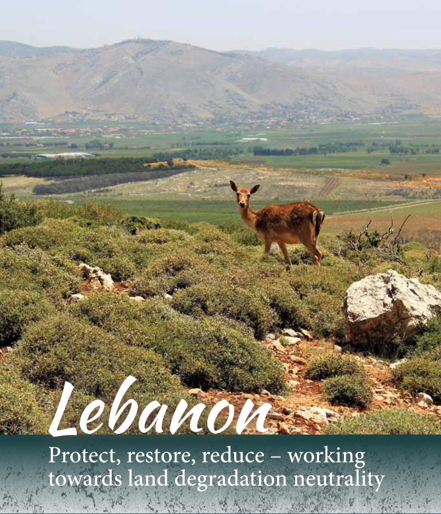
LebanonProtect, restore, reduce – working towards land degradation neutrality
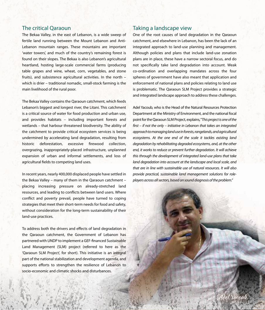
Taking a landscape viewone of the root causes of land degradation in the Qaraoun
catchment, and elsewhere in Lebanon, has been the lack of an
integrated approach to land-use planning and management.
Although policies and plans that include land-use zonation
plans are in place, these have a narrow sectoral focus, and do
not specifically take land degradation into account. Weak
co-ordination and overlapping mandates across the four
spheres of government have also meant that application and
enforcement of national plans and policies relating to land use
is problematic. The Qaraoun SLM Project provides a strategic
and integrated landscape approach to address these challenges.
Adel yacoub, who is the Head of the Natural Resources Protection
Department at the Ministry of Environment, and the national focal
point for the Qaraoun SLM Project, explains, “This project is one of the
first – if not the only – initiative in Lebanon that takes an integrated
approach to managing land use in forests, rangelands, and agricultural
ecosystems. At the one end of the scale it tackles existing land
degradation by rehabilitating degraded ecosystems, and, at the other
end, it works to reduce or prevent further degradation. It will achieve
this through the development of integrated land-use plans that take
land degradation into account at the landscape and local scale, and
that are in line with sustainable use of natural resources. It will also
provide practical, sustainable land management solutions for role-
players across all sectors, based on sound diagnosis of the problem.”
The critical QaraounThe Bekaa Valley, in the east of Lebanon, is a wide sweep of
fertile land running between the Mount Lebanon and Anti-
Lebanon mountain ranges. These mountains are important
‘water towers’, and much of the country’s remaining forest is
found on their slopes. The Bekaa is also Lebanon’s agricultural
heartland, hosting large-scale commercial farms (producing
table grapes and wine, wheat, corn, vegetables, and stone
fruits), and subsistence agricultural activities. In the north –
which is drier – traditional nomadic, small-stock farming is the
main livelihood of the rural poor.
The Bekaa Valley contains the Qaraoun catchment, which feeds
Lebanon’s biggest and longest river, the Litani. This catchment
is a critical source of water for food production and urban use,
and provides habitats – including important forests and
wetlands – that harbour threatened biodiversity. The ability of
the catchment to provide critical ecosystem services is being
undermined by accelerating land degradation, resulting from
historic deforestation, excessive firewood collection,
overgrazing, inappropriately-placed infrastructure, unplanned
expansion of urban and informal settlements, and loss of
agricultural fields to competing land uses.
In recent years, nearly 400,000 displaced people have settled in
the Bekaa Valley – many of them in the Qaraoun catchment –
placing increasing pressure on already-stretched land
resources, and leading to conflicts between land users. Where
conflict and poverty prevail, people have turned to coping
strategies that meet their short-term needs for food and safety,
without consideration for the long-term sustainability of their
land-use practices.
To address both the drivers and effects of land degradation in
the Qaraoun catchment, the Government of Lebanon has
partnered with UNDP to implement a GEF-financed Sustainable
Land Management (SLM) project (referred to here as the
‘Qaraoun SLM Project’, for short). This initiative is an integral
part of the national stabilization and development agenda, and
supports efforts to strengthen the resilience of Lebanon to
socio-economic and climatic shocks and disturbances.
Adel Yacoub
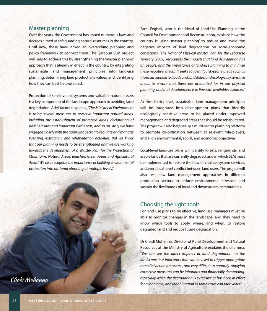
51 Listening to our Land: STOriES Of rESiLiEnCE
Master planningover the years, the Government has issued numerous laws and
decrees aimed at safeguarding natural resources in the country.
Until now, these have lacked an overarching planning and
policy framework to connect them. The Qaraoun SLM project
will help to address this by strengthening the ‘master planning’
approach that is already in effect in the country, by integrating
sustainable land management principles into land-use
planning, determining land productivity values, and identifying
how they can best be protected.
Protection of sensitive ecosystems and valuable natural assets
is a key component of the landscape approach to avoiding land
degradation. Adel yacoub explains, “The Ministry of Environment
is using several measures to preserve important natural areas,
including the establishment of protected areas, declaration of
RAMSAR sites and Important Bird Areas, and so on. Also, we have
engaged closely with the quarrying sector to regulate and manage
licensing, extraction, and rehabilitation activities. But we know
that our planning needs to be strengthened and we are working
towards the development of a ‘Master Plan for the Protection of
Mountains, Natural Areas, Beaches, Green Areas and Agricultural
Areas.’ We also recognize the importance of building environmental
protection into national planning at multiple levels.”
Sami Feghali, who is the Head of Land-Use Planning at the
Council for Development and Reconstruction, explains how the
country is using ‘master planning’ to reduce and avoid the
negative impacts of land degradation on socio-economic
conditions, ‘The National Physical Master Plan for the Lebanese
Territory (2009)’ recognizes the impacts that land degradation has
on people, and the importance of land-use planning to minimize
these negative effects. It seeks to identify risk-prone areas such as
those susceptible to floods and landslides, and ecologically sensitive
areas, to ensure that these are accounted for in our physical
planning, and that development is in line with available resources.”
At the district level, sustainable land management principles
will be integrated into development plans that identify
ecologically sensitive areas to be placed under improved
management, and degraded areas that should be rehabilitated.
The project will also help set up a multi-sector planning platform
to promote co-ordination between all relevant role-players,
and align environmental, social, and economic objectives.
Local-level land-use plans will identify forests, rangelands, and
arable lands that are currently degraded, and in which SLM must
be implemented to restore the flow of vital ecosystem services,
and avert local-level conflict between land users. The project will
also test new land management approaches in different
production sectors to reduce environmental stressors and
sustain the livelihoods of local and downstream communities.
Choosing the right toolsFor land-use plans to be effective, land-use managers must be
able to monitor changes in the landscape, and they need to
know which tools to apply, where, and when, to restore
degraded land and reduce future degradation.
Dr Chadi Mohanna, Director of Rural Development and Natural
Resources at the Ministry of Agriculture explains the dilemma,
“We can see the direct impacts of land degradation on the
landscape, but indicators that can be used to trigger appropriate
remedial action are scarce, and very difficult to quantify. Applying
corrective measures can be laborious and financially demanding,
especially when the degradation is extensive or has been in effect
for a long time, and rehabilitation in some cases can take years.” Chadi Mohanna
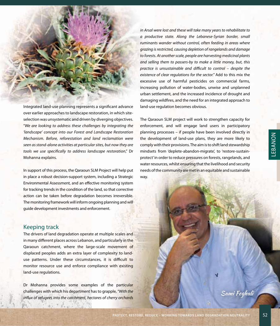
PrOTECT, rESTOrE, rEDuCE – wOrKing TOwarDS LanD DEgraDaTiOn nEuTraLiTy 52
Leba
no
n
Integrated land-use planning represents a significant advance
over earlier approaches to landscape restoration, in which site-
selection was unsystematic and driven by diverging objectives.
“We are looking to address these challenges by integrating the
‘landscape’ concept into our Forest and Landscape Restoration
Mechanism. Before, reforestation and land reclamation were
seen as stand-alone activities at particular sites, but now they are
tools we use specifically to address landscape restoration,” Dr
Mohanna explains.
In support of this process, the Qaraoun SLM Project will help put
in place a robust decision-support system, including a Strategic
Environmental Assessment, and an effective monitoring system
for tracking trends in the condition of the land, so that corrective
action can be taken before degradation becomes irreversible.
The monitoring framework will inform ongoing planning and will
guide development investments and enforcement.
Keeping trackThe drivers of land degradation operate at multiple scales and
in many different places across Lebanon, and particularly in the
Qaraoun catchment, where the large-scale movement of
displaced peoples adds an extra layer of complexity to land-
use patterns. Under these circumstances, it is difficult to
monitor resource use and enforce compliance with existing
land-use regulations.
Dr Mohanna provides some examples of the particular
challenges with which his department has to grapple, “With the
influx of refugees into the catchment, hectares of cherry orchards
in Arsal were lost and these will take many years to rehabilitate to
a productive state. Along the Lebanese-Syrian border, small
ruminants wander without control, often feeding in areas where
grazing is restricted, causing depletion of rangelands and damage
to forests. At another scale, people are harvesting medicinal plants
and selling them to passers-by to make a little money, but, this
practice is unsustainable and difficult to control – despite the
existence of clear regulations for the sector.” Add to this mix the
excessive use of harmful pesticides on commercial farms,
increasing pollution of water-bodies, unwise and unplanned
urban settlement, and the increased incidence of drought and
damaging wildfires, and the need for an integrated approach to
land-use regulation becomes obvious.
The Qaraoun SLM project will work to strengthen capacity for
enforcement, and will engage land users in participatory
planning processes – if people have been involved directly in
the development of land-use plans, they are more likely to
comply with their provisions. The aim is to shift land stewardship
mindsets from ‘deplete-abandon-migrate’, to ‘restore-sustain-
protect’ in order to reduce pressures on forests, rangelands, and
water resources, whilst ensuring that the livelihood and security
needs of the community are met in an equitable and sustainable
way.
Sami Feghali

53 Listening to our Land: STOriES Of rESiLiEnCE
Background to the story
Lebanon is among the smaller countries of the world, with an
area that occupies only 0.07 percent of the Earth’s land surface.
But, this country grapples with a disproportionate share of
complex challenges resulting from its war-torn past, and, more
recently, the pressures brought to bear by the influx of over one
million displaced Syrian people. A long history of unsustainable
and weakly-regulated land use, compounded by the ravages of
war, has left the natural landscapes of Lebanon deeply scarred.
Accelerating land degradation poses a significant barrier to the
country’s efforts to reconstruct its infrastructure and economy,
restore its social fabric, protect people’s livelihoods and well-
being, and restore peace.
Lebanon falls into the Mediterranean ecoregion – one of the most
endangered in the world, and one of 25 globally recognized
biodiversity hotspots. Much of the country is dominated by
mountainous landscapes, which are important watersheds.
Historically, these landscapes were largely cloaked in forests
and woodlands, but mounting human-induced pressures over
the span of many years has led to widespread changes in land
cover, including a reduction in forest cover from 74 to 13 percent.
This undermines the provision of ecosystem services, especially
the supply of water – the life-blood of this drought-prone land.
over the past decade, the Lebanese government has adopted a
suite of policies to address the pressing problems of land
degradation and desertification through active reforestation,
enhanced protection of important biodiversity, integrated
management of water resources, and improved land-use
planning. To assist the government in these efforts, UNDP is
supporting the GEF-funded project in the Qaraoun catchment,
to promote the adoption of sustainable land management
practices to minimize land degradation, rehabilitate degraded
and abandoned lands, and support sustainable livelihoods. This
project builds on the achievements of earlier work to preserve
aquifers through large-scale reforestation, and other methods
to improve forest cover, and contributes to new efforts to set
targets for achieving land degradation neutrality (See page 64).
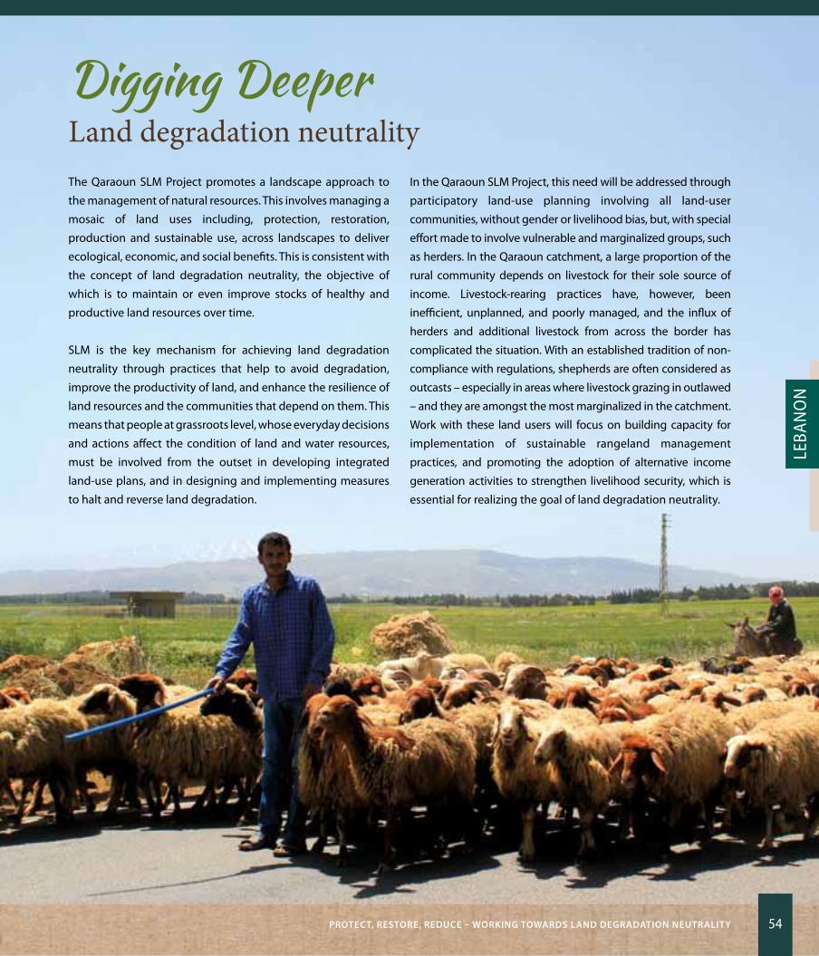
PrOTECT, rESTOrE, rEDuCE – wOrKing TOwarDS LanD DEgraDaTiOn nEuTraLiTy 54
Leba
no
n
Digging DeeperLand degradation neutralityThe Qaraoun SLM Project promotes a landscape approach to
the management of natural resources. This involves managing a
mosaic of land uses including, protection, restoration,
production and sustainable use, across landscapes to deliver
ecological, economic, and social benefits. This is consistent with
the concept of land degradation neutrality, the objective of
which is to maintain or even improve stocks of healthy and
productive land resources over time.
SLM is the key mechanism for achieving land degradation
neutrality through practices that help to avoid degradation,
improve the productivity of land, and enhance the resilience of
land resources and the communities that depend on them. This
means that people at grassroots level, whose everyday decisions
and actions affect the condition of land and water resources,
must be involved from the outset in developing integrated
land-use plans, and in designing and implementing measures
to halt and reverse land degradation.
In the Qaraoun SLM Project, this need will be addressed through
participatory land-use planning involving all land-user
communities, without gender or livelihood bias, but, with special
effort made to involve vulnerable and marginalized groups, such
as herders. In the Qaraoun catchment, a large proportion of the
rural community depends on livestock for their sole source of
income. Livestock-rearing practices have, however, been
inefficient, unplanned, and poorly managed, and the influx of
herders and additional livestock from across the border has
complicated the situation. With an established tradition of non-
compliance with regulations, shepherds are often considered as
outcasts – especially in areas where livestock grazing in outlawed
– and they are amongst the most marginalized in the catchment.
Work with these land users will focus on building capacity for
implementation of sustainable rangeland management
practices, and promoting the adoption of alternative income
generation activities to strengthen livelihood security, which is
essential for realizing the goal of land degradation neutrality.
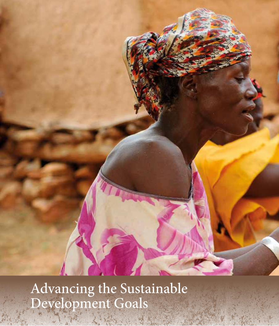
Advancing the Sustainable Development Goals
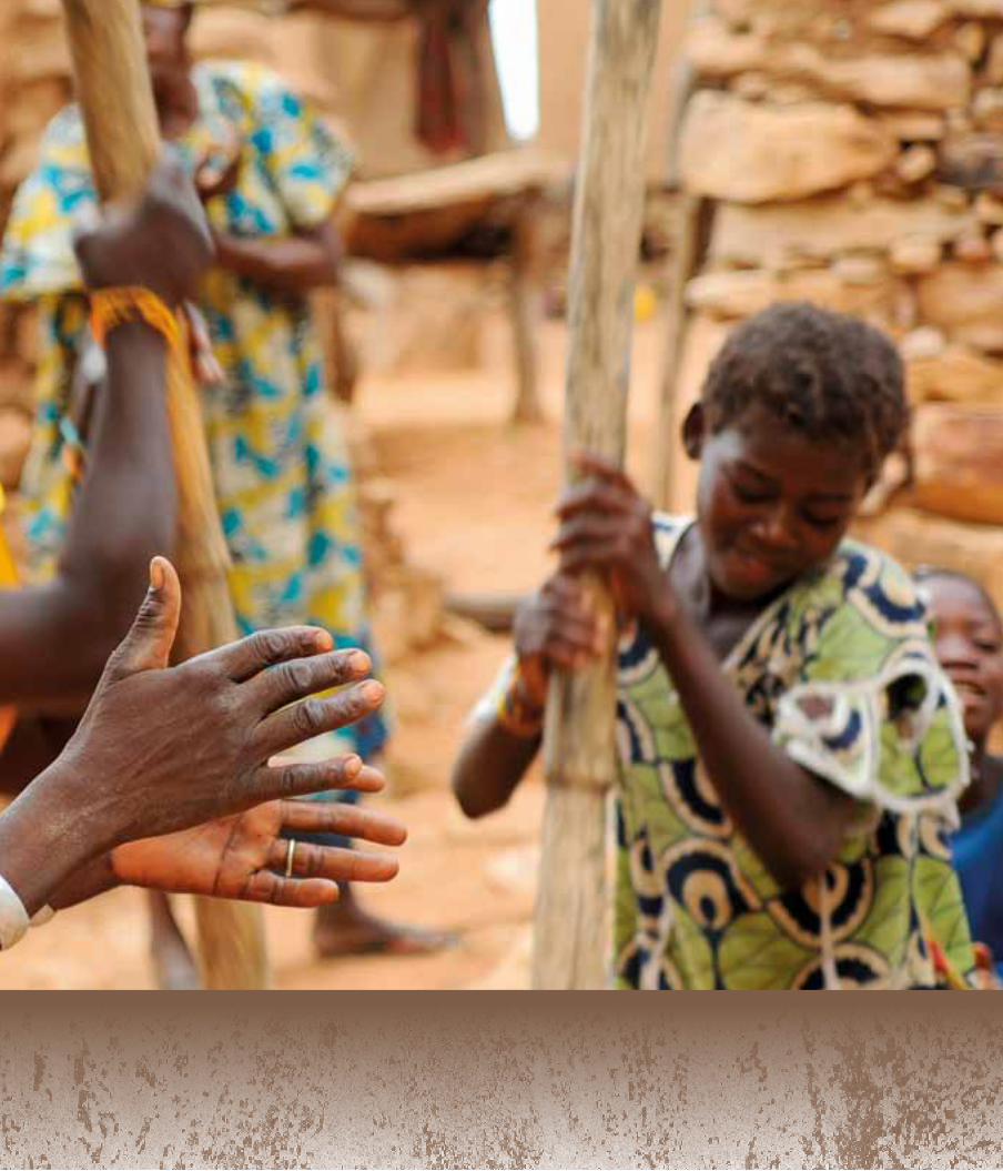

57 Listening to our Land: STOriES Of rESiLiEnCE
Namibia“The Country Pilot Partnership (CPP) Programme for Integrated Sustainable Land Management” Programme duration: 2007-2012
GEF grant: $9,000,000Co-financing (cash and in-kind): $36,467,112
“Sustainable Management of Namibia’s Forested Lands (NAFOLA)” Project duration: 2014 - 2019
GEF grant: $4,446,000Co-financing (cash and in-kind): $22,500,000
15.2Sustainable management and restoration of dry forests promoted through the declaration of Community Forests and strengthening of Community Conservancies to implement improved land stewardship over at least 500,000 ha.
15.3Rehabilitation of degraded rangelands promoted through de-bushing, regulation of grazing, and other restoration measures, in 13 land degradation hotspots, to combat desertification and strive for land degradation neutrality,
15.6Fair and equitable sharing of the benefits of sustainable use of natural resources to be advanced through the development of nature-based, alternative income generating activities (such as integrated ecotourism based on conservation of African Wild Dogs, and sustainable harvesting of Devil’s Claw).
1.3Access of rural communities to natural and economic resources, and secure tenure and control over land, ensured through support for the declaration of a Community Forest and strengthening of a Community Conservancy, affecting 5,000 people in 112 settlements and villages (to be replicated in 10 other Community Conservancies).
1.3
1.4
Community livelihoods and resilience enhanced through restoration of degraded rangelands for improved livestock production, and productive use of invasive species for income generation and creation of local employment in the catchment of the African Wild Dog Community Forest.
13.1Adaptive capacity to climate-related hazards and natural disasters, such as drought and damaging fires, strengthened through holistic management of dry forest ecosystems, sustainable livestock and rangeland management to reduce of overgrazing, improved fire management, and de-bushing of encroached areas to reduce fuel loads, and diversification of livelihood activities to strengthen resilience.
58
Cuba“The GEF Country Pilot Partnership (GEF-CPP) on SLM”
Programme duration: 2008-2023GEF grant: $10,000,000
Co-financing (cash and in-kind): $79,437,499
15.3SLM practices implemented over 15,000 ha at demonstration sites to combat desertification, halt deforestation, and restore degraded soil, with replication taking place in 153 municipalities, to achieve land degradation neutrality.
15.8Measures taken to reduce the impact of invasive alien species over 12,100 ha of terrestrial and aquatic ecosystems, by removal of invasive species and use of bio-control agents.
15.9Ecosystem values incorporated into national and local-level planning, with SLM principles built into the regulatory and policy framework of the agriculture, forestry, and economic planning sectors. This includes the development of a Manual of Procedures for Sustainable Land Management; and incorporation of SLM into 100 technical norms and standards in the agricultural sector.
2.3Agricultural productivity restored to previously-degraded land and incomes of food producers at least doubled (at demonstration sites) through adoption of SLM, and through secure access to land.
2.4Sustainable food production systems and resilient agricultural practices introduced such as use of organic worm compost, bioenergy, biopesticides, mulching, intercropping with leguminous plants, and use of check-dams to maintain ecosystem services, strengthen capacity to adapt to climate change, and improve soil and water quality.
6.4 Water-use efficiency improved by up to 70% at some sites, through community in engagement integrated water resource management.
8.3SLM integrated into the ‘Procedure for assessing economic, environmental, social and technological impact of SLM practices’ to inform investment policies that support productive activities, job creation, and innovation.
17.7Development, transfer, and dissemination of environmentally sound technologies achieved through training (over 4,070 farmers, experts and school teachers), awareness-raising and incorporation of SLM into the school and university curricula.
17.13Policy coherence promoted through incorporation of SLM into regulatory and policy frameworks in agriculture and national development planning, including the Decree Law on Idle Land, the National Land Management Scheme, and Cuban Standards for Soil and Water Quality.
59 Listening to our Land: STOriES Of rESiLiEnCE
Tanzania“Reducing Land Degradation in the Highlands of Kilimanjaro Region” (known as the Kilimanjaro SLM Project)
Project duration: 2010 -2015GEF grant: $2,630,000
Co-financing (cash and in-kind): $18,800,000
15.2Demand for forest products reduced and restoration of degraded forests promoted through the creation of alternative sustainable livelihoods that are not based on consumptive use of forest resources (such as apiculture, mushroom, and poultry farming), the establishment of tree nurseries (55,000 tree saplings) and implementation of tree planting projects covering 18, 425 ha.
15.3More than 59, 000 farmers and 265 district officials trained to implement SLM practices, over 100,000 ha of land affected by soil erosion rehabilitated, and tree cover increased by 60% at pilot sites, as a contribution towards combatting desertification, restoring degraded land and striving to achieve land degradation neutrality.
15.4Capacity of the Kilimanjaro mountain ecosystem to provide services essential for sustainable development enhanced through the adoption of SLM measures, with 74,532 ha directly under SLM practices and another 26,978 ha impacted through upscaling.
15.11Capacity of local communities to pursue alternative livelihoods strengthened through introduction of apiculture, mushroom growing, improved animal husbandry, and poultry-keeping. With the establishment of these micro-enterprises, household incomes across participating communities increased by between 7% and 300%.
2.3Average annual agricultural productivity increased (by 58% for bananas, 126% for maize, and 120% for shade coffee), reducing the number of food-insecure days of participating households by 27%, and generating a 95% average increase in incomes.
7.3
7.4
Improved energy efficiency achieved through the introduction of 901 fuel efficient stoves that burn 67% less wood and emit 50% less carbon dioxide than old cook stoves.
13.1Resilience and adaptive capacity of local communities to increased drought and unpredictable rainfall strengthened through measures to improve water-use efficiency through rehabilitation of water furrows, installation of rainwater tanks and drip irrigation, and through the use of weather data from 14 mini-weather stations to plan the farming cycle.

60
Kazakhstan“Supporting Sustainable Land Management in Steppe and Semi-Arid Zones through Integrated Territorial Planning and Agro-Environmental Incentives”
Project duration: 2015-2020GEF grant: $1,900,000
Co-financing (cash and in-kind): $9,499,459
15.1Conservation, restoration, and sustainable use of dryland ecosystems enhanced over 85,503 ha.
15.3Desertification addressed through agroforestry, soil and water conservation, and afforestation measures introduced over 68,697 ha (including afforestation of the dried Aral Sea bed) to restore degraded land and soil.
1.2Incomes of 729 farmers (460 men and 269 women) increased by between 30 and 79% as a result of improved land productivity due to use of efficient irrigation systems, cultivation of high value crops, improved livestock breeding, and other SLM measures.
1.3Access to economic resources facilitated for the poor and vulnerable (especially previously displaced people and women) through job creation (93 permanent jobs and 221 jobs for seasonal workers from adjacent regions created on 19 new, sustainably-managed farms covering 154,200 ha of restored land), and through recruitment of 131 local residents (mostly women) to work in forest nurseries and land restoration projects.
3.9Well-being and health of more than 74, 000 people living in the Aralsk district improved due to reduction of hazardous contaminants in the air, soil, and water achieved through improved land cover and a shift to organic farming that does not use chemical pesticides and fertilizers.
6.4Water scarcity addressed, access to water and water-efficiency improved through reconstruction of the Basykara Canal and Sholakaryk Channel, a 100% improvement in the per-hectare efficiency of irrigation system, installation of water filters, and improved participation of local communities in integrated water management.
13.1Exposure and vulnerability to climate hazards and natural disasters reduced through the establishment of green zones to protect villages from moving sands exposure and vulnerability to climate hazards and natural disasters.
1. Results achieved in the Kyzylorda region, since 2015 to date.
1
61 Listening to our Land: STOriES Of rESiLiEnCE
Eritrea“Mainstreaming Climate Risk Considerations in Food Security and Integrated Water Resources Management in Tsilima Plains”
Project duration: 2017-2021GEF(LDCF) grant: $9,050,000
Co-financing (cash and in-kind): $27,500,000
“Capacity Building for Sustainable Land Management in Eritrea” Project duration: 2009-2016
GEF grant: $1,820,000 Co-financing (cash and in-kind): $8,542,000
15.3Degraded forest and woodland restored over 9,000 ha in the Tsilima highlands and plains, through the introduction of soil and water conservation measures, including terracing of hillsides, construction of check-dams, and planting of 2,300,000 tree seedlings.
2.3Agricultural productivity and incomes of small-scale producers, including women, increased in 11,000 households and 28 villages in Serejeka sub-zoba, through implementation of the 1994 Land Proclamation to secure long-term access to land; and, 17,000 households in the Tsilima region benefitting from climate-smart agriculture measures.
2.4Sustainable food production strengthened by introduction of resilient agricultural practices, including use of drought-resistant and early-maturing sorghum and millet varieties (with production increasing from 0.5–0.6 to 1.0–1.2 tons/ha) using the new varieties; diversified production of grains, fruits, vegetables, and fodder plants enabled by improved water conservation measures (such as check-dams) and use of improved small-scale solar-powered irrigation systems by 400 to 500 households over 120 ha of previously-abandoned land.
5aWomen’s access to land promoted through implementation of long-term land-use (usufruct) rights, and their capacity for management of natural resources built through involvement of the National Union of Eritrean Women as an active member of the SLM sub-zoba committee, participating fully in SLM awareness-raising and capacity building programmes.
6.4The number of people suffering from water scarcity reduced through construction of 4 micro-dams (with a capacity of 120,00m3–340,000m3) in Bashari, Wazentet, and Gebsie villages, enabling year-round water supply to 1,200 households in Hemalmalo and Habero sub-zobas.
6.5Integrated water resources management implemented through support for the financing and roll-out of the Eritrea Integrated Water Resources Action Plan.
13.2Climate risk and resilience mainstreamed into the National Food Security Strategy and the Integrated Water Resources Management Action Plan.
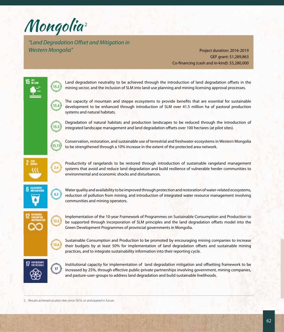
62
Mongolia 2
“Land Degradation Offset and Mitigation in Western Mongolia” Project duration: 2016-2019
GEF grant: $1,289,863Co-financing (cash and in-kind): $5,280,000
15.3Land degradation neutrality to be achieved through the introduction of land degradation offsets in the mining sector, and the inclusion of SLM into land-use planning and mining licensing approval processes.
15.4The capacity of mountain and steppe ecosystems to provide benefits that are essential for sustainable development to be enhanced through introduction of SLM over 41.5 million ha of pastoral production systems and natural habitats.
15.5Degradation of natural habitats and production landscapes to be reduced through the introduction of integrated landscape management and land degradation offsets over 100 hectares (at pilot sites).
15.11Conservation, restoration, and sustainable use of terrestrial and freshwater ecosystems in Western Mongolia to be strengthened through a 10% increase in the extent of the protected area network.
2.4Productivity of rangelands to be restored through introduction of sustainable rangeland management systems that avoid and reduce land degradation and build resilience of vulnerable herder communities to environmental and economic shocks and disturbances.
6.3Water quality and availability to be improved through protection and restoration of water-related ecosystems, reduction of pollution from mining, and introduction of integrated water resource management involving communities and mining operators.
12.2Implementation of the 10-year Framework of Programmes on Sustainable Consumption and Production to be supported through incorporation of SLM principles and the land degradation offsets model into the Green Development Programmes of provincial governments in Mongolia.
12.6Sustainable Consumption and Production to be promoted by encouraging mining companies to increase their budgets by at least 50% for implementation of land degradation offsets and sustainable mining practices, and to integrate sustainability information into their reporting cycle.
17Institutional capacity for implementation of land degradation mitigation and offsetting framework to be increased by 25%, through effective public-private partnerships involving government, mining companies, and pasture-user-groups to address land degradation and build sustainable livelihoods.
2. Results achieved at pilot sites since 2016, or anticipated in future.
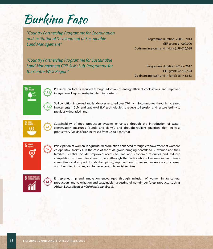
63 Listening to our Land: STOriES Of rESiLiEnCE
Burkina Faso“Country Partnership Programme for Coordination and Institutional Development of Sustainable Land Management”
Programme duration: 2009 – 2014GEF grant: $1,000,000
Co-financing (cash and in-kind): $8,616,088
“Country Partnership Programme for Sustainable Land Management CPP-SLM: Sub-Programme for the Centre-West Region”
Programme duration: 2012 – 2017GEF grant: $2,219,594
Co-financing (cash and in-kind): $8,141,633
15.2Pressures on forests reduced through adoption of energy-efficient cook-stoves, and improved integration of agro-forestry into farming systems.
15.3Soil condition improved and land-cover restored over 776 ha in 9 communes, through increased investments in SLM, and uptake of SLM technologies to reduce soil erosion and restore fertility to previously degraded land.
2.4Sustainability of food production systems enhanced through the introduction of water-conservation measures (bunds and dams), and drought-resilient practices that increase productivity (yields of rice increased from 2.4 to 4 tons/ha).
5aParticipation of women in agricultural production enhanced through empowerment of women’s co-operative societies, in the case of the yiida group bringing benefits to 30 women and their families. Benefits include: improved access to land and economic resources and reduced competition with men for access to land (through the participation of women in land tenure committees, and support of male champions); improved control over natural resources; increased and diversified incomes; and better access to financial services.
8.3Entrepreneurship and innovation encouraged through inclusion of women in agricultural production, and valorization and sustainable harvesting of non-timber forest products, such as African Locust Bean or néré (Parkia biglobosa).

64
Lebanon 3
“Sustainable Land Management in the Qaraoun Catchment”Project duration: 2015-2019
GEF grant: $3,187,671Co-financing (cash and in-kind): $18,050,000
15.1
15.2
Ensure the conservation, restoration, and sustainable use of terrestrial and freshwater ecosystems, including all types of forest, and ensure that measures to restore and rehabilitate degraded forests are identified, demonstrated, and integrated into existing Forestry Management Plans.
15.3Contribute to achievement of land degradation neutrality (LDN) through: (a) co-ordination of and participation in LDN target-setting workshops; (b) facilitation of the legal assessment to underpin LDN targets; and (c) restoration of 10,000 ha of rangelands and 300 ha of forests.
15.9Ecosystem and biodiversity values incorporated into national Master Plans, Integrated Land Use Plans in West Bekaa and Rachaya, a Land Use Monitoring System, and decision-support framework to ensure that SLM considerations guide development and investment planning and that changes in land use remain within acceptable limits.
2.3Productivity of rangelands and farms enhanced and the incomes of small-scale farmers and pastoralists increased through uptake of SLM techniques by 50% of land users at pilot sites in the project implementation area (in West Bekaa and zahle).
8.3Productive activities, entrepreneurship, and the growth of small enterprises promoted through development of an econometric model to develop production best practices and support alternative income generating activities, in line with available resources.
16.7Establishment of a peaceful and inclusive society in the Qaraoun catchment supported through inclusion of all stakeholders, without prejudice, in responsive, participatory land-use planning to earmark parcels of land for different land uses, and design appropriate sustainable land management measures.
3. This project has only recently started and information reflected here represents targets, not results achieved.
65 Listening to our Land: STOriES Of rESiLiEnCE
AcknowledgementsParticular thanks are due to:
Gricel Acosta, Hurelee Agchbayar, Victoria Bagazina, Munkhdorji Bayandelger, Erdene Bayasgalan, Bayarsaikhan Byamba, Bryn
Canniffe, Patrizia Cocca, yamilka Caraballo, zanbaga Enhbaatar, Khurel Erdene A, Lisa Farroway, Lyes Ferroukhi, Lela Fikrou, Herman
Frans, Solomon Gebreyohannes, Maria Cruz Gonzalez, Adam Habteab, Tomas Escobar Herrera, yukie Hori, Firuz Ibrohimov, Gulmira
Kabanbayeva, Khishigjargal Khakhuu, Viviane Kinyaga, Gertrude Lyatuu, Cathy Maize, Saskia Marijnissen, Damas Masalogo, Nour
Masri, Salvatory Matemu, Simon Msoka, Elizabeth Mwaniki, Rassul Rakhimov, Martha Talamondjila Naanda, oumar Papis Ndiaye,
Irma ovelar, Pakamon Pinprayoon, Esther Pormes, Jihan Seoud, yves de Soye, Rositsa Todorova, Hama Traore, Maxim Vergeichik,
Jamie Spencer Wright, onon yondon, yerlan zhumabayev.
Photographer credits(listed by page number):
Foreword: pVI (Going to plough rice fields, China): rawpixel.com/Shutterstock.com; pp1&2 (Altai region, Mongolia, aerial view):
Midori Paxton; p3 (Land degradation): Dirk Ercken/Shutterstock.com; p4 (Women carrying water, Burkina Faso): guilio napolitano/
Shutterstock.com; p5 (Peruvian woman with natural dye plants): ostill/Shuttersock.com; P6 (Women winnowing seed): imen Meliane/UNDP Climate Change Adaptation Flikr; pp7&8 (Panorama, Kalahari region, Namibia): Dmitry Pichugin/Shutterstock.com;
p8 (Wild Dog): rich Carey/Shutterstock.com; pp9&10 (Jaqueline Tjaimi and Rinouzeu Karizembi): jamie Spencer wright; p11
(Cattle): friedrich Stark/Alamy Stock Photography; p12 (Devil’s Claw): Midori Paxton; pp13&14 (Viňales Valley National Park):
National Center of Protected Areas, Cuba; P15 (onay Martinez Diaz) and p17 (Farm scenes): Midori Paxton; P18 (Soursop fruit):
COLOa Studio/Shutterstock.com P19&20 (Kilimanjaro and woman carrying bananas): ulrich Doering/Alamy Stock Photo;
pp21&22 (Devotha Tumainieli and Jubilate Kweka): Salvatory Matemu; pp22 (Coffee beans): gukov andrei/Shutterstock.com; p23 (Chagga homegarden): Mandy Cadman; p25&26 (Rusted boats, dried Aral Sea): Milosz Maslanka/Shutterstock.com; pp27&28 (zhandos Moldagulov and Gulnara Bayanayeva) and p29 (Woman
and village scene): unDP Kazakhstan; p30 (Tulip growing in sandy flats, Aral region):
ScDmfch/Shutterstock.com; p31 (Tsilima view) and pp33&34 (Gebremichael
Gebremeskel): Elizabeth Mwaniki/UNDP Eritrea; p35 (Women piling stones
to stop erosion): jenny Matthews/Alamy Stock Photo; p36 (Man tending
crops): unDP Eritrea; p37 (Tuvshee orgodol), p41 (Water channel) &
p42 (Khotgor coal mine): Munkhdorji Bayandelger; p38 (Golden
Eagle) & p38 (Camels on steppes): Midori Paxton; p39 (Woman
milking yak): Katiekk/Shutterstock.com; p40 (Women at market),
pp45&46&47 (Members of yiida womens group), p48 (Stone bund in
rice field): unDP Burkina faso; p49 (View over part of Bekaa Valley) &
p54 (Herders and sheep): Elsa Sattout; p50 (Adel yacoub), p60 (Chadi
Mohanna) & p61 (top: Medicinal plant; bottom: Sami Feghali): nour Masri/UNDP Lebanon; p53 (Women at market in Bekaa Valley): Dalia Khamissy/UNDP Lebanon Flikr; pp55&56 (Village life): Quick Shot/
Shutterstock.com; p65 (Child cradling seedling): kram9/Shutterstock.com


UNITED NATIONS DEVELOPMENT PROGRAMME304 EAST 45th Street, 9th FLOOR
New York, NY 10017, USAFor more information: www.undp.org
Copyright 2017, UNDP