Embed Size (px)
Citation preview
Lippershey, Galileo and the Starry Messenger: Observations on the
Role of GIS in Geography and Tools in Science
Keith C. ClarkeProfessor and Chair
Department of GeographyUniversity of California, Santa Barbara
Santa Barbara, CA, USA

The scene 17th Century European astronomy Ptolemaic earth-centered universe challenged
by Copernicus 100 years prior Direct observation not yet a major input to
“natural philosophy” Dogma and science interlinked Glasses around since early 14th Century Galileo Galilei (1564-1642), mathematician of
Padua
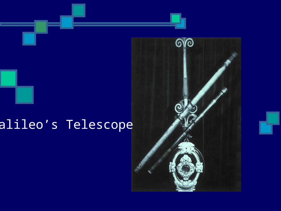
Galileo’s Telescope

The Starry Messenger (Sidereus Nuncius) Published in March 1610 24 page pamphlet Hundreds of new observations on the moon,
stars, made possible by a new device, the telescope
Four new planets (moons of Jupiter) “Each of his simple observations shook
another pillar of the Aristotelian-Ptolemaic Universe.” (Boorstin 1983)

Galileo’s Journal with observations on the moons of Jupiter
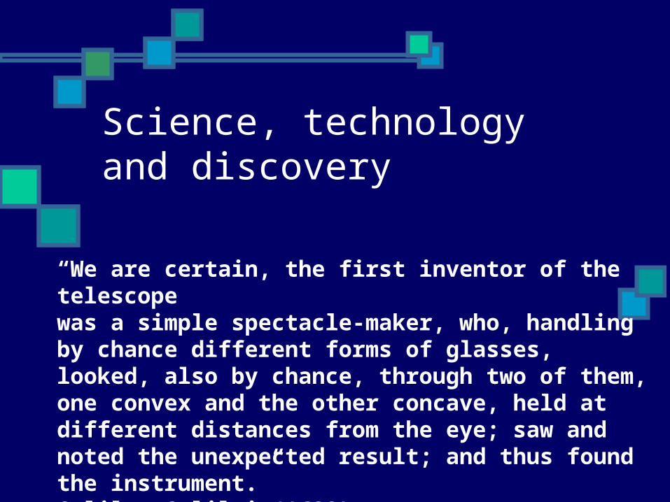
Science, technology and discovery
“We are certain, the first inventor of the telescopewas a simple spectacle-maker, who, handling by chance different forms of glasses, looked, also by chance, through two of them, one convex and the other concave, held at different distances from the eye; saw and noted the unexpected result; and thus found the instrument.”Galileo Galilei (1623)

Galileo and Lippershey

Enter Hans Lippershey
Worked in Middelberg, Netherlands around 1600
Two children in his shop put the lenses together to look at a weathervane
“illiterate mechanick” Petitioned the States General for a 30
year monopoly October 2, 1608
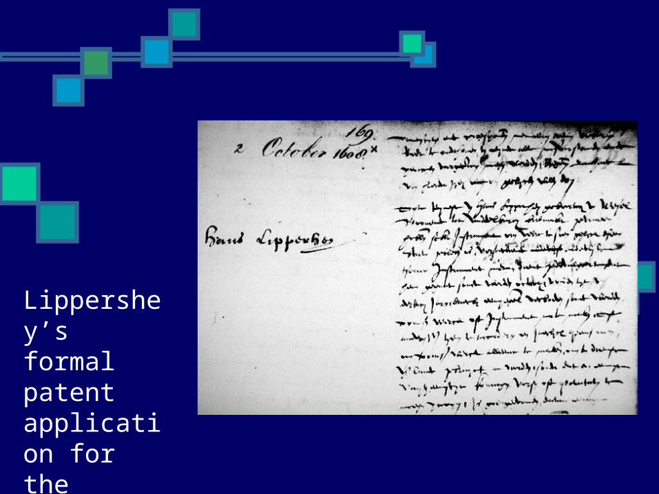
Lippershey’s formal patentapplication for the telescope

The traditional model: Progress in science Brilliant scientist, working alone in
isolation makes theoretical breakthrough
Idea openly distributed through scientific literature
Theory suggests experiment, experiment reveals discovery
Discovery commercialized for public benefit

Shifting paradigms in astronomy and science Technical innovation then… Commercial development then… Knowledge discovery then… Theoretical change “Invention is the mother of
necessity”
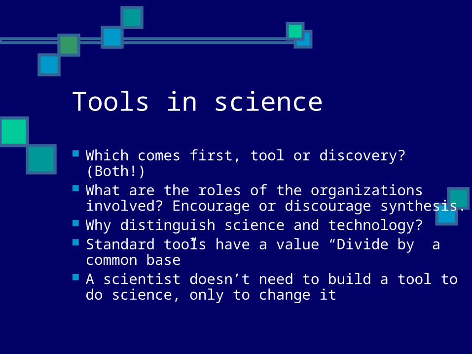
Tools in science
Which comes first, tool or discovery? (Both!) What are the roles of the organizations
involved? Encourage or discourage synthesis. Why distinguish science and technology? Standard tools have a value “Divide by a
common base” A scientist doesn’t need to build a tool to do
science, only to change it

What about tools in geography?
Is there a common tool base? Geography “that part of the exact sciences
which studies the earth and its parts in terms of their measurable characterisics” Varenius (1650)
General = theory (Spatial analysis) Specific = description (Regional, Cultural) Spatial analysis (theory) led to quantitative
revolution Is GIS a tool or a science?
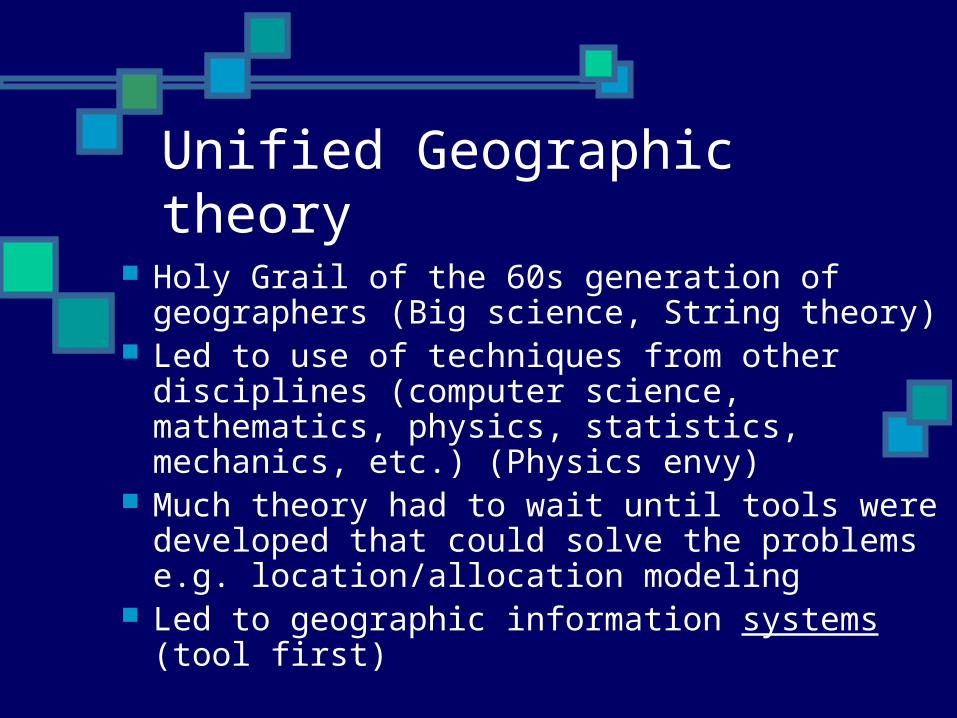
Unified Geographic theory
Holy Grail of the 60s generation of geographers (Big science, String theory)
Led to use of techniques from other disciplines (computer science, mathematics, physics, statistics, mechanics, etc.) (Physics envy)
Much theory had to wait until tools were developed that could solve the problems e.g. location/allocation modeling
Led to geographic information systems (tool first)
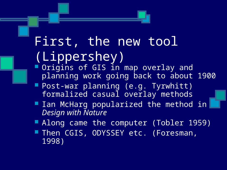
First, the new tool (Lippershey) Origins of GIS in map overlay and
planning work going back to about 1900 Post-war planning (e.g. Tyrwhitt)
formalized casual overlay methods Ian McHarg popularized the method in
Design with Nature Along came the computer (Tobler 1959) Then CGIS, ODYSSEY etc. (Foresman,
1998)
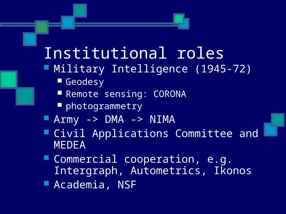
Institutional roles Military Intelligence (1945-72)
Geodesy Remote sensing: CORONA photogrammetry
Army -> DMA -> NIMA Civil Applications Committee and MEDEA Commercial cooperation, e.g.
Intergraph, Autometrics, Ikonos Academia, NSF
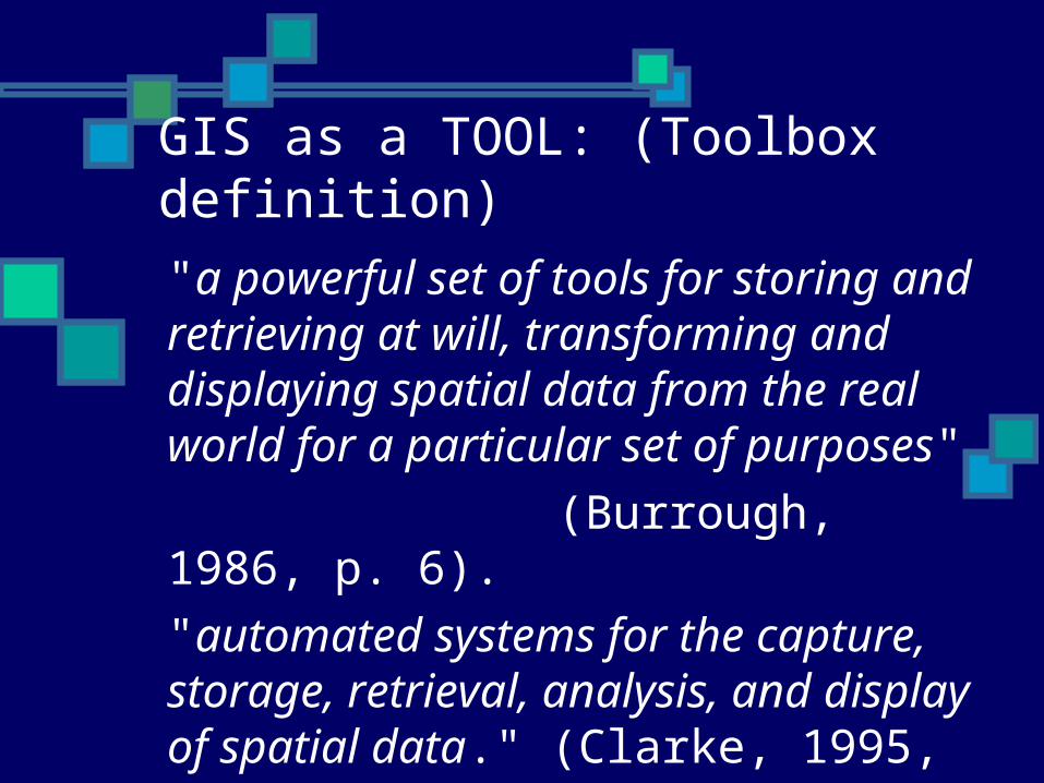
GIS as a TOOL: (Toolbox definition)
"a powerful set of tools for storing and retrieving at will, transforming and displaying spatial data from the real world for a particular set of purposes"
(Burrough, 1986, p. 6).
"automated systems for the capture, storage, retrieval, analysis, and display of spatial data." (Clarke, 1995, p. 13).

City of Oakland: Dynamic Maps

Oakland: Integration of Hi-Res Imagery

Words of caution about tools Hammers and nails System limitations System ontology vs. geography “Just because it could be done” Push-button geographers “Unbelievably faithful reproductions
of erroneous maps”

GIS challenges theory
Inadequate formalisms (ontology) Post-modern critique of “positivism”
(GIS2) Simple models often inadequate (e.g.
gravity model) or too static Space-time dichotomy Process vs. form Data at the point of measurement,
beyond the map model
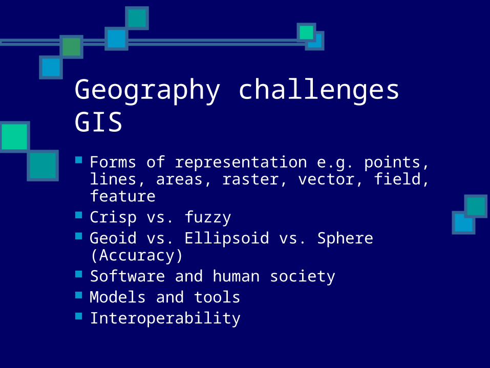
Geography challenges GIS
Forms of representation e.g. points, lines, areas, raster, vector, field, feature
Crisp vs. fuzzy Geoid vs. Ellipsoid vs. Sphere
(Accuracy) Software and human society Models and tools Interoperability
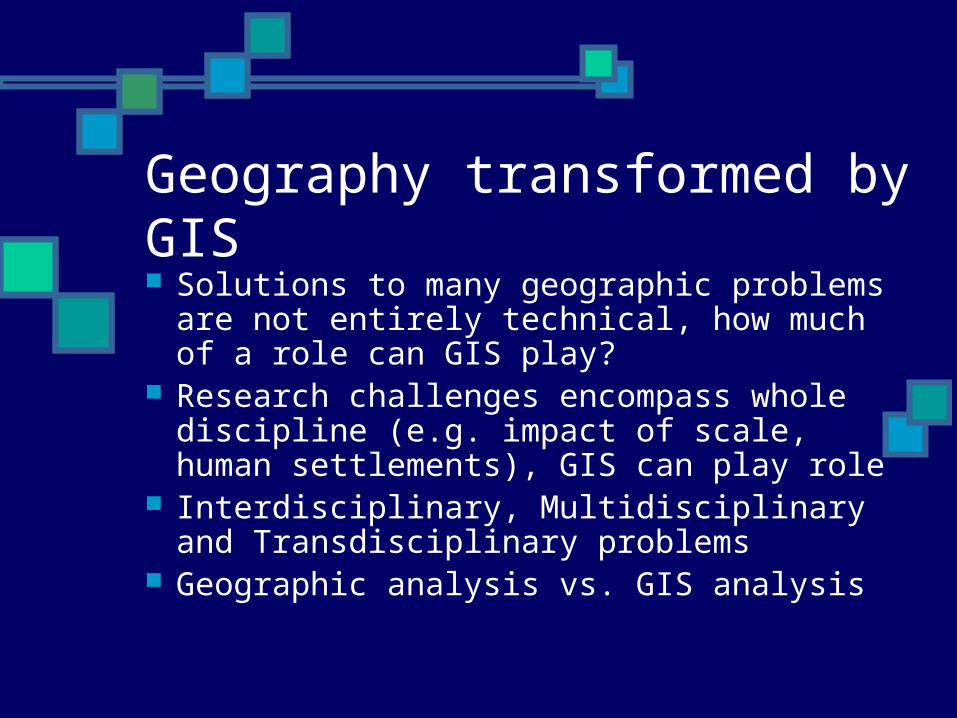
Geography transformed by GIS Solutions to many geographic
problems are not entirely technical, how much of a role can GIS play?
Research challenges encompass whole discipline (e.g. impact of scale, human settlements), GIS can play role
Interdisciplinary, Multidisciplinary and Transdisciplinary problems
Geographic analysis vs. GIS analysis
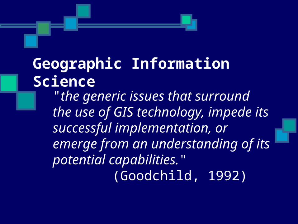
"the generic issues that surround the use of GIS technology, impede its successful implementation, or emerge from an understanding of its potential capabilities."
(Goodchild, 1992)
Geographic Information Science
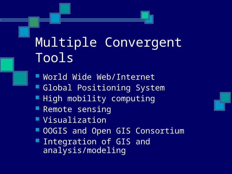
Multiple Convergent Tools
World Wide Web/Internet Global Positioning System High mobility computing Remote sensing Visualization OOGIS and Open GIS Consortium Integration of GIS and
analysis/modeling

GIS meets the internet: New tools Data depository and distribution system Map server systems e.g. IMS web-
enable existing GISs New display and query mechanisms
e.g. GeoVRML, GML (XML) Highly distributed databases Alexandria and ADEPT, Digital Earth,
Global Map

Web-enabled thematic mapping

Spatially-aware web searching
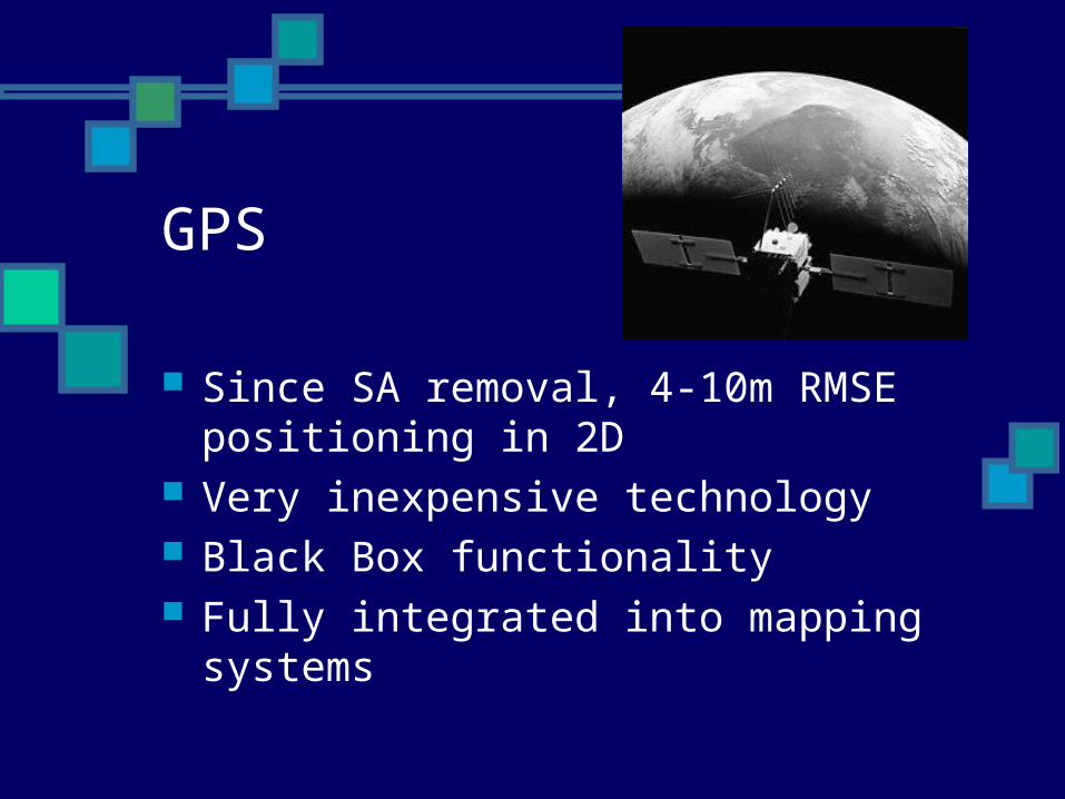
GPS
Since SA removal, 4-10m RMSE positioning in 2D
Very inexpensive technology Black Box functionality Fully integrated into mapping
systems


UCSB PrototypeWearable Computer(Project Battuta)PC-104 basedSystem with MicroopticalDisplay, Garmin GPS, and Twiddler 2.

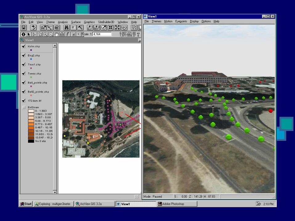
Visualization

A New General Geography? Problem orientation GIS data provide solution context Analytical tools provide approach Models allow scenario development,
consequence prediction and planning GIS can help in the final, decision-
making process (PPGIS) GIS can help explore solutions
(visualization)
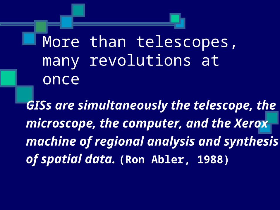
More than telescopes, many revolutions at once
GISs are simultaneously the telescope, the
microscope, the computer, and the Xerox
machine of regional analysis and synthesis
of spatial data. (Ron Abler, 1988)

The bottom line Science vs. Technology a worthless division Geography needs both Galileos AND
Lippersheys Geography has always been interdisciplinary Transdisciplinary problems are now
approachable Born in geography and cartography, GIS is
powerful enough a concept to have transcended geography
GISystems has become GIScience GIS can lead geography to a problem-solving
orientation


![starry starry starry starry - 弟子屈なびstarry starry ...starry starry ... !" Y Z[\] 9 %W*)(& CD B8+ *)& 6*^4) POLARIS It is a small lodging. You can feel the nature of Hokkaido](https://img.dokumen.tips/doc/110x75/6016819b9b72ac11c10487a5/starry-starry-starry-starry-starry-starry-starry-starry-.jpg)