Embed Size (px)
Citation preview
MET 4994 Remote Sensing: Radar and Satellite Meteorology MET 5994 Remote Sensing in Meteorology
Lecture 21: Satellite Imagery Interpretation:
Identifying Clouds
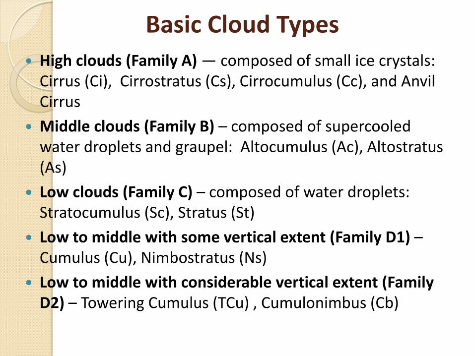
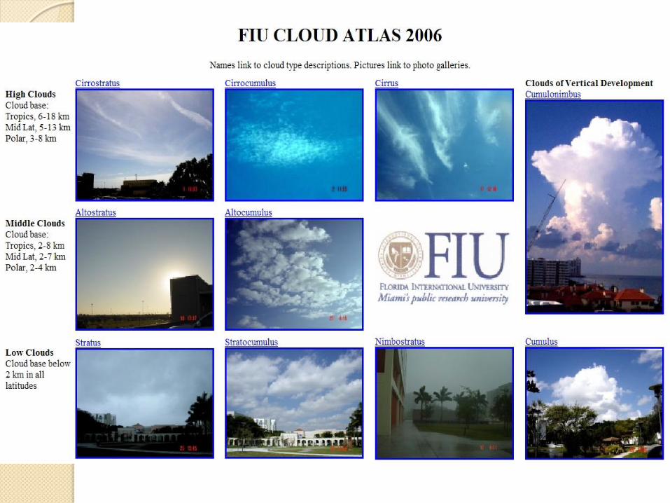
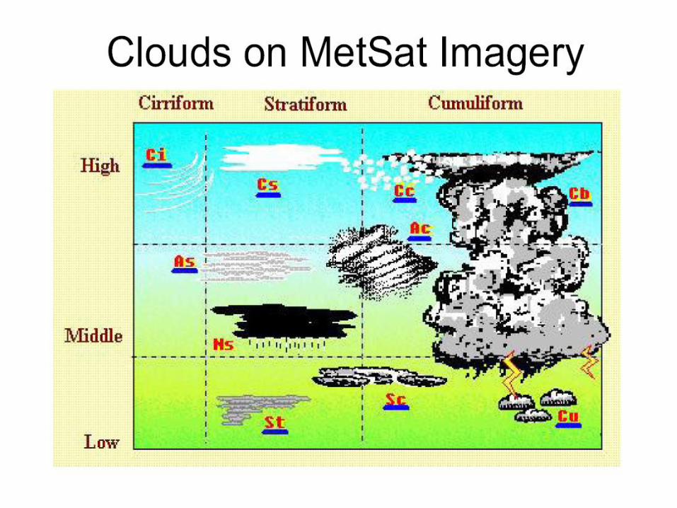
Basic Cloud Types
High clouds (Family A) — composed of small ice crystals: Cirrus (Ci), Cirrostratus (Cs), Cirrocumulus (Cc), and Anvil Cirrus
Middle clouds (Family B) – composed of supercooled water droplets and graupel: Altocumulus (Ac), Altostratus (As)
Low clouds (Family C) – composed of water droplets: Stratocumulus (Sc), Stratus (St)
Low to middle with some vertical extent (Family D1) – Cumulus (Cu), Nimbostratus (Ns)
Low to middle with considerable vertical extent (Family D2) – Towering Cumulus (TCu) , Cumulonimbus (Cb)
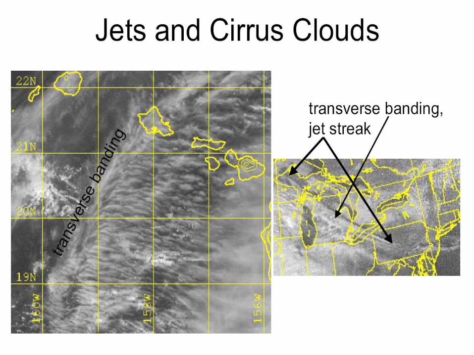
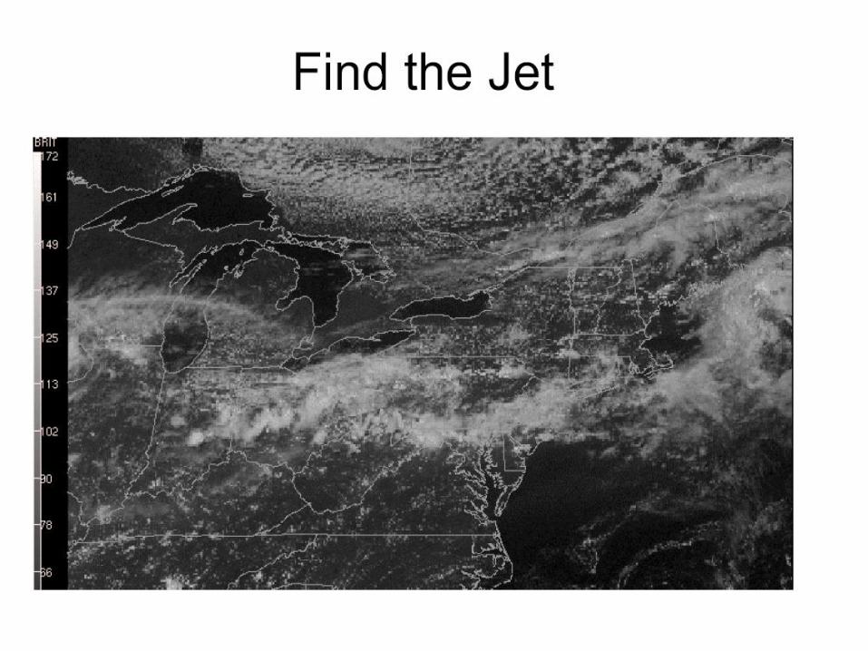
High Clouds (Bases 5-13 km) Cirrus (Ci): thin hooks, strands, and filaments or dense tufts
and sproutings.
i) Visible imagery:
(1) Brightness normally a darker or translucent appearance, often
obscuring definitions of lower features. A light gray compared to
thicker clouds.
(2) Texture fibrous with banding perpendicular to winds.
ii) IR imagery:
(1) Brightness usually dense patches are very bright but thin
cirrus is subject to considerable contamination and appears
much warmer (darker gray) than the actual temperature.
(2) Texture subject to variation due to contamination.
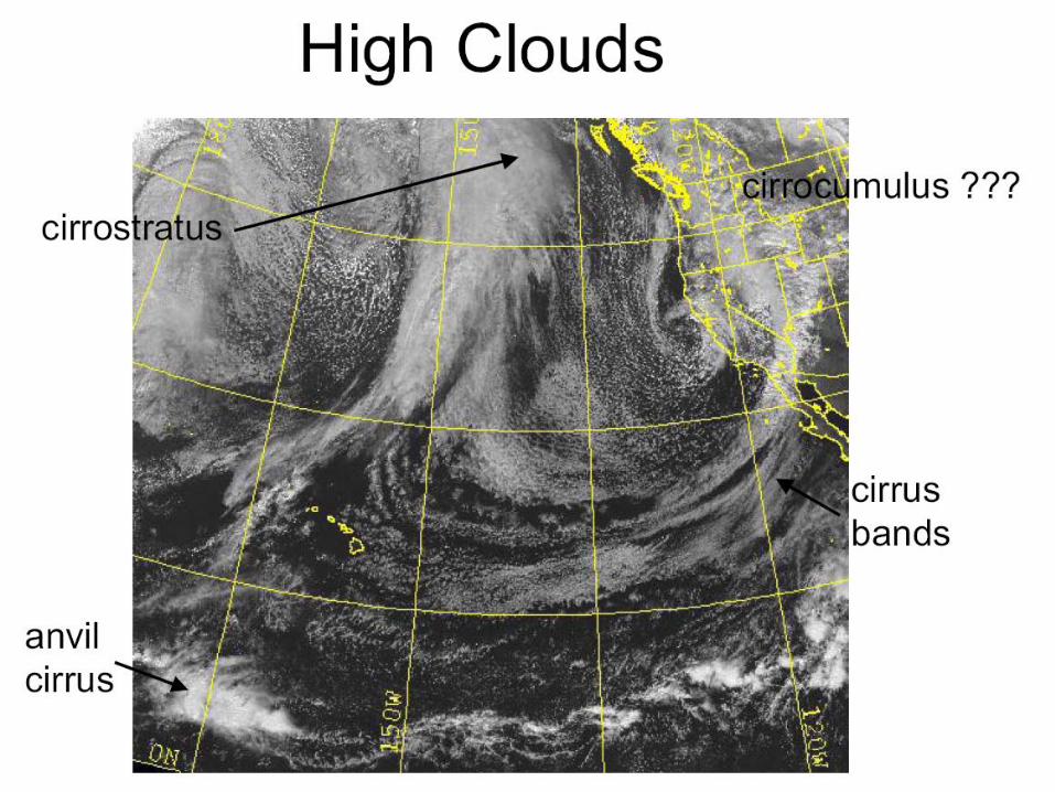
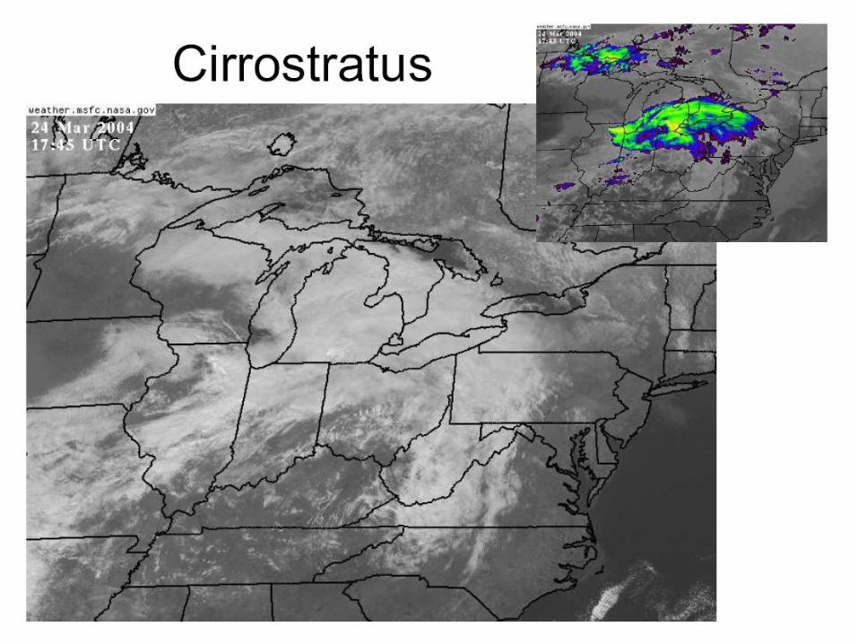
High Clouds (2)
Cirrostratus (Cs): High/thin to dense continuous
veil of stable ice crystals covering an extensive area.
Commonly found on equatorial side of jet streaks.
i) Visible imagery: generally appears white, thick,
smooth, and organized when associated with
cyclones. Casts shadows on surfaces below.
ii) IR imagery: appears as uniformly cold (white), often
the coldest, cloud layer (except when cumulonimbus
clouds are present) with small variations in gray shades.
Thin cirrostratus has considerable contamination
problems.
High Clouds (3)
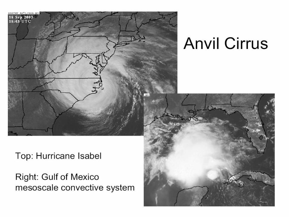
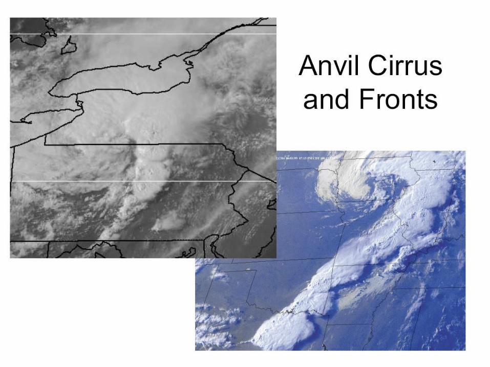
Anvil Cirrus (detached from cumulonimbus clouds)
dense remains of thunderstorms, usually irregularly
shaped, aligned parallel to the upper level winds. Vary in
shape and especially in size from 5 to 500 km. Tends to
become thin and dissipate rapidly.
i) Visible imagery bright white but diffuse. Thick
anvils may cast shadows on lower surfaces whereas
thin anvils are often translucent to lower features.
ii) IR imagery bright white patches, usually coldest
(whitest) cloud, except when active thunderstorms are
present.
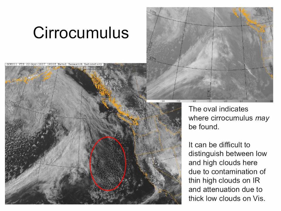
High Clouds (4)
Cirrocumulus (Cc) : cumuliform ice crystal clouds
formed by upward vertical motions in the upper
troposphere. May precede rapidly developing cyclone.
i) Visible imagery thin patches of clouds, gray to
white, usually in advance of a cyclone. Individual
elements often below the resolution of geostationary
sensors.
ii) IR imagery similar to cirrostratus, white to gray
clouds subject to contamination.

Guess? (12:00UTC, this morning, METEOSAT-9)
Cirrostratus
Cirrus
Cirrocumulus

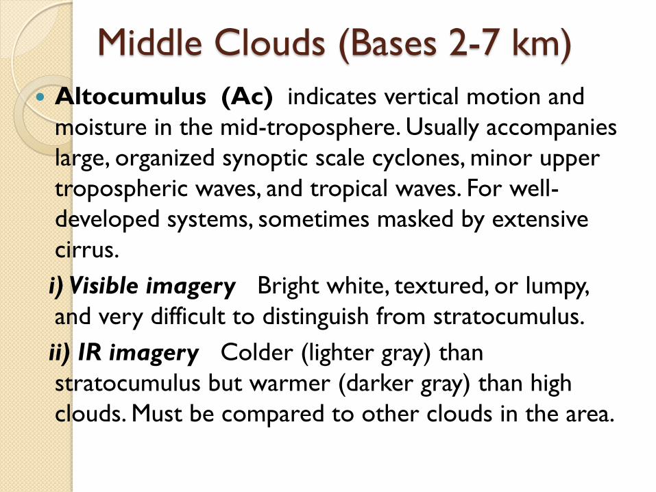
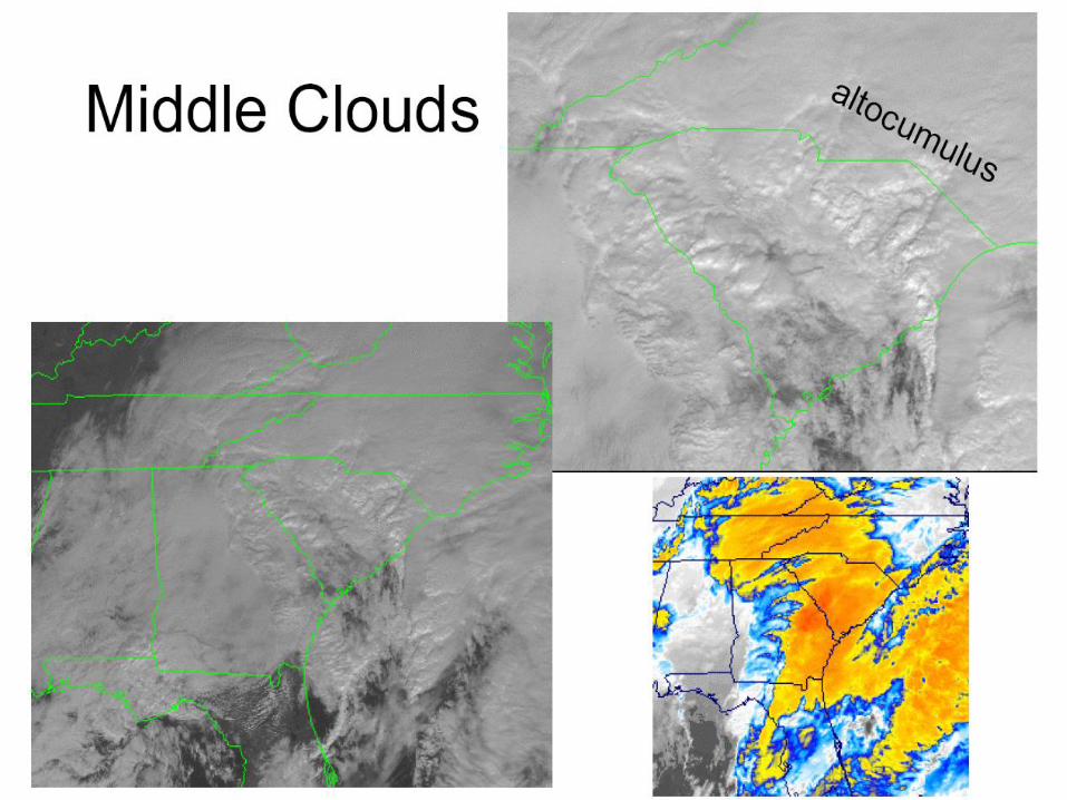
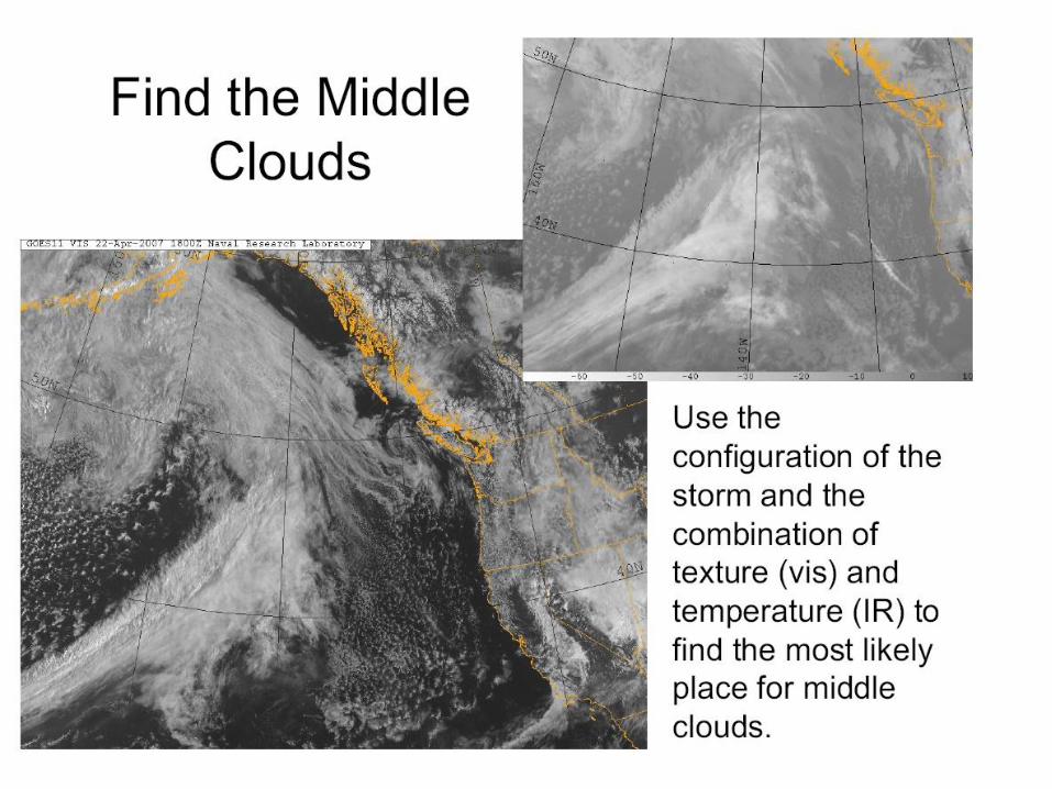
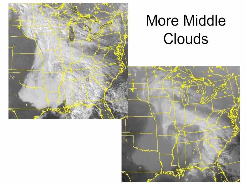
Middle Clouds (Bases 2-7 km)
Altocumulus (Ac) indicates vertical motion and
moisture in the mid-troposphere. Usually accompanies
large, organized synoptic scale cyclones, minor upper
tropospheric waves, and tropical waves. For well-
developed systems, sometimes masked by extensive
cirrus.
i) Visible imagery Bright white, textured, or lumpy,
and very difficult to distinguish from stratocumulus.
ii) IR imagery Colder (lighter gray) than
stratocumulus but warmer (darker gray) than high
clouds. Must be compared to other clouds in the area.
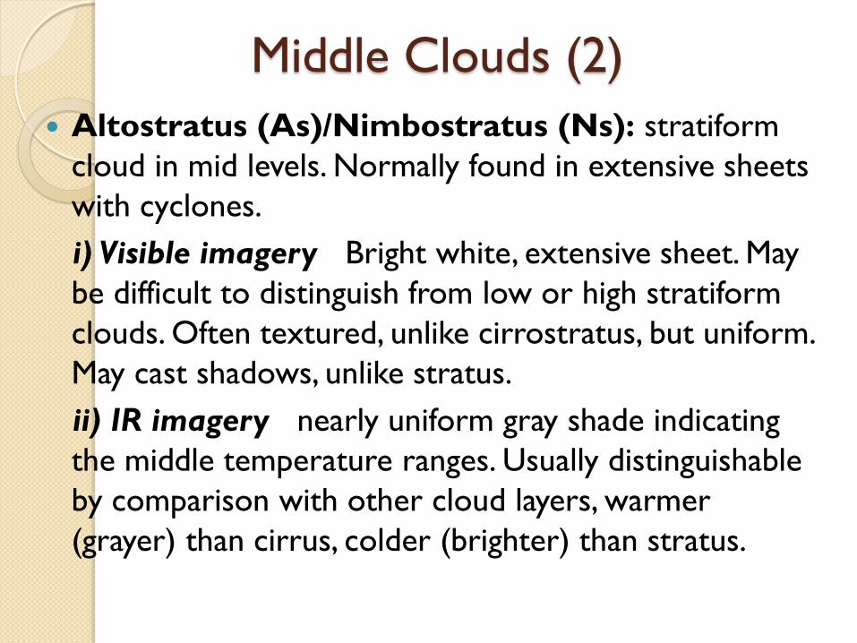
Middle Clouds (2)
Altostratus (As)/Nimbostratus (Ns): stratiform
cloud in mid levels. Normally found in extensive sheets
with cyclones.
i) Visible imagery Bright white, extensive sheet. May
be difficult to distinguish from low or high stratiform
clouds. Often textured, unlike cirrostratus, but uniform.
May cast shadows, unlike stratus.
ii) IR imagery nearly uniform gray shade indicating
the middle temperature ranges. Usually distinguishable
by comparison with other cloud layers, warmer
(grayer) than cirrus, colder (brighter) than stratus.
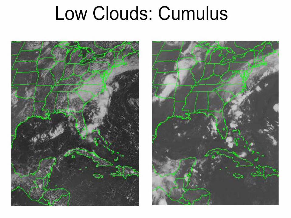
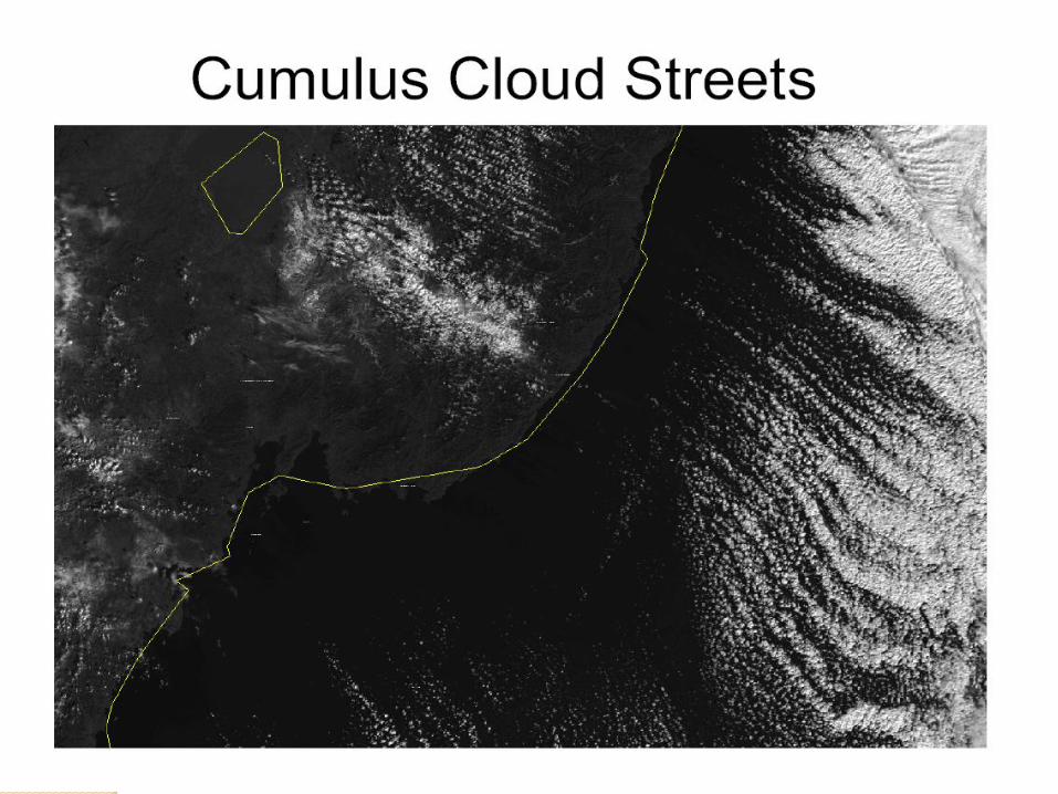
Low Clouds (Bases below 2 km)
Cumulus (Cu): similar to detached cauliflower-like clouds
with sharp outlines. Often, a region of unorganized cumulus
(“popcorn”) forms over landmasses during fair weather.
Cumulus clusters whose edges are clearly visible are
referred to as “open cell” cumuli.
i) Visible imagery scattered individual elements are often
below the resolution of geostationary sensors and appear
as gray areas due to contamination. Large individual
elements and groups of broken cumulus appear as bright
white blobs of clouds.
ii) IR imagery only large areas show due to
contamination, appearing as dark gray blobs.
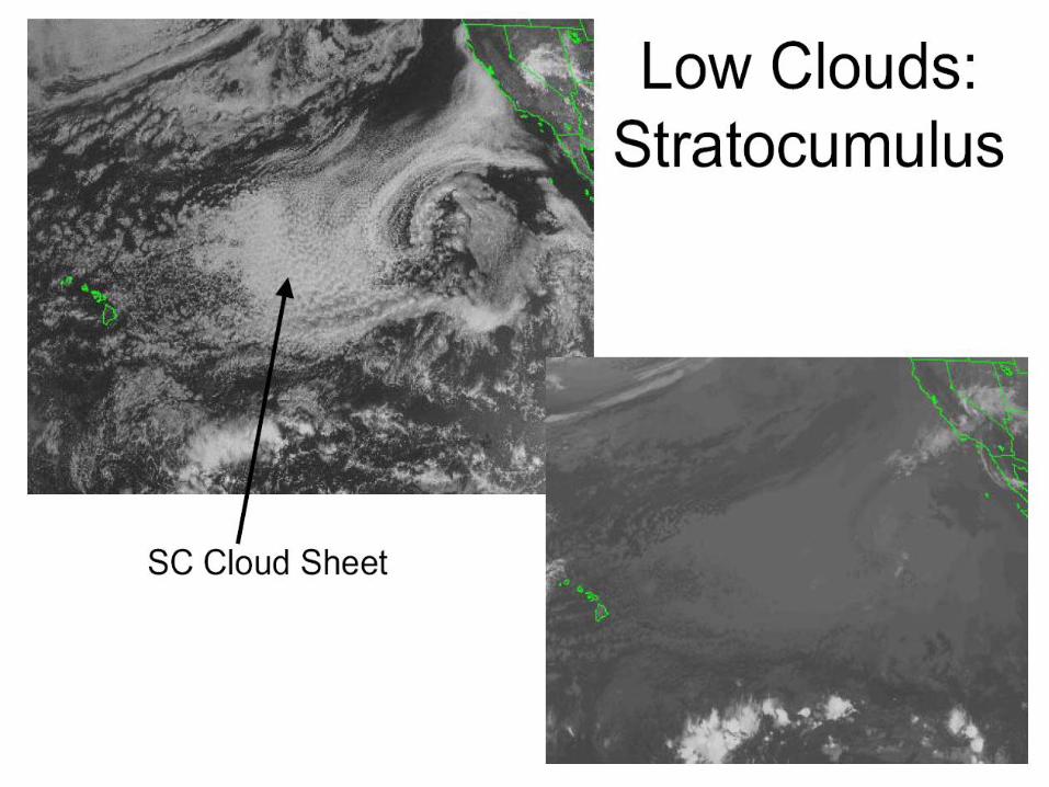
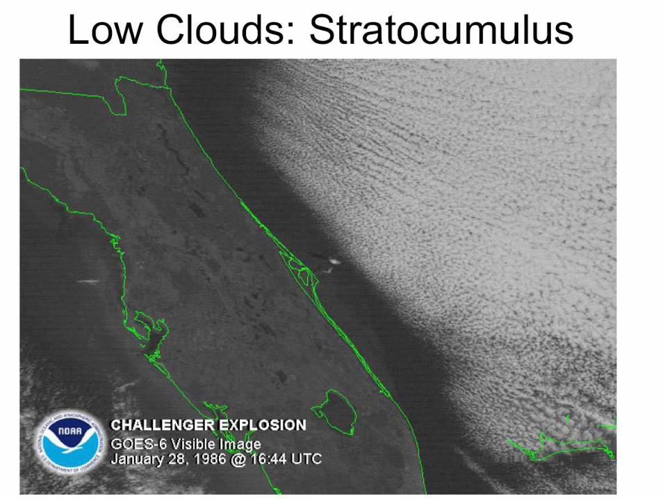
Low Clouds (2) Stratocumulus (Sc) formed by the spreading of cumulus or
convective development of stratus.
i) Visible imagery light gray to white, appearing in cloud lines
or sheets composed of parallel rolls. Textures are noticeable.
ii) IR imagery Dark gray, often difficult to distinguish from the
surface due to contamination. Cellular or textured nature often
not observed.
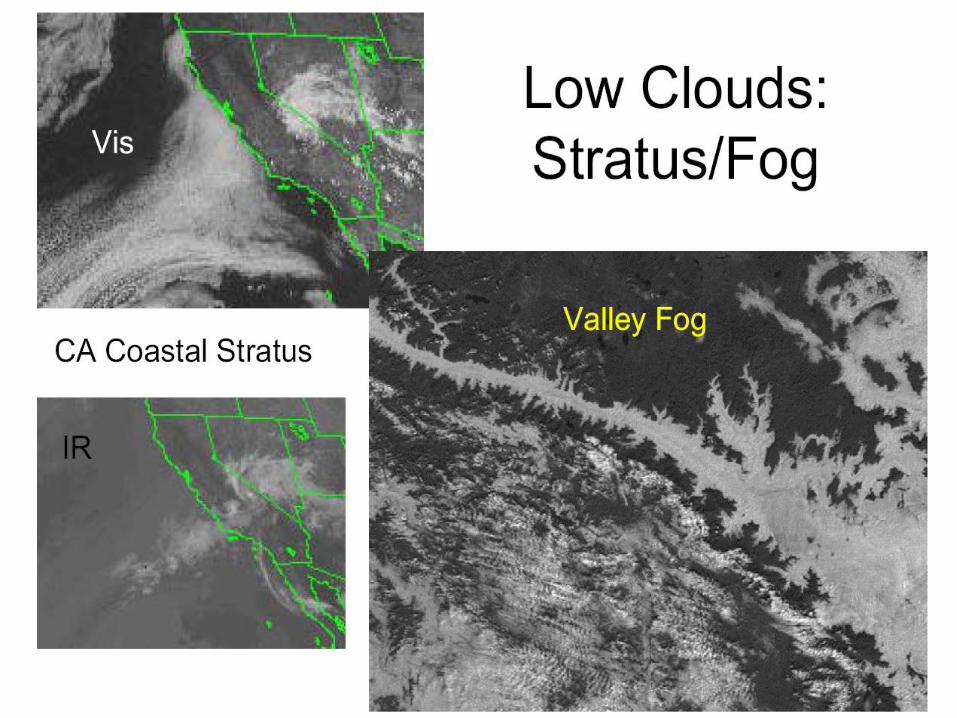
Low Clouds (3) Stratus and Fog caused by various means. Large
areas of stratus are found over cold ocean currents, as
warm subsiding air underneath anticyclones meets the
cold water below.
i) Visible imagery white to gray, uniform, smooth
sheet, except when terrain features penetrate above
the stratus tops. Coastal and valley stratus often
outlines the surrounding terrain.
ii) IR imagery nearly invisible due to lack of contrast
between the surface and cloud top temperatures.
Occasionally, stratus forming beneath a radiation
inversion will appear warmer (darker) than the surface,
and is called “black” stratus.
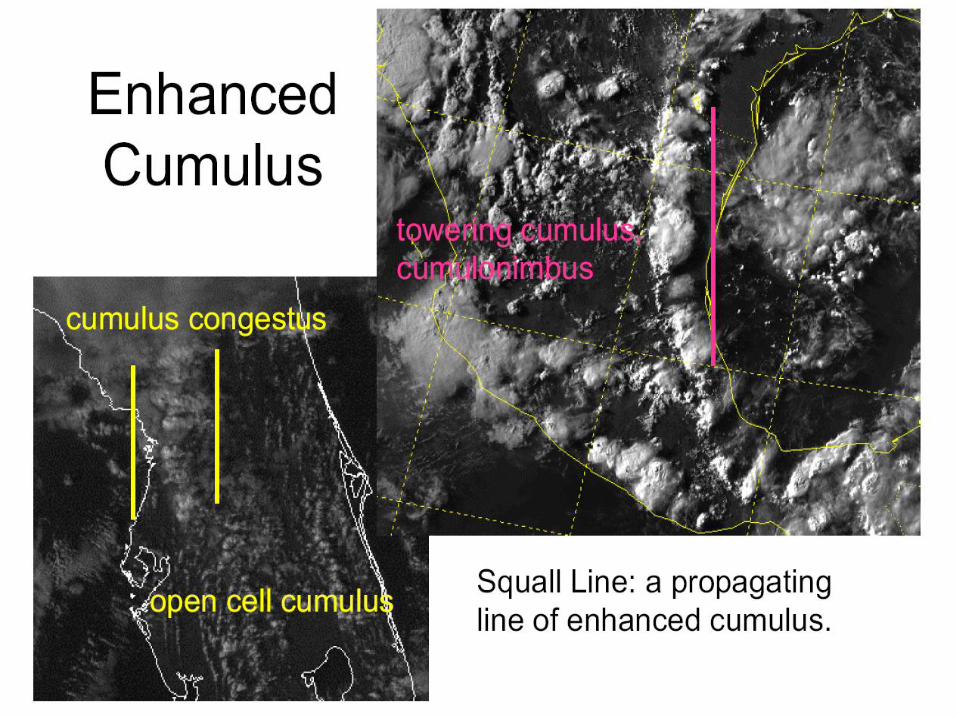
Miscellaneous Cloud Forms Open Cell Cumulus cumulus clusters whose edges
are clearly visible.
Enhanced Cumulus area of cumulus congestus,
towering cumulus, or cumulonimbus clouds. Associated
with fronts, PVA, or orography, and appear as very
bright dots in a field of otherwise uniform open cell
cumulus.
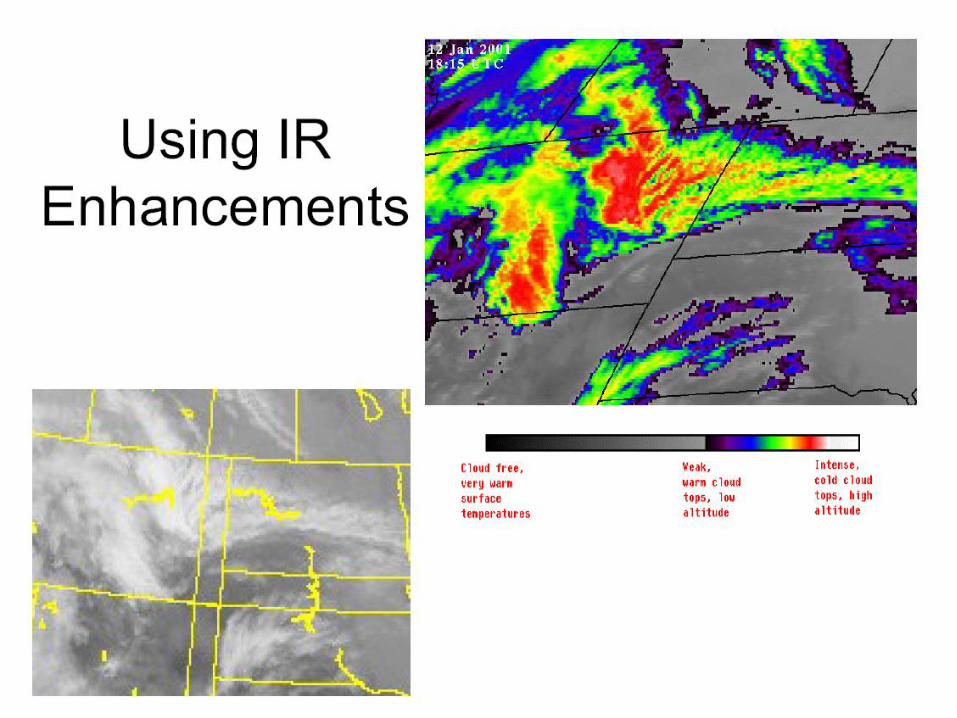
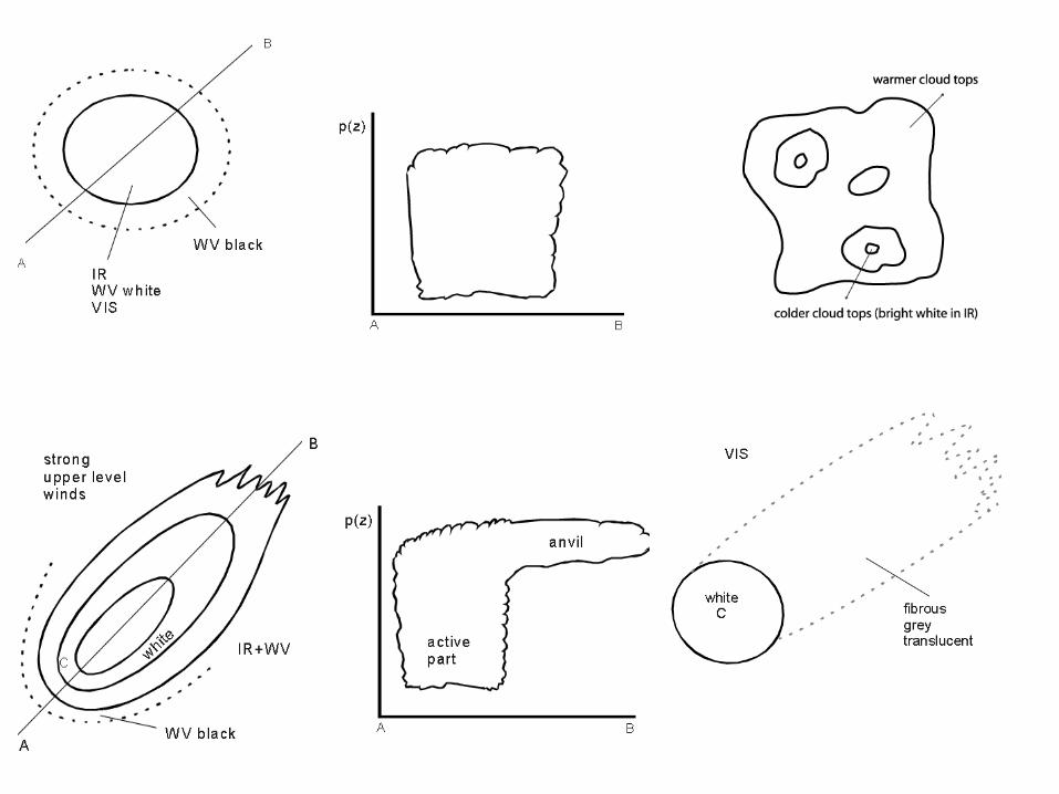
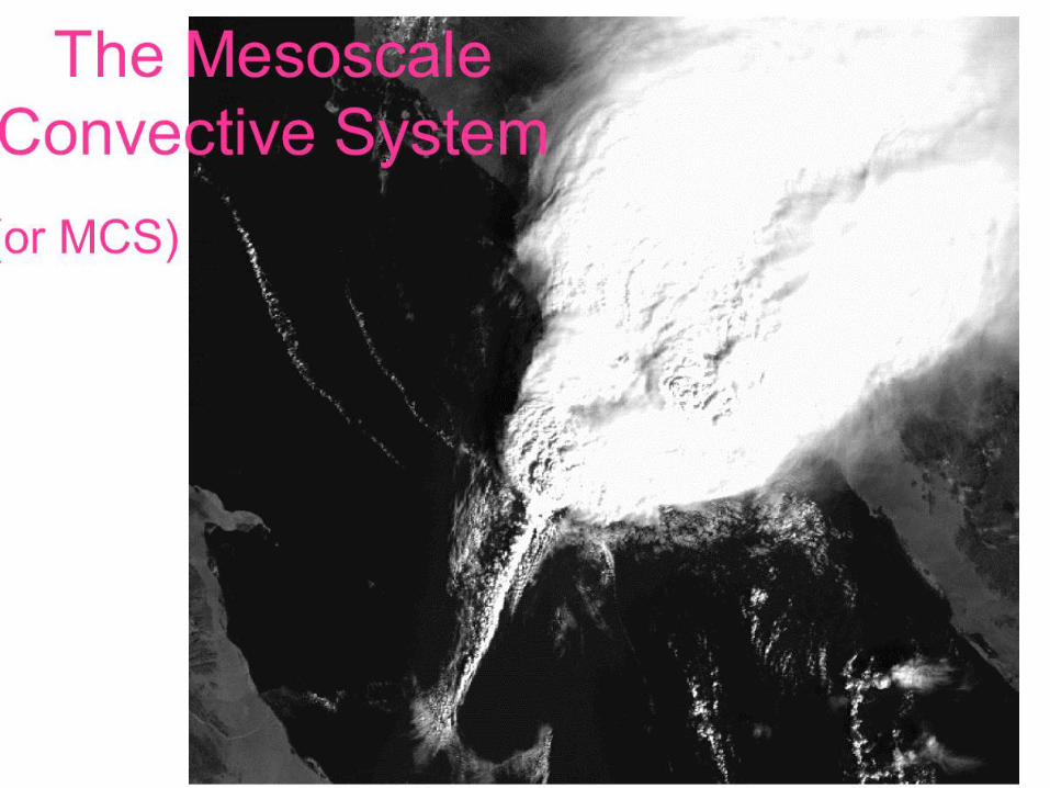
Mesoscale Convective System (MCS) In the satellite images an MCS looks like a mesoscale cloud
cluster, which has a circular or oval shape depending on
upper level wind strength.
In IR, WV and VIS images MCS are characterized by high pixel
values (white) in the active part, indicating cloudiness which
extends through the whole troposphere.
The upstream edges of the cloud cluster are generally very
sharp. In situations with high upper level winds, the high cloud is
transported downstream leading to an extended white cloud
shield in the IR but a fibrous grey texture in the VIS image. The
brightest grey shades can be found in the active part upstream.
In the case of MCSs consisting of several independent sub-
storms, the cloud patches have more irregular appearance and
distribution of cloud top height. In such cases VIS images show a
lumpy appearance.
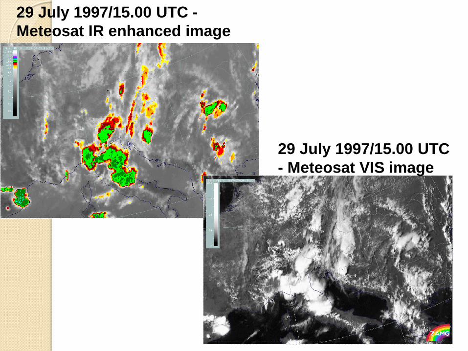
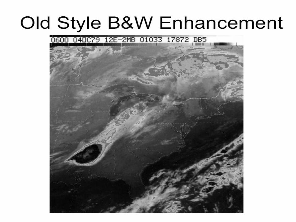
29 July 1997/15.00 UTC -
Meteosat IR enhanced image
29 July 1997/15.00 UTC
- Meteosat VIS image
Half-hour IR image loop showing the
development of MCSs:
http://rammb.cira.colostate.edu/wmovl/V
RL/Tutorials/SatManu-
eumetsat/SATMANU/CMs/Cb/loop1.htm
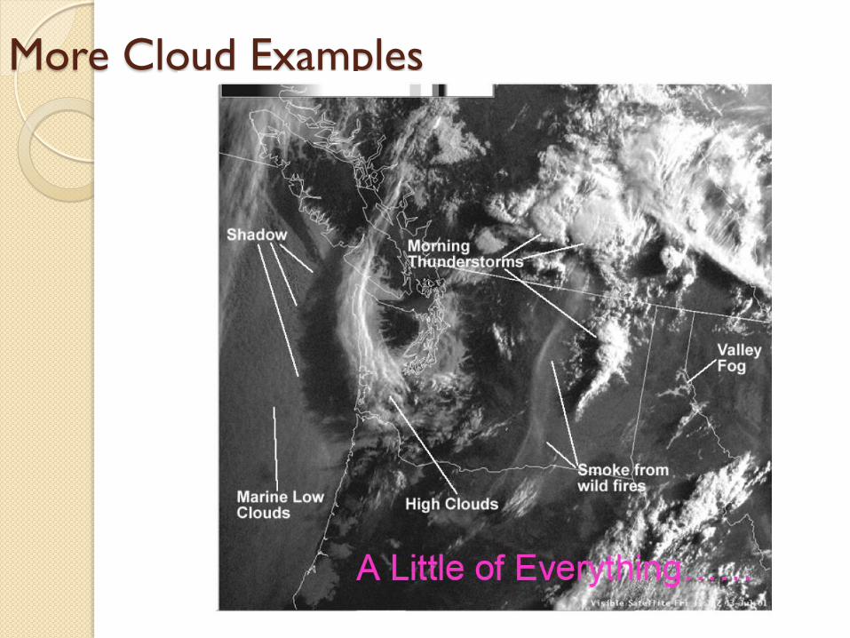
More Cloud Examples