Embed Size (px)
Citation preview
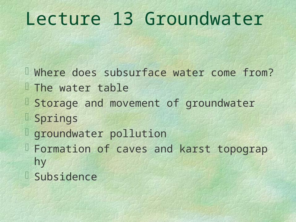
Lecture 13 Groundwater
Where does subsurface water come from?The water tableStorage and movement of groundwaterSpringsgroundwater pollutionFormation of caves and karst topographySubsidence
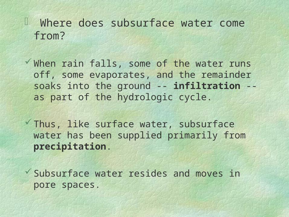
Where does subsurface water come from?
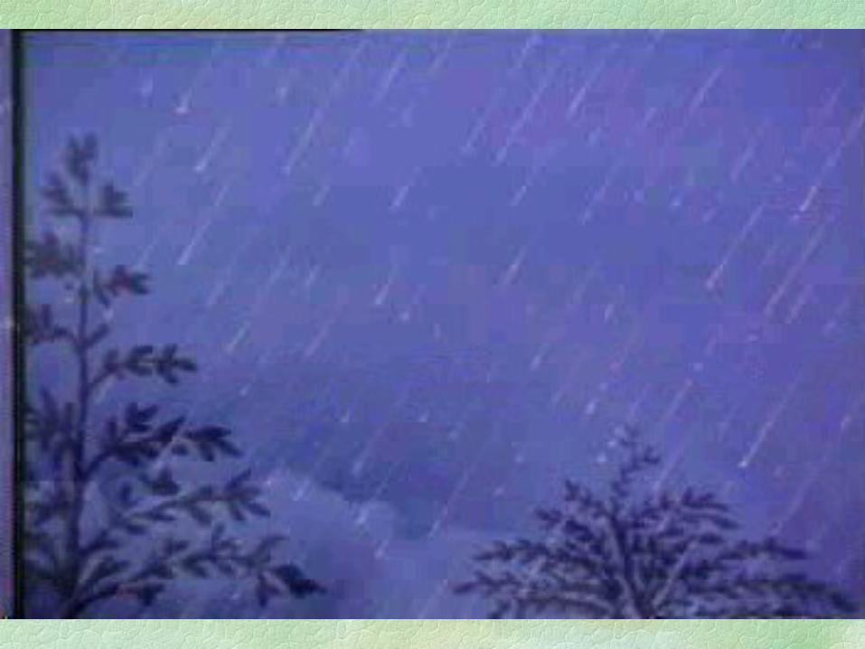
When rain falls, some of the water runs off, some evaporates, and the remainder soaks into the ground -- infiltration -- as part of the hydrologic cycle.
Thus, like surface water, subsurface water has been supplied primarily from precipitation.
Subsurface water resides and moves in pore spaces.
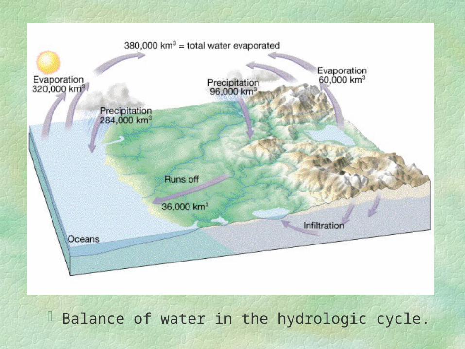
Balance of water in the hydrologic cycle.
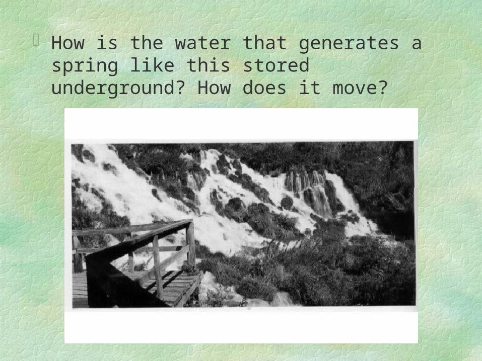
How is the water that generates a spring like this stored underground? How does it move?
Storage and movement of groundwater
Porosity
Porosity is the amount of pore space in a soil or rock as a percentage of the total volume. Porosity determines the amount of groundwater that can be stored. (Table 15.1
p.329 lists porosities of soil and rock.)
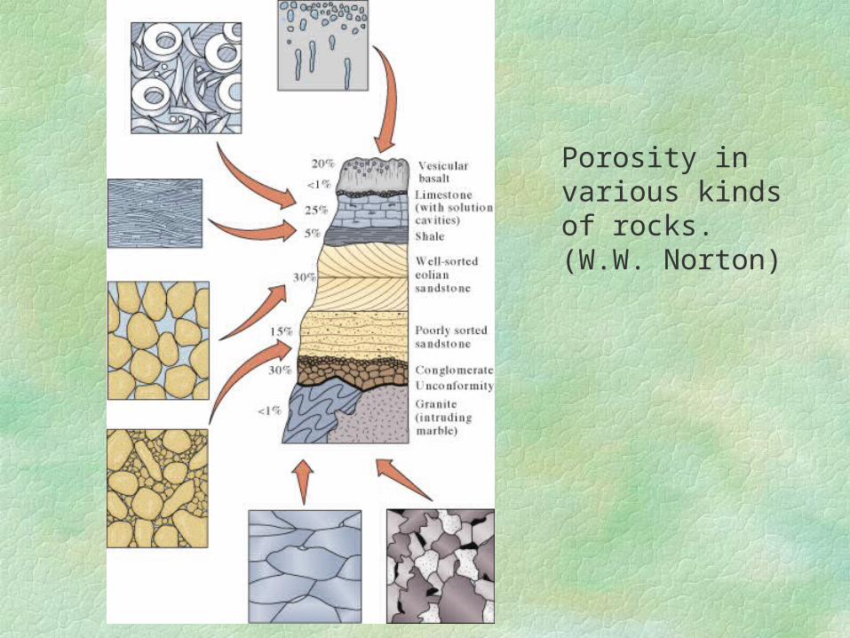
Porosity in various kinds of rocks. (W.W. Norton)

Permeability Permeability measures the ability of soil or rock to
allow the passage of fluids, e.g. the permeability of sands and gravels is much higher than that of clay.
Impermeable layers that hinder water movement are called aquitards (such as clay layers). Permeable rock layers that transmit groundwater freely are called aquifers (such as layers of sands and gravels).
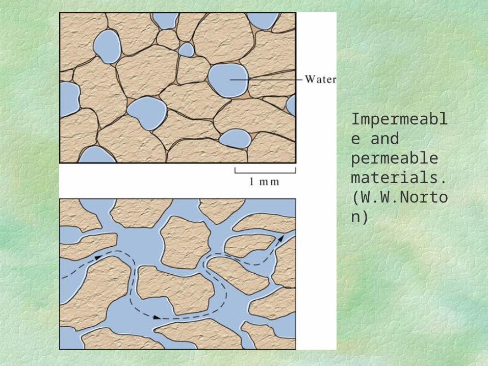
Impermeable and permeable materials. (W.W.Norton)
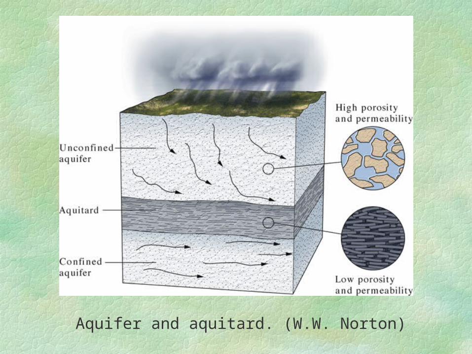
Aquifer and aquitard. (W.W. Norton)
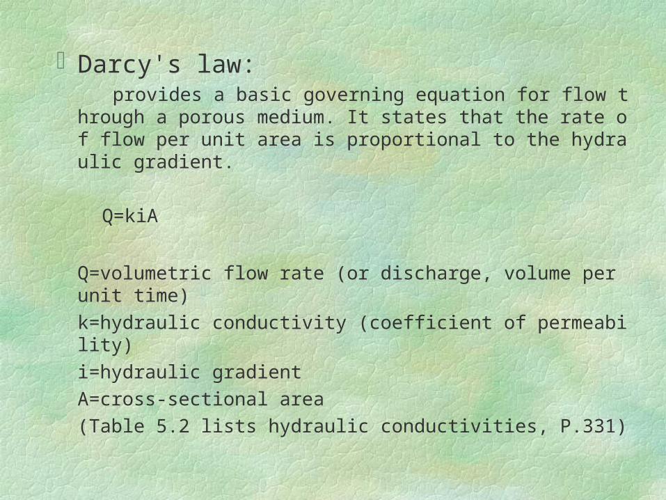
Darcy's law: provides a basic governing equation for flow through a porou
s medium. It states that the rate of flow per unit area is proportional to the hydraulic gradient.
Q=kiA
Q=volumetric flow rate (or discharge, volume per unit time)
k=hydraulic conductivity (coefficient of permeability)
i=hydraulic gradient
A=cross-sectional area
(Table 5.2 lists hydraulic conductivities, P.331)
The water table
Part of the water that soaks into the ground is held by plants near the surface. Water that is not held in this zone of soil moisture can go downward until it reaches a zone of saturation where all the open pore spaces are filled with water. Water within the zone of saturation is called groundwater. The upper surface of the groundwater is known as water table.
When a well is drilled a short distance into the saturated zone, the level of water in the well coincides with the water table.
The water table is rarely level; its shape is usually a subdued replica of the surface topography.
The most important reason for this is that groundwater moves very slowly, thus frequent enough rain falls keep water piled up even in the high areas.
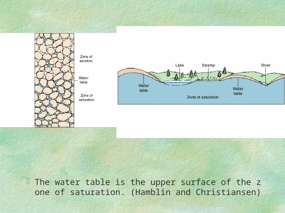
The water table is the upper surface of the zone of saturation. (Hamblin and Christiansen)

Distribution of subsurface water. The shape of the water table is usually a subdued replica of the surface topography. During periods of drought, the water table falls, reducing streamflow and drying up some wells. (Tarbuck and Lutgents)
Springs Springs are mysterious to many people: they flow
constantly freely from the ground in seemingly inexhaustible supply but with no obvious source.
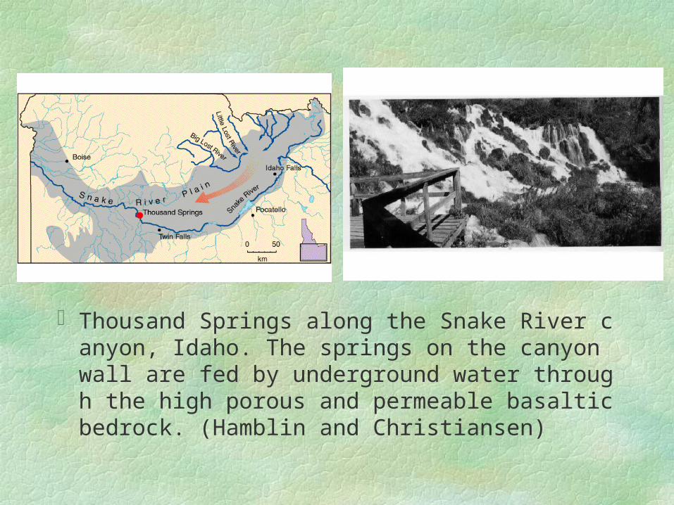
Thousand Springs along the Snake River canyon, Idaho. The springs on the canyon wall are fed by underground water through the high porous and permeable basaltic bedrock. (Hamblin and Christiansen)
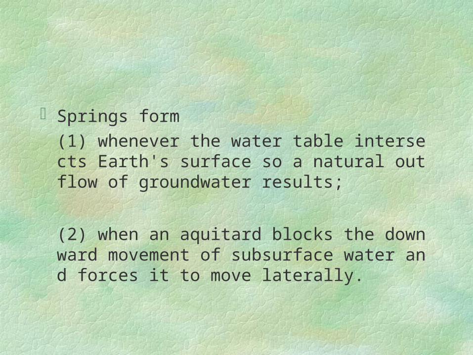
Springs form (1) whenever the water table intersects Earth's surf
ace so a natural outflow of groundwater results;
(2) when an aquitard blocks the downward movement of subsurface water and forces it to move laterally.
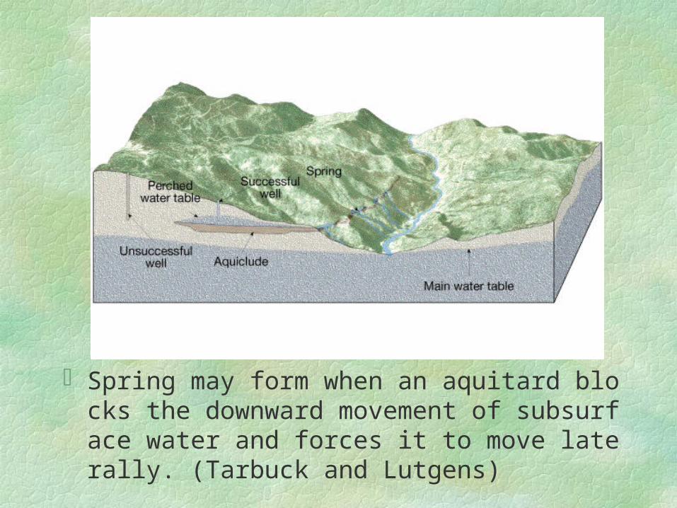
Spring may form when an aquitard blocks the downward movement of subsurface water and forces it to move laterally. (Tarbuck and Lutgens)
Groundwater pollution Groundwater pollution is a serious matter in areas where
groundwater is used as water supply.
Septic tanks
Septic tanks are widely used by households in some area that lack full sewer networks. Sewage water is discharged into the soil to be filtered out. The drainage of septic tanks should be placed at sufficient distance from water wells in shallow aquifers.
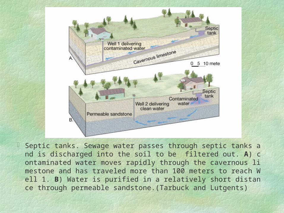
Septic tanks. Sewage water passes through septic tanks and is discharged into the soil to be filtered out. A) contaminated water moves rapidly through the cavernous limestone and has traveled more than 100 meters to reach Well 1. B) Water is purified in a relatively short distance through permeable sandstone.(Tarbuck and Lutgents)
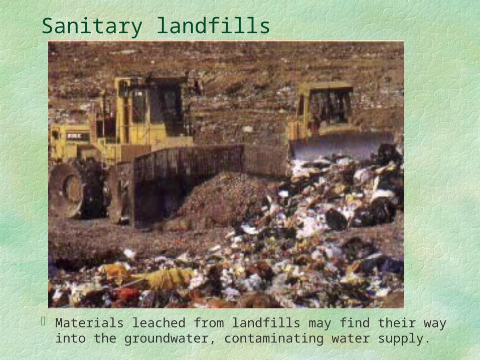
Sanitary landfills
Materials leached from landfills may find their way into the groundwater, contaminating water supply.
Sanitary landfills … Fine-grained soils such as clay provide a more de
sirable landfill site than coarser-grained soils.
1) Finer soils have a lower permeability.
2) Finer soils are able to exchange heavy toxic cations in the wastes (such as lead, zinc, chromium, and mercury) with Na, Ca, and Mg cations.
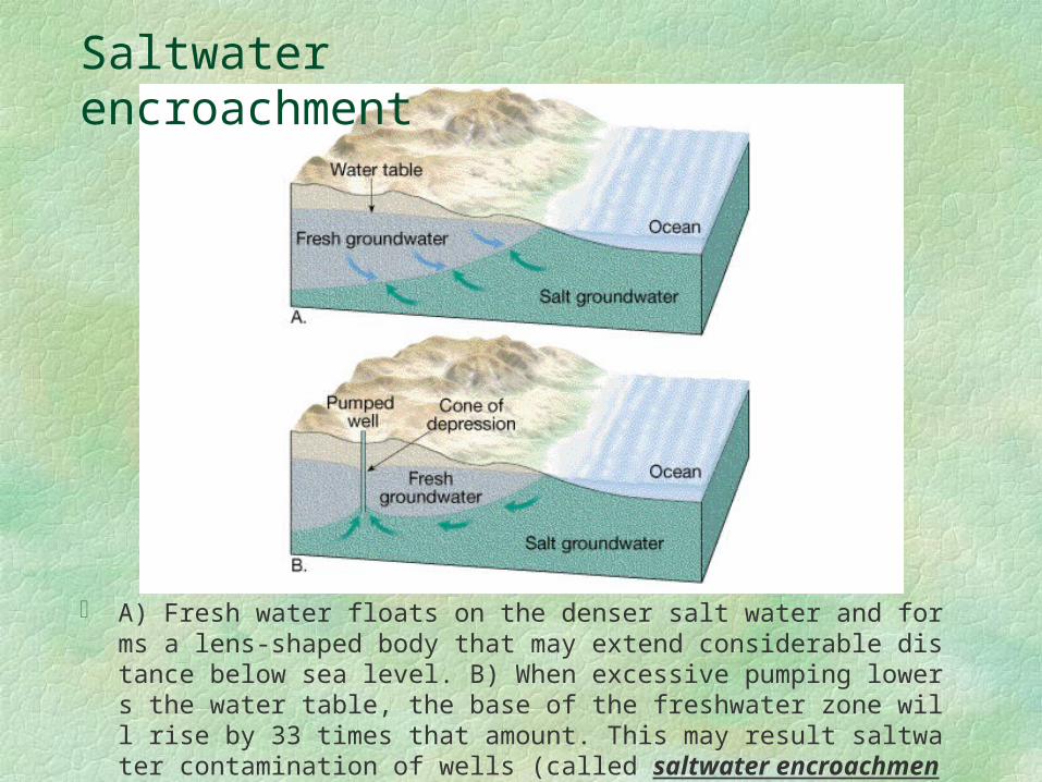
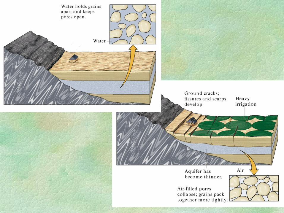
A) Fresh water floats on the denser salt water and forms a lens-shaped body that may extend considerable distance below sea level. B) When excessive pumping lowers the water table, the base of the freshwater zone will rise by 33 times that amount. This may result saltwater contamination of wells (called saltwater encroachment). (Tarbuck and Lutgens)
Saltwater encroachment

Formation of caves and karst topography
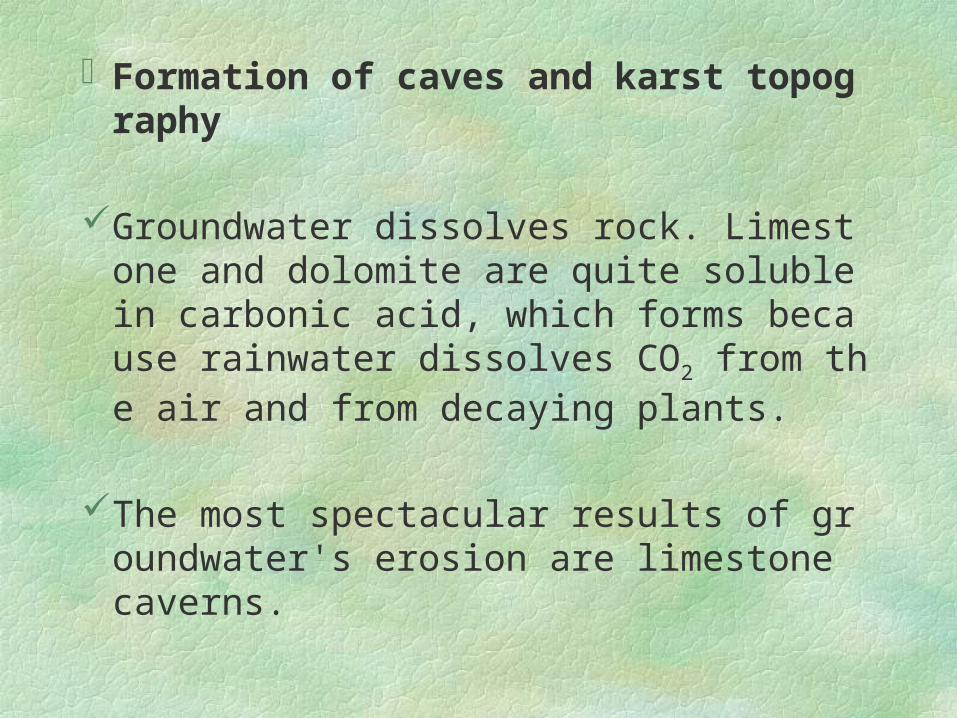
Groundwater dissolves rock. Limestone and dolomite are quite soluble in carbonic acid, which forms because rainwater dissolves CO2 from the air and from decaying plants.
The most spectacular results of groundwater's erosion are limestone caverns.

A soda straw “forest” in Carlsbad Caverns, New Mexico. When a water drop reaches air in the cave, some of the dissolved carbon dioxide escapes from the drop and calcite precipitates.
Karst topography (after Kras Plateau in Slovenia) is another result of the dissolving power of groundwater in a limestone or dolomite region.
Karst areas have irregular terrain sinkholes.
Sinkholes can form gradually as the limestone below the soil is dissolved and the surface is gradually lowered. They can also form abruptly when the roof of a cavern collapses.
Karst areas in the U.S. appear in limestone regions in SW Illinois, southern Indiana, central Tennessee, Kentucky, Alabama, Florida, and Texas.
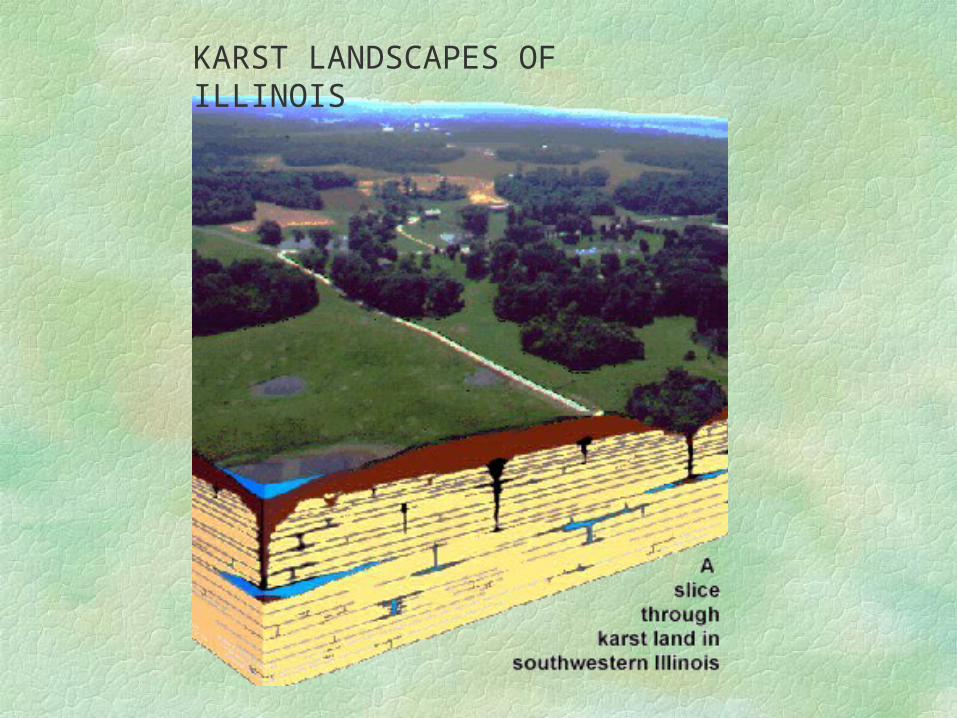
KARST LANDSCAPES OF ILLINOIS
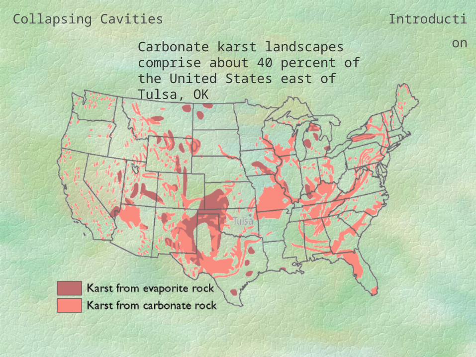
Collapsing Cavities Introduction
Carbonate karst landscapes comprise about 40 percent of the United States east of Tulsa, OK
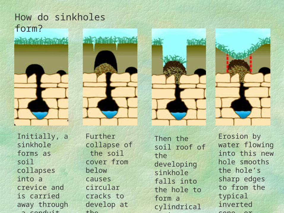
How do sinkholes form?
Initially, a sinkhole forms as soil collapses into a crevice and is carried away through a conduit by water.
Further collapse of the soil cover from below causes circular cracks to develop at the surface.
Then the soil roof of the developing sinkhole falls into the hole to form a cylindrical cavity.
Erosion by water flowing into this new hole smooths the hole’s sharp edges to from the typical inverted cone- or bowl-shaped depression.
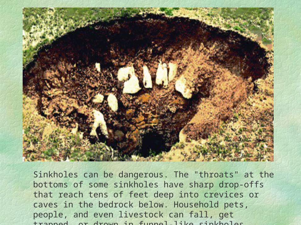
Sinkholes can be dangerous. The "throats" at the bottoms of some sinkholes have sharp drop-offs that reach tens of feet deep into crevices or caves in the bedrock below. Household pets, people, and even livestock can fall, get trapped, or drown in funnel-like sinkholes.
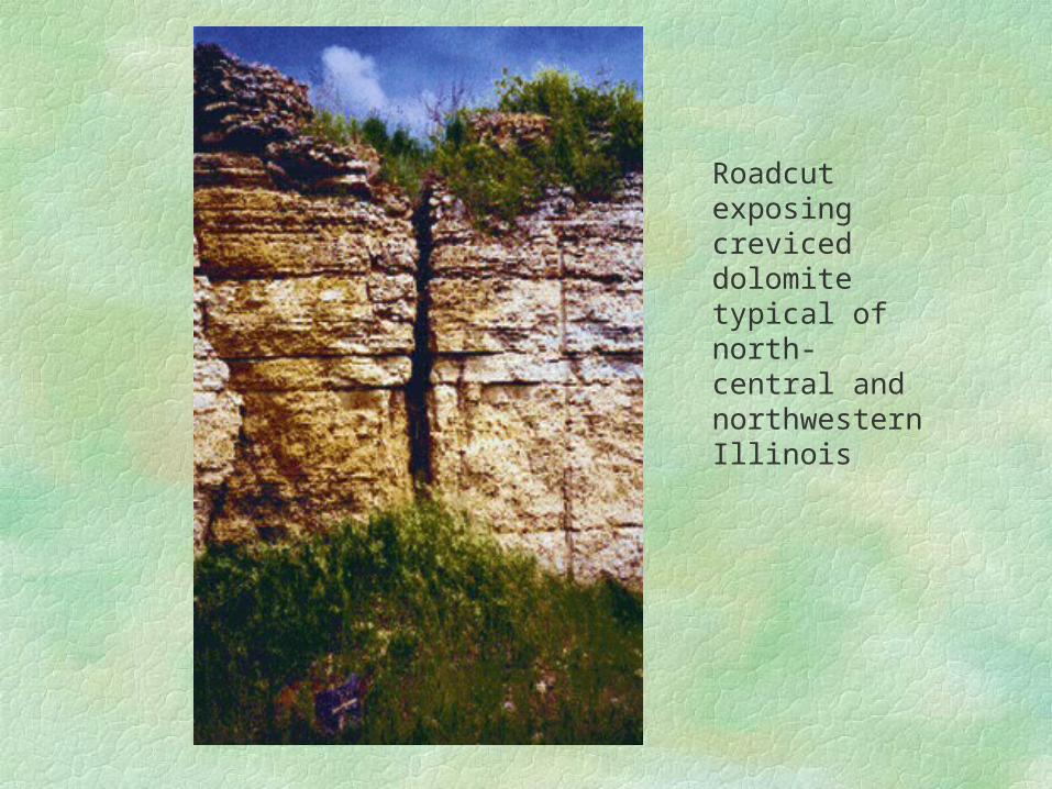
Roadcut exposing creviced dolomite typical of north-central and northwestern Illinois
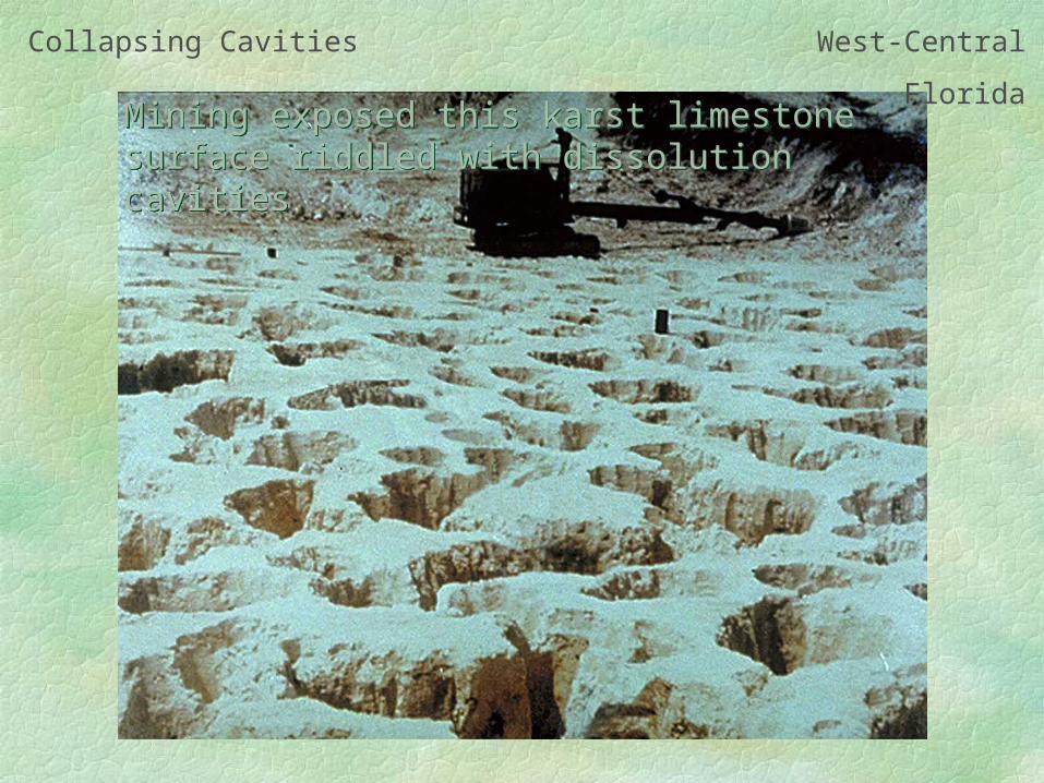
Collapsing Cavities West-Central Florida
Mining exposed this karst limestone surface riddled with dissolution cavitiesMining exposed this karst limestone surface riddled with dissolution cavities
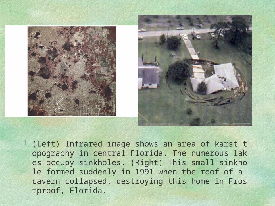
(Left) Infrared image shows an area of karst topography in central Florida. The numerous lakes occupy sinkholes. (Right) This small sinkhole formed suddenly in 1991 when the roof of a cavern collapsed, destroying this home in Frostproof, Florida.

Subsidence
When groundwater is withdrawn faster than natural recharge, significant subsidence can occur, damaging construction, water supply lines, sewers, and roads.
This is particularly pronounced in the areas of unconsolidated sediments. As the water is withdrawn and the water pressure drops, the sediments undergo additional compaction, causing the ground to subside.

The marks on this utility pole (left) indicate the level of the surrounding land in preceding years. Between 1925 and 1975 this part of the San Joaquin Valley (right) subsided almost 9 meters because of the withdrawal of groundwate and the resulting compaction of sediments.
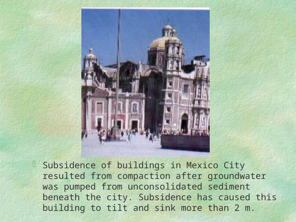
Subsidence of buildings in Mexico City resulted from compaction after groundwater was pumped from unconsolidated sediment beneath the city. Subsidence has caused this building to tilt and sink more than 2 m.
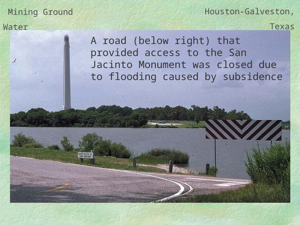
Mining Ground
Water
Houston-Galveston,
Texas
A road (below right) that provided access to the San Jacinto Monument was closed due to flooding caused by subsidence
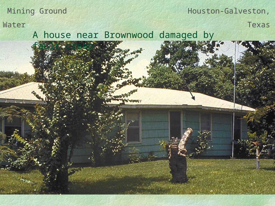
Mining Ground
Water
Houston-Galveston,
TexasA house near Brownwood damaged by fault creep