Embed Size (px)
Citation preview

9
SOUTHERN SCOTTSDALE COMMUNITY AREA PLAN
1 �LAND USE,GROWTH & ACTIVITY AREAS
IntroductionLand Use, Growth and Activity Area elements will assist in transforming the Southern Scottsdale vision into the built environment of the community. Additionally, these elements will guide infi ll, revitalization, reinvestment, and new local and regional development opportunities through the establishment of goals, policies, and implementation strategies.
Over the years, Southern Scottsdale has evolved from a predominantly agricultural area into a community of residential neighborhoods framed by commercial corridors. To maintain the positive attributes of Southern Scottsdale and seize new opportunities for the area, the public and private sectors should explore innovative development ideas, encourage land use and development fl exibility, and provide a coordinated approach to local and regional development and economic revitalization. To accomplish this end, land use and growth policies must encourage a mix of land uses, height and density fl exibility, and quality of development that enhances Southern Scottsdale’s overall quality of life.
Th e land use and growth area goals and policies expressed in this chapter promote the vision for Southern Scottsdale’s future, encourage the deliberate management of change, and rely on a collaborative process between the public and private sectors to accomplish the transformation of Southern Scottsdale into a continuing dynamic community.
10
1.1 � CHAPTER 1: Land Use, Growth & Activ i ty Areas
Goals and Policies
GOAL LU 1 PROMOTE RESIDENTIAL REINVESTMENT AND REVITALIZATION THROUGH REGULATORY FLEXIBILITY.
Update land use regulations to allow for the revitalization and/or expansion of residential properties to current market standards.
Encourage new residential development and revitalization that complements the established urban form.
Provide flexibility in residential mixed-use development standards to encourage revitalization of properties within higher density areas of Southern Scottsdale.
GOAL LU 2 CREATE A HIERARCHY OF REGIONAL, OPPORTUNITY, AND RESORT CORRIDORS TO GUIDE FUTURE LAND USE, DEVELOPMENT AND REDEVELOPMENT THROUGHOUT SOUTHERN SCOTTSDALE.
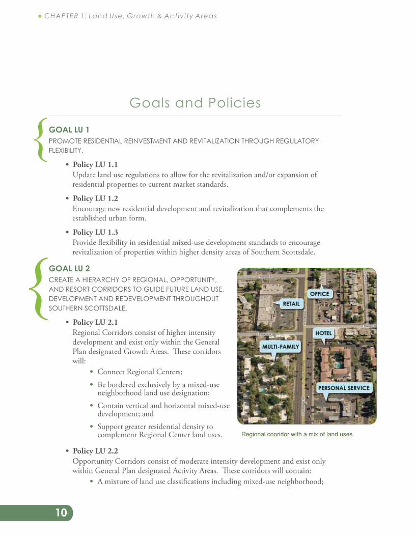
Regional Corridors consist of higher intensity development and exist only within the General Plan designated Growth Areas. These corridors will:
Connect Regional Centers; Be bordered exclusively by a mixed-use
neighborhood land use designation; Contain vertical and horizontal mixed-use
development; and Support greater residential density to
complement Regional Center land uses.
Opportunity Corridors consist of moderate intensity development and exist only within General Plan designated Activity Areas. These corridors will contain:
A mixture of land use classifications including mixed-use neighborhood;
{
{
Regional cooridor with a mix of land uses.
11
SOUTHERN SCOTTSDALE COMMUNITY AREA PLAN
A number of medium to low scale vertical and horizontal mixed-use developments; and
Additional residential density to complement Activity Area land uses.
The Resort Corridor consists of medium to low intensity development and exists along Scottsdale Road between East Highland Drive and Indian Bend Road. This corridor will:
Contain a mixture of land use classifications including mixed-use neighborhood; and
Support, maintain, enhance, and expand hospitality/tourism land uses in Southern Scottsdale.
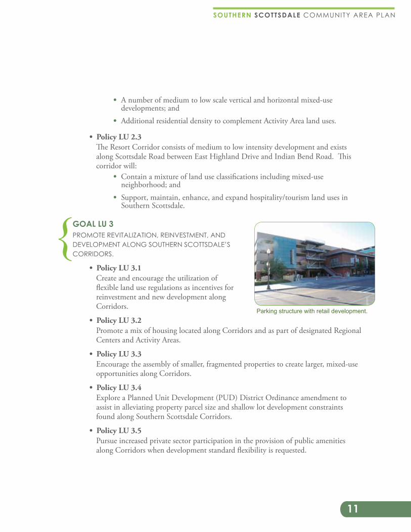
GOAL LU 3 PROMOTE REVITALIZATION, REINVESTMENT, AND DEVELOPMENT ALONG SOUTHERN SCOTTSDALE’S CORRIDORS.
Create and encourage the utilization of flexible land use regulations as incentives for reinvestment and new development along Corridors.
Promote a mix of housing located along Corridors and as part of designated Regional Centers and Activity Areas.
Encourage the assembly of smaller, fragmented properties to create larger, mixed-use opportunities along Corridors.
Explore a Planned Unit Development (PUD) District Ordinance amendment to assist in alleviating property parcel size and shallow lot development constraints found along Southern Scottsdale Corridors.
Pursue increased private sector participation in the provision of public amenities along Corridors when development standard flexibility is requested.
{Parking structure with retail development.
12
1.1 � CHAPTER 1: Land Use, Growth & Activ i ty Areas
AR
IZO
NA
CA
NA
L
CRO
SS
CU
T
CA
NA
L
Indian Bend
McDonald
ContinentalActivity Area
Thomas Crosscut
Activity Area
Activity Area
Activity AreaScottsdale RoadRegional Corridor
Resort Corridor
McDowell Road Regional Corridor
Regional CenterRegional Center Regional Center
PimaSkysongPapago
Regional Center
Activity Area
Regional Corridor
Resort Corridor
Opportunity Corridor
LEGENDConceptual Centers and Corridors
1 Mile
N
5 Minute Walk
HAYD
EN
ROA
D
SCO
TTSD
ALE
ROA
D
64TH
STR
EET
54TH
STR
EET
PIM
A R
OA
D
MIL
LER
ROA
D
68TH
STR
EET
GRA
NITE
REE
F
ROA
D
MCDONALD DRIVE
INDIAN BEND ROAD
CHAPARRAL ROAD
CAMELBACK ROAD
INDIAN SCHOOL ROAD
THOMAS ROAD
MCDOWELL ROAD
MCKELLIPS ROAD
ROOSEVELT STREET
OAK STREET
OSBORN ROAD
JACKRABBIT ROAD
T O W N O FP A R A D I S E V A L L E Y
C I T Y O FP H O E N I X
C I T Y O FT E M P E
S A L T R I V E RP I M A -
M A R I C O P AI N D I A N
C O M M U N I T Y
Pim
a 10
1 C
orrid
or
SeeDowntown
Plan
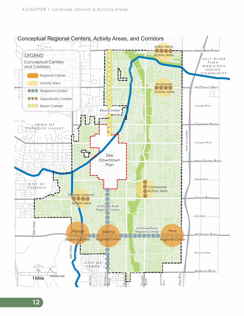
Conceptual Regional Centers, Activity Areas, and Corridors
13
SOUTHERN SCOTTSDALE COMMUNITY AREA PLAN
Encourage a diversity of new development, redevelopment, and infill projects that incorporate vertical and horizontal mixed-use development along Southern Scottsdale Corridors.
Develop partnerships between the city and private sector to provide convenient, safe, clean, and accessible public parking to meet the revitalization and development needs along Southern Scottsdale Corridors.
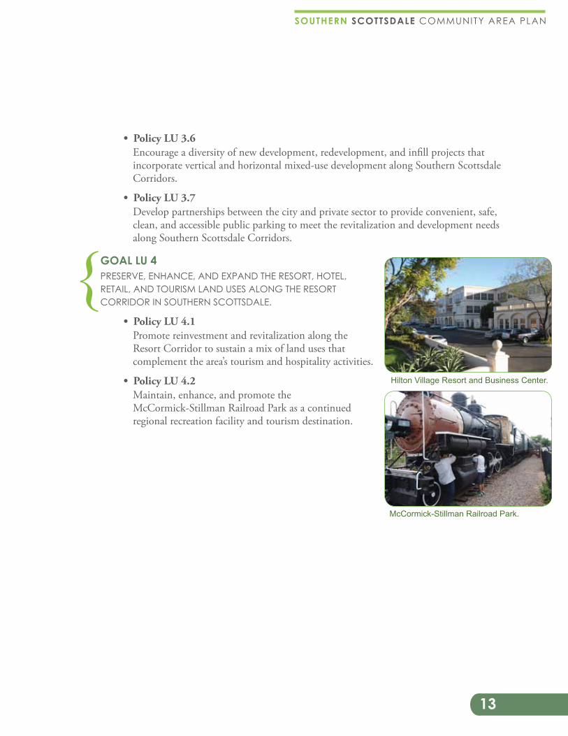
GOAL LU 4 PRESERVE, ENHANCE, AND EXPAND THE RESORT, HOTEL, RETAIL, AND TOURISM LAND USES ALONG THE RESORT CORRIDOR IN SOUTHERN SCOTTSDALE.
Promote reinvestment and revitalization along the Resort Corridor to sustain a mix of land uses that complement the area’s tourism and hospitality activities.
Maintain, enhance, and promote the McCormick-Stillman Railroad Park as a continued regional recreation facility and tourism destination.
McCormick-Stillman Railroad Park.
{Hilton Village Resort and Business Center.
14
1.1 � CHAPTER 1: Land Use, Growth & Activ i ty Areas
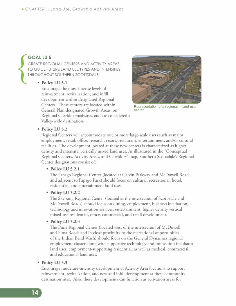
GOAL LU 5 CREATE REGIONAL CENTERS AND ACTIVITY AREAS TO GUIDE FUTURE LAND USE TYPES AND INTENSITIES THROUGHOUT SOUTHERN SCOTTSDALE.
Encourage the most intense levels of reinvestment, revitalization, and infill development within designated Regional Centers. These centers are located within General Plan designated Growth Areas, on Regional Corridor roadways, and are considered a Valley-wide destination.
Regional Centers will accommodate one or more large-scale users such as major employment, retail, office, research, resort, restaurant, entertainment, and/or cultural facilities. The development located at these new centers is characterized as higher density and intensity, vertically mixed land uses. As illustrated in the “Conceptual Regional Centers, Activity Areas, and Corridors” map, Southern Scottsdale’s Regional Center designations consist of:
The Papago Regional Center (located at Galvin Parkway and McDowell Road and adjacent to Papago Park) should focus on cultural, recreational, hotel, residential, and entertainment land uses.
The SkySong Regional Center (located at the intersection of Scottsdale and McDowell Roads) should focus on dining, employment, business incubation, technology and innovation services, entertainment, higher density vertical mixed-use residential, office, commercial, and retail development.
The Pima Regional Center (located west of the intersection of McDowell and Pima Roads and in close proximity to the recreational opportunities of the Indian Bend Wash) should focus on the General Dynamics regional employment cluster along with supportive technology and innovation incubator land uses, employment-supporting residential, as well as medical, commercial, and educational land uses.
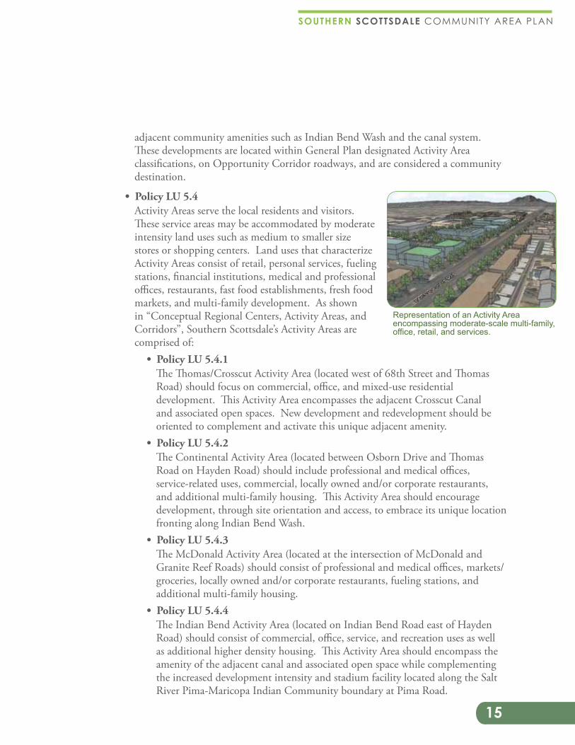
Encourage moderate-intensity development at Activity Area locations to support reinvestment, revitalization, and new and infill development at these community destination sites. Also, these developments can function as activation areas for
{Representation of a regional, mixed-use center.
15
SOUTHERN SCOTTSDALE COMMUNITY AREA PLAN
adjacent community amenities such as Indian Bend Wash and the canal system. These developments are located within General Plan designated Activity Area classifications, on Opportunity Corridor roadways, and are considered a community destination.
Activity Areas serve the local residents and visitors. These service areas may be accommodated by moderate intensity land uses such as medium to smaller size stores or shopping centers. Land uses that characterize Activity Areas consist of retail, personal services, fueling stations, financial institutions, medical and professional offices, restaurants, fast food establishments, fresh food markets, and multi-family development. As shown in “Conceptual Regional Centers, Activity Areas, and Corridors”, Southern Scottsdale’s Activity Areas are comprised of:
The Thomas/Crosscut Activity Area (located west of 68th Street and Thomas Road) should focus on commercial, office, and mixed-use residential development. This Activity Area encompasses the adjacent Crosscut Canal and associated open spaces. New development and redevelopment should be oriented to complement and activate this unique adjacent amenity.
The Continental Activity Area (located between Osborn Drive and Thomas Road on Hayden Road) should include professional and medical offices, service-related uses, commercial, locally owned and/or corporate restaurants, and additional multi-family housing. This Activity Area should encourage development, through site orientation and access, to embrace its unique location fronting along Indian Bend Wash.
The McDonald Activity Area (located at the intersection of McDonald and Granite Reef Roads) should consist of professional and medical offices, markets/groceries, locally owned and/or corporate restaurants, fueling stations, and additional multi-family housing.
The Indian Bend Activity Area (located on Indian Bend Road east of Hayden Road) should consist of commercial, office, service, and recreation uses as well as additional higher density housing. This Activity Area should encompass the amenity of the adjacent canal and associated open space while complementing the increased development intensity and stadium facility located along the Salt River Pima-Maricopa Indian Community boundary at Pima Road.
Representation of an Activity Area encompassing moderate-scale multi-family, office, retail, and services.
16
1.1 � CHAPTER 1: Land Use, Growth & Activ i ty Areas
Regional Centers and Activity Areas will act as catalysts for the development and redevelopment of associated corridors within the character area.
Enhance transportation and infrastructure availability, efficiency, delivery, and management systems to accommodate development activity in designated Regional Centers, Growth/Activity Areas, and Corridors.
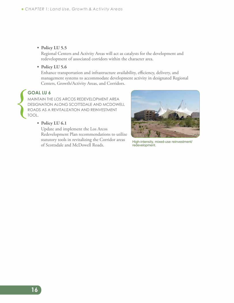
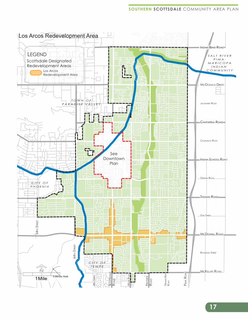
GOAL LU 6 MAINTAIN THE LOS ARCOS REDEVELOPMENT AREA DESIGNATION ALONG SCOTTSDALE AND MCDOWELL ROADS AS A REVITALIZATION AND REINVESTMENT TOOL.
Update and implement the Los Arcos Redevelopment Plan recommendations to utilize statutory tools in revitalizing the Corridor areas of Scottsdale and McDowell Roads.
{High-intensity, mixed-use reinvestment/redevelopment.
17
SOUTHERN SCOTTSDALE COMMUNITY AREA PLAN
AR
IZO
NA
CA
NA
L
CRO
SS
CU
T
CA
NA
L
Los ArcosRedevelopment Area
LEGENDScottsdale DesignatedRedevelopment Areas
1 Mile
N
5 Minute Walk
HAYD
EN
ROA
D
SCO
TTSD
ALE
ROA
D
64TH
STR
EET
54TH
STR
EET
PIM
A R
OA
D
MIL
LER
ROA
D
68TH
STR
EET
GRA
NITE
REE
F
ROA
D
MCDONALD DRIVE
INDIAN BEND ROAD
CHAPARRAL ROAD
CAMELBACK ROAD
INDIAN SCHOOL ROAD
THOMAS ROAD
MCDOWELL ROAD
MCKELLIPS ROAD
ROOSEVELT STREET
OAK STREET
OSBORN ROAD
JACKRABBIT ROADT O W N O F
P A R A D I S E V A L L E Y
C I T Y O FP H O E N I X
C I T Y O FT E M P E
S A L T R I V E RP I M A -
M A R I C O P AI N D I A N
C O M M U N I T Y
SeeDowntown
Plan
Los Arcos Redevelopment Area
18
1.1 � CHAPTER 1: Land Use, Growth & Activ i ty Areas
GOAL LU 7 PROVIDE LAND USE TRANSITIONS, BUFFERING, AND CONNECTIVITY BETWEEN DOWNTOWN DEVELOPMENT AND SOUTHERN SCOTTSDALE’S SURROUNDING RESIDENTIAL NEIGHBORHOODS.
Recognize the benefits of Downtown Scottsdale’s commercial and employment generating land uses while protecting Southern Scottsdale’s residential neighborhoods from incompatible adjoining land uses.
Support the Downtown Plan development buffer and transition goals and policies to mitigate Downtown’s higher intensity land uses with surrounding Southern Scottsdale lower intensity development.
Encourage greater connectivity between the Downtown and surrounding Southern Scottsdale neighborhoods by increasing the accessibility and frequency of local and regional multi-modal transportation connections and enhancing pedestrian and bicycling opportunities.
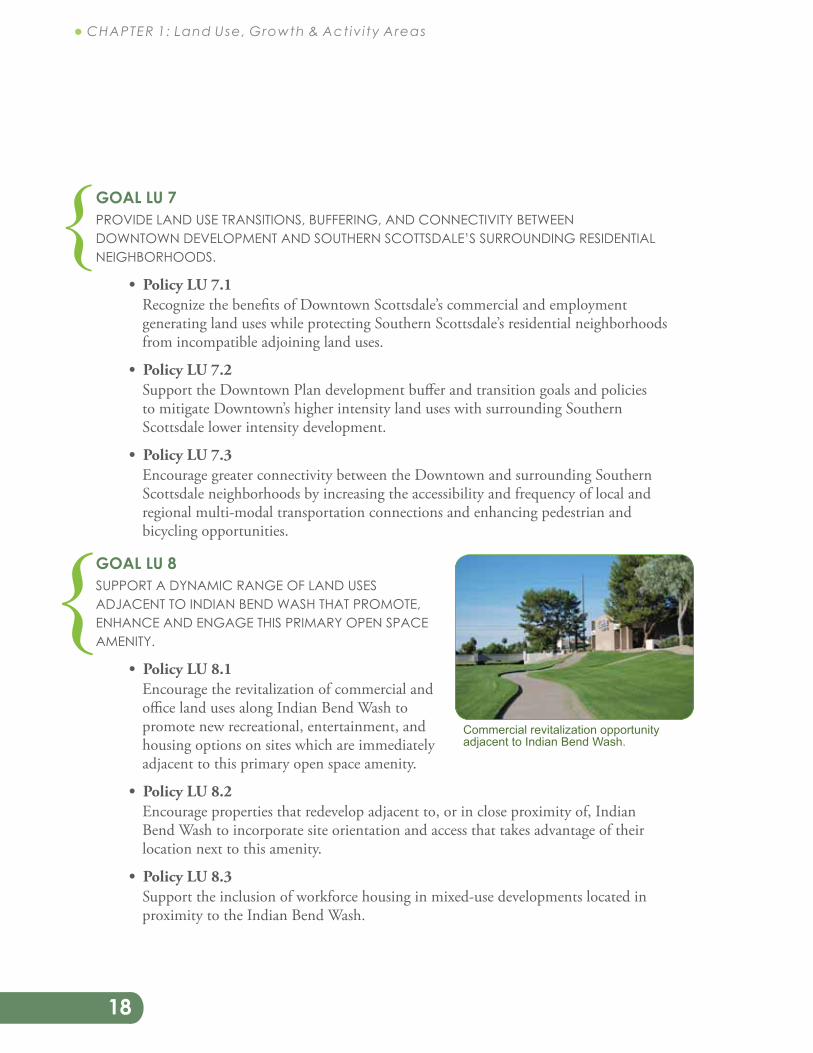
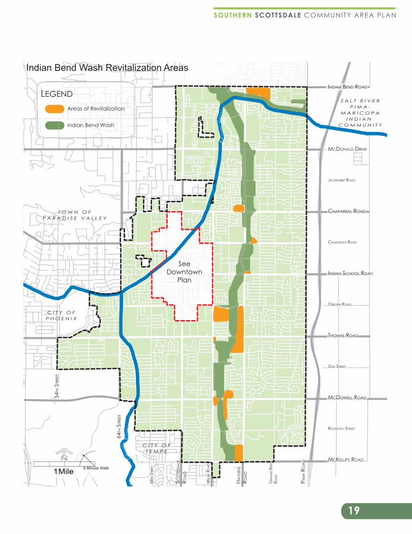
GOAL LU 8 SUPPORT A DYNAMIC RANGE OF LAND USES ADJACENT TO INDIAN BEND WASH THAT PROMOTE, ENHANCE AND ENGAGE THIS PRIMARY OPEN SPACE AMENITY.
Encourage the revitalization of commercial and office land uses along Indian Bend Wash to promote new recreational, entertainment, and housing options on sites which are immediately adjacent to this primary open space amenity.
Encourage properties that redevelop adjacent to, or in close proximity of, Indian Bend Wash to incorporate site orientation and access that takes advantage of their location next to this amenity.
Support the inclusion of workforce housing in mixed-use developments located in proximity to the Indian Bend Wash.
{
{Commercial revitalization opportunity adjacent to Indian Bend Wash.
19
SOUTHERN SCOTTSDALE COMMUNITY AREA PLAN
LEGENDAreas of Revitalization
Indian Bend Wash
1 Mile
N
5 Minute Walk
HAYD
EN
ROA
D
SCO
TTSD
ALE
ROA
D
64TH
STR
EET
54TH
STR
EET
PIM
A R
OA
D
MIL
LER
ROA
D
68TH
STR
EET
GRA
NITE
REE
F
ROA
D
MCDONALD DRIVE
INDIAN BEND ROAD
CHAPARRAL ROAD
CAMELBACK ROAD
INDIAN SCHOOL ROAD
THOMAS ROAD
MCDOWELL ROAD
MCKELLIPS ROAD
ROOSEVELT STREET
OAK STREET
OSBORN ROAD
JACKRABBIT ROAD
T O W N O FP A R A D I S E V A L L E Y
C I T Y O FP H O E N I X
C I T Y O FT E M P E
S A L T R I V E RP I M A -
M A R I C O P AI N D I A N
C O M M U N I T Y
Indian Bend Wash Revitalization Areas
AR
IZO
NA
CA
NA
L
CRO
SS
CU
T
CA
NA
L
SeeDowntown
Plan

20
1.1 � CHAPTER 1: Land Use, Growth & Activ i ty Areas
GOAL LU 9 CREATE NEW DEVELOPMENT AND CONNECTIVITY OPPORTUNITIES BETWEEN PAPAGO PARK AND SOUTHERN SCOTTSDALE.
Support more intense land uses adjacent to Papago Park that are tourism and regional destinations including (but not limited to): mixed-use, hotel, specialty attractions, housing, recreation, retail, and support services.
Develop destination-oriented entertainment and cultural facilities such as an outdoor concert venue and/or theater, a convention center, a resort, and a museum in close proximity to Papago Park.
Promote pedestrian and bicycle connectivity between Southern Scottsdale and Papago Park.
GOAL LU 10 ADAPT LAND USE AND REGULATORY POLICIES AND STANDARDS TO ACHIEVE THE GOALS OF THE SOUTHERN SCOTTSDALE COMMUNITY AREA PLAN.
As necessary, update General Plan land use categories and designations, growth and activity areas, and Transportation Master Plan Character Types classifications in order to promote new development and revitalization in targeted location throughout Southern Scottsdale.
Encourage the examination, evaluation, and relevancy of existing zoning districts in Southern Scottsdale.
Support regional cooperation and flexibility of cross border or community bordering land uses that provides mutually beneficial outcomes regarding existing or future commercial, employment, and residential development.
{
{