Embed Size (px)
Citation preview

Expert Meeting: Crowdsource MappingCrowdsource Mapping
for Preparedness and Emergency Reponse
“Land cover, land grabbing and drought: opportunities fordrought: opportunities for
crowdsourcing”crowdsourcing

Why is it so important to improve global land cover?land cover?
Originally focus and applications of land cover datasets where in the field of climate change projectionswhere in the field of climate change projections
Now increasing demand comes from the integrated assessment community and the global biophysical modelling community
Cropland extend has been neglected, but crucial for applications in the field of food security assessing yieldapplications in the field of food security, assessing yield and production gaps,
Cropland extend dataset is also crucially important for investment decisions both by governments as all as foundations (e.g. Gates)
2

Disagreement in Africa in the cropland domain between GLC‐2000 and MODIS v. 5

Motivation to build GEO‐Wiki Problems with global land cover
When different products are compared, there is a lot of disagreement between themlot of disagreement between them One product might say cropland, another grassland
Confusing if you are a user – which one is correct?Confusing if you are a user which one is correct? Which is the best product to use?
Disagreement overall and/or spatially Google Earth/Bing Maps are still the only very high resolution data available to researchers to collect l d l b ll ( l l bvalidation points globally (examples, GlobCover,
latest Chinese product)
4


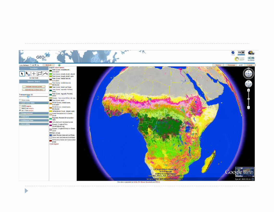
http://Geo‐Wiki.orgttp //Geo o g
Geo‐wiki makes GEO data easy to visualize and analyze.
V l t f d Volunteers from around the globe can classify Google Earth imagery, input their agreement/ disagreement with the existing dataexisting data
6

Geo‐Wiki Project: Disagreement


www.geo-wiki.org
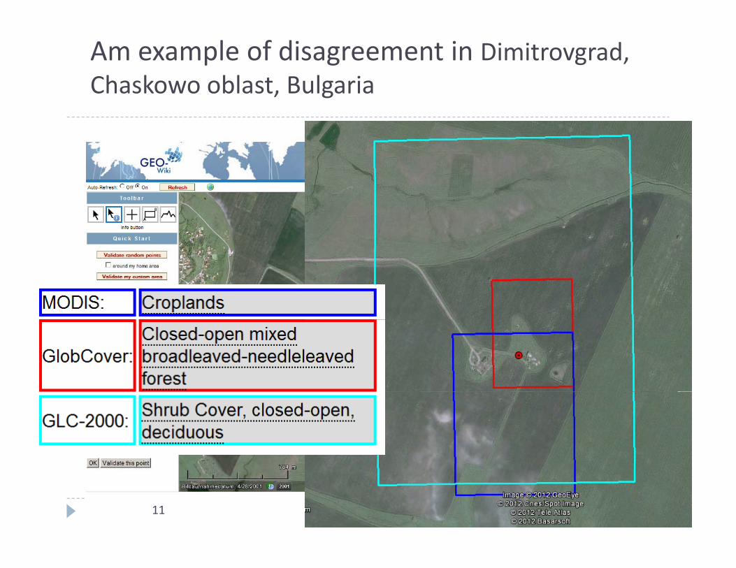
Am example of disagreement in Dimitrovgrad, Chaskowo oblast, Bulgaria
11

Geo‐Wiki Family of Crowdsourcing ToolsGeo Wiki Family of Crowdsourcing Tools
Contributes toOpen Data

Map improvement via crowd‐sourcingp p g
More than 1000 users in more than 120 countries00 000 lid i i > 100,000 validation points
13

14


`


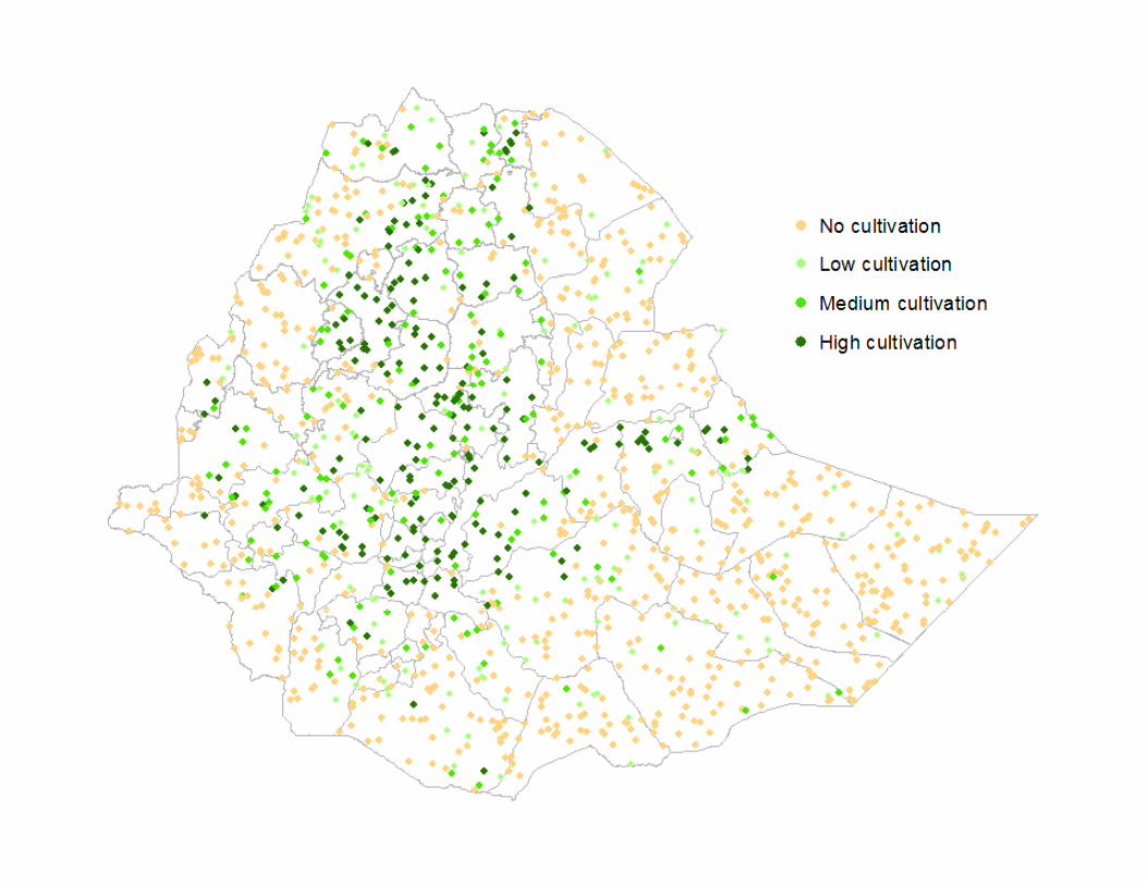
Land AcquisitionAcquisition
Area
+Clear EvidenceClear Evidence of Settlements (from Geo‐Wiki (Hackathon)
=Areas f C fli tof Conflict


Much less marginal land is available
70
80
60
70
40
50
d available (%
)
Only Land cover based
Field size adjusted
20
30
Land Human Impact adjusted
0
10
0S1 S2 S3 S4
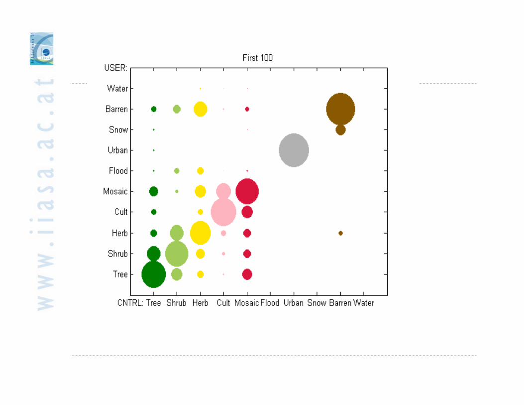

Game for Land Cover validationGame for Land Cover validation
26

Geo‐Wiki mobile – new technologies...
27 Geo‐wiki mobile

Disaster Drought, Northern Hemisphere Crop NDVI AnomaliesAugust 13th 2012August 13th, 2012
RussiaCanada
USA
KazakhstanUkraine
China
‐0.4 0 Worse than
lnormal Better than
normal
Crop NDVI Anomaly IndiaNon CroplandNot shown
normal normal
anomalyanomaly
anomalySpring Wheat Spring Wheat Spring Wheat Winter Wheat/ CornCorn/
Soy
anomalyanomaly
anomaly
Current season crop development (2012)Average season development (2000‐2011)

FarmSupport – APP: Menue

Take a Picture
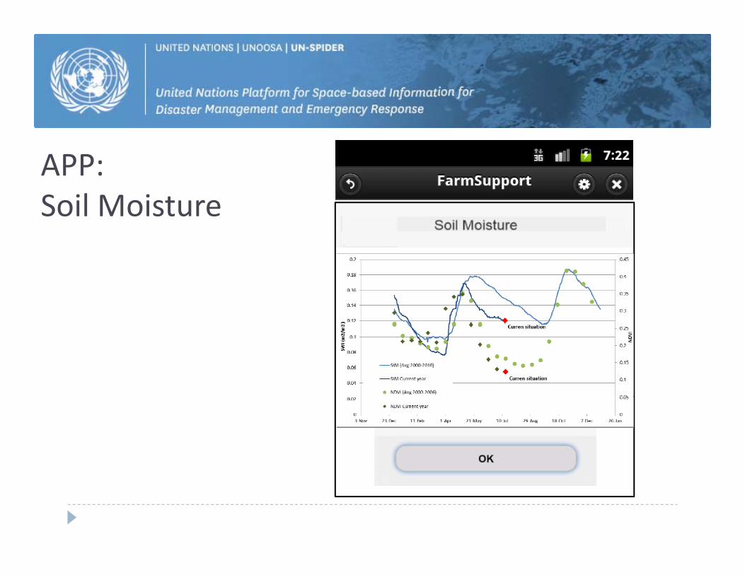
APP: Soil Moisture

FarmSupport – APP: Sample Question

ISPRS Special Issue on: Collaborative Mapping
‐ Thematic and geometric accuracy of collaborative mapping (i.e. quality of the information) ‐ Development of indicators of robustness of / confidence in the VGI‐ Authoritativeness of collaborative map products, i.e. ideas on how to bring collaborative map products to a ‐‐ level of authority that is not disputednot disputed ‐ Data harmonization ‐ Collaborative mapping and the role of mapping institutions ‐ Spatial cognition in collaborative mapping ‐ Cost effectiveness and cost benefits of collaborative mapping ‐ The use of collaborative mapping in the areas of biodiversity, land use science, climate change, emergency response, and other relevant The use of collaborative mapping in the areas of biodiversity, land use science, climate change, emergency response, and other relevantapplied fields
Guest EditorsDr. Linda SeeDr. Steffen FritzDr. Steffen FritzDr. Jan de Leeuw
http://www.mdpi.com/journal/ijgi/special_issues/collaborative‐mapping

Participation in a COST Action
TD1202: Mapping and the Citizen Sensor Started 28/11/2012 – 4 year action We are co‐leading Working Group 1 on Acquiring and Managing VGI
Three other WGs that may be of interest: Three other WGs that may be of interest: WG2: Understanding and influencing contributors WG3: Map production
WG4: Map validation activities WG4: Map validation activities
Email us if you want to participate ([email protected]) or find out more here:
http://www.cost.eu/domains_actions/ict/Actions/TD1202