Embed Size (px)
Citation preview

52H84NEaa27 63.17)1 LAC DES ILES 010
LAC UiS ILffi CLAIM OBOU?
S O l T") l f
GUNNKX LIMITED
Introduction
is H Buiuiuttry report of exploration work in the Lac dee
Iles area during 19&3-
Duriug the latter part of June, W. Baker and O. Moore made a
reconnaissance prospecting trip and fouad widespread low-grade copper-nickel
mineralization in ultra basic rocks B out h of Lac des Iles. The indications
were sufficiently encouraging to warrant additional time being spent i a the
area and subsequently u block of 175 contiguous claims were staked, with
considerable detailed prospecting, geological mapping, and geophysical work
on about 38 of them.
There has been no previous geological work done in the immediate
area and a considerable part of the prospectors' tine was spent iu IMS rely
attesting to establish the boundaries of the favourable ultrabasic intrusive
muss. It I B also of interest that no evidence has been found of any previous
prospecting activity. Tue area of favourable geology apparently was overlooked
by prospectors and geologists because it lies on a height of land and there are
no canoe routes through it.
Property k Location
The property consists of 17^ contiguous claims numbered as follows:
TB 107b^ to 107868 inclusive TB 107872 to 107907 inclusive

.2
TB 108122 to 108126 inclusive TB 108155 to 108184 inclusive Tli 108521 to 108564 inclusive TB 108707 to 108733 inclusive TB 109361 to 109378 inclusive
They are located sixty miles north of Fort William. The only means
of access is by airplaue which ordinarily land on Camp Lake which is about one
mile in length and is located near the centre of the property.
A new all-weather roud, called the Spruce River Boud, takes off from
Highway 17 about three miles east of the city limits of Port Arthur and passes
11 to 12 miles eaiit of the property. An access road to the property would be
fairly easy to construct as the Intervening ground is mostly veil drained and
gently rolling.
Diamond drilling equifntent can be most economically flown in from
iidmona., ./a Lake which IB on trie Spruce River Road. This lake is 45 to 50 miles
from Port Arthur by truck and is 22 air miles to the camp, thus it is within
distance for ths minimum flight rate.
Physical Features
The surface of the gabbro complex body lying south of Lac des Iles
forme a plateau which rises steeply about 200 feet above Lac des Iles and
slopes gently to the west, south and east. The surface in the vicinity of the
mineralized eoues is mostly gently rolling with a shallow cover of overburden
consisting mostly of large boulders. There is little surface water except for
the few scattered ponds. The topography is such that the whole area could be
completely drained by one or two ditches.
General
There is no record of previous geological vork in the immediate area.
A compilation of the existing information on the surrounding areas is shown on

Ontario Department of RI ne B Preliminary Geological Map No. P.1&7, Lac dee
Iles Sheet. However, this iw*p la blank in the area la vhich the claim group
le located. Aeroiaagnet le Survey Map No* 2099G shows anomalous readings over
thw ultrabasic Intrusive body aud work on the ground Indicates that this map
represents the broad geological picture vlth a fair degree of accuracy.
Table of Formations;
DiabaseFine grained basic dikesQuar t x -.feldspar porphyry dikesOranite
Gabbro complexPeridotiteGranite-gneiss
Oranite -Gneiss;
The body of ultrabasic rock referred to as the gabbro complex Is in
contact with granite-gneiss on the vest. This gneiss generally is a medium-
grained light to dark gray rock vhich commonly has a ribbed appearance due to
differential erosion. Most of the banding is from a fraction of an inch to a
fev Inches thick and iu due mainly to the differences in the ratios of light
to dark minerals. Very little vork has been done in this area, but the gneiss
appears to be about one mile in width and to grade into massive gray granite to
the vest. The age relationship of the granite-gneiss with the gabbro is unknown.
Peridotite;
A body of peridotite from 1^ to 2 miles in diameter is believed to lie
under the main part of Lac des Iles. This rock can only be observed at scattered
locations due to the lake and a thin diabase sill capping vhich covers most of the
higher ground. It i e u rusty weathering fine to medium-grained rock and is
considerably serpentini^ed. Tne magnetite content is high and therefore the
aeromagnetic anomaly probably delineates its boundaries. Minor fractures are

.1*
very common and some of the outcrops are highly sheared. Sulphide* are very
fine and sparse but assay results shov low nickel values of about 0*1 to 0.2Jfc.
Gabbro Complex;
A body of mafic rock of various phases consisting of gabbro, norite,
anorthosite and pyroxenite extends in a south-southwest direction from the aain
body of Lac des Iles peridotite. This ultrabasic body appears to be about six
mil*s in length and its southern boundary is about four miles south of Lac des
Iles. It appears to have a maximum width of a little nore than two miles. In
addition to variations in mineral composition It varies from fine grained to
very coarse grained pegmatitic phases. Its magnetic properties are also very
erratic. Much of the rock carries no appreciable magnetite, but in acme areas
the magnetite content is over 50JG. All the occurrences of copper-nickel of any
Importance that have been found to date lie within this assemblage of ultrabasic
rocks.
gabbroic -Gneiss:
The only location where this rock type has been located is near the
southeast end of Centre Lake. It consists of a typical gabbro which has been
intruded by narrow acid dikes in a lit-par-lit fashion. It l* uncertain whether
this is a distinctive rock type or if it is a part of a fault cone with the narrow
acid dikes intruded along the planes of shearing.
Oranite;
On the east side the gabbro complex is in contact with a body of massive
medium grained biotite granite which is pinkish-red to red-brown in colour. This
granite has only been examined near the gabbro contact and here it is distinctly
porphyritic in texture. It is unknown whether the main body of the granite also
has the porphyritic character.

Three outcrops were found where the granite -gabbro contact is veil
exposed and it le definitely entablished that the granite is intrusive into
the gabbro. On two outcrops it vac possible to determine the dip of the
contact and t lie ae were 70O and &00 respectively to the east towards the granite
body.
, Porphyry Pike e;
Acid dikes from a few inches to a few feet in width are sparsely
scattered throughout the gabbro body. They are medium grained and gray to pink
in colour with veil de ve I oped quartz and feldspar phenocrysts. They are probably
related to the granite uiat.ii to the east.
Fine-grained Basic Pikes;
Widely scattered throughout the gabbro complex are numerous fine-grained
basic dikes. These dikes ure all small, being f rosa about one inch to a oiaxliauia
of a couple of feet in width. They are very irregular in outline and pinch and
swell rapidly.
A thin section examination of a specimen of this rock shoved it to be
e o Ben t i ally a uixture of plagioclase and pyroxene in the ratio of 70:30.
Wherever they have been observed these dikes are post sulphides.
Diabase ;
Most of the northern portion of the claim group is covered by a capping
rock consisting of a Keweenawan diabase sill. This is aprt of the diabase which
o ve r li e B much of the area surrounding Lake Nipigon to the east. On the islands
and shore of Lac des Iles this sill is apparently only a fev feet thick and nottt
of the surface depressions are windows through the diabase to the underlying
formations.
The Keweenawan dluba.be as exposed in this area is a medium to coarse-
grained rock, weathering to a pule brownish colour but generally exhibiting a

.6
characteristic fresh appearance. The lover portions of the flow become fine
grained near the contact, with the underlying rocks. The rock commonly has a
good ophitic texture, but in places it is uon-ophitic and resembles a gabbro.
Small bodies of diabase also occur within the gabbro complex south of
Lac des Iles. These have near horizontal contacts with underlying gabbro and
some shearing is exhibited ut these contacts.
Detailed Mapping
A base line 15,000 feet in length and bearing N.25OE. was run from the
north shore of Two Island Lake to the south shore of Lac des Iles. Picket lines
were turned off at ^00-foot intervals and in the areas of the aain showings inter
mediate lines at 200-foot intervals were established. The cross line* were
extended so as to cover a strip ^,i?00 feet in width. This area covers all, or
the major part of 3^ claims, amounting to about 20Jfc of the total area of the
property.
Mapping was carried out on a scale of 200 feet to the inch by traversing
along the lines and between the pickets of adjacent lines by pace and compass. So
far as possible all outcrops were sketched and features of Interest recorded. A
large part of the area is covered with overburden, but much of this cover appears
to be very light and when more time it available much more rock could be uncovered.
In order to map the various phases of the gabbro complex a detailed
study will be necessary and there was not sufficient time to attempt this. How
ever, it is suggested that this detailed work is well warranted for next season.
There are numerous lineaments recognizable on the aerial photographs
oui the more prominent of these have been plotted on a base map on a scale of one
inch to 400 feet. A transparent overlay showing these lineaments has been
prepared r i,'r the detailed geological map of the known mineralized zones.

.7
Two of these lineaments appear to be regional structures. A ravine
which strikes northfcuut uud pubfacs through Narrow Lake in the southeast corner
of the property extends for a number of miles and apparently represents a major
fault. Another very strong structure causes the steep and straight line of the
south shore of Lac des Iles.
Within the limited area that hag been mapped in detail some of these
lineaments art; recognisable ut topographic depressions and shearing on the lower
edges of outcrop** lends support to the view that they are caused by faults. Other
persistent linear** are not rcco^aizabJe on tiie ground, and they may be simple or
diKe-filled fracture**.
l believe that it is significant that there is a pronounced concentration
of these photo linear s in the areas where the most important mineralized zones have
been i\ and. Of oven wore significance is the fact that there are other nearby
overburdened areas where the air photos show a similar concentration of lineaments,
A comparison of these photo-linears with the known geology indicate that the known
mineralized zoaee are nearly all situated close to the Junction of two or more of
the lineaiuents.
Extending over u lentil of about two miles in a south-southwest direction
are a number of irregular wluerulized zones carrying pyrrhotite, pentlandite and
chalcopyrite. A thin section utudy of specimens from two separate zones ident
ified them as being composed of plagioclase feldspar and hypersthene, thus class
ifying them as norite. The grain size of the noritlc rock changes sharply in a
Bhort distance from fine-grained to a coarse-grained pegmatitic material and the
relative mineral constituents also b how abrupt changes, but as far as is known at
this date thouc changes huvu no bearing on the abundance of the sulphide minerals.
The sulphides occur as finely disseminated grains, as coarse localized
clusters, or, more rarely, as fracture fillings. j&auination of thin sections

.d
under microscopic low power indicates clots of sulphides consisting of bright
yellow chalcopyrite and a pale yellov complex of tvo minerals. The chalcopyrite
occurs ae sharply defined cryatals and areas and is possibly the last mineral to
have crystallized. With a higher power the pale complex can be more readily
resolved Into its tvo components, a dominant creamy yellov mineral and a pinkish
creamy yellov one vith a darkur complexion. The latter occurs in small blocky
crystals that range down to 0.05 urns, in diameter, and In larger fractured
individuals up to l turn. long. Both minerals are medium in hardness. The paler
mineral has cleavage and is isotropic vith crossed nicols. The chemical analysis
of a tiny fragment of this mineral shoved 3M" nickel and a high content of iron.
These data identified the mineral as pentlandite. The darker mineral is isotropic
and this feature, together with its pinkish colour and a suggestion of magnetism,
indicates pyrrhotite. In the sections examined, the percentage ratio of chalcopy
rite, pentlandite tt;...! pyrrhotite is roughly 30i50*20. The ore minerals are
moderately pocked with gangue. Although the pentlandite and pyrrhotite are closely
mixed, they are not intimately so and the tendancy is to a blocky or bladed type
of crystallization. The genetic sequence is suggested protem to be pyrrhotite,
pentlandite and chalcopyrite.
The relationship of the sulphides to the gangue appears to be more or
less contemporaneous. No evidence was seen of secondary features such as shearing,
schistosity or lines of weakness where solutions may have penetrated, nor vat there
any evidence of replacement of other minerals. Most of the sulphides observed
were located between or in contact vith grains of hypersthene, suggesting an
affinity between them, although some of the sulphide was entirely surrounded by
feldspar.
A Zone;
This mineralized zone lies on Claim 107901, at the northwest side of
Shorty Lake. It h&a been opened up by tvo trenches 220 feet apart. It has a

700 to
BtrlJte of 8.65^. One trench la k6 feet in length and appears to expose the
full width of the zone. The second trench le 10 feet in length and the full
vidth of the mineralization le not expoted.
The norite varies from fine to medium grained and the sulphides are
evenly distributed.
B Zone;
This zone lies about 3*000 feet southwest of A Zone on Claims 107873-
107907. Sulphide mineralization occurs on a number of outcrops over
aii area several hundred feet la diameter. The mineralization occur B both as
evenly disseminated grainti and in massive form, filling narrow fractures. The
neritic gabbro in this area is veil foliated and shows a fold swinging from noth-
east to northwest, as indicated on the map. The dip of the foliation is from
to the east.
Sulphide mineralization here is associated with a variable luagnetite
content up to 2^ of the rock. This magnetic zone is well outlined on the magnet
ometer survey map. Magnetite occurs as small to medium sized grains in dissemin
ated form, but generally exhibiting a banded appearance which may reflect a layering
within the gabbroic norite complex.
C Zone;
Thin zone lies about 1,500 feet 8.25^. of the B Zone on Claims 107874
and 107656. It has been opened up in a number of small pits and all sulphides
o exposed are sparsely disseminated in medium-grained neritic gabbro. The
vieible zone is 500 feet in length and in excess of 100 feet in width, striking
almost east-west. It may continue beneath the diabase capping to the west, but
trends into t'wsuup and low ground in an easterly direction. The so-called B Zone
may represent a northeast swing in strike of the C Zone.

.10
D Zone:
This tone lies about 2,000 feet S.2b0W. of the C Zona on Claim* 108175
and 10dl?6. It also has been exposed in a number of pits over an area of 300
to kOQ feet in diaeneion but, due to overburden, its full extent and its attitude
it unknown.
The rock is aedium to fine-grained neritic gabbro and the sulphides
occur both in a finely disseminated form and as coarse blebs. This lone is fairly
typical of much of the mineralisation south of Lac des Iles, and samples from here
vere used in much of the thin section and polished section microscopic examination.
K Zone;
This gone lies about 1,000 feet southwest of the B Zone on Claim 107674.
It has been opened up in three pits over an area of 130 by 60 feet. The rock is
mostly very coarbe-grained and varies in composition from a neritic gabbro to
phases composed entirely of pyroxene.
The mineralised area is associated with a narrow northeast striking
draw, and there could conceivably be sons structural control of the sulphide
mineralization at this point.
F.Zone;
This zone lies about 1,000 feet 8.25^. of the S Zone, and near the
west boundary of Claim 107874. The rock type and mineralization is similar to
that of the E Zone, and there may in fact be some direct spacial relationship
between the two.
Q Zone;
This appears to be the largest cone, being at least 600 feet in diameter,
and with the exception of localised areas, is also the lowest in sulphide content.
It lies on Claim 1081^5 on the east side of Centre Lake and about 2,^00 feet south
of the D Zone. The rock is a fine to medium-grained norite and the sulphides are
evenly and sparsely disseminated. Both the appearance of hand specimens and two
polished sections indicate the sulphides to be of syngenetic origin.

.11
H Zone;
Lying about midway between the B and C Zone* are three small outcrops
over a length of about 50 feet that have been designated as the H Zone. The**
outcrops are on the edge of a swamp which extends to the east and the presence of
sulphide-bearing float in the swamp indicates that the outcrops could be on the
edge of a cone of considerable size. It is possible that these outcrops nay be
part of the C 2-one, the exposed part of which lies about 600 feet away.
Geophysical jit geochemical Surveys
Magnetoiueter, electromagnetic and self-potential surveys and soil
sampling procedures have all been carried out over the known mineralized tones and
none of these techniques has given positive results. A brief summary of the
results follows.
Magnetometer Survey:
The distribution of magnetite within the gabbro complex is erratic and
it appears that the scattered heavy concentrations of nagnetite mask the bodies
of sparsely disseminated pyrrhotite. Indeed it appears at this date that the
sulphide-bearing fconea always have a low magnetic susceptibility and that where
appreciable magnetite is present there is an absence of nickel and precious metal*.
However, the sections that are high in magnetite often carry low but uniform
copper values. A forty-foot long outcrop on the south side of Walter Lake carries
about O.jyjt Cu in a rock that is 50*jL magnetite, but there is no nickel or precious
metals. Two or three other widely separated outcrops also exhibit this same
mineral relationship.
Certain Btruetoral trends that are indicated by the magnetometer survey
may eventually prove to be of use. There seems to be a rough correlation between
the area of high luagnetic intensity surrounding Walter Lake and the higher magnetic

.12
area to the southwest of Centre Lake with the aerial magnetic information. How
ever, there is no obvious correlation between disseminated sulphide zones and the
magnetic anomalies.
The survey instrument used le an ABfM model MZ4 torsion wire magnetometer
reading total field intensities with a scale division of 10.5 gammas. Please note
that to facilitate plotting, all calculated readings have been divided by a factor
of 10.
iSlectromagnetlc Survey;
Tliis tmrvey wue run with a Minigun horizontal coil two-phase instrument
with a 200-foot connecting cubic.
It WUB recognized that the sulphide mineralization in the known showings
was too idsseiiiinated to be a conductor. However, it was thought possible that
there might be heavier concentrations in overburdened ground which might be
detected, arid therefore tin E-M survey was carried out in the vicinity of some of
the known mineralization. No true conductors were locautd due primarily to the
magnetite content and to overburden conditions.
Self-Potential;
The self-potential method gave results that can but be described as
indefinite. Certainly it gave no results positive enough with which to locate a
drill hole. It is believed that the type of overburden may have been a limiting
factor. Over lar^e purts of the survey area the surface is composed of a mass of
large boulders with open interspaces, and the whole is covered with grass and
brush. T. .efore, at many atations the probes probably had poor contact. In
view of these conditions it might be worth while to try a trial traverse witL the
self-potential on the snow.
G e oc l taiiiic al Survey:
Boil sampling was carried out over the entire grid on 100-foot centres
with the exception of those areas where boulders precluded proper sampling proce
dures.
.13
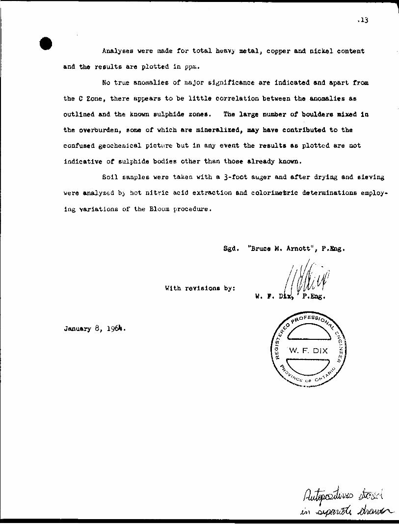
Analyses vere made for total heavy metal, copper and nickel content
and the results are plotted in ppm.
No true anomalies of major significance are indicated and apart from
the C Zone, there appears to be little correlation between the anomalies as
outlined and the known sulphide zones. The large number of boulders mixed in
the overburden, some of which are mineralized, may have contributed to the
confused geochemical picture but in any event the results as plotted are oot
indicative of sulphide bodies other than those already known.
Soil samples were taken with a 3-foot auger and after drying and sieving
vere analyzed b,y hot nitric acid extraction and colorimetric determinations employ
ing variations of the Bloom procedure.
Sgd. "Bruce M. Arnott", P.Bag.
With revisions by:
January 8,

Heaven Lake Area (M-2908)89?45
49 0 I5
CT)
\.
oi-o:O)
D
-
89*?30'
49 007'30'
89 045'
Shelby Lake Area - M.2898
49 D I5'
14
13
12
10
09
08
en ooOJ
o a;
O)-^o
xo
49 0 07'30"
890 30
492893
52HC4NE0C27 63.1711 LAC DES ILES 200
AREA OF
LAC DES ILES
DISTRICT OF THUNDER BAY
THUNDER BAY MINING DIVISION
SCALE: 1 INCH 1=40 CHAINS
LEGEND
PATENTED LAND
CROWN LAND SALE
LEASES
LOCATED LAND
LICENSE OF OCCUPATIONMINING RIGHTS ONLY
SURFACE RIGHTS ONLYROADSIMPROVED ROADS
KING'S HIGHWAYSRAILWAYSPOWER LINES
MARSH OR MUSKEG
C.&
©LocU).
M.RK) S.RO.
, r*T^-—'"^sg y i. mi i ss
CANCELLED c.
NOTES
4OO Surface Rights Reservation orotund ail lakes and rivers
NATIONAL TOPOGRAPHIC SERIES 52 H4
PLAN NO. M.I788
ONTARIODEPARTMENT OF MINES
AND NORTHERN AFFAIRS

"f
LAC DES ILES
LEGEND:
Gabbro C omplex
Sulphides
108721 ' 108722 t
l- * (0789? l 107863
i f 107684 l 107880
108169 l 108165
(\SLAND LAKf
GUNNEX LIMITED07864 i /I07866 i 107868
LAC DES ILES CLAIM GROUPA K T H
rO l M G P i V.
SCALE: i INCH * 1320 FEET
52H04NE8C27 53.171 l L AC DES ILES210
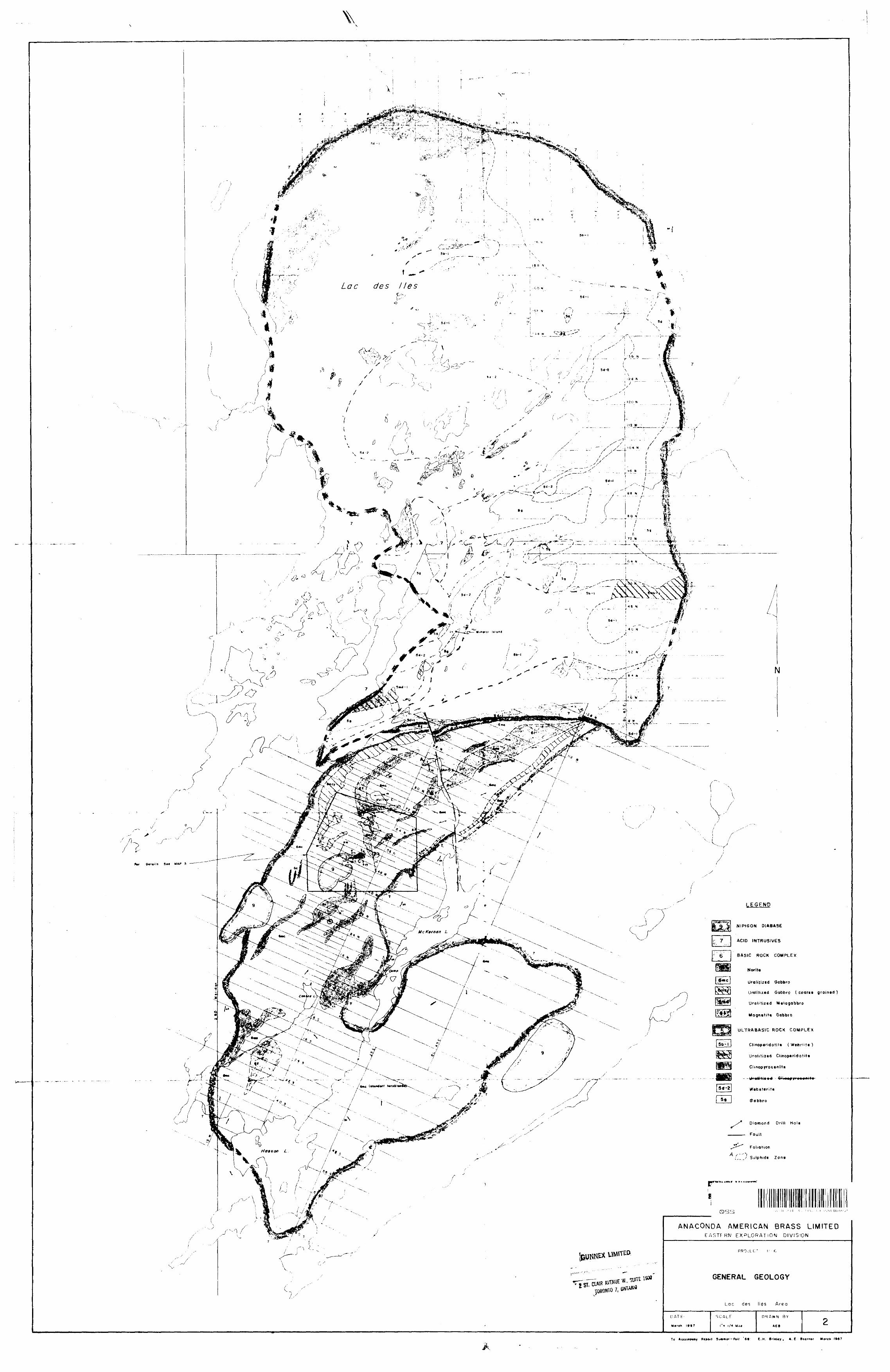
Lac des lies Area
ACID INTRUSIVES
BASIC ROCK COMPLEX
NoriU
Gabbro
Uralitizad Gabbro ( coortt grained
Uratitizid Mvlogobbro
Magnttitt Gabbro
ULTRABASIC ROCK COMPLEX
Clinop*ridotif* ( Wetirtita )
Ur ali t i ltd Clmop*rido!iti
Clinopyroxtniti
Diamond Drill Hal*
Fault
Foliation
Sulphidt Zon*
ANACONDA AMERICAN BRASS LIMITEDEASTERN EXPLORATION DIVISION
GENERAL GEOLOGY
To Aeccmw*y fl*po*t S invrnx-Foll ' ftf C ,H. B rlaUy , A .C. Po*rn*i March (987

Y
. \.ov - f*-.w* . J. a fcw~^
N
LEGEND
9 l NIPIGON DIABASE• -x?- 1
ACID INTRUSIVE
6 BASIC ROCK COMPLEX
'l6mb Anorthositt Gabbro
Urolftiztd Gabbro
Uralitiztd Gabbro lcoarst graifitd
UraMtned M e! a gabbro
Magncfitt Gabbro
GEOLOGICAL BOUNDARIES
—— Observed
__ Approximate
__ G P Inferred
Outcrop
— Fault
Sulphide Zone
Foliation
Pit o r Trench
*" Diamond Drill Hole
ASSAYS: Length (Q oCopper - {X) Nictiel - OT Platinum Group
Cilunirv
oes
ANACONDA AMERICAN BRASS LIMITEDEASTERN E XPLORATION DIVISION
PROJECT P-6
GEOLOGICAL PLAN
Zones B, C, E, P SB
PL 40N - 68N
Lac d es I les Area
DATE,
March 1467
SCALEi
t' s 200'
DRAWN BY;
AEB
To Accompany SuRMiir - Foil fl* E. H Ifinlty, A E. Boamtr ll*(Ch

TR 1
0818
0\
TR
I07857
WE
ST
L
AK
E
TB
I07878
TB
I08I7
7
Bou
lder
sS
pruc
e S
jo
ckpi
nel"
P
opla
rT
BI0
8I7
0T
BI0
7899
TB
I08I8
I
TB
I07
87
5T
BI0
8I7
8
TR
I08I6
5
f. gr
'd
basi
c di
kex
Bou
lder
sT
BI0
78
74
••'..
....,,
,,.,,,
......
. ..,
...S
r;ep
TB
I08I6
0
No
outc
rops
No
outc
rops
Hig
h ro
lling
Jock
pine
S
popl
arpr
uce
a
lack
pme
TB
I08I6
6T
BI0
8I6
IT
BI0
7856
Rolli
ng,
no
outc
rops
Pop
lar
a
jock
pine
TB
I08
I75
TB
I07
90
0T
BI0
8I6
7St
eep
hill
Ope
n m
arsh
\ \
Gen
tle s
lope
No o
utcr
ops
Ope
n m
orsn
Hig
h, n
o ou
tcro
psT
6I0
7907
Pop
lar
ridge
Dpe
n m
arsh
Cpe
n^m
arsh
TB
I08
I62
TB
I08I7
6
TB
I07
90
IT
BI0
7897
T B
1078
73cr
oss
fr
acs
mos
s.py
rti~
cpy
ti."^
***^
DO
N Bo
uld
ers
36
l O
OS
\32
TB
I08I6
3
\:
jtee
p
slop
e
Pot
;or
a
jock
pine
TB
I08I7
3T
BI0
7855
BI0
8I5
6T
B 1
079
06
,- II
.1
1
.
V: T
BI0
8I5
5T
WO
IS
LA
ND
L
AK
ET
BI0
78
72
Rolli
ng
, no
ou
tcro
psT
BI0
8I7
4S
HO
RT
Y
LA
KE
Spr
uce
a
lack
pme
TB
I07859
a je
t 8
b
cjid
ers
TB
10
78
54
TB
I08I5
7P
opla
r 11
a g
e
Hig
h,popla
r 8
birch
TB
IC7
E.6
0
S i.
r -j c
e
S o
c *
L ''
e
Bould
ers
\
TR
I08
53
8Larg
e
pep ta
ri
TB
IO8
I58
Po
pla
r rid
ge
TB
I0786I
TB
I08
539
TB
I08
54
7
TB
I085
30
CA
MP
L
AK
E
52H04NE0027 63.1711 LAC DES ILES
. o)
E g
"
c c D
-
8 8
c g
LEG
EN
D
7
"f'\
Gab
bro
ic
gnei
ss
Dia
base
Fine
gr
aine
d ba
sic
dike
s
Quart
z-fe
ldsp
ar
porp
hyry
di
kes
Gra
nite
Gra
niti
c gn
eiss
l B*-.. -'
Per
idot
ite
Gab
bro
Com
plex
Min
era
lized
gabb
ro
Sp
ars
ely
m
ine
raliz
ed
g
ab
bro
SY
MB
OLS
...J
70
C
L r
Are
a of
ou
tcro
p
Tra
il
Cla
im
line
Bas
e of
sl
ope
Mus
keg
or
swam
p,
with
b
ou
nd
ary
Pic
ket
line
Str
ike
a di
p of
sc
his
tosi
ty
Fault,
in
dtc
ate
d
or
assu
med
Pits
Des
igna
tion
of
min
era
lize
d
zone
Dia
mond
Drill
Hole
f O
GUN
NEX
LIM
ITED
LAC
D
ES
ILE
S
THU
ND
ER
BA
Y M
ININ
G
DIV
ISIO
N -
ON
TAR
IO
(o "b
.
SURFACE PLAN AND GEOLOGY
Scale
l" =
2OO'
C.'M
PILE
I:

FRC
QU
EN
CY
CN
STR
IBU
TIO
W
GR
APH
O
F
so ~
no
WEA
K AN
OMAL
Y11
0 -
I4O
M
EDIU
M
+ I
40
S
TR
ON
G
AN
OM
ALY
SO
60
TO
SO
9O
IOO
IW
(30
ISO
M
O SO
ISO
I7
022O
Z5O
3OO
I2
OO
LA
C
DE
S
ILE
S
Hot a
cid e
xtra
ctio
n m
etho
d us
ed
Resu
lts
plot
ted
as f
ollo
ws.
THM
C
u
PP
M
PP
M50
3
0
TWO
IS
LAN
D
CA
KE
"^
W*
l l
l l
01
2
3 4
5 cm
. M
inis
try o
f Nor
ther
n D
evel
opm
ent a
nd M
ines
Ass
essm
ent F
ile S
cann
ing
Proj
ect
GU
NN
EX
LIM
ITED
LAC
D
ES
ILE
S
THU
ND
ER
B
AY
M
ININ
G
DIV
ISIO
N -
ON
TAR
IO
GEO
CH
EMIC
AL
SUR
VEY
Sca
le
l -
20
0'
OC
TO
BE
R
1963
B
v J-
B
S
NB

~-L
- '"
-'
.
07
639
10
787
5
10
61
65
C7&
7A
-
\08t
T5
i o 7
S) o
r.
~
58
67
84TO
ON59^
6
92
l D
ON
B s.
NO. i
96
OO
N3953
(00 f
00
60
52
104
j OO
N
TW
O
ISLA
ND
LA
KE
-J_
_..
^
LE
GE
ND
Less
tha
n 57
000
Gam
mas
570O
O
-
58
000
5800O
-
59O
OO
59O
OO
-
6000O
60O
OO
-
610O
O
6IO
OO
-
62O
OO
620O
O
-
63
000
Mor
e th
an
6300
O
(Sbm
mas
NO
TE
To
conv
ert
read
ings
to
gam
mas
, mul
tiply
by
ten.
(s T
otal
Fiel
d)
O1
2 in
ch
Ii
i i
i l
~r
01
2 3
4 5
cm.
Min
istry
of
Nor
ther
n D
evel
opm
ent a
nd M
ines
A
sses
smen
t File
Sca
nnin
g Pr
ojec
t
GU
NN
EX
LIM
ITE
D(o'
b. n
u,4/
LA
C
DE
S
ILE
S
THU
ND
ER
BA
Y M
ININ
G
DIV
ISIO
N
- O
NTA
RIO
MA
GN
ET
OM
ET
ER
S
UR
VE
Y
(AB
EM
T
OT
AL
FIE
LD
)
Sca
le
f" ;
200'
582 7
52H04NE0027 63.1711 LAC DES ILES
26
0

\
DO
S
TW
O
ISLA
ND
LA
KE
40
CO
S
l
36D
OS
32oo
sO
OS
24O
OS
20O
OS
16O
OS
12
OO
S8
OO
S
00
-l
, 10
2
— i
IO2
-t-l
103
oc
-t-
. 10
3
02
-t-s
, 02
-t-Z
10
1
O '0
3
-f
1C
!01
I02
O3
B
-l IO
I-t
-2
IOO
l I0
2
O
IO
— 2
IO
I
IOI
-M
IOO
O .
IOO
O
. 9
9-t
-2
, IO
I
-t-2
I0
2
-t-2
.
(02
O
IOI
tO!
O ,
I02
l !0
2
— l
I03
-3
,
IOI
O .
IOI
t-4
IOO
-t-3
I0
2
. I0
2
— 2
;
I02
O I0
2
-*-2
IO
I
-t-2
.
IO2
-4-4
I0
2
O
' I0
4
. IO
I
t-4
IOI
-t- 2
l 0
2
-t-2
IO
I
-t-3
IO
I
IOI
-t-
f. l 0
2
-t-1
6 IO
I
-t-
S IO
2
-t-
5 3
8
3 ,
io;
-t-2
. ic
;
o IO
I•4
iO
?•2
,
IOO
--4
. ic
;
5 10
3
- 33
-t-2
l
9I
-t-5
.
IOI
•i-2
'
104
— 3
,
IOI
— 2
:
IOI
O I0
2
O ,
l O2
-t-2
;02
. 98
I03
ice
*7 e
iC2
-t-3
IO
I
O lo;
I02
-t-2
-
I04
•l .
IOI
-t ^
'
I03
— 6
L
9l
O
, I0
2
I02
— l
. IO
O
o8l7
IOO
-6IO
O
4 i
lOC
-f-
4 IO
2
O
l I0
3
l
-H
. I0
2
O
, lO
t
— 2
i
IOI
— 2
X ;
—2
loo
: -*-
ie
' f
y
—2
1
101
-2
~^—
~^-
^^/
os 03 ot 01 too
CI 02
103
O o
-t-i 0
1
-t-2
t
00 96 IOO
—
j "
IOO
IOO
0
t IO
I
IOI
0
OO
N
! 8
-l
f IO
I j
-H
— l
37
0
IOO
—1
i IO
O
0
IOI
-t-l
IOO
-t-l
IOO
IOI
I03
— l
. IO
I
— l
I02
:02
(0 g
i5-5
~'
t IC*
IOI
—1
IOI
-t-l
-t-2 —l
IOI
OO
N
IOI
99
IOI
^
-t-l
-t-4
-t-ll
-*-4
IOO
+I5
IOO
99
IOO
99
0 -t- 1 12 0 0
-t-l
-t-l 0 0
lot
. o
IOI
IOI
OO
N -, IG2
IOI
1 03
'02
IOI
IOI
IOI
— 2
— 2
-t-
l 16 -t-i 0
—i
-t-i 0
-t-l 0
IO2
IOO
99
OO
N
IOO
IC3
IOI
99 IOI
IOO
lOt
I02
-t-3
:O
2 '
— i
0 p
1 0 1
\-t
-5
IOI
i -t-2
7
l lo
t
\
-t-2 20
-t-4
-t-*
-H5
-t-5
-t-
Z
-t-4 -t-6 -f-2
1
IOI
\ -t
-21
OO
N
24
^
-t-ie
no OO
N
iO
101
0
j 10-
102
1- Z
7
I04
-t-3
3
I04
I04
IO2
-t-4
l
I07
r. -
I04
-+-2
S
IOO
-t
-IO
IO7
I02
tOI
— I
S
IO2
-t- i
id
t —
2
( IO
I
'
-t-
l 28 o
— 4
— 3
-t-2
— l
-l
-t-4 — l
IOI
OO
N
I02
IO4
I02
I02
99
94 82 99
-t-l
I02
^'
' 'O
l
i 0
|-t
-2
' 39
l -
'
-t-l 32 -t- ^ ~ o
-t-3 -t-2
-t-3
- -t-2
gg
B
A?E
L
NE
—j
OO
N 36
IOI - IOI
.j
39
0
98
~t-'
loi
-t-i
I02
0
I02
IOI
022'[
OO
N
IOO
I03
IO-I
r r*
.l 0
!
I02
IOI
IO5
I04
1 04
— 2
IOB
I04
IO4
I04
LE
S
52H04NE0027 63.1711 LAC DES ILES
NO
TE
PH
AS
E
-t-2
IO
I IN
fH
4S
E
100
102
O1
2 in
ch
ll
l l
l \
01
2
3 4
5 cm
. M
inis
try o
f Nor
ther
n D
evel
opm
ent a
nd M
ines
As
sess
men
t File
Sca
nnin
g Pr
ojec
t
LAC
D
ES
ILE
S
THU
ND
ER
B
AY
MIN
ING
D
IVIS
ION
-
ON
TA
RIO
EL
EC
TR
O M
AG
NE
TIC
(M
INIG
UN
) S
UR
VE
Y
Scol
e l"
* ZO
O'
COM
PILE
D OC
TOBE
R 19
*3
By
W. L
.