Embed Size (px)
Citation preview

IRRIGATION MANAGEMENT IN NEPAL: RESEARCH PAPERS FROM A NATIONAL SEMINAR
National Seminar on Irrigation Management in Nepal: Research Results
Bharatpur, Nepal 4-6 June 1987
Sponsored by the International Irrigation Management Institute (IIMI), the Institute of Agriculture and Animal Science (IAAS), and Winrock International. Edited and published by IIMI, PO Box 3975, Kathmandu, Nepal.
Cover photo: V-notch weir being used to measure accuracy of water distribution by a =o (proportioning weir) in Saili Kulo, Argali, Pa!pa. Courtesy of Robert Yoder.
Citation: IIMI pub 88-07
International Irrigation Management Institute (IIMI). 1988. Irrigation Management in Nepal: Research papers from a national seminar. Kathmandu, Nepal:
/ case studies / farmer-managed irrigation systems / farmer participation / government-managed irrigation systems / irrigation / management / methodology / Nepal / research / resource mobilization / property / water allocation / water rights /
IIMI Pub.
DDC 631.7
Summary: Numerous field etudies related to irrigation management have been conducted in Nepal since the last national seminar on irrigation issues in 1983. The relationship between organizational structure and resource mobilization was the topic of several. Another examined changes in organization and resource mobilization as property relationships and water rights changed when systems expanded and allowed new members. Concern for improving intervention strategies to existing farmer- managed irrigation sys tems has stimulated work on finding methods for quickly collecting data for identification and assessment of systems where substantial gains can be made by giving assistance. Numerous case studies have expanded the information available on management of operation and maintenance in both farmer- and agency-managed systems. These seminar papers report the findings of eleven of the studies.
-- Please direct inquires and comments to:
INTERNATIONAL IRRIGATION MANAGEMENT INSTITUTE PO Box 3915 Kathmandu, Nepal
---_____________________________________---_------------------ Responsibility for the contents of this publication rests with the authors. The papers have been edited by IIMI Kathmandu.

TABLE O F CONTENTS
FORWARD
- S13CTION I:
LISSSONS FROM INVENTORY PREPARATION O F IRRIGATION SYSTEMS 01' BUDHI RAPT1 RIVER, CHITWAN, NEPAL T.B. K h a t r i- C h h e t r i , N.K. M i s h r a , S.N. T iwar i , B.P. S h i v a k o t i , and A. S h u k l a
INVENTORY AND RAPID APPRAISAL METHODS
... 111
RECONNAISSANCE/INVENTORY STUDY O F IRRIGATION SYSTEMS IN THE INDRAWATI BASIN O F NEPAL Robert Yoder Zzd S.B. U p a d h y a y
GUIDELINES FOR RAPID APPRAISAL O F IRRIGATION SYSTEMS: EXPERIENCE FROM NEPAL P r a c h a n d a Pradhan, R o b e r t Yoder, and Uj jwa l P r a d h a n
- SECTION CASE STUDIES
MULTI-FUNCTIONAL, NON-RESIDENTIAL IRRIGATION ORGANIZATION: A CASE STUDY O F KODKU IRRIGATION SYSTEM O F KATHMANDU VALLEY S.P. S h r e s t h a
INSTITUTION BUILDING AND RURAL DEVELOPMENT IN NEPAL: GADKHAR WATER USERS COMMITTEE L p e n d r a Gau tam
A__ -
- SECTION III: COMPARATIVE STUDY O F D H U W A AND CHAINPUR IRRIGATION SYSTEMS G.P. Shivakoti, A. Shukla, T.B. Kha t r i- Chhe t r i , S.N. T i w a r i and N.K. M i s h r a
COMPARATIVE CASE STUDIES
A. COMPARATIVE STUDY O F FARMER-MANAGED AND AGENCY-MANAGED IRRIGATION SYSTEMS FLatna Sansar S h r e s t h a and Nirmal Kumar S h a r m a
A COMPARATIVE CASE STUDY O F TWO COMMUNITY-MANAGED IRRIGATION SYSTEMS I N CHITWAN DISTRICT, NEPAL Ihtna Raj Nirola and Ravindra Prasad Pandey - SECTION rV: CONCEPT PAPERS
ORGANIZATIONAL STRUCTURE FOR RESOURCE MOBILIZATION
E d w a r d D. Martin and R o b e r t Yoder I N HILL IRRIGATION SYSTEMS
2
15
24
39
46
59
69
78
85
RESOURCE MOBILIZATION AND ORGANIZATIONAL SUPPORT IN IRRIGATION SYSTEM MANAGEMENT: EXPERIENCES FROM KULARIYA, JAMARA, AND IWI KULOS OF KAILALI DISTRICT 2 r a c h a n d a Pradhan, Khadka Giri , and Dirgha Nidh i T i w a r i 102
PROPERTY PERSPECTIVE IN THE EVOLUTION OF A HILL IRRIGATION SYSTEM: A CASE FROM WESTERN NEPAL U.ijwal Pradhan
- SlSCTION 1:
FARMERS' PANEL DISCUSSION
L I S T OF PARTICIPANTS
116
129
134
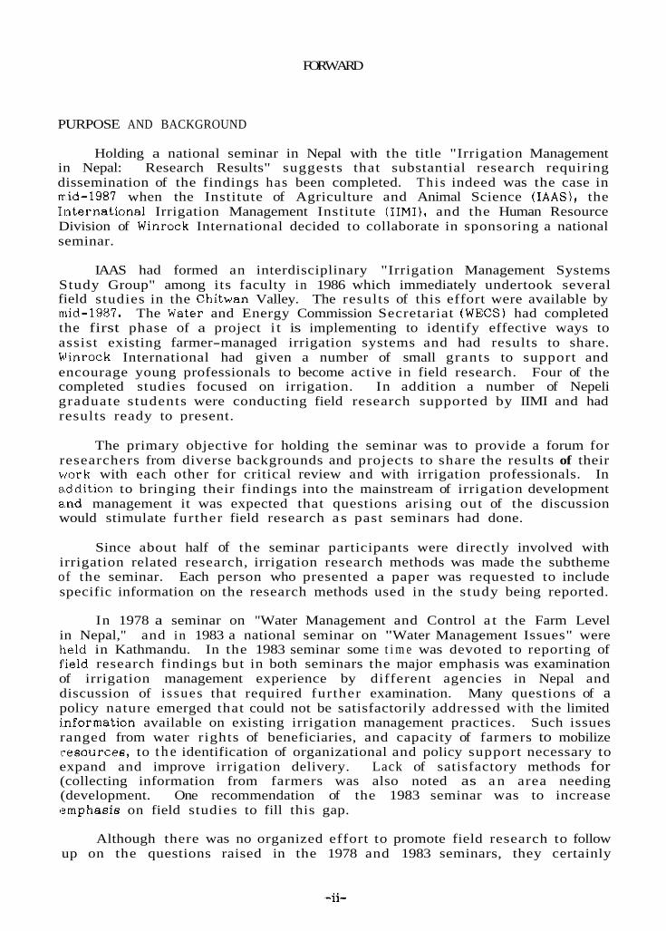
FORWARD
PURPOSE AND BACKGROUND
Holding a national seminar in Nepal with the title "Irrigation Management in Nepal: Research Results" suggests that substantial research requiring dissemination of the findings has been completed. Th i s indeed was the case in m,id-1987 when the Institute of Agriculture and Animal Science ( IAAS), the Iiiternational Irrigation Management Institute (IIMI), and the Human Resource Division of Winrock International decided to collaborate in sponsoring a national seminar.
IAAS had formed an interdisciplinary "Irrigation Management Systems Study Group" among its faculty in 1986 which immediately undertook several field studies in the Chitwan Valley. The results of this effort were available by mid-1987. The Water and Energy Commission Secretariat (WECS) had completed the first phase of a project i t is implementing to identify effective ways to assist existing farmer-managed irrigation systems and had results to share. hiinrock International had given a number of small grants to support and encourage young professionals to become active in field research. Four of the completed studies focused on irrigation. In addition a number of Nepeli graduate students were conducting field research supported by IIMI and had results ready to present.
The primary objective for holding the seminar was to provide a forum for researchers from diverse backgrounds and projects to share the results of their work with each other for critical review and with irrigation professionals. In a,.ddition to bringing their findings into the mainstream of irrigation development end management it was expected that questions arising out of the discussion would stimulate further field research a s past seminars had done.
Since about half of the seminar participants were directly involved with irrigation related research, irrigation research methods was made the subtheme of the seminar. Each person who presented a paper was requested to include specific information on the research methods used in the study being reported.
In 1978 a seminar on "Water Management and Control a t the Farm Level in Nepal," and in 1983 a national seminar on "Water Management Issues" were held in Kathmandu. In the 1983 seminar some t i m e was devoted to reporting of l'ield research findings but in both seminars the major emphasis was examination of irrigation management experience by different agencies in Nepal and discussion of i ssues that required further examination. Many questions of a policy nature emerged that could not be satisfactorily addressed with the limited i.nformation available on existing irrigation management practices. Such issues ranged from water rights of beneficiaries, and capacity of farmers to mobilize rresources, to t h e identification of organizational and policy support necessary to expand and improve irrigation delivery. Lack of satisfactory methods for (collecting information from farmers was also noted as a n area needing (development. One recommendation of the 1983 seminar was to increase (?mphasis on field studies to fill this gap.
Although there was no organized effort to promote field research to follow up on the questions raised in the 1978 and 1983 seminars, they certainly

(stimulated increased research activity. By 1987 many individuals and groups .including graduate students and faculty from the academic community in Nepal 'had completed field work. All of this work was field based making valuable (observations with implications for irrigation policy, design, implementation, and (operation and maintenance. Eight out of the eleven papers report on work icarried out by groups rather than individuals. The interdisciplinary character of .the field work improved the quality of the observations and added value to ranalysis of the results.
Since initiative and support for the work came from many sources there 'was no predetermined forum for making the results available to the larger icommunity of irrigation professionals and policy makers. Realization of this :situation prompted the June 1987 "Irrigation Management Research Results" ;seminar.
The 65 persons who participated in the seminar represented three distinct ,groups: researchers, irrigation professionals, and farmers. Eleven farmers from (eight different farmer-managed systems were invited to participate in the ,seminar and present a panel discussion. This was successful beyond all (expectation a s the farmers entered into discussion in all sessions, and interacted .informally between sessions. Their presentations which stressed the solutions .they have found to management problems carried the weight of many years of :active irrigation experience and provided much stimulating deliberation. Their presence and participation added significantly to the seminar a s it became clear that they were indeed among the most experienced irrigation managers present 1st the meeting.
ORGANIZATION OF THE PAPERS
The papers have been organized into four sets of related topics. The first are those dealing with rapid collection of field information about existing irrigation systems. These are methods for collecting data pertinent to identification of a system's strengths and weaknesses. In one paper examples of the information collected are presented. The second se t of papers w e case studies of individual systems. One describes the evolution of the organization, and the other describes a unique organization whose primary function is not irrigation. The third set of papers a r e comparative case studies of two systems each. Two of the final set of papers provide analysis of organizational s t ructure in relation to capacity for resource mobilization and another paper analyzes issues of water r ights and property relationships as irrigation systems expand and accept additional beneficiaries.
A brief summary of the presentations made by t h e farmer participants during their panel discussion is also included. I t provides a glimpse of the background and experience t h a t made their input so credible.
ACKNOWLEDGEMENTS
Dean K. N. Pyakurel and t h e members of the Irrigation Management Systems Study Group from the Institute of Agriculture and Animal Science, Rampur, deserve all the credit for arranging the logistics and smooth organization of the seminar. They also led a valuable and informative field t r ip to farmer-managed systems of the Budhi Rapti River. This gave visual support to the information they presented in one of their reports st the seminar.

D r . Mike Wallace and the staff of t h e Human Resources Development IDivision of Winrock International deserve recognition for the support they gave to four of the field studies presented at the seminar. They also provided -valuable assistance with the planning and Winrock contributed financial support :'or the seminar.
IIMI's resident scientists based in Nopal, Dr. Prachanda Pradhan and Dr . Xobert Yoder were responsible for contacting researchers and encouraging the .preparation of papers. IIMI Kathmandu staff w a s also responsible for preparing 'the summary of the farmer's panel discussion. The papers were edited by M r s . ,Juanita Thurston.
Roberto Lenton Director General IIMI
LESSONS FROM INVENTORY PREPARATION OF IRRIGATION SYSTEMS OF BUDHI RAPTI RIVER, CHITWAN, NEPAL'
T.B. Khatri-Chhetri, N.K. Mishra, S.N. Tiwari, G.P. Shivakoti and
A. Shuklar
INTRODUCTION
Irrigation can contribute to agricultural production if i t is properly integrated into an agricultural development package. Realizing this vital role of water in increased potential production, the Department of Irrigation, Hydrology and Meteorology (DIHM), His Majesty's Government of Nepal (HMGN), has begun to design and construct irrigation systems in different par ts of the country.
The Chitwan Irrigation Project ICIP) is a huge irrigation undertaking which started in 1974 with a loan for US$ 19.5 millions signed by the Asian Development Bank IADB) and HMGN. The project comprises three schemes covering an estimated area of 12,000 hectares (ha). Big projects like this have been criticized for not being able to ensure timely, reliable, and adequate supplies of irrigation water, and have been blamed for not being able to reduce the farmers' production r isks .
In addition to the CIP, there are many farmer-developed and managed irrigation systems operating in the Chitwan valley. The farmers' efforts have been very encouraging. In the Chitwan valley alone, the estimated total irrigated land is 17,530 ha (WECS 19851, of which a substantial area is under farmer-managed irrigation systems.
Wherever there is a farmer-managed irrigation system, there needs to be effective management to assure the timely delivery of water to the farmers' fields to meet the crop water requirements. However, the lack of technical knowledge and resource constraints such a s limited finances or lack of construction materials, or natural occurrences such a s changes in river course, are some of the major problems associated with the operation and maintenance of such systems. Limited outside assistance to improve these systems has a tremendous potential for increasing agricultural production in the valley.
The Farm Irrigation and Water Utilization Division (FIWUD) of the Department of Agriculture (DOA) is working in the District to provide assistance to farmer-managed irrigation systems in order to improve water utilization. Eight irrigation projects covering a total command area of 640 ha
1 This material is based upon the work supported in part by the International Irrigation Management Institute (IIMI) and Institute of Agriculture and Animal Science (IAAS) for a project entitled "Water Resource Inventory of the Chitwan Valley Irrigation Systems with Emphasis on Issues and Problems in Irrigation Management".
* T.B. Khatri-Chhetri is a Professor of Soil Science a t the Institute of Agriculture and Animal Science (IAAS), Rampur, Chitwan, Nepal. N.K. Mishra is a Reader of Agronomy, and S.N. Tiwari a Reader of Agricultural Extension at IAAS. G.P. Shivakoti is a Lecturer of Agricultural Economics, and A. Shukla a Lecturer of Agricultural Engineering, also a t IAAS.
-2-

-- SECTION I: LESSONS FROM INVENTORY PREPARATION OF IRRIGATION SYSTEMS OF BUDHI RAPT1 RIVER, CHITWAN, NEPAL T.R. Khstri-Chhetri, N.K. Mishra, S.N. Tiwari, B.P. Shivakoti, and A. Shukla
RECONNAISSANCE/INVENTORY STUDY OF IRRIGATION SYSTEMS IN THE INDRAWATI BASIN OF NEPAL R o b e r t Yoder and S.B. Upadhyay
GUIDELINES FOR RAPID APPRAISAL OF IRRIGATION SYSTEMS: EXPERIENCE FROM NEPAL Prachanda Pradhan, R o b e r t Yoder, and Ujjwal Pradhan
INVENTORY AND RAPID APPRAISAL METHODS
2
15
24
are presently (February 1987) under improvement in the East Chitwan valley with FIWUD assistence (FIWUD office, Hetauda). The Ministry of Panchayat and Local Development (MPLD) also provides financial and technical support to local small-scale irrigation systems for effective operation of t h e systems.
In bringing about modifications in the existing system? or in planning a new system, a thorough knowledge of the existing systems and the e.ctent of water utilization is needed. The Water and Energy Commission Secretariat (WECS 1985) has carried out a water resource inventwy of the Chitwan District. A fessibility study of the E a s t Rapti Irrigation Project (DIHM/ADB/Nippon Koei Co. Ltd. 1986) has included a comprehensive list of both government as well as farmer-built irrigation systems. However, these reports were incomplete. I t was therefore considered appropriate to prepare a complete resource inventory of the irrigation systems from the Budhi Rapti river. Such an inventory is expected to develop a picture of the numbers, sizes, and types of systems in terms of the physical s t ructures that exist for conveying, distributing, and draining water. The inventory also proposes to survey the social structure that exists for determining rules and regulations for allocating water, for repair and maintenance of the physical s t ructures , and for resolving conflicts over water matters. I t is also expected to identify the present farming systems along with possible modifications within the command area of some of the new or rehabilitated systems. Further, the study is visualized to generate lessons for future directives on issues such as the operation and maintenance of the irrigation s y s t e m s in general.
BACKGROUND
The Chitwan District is located a t the southwestern corner of the Central Development Region, between longitudes 85 degrees 55 minutes to 85 degrees 35 minutes east and latitudes 27 degrees 21 minutes to 27 degrees 46 minutes north and covers an area of 2,510 square kilometers (kmz). About three-fourths of the total area of the District i s flat to almost-flat plain with high agricultural potential and is known by the name of the Chitwan valley. The valley floor was formed mainly by detrital depositions from the lower slopes of the enclosing Mahabharat Lekh in the north and northeast and Chure range in the south. The average altitude of the valley i s about 244 meters ( m ) above mean sea level.
Physiography, Natural Drainage and the Soil
The Chitwan valley is made of terraces of various ages created by the Narayani and Rapti River systems. The valley is divided into an eastern area and a western area by the Khageri river, a tributary of the Rapti running from north to south in the valley. The area south of the Rapti river is called Madi valley.
The principal features seen today in t h e East Chitwan valley a re the alluvial plains dissected into a mosaic of land types by the action of t h e tributaries of the Rapti and Narayani river systems. The general slope of the valley floor is south and southwest with many streams flowing into the valley from the Mahabharat Lekh. Most of these a re either ephemeral in character or the volume of water declines heavily during the dry season. The section of land north of the East-West Highway usually suffers from the shortage of water. Physiographically depressed areas with poorly drained to swampy floor beds are also occasionally encountered. Perennial rivers like the Manahari and Lothar flow f rom t h e eastern boundary of the valley and become t h e part of
-3-

the Rapti River which again flows from the northeast to southwest and ultimately loses itself i n the Narayani river system.
The Dhongre Khola originates from the Lothar river and the Budhi Rapti river from springs in the jungle of Kuchkuche which is being rapidly deforested. Both of these rivers flow from east to west parallel to the Rapti river and are perennial in nature. Unlike the Nerayani river, the Rapti and i ts tributaries flow a t levels almost equal to the average level of the valley floor and, a s such, have large flood plains. The water from these streams is utilized for irrigation. The Narayani river flows a t a lower level than the average level of the valley floor.
The soils of most of the valley are young without much differentiation into horizons. However, the soils developed on the old terraces have weakly to moderately well-developed horizons. Most uplands and well-drained khet (paddy) lands have an acidic reaction (pH ranging from 4.2 to 7.0). Soils deposited on depressed areas and where drainage is impeded are alkaline (pH <8.5). Generally the soils developed on the terraces of the Rapti river and i ts tributaries tend to be alkaline. Sandy loam and loam are the most dominant textural classes of the surface soil with a few patches of sandy clay loam and silty clay loam as well. East Chitwan valley soils tend to be heavier in texture than those of the west. A relatively high content of organic matter (1.1 to 6.8 percent, with an average of 2.8 percent) reflects the recent agricultural history of the valley (Khatri-Chhetri 1982). With proper management and adequate inputs including irrigation water, the soils of the Chitwan valley can be highly productive.
Agro-climatic Conditions and Agricultural Development in the Valley
In t h e early fifties the valley w a s inhabited by Tharus and Darais (ethnic groups of Nepal) whose settlements were scattered. After the introduction of the resettlement program in the mid-fifties, settlers came into the valley from various parts of the country. The new settlers were more willing to adapt new technologies and hence were more advanced and cooperative. As a consequence, intensive agriculture including livestock raising and plantation crops are practiced in the valley and it is the area with the most potential for producing surplus food grains, oil-seeds, fruits, and animal products in the country. Various agricultural agencies located at different parts of the valley have given impetus to i ts agricultural development.
The agro-climatic conditions of the valley a re most favorable to the tropical and sub-tropical crops and fruits. The major crops grown are rice, maize, mustard, and wheat. Other crops are also grown but on a small scale. Rice followed by wheat or spring maize is a common rotation in lowlands. Wherever water is available double crops of rice a re grown. In the uplands maize-mustard is the favored rotation. Maize after maize is also grown. Seasonal vegetables and fruits such as banana, pineapples, guava, mango, and litchi are commonly grown in the valley.
The following is a summary of the meteorological features a t Rampur, which can be generalized to the valley. The hottest months are April, May, and June when the average maximum temperature rises to 35 degrees Celsius (OC). with extremes a s high a s 42oC. The winter temperature goes down as low as 7OC. during December and January. Over 75 percent of the annual rainfall (average annual = 2,000 millimeters) falls during June through September. July and August a re the wettest months. Heavy dew is seen during winter months
-4-

but its contribution to the water requirements of the wheat crop is negligible (Sharma, et al. 1984).
June through September appear to be the water surplus months. The major crops of th i s season are monsoon paddy and summer maize. If the crops cannot be planted on time due to the erratic nature of rainfall regarding the arrival, amount, and the number of rainy days in each monsoon, the productivity declines. If rainfall is not regular in early June, water s t ress may adversely affect the paddy nursery beds. Similarly, ?he early-sown summer maize crops are severely affected by drought. However, t h e late-sown crop usually does better.
October through May are water deficit months. The major crops grown during these months are: mustard, winter maize, wheat, spring maize, and spring paddy. The winter and spring showers a re also erratic with respect to time and amount. If there is no rainfall during February and March the wheat crop is seriously affected. The spring maize crop i s a complete failure if it is affected by drought a t t h e tasselling stage. Observations of the partial or complete failure of spring maize due to drought a re numerous in the valley. Similarly, there has been evidence of reduced yields of mustard and winter maize due to drought. The spring paddy is commonly grown in the valley where there is dependable irrigation. I t is therefore clear that the value of water in the valley for agricultural production lies in its timely availability.
METHODOLOGY
The inventory data collection methodology was divided into two parts: the preparation for the field survey and the field work.
Preparation for the field survey
Preparation for the field survey required the collection of information about the area with reference to agricultural land-use, geology, and soil geomorphology. In order to understand the area and the mapping of the drainage pattern, the previously published works of WECS (1985) and DIHM/ADB/Nippon Koei Co. Ltd. (1986) were carefully reviewed. The agro- meteorological information helped to visualize the need for irrigation water in the area.
Preparation of questionnaire. To collect sufficient factual and reliable information about the farmer-managed irrigation systems, an inventory checklist and questionnaire were prepared. The questionnaire was designed to probe for a brief historical background of the system, characteristics and performance of the physical systems and the farmers’ organizations, and agricultural services and production.
- The base-map. An appropriate base-map with details including the river systems, villages, village to village footpaths, panchayat boundaries, plantations, and other physical features of the area was needed. A topographical map (1:25,000 scale) of the District prepared by the Survey Department, Topographical Survey, HMGN was used as the base-map.
Field work
With the help of the information collected f r o m secondary sources, field visits were planned to conduct interviews with key informants and observations
-5-

of the irrigation systems. The study group consisted of an interdisciplinary team with backgrounds in agronomy and soil science, agricultural engineering, agricultural economics, and agricultural extension.
Interview. The questionnaire was designed to elicit detailed information on selected topics. The key informants selected included members of the local water users’ organization (i.e. mambers of the Kulo Samiti), village leaders, and local farmers.
The information was used to provide background information on the systems and was also used to investigate problem areas in the community and in the operation and maintenance of the irrigation system. The data gathered from key informants were checked and cross-checked with other key informants. A t the same time the minute books of the canal committees were used to verify the data wherever possible.
Observation of the irrigation system. Field observations of each and every system were done either before or after the interviews. The field observations included the inspection of the source and the intake points, the head-works and types of diversion structures, the network of canal systems, and measurements of the cross-section of the main canal to evaluate its carrying capacity. The devices used for distributing water among lower order canals and into the field were also noted.
After the completion of the field work the information w a s compiled by the authors. N o statistical analysis was involved.
RESULTS AND CONCLUSIONS
Irrigation Systems of the Budhi Rapti River
The Budhi Rapti river originates from springs in Kuchkuche forest in the southeastern Chitwan valley and h a s a perennial flow of water. The river meanders in the southern part of t h e East Chitwan valley almost parallel to the main Rapti river. The total length of the river is about 4.5 km and there a re 11 independent farmer-managed irrigation systems with a year-round irrigation command of over 1,800 bighas (1,200 ha). Due to the recharging capability of the Budhi Rapti river there has been no complaint of water shortage. The Budhi river i s called an Amrit Khola, or “life-saving river” in the area. All irrigation sys tems from the Budhi Rapti are gravity systems, run-off-the-river diversion types. T h e systems are simple, indigenous, labor-intensive, and have temporary diversion structures.
A sketch of t h e river course and the irrigation systems follows (Figure. 1) so that the relationship between the systems is apparent a t a glance. Arrows indicate t h e direction of flows and the number of each system corresponds with the names given in Appendix 1.
Some of the systems are very old. Chronologically, the systems are arranged a s Kathar (over 100 years), Tin-Mauje (1915), Janakpur (1920), b p i y a (1948), Jiwanpur (1952), Kusuna Gathauli (1957), Kharkhutte lower (1957), Kharkhutte upper (1961), Khairgahari (1967), Sathi-Bighe (1984), and Budhi Rapti Community Irrigation Project (1984).
-6-

Figure 1. Map of the Budhi Rapti irrigation systems.
-7-

Since their construction, the performance of the systems has been excellent, although frequent problems of recurrent supply interruptions due to flood damages of diversions, washing away of canal reaches and branches, and subsidence of canals due to undercutting, were reported. Even wi th such difficult situations t h e farmers have demonstrated their capability to operate and maintain the nystems.
One of the most important considerations for t h e excellent performance of the systems might be due to the ownership feelings among farmers. The farmers have participated in all aspects from construction to t h e various repair and maintenance aspects of the irrigation systems. The s y s t e m s have been crude and need intensive maintenance and management for their operation. Therefore, farmers have developed a mechanism to take care of the operation and the maintenance of the system which is based on need and problem resolution. This has played a crucial role in getting farmers to cohere and work together. I t has ultimately led to the formation of management committees, locally called Kulo Samitis.
- _ _ Kulo Samiti. The Kulo Samitis have been most effective in creating favorable impacts on water utilization. They have been very efficient in the operation and maintenance of the system, water allocation, and conflict resolution. The reason for such excellent performance of the Kulo Samiti is perhaps due to its leadership, which is accountable to the water users. If the responsibility fails to be fulfilled, t h e water users change the incumbent in the next annual meeting of the general body.
Another important feature of the Kulo Samiti is that its activity is kept away from the local power-politics and hence i t is regarded as impartial. Farmers of the command area a re of the opinion that once the irrigation water management i s brought under or influenced by the local power-politics its effectiveness diminishes. For example, the Kulo Samiti formed at Kharkhutte lower irrigation system under the ward chairman in 1980 could not function. Since then the system is working effectively under the leadership of Mr . Rudra Bahadur Dhakal, one of the farmers of t h e syatem. One common disadvantage of the farmer-managed irrigation systems is that it is labor-intensive and has limited resources which prevent i t from reaping the full potential of the project.
Agriculture
The agricultural productivity achieved in the command area of the Budhi Rapti irrigation systems is tremendous. Triple cropping is practiced with cropping intensities of 300 percent. The crop yields, common varieties used, and estimated area under major crops are shown in Table 1.
Liberal application of farmyard manure and compost is done by the farmers. The use of chemical fertilizers is an increasing trend. However, its use is limited to a few crops only. Rice, maize, wheat, and mustard are the major crops receiving chemical fertilizers. The doses applied were usually half of the recommended doses. Chemical fertilizers and improved seeds are available from local cooperatives. Information regarding the use of chemical fertilizers and improved seeds was obtained from innovative farmers and junior technical assistants and junior technicians of the District Agriculture Office.
-8-
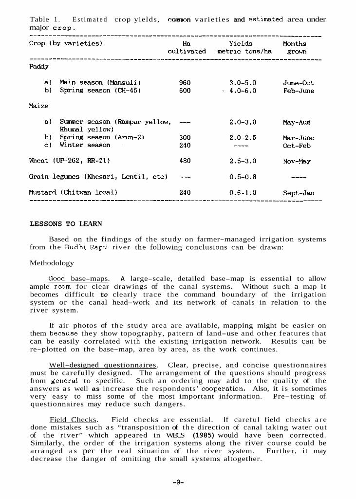
Table 1. E s t i m a t e d crop yields, c0rmK)n var ie t ies and estimated area under major crop.
LESSONS TO LEARN
Based on the findings of the study on farmer-managed irrigation systems from the Budhi Rapti river the following conclusions can be drawn:
Methodology
Cood base-maps. A large-scale, detailed base-map is essential to allow ample room for clear drawings of the canal systems. Without such a map it becomes difficult to clearly trace t h e command boundary of the irrigation system or the canal head-work and its network of canals in relation to the river system.
If air photos of the study area are available, mapping might be easier on them beCSUSe they show topography, pattern of land-use and other features that can be easily correlated wi th the existing irrigation network. Results can be re-plotted on the base-map, area by area, as the work continues.
Well-designed questionnaires. Clear, precise, and concise questionnaires must be carefully designed. The arrangement of the questions should progress from general to specific. Such an ordering may add to the quality of the answers a s well as increase the respondents’ cooperation. Also, it is sometimes very easy to miss some of the most important information. Pre-testing of questionnaires may reduce such dangers.
Field Checks. Field checks are essential. If careful field checks a re done mistakes such a s “transposition of t h e direction of canal taking water out of the river” which appeared in WECS (1985) would have been corrected. Similarly, the order of the irrigation systems along the river course could be arranged a s per the real situation of the river system. Further, it may decrease the danger of omitting the small systems altogether.
-9-
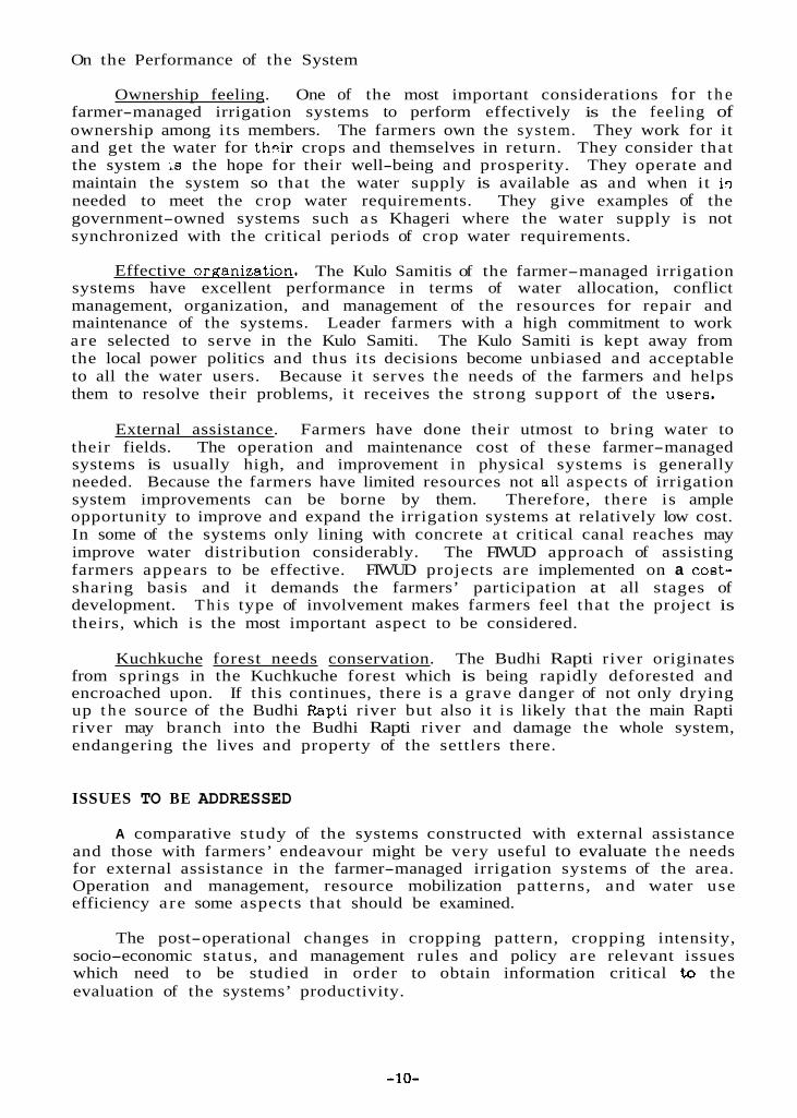
On the Performance of the System
Ownership feeling. One of the most important considerations for t h e farmer-managed irrigation systems to perform effectively is the feeling of ownership among its members. They work for it and get the water for th:ir crops and themselves in return. They consider that the system is the hope for their well-being and prosperity. They operate and maintain the system so that the water supply is available as and when it iq needed to meet the crop water requirements. They give examples of the government-owned systems such a s Khageri where the water supply is not synchronized with the critical periods of crop water requirements.
The farmers own the system.
Effective orrtanization. The Kulo Samitis of the farmer-managed irrigation systems have excellent performance in terms of water allocation, conflict management, organization, and management of the resources for repair and maintenance of the systems. Leader farmers with a high commitment to work a re selected to serve in the Kulo Samiti. The Kulo Samiti is kept away from the local power politics and thus i ts decisions become unbiased and acceptable to all the water users. Because it serves t h e needs of the farmers and helps them to resolve their problems, it receives the strong support of the uaers.
External assistance. Farmers have done their utmost to bring water to their fields. The operation and maintenance cost of these farmer-managed systems is usually high, and improvement i n physical systems is generally needed. Because the farmers have limited resources not all aspects of irrigation system improvements can be borne by them. Therefore, there is ample opportunity to improve and expand the irrigation systems at relatively low cost. In some of the systems only lining with concrete a t critical canal reaches may improve water distribution considerably. The FIWUD approach of assisting farmers appears to be effective. FIWUD projects are implemented on a cost- sharing basis and it demands the farmers’ participation at all stages of development. Th i s type of involvement makes farmers feel that the project is theirs, which is the most important aspect to be considered.
Kuchkuche forest needs conservation. The Budhi Rapti river originates from springs in the Kuchkuche forest which is being rapidly deforested and encroached upon. If this continues, there is a grave danger of not only drying up t h e source of the Budhi Rapti river but also it is likely that the main Rapti river may branch into the Budhi Rapti river and damage the whole system, endangering the lives and property of the settlers there.
ISSUES TO BE ADDRESSED
A comparative study of the systems constructed with external assistance and those with farmers’ endeavour might be very useful to evaluate t h e needs for external assistance in the farmer-managed irrigation systems of the area. Operation and management, resource mobilization patterns, and water use efficiency are some aspects that should be examined.
The post-operational changes in cropping pattern, cropping intensity, socio-economic status, and management rules and policy a re relevant issues which need to be studied in order to obtain information critical to the evaluation of the systems’ productivity.
-10-
In order to develop and manage irrigation systems, a number of issues were raked in a seminar on "Water Management Issues" organized jointly by MOA/APROSC/ADC in 1983. The issues raised and presented in the proceedings of the seminar need to be addressed as well.
REFERENCES.
DIHM/ADB/Nippon Koei Co. Ltd. 1985. Feasibility study on East Rapti irrigation project. DIHM, HMGN. Kathmandu, Nepal.
FIWIJD. 1987. Personal communication. FIWUD office, Hetauda, Nepal.
Khatri-Chhetri, T.B. 1982. Assessment of soil test procedures for available boron and zinc in the soils of the Chitwan valley, Nepal. Ph.D.thesis. University of Wisconsin, Madison.
MOA/APROSC/ADC. 1983. Farm water management in Nepal. Proceedings of the seminar on water management issues. MOA/APROSC/ADC, Nepal.
Sharma, P.P., B.R. Khakural, R.B. Chhetri, and T.B. Khatri-Chhetri. 1984. Contribution of dew on winter wheat in Rampur, Chitwan, Nepal. Journal of the Institute of Animal Science, 5:71-82.
WECS. 1985. Water resource inventory study of Chitwan District report. HMGN, Ministry of Water Resources, Water and Energy Commission.
-11-

APPENDIX 1
System name: Kusuna GathauliMap symbol: 1.1 Type of Headworks: Length of main canal: 2 k m with 9 branches Villages sawed: 9 of Bhandara Village Panchayat. Command area: 160 bighaa (107.2 ha) Water user organization: Five-member Kulo Samiti Remarks: The system was first constructed in 1957 and rehabilitated in 1975
after flood damage. The Water Users Organization (WUO) of Gathauli and Ward No. 9 of Bhandara assisted in the repairs. The system is desilted twice a year due to the high silt load from the main Rapti River which is mixed with this system from Janakalyan Ka Kulo.
Temporary diversion s t ructure a t Kuchkuche forest
Kusuna and Gathali of Kather Village Panchayat and Ward No,
-
System name: ,Kharkhutte Upper System Map symbol: 1.2 Type of headworks: Length of main canal: 8 km with 9 branches Villages served: Ward No. 7 of Kathar Village Panchayat Command area: 181 bigha (121.27 h a ) Water user organization:
Remarks:
Temporary diversion s t ructure a t Kuchkuche forest
Nine-member Kulo Samiti responsible for all operation and management (O&M) of the system.
T h e system was f i rs t constructed in 1961 and had a command area of 32 bigha. It was expanded in 1967 to 62 bigha with grant assistance of R s 7,000 from the Local Development Office. In 1975 it w a s damaged by flood and rehabilitated in the same year. The FIWUD-constructed Janakalyan Ka Kulo from the main Rapti river mixes with this system since 1985 and covers an additional 70 bighas, consisting of three sections each 50 m long. There a r e unstable and critically vulnerable points a t the canal dikes which need continuous repair and maintenance.
----__-____-___-________________________------------------_----------------- System name: Kathar Irrigation System Map symbol: 1.3 Type of headworks: Length of main canal: Villages served: Command area: 95 bigha (63.65 ha) Water user organization:
O&M of the system. Remarks: More than 100 years old.
System name: Khairghari Irrigation system Map symbol: 1.4 Type of headworks: Length of main canal: Villages served: Command area: 11 bigha (7.37 ha) Water user organization: No formal WUO. Being a small system, all the
Remarks: In 1972 the intake point w a s moved 200 m
Temporary diversion s t ructure a t Kuchkuche forest 2 branch canals; ends a t Budhi Rapti for drainage
Wards No. 2 and 5 of Kathar Village Panchayat
Nine-member Kulo Samiti which i s responsible for all
Temporary diversion s t ructure a t Kuchkuche forest 1 km main canal; irrigation is direct from main canal
Ward No. 3 of Kathar Village Panchayat
farmers gather and resolve problems as and when there is need.
upstream from the common intake point with Kharkhutte lower system. First constructed in 1967.
............................................................................
3Bigha is a local unit of land measurement. One bigha equals 0.67 hectares.
-12-

System name: Kharkhutte Lower SystemMap symbol: 1.5 Type of headworks: Temporary diversion structure a t Kuchkuche forest with a
Length of main canal: 2 km main canal delivering 150 liters/sec, and 5
Villages served: Command area: 150 bighas 100.5 h a Water user organization: N o U U O . Rudra Bdr. Dhaka, a local farmer, is
mobilizing the users for the O&M of the system. Remarks: In 1975 the diversion was washed away in
a flood. Major rehabilitation with a gabion diversion s t ructure and canal dikes was completed in 1980 with grant assistance of R s 7,000 from the Local Development Office.
gabion-type structure since 1980.
branches. The tailend of the canal d-ains to Gaida Ghole. Ward No. 7 ,of .. Kathar .~ Village Pancha;-at
First constructed in 1957.
............................................................................
System name: Jiwanpur Irrigation System Map symbol: 1.6 Type of headworks: Length of main canal: 4 km main canal delivering 200 liters/sec; 11 branches Villages served: Ward No. 5 of Kathar Village Panchayat Command area: 56 Bighas (37.52 ha) Water user organization: Remarks: First constructed in 1952. In 1975 a semi-permanent gabion-type
diversion s t ructure was built with grant assistance of Rs 7,000 from the Local Development Office, but it was later washed away.
Temporary diversion structure near Budgaon village
Five-member WUO supervises O&M of the system
______-____________-____________________------------------------------------
System name: Janakpur Irrigation System Map symbol: 1.7 Type of headworks: Length of main canal: 3.78 km main canal delivering 200 liters/sec: 10 branches Villages served: Bhatihani, Sattisal. Gorkhela, Dharampur, Janakpur Kumroj of
Command area: 283 bighas 189.61 ha)
Permanent s t ructure gated with a head regulator
Kumroj Village Panchay
Water user organization: P A ormal Kulo Samiti looks after the O&M of t h e system.
Rehabilitated in 1985 and the command area was increased to 283. Remarks: First constructed in 1920, having a command area of 278 bigha.
System name: Kapiya Irrigation System Map symbol: 1.8 Type of headworks: Length of main canal: 3 km main canal with 4 branches Villages served: Command area: 113 bighas 75.71 ha)
Remarks:
Temporary diversion structure
Kapiya villa e W rd No. 8 of Kumroj Village Panchayat
Water user organization: .iB"-, 'ne-mem e r Kulo Samiti responsible for O&M First constructed in 1948. In 1960 a masonry flume was constructed
over the main canal of the Kumroj-Dharampur-Sishani Irrigation System with R s 5,000 from the Local Development Office. Recently a new concrete flume was constructed by the Small Farmer Development Project/CARE, Nepal (SFDP/CARE) over the canal of Naya Simalghari Sathi-Bighe Irrigation system to guide the tailend branch to the Kapiya system.
-13-
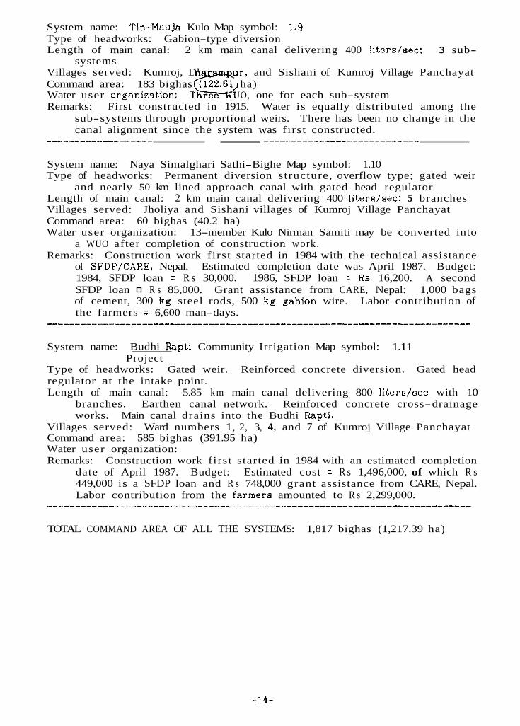
System name: Tin-Mauja Kulo Map symbol: 1.9 Type of headworks: Gabion-type diversion Length of main canal: 2 km main canal delivering 400 liters/sec; 3 sub-
Villages served: Kumroj, Dhar u r , and Sishani of Kumroj Village Panchayat Command area: 183 bighas (122.61 ha)
Remarks: First constructed in 1915. Water is equally distributed among the sub-systems through proportional weirs. There has been no change in the canal alignment since the system was first constructed.
systems
Water user organimtion: Three G UO, one for each sub-system
System name: Naya Simalghari Sathi-Bighe Map symbol: 1.10 Type of headworks:
Length of main canal: Villages served: Jholiya and Sishani villages of Kumroj Village Panchayat Command area: 60 bighas (40.2 ha) Water user organization: 13-member Kulo Nirman Samiti may be converted into
a WUO after completion of construction work. Remarks: Construction work first started in 1984 with the technical assistance
of SFDP/CARE, Nepal. Estimated completion date was April 1987. Budget: 1984, SFDP loan = R s 30,000. 1986, SFDP loan = R s 16,200. A second SFDP loan R s 85,000. Grant assistance from CARE, Nepal: 1,000 bags of cement, 300 kg steel rods, 500 kg gabion wire. Labor contribution of the farmers = 6,600 man-days.
Permanent diversion structure, overflow type; gated weir
2 km main canal delivering 400 liters/sec; 5 branches and nearly 50 km lined approach canal with gated head regulator
___________-____________________________------------------------------------
System name: Budhi Rapti Community Irrigation Map symbol: 1.11
Type of headworks: Gated weir. Reinforced concrete diversion. Gated head regulator at the intake point. Length of main canal: 5.85 km main canal delivering 800 liters/sec with 10
branches. Earthen canal network. Reinforced concrete cross-drainage works.
Project
Main canal drains into the Budhi Rapti. Villages served: Ward numbers 1, 2, 3, 4, and 7 of Kumroj Village Panchayat Command area: 585 bighas (391.95 ha) Water user organization: Remarks: Construction work first started in 1984 with an estimated completion
date of April 1987. Budget: Estimated cost = R s 1,496,000, of which R s 449,000 is a SFDP loan and R s 748,000 grant assistance from CARE, Nepal. Labor contribution from the farmera amounted to R s 2,299,000.
TOTAL COMMAND AREA OF ALL THE SYSTEMS: 1,817 bighas (1,217.39 ha)
-14-
RECONNAISSANCE/INVENTORY STUDY OF IRRIGATION SYSTEMS IN THE INDRAWATI BASIN OF NEPAL
Robert Yoder and S.B. Upadhyayl
INTRODUCTION
The first official recognition and estimate of the extent of farmer-managed irrigation systems (FMIS) in Nepal was made by the Water and Energy Commission Secretariat (WECS) in 1981. The size of systems ranges from a single farmer’s plot consisting of a fraction of a hectare (ha) to the federation of several organizations and diversions into a system which irrigates as much as 15,000 ha. However, it is the sheer number of systems rather than their size that makes the greatest impact on irrigated agriculture. Farmers in Nepal have been active for many generations in pushing the technology available to them to its limit. They have tapped all easily accessible water and land resources to develop irrigated agriculture.
Excluding the systems in the tarai, simple extrapolation of the results shown in this paper along with information from the Land Resource Mapping Project (1986), indicates that there may be well over 17,000 farmer-managed systems in the hills of Nepal. The impact of FMIS in terma of subsistence living and hence the national economy has not been carefully studied. MBrtin (1986) and Yoder (1986) present data from several communities with perennial irrigation a t elevations below 1,000 meters ( m ) which produce three crops per year. The net annual increase in cereal production with irrigation over that of nearby unirrigated land w a s found to be well over 6,000 kilograms per hectare (kg/ha). As a conservative estimate one can assume an average increase in production of at least 2,000 kg/ha through FMIS. Using this estimate of yield increase and the WECS estimate that roughly 390,000 ha a re irrigated by such systems in all of Nepal, one can show that the incremental increase in production due to FMIS is providing the total subsistence level cereal production for at least 30 percent of Nepal’s population. This calculation is based on the average cereal consumption of 164 kg/person/yr (Khadka and Gautam 1981). WECS is presently conducting a water-use inventory in the tarai districts which will give a better estimate of irrigated land area. Preliminary analysis indicates that the area irrigated by FMIS may be as much a s double the earlier estimates. In this case the dependency upon FMIS for food production may be much higher than t h e above analysis indicates.
INTERVENTION IN FMIS
1Robert Yoder ie a resident scientist in Nepal for the International Irrigation Management Institute (IIMI) and S.B. Upadhyay is the executive director of the Water Reaources Directorate in His Majesty’s Government of Nepal’s Water and Energy Commission Secretariat (HMGN/WECS).
The action research project reported on in this paper i s administered by WECS and partially funded by the Ford Foundation. The viewe and interpretations in this paper are the authors’ and are not attributable to the International Irrigation Management Institute, Water and Energy Commission Secretariat, or the Ford Foundation.
-15-

The appearance of most FMIS belies their potential performance. Brush/stone diversions and earth-lined canals leak and require frequent maintenance. This has led development agencies, and engineers in particular, to assume that structural improvements in the water acquisition and delivery system will improve the system efficiency. Further, that efficient operation will allow for more reliable, intensive irrigation of the existing command area, and expansion ct the irrigated area where land is available.
Past efforts of intervention in FMIS to improve their agricultural performance have not been highly successful, This is partially due to misdiagnosing the cause of the shortcomings. FMIS are generally built with local materials that decay quickly when not in use. Inspection of systems by technicians responsible for intervention usually takes place in the winter and dry season. At that time many systems do not have water available in their source and farmers do not waste effort in trying to maintain a system that cannot be used for a season. Technicians often declare such systems to be in total disrepair without the understanding that they will be transformed into viable systems by the beneficiaries a s soon a s water is available. In some cases farmers are willing to invest as much a s 50 person-days/ha/year in maintaining their systems (Yoder 1986).
Physical improvements in a system may be a necessary condition for better performance but making structural improvements alone seldom brings the desired results. The strength of an irrigation system with scarce resources that performs well, is i ts management. Improving the management capability of poorly performing systems may be equally important to making improvements to its physical system. In some cases assistance from outside the community has eroded local management and resource mobilization capability.
The magnitude and impact of resource mobilization by the beneficiaries is not well known or understood. The high performance of some FMIS is attributed to t h e capability to mobilize tremendous labor and cash resources for operation and maintenance (Yoder 1986). One system in Gulmi, two in Palpa and one in the Nawalparasi hills were intensively monitored for 18 months in 1982-83. In systems where the water source was adequate, all were producing three irrigated crops each year. Using crop cuts to estimate the yield, the system wi th least water--producing two crops--had a total annual production of 5,200 kg/ha and those with three crops per year ranged from 7,500 to 9,000 kg/ha. Such examples of intensive agriculture production in FMIS are not isolated cases (Pradhan 1986).
However, some FMIS are operating far below the production level that they could potentially achieve with the available water and land resources (Pant 1985; Tiwari 1986). In many cases farmers have good cause for requesting and actively campaigning to attract outside assistance for structural improvements. In addition to more reliable and extensive irrigation, farmers are interested in reducing the effort--labor and in some cases, cash--that they need to invest in maintenance of their systems.
With increasing interest among agencies to target poorly performing systems for intervention, several practical questions emerge. I t i s clear that FMIS have been successful in increasing agriculture production. Some systems perform well and are close to achieving their potential. Others perform far below their potential. How does one distinguish between systems? What procedure can be used to quickly collect and analyze information for ranking systems in priority for assistance? How does one analyze the symptoms in
-16-

order to diagnose the causes of low performance'? improve the performance?
How does one intervene to
WECS has engaged in an action-research project to attempt to answer some of these questions.
THE WECS ACTION-RESEARCH PROJhCT
The underlying rationale for the WECS action-research project is the hypothesis that farmers in the hills of Nepal have already, to some extent, developed most of the sites with potential land and water resources for irrigated agriculture. Few new systems will be built where there i s not a t least some existing irrigation activity. Where irrigated agriculture already exists, farmers have some irrigation management experience. They also have knowledge about the stream discharge, diversion and canal maintenance problems, soils, irrigated agriculture practices, and benefits of irrigated agriculture. I t is expected that food production gains can best be made by examining the existing (running) systems to identify, and to the extent possible, release the constraints t h a t farmers face in increasing agricultural production through intensification or expansion of their irrigation system.
The aim of the WECS project is to examine the physical, hydrologic, agronomic, economic, and social/organizational aspects of existing irrigation systems to first identify if there a re water and land resources in a community that are not fully utilized, and then attempt to uncover the reason for less than full exploitation of the irrigation potential. Another a i m is to develop and test processes to overcome the problems. Emphasis is placed on developing the necessary methods and tools for collecting useful information as quickly and cheaply a s possible. After evaluating the alternatives, recommendations for upgrading and improving individual system operation will be made and carried out a s a part of the project.
The intent is to carry out all activities in such a way as to enable the beneficiaries to continue to take full responsibility for the operation and maintenance of their irrigation system. This implies maximum participation by the farmers in the identification of the constraints, examination of alternatives, choice of the appropriate action, and implementation of the action. The action-research mode of carrying out the work allows specific problems to be addressed as they are identified. Recommended actions can be implemented immediately, offering an opportunity to further study the impact of these activities and to make additional recommendations and carry them out a s necessary.
Objectives of the Project
The primary objective of this action-research project is to examine ways to assist farmer-managed systems tha t will allow them to overcome the constraints limiting intensification and expansion of irrigated agriculture. This includes testing lower-cost techniques and technologies and maximizing the participation and resource mobilization of the beneficiaries. I t also includes developing and testing low-cost processes, procedures, methods, and technology for developing under-utilized human and physical resources. The maxim i s to do this without shifting the responsibility for operation and maintenance to the government.
-17-

The WECS action-research project proposes to assist irrigation systems in the project area. However, success of the project will not be measured by the intensification or expansion of irrigated area, but by the degree to which the objectives of developing processes and procedures are accomplished.
The implementation of the project is being carried out in two phases. The first phase cqnsists of information gathering, analysis, and recommendations of bteps for initiating the second phase. The second phase will involve intervention in irrigation systems selected a s a part of the first-pbase activity. Monitoring and evaluating the intervention will be an integral par t of the activity.
The chronological s teps taken to carry out the first phase include:
1. Project site selection.
2. and rapid appraisal study of the project area.
3. Selection of a local consulting firm to carry out the f i rs t phase field
Development of the terms of reference for a reconnnissance/inventory
studies.
4. Development of a procedure for the reconnaissance/inventory s tudy and carrying out the field work and report writing associated with it.
5. Selection of micro areas for fur ther investigation by rapid appraisal techniques based on the reconnaissance/inventory study report.
6. Development of a procedure for the rapid appraisal study and carrying out the field work and report writing associated with it.
7. Development of a work plan for the second phase based on the reconnaissance/inventory and rapid appraisal reports by the consultants, and additional field reconnaissance by WECS staff.
With the exception of developing a work plan in the last step, the first phase is complete. The remainder of this paper will examine and analyze the procedure and results of the reconnaissance/inventory s tep of this activity.
Methodology and Field Procedures
The project site was envisioned to encompass a large river basin and include all of i ts numerous minor tributaries. The criteria for selecting the site were: accessibility from Kathmandu for supervision and representativeness of the hill areas of Nepal. The Indrawati River basin in Sindhupalchok f i t these criteria. To further define the boundaries of the project, only the area above Sipa Ghat, extending four kilometers (km) on each side of t h e Indrawati River, was included. This excluded the Melaunche River, a major tr ibutary, but included almost all of the remaining irrigated area in the basin.
The consultants were given background materials, including check-lists and write-up guides developed in different parts of the world, and available materials from Nepal. From this material they developed their own lists and guides for both the reconnaissance/inventory and rapid appraisal study.
To carry out the field work t h e consultants were to use an interdisciplinary team consisting of a t least an engineer, a social scientist, and
-18-

an agriculturalist. However, t h e nature of consulting firms does not lend itself to fielding such a team. Few persons can be employed full time by consulting firms, therefore individuals who can take leave from their regular jobs are recruited. Frequently the best-qualified persons on the roster a r e not available and others must be substituted. This allows little flexibility in selecting disciplines.
The reconnaissance/inventary field work was carried out b y a civil engineer, an agriculture specialist, one junior hydrologist and two helpers. Some assistance was provided for part of the time in the field by an IIMI social scientist.
The reconnaissance/inventory team visited each irrigation system in the basin. The most important activity was to walk along the length of the canal from the intake to the command area. One or a group of farmers was invited to accompany the team. While walking along the canal the farmers were questioned about the operation and maintenance of the system and the organization that was in place to carry out the various irrigation activities. Problems wi th the diversion and along the canal were discussed while making this inspection.
Water in the source was estimated while inspecting the intake. Farmers were also asked to estimate the discharge in the stream and relate the observed discharge to that in each irrigation season. In addition to the consultant's estimate of discharge by visual inspection, he asked the farmers to make their own estimate by asking them how they measure water. Usually the response was in of water (discharge required to drive a locally-built water- powered flour mill assumed to average about 28 liters per second [Ips]) or & (water pot used for carrying domestic water holding about 20 liters) or samaha (water basin 5-10 liters). Water for driving a ghatta w a s fur ther differentiated by asking if the water w a s sufficient for grinding all types of grain. If a t some periods of the year it could only grind millet, the discharge was clearly lower than a t other times. Half or one-fourth ghatta of water were also typical responses for discharge estimates. For lower discharges, farmers were asked how long i t would take to fill a gagri or samaha. Since time is not generally measured in minutes and seconds by the farmers, they were asked how many times the gagri would fill in the time that it took to smoke a cigarette, which w a s estimated to be about four minutes.
The error in this type of estimate is high. A mill can grind grain with 0.25 - 1 kilowatt (kw) of power and power is a function of both the discharge and head (height the water is dropped) a s well a s the efficiency of the particular ghatta. However, it does give an idea of the relative discharge and of the variation over the year, Coupled with information from the farmers about t h e adequacy of the water supply for irrigating different crops and whether there was sufficient water to expand the area irrigated, the discharge information provided insight into the extent that the water resource had potential for fur ther utilization.
To the extent possible the command area was also inspected. This was a difficult task among the many ridges and valleys and not always possible in the time available. The farmers were asked to estimate the area in the hydraulic command of the canal, how much of that area w a ~ actually irrigated, how much was cultivated but not irrigated, and the extent of the waste area. While examining the command area, farmers were also asked about their agricultural practices.
-19-
Estimates of land area were more difficult for farmers to make than estimates of water discharge. The cadastral survey of this area i s complete and individuals have knowledge about their own holdings but not of the aggregate in the system. The most common measure of land area used by the farmers in this area is the volume of seed required to plant the area. A rough estimate for conversion is 20 patti of seed/ha (91 liters of seed/ha). Unlike most systems dudied in western Nepal, few of these systems had quantified ihe resource mobilization or water allocation of the system on the basis of [and area. Therefore, farmers have not needed to compute the total land area or seed required for a sy s t em and found it difficult to do so. The accuracy of the land area information could be improved with good quality air photos.
Since maps of a suitable scale are not available, the consultants were asked to make a sketch map of the area showing the irrigation water source, rough alignment of the canal, and layout of the command area. The map included the names and relative locations of the intake, canal, and command area of each system from that particular water eource.
RESULTS AND ANALYSIS OF THE RECONNAISSANCE/INVENTORY WORK
The project area covers about 200 square kilometers (km*). The Indrswati River cannot be used extensively for irrigation because it i s deeply incised, and is large, with violent floods. Almost all of the irrigated fields in the project area receive their water from the 25 tr ibutary streams. Most of these streams are steep-sloped having highly destructive, short-duration floods during the rainy season and very little water in the d ry season. .
The reconnaissance/inventory study identified 119 irrigation systems in the project area w i t h canals longer than 0.5 km. These systems irrigate about 2,100 ha of land and were found to benefit approximately 10,100 households. In addition there are many systems with shorter canals and small command areas in the valley bottoms which have easy access to the available water. These were not included in the inventory because they have little potential for intensification or expansion.
The longest canal was found to be 5.5 km from the source to the command area. On the average the canals a r e 1.9 km long and serve 100 households. Several systems irrigate over 100 ha. Up to 800 households own portions of land in the larger systems. The average land area served by the systems in the study area is 18 ha. However, the median area covered by a system is about 10 ha.
Of the approximately 3,800 ha within the boundaries that can be irrigated by gravity (hydraulic or gross command area) from the canals, 30 percent is too steep or rocky for cultivation. Of the gross area, 56 percent is irrigated and about 14 percent is cultivated but not irrigated because of insufficient water in the source or inability to deliver the water to the land.
The area irrigated represents about 11 percent of the total 200 kmz project area. Although the project area is small and no claim can be made that it is average for t h e hills, this is possibly the best data presently available for estimating the area irrigated by FMIS in the hills and fur estimating the total number of such systems. Extrapolation of the number of systems and percentage of area covered by FMIS in the project, to all of the hills and mountains of Nepal, yields an estimate of at least 17,000 systems covering 300,000 ha. The basis for land area in this calculation is taken from the Land
-20-

Resource Mapping Project (1986) and only Class I, 11, and 111 land (land classified as supporting cultivation) from the siwaliks, mid-mountains, and high mountains was included.
Out of the 119 systems identified, 25 have received some form of outside assistance in the past 20 yeare. For some the assistance was a certain tonnage of grain for working on the improvement or rehabilitation of an existing canal. In such cases the beneficiarim did most or all of the work themselves. Eleven systems in the study area have been built (about half are still under construction) by the Department of Irrigation, Hydrology, and Meteorology.
A major accomplishment of the reconnaissance/inventory work is a detailed l is t ing of the potential for either intensifying the cropping pattern or expanding the area irrigated by each system. Out of t h e 25 basins of the minor streams tapped for irrigation in the study area, only 11 basins with 2 1 different irrigation systems were identified by the consultant a s having land and water resources with potential for expansion of the irrigated area. A more reliable water supply would allow more intensive cropping in many systems beyond these 21 and improvements in both the management and physical system would assist in making this possible. However, assisting the 21 systems identified by the reconnaissance/inventory study is likely to lead to the largest gain in food production.
In addition to the physical resources, the study examined operation and maintenance (O&M) activities of the irrigation systems and agricultural practices. Even by spending very little extra time in each system the t e a m collected valuable information about the historical development of the system, the current organization for O&M, and the capability for resource mobilization. This information w a s considered along with information about the physical system in determining the potential for expanding water and land resource utilization.
A summary of the effort that went into carrying out the reconnaissance/inventory work is presented in Table 1. Here it is seen that the report writing was more time consuming than t h e field work. Attention should be given to making the report writing simpler without compromising content and also to making it more readable than the present two volumes totaling 500 pages.
Table 1. Resources expended i n carrying out the reconnaissance/inventory work (person-days).
-21-
By making a comparison of river basins i t is estimated that the same level of intensive field work to cover the entire Sindhupalchok District would require one team to spend about 18 weeks in the field.
DISCUFSION AND CONCLUSIONS
Although the estimates of water discharge and land are3 are not accurate in absolute terms, the reconnaissance/inventory work is extremely valuable in determining the irrigation development potential in a relative sense. The study has successfully identified the existing irrigated land resource. I t has also successfully captured farmer input in identifying under-utilized resources. Finally, it has allowed t h e identification of systems with obvious potential for intensification or expansion from among those wi th little or no potential. Through systematic examination, attention i s focussed on 21 of the 119 systems. The study provides a combination of information on the agriculture system, management practices, and physical system, giving an insight into the constraints that must be overcome to make the systems more productive.
If this type of study were to be carried out on a district-wide basis it would allow planners and policy makers to se t priorities that would maximize re turns on investment in development. The cost for completing the reconnaissance/inventory study in Sind hupalchok would be approximately six times what has been invested in studying the Indrawati basin.
Two limitations of the present study should be addressed in future work. The land area estimates need to be improved and potential areas where farmers have not been able to develop irrigation should also be examined. Both of these could best be addressed by using good quality, large-scale air photos in the field. The possibility of using existing air photos by enlarging relevant areas should be examined. By tracing the boundaries of the irrigated area on !.he air photo, more accurate estimates of area could be calculated. Some effort would need to go into determining the scale of each photo segment by making measurements on the ground or using the cadastral map, if identifiable features can be found on both the photo and map.
REFERENCES
Hydro-Engineering Services. 1986. Profile report of farmer-managed irrigation systems, Sindhupalchok District. Volume I Main report and write-up. Water and Energy Commission Secretariat, HMGN, Kathmandu, Nepal.
Hydro-Engineering Services. 1986. Profile report of farmer-managed irrigation systems, Sindhupalchok District. Volume 11, Annexes. Water and Energy Commission Secretariat, HMGN, Kathmandu, Nepal.
Hydro-Engineering Services. 1986. Methodology questionnaire and write-up formats used in reconnaissance/inventory study of farmers' irrigation systems, Sindhupalchok District. Water and Energy Commission secretariat, HMGN, Kathmandu, Nepal.
Khadka, B.B. and J.C. Gautam. 1981. Quoted in ADB/HMGN. 1982. Nepal agriculture sector strategy study. Asian Development Bank, Manila, Philippines.
-22-

1,and Resource Mapping Project. 1986. Land capability report. HMGN Topographical Survey Branch, Kathmandu, Nepal.
Martin, Edward D. 1986. Resource mobilization, water allocation, and farmer organization in hill irrigation sys tems in Nepal. Unpublished Ph.D. dissertation. Ithaca, New York: Cornell University.
Pant, Mahesh. 1985. Action-research on community participation in the management of irrigation resources: Case study of Solma irrigation project of E a s t Nepal. Report submitted to the Agriculture Development Council, Kat hmandu, Nepal.
Pradhan, Prachanda. 1986. A comparative study of 21 farmer-managed irrigation systems in Nepal.
Tiwari, D.N. 1986. Farmer-managed irrigation systems: A case of Mana Besi Phant, Nepal. Unpublished paper. Kathmandu, Nepal.
Yoder, Robert. 1986. The performance of farmer-managed irrigation systems in t h e hills of Nepal. Unpublished Ph.D. dissertation. Ithaca, New York: Cornell University.
Water Resources and Energy Commission Planning Unit. Irrigation sector review. Report no. 3/2/190981/1/1. HMGN, Ministry of Water Resources, Nepal.
IIMI, Sri Lanka.
-23-

GUIDELINES FOR RAPID APPRAISAL OF IRRIGATION SYSTEMS EXPERIENCE FROM NEPAL
Prachanda Pradhan, Robert Yoder, and Ujjwal Pradhanl
THE UTILITY OF RAPID APPRAISAL
Given constraints of time, money, and manpower, rapid appraisal is a useful tool for assessing existing irrigation systems. It can be used to identify key issues and problem areas and to give direction for fur ther investigation. The effort of rapid appraisal should lead to a wide variety of options and possible alternative arrangements for irrigation management.
The "quick and dirty image" often associated with rapid appraisals can be overcome with a well-developed framework and a team that is integrated in its effort. Intensive interaction of the team while in the field leads to cross- checking of information and an opportunity for follow-up questions.
One must recognize that rapid appraisal has limitations. Not all questions can be answered by it. Complex issues cannot be unraveled in a short time. Some results and conclusions will inevitably be wrong. Increased skill in cross- checking can reduce this problem but there is always danger that the investigator will be misled by one or a few informants. I t is important to examine rapid appraisal results within the context of i t s limitations.
This guideline for rapid appraisal of irrigation systems was largely prepared on the basis of experience wi th farmer-managed irrigation systems in Nepal. With some modification it could be used to investigate agency-managed systems a s well.
INTRODUCTION TO RAPID APPRAISAL
Agrarian change and agricultural development a re quite intimately associated with the status of irrigation in Nepal. Irrigation systems are complex socio-technical units, and development activities have directly and indirectly affected the status of these systems. Due to resource constraints of a developing country, a detailed and in-depth study of each irrigation system under consideration is not possible. Th i s i s certainly not possible in Nepal where it is estimated that there a re between 20,000-50,000 irrigation systems.
Effective rapid appraisal studies cannot be conducted by simply putting together a comprehensive question guide and taking i t to the field for systematic investigation. Before a t e a m goes to the field it i s important that each member understand "what" the nature of a rapid appraisal s tudy is, "why" rapid appraisal methods have been selected, "how" i t will be applied, and what the nature of the "product" of the study will be.
'Prachanda Pradhan and Robert Yoder a re reeident scientists in Nepal for the International Irrigation Management Institute (IIMI). Ujjwal Pradhan is a research fellow affiliated with IIMI and Cornell University.
-24-
What I s Rapid Appraisal?
Rapid appraisal is a methodology for collecting information quickly. Appraisal is used in the general sense to mean investigation and analysis, and primary attention is given to practical investigation. Since the time-frame for field investigation is shortened, there is an attempt to compensate by intensive preparation and carefully planned procedures in the field. I t is particularly well-suited for studies of irrigation systems since there is usually more than one system to examine, and time, funds, and sk.illed manpower a re often a constraint to conventional studies. The output of rapid appraisal studies is generally a report for a specific purpose. The purpose for the study must be well defined in advance. The study is usually carried out by an interdisciplinary team.
Why U s e Rapid Appraisal?
A rapid appraisal study can be used for various purposes. In some cases it can be used a s a way to identify and describe systems for which there i s no written documentation. I t can be used to assess the physical system and problems associated with it such a s identifying the need for rehabilitation. I t can be used to assess the organizational strength and weaknesses of a system. A study can be used to lay out the socio-technical processes involved in the operation of a system and this information used to solicit participation in organizational activities or collaborative resource mobilization for improving the system. The utility of rapid appraisal methods will vary depending on the type and depth of information that is needed and how the results are to be used.
A series of rapid appraisal studies can be used to provide a comparative picture of irrigation operation across systems. By identifying pertinent variables such a s maintenance labor mobilized per hectare, sanctions for water theft, leadership roles, etc., it is possible to make cross system comparisons and in some cases rank the strengths and weakness of each system.
A general picture of a single system or a comparative understanding of a series of systems helps decision makers focus on key issues. I t might point toward the need for more in-depth research or identify the physical areas or social interactions that require further study. I t may thus be a tool for identifying further research needs.
How to Undertake Rapid Appra id?
Since irrigation is multidimensional with interacting physical, biological, and social environments, an interdisciplinary team has a definite advantage. This assumes, however, that the t eam will work together and interact: i t i s an ideal that cannot be taken for granted. A balance is needed among the t e a m members to insure that the necessary multitude of perspectives a re properly integrated and incorporated into the report.
There should be a conscious effort to cover the range of disciplines needed to understand the complex interaction of the biological, social, and physical environments. A valuable contribution that should not be overlooked is the opportunity for cross-fertilization of research methods among the different disciplines represented on the team.
Unstructured, small-group interviews and careful observation a re powerful tools for collecting accurate information and should be used a s much a8 possible. Interviews should be conducted with a checklist to ensure that the
-25-
important points are not missed. Open-ended discussion should be encouraged by avoiding formal questionnaires. Since time is a factor in rapid appraisal, choose a guide who knows the people and is familiar with the par t of t h e system to be visited. This will assist in moving about and meeting key informants, allowing for rapid investigation. Use maps or aerial photos to select locations find pick out key categories of information to determine which people to visit. Key infcrmants to interview should be selected for their specialized knbwledge: irrigators (head, middle, and tail), women, agriculture workers, and project staff. When different versions of issues are given by different informants, they must be interpreted from the perspective of the different interests within the community. On sensitive issues one must be careful to remain neutral.
For many irrigation systems in Nepal, what one sees in the field visit will be dependent upon the time of the year. Some systems are not operating in the d ry season. Most systems have been built for irrigating monsoon rice. I t would be desirable to visit them during the monsoon even though that is the time when travel is most difficult. If a system is visited while it is not operating one must look for clues to how t h e system migh t function. For example, the cropping pattern and the extent and location of fallow land would lead to questions about water adequacy and the management of distribution. The logic for type and location of physical s t ructures like aqueducts, siphons, and gates, or lack of structures, are easier to understand if the system is seen in operation but can also be visualized by imaginative questioning.
Preparatory steps before a rapid appraisal study. Gathering all available information such as maps, previous reports and air photos, is the logical way to begin any study. To become familiar with the study area, there is no substitute for desk work. If a large area or large number of systems are assigned for study, it may be necessary to do a reconnaissance. I t is not necessary that all team members participate in this step. One or two persons can do the reconnaissance. The purpose of the reconnaissance is to help in selecting, or limiting, the type and number of systems for fur ther study. I t should give an overview of the situation and the reconnaissance report should provide valuable background material for briefing the team.
Formation of the team. For irrigation studies i t is useful to have a t least a mix of four disciplinary skills on the team--organizational, cultural/social, technical, and agronomic. However, even more important than the disciplinary mix is mutual respect and an attitude and desire to learn from each other’s point of view. Three to six members on a team allow easy interaction and discussion. If a portable computer i s available, an experienced typist with the team in the field would help reduce the drudgery of writing and speed u p the report writing.
Rapid appraisal activities. There should be an organizational meeting where information is shared and roles for the study are established. A team leader should be selected to assign tasks: logistics, public relations, scheduling. All of the background material available should be shared among all of the t e a m members. There should be discussion about the purpose of the study and the format of the report. The checklist or question guide should be discussed and amended by consensus. I t is useful if this checklist can be arranged in the desired outline for the field notes. This facilitates merging each individual team member’s notes into one complete se t of comprehensive field notes containing all observations and data collected. Such a set of notes can be more easily checked for consistency than each member’s separate complete se t of
-26-

notes. A sample checklist that doubles a s an outline for merging the field notes is included in Appendix 1.
A useful exercise for the team in the first meeting would be to discuss the interaction of the various irrigation activities. This would help to underscore the need for different perspectives to establish a comprehensive Understanding of the irrigation system and how it operates. A matrix showing the interrelationship of organizational, physical and water use activities is given in Appendix 2. This matrix could be used to Pacilitate discussion.
If a t all possible the team should be resident in the command area while in the field. There should be as much interaction a s possible with farmers on an informal basis. The team must be disciplined in not displaying authoritative behavior. They should answer questions asked by farmers about the reason for the study as soon a s they are raised with as much detail as necessary but without giving false assurances about assistance. Sensitivity about intruding upon the farmer’s time is important. Food and services should be paid for.
The team should travel through the system together the first time (walking, if possible) to share observations and jointly conduct farmer interviews. Then the group should break into smaller units of two or three for subsequent visits. Useful suggestions from Chambers and Carruthers (1986) for offsetting frequent appraisal biases while carrying out field work a re given in Table 1.
In addition to writing notes in the field (while observing t h e system and discussing with informants), the team members should spend time alone each day rewriting the notes according to the agreed-upon outline and making certain the notes are complete. If a typist is part of the field t eam the team members should have these rewritten field notes entered into the word processor. The emphasis should be on simple statements and phrases ra ther than polished sentences and paragraphs in order to record the raw data quickly and make it available for discussion with the res t of the team.
The most important group activity i s to have frequent meetings to share and discuss what has been measured, observed, and heard. Different and contradictory points of v iew need to be aired and hypotheses formulated for testing in order to identify gaps in understanding and interpretation. This intensive discussion will help the team to comprehend the relationship among the physical, social, and agronomic environmenta. The group discussion sessions will generate new questions to be taken back to the field on the next visit.
Before leaving a system it is essential that each team member’s notea be compiled into a master note file according to t h e agreed-upon outline. This can be done by each team member or one individual and is greatly facilitated by having a typist and computer in the field. Even though doing i t by hand is time consuming and difficult when a computer and typist are not available, i t improves accuracy and ease in report preparation later. The master note file assures that discussion of each point has taken place and discrepancies resolved before leaving the opportunity to ask a few final questions or make additional observations in the field. Analysis of the information while compiling the master note file allows weeding out of misleading information. I t also assures that all of the information of one system has been processed before moving on to another system with the possibility of getting the two systems mixed and confu sed.
-27-

Table 1. Offsetting appraisal biases.
S o m e B i a s What to do
Visiting only head reaches and Co t o the tails and off traveling canal roads by car. the roads: walk around.
Examining the dis t r ibut ion system. Visiting only during working hours and in daylight. hours, and at night.
Making only one v i s i t , or v i s i t ing at the same t i m e each season. seasons.
Observing only physical works such as headworks, canals, cross dis t r ibut ion, comunication--and regulators, and gates. meet people.
V i s i t i n g only demonstration trials V i s i t fanners lower down the same or special projects.
............................................................................
Look at t h e drains. Co before and after working
Inquire about the s i tua t ion a t other times, and i n other
Find out about process--
channel who may ge t less water because of a trial or project.
Meeting only the eli te: s t a f f , Make an e f f o r t t o meet poorer better-off farmers, inf luent ia l fanners, laborers, and women. people, and men.
Blaming farmers for misusing t h e system. do.
T e l l i n g people what they should do. them.
V i s i t i n g people hurriedly.
Find out why farmers do what t h e y
Listen t o people and learn from
Plan t o spend more t i m e and be pat ient with people. ............................................................................
Source: Chambers, Robert and Ian Carruthers. 1986. Rapid appraisal t o improve canal i r r iga t ion performance: experience and options. IIMI Research Paper No. 3 , IIMI, Digana V i l l a g e , S r i M a .
THE PRODUCT OF RAPID APPRAISAL
The product of rapid appraisal is a report which reflects a well-integrated team effort. The integration begins with the organizational meeting when tasks and roles a re assigned and continues in the field as notes of discussions are compiled. The effectiveness of rapid appraisal is due to the t e a m effort and utilization of input from all team members on all issues.
The style of the report should reflect t h e purpose for which the information is intended to be used. If the primary purpose is identification and description of systems, the report will be mostly narration. However, if comparison of systems is planned, the variables to be compared should be identified before the report is written 80 that the material to be compared in different reports is presented in an identical format and is easily found in each report.
-28-

The s t ructure of the final report should be decided by the group and does not need to follow the organization of the question guide. To ensure continuity in style and content it is best if one person writes the f i rs t draft of the report. T h e report should contain appropriate maps and sketches of important features. I f possible, photos should be included to assist in communicating the information that has been collected.
Under constraints of time, finances, and manpower, rapid appraisal is a useful tool for compiling information that can only be acquired through field studies. Experience and skill in cross-checking are necessary to reduce the e r ro r s often associated with rapid appraisals. This requires a well developed framework and an integrated team effort.
-29-

I.
A.
B.
C.
APPENDIX 1
RAPID APPRAISAL CHECKLIST
INTRODUCTION
Arta overview
-Location: -Access to the system. -Access to support services and markets. -Physical information of the surrounding area. -Food sufficiency. -Labor availability in each season: daily wage, contract.
Settlement pattern of surrounding area
-History of settlement. -Population. -Milestones in agricultural development (establishment of support services,
-In- and out-migration patterns. -Ethnic composition.
History of the surrounding area’s irrigation development
-Map or sketch including the following for each system: relative location,
-For each system: type (hill, river valley,or tarai),
zone, district, village panchayat, ward.
introduction of new crops, etc.).
water source, diversion point, command area, name.
management (agency, farmers, or joint).
ILHISTORY OF THE SYSTEM
A. Original construction
-When? -Who initiated and directed? -Amount and source of resources invested: cash, .bor, materials. -Basis for internal resource mobilization: -External resources.
household, landholding.
B. Improvements/rehabilitation
-Other than routine maintenance, when have major inputs and
-Who initiated? When? What was done? -Internal or external resources. -Basis for internal resource mobilization. -Are there regular external resources given?
improvement8 been made?
C. System expansion
-How have boundaries of system changed over time?
-30-
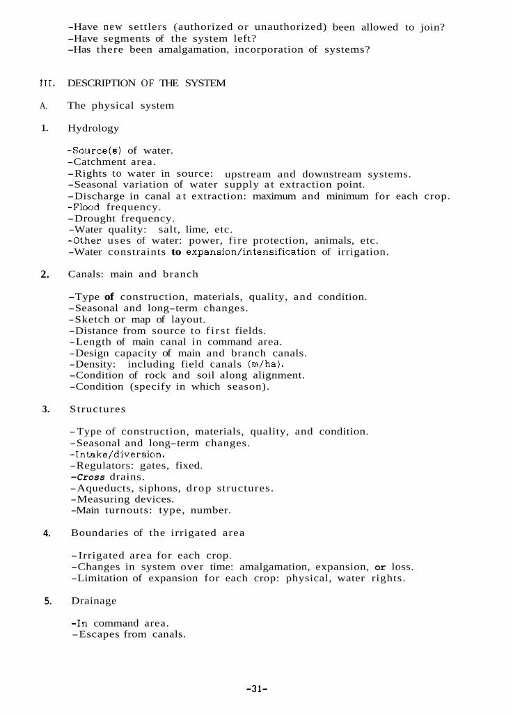
-Have new settlers (authorized or unauthorized) been allowed to join? -Have segments of the system left? -Has there been amalgamation, incorporation of systems?
111. DESCRIPTION OF THE SYSTEM
A.
1.
2.
3.
4.
5.
The physical system
Hydrology
-Source(s) of water. -Catchment area. -Rights to water in source: -Seasonal variation of water supply a t extraction point. -Discharge in canal a t extraction: maximum and minimum for each crop. -Flood frequency. -Drought frequency. -Water quality: salt, lime, etc. -Other uses of water: power, fire protection, animals, etc. -Water constraints to expansion/intensification of irrigation.
Canals: main and branch
-Type of construction, materials, quality, and condition. -Seasonal and long-term changes. -Sketch or map of layout. -Distance from source to f i r s t fields. -Length of main canal in command area. -Design capacity of main and branch canals. -Density: including field canals (m/ha). -Condition of rock and soil along alignment. -Condition (specify in which season).
Structures
-Type of construction, materials, quality, and condition. -Seasonal and long-term changes. -Intake/diversion. -Regulators: gates, fixed. -Cross drains. -Aqueducts, siphons, d rop structures. -Measuring devices. -Main turnouts: type, number.
Boundaries of the irrigated area
-Irrigated area for each crop. -Changes in system over time: amalgamation, expansion, or loss. -Limitation of expansion for each crop: physical, water rights.
Drainage
-In command area. -Escapes from canals.
upstream and downstream systems.
-31-

6. Soils.
IV.
A.
B.
C.
D.
E.
V.
A.
-Type: head, middle, tail. -Fertility and suitability for irrigated agriculture.
OPERATION AND MAINTENANCE
Activity/problems
-Related to water acquisition: water rights, paucity of supply, damage from floods, etc. -Related to water delivery: canal cleaning, landslide repair, flood damage,
-Related to water distribution and drainage. -Priority t a s k s in O&M: maintenance of diversion and canal or water
crabs, animals, seepage.
distribution.
Water distribution tasks (Frequency and magnitude of effort)
-Method of water distribution for each crop and variation during each crop: rotation (who and how initiated, frequency of turn) ; continuous flow; contract; turns (head to tail).
-Distribution during water-short period: rotation among outlets, among field neighbors within outlet.
-Match between water distribution and allocation: method of matching, proportioning weir, timed rotation.
-Relationship of water distribution to physical infrastructure. -Who is responsible for water distribution activities?
Routine maintenance
-What w o r k is done. -Frequency. -Purpose: improve performance, preventive. -How long does i t take? -Who initiates and directs work?
Emergency maintenance
-Reasons. -Frequency. -How long does it take? -Who determines it is an emergency? -Who organizes and leads the work?
Extent of agency involvement in system
-What agency is involved? -Management input of agency. -Agency organization for water delivery and O&M.
INSTITUTIONS AND SOCIAL ENVIRONMENT
Social s t ructure
-32-
-Landholding pattern. -Nature of tenancy (criteria: owner, tenant, sharecropper). -Ethnic composition in the command. -Villages. -Settlement pattern and irrigation labor availability. -Power s t ructure (related to 1qnd and panchayat affiliations). -Religion. -Kinship pattern. -Leadership: formal, informal, -Migrants: -Non-agriculture employment. -Seasonal migration for employment.
Organization for irrigation operation and maintenance
where from, previous irrigation experience.
B.
1. Membership
-Criteria: land, water share, crop, tenancy, official panchayat position, contractual, ethnic (exclusions), gender, age, labor, investment input.
-Membership in other systems. -Absentee members.
2. Roles and positions
-For each position include: method of nomination, appointment, tenure, remuneration (cash, in kind, labor exemption).
-Appointed functionaries. Chairman. Vice-chairman. Secretary. Treasurer, etc. Water supply and/or system damage monitor. Crier. External communications. Moderator of meetings. Tool keeper,
-Committees: regular and ex officio. -Informal leaders. -Relationship of panchayat and political leadership to system.
3. Tiers of organization
-Federation/unitary. -Central. -Regional/dis tributor y. -Village/ferm channel (mauja).
4. Meetings
-Regular: time, place, who calls. -Extra. -purpose: -Attendance: landlords, tenants, women. -Penalty for not attending. -Leadership:
resource mobilization, accounts, maintenance, conflict.
moderator, minute keeper, how selected.
-33-
-How are resolutions passed'? -Records of meeting.
vote, consensus.
5.
6.
I.
8.
9.
Conflict and conflict management
-Cause, nature, frequency of conflict. -Speci'ic to cropping season? -Internal or external to the system. -Among systems. -Non-water issues. -To whom is first appeal for conflict resolution and what i s the step-by-
-What is handled within the organization and what is taken outside? -Police cases. -Court cases, -Panchayat involvement. -Rules and sanctions. -Records of conflict resolution.
step procedure for difficult cases?
Water rights a t system level
-Sharing with other system. -Permit, rent, prior appropriation, riparian. -Customary rights. -Evidence of conflict among systems.
Water allocation (water righta of members within system)
-Rases for allocation principle: land area, soil, investment, purchased,
-How does water allocation change wi th crop, level of water supply. -Outside influence due to assistance. -Dominance of one social group.
traded.
Internal resource mobilization
-Purposes for resource mobilization. -Basis: same as water allocation, household. -Type of resource: cash, labor, in kind (remuneration, etc.), animal,
-Organization to manage. -Accounts of resources due and contributed. -Annual quantity of each type of resource. -Sanctions for not contributing. -Annual amount realized from fines, how collected and used? -What is consequence of not paying fine? -Where are funds and in-kind resources held? Is there intermediate
-Discrimination against contribution: caste, sex, age. -What if family does not have male member? -Contractual arrangements for maintenance: -Resource generating activity: mill.
bullock cart, local knowledge.
(short-term loans) use?
method, reason.
External resources
-Purpose. -Source: connections, contacta.
-34-

C.
VI.
A.
1.
2.
3.
-Who (person) initiated contact with outside agency, incumbent or previous
-Frequency. -Type: cash, food-for-work, cement, gabion wire, technical advice. -Equipment: bulldozer, jackhammer.
experience in government position.
Organizational development.
-Changes over time in: rides, roles, resource mobilization, processes for
-Changes in decision-making process. -Process of allowing new outlet from main canal. -Terms and conditions of external agency for providing aid and resolving
-Change in involvement of panchayat or district offices. -Changes in relationships with other systems: water sharing when
electing functionaries, etc.
conflict.
temporary damage in canal, sharing resources for maintenance.
DESCRIPTION OF THE AGRICULTURAL SYSTEM AND SERVICES
Agricultural system
General
-Main crops. -General condition of crops. -Cropping pattern (provide a rough sketch map indicating the crops
-Crop calendar. -Cropping intensity. -Estimated yield. -Change in agricultural practices in past 25 years: new crops, varieties,
technology. -Mechanization vs. labor-intensive system.
growN in different locations).
Production inputs
-Use of improved of seed. -Use of fertilizer. -Extension services (types, training, production campaign). -Price of inputs.
Agricultural practices
-Land preparation methods. -Use of manure, fertilizer. -Broadcasting or transplantation. -Yield per crop. -Tots1 yield per year. -Prices and marketing.
VII. SYSTEM STRENGTH AND WEAKNESS
A. Strengths. B. Weaknesses.
-35-

APPENDIX 2
IRRIGATION SYSTEM ACTIVITIES MATRIX
All irrigation sys tems require that certain essential tasks be accomplished if the system is to function productively. One set of management activities focuses directly on the water. Water must be acquired, allocated, distributed, and, if there is excess, drained. A second se t of management activities deals with the physical structures for controlling the water. A final set of activities focusses on organization which manages the water and structures and includes decision making, resource mobilization, communication, and conflict management.
There is interaction among the activities of the three sets; for example, the organization must decide how to operate the structures to distribute the water. The matrix shown in the figure illustrates these interactions. Not all activities a re equally important in each environment, and t h e farmers' irrigation management institutions will reflect the relative importance of activities in a particular location.
For a rapid appraisal study i t is instructive to use the matrix to formulate questions about the management of the system. Each of the 64 boxes is a potentially important interaction. For example, one might ask what decisions need to be made about the operation of the system as it relates to water allocation. Often whole blocks of interactions "boxes" a re not relevant for a particular system. This matrix is useful for examining the activities internal to t h e irrigation system.
-36-

IRRIGATION SYSTEM ACTIVITIES MATRIX
Adapted from:Uphoff, Norman, Ruth Meinzen-Dick, and Nancy St. Julien. 1985. Getting the process right: farmer organization and participation in irrigation water management. A State-of-the-Art Paper prepared at Cornell University for the Water Management Synthesis I1 Project, Consortium for International Development, Cornell University, Ithaca, NY.
-37-

SECTION 11: CASE STUDIES
MULTI-FUNCTIONAL, NON-RESIDENTIAL IRRIGATION ORGANIZ$.TION: A CASE STUDY OF KODKU IRRIGATION SYSTEM OF KATHMANDU VALLEY S.P. Shreatha 39
INSTITUTION BUILDING AND RURAL DEVELOPMENT IN NEPAL: GADKHAR WATER U S E R S COMMITTEE U p e n d r a Gautam 46
-38-
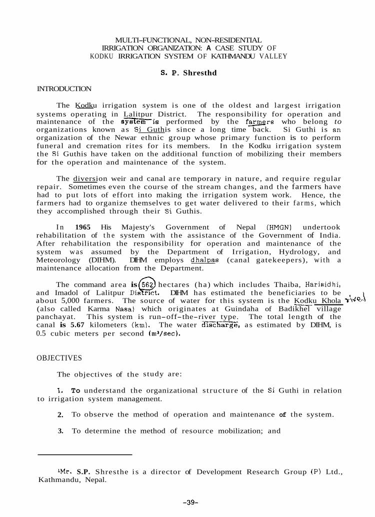
MULTI-FUNCTIONAL, NON-RESIDENTIAL IRRIGATION ORGANIZATION: A CASE STUDY OF
KODKU IRRIGATION SYSTEM OF KATHMANDU VALLEY
S. P. Shresthd
INTRODUCTION
The Kodku irrigation system is one of the oldest and largest irrigation systems operating in Lalitpur District. The responsibility for operation and maintenance of the sysfe?iis performed by the f w r s who belong to organizations known as Si Guthis since a long time back. Si Guthi is an organization of the Newar ethnic group whose primary function is to perform funeral and cremation rites for i ts members. In the Kodku irrigation system the Si Guthis have taken on the additional function of mobilizing their members for the operation and maintenance of the system.
--
The diversion weir and canal are temporary in nature, and require regular repair. Sometimes even the course of the stream changes, and the farmers have had to put lots of effort into making the irrigation system work. Hence, the farmers had to organize themselves to get water delivered to their f a rms , which they accomplished through their Si Guthis.
I n 1965 His Majesty's Government of Nepal (HMGN) undertook rehabilitation of t h e system with the assistance of the Government of India. After rehabilitation the responsibility for operation and maintenance of the system was assumed by the Department of Irrigation, Hydrology, and Meteorology (DIHM). DIHM employs dhalpas (canal gatekeepers), wi th a maintenance allocation from the Department.
The command area is 562 hectares (ha) which includes Thaiba, Harisidhi,
\ --___ and Imadol of Lalitpur D i s @ net . DIHM has estimated the beneficiaries to be about 5,000 farmers. (also called Karma Nasa) which originates a t Guindaha of Badikhel village panchayat. This system is run-off-the-river type. The total length of the canal is 5.67 kilometers (km). The water as estimated by DIHM, is 0.5 cubic meters per second (m3/sec).
The source of water for this system is the Kodku Khola T'\dq>
OBJECTIVES
The objectives of the study are:
1, To understand the organizational s t ructure of the Si Guthi in relation to irrigation system management.
2.
3. To determine the method of resource mobilization; and
To observe the method of operation and maintenance of the system.
1Mr. S.P. Shresthe i s a director of Development Research Group (P) Ltd., Kathmandu, Nepal.
-39-
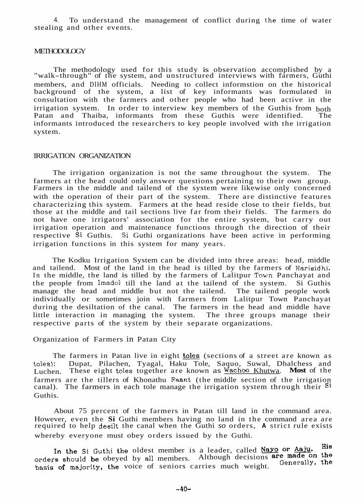
4. To understand the management of conflict during t.he time of water stealing and other events.
METHODOLOGY
The methodology used for this study is observation accomplished by a "walk-through" of the system, and unstructured interviews with farmers, Guthi members, and DIHM officials. Needing to collect informstion on the historical background of the system, a list of key informants was formulated in consultation with the farmers and other people who had been active in the irrigation system. In order to interview key members of the Guthis from both Patan and Thaiba, informants from these Guthis were identified. The informants introduced the researchers to key people involved with the irrigation system.
IRRIGATION ORGANIZATION
The irrigation organization is not the same throughout the system. The farmers a t the head could only answer questions pertaining to their own group. Farmers in the middle and tailend of the system were likewise only concerned with the operation of their part of the system. There are distinctive features characterizing this system. Farmers at the head reside close to their fields, but those a t the middle and tail sections live f a r from their fields. The farmers do not have one irrigators' association for the entire system, but carry out irrigation operation and maintenance functions through t h e direction of their respective Si Guthis. Si Guthi organizations have been active in performing irrigation functions in this system for many years.
The Kodku Irrigation System can be divided into three areas: head, middle and tailend. Most of the land in the head is tilled by the farmers of Harisidhi. I n the middle, the land is tilled by the farmers of Lalitpur Town Panchayat and the people from Imadol till the land a t the tailend of the system. Si Guthis manage the head and middle but not the tailend. The tailend people work individually or sometimes join with farmers from Lalitpur Town Panchayat during the desiltation of the canal. The farmers in the head and middle have little interaction in managing the system. The three groups manage their respective par ts of the system by their separate organizations.
Organization of Farmers in Patan City
The farmers in Patan live in eight tales (sections of a street a r e known as toles): Dupat, Pilachen, Tyagal, Haku Tole, Saquo, Suwal, Dhalchess and Luchen. Most of the farmers are the tillers of Khonathu Faant ( the middle section of the irrigation canal). The farmers in each tole manage the irrigation system through their Si Guthis.
These eight toles together a r e known as Wachco Khutwa.
About 75 percent of the farmers in Patan till land in the command area. However, even the Si Guthi members having no land in t he command area are required to help desilt the canal when the Guthi so orders, A s t r ic t rule exists whereby everyone must obey orders issued by the Guthi.
in the s i Guthi the oldest member is a leader, called N Z Of' &.&. His Although decisions are made on the
Generally, the orders should be obeyed by all members. basis of majority, the voice of seniors carries much weight.
-40-

heads of households of the tole become members of a Si Guthl but membership A l l the members in these Guthis belong to Maharjan
castes.
The eight s i Guthis of the different toles have combined to mobilize labor for the operation and maintenance of the system. Dupat Tole has taken leadership among these Guthis. Tt.is authority, a s reported, was delivered by the Mall8 king and it continues to be recognized. Functions which include determining meeting dates and keeping records a r e the responsibility of Dupat Tole.
When a meeting is needed, three messengers from Dupat known a s Ksajis The decisions taken
not ComPuIsorY.
inform six senior members (aajus) in the different Guthis. in t h e meeting are then conveyed to the appropriate Guthi member.
Organization of Farmers in Harisidhi
Similar to Patan, there a r e four Si Guthis: Raj Guthi, Etagu Guthi, Mydyagu Guthi, and Sallagu Guthi operating in this area which also perform management functions for the irrigation system at the head. All the people in these Guthis are from the Maharjan caste of the Newar ethnic group. Every household head of Harisidhi Panchayat is a member in one of the four Guthis. Even the migrant Maharjans in t h i s area have been included in these Guthis. There a r e altogether 655 households including nonmembers.’ There a r e only five families from non-Newar communities in the village who a re not members of these Guthis and who need not contribute to operation and maintenance of the system.
Raj Guthi is recognized a s the main Guthi in this area. I t has the largest number of members and has been in existence for a long period of time. The directives issued by Raj Guthi a r e binding upon all the other Guthis in the area.
Various Guthi leaders perform specific functions for t h e organization:
1. m: Nay0 (lesder) is the oldest member of the Guthi, and he i s in charge of all Guthi activities. Other members act according to his direction.
2. u: The madaa receives his position on a hereditary basis. H i s responsibility is to keep the account books. He is also responsible for mobilizing i t s members to collect firewood on the date fixed by HMGN. On that day they are allowed to cut the living trees in Pulchoki forest. The collected firewood is used only for cremating the Guthi members.
3. m: The paalas are Guthi members responsible for organizing different ceremonies. This responsibility i s rotated annually to other members of the Guthi. There are four paalas in the Raj Guthi, three in Etagu, two each in Mudyagu and Sallagu Guthi a t a time. During their t e r m , they a re responsible for informing members when work i s to be done on the irrigation
z A son maintaining a household separate from his father is considered a nonmember until the death of the parent, whereby the 8013 becomes a Guthi member. Nevertheless, the son is expected to contribute 3.5 kg Of rice to the Guthi each year 80 t ha t his family can receive the Guthi’s assistance when needed. There are 204 members and 300 nonmembers in WJ Guthi, members
57 nonmembers in E-gu, 30 and 14 in Mudyagu and Sallagu respectively*
-41-
canal. Gu th i for punitive action.
Water Allocation and Distribution
Paalas keep records of absentees and forward the information to the
I n this irrigation system, within a section, there i? no hard and fast rule for allocating water to a particular field. Wherever the farmers need water they open the canal outlet and irrigate their land. After getting enough water, they either channel it to another field or they close the outlet in the canal,
However, a s reported by the farmers, there was an order issued by the then Rana Prime Minister, Judha Shamsher J.R.R. that farmers cultivating fields at the head should finish paddy transplantation before the end of June (15th of Ashadh on the Nepali calendar). This practice later became the rule. Therefore, farmers in th i s area usually transplant the paddy from the middle of May (beginning of Jestha) and finish before June. The turn then goes to the farmers cultivating in the middle par t of the command area. In both places, farmers get enough water to their land for the transplantation of paddy.
There is another understanding: all land is to receive water for transplanting paddy before water can be re-distributed to the head where they have already used water for transplantation. There is no law regarding this. However, it is socially accepted that everybody should plant the paddy first , and unacceptable to get water repeatedly to the detriment of the transplantation of paddy of others. However, when there is no rain, the farmers a t the head sometimes apply water repeatedly to their land. The farmers consider t h i s water stealing. In order to check such malpractice the farmers in the middle area guard the canal. The canal gatekeeperdguards (dhalpas) continue their supervision until all the farmers finish the transplantation. The dhalpa syatem is usually only necessary during drought or if the monsoon is late.
For water allocation, land ad joining the canal receives first priority. Water is allocated according to land size. Water is usually allowed to reach a level of nine inches in the field before it is then channeled to adjoining land sequentially. This is easily achieved because the land is terraced.
For water distribution, no devices are used. There are outlets in the main canal as well as in t h e branch canals. When the farmers need water, they open the outlet in the canal. After using water, they close the outlet with mud known a s chapari along with some bushes and stones. To channel the water from one terrace to another they make an opening in the bund and divert the water. During the season most farmers remain in the field awaiting their tu rns for water. I n t he middle section of the command area the dhalpas supervise the distribution.
Resource Mobilization
This i s the common field-to-field irrigation practice.
In order to manage t h e Kodku Irrigation System, Si Guthis mobilize labor for desiltation and canal repairs, and organize the dhalpas to guard against water stealing. They also assign the waa paas, who guard the ripe paddy crop from thieves.
- Role of the farmers within Lalitpur Town Panchayat. In the past, when the intake washed away or needed major repair due to changes of the river course, a lot of labor and materials had to be mobilized. If the damage was beyond the capacity of the farmers, the farmers would request that the town
-42-
brigade3 provide assistance. materials (bamboo and wooden sticks) for the repair work.
The brigade would provide army personnel and
There was a religious belief that iron implements should not be used in Thus, when
The annual tabk of desilting the canal is begun b y the farmers of Wachw Khutwa on the firet of July (15th of Ashadh). Shortly before this date, a team of farmers including messengers from Dupat assesses the damage in the canal and reports to the Guthi members.
All Si Guthi members must be present a t the time of desiltation.
constrocting the intake and everything should be done by hand. they had to divert the stream they used bamboo and wooden sticks.
Persons absent from work are fined by their Guthi, which keeps records of attendance. The fines vary from one Si Guthi to another. Previously, t h e fine amounted to less than one cent U.S. but due to inflation the fine has been raised to approximately U.S.51.00. The actual amount of the fine is not a s important a s is the social sanction which it enforces. Consequently, it is reported that relatively few people remain absent from the work.
When major repairs of the canal m u s t be undertaken, a meeting is held in Dupat Tole where the area to be repaired is divided into parts and each part is assigned to a different Si Guthi.
During water shortages, the people from Wachoo Khutwa guard the canal. This practice continues until all the farmers complete paddy transplantation work.
Each of the five main Guthis send four persons (previously it was eight persons) and each of the three smaller Guthis send two persons each a s guards (dhalpas). The 26 dhalpas a r e divided into three groups, each assigned to guard a particular area: the intake site, the water spout in Thaiba, and in Khonathu (the middle section).
The dhalpas a t the intake are responsible for the canal section a s far as Thaiba. The Thaiba dhalpa guards the canal up to the brick factory, and dhalpas staying in Khonathu are responsible for the rest of the canal. Each tole has a specific responsibility. Four people from Sunwal tole and four from Peenchen guard the intake. Four dhalpas from Dupat and four from Pilchen toles supervise the middle section, and ten persons from the four remaining toles are assigned to Thaiba.
The tu rn of the dhalpas is decided by the respective Si Guthi. Their responsibility is to operate the canal and prevent water stealing. The dhalpas staying in Khonathu also have to supervise the distribution of water in the field. I t is their obligation a s members of the Guthi.
The dhalpas do not get a n y remuneration for their work.
r n the past, there were often incidents of stealing the paddy from the field since the farmers of this area live far from their farms. To Prevent this, the farmers from Wachoo Khutwa assigned people to guard the Paddy fields at harvest time. USUallY only 20 guards were required* The guards rotated duty.
3 Prior to the overthrowing of the Rsna regime in Nepal i n 1951 there was an Army brigade in Lalitpur located at Lagankhel whose responsibility was to maintain law and order in the area, similar to the Chief District Officer at present.
-43-
If somebody w a s caught stealing paddy, he or she was handed OVPI- to the brigade for punishment.
During the time of drought, farmers from Wachoo Khutwa and Hnrisir lhi visit Naudhara in Godavari to pray to the snake god for wal,er. On that occasion, representatives from each house in Wachoo Khutwa and Flarisidhi g o to worship the snake god. The Fkna government would provide a goat. and money for two Buddhiat Bajracharya priests to worship the snake god in Naudhara, and a goat js sacrificed to t h e goddess Fucha mai in Pulchoki. Then the farmers re turn and walk along the canal, asking for rain. On this occasion, all the members are not compelled to attend, but usually everyone would be present.
When the monsoon arrived too late for paddy transplantation, the brigade supplied pea seed to the farmers so tha t the land would not remain fallow.
~ Role of the farmers in head area. The farmers of this area mobilize labor for canal repair and operation. Generally, repairing and desilting this part of the canal is less problematic. The farmers a t the head have only a small stretch of the canal to maintain. They usually transplant paddy during the middle of May (first week of Jestha) when the monsoon has not yet started. Therefore, there are less chances of changes in the course of the stream, and usually less repairs to the canal are needed.
If the canal is damaged, the Guthi members of the area organize for the maintenance of the canal. The leader of Raj Guthi and other members hold a meeting at which they estimate the amount of work needed to make the repairs, divide the duties among the various Guthis, and then make assignments to their own members. The paala relays the division of work assignments to the paalas of the other Guthis in the area, The paala is responsible for informing the members of h i s Guthi and he also keeps the record of absentees. Defaulters are fined and the funds raised from fines a r e kept in the Guthi’s treasury. The names of those members who have already participated in the work are reccorded a n d they need not contribute labor again until all the members have contributed.
Once all the members and nonmembers of a Guthi fulfill their duty the paalas inform another Guthi and i t becomes the responsibility of that Guthi to work in the canal. This continues until all the members of the four Guthis complete their turns. All the members and nonmembers of the four Guthis may not finish their t u rn of duty in a year, in which case the t u rn rotates into the next year.
During a drought, the members of these Guthis 8160 worship the rain god in Naudhara of Godavari. If it has not rained by the f i rs t of July (15th of Ashadh) the madae collects money from each member of the four Guthis to pay for the offerings to the rain god, asking for rain for their lands. All members of the Guthi are not required to participate in the worship, but few farmers miss this event.
Conflict Management
Generally, there are few conflicts over water allocation and distribution among the members of a Guthi. Differences of opinions are usually resolved in Guthi meetings. However, when there are conflicts between the People of the head and middle sections of the system, the brigade is called in to resolve the dispute. Most of the conflicts occur during plantation time when farmers in
-44-

the head area middle area.
sometimes apply more water a t the cost of plantation in the
The dispute is resolved in a public meeting held a t the public court area of Lagankhel. The farmers and public gather to hear the case as put forth by the respective parties, and the colonel g ivw his dec~sion. If punishment is necessary, the colonel determines what i t should be. The culprit might be locked up in the army camp for several days, or he might be released after giving a written bond. I n the case that the colonel of Lalitpur is unable to resolve the problem, he forwards t h e case to the Sundhara Brigade of Kathmandu, which is the headquarters of the three brigades of Kathmandu, Lalitpur, and Bhaktapur. Most cases referred to the brigade involved water stealing.
Aftermath of Rehabilitation
Under a program of rehabilitation, the DIHM took over the responsibility for the regular maintenance of the system. I t hired government dhalpas and se t aside funds for annual maintenance. Table 1 shows the operation and maintenance expenditure by DIHM for the Kodku system from 1983 to 1986.
However, the farmers say that the system has deteriorated since government has assumed responsibility for maintenance and operation. The government funds are insufficient to undertake necessary improvements and the dhalpas from DIHM do not take full responsibility for the operation and maintenance. When the system was run by the farmers a regular schedule for maintenance was followed and everyone knew the dates when the work was to be done. Now the Guthis are never sure whether DIHM will do the repairs and complete them in time. Due to lack of funds, maintenance is sometimes not performed. By the time the farmers realize the problem, it may be too late for agricultural activities.
Table 1. Actual operation and maintenance expenditure by DIHM for the' Kodku System from 1982/83 to 1985/86.
CONCLUSION
This irrigation system is an old and traditionally community-managed system. The Si Guthis of the Newar ethnic group have been involved in the operation and maintenance of the system for a long t ime. With the intervention of DIHM in 1965 there has been structural improvement in the aystem thereby reducing the burden of labor mobilization to some extent. However, lack of communication between farmers and DIHM dhalpas in the O&M and the apathetic attitude of the DIHM dhalpas have affected the effective management of the irrigation system.
-45-
INSTITUTION BUILDING AND RURAL DEVELOPMENT IN NEPAL: GADKHAR WATER USERS COMMITTEE
Upendra Gautaml
INTRODUCTION
Building institutions in rural areas has become an important task for development projects undertaken by the government. The idea is that without decisive involvement, neither the benefactors nor the beneficiaries can fully identify with a project and donated resources will not be utilized effectively.
The government h a s now developed "users' committees" a t the rural project level to increase the involvement of the beneficiaries. Formation of these committees is consistent with the Decentralization Act of 1982, which states that enlisting maximum participation from the local people in managing scarce resources and equitably distributing the fruits of development would promote the welfare of the whole population. The Act specifically provides for users' committees in Clause 19. Clauses 35 and 85 of the Decentralization Regulations laid down in 1984 stipulate that the committees would be responsible for the operation and maintenance of rural projects a n d for the collection of taxes levied on services delivered by the project. This would institutionalize a pattern of self-reliance in the rural development process.
FOCUS OF THE STUDY
Documentation is needed in t h e areas which have begun to build institutions to monitor ongoing projects, and it is the purpose of this paper to record part of this process.
The study focuses on the Gadkhar Irrigation Project Kater Users Committee (WUC). I t assesses the Committee's capacity for: 1) maintaining harmonious plural memberships; 2) distributive equality across command units; and 3 ) sustaining the irrigation system.
The Users Committee is jointly managed by panchas (elected officials of local government agencies), public personnel, and users' representatives. There is a complex mix of political, bureaucratic, and socioeconomic influences in the organization which manages the physical structures. These diverse interests influence water allocation and distribution and the irrigation users ' behavior.
OBJECTIVES OF THE STUDY
The major objectives of the study a re to:
1. Examine relationships among the users' representatives, panchas, and public personnel involved in the Users' Committee, and the effect of these relationships on their ability to carry out the t a s k s required;
1 Upendra Gautam i s a Lecturer on the Public Administration Campus, He is currently working with the Tribhuvan University, Kathmandu, Nepal.
Irrigation Management Project as a n institutional development consultant.
-46-

2. Assess the capacity of the command units in terms of their accessibility and the extent of the Committee’s ability to distribute irrigation resources equitably;
3. Identify the relationship betweer the status of the system and the Committee’s ability to meet t h e system’s maintenance requirements.
METHODOLOGY
Comparative analysis was used on information primarily gathered from organizational groups. Three groups were identified to meet the f i r s t objective of the study: the users’ representatives, panchas, and public personnel involved in the Committee. The f i rs t group was categorized into classes in terms of land holding, ethnic group, and location status. Panchas were divided into incumbents and landholders. The public personnel were from agricultural and irrigation sectors.
To meet the second objective, the general users were taken as the reference group. They were organized into command units in terms of each unit’s access to the irrigation facilities: head, middle, and tail.
For the third objective, attitudes of members of organizational groups towards resource mobilization to operate and maintain the system were identified. Information was sought on the formal (government) and informal (users) systems of operation and investment management. Members’ attitudes towards public property, sanctions, and awareness of the status of the system vis-a-vis their values and expectations were ascertained.
The study was mainly empirical. All the members of the Water Users’ Committee (WUC), 20 percent of households in the command area (20 households each in the head, middle, and tail units of the command, chosen a t random from lists obtained from the Subdivisional Irrigation Office in Battar, Nuwakot), and relevant persons associated with the system were separately interviewed. Participant observation provided insight into the workings of the Committee. Gadkhar Irrigation Project was visited in June and August, 1986. Secondary data was collected from the WUC’s Minute Books, the DIHM (Department of Irrigation, Hydrology and Meteorology), the Central Region Irrigation Directorate, and Battar Irrigation Subdivision Office (ISO).
BACKGROUND
Gadkhar Irrigation Project (GIP), which covers 105 hectares (ha) of land, lies in Choughada village panchayat of Nuwakot district, in the Central Development Region of Nepal. GIP i s 12 kilometers (km) southeast of Trisuli, the district headquarters. Trisuli is linked to Kathmandu by a 70 km secondary highway, built to transport materials and labor for the construction of t h e Trisuli Hydel Plant in 1965. Gadkhar is difficult to reach by vehicle, especially in the monsoon, as there is no bridge over the Tadi River which separates the village from the mud road that starts off from Gungate, on the Kathmandu- Trisuli highway.
External Assistance
-47-

GIP was an offspring of the Rasuwa-Nuwakot Rural Development Project, financed by the International Development Association (IDA) and the International Bank for Reconstruction and Development (IBIID). These two donors provided 67 percent of the irrigation construction costs. The othev third was borne by H i s Majesty’s Government of Nepal (HMGN). The design, construction, and implementation of GIP were done under the umbrella of the DIHM. The project cost US$ 134,555 ( N R s 2,946,743) to construct. Construction was started in 1979 and finally completed in 1982.
Between 1983-86, a total of US$ 44,642 (NRs 97‘7,651) w a s invested in project maintenance and renewal works. Over this period, the per ha average maintenance and renewal costs were US$ 106 ( N R s 2,328) each year. This increased substantially with the additional cost of an increasingly frequent labor contribution. Each household would supply one of paddy (about 3.6 kg) which would be equally divided among panipales as wages.
The users also bore the cost of panipales (water guards).
INTERRELATIONSHIPS AMONG MEMBERS O F THE WUC
The f i rs t WUC was constituted in 1980 to assume responsibility for operating and maintaining the irrigation system. Specifically, it was to se t and enforce policies relating to water use (Peabody 1983). The engineer a t the Battar ISO/DIHM, who was implementing GIP supervised i t s formation.
The farmers’ assembly was presided over by the pradhan pancha (chairman of the village political unit). He was unanimously elected chairman, and 14 others, including a vice-chairman and secretary were also chosen. The irrigation engineer, overseer, and agricultural assistant were invited to attend.
Composition of the WUC
There were three Brahmins, eight Rais, one Chhetri, one Newar, and t w o others on the Committee. Four members were panchas; the rest considered themselves more users’ representatives than panchas. There was no formal representation of public personnel in irrigation or agriculture.
Relationships among members of the committee were characterized by rank undiscipline. The vice-chairman was involved in more than one deliberate breaching of the branch I1 canal a t the head, in order to divert water to h i s farm. The irrigation engineer ordered his personnel to repair the canal breach out of the maintenance budget. For various political and social reasons, the irrigation personnel became increasingly dependent on the vice-chairman, and the more the local farmers saw them hobnobbing with him, the more the farmers distrusted them, which in turn pushed the irrigation personnel fur ther towards the panchas. The history of the area may throw light on how such a situation developed among a majority of the local farmers.
Historical Perspective
The head unit of the command used to be a large mango grove. I t was a horticultural estate belonging to the Rana family. On the death of the Rana owner, the estate w a s divided into seven equal par ts for his six sons and wife. The Rais, an ethic group who lived on the periphery of the estate, were considered inferior by the estate owners and were not allowed on the premises.
-48-
The death of the sole owner, the fragmentation of the estate, and the new l a w s stripping the Ranas of their power caused anarchy in the area. People tried to encroach upon the estate from all sides and take a s much of the horticultural property a s they could. A Newar businessman who was a pradhan pancha, and a Brahmin pancha took the opportunity to convince the heirs to the estate to dispose of their part of the estate. The Newar managed to pool enough resources from several buyers to purchas.? a major portion of the estate for himself. Then he cleared the hcdicultural resources for commercial gain, and resold the estate in plots to those buyers from whom he had already collected money. These buyers were predominantly Brahmins and Chhetris.
The Brahmin pancha purchased part of the estate directly from one of the deceased owner’s sons. Thus, the estate was populated by Brahmins and Chhetris, who filled the socioeconomic vacuum left by the Ranas. The Rais did not gain a t all from the changeover.
-~ The Rais’ point of view. The Rais felt that the irrigation project was for the benefit of the elite group living in the head unit of the command, In 1979 they opposed the project a s they felt that what was a communal river and supply of water would become tied up in a system that excluded them.
The way the project developed in i t s initial years (1979-81) only strengthened the Rai’s notion that it was to serve the local elite. .4 farmer w a s deprived of his water mill upstream because it was using water from the Likhu River. The farmer also lost part of his land to the canal. He has not yet received compensation.
The Rais noted that in the first two years of the project’s phased water delivery, most of those who practiced irrigated agriculture were head unit, high caste people. Rais were pressured into selling good pieces of land that were favorably located in terms of the irrigation network. The buyers were quick to anticipate an increase in the value and agricultural productivity of the land. It has been estimated that the Rais lost over 10 percent of their land to high caste immigrants.
The committee chairman, who was an immigrant himself, seemed reluctant to open cases of illegitimate water diversion by h i s committee colleagues for public hearing, or to punish the guilty. The committee’s failure to punish its own er ran t members affected i ts legitimacy. The head unit farmers enjoyed license to tamper with the canal anywhere and take the quantity of water they wished, whereas it was difficult for the middle and tail unit Rais to get the water they needed. The situation divided the farmers both at the command level and a t the committee level. Many members began to feel that the chairman and vice-chairman were siding with the high castes and bullying the lower ones.
Irrigation officials did not contribute to harmony and equity. The engineer would informally allow high caste influential farmers to open new outlets unilaterally. The overseer was responsible to the engineer and to the committee. He did not have the power to correct or punish violations of the distribution system, and it was impractical for him to antagonize the committee’s influential high caste pancha leaders.
The relationship between the committee and the water users often rendered committee decisions on water allocation and enforcement of sanctions against rule violators redundant. The committee was not able to bring i ts
-49-
plural membership together to realize i ts purpose in a positive way. Although 8 out of 15 members were h i s they were too weak to correct the imbalance.
Another general assembly of users replaced the f i rs t commit,tee with a new By this time, the village panchayat had a new pradhan pancha and one in 1982.
the new committee was chaired by him.
Subsequenl w. The new chairman was a Rai who therefore represented the majority ethnic group in the command area, although this time they did not constitute the majority on the Committee ( 4 out of 11). He himself held less than ten ropanis (one ropani equals 0.13 acres) of land in the command. He was the first pradhan pancha to be elected by universal adult franchise, a system adopted in 1980 when the Third Amendment of the Constitution became effective. The controversial chairman and vice-chairman of the first committee both got membership positions on the second.
This reorganization probably reflected the users’ concern to make the WUC ethnically broad-based and make it a more representative agency of cooperative relations among the communities that managed land in the head, middle and tail units. From a socio-organizational perspective this was a n outstanding effort to sustain the users’ divergent irrigation interests in terms of ethnic group, land ownership, and geography.
A perspective 1981-86. Between 1981 and 1986 the water users of Gadkhar have elected five WUCa: a total of 58 members. A few were elected several times. Undisciplined water users were sometimes elected to the Committee. This was an attempt to make them accountable for a cause that called for collective cooperation and equitable irrigation management. A tradition of giving almost ex-officio membership to the Agricultural Technical Assistant and the irrigation overseer, w a s broken in later years since the users were interacting with these people less and less. In the last five years the total membership of the five WUCs decreased from 29 to 26 a s public personnel were no longer included.
A majority of the Committee members were politically affiliated (54 percent), although 57 percent were non-incumbent and only 43 percent owned large pieces of land mostly a t the head of the command. Rais constituted the largest single group (50 perc.ent), followed by Brahmins (19 percent) , Chhetris (11 percent), and Newars (8 percent). Most members were big landowners, with 31 percent and 27 percent in middle and small landownership strata respectively. Committee members equally represented the different locations in the command.
No important relationship between ethnic identity and land ownership status was noted. The Rais made u p 23 percent of the big landholders, and the Brahmins were equally divided between the big and medium landholders. Each caste group had a t least one politically affiliated member, except the Chhetris. Both Newars were panchas. Though one tenant and one big landowner were elected to all five Committees, i t is clear that more farmers from the medium and small land ownership bracket were repeatedly re-elected than from the others.
CAPACITY AND IRRIGATION ACCESS OF THE COMMAND UNITS
Most land that was supplied wi th irrigated water was (flat highland) lying between two rivers, t h e Tadi and t h e Likhu. The former flows along the north boundary of the command area, and the latter, the water source of the
-50-
project, flows along the south side. Ethnic groups were not evenly spread over different quality land in terms of access to irrigation, ability to use fertilizer, soil texture, and topography.
Ethnic Groups and Land Distribution
Although a majority of the households in the command area are Ram, only 27 percent of them lived in the head unit. All the Brahmin, Chhetri, and Newar households were located in the head unit.
Choughada Agricultural Subcenter Official Report of 1986 gave t h e following socioeconomic data on the Gadkhar command. There were 230 households of 1,610 people. Small landowners made u p the largest group (45 percent), followed by marginal landowners (24 percent) , medium landowners (20 percent) , and big landowners ( 4 percent). Five percent were landless and the average landholding size in the command was 0.5 ha (10 ropanis), with the highest average at 0.83 ha and the lowest a t 0.25 ha. These figures exclude land owned by Chhetrapal School and land under guthi (socio-religious t rus t ) .
What emerges from the findings is t h e fact that the Gadkhar command head unit was socially and economically dominated by Brahmins and Chhetris. They were strategically placed in terms of access to irrigated water. They used chemical fertilizers to compensate for t h e chemical deficiencies in the soil. The Rais were overwhelmingly the largest group in the middle and tail units, but their landholdings were smaller that those of the Brahmins. Some of their land was less productive than the soil in the head unit, but some had a clay-based soil and could match the latter’s paddy and maize production. The tail unit farmers could not afford to use chemical fertilizers. If they could, they might substantially increase summer paddy yields.
WUC’s EFFORTS TO DISTRIBUTE WATER EQUITABLY
Almost six months before the formation of the first WUC, GIP reached a stage in construction when water was released onto two ha owned by a Brahmin who used i t to prepare paddy seedlings.
In the second year, water was released to 93 ha in the command. The Committee meeting held in 1980 set rules for rotational distribution of water, because it found that there was too little water for continuous irrigation throughout the command. Water would be released through one branch canal a t a time. I t would be distributed through the se t tert iary pipe only. Distribution channels would be built after consulting with irrigation officials. The Committee also agreed that a s there was not enough water, a ceiling would be fixed on each farmer’s area of irrigated agriculture.
The rotational distribution schedule w a s for both wheat and an early paddy crop. I t was decided that all farmers should grow summer paddy on 25 percent of their land, and traditional maize and millet crops on the other 75 percent (Committee Minute Book 1980). These decisions were rarely enforced. Farmers took water from wherever they could and cultivated summer paddy over large areas, despite the ceiling. This resulted in a shortage of water and unequal distribution of what was available.
-51-
Distribution Schedules
At a second major meeting held in 1981, the Committee decided to change the four-day rotational schedule to a five-day one, a s the earlier one could not meet the users’ requirements. It also elaborated on the method for water allocation in earh branch canal area. Ostensibly for equity purposes, priority was given to tail unit hou3eholds.
The second water distribution schedule was an improvement over the first: it was more equitable in terms of branches I and I1 and branches 111 and IV, water distribution priority was given to the tail unit uaera, and the area to be served was delineated geographically.
Unfortunately, these improvements were only put down on paper; the four- day distribution schedule continued in practice. The four-day rotation schedule had a built-in bias in favor of branches I and 11. The two branches, which irrigated a total of 31 ha, were given water for 48 hours. There were widespread complaints from tail and middle unit farmers of branches 111 and IV of not getting enough water. Possibly more revealing was the fact that the tail unit farmers of branches I and I1 also complained about the erratic supply. The committee leaders--the chairman and vice-chairman--were head unit usera of branches I and 11. A new four-day rotational distribution was activated that was to be effective from the 1982 summer paddy, because of water scarcity (Committee Minute Book 1981). By this time, irrigation water could potentially reach the entire command area.
The distribution bias continued, though this time the tail unit w a s given equal chance to get irrigation services. They continued to complain about the illegitimate canal breaches and water theft in the head unit, and the erratic supply.
On the advice of the engineer, the Committee decided that summer paddy should be planted on 50 ha of land, and millet on another 50 ha. No user heeded this suggestion and they continued to grow paddy on larger than prescribed areas, stealing water, and illegitimately breaching canals to do S O .
Later, the Committee admitted that it could not implement i t s decision. It felt that the intake of the system was too low, so i t was suggested t h a t the Irrigation Subdivision increase the system’s capacity. A t that time, they decided on a new rotation schedule which was unique in that it demarcated command units into more specific sub-command entities. For example, of the 32-hour supply given to the tail unit, water specifically flowed into one area of the tailend for 16 hours, and the second 16-hour supply flowed into another area.
Despite measures to be equitable, the problems of water theft and canal breaches continued, so the WUC decided to form a sub-committee for supervision and control of each branch canal. In a later meeting, these branch level sub-committees were reshuffled and authorized to punish those found guilty of water stealing and canal breaches. The punishment for each crime was fixed in the form of fines ranging from US$ 4.57-22.84 ( N R s 100 to N R s 500). Private, overlarge, channel level distribution pipes were removed. A nine-day rotational schedule was adopted with branches I and I1 receiving water for 96 hours, and the other two for 120 hours.
In 1984, the nine-day schedule was replaced with the five-day one which Within 30 days the decision was amended as the
The WUC also had been proposed in 1981. committee tried hard to adapt to changes in water availability.
-52-
decided to dissolve the branch level sub-committees on the grounds that each branch had a representative on t h e main committee.
The WUC did not have problems of illegitimate water diversion in the Farmers who had developed cropland just below the five command area alone.
kilometer idle main canal were now using water straight from the main canal.
WUC Persistence
The WUC’s persistence in finding a rotation pattern that would allow a scarce resource to be distributed equitably was impressive. It w a s a t pains to admit that despite these efforts, conflict and tension during rotatlonal water dlstribution was increasing over the years (Gadkhar households were divided on the question of whether discipline levels had improved or declined). A farmers’ general assembly was convened in 1985 to discuss the issue and a resolution was made. The resolution provided a new position of two panipales (water guards) in each branch canal who were employed by the committee. Their main duty was to distribute water equitably. They were solely employed a t summer paddy time when the conflict for water was a t i t s highest.
The panipales were a remarkable innovation. Although the middle and tail unit farmers were happy, the head unit farmers felt that panipales were a useless investment. In anticipation of such an attitude from the higher castes, the assembly nominated a high caste, head unit farmer a s adviser to the present Committee on water distribution. The new Committee found the panipales to be useful and satisfactory so the arrangement was continued through 1986. However, some problems arose. Head unit farmers gave incorrect quantities of grain a s payment for the panipales. The panipales felt that some of those they had caught stealing were not punished and therefore that the job was not worthwhile. The head unit farmers thought that the committee w a s simply shifting i ts responsibility for equitable water distribution onto some petty wage earners.
Communication
The users were not uneasy about so many institutional changes and innovations. They were aware when they were entitled to water, of the water allocation entitled to each branch of the command area, and limitations or constraints on access. This shows that the WUC maintained close communication with the farmers and made sure that they understood every decision.
The committee introduced all the major changes a t the farmers general assembly which functioned a s a mass communication mechanism. The committee was elected and structured in a manner that allowed representation of all four branch canals. Whenever t h e Committee made an important decision regarding water distribution, a representative from each branch would brief his fellow farmers. In addition, the panipales could inform farmers of any decision that related to them. All meetings and general assemblies were recorded in a Minute Book maintained by t h e member-secretary of the WUC. All decisions were taken formally: an agenda would be fixed by the Committee, a date and place agreed upon, and the signatures recorded in the Minute Book of all those who attended.
-53-

WUC AS RELATED TO THE STATUS OF THE SYSTEM
WUC members were also aware of the state of the Gadkhar Irrigation Project. They were aware of organizational problems and that the physical state of the project was seriously interfering wi th the Committee’s potential for organizational growth.
An overwhelming majority of WUC members mentioned the following detrimental physical characteristics of the Project: 1 ) bad links between the intake and the river; 2) narrow canals that cannot contain and convey monsoon water; 3 ) emergence of new cropland between the river and the intake; 4 ) emergence of 20-25 ha of agricultural land just below the five k m idle main canal; 5 ) indiscriminate insertion of distribution pipes of different sizes by irrigation officials; and 6) unstable, slide-prone sections along the main canal.
The project’s physical state had been largely responsible for the promotion of certain organizational issues. The Committee was able to handle many of these issues, but not all. It mobilized the necessary labor every year to maintaidbuild a link canal or feeder channel between the intake and the river, and to restore unstable sections of the main canal destroyed by landslides. I t took the initiative in demanding first r ights to the water from farmers who had started to cultivate the area between the intake and the river.
However, the Committee was not so successful in preventing the indiscriminate insertion of varying sizes and qualities of pipes. This reflected a certain degree of manipulation as the more influential, high caste farmers laid the biggest pipes and therefore received the most water. With the introduction of panipales, the Committee had tried to control the release of water through the pipes, whatever the size, so that every farmer had three inches of water covering their summer paddy, but they did not exercise enough control.
Structural problems hampered efficient water conveyance and equitable water distribution. WUC members felt that the initial structural design was a t fault and stressed that even though the water in the Likhu River was sufficient for nine months of the year, they were not getting enough water to irrigate their fields.
Irrigated farming below the idle main canal w a s diverting water illegitimately to farmers outside the command, adding 25 percent to the irrigated area. The Committee repeatedly suggested ways to tackle the problem. They pressed the dhalpales (government-employed canal guards) to be more vigilant, but during the night they could do nothing. The Committee tried a conciliatory approach a t the last 1986 meeting. They offered farmers an agreement which would insure access to the water every 96 hours. This has come into operation recently and seems to be working, but the Commit.tee has found itself supplying a much larger area than originally anticipated.
EXPECTATIONS
WUC members have had high expectations of the project for a long time. However, they feel that the future of the irrigation system is insecure due to the lack of a clear-cut government program that defines the government’s responsibilities and their own for the system. Furthermore, their experience with t h e erratic performance of the government regarding the fulfillment of i t s maintenance responsibilities has made the committee members skeptical a s to i t s fulfillment of promises in the future.
-54-

All WUC members perceived labor mobilization for system maintenance as critically important. I t was increasingly felt that the Committee substantially filled the serious lapses and gaps in the public bureaucracy. It was becoming more involved a t all levels of system management.
One year af ter the system went into o?eration, it became apparent that a new feeder channel had to be ouilt every year, to feed water into the intake. The Likhu River channel had shifted almost one km to the south. The Committee had to mobilize villagers to excavate the channel. Simultaneously, they had to perform the task of cleaning landslide debris out of t h e main canal and regular field canal maintenance. The Committee became more involved in maintenance each year, a s the problems and defects of the system were revealed. The original design had not included structural facilities to drain excess rain water, and mud slides caused by deforestation on higher reaches of the main canal had made the canal portion with buried hume pipe more unstable.
The increasing preoccupation of the WUC with main canal maintenance, which was considered the responsibility of the Battar Subdivision, had an adverse effect on branch field channel maintenance and supervision. On several occasions, branch canals were left uncleaned. The Committee was aware of the situation and so organized the system of sub-committees for each branch canal mentioned earlier. Then they proposed to the Subdivision that it place i ts dhalpales whose t a sk it was supervise the main canal repairs under WUC direction, thereby ensuring a continuous flow of water.
A major expectation is related to the construction of a new intake canal about one km upstream from the existing intake point to solve the problem of the gap between the latter and the river. Another pertains to increasing the capacity of the system. Water scarcity during the d r y season was understandable, but non-availability during the summer monsoon months was intolerable. Members wanted larger hume pipe to be inserted along the canals to increase the capacity of the system. A suggested alternative was to link Gadkhar with a proposed irrigation project upstream a t Simara. If Gadkhar could receive all t h e drainage water from Simara, it would solve Gadkhar's perennial water shortage. In response to queries, the WUC members replied that they could not possibly take over the system because they would not be able to maintain it. They felt they would need the technical supervision and assistance of irrigation officials to maintain some of the structures.
The farmers were wary of relying on the DIHM for assistance, even if they were assured of it. As one farmer explained, "even under the present arrangement whereby the DIHM is responsible for the operation and maintenance of the project, it took three years for them to release a grant to repair main canal damage". Fulfillment of farmers' expectations is a pre- condition for more responsible participation of the users in joint management of the project.
DECENTRALIZATION
Under the provisions of the Decentralization Act's Work Arrangement Regulation, and present policy level thinking, the GIP should have been handed over to t h e users for management. Legally, the users must have the leadership of the pradhan pancha and should function alongside the village panchayat. The WUC has m e t all these requirements.
-55-
A team of DIHM personnel visited the project a t the beginning of 1986 and suggested that Rattar Subdivision hand t h e overall management of it to the users. This suggestion was also made earlier by the Rasuwa-Nuwakot Rural Development Project Coordinator and h i s expatriate advisers. However, due to the physical state of the irrigation network, both the users and their pnncha representatives were unwilling to take it over completely. Irrigation officials related t s the project also felt that it should not be handed over until i t had been remodeled. Estimates of the cost of remodeling ranged from U S $ 17 398- IJS$ 91,324. According to the Subdivisional Assistant Engineer, the proJect,
was in the "poorest shape".
A t the remodeling stage, the entire process would have to go through a different institutional channel. Under the Decentralization A c t rules, Nuwakot District Panchayat. had to approve the resolution. It would then be referred to Battar Irrigation Subdivision for implementation (all field level developmental work agencies come under the District Panchayat Secretariat, in accor.dance with the provisions of the Decentralization Act). The District Panchayat has so far not touched the GIP a s i t is considered a central level project. I n 1985, about 50 users approached the Local Development Officer with their grievances- - the main one being the need for a new intake further upstream--but the District Panchayat Office could not respond in any meaningful way as the Project is beyond their jurisdiction.
CONCLUSIONS
Throughout the years, Committee members have upheld certain values that will eventually have a far-reaching impact on the institution and i t s future prospects:
1. They have been continuous and untiring in experimenting with neli rules and regulations for water allocation and distribution in an effort to adapt to the needs of the users and physical changes over time.
2. They have steadfastly tried to make water distribution equitable, giving tail unit members priority and carefully selecting WIJC members so that all farmers were represented.
3. They have tried not to antagonize t h e high caste Hindu farmers w h o migrated to the area and took over strategically placed, good farmland, giving rise to sentiments such a s "strong versus weak". The Committee's endeavors have helped the "weak" by giving them influential membership positions. Tail unit productivity increased a s a result.
4. The Committee actively participated in system maintenance a t all le\.els through massive labor mobilization and its belief that, irrespective of what is written in the Decentralization Act, it can manage the system only when the users and the DIHM cooperate to evolve a meaningful framework on which to build a capable institution.
The GIP case study highlights the struggle of a WUC to perform certain roles with the ultimate goal of distributing a scarce resource equitably. In i ts struggle, the Committee has repeatedly had to negotiate with interference from local politicians and elite. A s the government proceeds to decentralize the operation and maintenance of irrigation systems, it must be recognized t h a t W U C s are susceptible to a number of constraints including the physical
-56-

limitations of the system, the need for government support for Pome technical expertise and monetary resources, and local power politics. Also, to function effectively, most members who have been repeatedly elected to the Committee feel that it needs authority to enforce sanctions on those who tamper with the system. The decentralization process need? to consider the users’ perceptions of what the) can reasonably manage themselves and what external resources, including technical and legal support, need to be provided by government.
It does not have sufficient power to punish abusers effectively.
REFERENCES
Agricultural Subcenter. 1986. Choughada village panchayat official report. Nuwakot, Nepal.
Gadkhar Irrigation Project (GIP). Department of Irrigation, Hydrology and Meteorology. Kathmandu, Nepal.
Gadkhar Water Users Committee, 1980-86. WUC minute book. Choughada village panchayat. Nuwakot, Nepal.
Gautam U. organizational effectiveness in relation to the Rasuwa-Nuwakot Project, with special reference to the irrigation scheme. Ph. D. thesis. Punjab University. Chandigarh, India.
IBRD/IDA, 1976. Nepal appraisal of rural development projects. Washington D.C., U S A .
Peabody, N.S. 1983. Gadkhar irrigation scheme. Socioeconomic unit of Rasuwa-Nuwakot project coordinator’s office.
1979. Design report by the Central Regional
1985. Rural development administration in Nepal: A s tudy of
Kathmandu, Nepal.
-57-

SECTION III: COMPARATIVE CASE STUDIES
COMPARATIVE STUDY O F PITHUWA AND CHAINPUR IRRIGATION S Y S T E M S G.P. S h i v a k o t i , A. S h u k l a , T.B. K h a t r i- C h h e t r i , S.N. T i w a r i and N.h. M i s h r a 59
A COMPARATIVE STUDY OF FARMER-MANAGED AND AGENCY-MANAGED IRRIGATION S Y S T E M S Ratna Sansar Shrestha and N i r m a l K u m a r S h a r m a 69
A COMPARATIVE C A S E STUDY O F TWO COMMUNITY-MANAGED IRRIGATION S Y S T E M S I N CHITWAN DISTRICT, NEPAL R a t n a R a j Nirola and Ravindra Prasad Pandey 78
-58-

COMPARATIVE STUDY O F PITHUWA AND CRAINPUR IRRIGATION SYSTEMS'
G.P. Shivakoti, A Shukla, T.B. Khatri-Chhetri, S.N. Tiwari and N.K. Mishraz
INTRODUCTION
Farmer-managed irrigation systems are found in diverse environments and employ a wide range of technologies to exploit different types of water resources for the production of a variety of crops. Al l these irrigation systems require certain tasks to be accomplished if the system is to function productively. One set of management activities directly focuses on water. The water needs to be acquired, allocated, distributed, and if i t is in excess, drained. A second se t of management activities a r e concerned with physical s t ructures for controlling water i.e., design, construction, operation and maintenance. A third set of activities focuses on organization to manage the water and the structures, i.e. decision making, resource mobilization, communication, and conflict management (Martin and Yoder 1986).
There is a positive interaction among the activities of these three sets for the operation and management of the systems and they have a direct impact over productivity. Al l the activities may not have equal priority in every irrigation system, however the priority is based on the need encountered in each specific situation (Martin and Yoder 1986).
The farmers' investment in irrigation in Nepal has gone largely unrecognized until recently, though over 70 percent of irrigation in the Tarai and over 90 percent in the hills are managed by farmers (Water Resource and Energy Commission Planning Unit [WEC] 1981). The pressing need to expand the use of irrigation for increased food production has prompted a search for new models and alternatives. Upadhyay and Koirala (1981:lOO-110) suggested that the experience, expertise, technology and knowledge that the local communities already have in building and operating the irrigation systems can be tapped by engineers and agriculturists for improving the performance of government-managed irrigation systems.
One of the first steps in ' understanding the farmer-managed irrigation systems of a country or a region is to document their nature, size, and the range of technologies employed in the operation of the systems. In order to incorporate farmer systems into the larger public sector irrigation development without losing t h e benefit of the experience and knowledge they present,
1 This material is based upon the work supported in pa r t by the International Irrigation Management Institute (IIMI) and Insti tute of Agriculture and Animal Science (IAAS) for a project entitled "Water Resource Inventory of the Chitwan Valley Irrigation Management".
2G.P. Shivakoti is a Lecturer of Agricultural Economics and A. Shukla a Lecturer in Agricultural Engineering at the Institute of Agriculture and Animal Science (IAAS), Rampur, Chitwan, Nepal. T.B. Khatri-Chhetri is a Professor of Soil Science at IAAS, and S.N. Tiwari a Reader of Agricultural Extension. N.K. Mishra is a Reader of Agronomy, also at IAAS.
-59-
iri-igation activities and the ways in which the farmers organize to c a r r y t h e m o u t need to be identified and understood.
Therefore, a comparative s t u d y of the Pithuwa (ajiency-constriir.ted and farmer-managed) and Chainpur (farmer-constructed and farmer-managedl irrigation s y s t e m s in the Chitwan valley was under taken to ohtain "a tn on organizational ps t t e rns and irrigation activities such a s repair and maintenance, r e s m r c e mobilization, water allocation, water dis tr ibut ion and conflict management.
METHODOLOGY
Various informants within the command areas of t h e t w o irrigation sys t ems were interviewed using a questionnaire. The questionnaire covered historical development, character is t ics and performance of agricul tural serv ices ,and production, character is t ics and performance of the physical system, and t h e eocial and institutional systems. Some uns t ruc tu red interviews were also conducted dur ing field visits to gain a general unders tanding of the i rr igat ion procedures and farming systems.
The five-member s tudy team walked from the head to tailend of t h e s y s t e m s to identify t h e na ture of diversion s t r u c t u r e s , character is t ics and performance of conveyance s t ruc tu res , water allocation practices, and cropping pa t te rns .
DESCRIPTION OF THE TWO IRRIGATION SYSTEMS
The Pithuwa irrigation system is a government- constructed fgrte-rzmaaeqe .d system, named after P i m m C g e Panchayat which falls within the command a r e a of this project. The C M q r irrigation system is a farmer-constructed farmer-managed system named a f t e r Chainpur Village Panchayat. Water h a s been tapped from the Kair Khola for both systems.
Though a perennial source, t he d ischarge from Kair Rhola diminishes considerably dur ing the d r y months. A t the point of abstract ion in the Kair Khola, water is diverted to the Pithuwa and Chainpur irrigation systems th rough separa te intake s t ruc tures . The point of abstract ion of both systems being the same, water is diverted to the Chainpur system d u r i n g the day and to the Pithuwa system at night du r ing the d r y season. Water is utilized for d r ink ing purposes in the Chainpur system in t h e d r y season since no dr inking water facility is available. Although the re is no written agreement, th is unders tanding is str ict ly followed.
The canal network of the Pithuwa system extends through ward numbers one to nine of Pithuwa Village Panchayat except ward number six, which includes three villages in t h e command: Khairate, Madavpur and Pithuwa. The Chainpur system irr igates ward numbers three , eight , and nine of Chainpur Village Panchayat, covering four villages: Gaindehal, Kunaghari, Hatiledh, a n d
ed in Figure 1. =, w h q the
Ladriko Dil. The command boundary of these systems is The command area of the m w a system is 900 bighas C h a i n p z system covers a recorded command area of 98 bighas l(67 ha). However, the actual i r r igated area comes to a total of 233 bighas ( 1 5 8 k ) .
-60-

Figure 1. Command area nf Pithuwa and Chainpur Irrigation systems.
-61-

The Pithuwa irrigation scheme was implemented in 1967 under the minor irrigation program supported by the Regional Directorate of the Irrigation Department a t a cost of R s 75,000.00. A possibility for expansion of the command area was realized since the water supply in t.he Kair Khola w a s not a limiting factor for summer paddy cultivation. In 1971 the main canal was enlarged up to the Pithuwa market. Construction of outlets a t the branch canals and modification of the old canal network were also accomplished. Afte: the construction, the command area increased to 200 bighas (137 ha). The additional cost of construction was R s 125,000, funded by the Qepartment of Irrigation, Hydrology, and Meteorology (DIHM). To develop a better conveyance and regulation facility, a rehabilitation program was launched in 1974 which resulted in construction of a permanent head regulator, construction of a service road, and a number of outlets. The rehabilitation cost incurred was R s 110,000, supported by DIHM. With these improvements, the command area of this system increased to 900 bighas (600 ha).
The history of the construction of the Chainpur system dates back to 1961 when the diversion and canal construction was started utilizing only local expertise and resources. The construction cost was R s 1,800 and the operation started after July 1961. However, even during the monsoon, water was insufficient for irrigation. In 1972 a new canal was constructed with the intake approximately 3.5 kilometers ( k m ) upstream of the old intake. The new canal was incorporated into the old system. This change provided sufficient water for irrigation during monsoon paddy season and drinking water during the d ry season. The district panchayat provided R s 17,000 and the technical assistance of an engineer to plan the canal alignment. The farmers mobilized labor estimated to be worth Rs 34,000 for the construction of the new canal.
Physical characteristics and distribution system
N o permanent diversion ..u ture exists in the Kair Khola for either of the sys'iems;~~ Ever'y year^ an ?&eir a r is constructed by piling s w , a n d dir t across the river. n the Pithuwa system water is diverted into the nSFYaZikitTAn-xrgh- an.Ba>then approach canal 75 meters ( m ) long from river to head regulator. After every high flood the weir and the approach canal a r e damaged, requiring frequent repair taking two to three days. A bulldozer h a s been provided by the Chitwan Irrigation Project to repair the approach canal and the weir during the rainy season. The network indudes 16 branches and a main canal of 7.5 km. Piped outlets from the main canal have been provided a t the branches. There are 19 masonry falls constructed in the main canal to stabilize the canal bed. The main canal runs in a north-south direction with the branches running east or west.
The designed discharge capacity of the main canal was 1,400 liters per second (liters/s) a t the time of construction of t h e Pithuwa system. A heavy reduction in the carrying capacity of the canal occurred due to silt deposition in the canal bed. The canal is operated throughout the year. Over 600 households are served by this system.
In the C m r system a t T r q F @ s k > m is constructed by piling logs, brush, and st the river o divert the water into the main canal. Water =of 4lO-been recorded in the Chainpur main canal (WECS 1985). The length of the main canal is five km with a trapezoidal cross- section. The canal network includes 10 branches to convey water to the farmers' fields. No change in the alignment has been made since the canal was f i r s t constructed. However, a few permanent s t ructures such as flumes and aqueducts have been constructed after a major expansion program in 1972.
-
-62-

Temporary checks are made in the main canal a t each outlet to divert, water into the branches. The amount of water allncated to each hranch is calculated on the hasis of area to be irrigated. Water allocation to branch channels is decided on a time basis. In the lean period, farmers get water through branch channels in rotations. Those who shared more labor and money for the construction of the syst?m in the beginning have the right to sell water to other farmers nr.t receiving water for irrigation acc0rdin.g to the cumulative sharing of the cost of construction of the system. Once the share is sold to someone, the buyer of the land is entitled to water. Due to this the recorded command area is far less than the actual irrigated area.
Agricultural services and production
Farmers in both systems have adopted more or less the same cropping patterns. However, the farm sizes a r e smaller in the Chainpur system a s compared to the Pithuwa system. Therefore, there is grenter intensification of farming practices in Chainpur, which has resulted in higher yields per unit of area in the Chainpur system. The other reason for higher yields in the Chainpur system is the cultivation of farms by the owners themselves. In Pithuwa village a share-cropping system is commonly practiced, resulting in relatively lower yields. In the share-cropping system the landowner provides all the inputs and the labor is supplied by the share-cropper. Each contract is valid for one crop season, particularly for p s , and the product is distributed equally between the landowner and the share-cropper.
addy and maize’)are the major summer crops in both localities. The
winter crops, mustard and wheat a r e common. The cropping patterns in both areas are maize-paddy-mustard, paddy-wheat-fallow in the irrigated area. In the unirrigated areas the popular crop rotations are ghaiyapaddy (upland rice)- mustard-maize, maize-mustard-fallow, and maize-wheat-fallow. The cropping intensity is slightly higher in Chainpur (275-280 percent); in Pithuwa the intensity is 250-260 percent.
--. .,
major1 c y o Th’e,--fme’rs ” grow paddy as the main summer crop. Among the
Masuli is a commonly grown paddy in both areas. 4 few farmers also grow IR-20 and IR-84 cultivars of paddy. RR-21, Lerma-54, and Siddartha cultivars of wheat a r e in extensive cultivation. Rampur yellow in summer and Arun in spring are the dominant varieties of maize in the area. In mustard, the Chitwan local variety is grown extensively. Although the Sajha Depot (cooperative) supplies chemical fertilizers and improved seeds, the sources of information for improved seeds and the use of chemical fertilizers are the innovative local farmers. Other minor crops grown in the area are black gram on the bunds of paddy fields and potato and other vegetables a t the, kitchen yards and paddy nursery fields during winter.
The use of chemical fertilizers is limited to wheat and mustard crops in both systems. Nearly 95 percent of the farmers use chemical fertilizers for mustard, and 60 percent of them use it for wheat. However, the quantity of fertilizers used falls far below the recommended doses. The Cooperative, located in Pithuwa Panchayat, is the source of supplies of these inputs for both systems. Farmyard manure is used extensively in both localities.
Free flooding is the common method of irrigation in both systems. The water holding capacity of the soil is medium to high. Furrow irrigation i s limited to vegetables. The farmers rely on their own experiences to help them
-63-

plan irrigation schedules depending upon the critical stiryes of the crops. There is no alternative source of irrigation in both command areas.
Organization for irrigation management
Strong organizational structures to supervise the ope-ation of a n d maintenawe of the systems have been formed by the farmers of both systems through selection/election. The members of the organization dec.ide the schedule of the major repair and maintenance program as we:l as resolve the conflicts arising due to water share and resource mobilization. The organizations are known a s Kulo Samitis (canal committees) and have the respective functionaries shown in figure 2.
Figure 2. Functionaries of the Pi thuwa and Chainpur systems.
Chainpur i r r iga t ion system --______________________________________--------------------------
Pithuwa i r r igat ion system __-_____-___-__--_______________________--------------------------
-Chairman (v i l lage pradhan) -Chairman (selected/elect.ed)
-Mahasachib-selected/elected - V i c e chairman (selected) (general secretary)
-16 m e m b e r s (chairpersons from -10 m e m b e r s (one from each the branch committees) branch) (selected/elected)
-Member secretary (e lected)
-Treasurer ( se lec t&)
In Pithuwa no water distribution policy was formulated after completion of the canal network by DIHM which resulted in conflicts over water shares. More powerful farmers encroached upon the rights of others. A prominent farmer of branch number 14 organized all the farmers of this branch into a committee. The committee formulated rules and regulations for water allocation and distribution of this branch. With the farmers’ participation in the committee, the conflicts arising due to water share decreased quickly. The example set by this branch was observed by the farmers of other branches and they started organizing themselves into committees. Eventually all the farmers formed branch committees for water allocation and distribution. Once the branch committees started working satisfactorily a federation of branch canal committees was created by the elected/selected members of the general assembly of farmers known as Main Kulo Samiti.
The Chainpur system started with an irrigation system construction committee. This committee emerged as the Main Kulo Samiti after the water was released for irrigation. Those who contributed more labor and money for the construction of the system in the beginning had the right to sell water shares to others on the basis of cumulative sharing of the cost of construction, repair, and maintenance of the system. The selling of water shares started with the change of the source upstream which allowed water to be made available to an expanded area. Th i s has created a feeling of equal ownership among the new members and hence, the Kulo Samiti is a strong organization. Other binding factors contributing to the development of a strong committee are the varied uses of water. The farmers a r e totally dependent on
-64-

the water in the canals for household and livestock use. continuous repair and maintenance of the system.
T h i s has necessitated
The Chainpur farmers were engaged in a legal court case for the past five years due to the new irrigation canal diverting water from the same intake to cover a n area a t the upper side of the present system. The farmers had to spend more than R s 60,000 for legal expenses. This has further acted as a strong binding factor for the unification of the farmers although they had to spend more money in the legal case than the cost of repair and maintenance. The farmers a r e highly motivated with the court decision court in their favor.
In both systems all farmers owning a water share are members of the general assembly. The general assembly meets once s year in the month of June in both systems. The date for the meeting is decided by the chairman of the Kulo Samiti. I n the case of the Pithuwa system, Pithuwa Village Panchayat is the meeting place. In the Chainpur system, the meeting place is usually “Tilangeko Chhautaro,” which is situated in the middle of the canal network. In both systems, a t the general assembly a budget for the following year is formulated. Plans are made for major annual maintenance which begins shortly thereafter; new officials are selected/elected; and operating rules for the year are reviewed, amended, and formulated a s necessary.
In Pithuwa, the chairman of the Main Kulo Committee is responsible for organizing, supervising, and coordinating the works done in the system. The mahasachib keeps the accounts, records of members, and records of water allocation and attendance a t the work assignments, in addition to recording the minutes of the meetings of the Main Kulo Committee.
A similar organizational structure is followed in the branch canal committees. There a r e chairman, sachiv (secretary) and representative members of the branch. The chairman of the branch committee represents the branch committee a t the meetings of the main committee. He communicates the decisions made b y the Main Kulo Committee to the branch committee and the farmers of that branch. The secretary of the branch committee keeps the records and implements the decisions of the branch committee. He supervises the water rotation schedule.
In Chainpur, the kulo chairman calls the meeting of the Kulo Samiti whenever there is a need to discuss problems related to the management of the system. The members from each branch are responsible for looking after the allocation and distribution a t the branch level and the conflicts related to water shares. They are also responsible for repair and maintenance of the branch canal in addition to mobilizing labor and budget a t the time of major repair in the main canal.
Resource mobilization for repair and maintenance
The number of members may vary as needed.
There is a major difference in the repair and maintenance practices between t h e two systems. The Pithuwa system was constructed by public investment and the maintenance of the main canal was done by Chitwan Irrigation Project until 1983. Thereafter R s 100,000 was allocated by DIHM for the annual maintenance of the system. For the year 1986, the money made available for repair and maintenance was R s 31,000. This money was handed over to the Pithuwa Main Kulo Committee. A t present the Main Kulo Committee looks after the total maintenance of the system which includes desilting of the main canal, repair of the diversion structure, maintenance of service roads, and repairs of outlets. Though repair and maintenance of the
-65-