Embed Size (px)
Citation preview
Introduction to GIS and Water Resources
Phil GuertinSchool of Natural Resources and
Types of ApplicationsSurface Water – Watershed Management
• Current Watershed Conditions• Change in Watershed Conditions• Mapping of Hazards
– Erosion, Landslides, Floodplains, Pollutants
• Support Hydrologic Modeling• Watershed Assessment and Analysis• Watershed Planning
San Pedro River, AZ – AGWA Example
Kepner et al., EPA-NERL/ESD http://www.epa.gov/nerl1/land-sci/san-pedro.htm
Change in Land Cover Extent
1973 1997
Human Use Index (HUI = 100 * Total Area in Human Use / Total Area)
Area near Sierra Vista, AZFast-growing city
Courtesy Bill Kepner, US-EPA
Hydrologic Modeling
• Goal: Find stream discharge, Q, at a location for a given precipitation.
• GIS is used to summarize terrain and hydrologic characteristics of the watershed for input to a model.
• Many ways to calculate Q.– Statistical methods
• USGS regression equations (NFF, StreamStats)– “Physical” modeling (rainfall‐runoff models)
• HEC‐HMS, SWAT, AGWA
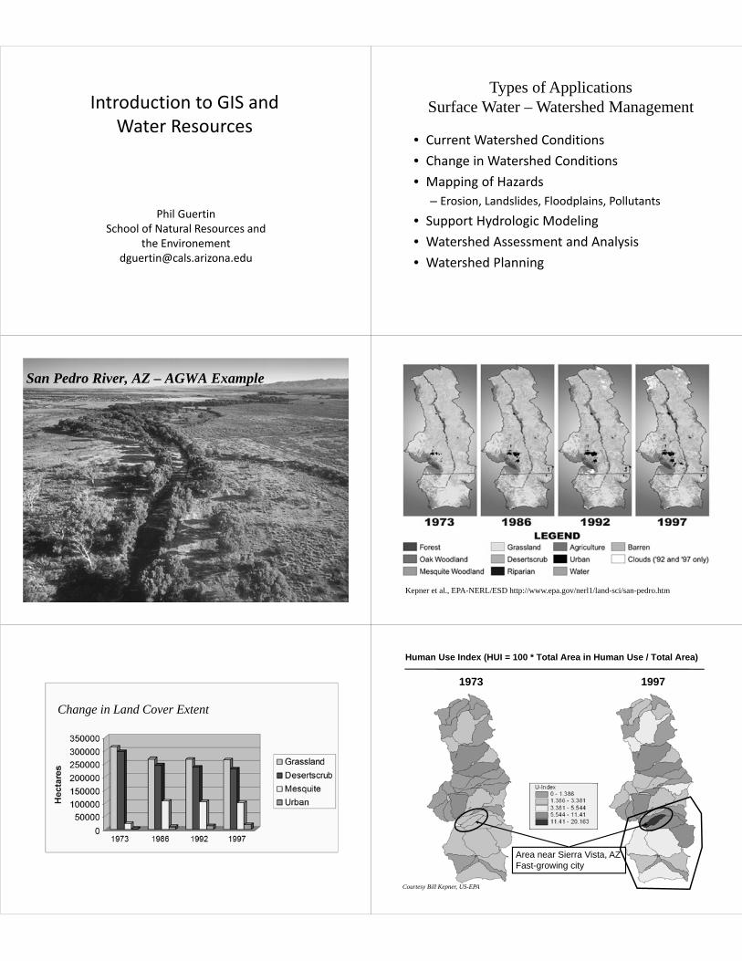
AGWAAutomated Geospatial Watershed Assessment:
GIS-based Hydrologic Modeling Tool for Watershed Assessment and Analysis
© Copyright Adriel Heisey
Watershed Discretization(model elements) +
LandCover
Soils
Rain (Observed or
Design Storm)
Results
Run model and import results
Intersect model elements with
Watershed Delineation using Digital Elevation
Model (DEM)
Sediment yield (t/ha)Sediment discharge (kg/s)
Water yield (mm)Channel Scour (mm)
Transmission loss (mm)Peak flow (m3/s or mm/hr)
Channel Disch. (m3/day)Sediment yield (kg)
Percolation (mm)Runoff (mm or m3)
ET (mm)Plane Infiltration (mm)
Precipitation (mm)Channel Infiltration (m3/km)
SWAT OutputsKINEROS Outputs
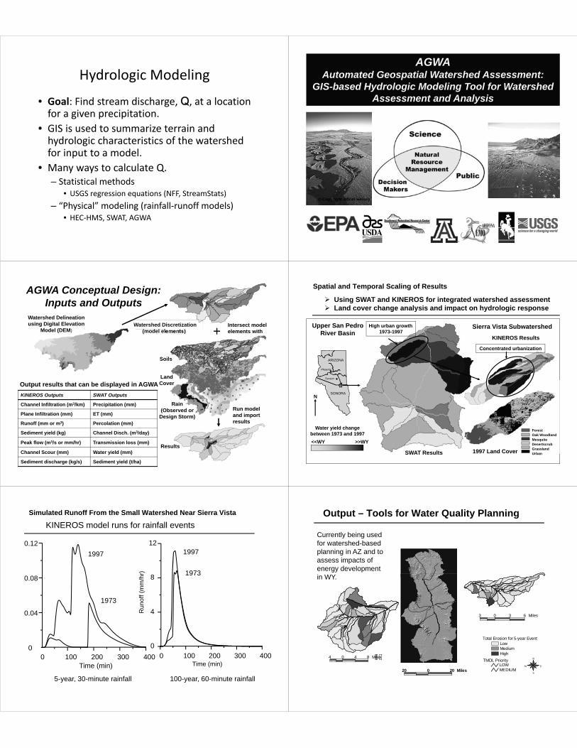
AGWA Conceptual Design: Inputs and Outputs
Output results that can be displayed in AGWA
Spatial and Temporal Scaling of Results
High urban growth1973-1997
Upper San PedroRiver Basin
#
#
ARIZONA
SONORA
Phoenix
Tucson
<<WY >>WY
Water yield change between 1973 and 1997
SWAT Results
Sierra Vista SubwatershedKINEROS Results
N
ForestOak WoodlandMesquite DesertscrubGrasslandUrban1997 Land Cover
Concentrated urbanization
Using SWAT and KINEROS for integrated watershed assessment Land cover change analysis and impact on hydrologic response
0 100 200 300 4000
4
8
12
Run
off (
mm
/hr)
Time (min)0 100 200 300 400
0
0.04
0.08
0.12
Time (min)
KINEROS model runs for rainfall events
5-year, 30-minute rainfall 100-year, 60-minute rainfall
1973
1973
1997 1997
Simulated Runoff From the Small Watershed Near Sierra Vista Output – Tools for Water Quality Planning
LowMediumHigh
Total Erosion for 5-year Event
TMDL PriorityLOWMEDIUM20 0 20 Miles
N
EW
S
4 0 4 8 Miles
3 0 3 6 Miles
Currently being used for watershed-based planning in AZ and to assess impacts of energy development in WY.

Characterizing the Watershed
complex topography land cover/use soilshigh spatial variabilitycomplex watershed response
Drainage System
Watershed (Basin, Catchment, Contributing area) Watershed Boundaries
(Drainage Divides)
Pour Points (Outlets)
GIS Tools for Describing Surface Water Movement
DEM
FLOW DIRECTION
SINK
FILL
FLOWLENGTH
FLOW ACCUMULATION
WATERSHED
SNAP POUR
DepressionlessDEMAre there any sinks?Are there any sinks?
No
Yes
STREAM LINE
STREAM ORDER
STREAM LINKApp
ly T
hres
hold
App
ly T
hres
hold
DEM Errors – Sinks and Spikes• Sinks: when sinks are (or are not) sinks – lakes, depressions, …– Global fill– Dealing with internal basins
– Selective fill• Depth• Area
SinkSinkFilled sinkFilled sink
Flow Direction
64 128
116
8 24
32
128 128
2
2 2
2
2
2
4
4
4
8
1 1 2
1
4
2
8
4
4
8
2
1
2
1
1
1
4
1
4
4
4
16
4
878
74
72
67
69
56
71
49
58
50
69
64
53
58
44
55
37
22
38
31
48
24
68
74
61
53
47
34
21
12
16
11
19
12
46
49
Elevation
Direction Coding
Flow Direction
GIS Background: Flow Direction
2 2 2 1 128
1 1 1 12864
3264128128128
128 64 64 32 80
Flow Direction Surface
100 100 100 100 94
100 97 96 95100
1001009998100
100 100 100 100 101
Original Surface

Flow Accumulation0
0
0
1
0
1
0
2
0
0
0
0
3
0
7
0
5
20
4
0
0
1
0
0
0
2
0
4
1
7
24
35
0
2
2
0
64 128
116
8 24
32
Direction Coding
GIS Background: Flow Accumulation
Flow Accumulation Surface
DEM Flow Direction Flow Accumulation
Creating Vector Streams
1 1
1 2 2
2 2 2 2
2 2
Value = No Data
NET_GRID
StreamToFeature
RasterToFeature
Stream Link
• Assign a unique value(s) to each stream segment.– Can be used as input to Watershed
Stream Ordering
Strahler Shreve
3
1
11 1
11
1
2 2
2 2
2
4
7
1
1
1
1 1
11
22
3
3
Watershed• Delineate the contributing area to a cell or group of cells.
• Input– Pour Point– Flow Accumulation– Flow Direction

SnapPour• Snap the “pour point” of a watershed to the cell of highest flow accumulation within a neighborhood.– Prevents accidental creation of tiny watersheds on channel
side slopes. Snap distanceSnap distance
Cell you clicked onCell you clicked on
The cell that will be selected(cell with highest flow accumulation)The cell that will be selected(cell with highest flow accumulation)
Flow Length• Calculate the length of the upstream or downstream flow path from each cell.
Summarizing Watershed Characteristics(Zonal Statistics)
• A zone is all the areas/cells with the same value.
• Calculate a statistic within the zones for each cell in a raster.
• Input zones can be feature or raster.• Output as a raster, summary table, or chart.
– Max flow length per watershed– Average slope per watershed– Average curve number per watershed
Zonal Overlay (cont.)
Slope
Watersheds
Mean Slope per Watershed
Where is this functionality?
• ArcInfo GRID Functions• ArcView 3.x Spatial Analyst
– Avenue requests– Sample extension
• ArcGIS Spatial Analyst 10.x– Tools in the Spatial Analyst Toolbox– Hydrology ToolKit
GIS Hydrologic Modeling Tools
• Automated Geospatial Watershed Assessment– http://www.tucson.ars.ag.gov/agwa/
• ArcSWAT– http://swatmodel.tamu.edu/software/arcswat/
• ArcAPEX – http://apex.tamu.edu/
• HEC – GeoRAS; HEC – GeoHMS– http://www.hec.usace.army.mil/
![Reed BRANCHING OUT.ppt - Sahraweb.sahra.arizona.edu/education2/wrtt/lecs/Reed_BRANCHING_OUT_… · Microsoft PowerPoint - Reed_BRANCHING _OUT.ppt [Compatibility Mode] Author: Jim](https://img.dokumen.tips/doc/110x75/5f70cbae7c69ad5c6e7b5e2f/reed-branching-outppt-microsoft-powerpoint-reedbranching-outppt-compatibility.jpg)