Embed Size (px)
Citation preview

10/27/14
1
Intro to Geophysics Non‐Seismic Methods
SECOND SECTION
Hector Gonzalez‐Huizar, PhD
This class
• Three Sec6ons (~1/3 of your final grad each):
• 1. Gravity
• 2. Data processing and Magne6cs
• 3. Electrical Methods

10/27/14
2
This class
• 2. Data processing and Magne6cs:
1. Lab 1 on Data processing
2. Lab 2 on MagneQcs
3. Exam (Oct. 29th)
Geophysics – defini6on
is a branch of earth science dealing with the physical processes and phenomena occurring especially in the Earth and in its vicinity.

10/27/14
3
Geophysics – branches
• Biogeophysics – study of how plants, microbial acQvity and other organisms alter geologic materials and affect geophysical signatures.
• Explora6on geophysics – the use of surface methods mainly to detect concentraQons of ore minerals and hydrocarbons.
• Geophysical fluid dynamics – study of naturally occurring, large‐scale flows on Earth and other planets.
• Geodesy – measurement and representaQon of the Earth, including its gravitaQonal field.
• Geodynamics – study of modes of transport deformaQon within the Earth: rock deformaQon, mantle convecQon, heat flow, and lithosphere dynamics.
• Geomagne6sm – study of the Earth's magneQc field, including its origin, telluric currents driven by the magneQc field, the Van Allen belts, and the interacQon between the magnetosphere and the solar wind.
Geophysics – branches (con6nua6on)
• Mathema6cal geophysics – development and applicaQons of mathemaQcal methods and techniques for the soluQon of geophysical problems.
• Mineral physics – science of materials that compose the interior of planets, parQcularly the Earth.
• Near‐surface geophysics – the use of geophysical methods to invesQgate small‐scale features in the shallow (tens of meters) subsurface.
• Paleomagne6sm – measurement of the orientaQon of the Earth's magneQc field over the geologic past.
• Seismology – study of the structure and composiQon of the Earth through seismic waves, and of surface deformaQons during earthquakes and seismic hazards.
• Tectonophysics – study of the physical processes that cause and result from plate tectonics.

10/27/14
4
Explora6on Geophysics – Defini6on
• is the applied branch of geophysics which uses surface methods to measure the physical proper6es of the subsurface of Earth, along with the anomalies in these properQes, in order to detect or infer the presence and posiQon of ore minerals, hydrocarbons, geothermal reservoirs, groundwater reservoirs, and other geological structures.
Explora6on Geophysics – main techniques
• Seismic methods, such as reflecQon seismology, seismic refracQon, and seismic tomography.
• Geodesy • Gravity techniques • Magne6c techniques
• Electrical techniques • Electromagne6c methods, such as magnetotellurics, ground
penetraQng radar and transient/Qme‐domain electromagneQcs. • Borehole geophysics, also called well logging. • Remote sensing techniques, including hyperspectral imaging.
+ basics of data processing

10/27/14
5
1. Seismic RefracQon AcousQc pulses are generated at predetermined source locaQons along the length of the refracQon seismic profile. The travel Qmes of acousQc energy that has been criQcally refracted at horizons of interest is recorded at predetermined receiver locaQons. The recorded travel Qme informaQon is used to generate a velocity–structure profile of the shallow subsurface.
1. Seismic RefracQon

10/27/14
6
1. Seismic RefracQon
2. Seismic ReflecQon The travel Qmes and amplitudes of reflected acousQc energy is recorded at predetermined receiver locaQons. The recorded travel Qme–amplitude informaQon is used to generate a reflecQon seismic profile. These data can be transformed into a velocity–structure profile.
10/27/14
7
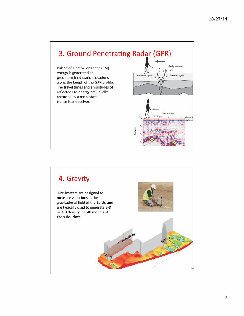
Pulsed of Electro‐MagneQc (EM) energy is generated at predetermined staQon locaQons along the length of the GPR profile. The travel Qmes and amplitudes of reflected EM energy are usually recorded by a monostaQc transmi`er‐receiver.
3. Ground PenetraQng Radar (GPR)
4. Gravity
Gravimeters are designed to measure variaQons in the gravitaQonal field of the Earth, and are typically used to generate 2‐D or 3‐D density–depth models of the subsurface.
10/27/14
8
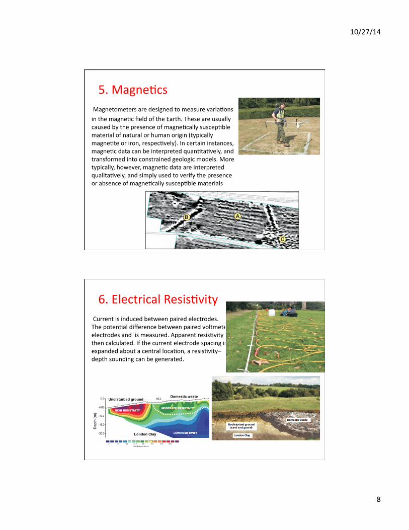
5. MagneQcs Magnetometers are designed to measure variaQons
in the magneQc field of the Earth. These are usually caused by the presence of magneQcally suscepQble material of natural or human origin (typically magneQte or iron, respecQvely). In certain instances, magneQc data can be interpreted quanQtaQvely, and transformed into constrained geologic models. More typically, however, magneQc data are interpreted qualitaQvely, and simply used to verify the presence or absence of magneQcally suscepQble materials
6. Electrical ResisQvity Current is induced between paired electrodes. The potenQal difference between paired voltmeter electrodes and is measured. Apparent resisQvity is then calculated. If the current electrode spacing is expanded about a central locaQon, a resisQvity–depth sounding can be generated.
10/27/14
9
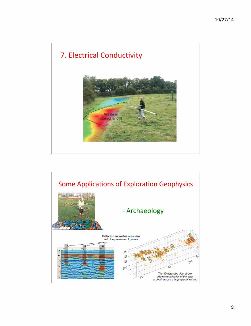
7. Electrical ConducQvity
Some ApplicaQons of ExploraQon Geophysics
‐ Archaeology
10/27/14
10
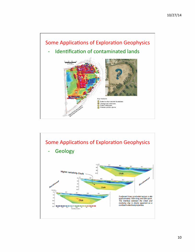
Some ApplicaQons of ExploraQon Geophysics ‐ IdenQficaQon of contaminated lands
Some ApplicaQons of ExploraQon Geophysics ‐ Geology

10/27/14
11
Some ApplicaQons of ExploraQon Geophysics ‐ Buildings and structures evaluaQon