Embed Size (px)
Citation preview

1

1
Information about this manual
East Riding of Yorkshire Council ‘Countryside Access Team’ has
produced this manual to aid voluntary groups and parishes who
wish to apply for a Local Paths Partnership Grant. It contains
everything you need to know about the history of the Grant, co-
ordinating a survey, organising a work programme, applying for
the Grant and everything between.
The aim of this manual is to allow you to take some ownership of
your local Rights of Way Network by providing you with sufficient
information to resolve the most commonly occurring problems at
the local level. Your Countryside Access officer will of course
support you should the matter be beyond the scope of the group.
This manual is designed to be readable, understandable and
interesting. You do not need to read the whole document but just
the relevant section as and when required. For new parishes and
groups obviously more time will need to be taken to read the
information.

2
Contents
Overview of the Local Paths Partnership 1
1. Introduction 2 - 4 The History of the old P3 Scheme
Why the P3 Scheme had to Change
How does the Community Paths Partnership Grant work
Map of East Riding of Yorkshire
List of Contacts
2. Background Information 5 - 13 History of the Public Rights of Way and the Definitive
Map
Rights of Way Legislation
Highway Authority / Landowner responsibility
3. The Grant Scheme Agreement 14 - 17 This section provides you with everything you need to
know to apply for the Grant
4. The Survey 18 - 20 This section details how you can conduct a full survey
of your local Public Rights of Way Network
5. Organising the Work Programme 21 - 24 This section highlights what work you can implement,
by whom and an estimated cost
6. Practical Work 25 - 43 This section gives advice on Practical work
7. Health and Safety 44 - 49 Insurance, Liability and Risk Assessments
8. Training 50 What training is available to your group.
9. Final Claims 51 - 52 This section explains how to enter your Final Claim
Forms
10. Promotion and Publicity 53 – 60 Leaflets, Guided Walks, Parish trail, Interpretation Board
11. APPENDIX 61 - 75 Glossary, List of Contractors, Risk Assessment
References, Blank Forms, Rates of Pay

1
Overview of the Local Paths Partnership Grant Scheme
Dec
No
v
Oct
S
ep
Au
g
Ju
l J
un
Jun
to
Oct
(to
avo
id w
et w
inte
r w
eath
er)
Jun
to
Oct
(to
avo
id w
et w
inte
r w
eath
er)
Ma
y
Ap
r
Cu
t fr
om
Ap
r to
Oct
Ma
r
Feb
Ja
n
Su
rvey
ing d
uri
ng
sp
ring
/su
mm
er w
ill
hel
p t
o i
den
tify
ov
ergro
wn
pat
hs
Inst
alli
ng
Fu
rnit
ure
can
be
don
e y
ear
roun
d
Lo
cal
Pa
ths
Pa
rtn
ersh
ip S
chem
e -
Th
e W
ork
ing
Yea
r
Su
rvey
ing
Cu
ttin
g
Fu
rnit
ure
Inst
all
ati
on
Su
rfa
cin
g
Dra
ina
ge
Local Paths
Partnership
Both the Group/Parish Council
and the local Countryside Access
Officer sign the Local Paths
Partnership Agreement
The Group/Parish conduct a
survey of the local network and
decide on what works to tackle in
the coming financial year
The Group/Parish returns Survey
results, Work Proposed Forms and
Materials Order Forms
(Before May 1st)
ERYC evaluate all applications
received against specific criteria.
If your Application is not
accepted apply again next year
ERYC provide the Grant, The
Group/Parish use this money to
fund the proposed works
Upon completion the
Group/Parish complete the Work
Completed and Final Claim Form
(Before March 31st )
The Group/Parish decide if they
wish to reapply for a grant the
following financial year

2
Introduction The Local Paths Partnership is a grant scheme funded by East Riding of Yorkshire
Council / Countryside Access Team. The partnership joins the statutory duties of the
Countryside Access Section (Highway Authority) with the desire of parish councils
and voluntary groups to be actively involved in the maintenance and improvement of
their local Public Rights of Way Network. It also stresses the importance of local
communities and their role in increasing awareness and use of the public rights of
way network. The Partnership will always endeavour to achieve -
• Harmony between landowners and users;
• Practical work of a high standard, which will last a long time;
• Sustainable solutions
• The philosophy of the Disability Discrimination Act (DDA) and the Rights of
Way Improvement plan (ROWIP)
The History of the P3 scheme
In 1993 Humberside County Council
joined a National initiative: The Parish
Paths Partnership (P3) largely
sponsored by the Countryside
Commission later known as the
Countryside Agency. The scheme was
continued by East Riding of Yorkshire
Council in 1996 when Humberside
County Council was abolished.
Countryside Agency funding ceased in
2003 since which time ERYC has
provided 100% of the required
funding.
Why the P3 Scheme is changing
The P3 scheme had been running for
13 years with only minor alterations
throughout its life. The loss of
Countryside Agency funding and
falling Best Value Performance
Indicators was the catalyst to a conduct
major overhaul of the scheme updating
the aims of the scheme to account for
changes in legislation, funding
availability, and ERYC’s Rights of
Way Improvement Plan.
How does the Local Paths Partnership Grant Work
The Public Rights of Way Network is
the legal responsibility of the Highway
Authority (ERYC/Countryside Access)
and will remain so even should you
join the Partnership.
The Grant:
The Local Paths Partnership Grant
allows voluntary groups/parish
councils to apply for a percentage
grant up to 100% for statutory work.
The Partnership Agreement:
A signed Agreement between the
Group/Parish Council and Countryside
Access Officer.
The Survey:
An evaluation of the state of the local
Public Rights of Way Network.
Work Proposed Forms:
A detailed description of the work you
wish to implement in the coming
financial year.
Work completed / Final Claim
Form:
Confirmation of works carried out and
costs incurred.

3
A Map of the East Riding

4
East Riding of Yorkshire Council Contacts
Countryside Access Staff
Patrick Wharam Countryside Access Manager
(01482) 395202
PHOTO 07717 893953
Trevor Appleton Countryside Access Officer
(01482) 395202
07767 330491
Simon Parker Countryside Access Officer
(01482) 395204
07717 703877
Andrew Chudley Countryside Access Officer
(01482) 395204
07768 190220
Lesley Whitehead Countryside Access Officer
(01482) 395205
07768 190218
Vacant Position Countryside Access Technical Assistant
Other useful ERYC Contacts
Gordon Grimley Definitive Map Team (Engineer) (01482) 395560
Highways Customer Care line 0845 6001666

5
Background Information
The History of the Public Rights of Way and the Definitive Map
The Public Right of Way network we have today has developed over many years, in
some cases hundreds of years. However, the initial registration of the Public Rights of
Way began in 1949. Parish Councils were at the heart of the process and were asked
to register what they considered to be Public Rights of Way. With the exception of
some diversions, creations and modifications today’s Definitive Map shows largely
what was recorded in 1949.
The Definitive Map
The Definitive Map is the legal record
of all Public Rights of Way and is
accompanied by a statement. Before
implementing work on a path it is
essential that the definitive map is
checked. There can be differences
between the line of the path on the
ground and what is shown on the
definitive map, when this is the case
the line shown on the definitive map is
the legal line of the path. Your
Countryside Access Officer can
provide you with a copy of the
definitive map.
Alterations to the Definitive Map:
There are only two mechanisms to alter
the ways shown on the Definitive map
1) Legal Event Modification Order
Public Path Orders (i.e. Diversions,
creations and extinguishments) make
physical changes to the network and
require a legal event modification
order to amend the Definitive map
2) Evidential Modification order
These amend the Definitive Map to
take account of matters that have
already occurred (i.e. adding a PRoW
to the Definitive Map that exists on the
ground but is not shown on the
Definitive Map)
Ordnance Survey Maps:
The information contained on the
Ordnance Survey Map is based upon
the Definitive Map and has been
supplied by the Highway Authority.
Older Maps may not show up to date
information and are not a suitable
substitute for a copy of the Definitive
map.
If you need further information
regarding the Definitive Map please
consult with your Countryside Access
Officer. They will make a decision
about whether your request needs to be
submitted to specialist officers within
the Definitive Map Team
Discovering Lost Ways:
The discovering lost ways project
(DLW) arose from the Countryside and
Rights of Way Act 2000, which set a
deadline of January 1st 2026 after
which it will not be possible to apply
for footpaths and bridleways, or higher
rights, to be included onto the
definitive map based upon historical
evidence (historical means pre-
1949)The countryside Agency has the
responsibility for coordinating the
work necessary to research rights of
way not currently shown on the
definitive map. www.countryside.gov.uk/LAR/ACCESS/DWL/index.asp

6
Public Rights of Way Legislation
What does the Rights of Way Network consist of?
Footpaths – over which the right is on
foot only. (Standard and motorised
wheelchairs, pushchairs and dogs are
all permitted to use the Rights of Way
but may not be able to negotiate
structures along the route)
Bridleway – over which the right is on
foot, on horseback and on pedal cycle,
possibly with an additional right to
drive animals.
Byway – over which the right is on
foot, on horseback/cycle and in a
motor vehicle.
Restricted Byway – over which the
right is on foot, on horseback/cycle and
with vehicles other than mechanically
propelled vehicles, for example a horse
and carriage. (Introduced by the
Countryside and Rights of Way Act
2000)
Other terms often used:
Permissive Paths – A route that is not
a Public Right of Way but where the
landowner has granted permission to
use the way. These may be signed but
are not always
Green Lane – A term with no legal
meaning, but generally used to
describe un-metalled highways.
Highway – A way over which the
public have a legal right to pass and re-
pass. All public rights of way are
highways.
‘List of Streets’ Highways
maintainable at the public expense
(Adopted roads) – The legal
document that record all highways, in a
council’s area, which are maintainable
at public expense.
To what standard should we expect to restore our paths?
The Law: The main consideration in determining the degree of maintenance for
individual paths or ways is that they should serve the purpose for which they are
primarily used. Hence someone in suitable outdoor wear should be able to use a
Public Right of Way in average weather conditions. In other words, the route would
be expected to be clear from obstruction, but might well become muddy in wet
weather. Paths nearer villages and towns would normally be expected to be in a better
condition than little used ones some distance from settlements. The Highway
authority has a duty to signpost Rights of Way were they leave a metalled road and
waymark along the route where appropriate.

7
Path Widths of Public Rights of Way
If you have been provided with a definitive statement you will see that the width of
the path is sometimes recorded. Where the definitive statement does not indicate a
width and there is no other relevant information (e.g. a legally enforceable width
given in a diversion order where a path has previously been diverted) then the
following widths apply to the paths crossing cultivated land (Rights of Way Act 1990)
• A cross-field footpath must be
restored to a minimum of 1
metre. • A cross-field bridleway must be
restored to a minimum of 2
metres • A cross-field byway must not be
cultivated and should have a
minimum width of 3 metres
• A field edge footpath should not be
cultivated and have a minimum
width of 1.5 metres
• A field-edge bridleway should not
be cultivated and have a minimum
width of 3 metres
• A field edge byway should not be
cultivated and have a minimum
width of 5 metres.
The widths specified in the Rights of Way Act 1990 apply where land is ploughed or
cultivated. They do not apply in other circumstances. For example:
• A path between properties fenced on either side
• A path along a farm track
• A path along a disused railway line
Field Edge Bridleway – 3m wide
Cross-field footpath – 1m wide

8
Public Rights of Way Furniture
Signpost
A signpost must be erected where a Right of Way leaves the metalled road and must
state whether it is a footpath, bridleway, byway or restricted byway.
Waymarkers
The use of waymarkers to define the route of a Public Right of Way should be
complimentary to signposting. They enable users to follow a route accurately at points
where they may otherwise have encountered difficulties.
Stiles and gates
The 1980 Highways Act states that stiles and gates are the responsibility of the owner
of the land. The owner shall maintain the structure to a standard to prevent
unreasonable interference with rights of the user. In order to provide a reasonable
balance between the landowner’s responsibility to control stock for which he is
responsible, and the Highway Authority to manage the rights of the public to use the
Rights of Way network, the ERYC is required to contribute 25% of the costs of
maintaining the structure.
Stiles and gates should only be placed on a Right of Way if it is necessary for one to
be there. This may be because the land is used to graze stock and a barrier is
necessary to prevent the animals straying, or it may be that the Highway Authority is
satisfied that it is necessary for such a structure to be there to safeguard users of the
way. Should a new structure be erected to safeguard users it cannot be a stile Stiles can be useful means of controlling stock; but it may be possible to replace the
stile with a self closing hand gate or a kissing gate which is easier to use for the
elderly and families with young children. In some cases it is perfectly acceptable to
remove any stiles which are no longer needed. A gate or just a gap is better on well
used paths allowing access to people of all ages and abilities.
New structures erected after the 1st April 2006 need to meet the requirements of the
Disability Discrimination Act, and have to meet the strict tests of section 147 of the
Highways Act 1980. The more structures that are placed on a Right of Way the more difficult it is to maintain. Each structure will need to be circumnavigated to enable cutting the path. Always ask if the structure is necessary. All new structures need the approval of the Highway Authority.
Bridges and culverts
Bridges or culverts are needed wherever a path crosses any form of ditch or watercourse. Bridges with a span in excess of 5m remain the responsibility of the ‘Bridges and Coastal section’ of Highway Authority, unless they are privately maintainable.

9
Landowners
The Public Rights of Way network generally crosses private land and the partnership is intended to work with landowners. This land, which is used for people’s pleasure and enjoyment, is usually the livelihood of a private individual. Always respect this and approach landowners in a pleasant and friendly manner. Firstly, explain who you are and the role of the Partnership. Secondly, explain what pieces of work you are proposing to carry out. Thirdly, give them the opportunity to comment on the proposals. Be sure that the person concerned has received and read the booklet Managing Public Access, which has been produced by Countryside Agency in conjunction with the NFU and CLA. (Ref No CA210) Landowners must be informed of work to be carried out on their land. Should the landowner refuse to allow this work to take place please report this to the Countryside Access Officer. The Parish Council has powers to maintain and improve rights of way and generally will not need the permission of the landowner. However, it is polite to approach a landowner first and this will usually be a worthwhile experience for both parties. Often landowners can assist with access for the required work
Who is responsible for Rights of Way?
Highway authorities, landowners and farmers
have legal duties and responsibilities for rights
of way. In addition, local councils have special
powers.
The Highway Authority is responsible for:
• Asserting and protecting the public’s
rights
• Keeping rights of way free from
obstructions
• Keeping the path surface clear of natural
vegetation
• Signposting rights of way where they
leave a metalled road
• Waymarking the path where the way is
unclear
• Recording rights of way on the definitive
map
The landowner or farmer is responsible for:
• Providing and maintaining gates and stiles
• Cutting back overhanging vegetation and
hedges
• Not obstructing the right of way
• Not ploughing field edge paths
• Reinstating cross-field paths within two
weeks of ploughing or within 24hrs of any
subsequent disturbance
• Ensuring that the line of the path is clear
on the ground in cultivated fields, and not
obstructed by growing crops.
The local council can:
• Maintain any footpath or bridleway in its
area
• Draw problems to the attention of the
highway authority
• Make improvements to the rights of way

10
Ploughing and Cropping
The East Riding is intensively farmed and much of the land is regularly in some form of cultivation. Some cross-field Rights or Way are not re-instated after ploughing and crops are allowed to obstruct the path, making it difficult for walkers to use the network.
A Headland Path - one that runs alongside a
ditch, hedge, wall or wood cannot be ploughed
or disturbed. Should this happen the Highway
Authority will need to know in order to ensure
the landowner reinstates and delineates the
path. A Headland Path is normally 1.5m – 2m
wide
In some cases a headland path can benefit
from being ploughed out. However, such
action is illegal unless the Highway Authority
gives written permission.
A Cross-field Path can be ploughed but the
line of the path must be reinstated within 2
weeks. This must be at least lm wide for a
footpath and 2m for a bridleway. Two stakes
placed at either side of the path are a good
way of delineating the line and the width.
(Tractor Wheelings and Spraying are other
suitable ones. Although when spraying
farmers should check the guidance that
accompanies the product). Any crops which
grow on the path must be cut or removed
before they hinder progress along the path.
You may feel that you would like to make an
initial approach to a landowner to keep open a
cross-field right of way. Should a quiet word
with the farmer not result in the path being
reinstated then the Highway Authority will
need to be informed so that they can take
action. Should you not wish to make an initial
approach to a landowner then the Highway
Authority will try and open up the cross-field
path.
It will save an enormous amount of time if
your Parish can find the name and address of
the landowner.
Stakes identify line of the path
Cropped path- line of path unclear

11
Open Access
We have a number of newly
accessible pieces of land in the East
riding called Open Countryside.
Across England and Wales all land
mapped as being mountain, moor
heath or down has been mapped as
Open Countryside and hence open
for the public to use. Although we
don’t have any mountains in the East
Riding or any pieces of Moorland
like the Peak District, we do have a
number of downland sites,
particularly in the Wolds.
These new areas are also accessible for walking by virtue of the Countryside and
Rights of Way Act, you can wander where ever you want across areas marked on the
new ‘Countryide Exporer’ maps with a yellow colour wash; these areas are ‘access
land’ and will be signed with a brown person symbol. The maps are available from all
good bookshops. These sites offer breathtaking views tranquillity, an opportunity to
connect with nature in peaceful and picturesque surroundings.
The new right comes with a few extra rules and can seem a little confusing so it’s
worth reading the basic rules set out below in order to enjoy your visit.
• land can be closed in the interests of the landowner; signs will be displayed if
this is the case. Always have a back up plan for your walk in case this happens
• Secondly dogs are welcome but should be kept on a lead particularly during
the nesting season
• Thirdly the right to go wherever you want doesn’t apply to land that is
cultivated, or to land very close to homes
• Fourthly you can only walk on access land riding bikes and horses is
prohibited.
Huggate Bridleway No.6

12
Disability Discrimination Act (DDA)
The disability discrimination act 1995 (known as DDA) introduced new laws to
prevent discrimination against disabled people. Local Authorities as a provider of
services (e.g. path networks, promotional literature or guided walks) must comply
with the Act.
The Act provides two distinct rights:
• Not to be unjustifiably discriminated against for a reason which relates to
disability
• To have reasonable adjustments made to premises or working arrangements
Under the Act, a disabled person is someone who has, or has had, a physical or mental
impairment causing a substantial or long-term adverse effect on his or her ability to
carry out normal day to day activities. This definition includes the familiar category of
wheelchair user but also includes all physical disabilities as well as those with sensory
impairment, learning difficulties and mental illness.
It will not be possible, desirable or
reasonable for all paths to be made
fully accessible. However, it is
unlikely to be reasonable for a path
network to offer no outdoor access
opportunities to disabled people.
The East Riding wish to ensure
that when planning work
consideration is given to the needs
of those with mobility problems
and disabilities.
One of the most simple, but very significant, steps that we can all take is to remove
stiles. The authority is working towards a stile free network by 2020.
Under the old ‘P3’ scheme stiles have been erected by the Highway Authority. From
1st April 2007 no stiles will be permitted to be renewed, repaired or erected under the
Local Paths Partnership grant scheme.

13
Rights of Way Improvement Plan (ROWIP)
Under section 60 of the Countryside and Rights of Way Act 2000, every local
highway authority has a duty to prepare and publish a Rights of Way Improvement
plan (ROWIP) by November 2007. Because East Riding of Yorkshire was judged to
be an ‘excellent’ council by the Audit Commission, it was relieved of the statutory
duty to prepare a Rights of Way Improvement Plan by the Office of the Deputy Prime
Minister. The East Riding has taken the decision to prepare the document as a matter
of good practice.
Amongst other things, the plan should include the authority’s assessment of:-
• The extent to which local rights of way meet present and likely future needs of
the public;
• The opportunities provided by local rights of way (and in particular by
footpaths, cycle tracks, bridleways and restricted byways) for exercise and
other forms of open air recreation and the enjoyment of their area;
• The accessibility of local rights of way to blind or partially sighted persons or
others with mobility problems.
The Rights of Way Improvement Plan is intended to be a mechanism for improving
the network of Public Rights of Way and other non-motorised routes in line with the
requirements of all types of users. It is not designed to provide individual detailed
solutions to access problems but rather a strategic approach to managing public
access.
Local Access Forum (LAF)
Section 94 of the Countryside and Rights of Way Act places a duty on local highway
authorities and national park authorities to establish local access forums:
• To advise the Council(s) on the improvement of public access to land in the
area for which it is established, for the purposes of open-air recreation and the
enjoyment of the area, and as to such other matters as may be prescribed.
• This includes advising on the implementation of the new access rights,
including the imposition of bylaws and proposals for long term closures on
access land, as well as on wider access issues contained in new Rights of Way
improvement plans, or recreation and access strategies. Helping the authorities
and other access providers such as Forestry Authority, Natural England,
British Waterways and the Environment Agency make improved provision for
the public.
• In carrying out its functions, a local Access Forum will have due regard to the
needs of land management, the conservation of the natural beauty of the area
and any guidance from the Secretary of State (as respects England).
Following the procedure identified in Section 94 of the Countryside and Rights of
Way Act, East Riding of Yorkshire and Kingston upon Hull City Council established
a joint Local Access Forum in June 2004. All formal meetings of the full forum are
open to the public and minutes of the meeting are available on request to the public.
Visit www/eastriding.gov.uk/countrysideaccess for more information

14
The Grant Scheme Agreement
How do I join?
To join the scheme the representative of the Voluntary group or Parish Council should
contact their Local Countryside Access Officer (see page 4) to discuss their interest or
arrange a meeting. Once a group has decided to apply for a grant they should
complete the Grant Scheme Agreement and return a copy to the Countryside Access
team at County Hall.
The Grant Scheme Agreement sets out the responsibilities of the group and the
Highway Authority. This must be repeated each year the group wish to apply for a
grant.
A copy of your agreement should be kept with your activity and risk assessment
record in your Public Right of Way information file.
Who can join and when?
The P3 scheme was primarily for
Parish Councils, however, voluntary
groups are welcome and encouraged to
join the Local Paths Partnership Grant
Scheme. All Grants must be paid to the
Parish Clerk or voluntary group
Treasurer.
A group is welcome to make contact at
any time throughout the year but the
Countryside Access budget is likely to
be allocated by the end of May. To be
considered for a Grant the Work
Proposed form together with the
completed agreement must be returned
to County Hall before April.
What Activities can a group carry out?
A group can carry out most of the
activities that the Highway Authority
(ERYC) is legally able to carry out, but
work can only take place on routes
identified on the Definitive Map.
(See the list of Responsibilities on Page 9)
Will we be responsible for all Public Rights of Way in the Parish?
The scheme does not alter or
extinguish any of the statutory
responsibilities of East Riding of
Yorkshire Council. All we ask is that
any proposed work must both improve
the condition of the Public Right of
Way Network and involve local
people.
We expect Parish Councils to survey
the whole network, and as far as is
practical, look after all paths within the
Parish. Smaller voluntary groups who
want to work on particular projects will
not be expected to look after all routes
within the Parish.
It is just as important for us to know
what you are not maintaining as it is
the routes you are. This way we know
what routes the Countryside Access
Team will be maintaining.

15
Local Paths Partnership Agreement - Example
The Local Community Group will:
LCG1. Make all effort to work toward restoring the whole of its ROW network to
full use through the means available to it through this Partnership
Agreement.
LCG2. Carry out a condition survey of any ROW it intends to work on or promote
with support from the Countryside Access Officer where necessary.
LCG3. Regularly inspect and notify the Countryside Access Officer of defects, or
problems on the network.
LCG4. Draw up a programme to restore and improve its local paths network to use
at an agreed standard.
LCG5. Decide how it wishes to carry out this programme:
The following means might be used to deliver the work:
- community groups; schoolchildren, WI and Young Farmers;
- individuals e.g. rights of way wardens;
- volunteer groups and user groups;
- employment of a local handyperson;
- farmer/landowner;
- private contractors.
In addition, the following expenditure would be considered eligible:
- purchase of basic hand tools for use by volunteers or handyperson;
- reasonable volunteers’ out-of-pocket expenses;
- insurance of volunteers and equipment:
LCG6. The parish council agree to meet the costs of the work agreed by the
Highway authority. The full costs of this work can be recovered annually
from the Highway Authority
LCG7. Make available from its local knowledge the details of land ownership over
the path network; make the first approach to landowners, under the guidance
of the Countryside Access Officer if required, about any problems.
LCG8. Will inform the landowner or tenant before carrying out work on a public
right of way, arrange for the programme of work to be carried out and keep
records of works undertaken and associated costs.
LCG9. Be responsible for overseeing the work where necessary, checking that it has
been carried out to an acceptable standard and informing the HA when it has
been completed in any year through the submission of the Work Completed
Form

16
LCG10. Be responsible for applying for the Parish Grant, accounting simply for the
previous year’s expenditure, reporting on progress and make work proposals
to the HA on an annual basis.
LCG11. Accept the HA’s guidelines for the standard of work to be carried out.
LCG12. Establish adequate insurance and public liability cover when using
volunteers on practical tasks, and ensure contractors have both insurance and
public liability cover. Contractors should have a minimum of £5 million
public liability indemnity.
The Highway Authority will:
HA1. Make available the support of a Countryside Access Officer to all Local
Community Groups entering into a Partnership Agreement, who can:
- provide information about the current PROW network;
- offer assistance in surveying, with the Local Community Group, the
condition of the local path network;
- offer assistance in drawing up a work programme to tackle identified
problems and upgrade the paths to an agreed standard;
- offer assistance in considering choices about ways of arranging for the
work to be done;
- offer assistance in checking work when completed, if requested
HA2. Make available to the Local Community Group a grant. The grant may cover
three areas of activity:
i) upgrading, improvement and maintenance works to keep paths open;
ii) publicity and information; (at a reduced rate)
iii) events and activities to encourage use. (at a reduced rate)
This agreement commits the offer of this grant for one year only from the 1st
of April through to the 31st of March
The local community group will apply for the grant on an annual basis, and the
total sum will be paid in advance if required (less any amount for materials).
Grant applications must be submitted by the 1st of May.
HA4. Provide materials for stiles, gates, signposts, waymark posts and discs.
HA5. Through the Countryside Access Officer, arrange training tasks and seminars
required for volunteer groups, also open to handyperson and
farmer/contractors, Parish Councillors wishing to take part, in order for them
to tackle their work programme effectively.
HA6. Produce a set of simple guidelines and standards which will enable Local
Community Groups to participate effectively in the scheme, for example
advice on surveys, practical work and promotion.
HA7. Will check all improvement and practical work (not clearance and
maintenance) to ensure that the Highway Authority standards of work are met.

17
I accept the conditions contained in this agreement until the end of March 2009.
Signed ……………………………………………….
On behalf of ………………………………………………Local community Group
Date …………………………………………………..
Signed ………………………………………………….
On behalf of East Riding of Yorkshire Council
Date …………………………………………….
What happens next?
After completing the agreement you
should encourage as many volunteers
to join as possible then with assistance
from the Countryside Access Officer
begin to Survey your local Network.
Completing the agreement does not
guarantee that your funding bid will be
accepted.
The Countryside Access Team have to
evaluate all the applications and if the
scheme is over-subscribed will have to
make priority decisions against the
following criteria
ERYC are looking for applications that:
• Demonstrate a knowledge and
understanding of the Public Rights
of Way network.
• Offer value for money / element of
Parish Precept.
• Wider involvement of residents and
others, and voluntary effort.
• Links to other schemes and
initiatives with wider benefits
beyond just maintaining Public
Rights of Way.
• Bring new groups and communities
into the scheme that have not had
the chance to join the Parish Paths
Partnership.
18
The Survey
Surveying your Local Rights of Way Network
Before you can survey the Network
you must obtain an up to date working
copy of the definitive map.
A survey of the condition of your
Rights of Way is an essential starting
point for the Grant Scheme and will
enable you to focus on things which
need to be done to improve and keep
open your Right of Way network. It is
well worth taking time to carry out a
quality survey.
Path surveying is a task which can
involve quite a lot of people. It should
involve members of your community
for example dog walkers, families,
parents with pushchairs, children and
the less able. It is then possible to get a
feel for the needs of different users. It
is important to remember that
Bridleways can be used by pedal
cyclists and horse riders as well as
walkers. It is best for these to be
surveyed by cyclists, horse riders and
walkers because each user has special
requirements, and what is satisfactory
for one may be impassable for others.
Always remember that with a little
thought and careful design wheelchairs
may be able to use some of your paths.
Inevitably when carrying out a survey
you will come across problems. We
have included a survey form within
these guidelines which will help focus
your parish on what is required, and
what can be done under the
Partnership.
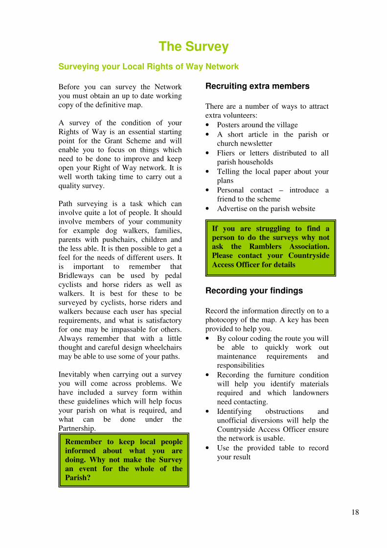
Recruiting extra members
There are a number of ways to attract
extra volunteers:
• Posters around the village
• A short article in the parish or
church newsletter
• Fliers or letters distributed to all
parish households
• Telling the local paper about your
plans
• Personal contact – introduce a
friend to the scheme
• Advertise on the parish website
.
Recording your findings
Record the information directly on to a
photocopy of the map. A key has been
provided to help you.
• By colour coding the route you will
be able to quickly work out
maintenance requirements and
responsibilities
• Recording the furniture condition
will help you identify materials
required and which landowners
need contacting.
• Identifying obstructions and
unofficial diversions will help the
Countryside Access Officer ensure
the network is usable.
• Use the provided table to record
your result
Remember to keep local people
informed about what you are
doing. Why not make the Survey
an event for the whole of the
Parish?
If you are struggling to find a
person to do the surveys why not
ask the Ramblers Association.
Please contact your Countryside
Access Officer for details

19
Survey Map and key
This is a fictional survey and may not accurately represent the Hedon Public Right of Way network.
Colour paths on map as
appropriate (Blue) No cutting required
(Purple) Infrequent cutting required
(Green) Frequent cutting required
(Orange) cross-field path
Indicate furniture in good condition
S Stile in situ – ok
B Bridge in situ – ok
G Gate in situ – ok
KG Kissing gate – ok
W Waymarker post – ok
P Fingerpost – ok
Circle letter to indicate work needed
(S) Stile needs repair/replacement
(B) Bridge needs repair/replacement
(G) Gate needs repair/replacement
(KG) Kissing gate repair/replacement
(W) Waymarker post required
(P) Fingerpost repair/installation
(D) Waymarker disc required
KEY ------- Unofficial diversion
permissive route
xxxx Obstruction,
(e.g. fence, building,
pond.)

20
Completed Survey Form- Fictional Example
Wh
o w
ill
do
th
e
wo
rk
Con
trac
tor
Vo
lunte
er
Hig
hw
ays
Vo
lunte
ers
(alt
houg
h i
t
is t
he
lando
wner
resp
on
sibil
ity
)
Con
trac
tor
Con
trac
tor
Con
trac
tor
Con
trac
tor
Con
trac
tor
Con
trac
tor
Con
trac
tor
Con
trac
tor
Con
trac
tor
Con
trac
tor
Ov
era
ll C
on
dit
ion
of
the
PR
oW
Acc
epta
ble
Acc
epta
ble
Acc
epta
ble
Usa
ble
wit
h d
iffi
cult
y
Acc
epta
ble
Acc
epta
ble
Acc
epta
ble
Acc
epta
ble
Acc
epta
ble
Acc
epta
ble
Acc
epta
ble
Acc
epta
ble
Acc
epta
ble
Acc
epta
ble
Acc
epta
ble
Ma
teri
als
req
uir
ed
New
hin
ge
Dis
c,n
ails
No
ne
No
ne
3 c
uts
per
yea
r (M
ay,
July
, S
ept)
2 c
uts
per
yea
r (
Jun,
Aug
)
1 c
ut
per
yea
r (M
ay)
3 c
uts
per
yea
r (M
ay,
July
, S
ept)
0 c
uts
1 c
ut
per
yea
r (M
ay)
1 c
ut
per
yea
r (M
ay)
1 c
ut
per
yea
r (M
ay)
2 c
uts
per
yea
r (J
un
, A
ug
)
2 c
uts
per
yea
r (J
un
, A
ug
)
3 c
uts
per
yea
r (M
ay,
July
, S
ept)
Wo
rk R
equ
ired
Rep
air
hin
ge
Nai
l up
new
dis
c
Wel
din
g
Fie
ld u
sed
fo
r cr
op
s, n
o s
tile
s o
r g
ates
requ
ired
, le
ave
gap
on
ly
(ag
reem
ent
fro
m l
ando
wn
ers
requ
ired
)
Fre
quen
t cu
ttin
g r
equir
ed
Fre
quen
t cu
ttin
g r
equir
ed
Infr
equ
ent
cutt
ing
req
uir
ed
Fre
quen
t cu
ttin
g r
equir
ed
No
cu
ttin
g r
equ
ired
Infr
equ
ent
cutt
ing
req
uir
ed
Infr
equ
ent
cutt
ing
req
uir
ed
Infr
equ
ent
cutt
ing
req
uir
ed
Fre
quen
t cu
ttin
g r
equir
ed
Fre
quen
t cu
ttin
g r
equir
ed
Fre
quen
t cu
ttin
g r
equir
ed
Iden
tifi
ed P
rob
lem
Kis
sin
g g
ate
in n
eed o
f re
pai
r
Way
mar
ker
dis
c re
quir
ed f
or
po
st
Bri
dge
dam
aged
Tw
o o
ld s
tile
s
500
m
200
m
700
m
350
m
150
m
1000
m
150
m
450
m
50
m
150
m
500
m
FP
/BW
/or
By
wa
y N
o
Fp
No.4
Fp
No.1
1
Fp
No.1
1
Fp
No.1
5
Cutt
ing
Req
uir
ed
FP
No
.1
Fp
No.2
Fp
No.3
Fp
No.3
Fp
. N
o4
Fp
No.5
Fp
No.6
Fp
No.7
Fp
. N
o.8
Fp
No..9
Fp
No.1
0

21
Organising the Work Programme
Once you have completed your survey you will understand what improvements
and maintenance will be required to open up your Public Rights of Way (PRoW)
network.
The total length of Rights of Way
within the parish will dictate the
maximum grant availability. Funding
availability will inevitably affect the
volume of work you are able to
achieve in any given year. It is likely
you will have to prioritise your work
projects.
The survey you have completed will
suggest whether your local PRoW
network is usable or in need of
extensive work. If extensive work is
required to bring it up to standard then
it would be wise to identify specific
goals and reapply for a grant in
subsequent years to achieve further
improvements.
It is important to remember that overgrown paths can easily be cleared under the partnership by using a volunteer, a local handyman, contractor, or even a landowner, and your grant can be spent on this type of work, which generally needs doing regularly each year. When discussing these issues with farmers and contractors consider access for machinery. It is best to discuss these issues with your Countryside Access Officer. Remember to consider the needs of the whole community and to ensure that gates and stiles are easy to use and do not put off users of your network. It may be acceptable to take out some stiles if they do not have a purpose or to replace a stile with a self closing gate. The maintenance of stiles and gates on
Public Rights of Way is the
landowners responsibility.
The new scheme has a
maximum amount which
means that the money is spread
more evenly amongst the
parishes and local groups with
an interest.
In 2009/10 this rate will be set
at £80 per km of Public Right
of Way in your parish.
A list identifying the Maximum Grant your
parish would be entitled to can be found in the
appendix (page 68)
The Work Programme
• Complete the work proposed form;
discuss this with the Countryside
Access Officer if necessary.
• Return a copy to ERYC for approval.
• Once the work has been agreed you can
organise the work schedule.
• Delivery of furniture requests are often
left until the end of the cutting season
(September). Let your Countryside
Access Officer know if you need the
materials sooner.
• Arrange times and dates for the required
works with your volunteers, contractors,
parish handymen or local farmers.
• Once the proposed work has been
completed fill in the Work Completed
form and the Final Claim form and send
a copy to ERYC.

22
What can we do?
Maintenance - 100% costs available
• Cutting back overgrowth i.e. around stiles, gates and bridges.
• Mowing a field edge right of way. • Cutting back village amenity path
• Signposting the PRoW network.
• Changing fingerboards to include
destination and distance.
• Waymarking the PRoW network.
• Renewing or repairing of minor
bridges.
• Taking out stiles which are not
necessary (e.g. no stock in fields).
• Replacing of stiles with gates to
encourage the less able. • Requesting a landowner to plough
and level a headland path to make it easier to mow during the growing season (NB only to be done with the permission of the Highway Authority).
• Building of steps. • Surfacing of severely boggy areas
Improvements - 75% costs available
• Constructing a path which is accessible for people with disabilities.
• Levelling a Public Right of Way.
• Surfacing (not tarmac) of amenity
paths.
Publicity and Promotion - 50%
cost available • Writing and producing a
walks/rides leaflet (e.g. circular walks)
• Putting up an Interpretation Board. • Putting up a map of the rights of
way network. • Organising and leading a guided
walk (perhaps on a theme). • Making an interpretative trail or
parish trail. • Holding an Open Day or other
rights of way event. • Writing an article for your local
paper.
PROBLEMS TO REPORT TO THE
HIGHWAY AUTHORITY
• Repair and replace major bridges.
• Ensure landowners and occupiers
reinstate cross-field rights of way
after ploughing.
• Resolve large scale drainage
problems or large surfacing
schemes.
• Take enforcement action against
landowners where necessary.
THINGS WHICH YOU COULD ASK A
LANDOWNER TO DO
• Reinstate a cross-field path after
ploughing.
• Remove an obstruction.
• Clear overgrown hedges.
23
Who Can Do The Work?
There are three important points to bear in mind before choosing someone to do the work: a) that the work will be done to an agreed standard or specification. b) that the work is carried out by someone who is ‘local’ to the area(if possible). c) that they have adequate public liability insurance. Should you have difficulty in finding someone to do the work, then your Countryside Access Officer will be able to help. The following people could carry out the work -
Parish Council employee. Some Parish Councils already employ an ‘odd job man’ handyman and he or she could undertake work on paths. A volunteer from the Parish could undertake some of the work. When using volunteers try and ensure there is an experienced leader - most tasks need careful planning. If you haven’t a leader, appoint someone, preferably a responsible person with a good knowledge of the type of work you are undertaking. Otherwise our Countryside Access Officer may be able to help you. Public Liability and Personal Accident Insurance are vital (see page 44) A landowner/farmer could work on paths on his/her land, and on other landowners land.
A contractor would be eligible to undertake the work. When using contractors make sure the same specification is given to each person asked to quote. This allows for fair competition. It is useful to keep a written record of the work specification. Current legislation requires those employing a contractor to check the contractor’s safety policy and practice and ensure that they have at least £5 million Public Liability Insurance in case anything goes wrong. Always ensure that contractors are aware of the need to comply with
Health and Safety legislation and good practice. The contractor is clearly responsible for this and for his or her employees. However, the Parish or Town Council must warn the contractor of any hazards of which it is aware, ie buried cables, water mains etc. It may also be prudent to check with the main utilities.
Other sources of volunteers: Young Farmers Women’s Institute Local firms Scouts and Guides Riding Stables The Ramblers Community Service School/College Groups Youth Clubs British Trust for Conservation Volunteers Duke of Edinburgh Award Scheme
Parishes undertaking practical work are entitled to drive along public footpaths, public bridleways and restricted byways, but should restrict that use to maintenance of the route itself, unless they hold private rights.
Generally speaking the more volunteers used the more work you
can get done.

24
Pricing The Job
Before starting work or awarding “jobs” to a particular person it is imperative to
estimate how much each of your pieces of work is likely to cost. It is from these
estimates that your Grant application is calculated.
When asking more than one contractor to supply a quote makes sure that the
specification is clear and that each person is given the same specification.
Activity Cost £
Cutting Cutting of a footpath 4p a metre / £40/km
Cutting of a bridleway 6p a metre / £60/km
Structures Furniture Cost Installation Cost
Signpost £20 - £40 £18 - £20
Waymark post £5 - £8 £7.50
Wooden Kissing Gate * £100 - £140 £100-£120
Metal Kissing Gate * £150 - £200 £100-£120
Bridle Gate * £130 - £150 £80
Hand Gate * £80 - £120 £70
Surfacing Material Cost Installation Cost
Surfacing of small areas around
stiles/gates
Please obtain three
quotes
£40 - £60
Surfacing of a complete length of
path
Please obtain three
quotes
£150 - £300 / 100m
Surfacing of a complete length of
path to wheelchair standard
Please obtain three
quotes
£300 - £500 / 100m
Minor Bridges Furniture Cost Installation Cost
To erect a footbridge with Decking
Boards & handrail
Please obtain three
quotes
£250 - £350
To erect a simple Plank Bridge Please obtain three
quotes
£80 - £120
These prices are a guide only and you will find that they vary. This is because of
access, soil conditions, labour rates and machine costs.
* Remember – all stiles and gates are the landowners responsibility to maintain and
repair. Our contribution is to provide and deliver the furniture free of charge.

25
Work Proposed Form The benefits of the Partnership are not achieved without spending some time completing the Work Proposed/Work Completed form. Your Countryside Access Officer will approve or modify the Work Proposed Forms. Once the forms are approved your grant will be released: this will be paid in full. One copy of the forms is then held by the Parish Council and one copy by your Parish Paths Officer. It is important that the Work Proposed Forms are filled in accurately for the following reasons:
• By approving the forms the Highway Authority is giving the Parish Council
permission to do that work, but no more.
• The forms make it clear exactly who is doing what.
• The forms allow the grant to be set for your Parish, and allow the Countryside
Access Officer to predict an under- or over-spend of the total grant money
available to parishes. The forms need to be approved by the Parish Council. It will probably benefit your parish to delegate this matter to a sub-committee.
The Countryside Access Team have to evaluate all the
applications and if the scheme is over-subscribed will have to
make priority decisions against the following criteria
ERYC are looking for applications that:
• Demonstrate a knowledge and understanding of the Public
Rights of Way network.
• Offer value for money / element of Parish Precept
• Wider involvement of residents and others, and voluntary
effort.
• Links to other schemes and initiatives with wider benefits
beyond just maintaining Public Rights of Way.
• Bring new groups and communities into the schemes that did
not have the chance to join the Parish Paths Partnership.

26
The work proposed form
PRoW No. The number of the Right of Way
Length of path The maps you have been given are 1:10,000 scale, thus the squares on the maps are 1km. You can use this to measure the length of the path. Path Condition when surveyed
Please choose one of the four options
outlined in the table opposite.
Description of Work This should be kept to a few words for example, cutting back undergrowth, erecting a signpost, repairs to two gates; on the publicity side the form could read drawing and printing of walks leaflet,
Amount of work required These boxes require the number of signs, gates, stiles etc to be erected; or the length of path to be cut back, surfaced or levelled. Who Will Do the Work? Please choose one from this list -
Volunteer; Farmer; Handyman; Contractor.
Cost of work – (Ex Vat)
Labour Costs
Please ensure quotes are obtained to
maximise the effectiveness of the
grant.
Materials required and costs
Include cost of materials. If the costs
are included on the Materials Order
Form do not duplicate
Rate of payment (%) – Clearly
indicate percentage required (not
total)
Statutory work – 100%
Non-statutory work – 75%
Publicity/promotion – 50% Other grants or parish precept to make up
deficit.
Path Condition.
'Good'
• There are signposts where the path leaves the
metalled road.
• The path can be used throughout the year by
someone used to the outdoors and dressed
appropriately.
• The path can be followed without the aid of a
map.
• No action is required.
'Acceptable'
• The path is signposted where it leaves the
metalled road.
• The path suffers from only minor problems, eg
overgrowth, short boggy areas but not enough to
impede progress:
• Waymarking may be required to enable the path
to be followed without a map.
• Some action is required
'Usable with Difficulty'
• The absence of roadside signposts would put a
path in this class.
• It is possible to walk the complete length of the
path but there are one or more obstacles which
make it difficult to use e.g. thick vegetation, a
missing bridge, long boggy stretches or crops on
the path.
• Action is required to bring the path up to
standard.
'Unusable'
• A path is unusable as a result of one or more
obstructions e.g. a missing bridge, crops or lack
of signs which make it extremely difficult to use
with ease and certainty not an enjoyable
experience.
• Difficult to follow even with a map.
• Action is required to bring the path up to
standard.

27
The Work Proposed Form – Fictional Example
Pa
th
con
dit
ion
aft
er
wo
rk
Co
st o
f
the
wo
rk
£
Da
te o
f
com
ple
ti
on
TO
TA
L
Wo
rk C
om
ple
ted
Wh
o d
id
the
wo
rk
Co
st o
f w
ork
Mat
Lab
£1
44
Mat
Lab
Mat
- M
OF
Lab
Mat
Lab
£1
8
Mat
- M
OF
Lab
Mat
Lab
£4
2
Mat
Lab
Mat
£100
Lab
Mat
- £
8
Lab
Mat
Lab
£2
50
(5
0%
)
£454
£172
(M
OF
)
=£
626
Wh
o w
ill
do
the
wo
rk
Con
trac
tor
Far
mer
Far
mer
con
trac
tor
volu
nte
ers
con
trac
tor
farm
er
volu
nte
ers
Pri
nt
and
des
ign
TO
TA
L
Qu
an
tity
of
wo
rk
2 C
uts
Jun/A
ug
1 K
issi
ng
gat
e
3 C
uts
May
/Ju
ly/S
ep
4 P
ost
s
1 S
leep
er
bri
dge
500
lea
flet
s
Fo
rm c
om
ple
ted b
y:
Mr
A V
olu
nte
er
Co
nta
ct D
etai
ls:
(01
48
2)
37
373
3
Len
gth
of
Wo
rk
1200
m
200
m
345
m
350
m
100
m
83
m
Wo
rk R
equ
ired
Cutt
ing
req
uir
ed
Cro
ss f
ield
Pat
h –
No
wo
rk r
equir
ed
Bro
ken
sti
le t
o r
epla
ce w
ith
Kis
sing
gat
e
Lan
do
wner
ag
reed
to
ere
ct g
ate
Cutt
ing
req
uir
ed t
o o
pen
foo
tpat
h
Way
mar
kin
g n
eeded
to
cla
rify
rou
te
Cutt
ing
req
uir
ed
Cle
aran
ce o
f ov
erh
ang
ing v
egit
atio
n
Bri
ge
rott
en,
requ
ired
rep
laci
ng
3 s
leep
er b
ridg
e – n
o h
and
rai
l
Gen
eral
mat
eria
ls
(nai
ls/s
crew
s/h
amm
er)
Lea
flet
s p
rinte
d
£ 8
50
Pa
th
con
dit
ion
s
wh
en s
urv
eyed
Go
od
Go
od
Usa
ble
wit
h
Dif
ficu
lty
Usa
ble
wit
h
Dif
ficu
lty
Acc
epta
ble
Acc
epta
ble
Acc
epta
ble
Usa
ble
wit
h
Dif
ficu
lty
XX
X
XX
X
Av
aila
ble
Par
ish G
rant
To
tal
Len
gth
of
pa
th
1200
m
532
m
201
m
562
m
354
m
750
m
750
m
83
m
XX
X
XX
X
Work
Pro
pose
d
Ty
pe
an
d
No
of
Pa
th
Br
No
.1
Fp
No
.2
Fp
No
.3
Fp
No
.4
Fp
.No
5
Br
No
.6
Br
No
.6
Fp
No
.7
XX
X
XX
X
‘MO
F’
Mat
eria
ls
Ord
er F
orm
(Pg
28
)

28
MATERIALS ORDER FORM Parish ____________
Cost £ Quantity Required
Waymarker Post £5 - £8 4
Bridle Gate £130 - £150
Hand Gate £80 - £120
Wooden Kissing Gate £100 - £140 1
Metal Kissing Gate ££150 - £200
Signposts Cost £ No of fingers required Posts required
One Finger £30 Footpath finger
Bridleway finger
Two fingers(180o) £40 Footpath finger
Bridleway finger
Two fingers(90o) £50 Footpath finger
Bridleway finger
Three fingers £60 Footpath finger
Bridleway finger
Four finger £70 Footpath finger
Bridleway finger
Byway fingers are available on request
Total Cost of Materials
£172 (if in doubt put in the higher
cost shown above)
Please ensure that the cost of materials is included in your grant total.
Please remember to use this form to order materials. In order for your Countryside Access Officer to arrange
delivery please write the name, address and contact details of the person who has agreed to take delivery of the
materials.
Name: _____________________________ Address: _________________________________
_________________________________
Tel: _______________________________ _________________________________
29
Work Completed Forms When all the work is completed then it is time to fill in the Work Completed section of the form. The information required is similar to the work proposed side of the form Once these forms are completed the Final Claim Form can also be completed. At this stage either the Parish Council will need to pay the ERYC a cheque, for monies not spent or ERYC will have to pay the Parish Council some money, provided any overspend has been authorised by the Countryside Access Officer. This form also asks for qualitative comments -- please take the opportunity to be honest and constructive -
your comments are an important part of the evaluation process. Once the Work Completed Forms have been filled in then you can start again by Re-surveying your network, holding meetings and deciding if you want to apply for a grant again. Blank Work Proposed, Work Completed and Final Grant Payment Forms are included in the Appendix. Please photocopy these when needed.
VAT
The Grant Payment does not include VAT because the relationship between the Local Paths Partnership and Group/Parish Council is considered non-business. If a parish uses a local contractor to do the practical work and are charged VAT on the invoice, the grant can not be used to pay that VAT. The Parish Council should pay this VAT and recover the costs at the end of the financial year from HM Revenue and Customs.

30
The Work Completed Form – Fictional Example
Pa
th
con
dit
ion
aft
er w
ork
Acc
epta
ble
Go
od
Go
od
Go
od
Go
od
Go
od
Go
od
Go
od
Co
st o
f th
e
wo
rk
£124
MO
F
£18
MO
F
£42
£100
£8
£250
(5
0%
)
£56
2+
172
=£
626
Da
te o
f
com
ple
ti
on
Jun/
Au
g
July
Dec
May
/Ju
ly/
Sep
t
Jan
May
/Au
g
July
Feb
Ap
ril
Ap
ril
TO
TA
L
Work
Com
ple
ted
Wh
o d
id
the
wo
rk
con
trac
tor
farm
er
farm
er
con
trac
tor
volu
nte
ers
con
trac
tor
farm
er
volu
nte
ers
Pri
nt
and
des
ign
Co
st o
f w
ork
Mat
Lab
£1
44
Mat
Lab
Mat
- M
OF
Lab
Mat
Lab
£1
8
Mat
- M
OF
Lab
Mat
Lab
£4
2
Mat
Lab
Mat
-£10
0
Lab
Mat
£8
Lab
Mat
Lab
£2
50
(5
0%
)
£
562
+£17
2 M
OF
Wh
o w
ill
do
th
e
wo
rk
Con
trac
to
r Far
mer
Far
mer
con
trac
tor
volu
nte
er
s con
trac
tor
farm
er
volu
nte
er
s Pri
nt
and
des
ign
TO
TA
L
Qu
an
tity
of
wo
rk
2 C
uts
Jun/A
ug
1 K
issi
ng
gat
e-w
ood
en
3 C
uts
May
/Ju
ly/S
ep
4 P
ost
s
2 C
uts
May
/Au
g
1 S
leep
er
bri
dge
500
lea
flet
s
Fo
rm c
om
ple
ted b
y:
Mr
A V
olu
nte
er
Co
nta
ct D
etai
ls:
(01
48
2)
37
373
3
Len
gth
of
Wo
rk
1200
m
200
m
345
m
350
m
100
m
83
m
Wo
rk R
equ
ired
Cutt
ing
req
uir
ed
Cro
ss f
ield
Pat
h –
No
wo
rk
requ
ired
Bro
ken
sti
le t
o r
epla
ce w
ith
Kis
sin
g g
ate
Cutt
ing
req
uir
ed t
o o
pen
foo
tpat
h
Way
mar
kin
g n
eeded
to
cla
rify
route
Cutt
ing
req
uir
ed
Cle
aran
ce o
f ov
erh
ang
ing
veg
itat
ion
Bri
ge
rott
en,
requ
ired
rep
laci
ng
3 s
leep
er b
ridg
e – n
o h
and
rai
l
Gen
eral
mat
eria
ls
(nai
ls/s
crew
s/h
amm
er)
Lea
flet
s p
rinte
d
£ 8
50
Pa
th
con
dit
ion
s
wh
en
Go
od
Go
od
Usa
ble
wit
h
Dif
ficu
lty
Usa
ble
wit
h
Dif
ficu
lty
Acc
epta
ble
Acc
epta
ble
Acc
epta
ble
Usa
ble
wit
h
Dif
ficu
lty
Av
ail
ab
le
Pa
rish
To
tal
Len
gth
of
pa
th
1200
m
532
m
201
m
562
m
354
m
750
m
750
m
83
m
Work
Pro
pose
d
Ty
pe
an
d
No
of
Br
No
.1
Fp
No
.2
Fp
No
.3
Fp
No
.4
Fp
.No
5
Br
No
.6
Br
No
.6
Fp
No
.7
XX
X
XX
X
‘MO
F’
Ma
teri
als
Ord
er
Fo
rm

31
Practical Work
Timber Choice and Preservation
Timber is used for nearly all work on Public Rights of Way and for much countryside construction work. For example stiles, gates, bridges, signposts and fences are usually constructed in timber; a product that fits in well with the natural environment. There are botanically and commercially two types of timber:
• Softwoods come from trees that have matured quickly and are not long lasting. • Hardwoods come from slower growing trees and are much more durable.
The East Riding of Yorkshire Council normally use softwoods for signposts (with the finger being Hardwood) and softwoods for waymark posts. Generally gates are also softwood. Preservation provides a means of extending the life of timbers that are normally prone to insect attack and decay. Treated timber should be used wherever possible, though this will obviously cost slightly more. Gates come in standard sizes and they may not fit or be suitable for the location; you may, therefore, wish to buy your own gates. Check with the Countryside Access Officer that the specifications you have in mind are acceptable. Remember to buy materials that are of a high quality and will last a long time. The East Riding of Yorkshire Council can supply the following wooden items:

32
Tackling the overgrowth
Woody Vegetation – the majority of woody vegetation will be overhanging
hedges/trees and as such the responsibility of the landowner to clear. We are
responsible if the growth is within the surface of the path.
Avoid the Nesting Season • Clearance may disturb nesting birds from March to September.
• The best time for clearance is just before Spring. Clearance in autumn
removes berries which are valuable bird food. • All wildlife is protected by the Wildlife and Countryside Act and it would
be an offence to disturb nesting birds.
Clear the Full Width of the Path • To allow light and wind to penetrate and help dry boggy patches. • To avoid returning every year, be brutal, the vegetation will recover. • Footpaths should always be wide enough for two people to enjoy.
Clear enough Height
• Horse riders need 4 metres clearance.
Dispose Carefully of Trimmings • A careful bonfire may be the best way but not on peat soil. Ask the
landowner's permission and beware of obstructing neighbouring roads with smoke.
Remove Stumps
• Remaining stumps can be dangerous especially on bridleways. Stumps
should either be either be removed or cut below ground level and should
always be cut flat. Grassy / Herbaceous Vegitation - Brambles - thrive after being cut. To ensure they do not return more vigorously than before, invest some time in bramble pulling or digging out the root. Nettles - like nutrient rich soils. If possible, remove clippings after mowing to reduce nutrients and discourage the nettles. Flails either front or rear mounted are the most useful type of machine and can deal with rough grass and wood growth. An appropriate working minimum is 2m wide x 2m high for a footpath and 3m x 4m for a bridleway. Before starting clearance work it is worthwhile considering how much use the path will receive? Will it be groups or individuals, one way or two way use? By making a bridleway wider than 3m you may attract illegal vehicular use. Paths should be cut back 0, 1, 2 or 3 times a year. The Highway authority will not authorise the cutting back of routes 4 times or more, although if the parish want to precept for this additional cut, this would be acceptable. Cutting should not be scheduled between the months of October to February. Parishes need to consider how best to allocate the grant which is set at a maximum of £75 per km (at the time of writing, 2007) of Public Right of Way which is unlikely to sustain all paths being cut back at 3 times.

33
Erecting a Signpost or Waymarker post
Signposts and Waymarkers indicate to path users the existence of Public Rights of
Way and in so doing impart confidence that they are entitled to follow the directions
indicated, as of right. With this in mind it is vitally important that signs are correctly
positioned and point in the right direction. Adequate signposting and waymarking of
public rights of way is therefore much more than a desirable improvement to the
network - it is an essential aid to users.
A signpost must be erected where a Right of Way leaves the metalled road and must
state whether the right is a footpath, bridleway or byway.
Signposts can be concreted or filled and tamped into holes at least 2’6” (750mm)
deep. The finger board should be placed clearly to show the direction and status of the
Public Right of Way. The finger board should be attached to the signpost with
wooden dowelling. Some parishes may want to put destination and distance details
onto the finger board. Many public roads end at isolated farms and houses where there
is a footpath or bridleway continuing from there it is worthwhile erecting a signpost in
the highway verge on the main road in your parish, where the cul-de-sac road begins.
The use of waymarkers to define the route of a Public Right of Way should be complimentary to signposting. They enable users to follow a route accurately at points where they may otherwise have encountered difficulties. Waymarking is a task well suited to volunteers from Parish Councils, user groups and local societies. Treated Waymark posts are available from the East Riding of Yorkshire Council, and waymark discs are available free from the Countryside Access Officer. These come in three different colours -
A yellow arrow on a green background
denote a Public Footpath
A blue arrow on a yellow background
denotes a Public Bridleway
A red arrow on a yellow background
denotes a Public Byway
Remember that when a tall
signpost or waymark post is
erected along the path the
landowner must be
consulted, although it is not
necessary to obtain his or
her permission. However,
when a waymark disc is to
be fixed to a landowner’s
property, then permission
must be obtained.

34
Erecting gates
Gates are an extremely useful mechanism for controlling the proper use of Rights of Way and for keeping stock in fields crossed by Rights of Way. They form identifiable features to members of the public and when they have waymarkers placed on them give reassurance to path users. They are the responsibility of the landowner. Always remember to inform landowners when work on gates is to take place and that it is a favour to them.
Legal Position
Gates should only be placed on a Right of Way
if it is necessary for one to be there. This may be
because the land is used to graze stock and a
barrier is necessary to prevent the animals
straying, or it may be that the Highway
Authority is satisfied that it is necessary for such
a structure to be there to safeguard users of the
way. Stiles can be useful means of controlling stock;
but it may be possible to replace the stile with a
self closing hand gate or a kissing gate which is
easier to use for the elderly and families with
young children. In some cases it is perfectly
acceptable to remove any stiles which are no
longer needed. A gate or just a gap is better on
well used paths allowing access to people of all
ages and abilities. The more structures that are placed on a Right of Way the more difficult it is to maintain. Always ask if the structure is necessary. All new structures need the approval of the Highway Authority.
Under the old ‘P3’ scheme
stiles have been erected by
the Highway Authority.
From 1st April 2007 no stiles
will be permitted to be
renewed, repaired or
erected under the Local
Paths Partnership grant
scheme.

35
Erecting Gates
Procedure for wooden Hand Gates, Kissing Gates and Bridle Gates
1. Dig the hole for the hanging post, at least 750-mm deep. Put the post in place
and tamp the backfill carefully in layers, after concrete has set. 2. The lower hook is fitted first. Take the measurement from the gate, allowing
for ground clearance. Drill a hole of a diameter slightly less than that of the hook. Drive in the hook with a lump hammer.
3. Lift gate onto lower hook to locate the position of the upper hook. If the latter
is to be inverted, this will be just above the hinge. 4. Drill hole in post, and fix upper hook, pointing downwards. 5. Undo the bolts attaching the upper hinge to the gate and remove. 6. One or two people hold the gate in position, while the upper hinge is slotted
onto the hook, and bolted back onto the gate. 7. The gate can now be used to locate the position of the shutting post (or posts
in the case of kissing gates).
Exception: Metal Kissing Gate
1. Identify where the holes should be
dug. Two holes and a shallow trench will be required and to a depth that will allow the gate to be 75mm above ground level
2. The cross of the H frame should be
level, whatever the ground conditions
3. Ensure frame is level and vertical
before backfilling with rubble and/or concrete
4. Once the gate is installed line the
hoops up by laying them upside down next to the gate.
5. Attach the first hoop to the gate and
the second hoop to the first. 6. Check the hoops are level and the
gate hits the second hoops before backfilling.
Metal kissing gates are the longest
lasting, most reliable self closing
stock proof kissing gate and are
our gate of choice. Because of their
appearance they may not be
suitable for all locations

36
Erecting Gates
Bridle gates
The gate should always be positioned in the safest location and so there is room for the horse to stand to one side while the rider leans over and opens the gate. The gate should normally open away from the road or track, and onto the field or bridleway. If opening onto a road, the gate should be set well back, by at least a horse’s length, to leave a holding area where horses and riders can wait to cross the road.
Hand gates
The simplest of all the gates and least stock proof, it will require a
spring and latch if its purpose is stock control.
Wooden kissing gates
Kissing gates are all designed to be stock proof; however there are
many designs to suit different users of the right of way.
The following diagrams show the British Standard for kissing gates which have been
designed to allow for wheelchair access. This design is preferred by East Riding of
Yorkshire Council, however it must be constructed correctly to be considered stock
proof (the gate must self shut each time).
An alternative and often used kissing gate is the design shown below. It is considered
the most stock proof wooden kissing gate, however because of its design it is difficult
for larger people and walkers with rucksacks to use. It is not suitable for locations
where people with wheel chairs or push chairs would want to use the Public Right of
Way. Try to ensure that the gate does self close into a latch.
Largest dimensions for use on a Public Right of Way
-Smallest dimensions for use on a Public Right of Way
© BTCV
© BTCV
© BTCV
© BTCV

37
What about stiles?
Under the old ‘P3’ scheme stiles have been erected by the Highway Authority.
From 1st April 2007 no stiles will be permitted to be renewed, repaired or erected
under the Local Paths Partnership grant scheme.
The East Riding of Yorkshire Councils Countryside Access Team in line with the
Governments Disability Discrimination Act 1995 is aiming to have a stile free Public
Right of Way network by 2020.
• Stiles, whilst a good means of stock control, prevent many users from
accessing many of the counties footpaths. They do not only pose a hindrance
to wheel chair and push chair users but to both the elderly and the young who
can struggle to climb over even a British Standard stile.
• Stiles can, when they fall into disrepair, become a serious hazard and it is not
possible for the Highway Authority to regularly check all stiles throughout the
1500 km of Public Right of Way network.
What do I do if a stile is dangerous?
The stile is ultimately the landowner’s
responsibility and it is in their interest to
ensure that the structures on their land are in
good condition. Should someone be injured
using a stile the landowner would be liable.
Your options within the Local Paths
Partnership are:
• Ask the landowner to repair the stile
• If the land is no longer used for stock
you could ask the landowner for a gap
to be left in place of the stile.
• Install a kissing gate in place of the
stile
• If the landowner refuses to accept
anything other than a stile you should
refer the issue back to your
Countryside Access Officer.
Sancton footpath No.11 – In good
condition so prioritise other work ahead
of replacing stile
Market Weighton Fp No.2 – A stile that
was in need of urgent attention

38
Minor Bridges and Culverts
Bridges or culverts are needed wherever a path crosses any form of ditch or watercourse. Bridges with a span in excess of 5m and Culverts may be maintainable by the Highway Authority or could be privately maintainable. Within the Local Path Partnership Grant you will be able to install/repair smaller bridges with a span up to 5m.
Bridges less than 3m
It is not necessary to install a handrail for a bridge less than 3m in length, unless there is an obvious reason why one would be needed. For bridges of this size a sleeper bridge will often be sufficient, an alternate design is also shown.
Bridges 3m up to 4m
A bridge of this size will require a minimum of one handrail, otherwise the design should be as for a bridge of 4 up to 5m
Bridges 4m up to 5m
A bridge of this size may require two handrails. There are many designs of bridges available and the cost can vary considerably. Always ensure you get at least three quote to the same specification. Some designs of often used bridges are shown below. The bridge on the left is preferred because it is more accessible to a wider range of people. Having good relations with landowners pays off when you want to use there land to gain easy access with materials or even a prefabricated bridge.
© BTCV
© BTCV
© BTCV
© BTCV

39
Surfacing
The majority of Public Rights of Way are never likely to be surfaced. However
certain paths are in need of surfacing; this is usually for the following reasons:
• the path is an amenity path used by people
with pushchairs, the elderly or perhaps
children on their way to school;
• the path is eroded due to over-use;
• the path is slippery and water logged in
winter;
• the maintenance of the path would be
greatly reduced by the laying of some
local material;
• a bridleway is churned up to the extent
that it is difficult to walk.
The type of surface treatment chosen for a path will depend on many factors. These
include the availability of materials and labour, the type of ground conditions and
slope, drainage, access, local traditions and personal preferences.
The choice of materials is a wide one. There are many types of material which can be
used. The most common are limestone, chalk, sandstone, slag, cinders, gravel. Should
the land be an SSSI or be noted for its wildlife and plant life more care may be needed
in choosing a suitable material. Road planings can sometimes be obtained free of
charge.
The Path Profile
Paths should be built with a cross-fall or camber to shed water off the path. A cross-
fall is normally used on paths which cross slopes and a camber on paths on level
ground.
Make the cross-fall about 1 in 40. For example, on a 2 metre wide path, level using a
block of wood 50mm high. Paths for cycles and wheelchairs should have a cross-fall
of 1 in 50. The camber on a 2 metre wide path should be 25mm as shown. Wheelchair
users generally prefer a camber to a cross fall.
Remember, most surfacing is
only grant aided at 50%
© BTCV

40
Path Edgings
Excavated
This is the normal method for most situations, very wet soils excepted. Paths of stone
aggregate should be contained along one excavated line called the path tray, otherwise
the layer of aggregate spreads and becomes too thin to be effective.
Hard Edgings The raised edge path requires little or no excavation, except to provide firm footings
for the edging. The edging can be of sleepers, logs or boulders. Sawn timber edging
boards should be 100mm by 25mm.
Secure edging with wooden stakes, angle iron or metal pins. Turf edgings can be used
in conjunction with geotextiles.
Informal Edge This is suitable for material such as hoggin which sets solid when compacted. The path will be weak at the edges, and tempting to walk off, so this is only appropriate for fairly resistant situations such as grassland areas, where turf becomes damaged by trampling in wet conditions. It may be possible to put down a path of this type which will then naturally grass over from the sides, creating a trample resistant route.
Where possible avoid edgings of any type, “as they can be an added expense,
intrusive in appearance, and maintenance will be required both to edgings and
path fill. Except in waterlogged situations, excavated or informally edged paths
are preferable.
© BTCV
Footpath No.1 North Ferriby

41
Stone Aggregate Paths
Laid in 1, 2 or 3 layers and compacted before use. Many different types are available but transport is a major cost. The materials act in one of the three following ways;
• Soft stone, such as chalk, limestone which shatters when rolled to form an almost solid surface. Using 40mm to dust is relatively quick and easy.
• Stone with clay or minute particles called fines, which bind when
rolled and set to form an almost solid surface. Examples are hoggin and self setting gravel. Sub base type 1 with a high proportion of fines will compact with rolling to form a suitable walking surface.
• Materials without fines, which should be graded and laid in layers, A
useful rule of thumb is that the size of the material should be half that of the available depth.
If material without fines is simply thrown together, a structurally weak and uneven surface will result. The highest specification paths have three layers - sub base, base and surfacing. This would be used for a disabled access path. Whether or not all 3 layers are needed will depend on the natural subgrade, drainage and expected use, and the type of material used to make the path. In many cases two layers or only a single layer will be necessary, particularly if using a geotextile. Rubble can be used for sub base material as it is strong and free draining. It should be used with caution on acidic sites because leaching of lime from mortar may alter the pH.
Sub-Base Material
Is used on very rough terrain, to even out the ground, or to provide a load bearing base
for a path over soft ground. Commercial supplies of stone or hard core for sub base
use are not usually intended for footpath work as this provides a greater load bearing
capacity than is necessary. Building rubble can be used for sub-base material as it is
strong and free draining. It should be used with caution on acidic sites because
leaching of lime from mortar may locally alter the pH.
Base and Surfacing - Commercial Supplies
Crushed stone can be bought to Department of Transport specifications. Type 1 sub-base should be suitable for the base layer, and depending on the type of top surface required, can be put down as a single layer to form the surfacing as well. Where a smoother surface is required, Type 1 can be laid 100-l50mm deep for the base layer, and then covered with a surfacing layer.
Quarry Bottoms
This is the waste material from the quarry bottom and is the cheapest type of quarried stone. It is obviously very variable, but should contain a lot of fine sediment and will bind without grading.

42
Planings and Scalpings
This is the material recovered from roads during resurfacing. It is effective as it binds well, and can be used for the base course, then surfaced with limestone dust. It should not be used on ecologically sensitive sites.
Industrial Waste Products
Basic slag is a waste product from steel works, and makes a good base or surfacing material. It is usually available in 20mm to dust, and should be laid and rolled over a firm sub-base.
Geotextiles
Can be useful for keeping stone separate from the earth and preventing weed encroachment up and across the path. Geotextiles have the advantage over other types of sub base of being light to handle and easy to install, and their efficiency compared with a stone sub base may also allow a reduction in the thickness of the base layer. Examples include Terram 1000, Lotrak 10/7 and Typar 3337. The general method for all geotextiles is to excavate the path to the required depth, removing any large stones which may distort the geotextile, and making as level a bed as possible. This excavation is called the path tray. The geotextile is then laid along the tray and part way up the sides.
Materials and Transport
Estimation of quantities is difficult but with care a reasonably accurate estimate can be made. Decide on the width of the path, the required depth of material, and multiply by the length of path. For example, a 1.2m wide path surfaced to a depth of 100mm, and l00m in length requires:
1.2m x 0.lm x l00m = 12m3
All materials have different weights. Limestone equates to 1.75 tonnes per cubic metre. Therefore 12. x 1.75 tonnes would be needed in this example, i.e. 21 tonnes. Consider the use of machines, such as dumper trucks. It may be possible for material be dumped alongside the path. If material has to be moved by hand, make it as easy as you can by providing builders wheelbarrows.
Footpath No.2 Stamford Bridge
Work by the Ramblers Association
Volunteers

43
SIGNS 1
All these signs can be ordered free of charge from your Countryside Access Officer.
Please remember to only attach it to a Waymarker Post, Signpost or a stile, gate or
other structure which the Parish has erected - do not attach them to landowners
property without their permission.
The authority agrees with the views of many countryside users that signs can be
a visual intrusion. Please only erect a sign when there is a persistent problem.

44
Health and Safety
Insurance
If you are undertaking work yourself, or are responsible for arranging for someone else to do it, the question of insurance should be investigated thoroughly. The three categories of insurance that may be required are public liability, personal accident, and insurance of tools and equipment. Public Liability may apply not only at the time of working, but also if injury is caused at a later date to a member of the public using a path on which work has been done. Even if you are employing a private contractor, ensure that they have adequate public liability insurance (£5 Million). Insurance cover can be a complicated issue, and if you are in any doubt, check with the contractor the organisation or their broker and your Parish Council insurers that the specific circumstances in which the work is undertaken are covered by the policy.
Volunteers
All volunteers should be covered for public liability and personal accident while on the task.
BTCV
Groups affiliated to the BTCV (British Trust for Conservation Volunteers) can
arrange to be covered by their policies; the cost of affiliation to the BTCV can be
reclaimed from the Local Paths Grant.
Farmers
Those landowners or occupiers working on their own land should have their own insurance. Any farmer working on another landowner’s land will need to be covered by extra insurance.
Handyman
Any individual who works for the Parish Council will normally be covered by the Parish Council’s own insurance, and anyone who sets themselves up as a mini-contractor, even a farmer, will need to hold adequate insurance.
Contractors
Should have public liability insurance already and be working within all Health and Safety Guidelines
Ramblers Association
The RA offers a scheme for public liability for Clubs and Associations affiliated to it.
IT IS IMPORTANT TO REMEMBER THAT
ANYONE WORKING ON YOUR BEHALF MUST BE
INSURED AND BE MADE AWARE OF THE
POTENTIAL DANGERS OF THE TASK.

45
Site Management
In some situations it is not immediately apparent who or even which organisation is in charge of the site at any particular time. It is essential to determine which individual and organisation will take responsibility before work starts. The Parish Council which initiates the activity will be held primarily responsible for ensuring that contractors, handymen and volunteers work to appropriate health and safety standards. This overall responsibility of the ‘client’ does not remove the responsibility of any contractor to ensure the safety of his/her people and any sub-contractors taken on. Responsibility for health and safety continues down the line.
Risk Assessment
Since January 1993 the Management of Health and Safety Regulations 1992 has required a risk assessment to be carried out for every work activity. Where there are five or more employees this assessment must be recorded and be part of material supporting the organisations health and safety policy. A hazard is defined as something with the potential to cause harm and covers all health, injury and damage to property. A risk is the likelihood of harm actual taking place. Risk assessment is about identifying hazards and the level of risk associated with them, then prescribing measures to control or reduce those risks. Assessments must consider the risks to non-employees, i.e. they must include volunteers, contractors and passers by on site etc. Risk Assessment must take into account a number of factors.
• How likely it is that something will go wrong? • If it did go wrong how serious would the result be? • How often does the risk arise - daily, every time a particular tool is used? • How many people would be affected? • Are the affects immediate or chronic? • What does the law dictate, e.g. specific regulations covering this hazard?
The communication of assessment is extremely important; they must be available to the people who are working in the field. It is an important responsibility of the group leader to brief all the volunteers on the assessment, the risks found and precautions needed before work begins. Specifically Groups/Parish Councils may need to consider the following.
• The degree of slope and the stability of the surface. • The proximity of roads. • The position of any vehicle • The weather-snow, ice, rain, distance to shelter, wind, sun and risk of
exposure. • Dust, noise, pollution, debris or other hazards from nearby sites. • Written information on the path and depth of utilities, such as water, gas and
electricity as required. • Other activities happening on site e.g. Races or games.
An example of a risk Assessment can be found in the appendix

46
Substances Hazardous to Health
COSHH states that substances that are hazardous to health include “substances labelled dangerous (very toxic, toxic, harmful, irritant or corrosive) agricultural pesticides and other chemicals used on farms and substances with occupational exposure limits”.
• Assess the risk to health arising from hazardous substances at work; • Introduce measures to prevent or control the risk at reasonable levels; • Ensure that control measures are used and that equipment is properly
maintained and procedures observed. • Where necessary, monitor the exposure of the workers and carry out an
appropriate form of surveillance of their health; • Inform, train and supervise employees about risks and the precautions to be
taken. (Volunteers may not be employees but the obligation to protect them in this way is similar.)
Chemicals
Volunteers should generally avoid work with chemicals labelled dangerous and should never work with pesticides, fungicides or herbicides. Where volunteers do use chemicals they must be provided with the COSHH assessment and adequate training to handle them safely.
Micro-organisms
Lyme Disease
Infection transmitted from animals to humans by the bite of the adult female sheep tick. Symptoms are like flu and a rash may appear at the site of the bite. People must go to a GP immediately. Check clothes and skin for ticks and shake clothes after work.
Tetanus
Disease forming spores enter the body through cuts, abrasions or puncture wounds made by splinters or thorns. People must obtain immunity and ensure that it is kept up to date.
Weils Disease (Leptospirosis)
A bacterial infection carried in rat urine which contaminates water and wet banks. Infection occurs through cuts, abrasions and the linings of the eyes and mouth. Symptoms are flu like leading to meningitis, jaundice and sometimes death. People must:
• Tell GP promptly if symptoms appear; • Cover cuts with waterproof plasters, avoiding further contact with pond water. • Wash thoroughly after contact with water and before eating or smoking.
Toxicara Canis
A micro-organism in dog faeces which can cause blindness in children. The risk to
adults is not considered great providing normal standards of hygiene are maintained.
(Wash with soap and water without delay)

47
Plants and Animals
Bites and Stings
Snakes, bees, wasps, dogs, rats, mosquitoes, nettles and plant sap. While these rarely present major hazards, it is important to be aware of the risk of anaphylactic shock. This is a major allergic reaction of the whole body and can be recognised by widespread red blotchy skin, swelling of the face and neck, impaired breathing and a rapid pulse. It is caused by rapid dilation of the body’s blood vessels and constriction of airways. People affected should be taken to hospital immediately.
Thorns/brambles
Cause wounds which can become infected. Wear gloves and stout legwear.
Blue Green Algae
Can create blooms in hot weather which can be toxic - avoid working close to this ‘scum’ and wash it off immediately if it comes in contact with the skin.
Giant Hogweed
Larger than normal hogweed, it can grow up to 3m tall with blotched purple stems. For some people, contact with the plant combined with the ultra violet of sunlight can cause rashes or blisters. Check on site before working and wear gloves to minimise risk.
Other Environmental Hazards
Smoke
Only burn materials when absolutely necessary - stay up wind of fires.
Sunburn
Is caused by over exposure to the ultra-violet radiation in sunlight. Remember to put on a hat, keep covered up and slap on sun cream.
Underground or Overhead Services
The greatest risk here is from electrical
services which are sometimes overhead
but usually underground; contact can
cause shock, fire, burns and recoil
physical injuries. Gas pipes and Water
pipes have a lower risk but damage to a
high pressure main can produce a
dangerous water jet. Inspect the site before work and plan work to avoid cables. Safe digging practice is no closer than 0.5m of the lines of the utility, if in doubt about the line get the utility responsible to mark the path on the ground.
Dust
Can irritate eyes and the upper respiratory track. Some dusts can be poisonous. Provide good ventilation and use special clothing and dust respirators where necessary.
Heat Exhaustion
It can be induced by hard physical work and dehydration, so ensure that people on all projects have access to a sufficient supply of drinking water.
Hypothermia
Caused by exposure to colder weather. Wrap up victims and take to hospital. Project leader should check the weather forecast, take appropriate clothing and monitor condition of volunteers regularly.
Water
Never leave people alone working in or close to open water. Don’t work in deep or fast flowing water. Avoid crumbling or slippery waterside banks. Don’t drink stream or river water. Avoid working in soaking rain and beware of ice.

48
Welfare of Volunteers
Protective Clothing and Equipment
Appropriate ‘personal protective equipment’ (PPE) which includes clothing must be provided either by the volunteer or the organisation responsible. The precise nature of what is actually required will depend on the risk assessment of the particular operation.
Gloves
These are required for use in most situations; they must not be worn when using sharp edged tools, sledge hammers, mells or picks.
Goggles
Should be worn whenever harmful substances might enter the eyes.
Helmets
Should be worn whenever the work is taking place above head height.
Reflective Waistcoats
Should be worn whenever working at the side of the road or if you are at risk from traffic.
Work Boots
Comfortable protective footwear should always be worn when undertaking practical work. When moving heavy objects or where there is any danger to the feet, steel toe capped should be worn.
Working alone-Remote Sites
Only in very special circumstances should volunteers be left to work alone; if this is unavoidable they must have transport available and access to a phone/radio.
Welfare kits
Contain a variety of useful items like toilet rolls and sanitary towels and can be provided on projects. They must not contain drugs or any medication which could cause an adverse reaction (i.e. aspirins, antihistamines and diarrhoea pills).
Hygiene facilities
In the majority of circumstances it is not appropriate to provide temporary toilet facilities. Use of nearby farm or pub may have to be negotiated. A lunchtime toilet run may be the most practical solution.
Accidents
Major accidents must be reported to
the Health and Safety Executive by
the ‘responsible person’ at the
scene of the accident. (Major
accidents include fracture, amputation,
serious eye injury, loss of consciousness,
and any other injury resulting in admission
to hospital for more than 24 hours.)
Minor accidents (which include fracture
of hand and foot) must be recorded in
the Accident Book.
First Aid
The aim of first aid is to sustain
life, prevent existing condition
deteriorating and to promote
recovery. First aid boxes should
contain a sufficient quantity of first
aid materials, a guidance card and
nothing else. It recommended
having a trained first-aider on all
practical projects.

49
General Health and Safety
The main problems arise from the, linear nature of the work site, and the fact that it is usually inaccessible to vehicles. The leader must be aware that it will not be possible to supervise all the work all the time if the group is spread along a length of path, and should explain details accordingly. It may be necessary to duplicate first aid equipment and tools (a first aid kit may be bought out of your Parish Grant for use in these types of situation). An inaccessible site will require the carrying in of tools and materials, and may lead to difficulty in the case of an accident
Tools safety
The leader should give a brief talk on tool safety at the base or van, before the group walk to the worksite. • Never use a tool with which you are unfamiliar. Ask the leader to explain and
demonstrate its use. • Carry tools by your side at their point of balance with the head of the tool forward,
where you can see it. Hold edged tools with the blade down. Do not walk too close to others, or try to overtake on narrow paths. There may be an exception if crowbars have to be carried a long way up a hillside, when carrying across the shoulder is less tiring. Keep well away from others.
• Keep a safe working distance from others. • Do not leave tools lying around where they may be stepped on or lost. At each
work site have a base for the tools away from the immediate working area, and out of the way of walkers. Beware of leaving crowbars on a slope where they may slide or roll down.
• Tools are safest to use when sharp and well maintained. Never use tools with
loose or damaged handles • Give the responsibility for looking after tools to specific individuals
.
This Section on Health and Safety is a provided as a
guide it should not be considered comprehensive. The
Information provided here is believed to be correct but
cannot account for all occurrences and circumstances.
You must be satisfied you have taken all necessary step to
ensure the safety of Volunteers and the General Public.

50
Training
Training needs of Parish Councils and Volunteers
It is accepted that Parish Councillors, volunteers, landowners and contractors will
learn more about the partnership as time progresses. However in order to impart more
information and to help Parish Councils make the most of the scheme, some training
will be given.
This training will probably take the form of get togethers which will allow for the
Parishes to discuss the Partnership, pick up tips and identify where problems are
occurring. You will be able to learn from each other.
The scope of the training will largely be demand-led - it is up to you to stress your
Parish Council’s needs and requirements to the Countryside Access Officer. Below is
a list of topics which can be covered. Should your Parish require any training in any
of them please contact your Countryside Access Officer who will ensure that all get
togethers will be enjoyable and interesting
Public Right of Way Theory:
• Rights of Way History. • Definitive Maps. • The Law of Public Rights of
Way.
• Reading and Understanding
Maps. • Arranging a Survey and making
use of your Results • The powers of Parish Councils.
Changing the Rights of Way Network
• Old Maps and Documentary evidence.
Practical Work:
• Site Assessment & Safety
• Dealing with landowners.
• Ploughing and Cropping
• Strimming and Flailing .
• Signposting and Waymarking. • Erecting Stiles and Gates. • Surfacing of Paths.
• Using Contractors.
• Using Volunteers.
• Tools and their Maintenance.
Promotional Work:
• Promoting your paths.
• Making an Interpretative Trail.
• Devising a Walks Leaflet.
• Organising and Leading a
Guided Walk.
• Devising and Marketing a
Circular Walk.

51
Final Claims
Once the work identified in the Work Proposed Form has been completed and you are
satisfied with the work you will need to return the following forms to your
Countryside Access Officer:
• Work Completed Form (Photocopy your completed work proposed form)
• Final Claim Form (Include a cheque for any money owed)
• Local Paths Partnership Agreement (Should you want to apply for a grant in the next financial year)
The Final Claim form should be completed fully. The section asking for reasons why
you incurred an overspend is essential if we are to consider funding the additional
cost. Providing us with information about improvements to the scheme is important as
it helps us monitor your feelings about the success of the partnership. Feedback on the
scheme may be summarised in reports to the Public Rights of Way Joint Liaison
Group and the Local (Countryside) Access Forum

52
Final Claim Form Parish: _________________ Year: __________________
Form completed by: _________________ Telephone/email: __________________
Please send this form in with your work completed form
Final Claim Total grant received in advance £
Total spent on Labour £
Total spent on Materials £
Final Claim £
Differences between the amount of grant received and the amount spent need to be
resolved by the end of the financial year.
If you have grant money unspent after all bills have been paid, the balance should be
returned to ERYC. (Cheques should be payable to East Riding of Yorkshire Council)
If you have spent more money than you have been allocated you will need to justify
why you have incurred the additional expense. (The authority reserves the right not to
reimburse additional expenditure that has not been authorised by your Countryside Access
Officer.) Please indicate your reason below.
_____________________________________________________________________
_____________________________________________________________________
_____________________________________________________________________
Please give any comments you feel may improve the scheme
_____________________________________________________________________
_____________________________________________________________________
_____________________________________________________________________
_____________________________________________________________________
_____________________________________________________________________

53
Publicity and Promotion
It is a crucial part of the partnership scheme that local people can enjoy the work that has taken place. There is little point in carrying out work on paths which are not then used. It is important to inform the local community of what is going to happen and what has happened. You may find that other local people want to be involved and hopefully carry out some of the work. It will help raise the profile of the rights of way network and their value to people of the parish.
Ideas
• Get a local resident to write an article about your work in a local paper or Parish Newsletter.
• Hold a Rights of Way open day in the Parish Hall - or outside.
• Organise a Guided Walk around your paths and work • Write a Walks Leaflet and hold a leaflet launch. • Invite local community groups to help with the scheme and to
spread the word.
• Erect an Information / Interpretation Board. • Hold a Training Day / Meeting for any interested volunteers.. • Erect a Map Board. • Take before and after photos to show how the Partnership is a
success. • Involve the local paper and radio, and your East Riding
Councillors. • Ask the local school children to help with the scheme • Write to local schools and ask if the children would like to
devise a Parish Trail and research local history, old place names and buildings plants and wildlife and features of interest.
• After a Parish Council meeting have an open meeting about
rights of way.
• Ask a local historian to lead a guided walk. • Have a competition to see how many paths you can walk.
• Hold a competition for all the farmers in your parish for the
best maintained headland path.
Remember - never lose an opportunity to inform local people about Public Rights
of Way and the role of the Partnership. One promoted task with good publicity
will get others interested and keep the Parish informed.

54
Devising a walks leaflet
Publicising your Public Rights of Way network is an integral part of the Local Paths Partnership. A leaflet showing where your paths are is something which can involve your community and be of benefit for years to come. Such a venture can be undertaken by any village group, for example a local history society, a Women’s Institute Group, Scout or Guides Group, or someone at school - it need not necessarily be someone on the parish council. Here is a Step by Step guide for those Parishes who want to produce their own leaflet.
Step 1 – Research and Survey
Take time to study your Rights of Way map and walk some of the paths which you have not used before. When surveying your network take a map and make a note of suitable paths and features such as adjacent field boundaries, streams, bridges. hedges, buildings etc, to provide a base map for use in your leaflet. Exploring your area may reveal paths which you didn’t know existed or had simply forgotten about. Just because a path has been neglected in the past does not mean you should avoid using it in your walk or ride. The Local Paths Partnership can usually pay for the opening up of a public right of way and its proper maintenance. Once you have selected a suitable route it may be advisable to consult with the relevant landowners. Identify places of interest along the route and research local history, local wildlife, local landmarks, old field names, the name of old lanes etc. Remember to talk to people who have lived most of their life in the Parish as they will no doubt provide many anecdotes and useful information which can be used in the text. Try to reflect as many local points of view as possible. Remember that not everyone walking or riding the route will be as familiar with the route as you are; so include the start and end of the route or points where the route can be joined, the distance covered, the character of the walk and parking details. Wherever you live there are things around you which are important to your everyday life. It might be a favourite old tree or building or a good place to sit and take in the view. Ask yourself what would I miss if it wasn’t there? This will help you to recognise the things you value in your local surroundings and it is these details which give your area its own distinctive character and make it special to you. Try and
Huggate Bridleway No.6

55
include these features on your map to allow others to see, enjoy, respect and protect locally valued features. Circular Walks are much preferred and can range from 1 – 8 miles. It is best to try and
identify link paths which can shorten the identified circular route.
Step 2 – Draft Leaflet
Once you have decided on a route or routes and found all the relevant information, it is time to start drawing up a draft leaflet. Your Countryside Access Officer can let you look at leaflets produced by other organisations to give you ideas on layout and design. The size of your leaflet is the next consideration. Map, text, illustrations, advertisements and standard elements such as addresses and acknowledgements all need to be included on a leaflet that is both easy to carry and easy to use. The front of the leaflet should include a title together with a good sketch or photograph of a feature or view to be seen on route. An eye catching cover will help draw attention to the publication. Details of who has produced the leaflet together with the County Council logo should also be included. The map should be on the inside of the leaflet and drawn in a simple form showing features visible from the walk or ride. Include field boundaries close to the path, as well as woodlands, hedges, stiles, gates, bridges, roads, buildings etc. to help walkers or riders locate themselves out in the field. Determine the position of any sketches; this will obviously depend on the space available. Make sure they show features visible on the route. Don’t forget the key, scale and north point. Text for the leaflet should be kept simple and brief with obvious and accurate instructions. Should you want the route to be walked or ridden in both directions, keep all annotations non-directional. Make sure features mentioned in the text are highlighted on the map. Avoid the temptation to put too much in the guide. Also incorporate the message of the Country Code into the text. Produce a draft leaflet by pasting a collage of photocopied map, text, titles and sketches on to the appropriate size of paper. This can be re-copied and amended until you feel it looks right. Seek advice from your Countyside Access Officer if you need any help. Once you are happy with the design and layout persuade friends or volunteers to try out the route (in both directions) using your leaflet. This will highlight any confusing instructions or omissions.
Step 3 – Artwork and Printing
The next step is to contact a firm who produce leaflets of this kind and get quotes for design, drawing and typesetting and the printing costs. Your Countryside Access Officer can put you in touch with a suitable firm if you do not have one in your locality. They will inform you what you need to give them. Consider the use of more than one print colour, especially to define the circular route or the Rights of Way on a general leaflet. A variety of paper colours and weights are available- these can make a publication more interesting and longer lasting. There are a huge number of styles of print - typefaces - make sure the one you choose is clear and easy to read. Remember to ask to see the paste up before they make the plates for printing.

56
The number of leaflets to be printed will depend on a number of factors - the number of people living in your area, the number of outlets stocking the leaflet and the number of people likely to visit the area. You may wish to allow one for every household in the Parish, and remember to send some to your Countryside Access Officer.
Step 4 – Distribution and Publicity
Before you print your leaflet you will need to think about making the leaflet accessible to people. Various outlets are available in most villages and small towns-
the post office, school, library etc. Remember to check stock regularly. If you have a noticeboard, display a copy of the leaflet and details of where they can be obtained. You could get the scouts or girl guides to deliver leaflets door-to-door. It is crucial to make sure that local people are made aware that the leaflet is available. Why not put up some posters, inform local press and radio or hold a guided walk.
Step 5 – Cost of the Leaflet
50% of the cost of producing the leaflet can be claimed through the Local Paths Partnership. The remaining 50% must be found elsewhere
• Other Grants (lottery /wren) • Parish Precept • Sponsorship
Try and get local traders, e.g. hotels, pubs, tea rooms, farm shops etc., to sponsor the production of the leaflet. Remember to leave a space for their advertisement.
Thoroughly proof-read your draft leaflet before handing it to
the printers. Get as many people as possible to spot that
elusive mistake which often remains undetected. Remember
information must be well researched and totally accurate.
Please ensure the Countryside Access Officer has a checked
the accuracy of the content before agreeing to a print run.

57
Organising and leading a guided walk
Guided Walks
Guided walks are a popular way to ensure people enjoy the fruits of your labour. You do not need to be an expert at anything to lead a walk but the checklist below may help your walk run more smoothly. You may like to give your walk a theme, we have heard of Dawn Walks, Winter Walks, Evening Walks, Local History Walks, Mid-summer day Walks, Cycle Rides, Treasure Hunts, or a walk designed for people with disabilities perhaps visually impaired or elderly people. A different leader will offer a different perspective, for example an ecologist, historian or photographer.
A Checklist for your Walk
Plan the Walk or Tour
• A themed walk is far more memorable than a disjointed series of unconnected
facts. So plan your walk around a theme rather than the other way round. Ensure
it has a beginning, middle and end.
• As a rule of thumb, and depending on your audience, aim to cover 3 - 5 miles,
taking 2 – 3 hours.
• A walk with a snappy title, which reflects the theme, is more likely to interest
potential participants. • Walk the route at least twice: once to research the theme; and again a day or two
before the walk to check the route. • Prepare some props. A simple drawing or an archeological artifact and even an
everyday object that has a surprise connection to the area. They are invaluable aids to understanding and appreciation.
• Prepare a first aid kit to take with you and know how to use it. • Arrive early. A simple notice or sign announcing Guided Walk starts here will
help those not familiar with the area and may even attract new participants. • Use the opportunity to find out a bit about your audience - where they come from,
how far they have travelled, how did they hear about the walk.

58
The Beginning of the walk
• Introduce yourself and explain the theme, the length and time of the walk.
Encourage group participation.
• If the audience, weather or circumstances dictate, be prepared to change your
walk.
• If charges or donations are to be collected pass a money box around.
Appoint a tail end Charlie to ensure gates are closed etc.
• Talk about what people can see and avoid using jargon.
• Don’t leave children out - they like spotting things! Try to stimulate use of all the
senses, not just sight. Keep up the group participation.
• Before you move on, describe what the next stop is and perhaps give the
participants something to think about along the way.
The Middle of the walk
• Wait until everyone has caught up before you start to talk. Ensure the first stop is in sight of the start to allow latecomers to join in.
• Face your audience, maintain eye contact and ensure you can be heard. This may entail standing on a log or step.
• Ensure everyone has heard any questions, repeating them if necessary, before giving your answer. If you do not know the answer, be honest!
At the End of the walk
• Finish on time and do not let the walk end with a whimper. Round off the theme, thank people for coming, offer to stay and answer further questions and direct people to other walks in the locality or programme.
Interpretation Boards
An Interpretation/Information Board with map and text could be erected at a local car
park or at another suitable location (with the agreement of the landowner). Such a board would need to have a clear map and the text would need to specify if waymarkers were coloured in a special way, whether a map was needed or where a leaflet was available from. It is worthwhile thinking about the less able when designing such an interpretation board and always try and make the siting and design vandal proof. Other key features are: a prominent ’you are
here’ label and brief text, well broken up,
with simple illustrations.

59
Making a Parish Trail / Interpretive Trail The rights of way network cannot only be enjoyed for exercise, fresh air and freedom;
but can also be an exciting and challenging way of learning about local history, social
history, wildlife and ecology. It also offers the opportunity to appreciate the landscape
beauty of our precious countryside.
It may be that when you are devising a circular Trail a missing link could be solved by
asking the landowner to accept a permissive path.
• A Wildlife Trail could be used by local school children to
‘spot’ birds, trees, hedges and pondlife.
• An Archaeological Trail could take local people close to
sites of archaeological interest, scheduled monuments,
historical buildings and historical landscapes.
• An Historical Trail can tell the story of a Parish, how the
village and surrounding land changed and developed through
the ages. Look at old maps (Enclosure and Tithe). Research
local names and ancient roads.
A Parish Trail may remain within the parish boundaries or move into another parish.
Should your route or routes cross into another parish it is advisable to inform the next
Parish Council - they may want to join together or join the Partnership. A good Parish
Trail will create interest, a sense of belonging and will encourage others to get
involved.
An Interpretative Trail could inform the users about local history, wildlife, landscape
and architecture. You should find the Trail is rich in interest and a useful asset for the
whole community.
An otherwise seemingly dull path can come alive with clever interpretation, and make
people want to use the paths again.

60

61
Appendix
• Glossary
• List of Contractors
• Rate of Payment for Parish Councils
• References
• Blank Work Proposed/Completed Form
• Blank Materials Order Form
• Blank Final Claim Form
• Blank Survey Form
• Risk Assessment

62
Glossary
Bridleway
A public right of way for walkers, users of mobility vehicles and those on horseback or
leading a horse, but not at the side of a road. Cyclists also have a right of way but must
give way to walkers and horse-riders. There may also be limited vehicular rights, such as
a farm track.
Byway open to all traffic (BOAT)
Although motorists are entitled to use them, the predominant use of byways is to
normally by walkers, horse-riders and cyclists.
Definitive Map
The legal record of public rights of way (footpaths, bridleways, restricted byways and
byways open to all traffic)
Definitive Statement
A statement that accompanies the definitive map
Footpath
A public right of way for walkers and mobility vehicle users but not at the side of a road.
Footway
The legal term for what is usually referred to as a pavement – a right of way on foot at the
side of a road or carriageway.
Green Lane
A descriptive term for a way. It is normally used where the surface does not appear to be
metalled or stoned and bounded by hedges or stone walls.
Higher rights
A term used to describe the actual, alleged or claimed existence of additional rights over
a way shown in a definitive map e.g. shown as a footpath but historical documents
suggest it may be a bridleway.
Highway
Any way over which the public have a right to pass and re-pass
Highway authority
The authority responsible for managing the public rights of way. In this case ERYC.
List of streets
A list that the highway authority is required to maintain and keep up to date, recording all
the highways in its area which it is liable to maintain at public expense.

63
Local Access Forum
Advisory body established by the highway authority under the Countryside and Rights of
Way Act 2000 to advise on the improvement of public access to land for the purpose of
open-air recreation and enjoyment of the area.
Open Access/Open Country
A term in the Countryside and Rights of Way Act 2000 to describe the areas of mountain,
moor, heath and down that are generally available for access under the Act.
Other routes with public access
Permissive path
A route that is not a public right of way but where the landowner has granted permission
to use the way.
Public right of way
Legally the same as highway, with the main difference in use being that highway is used
to refer to the physical feature and right of way to the right to walk, ride or drive over it.
Restricted byway
A public right of way for walkers, horse-riders and non-mechanically propelled vehicles.
Rights of way improvement plan
A plan that the highway authority is required to produce under the Countryside and
Rights of Way Act 2000. It will enable the highway authority to plan for the
improvement of the local rights of way network.
Road used as a public path
Old term, the Countryside and Rights of Way Act has required them reclassified as
restricted byways.
Unclassified road
Roads named A B or C by the highway authority are regarded as classified roads – others
are regarded as unclassified, and are sometimes given the reference U. The term
unclassified country road (UCR) means an unclassified road that the County Council is
liable to maintain.

64
List of Contractors
J&S Vicary
Bridgeholm Farm
Riverhead
Market Weighton
YORK
YO43 4LY
01430 872292
01430 871919 (Fx)
0802 907448 Mobile
Roger Westmorland
35 The Oval
POCKLINGTON
01759 305082
079897 734199
Tony Cook
Daisy Hill Road
Burstwick
HULL
HU12 9HD
01964 670690
01964 671174 (Fax)
John Hepworth
Braemar Farm
Rolston
HORNSEA
01964 532754
Tractor mounted flail, brushcutting.
Trevor Eling
19 Almond Close
Elm Road
DRIFFIELD
East Yorkshire
Ride on mower, strimming, chipping,
surfacing , landscape work
01377 253571
0831 150587 (Mobile)
Ferriby Fencing and Gardening Ltd
Grange Lane
North Ferriby
HU14 3AA
John Allison
Old Saddlers
87 Main Street
BRANDESBURTON
YO25 8RH
01964 543884
07711 050823 (Mobile)
Brushcutting, pramstrimmer, ride on mowing
R&K Smallwood
The Homestead
Sutton on Derwent
01904 607008
01904 608357
grasscutting
David Thornburn
30 Swine Lane
Coniston
HULL
HU11 4JU
01482 817619
treeplanting, hedgetrimming
Don Sweeting
Eastrington
01430 410641
Brushcutting, pramstrimming
Dave Lister
12 Dale Road
WELTON
01482 668750
Strimming

65
List of Contractors
J.A.Massey
16 Vicarage Close
BUBWITH
Selby
YO8 7LN
01757 288967
grasscutting, turfing, hedge trimming
Kevin Bainton
Airmyn Tree Care
39 Park Road
AIRMYN
West Yorkshire
Tree felling, hedgecutting,grass cutting,
bridge installation
01405 769823
0411 796818
Tony Curtis
(Foreward Services)
16 Minster Court
Howden
GOOLE
01430 430604
Path furniture installation, no grass
Cutting
L&K Warcup Construction Ltd
South View
Leas Lane
Seaton
HULL
HU11 5RE
Dave Lee
High Bank Cottage
Bishop Wilton,
YORK
YO41 1FR
Farm contractor, bridges,gates,stiles, cutting
01759 368532
Mike Dunning
Mill House
Walkington
BEVERLEY
HU17 8RT
01482 882349
any pathwork, cutting
Andrew Cook
A J Cook
Warrendale Farm
Londesborough
YO43 3LF
Ian Boyall
Willow Lodge
Main Street
Asselby
GOOLE
DN14 7HE
All works 01757 638946
Mobile 07769 927603

66
Rates of Payment for parish Councils Footpath Bridleway BOAT Restricted Byway Grand Total
PARISH
LPP grant @
£80.00/km Length Count Length Count Length Count Length Count Length Count
Airmyn £ 899.84 11248 7 11248 7
Aldbrough £ 1,302.48 10501 12 4014 4 1766 1 16281 17
Allerthorpe £ 649.76 3838 2 4284 2 8122 4
Anlaby £ 183.36 326 2 1966 2 2292 4
Asselby £ 656.40 7206 7 999 1 8205 8
Atwick £ 485.84 4797 4 1276 2 6073 6
Bainton £ 578.00 4797 4 2428 1 7225 5
Barmby Moor £ 149.60 1870 2 1870 2
Barmby on the Marsh £ 691.92 7832 8 657 1 160 1 8649 10
Barmston £ 719.36 8992 6 8992 6
Beeford £ 516.40 6455 7 6455 7
Bempton £ 623.28 7791 5 7791 5
Beswick £ 1,315.36 12652 19 3790 4 16442 23
Beverley £ 680.16 8502 23 8502 23
Bewholme £ 476.72 3975 3 1984 1 5959 4
Bielby £ 441.04 3805 5 1708 2 5513 7
Bilton £ 676.80 6279 8 2181 2 8460 10
Bishop Burton £ 417.36 2262 5 2955 2 5217 7
Bishop Wilton £ 1,531.28 14496 14 4645 5 19141 19
Blacktoft £ 985.68 6041 4 6280 4 12321 8
Boynton £ 266.72 2332 3 1002 1 3334 4
Brandesburton £ 1,370.40 11953 19 5177 5 17130 24
Brantingham £ 206.32 2579 6 2579 6
Bridlington £ 1,118.00 12265 33 443 1 1267 2 13975 36
Broomfleet £ 1,059.52 11619 9 1625 1 13244 10
Bubwith £ 1,437.52 16751 18 1218 3 17969 21
Bugthorpe £ 910.40 10286 12 1094 1 11380 13
Burstwick £ 1,821.28 15498 18 7268 3 22766 21
Burton Agnes £ 469.20 3980 5 1885 1 5865 6
Burton Constable £ 118.16 1477 3 1477 3
Burton Fleming £ 64.64 808 1 808 1
Burton Pidsea £ 831.44 4958 6 5435 3 10393 9
Carnaby £ 349.92 501 1 3873 4 4374 5
Catton £ 488.00 4374 7 1726 1 6100 8
Catwick £ 388.56 3530 7 1327 2 4857 9
Cherry Burton £ 359.36 4492 3 4492 3
Coniston £ 231.92 1816 4 548 2 535 1 2899 7
Cottam £ 1,214.00 4681 4 10494 5 15175 9
Cottingham £ 554.56 6327 14 605 1 6932 15
Cottingwith £ 244.40 2531 6 524 1 3055 7
Dalton Holme £ 192.24 1753 2 650 1 2403 3
Driffield £ 732.72 5414 7 3114 2 631 3 9159 12
Easington £ 1,050.32 8700 10 4257 3 172 1 13129 14
East Garton £ 278.56 2178 3 1304 1 3482 4
Eastrington £ 1,966.56 11352 9 13230 18 24582 27
Ellerby £ 621.76 6931 5 841 1 7772 6
Ellerker £ 454.88 5686 5 5686 5
Ellerton & Aughton £ 587.60 6597 6 748 1 7345 7
Elloughton £ 722.00 5547 9 2181 4 1297 2 9025 15
Elstronwick £ 458.72 1150 3 4584 5 5734 8
Etton £ 658.00 6164 2 2061 2 8225 4
Everingham £ 1,336.24 6342 6 10361 8 16703 14
Fangfoss £ 538.08 6117 11 609 1 6726 12
Fimber £ 424.48 2389 2 2917 2 5306 4
Flamborough £ 1,522.16 19027 10 19027 10
Foggathorpe £ 885.04 10144 12 919 1 11063 13
Foston on the Wolds £ 934.40 7919 9 3761 4 11680 13
Fridaythorpe £ 294.32 1858 2 1821 1 3679 3
Full Sutton £ 166.80 2085 3 2085 3
Garton on the Wolds £ 307.52 843 2 3001 2 3844 4
Gilberdyke £ 585.20 7315 12 7315 12
Goodmanham £ 614.80 6447 7 1238 1 7685 8
Goole £ 366.48 4581 7 4581 7

67
Goole Fields £ - 0 0
Gowdall £ 667.84 8348 9 8348 9
Grindale £ - 0 0
Halsham £ 1,014.40 7614 9 5066 1 12680 10
Harpham £ 928.80 10665 14 945 2 11610 16
Hatfield £ 1,585.44 10293 13 9525 9 19818 22
Hayton £ 426.88 5336 5 5336 5
Hedon £ 550.48 6221 11 660 3 6881 14
Hessle £ 354.72 4238 10 196 4434 10
Hollym £ 389.20 2701 5 2164 1 4865 6
Holme on Spalding
Moor £ 1,754.64 13945 17 6853 7 1135 1 21933 25
Holmpton £ 578.32 4564 8 1345 3 1320 1 7229 12
Hook £ 615.76 7697 9 7697 9
Hornsea £ 908.16 7359 9 3993 8 11352 17
Hotham £ 609.12 2044 2 5570 4 7614 6
Howden £ 919.20 11490 14 11490 14
Huggate £ 2,431.52 20972 12 9422 5 30394 17
Humbleton £ 9.04 15 1 98 1 113 2
Hutton Cranswick £ 1,219.20 14655 18 585 1 15240 19
Kelk £ 570.96 3025 6 4112 5 7137 11
Keyingham £ 233.60 2920 4 2920 4
Kilham £ 467.92 4527 9 1322 1 5849 10
Kilpin £ 1,040.56 7176 6 5831 5 13007 11
Kirby Underdale £ 582.08 6474 10 802 1 7276 11
Kirk Ella £ 137.04 1713 2 1713 2
Kirkburn £ 131.92 1464 4 185 1 1649 5
Langtoft £ 261.44 3268 2 3268 2
Laxton £ 919.92 8755 5 2744 2 11499 7
Leconfield £ 2,579.04 20895 21 11343 13 32238 34
Leven £ 1,130.80 10718 5 3417 1 14135 6
Lockington £ 981.04 7765 9 4498 4 12263 13
Londesborough £ 609.60 7620 7 7620 7
Lund £ 229.12 2864 4 2864 4
Mappleton £ 646.96 5002 6 2972 2 113 1 8087 9
Market Weighton £ 958.96 11987 14 11987 14
Melbourne £ 799.12 8873 9 1116 2 9989 11
Middleton on the
Wolds £ 778.64 7903 9 1830 2 9733 11
Millington £ 1,221.60 6913 7 8357 6 15270 13
Molescroft £ 278.64 3483 6 3483 6
Nafferton £ 747.12 4640 8 4699 4 9339 12
Newbald £ 1,106.16 10642 7 3185 3 13827 10
Newport £ 380.72 2254 7 2505 4 4759 11
Newton on Derwent £ 180.08 2251 4 2251 4
North Cave £ 1,483.52 10916 23 7628 14 18544 37
North Dalton £ 543.20 3720 4 3070 3 6790 7
North Ferriby £ 345.28 3918 5 398 1 4316 6
North Frodingham £ 442.24 5528 7 5528 7
Nunburnholme £ 804.24 5636 9 4417 3 10053 12
Ottringham £ 1,025.60 8392 8 4428 3 12820 11
Patrington £ 503.36 2245 4 4047 3 6292 7
Paull £ 1,399.84 17498 7 17498 7
Pocklington £ 560.72 6728 11 281 1 7009 12
Pollington £ 431.84 5073 9 325 1 5398 10
Preston £ 1,050.72 12092 17 1042 2 13134 19
Rawcliffe £ 1,225.12 15314 20 15314 20
Reedness £ 42.80 535 3 535 3
Rimswell £ 980.08 12251 12 12251 12
Rise £ 602.24 3288 4 4240 3 7528 7
Riston £ 817.52 10219 6 10219 6
Roos £ 931.20 10177 16 1463 1 11640 17
Rowley £ 1,318.72 10400 13 6084 6 16484 19
Rudston £ 790.80 553 2 9332 7 9885 9
Sancton £ 966.64 9251 9 2832 3 12083 12
Seaton £ 726.16 6631 9 2446 2 9077 11
Seaton Ross £ 1,167.20 14590 15 14590 15
Shiptonthorpe £ 152.24 1903 2 1903 2

68
Sigglesthorne £ 283.12 2830 4 709 1 3539 5
Skeffling £ 581.92 6010 3 175 1 1089 1 7274 5
Skerne & Wansford £ 950.16 8283 7 3594 5 11877 12
Skidby £ 1,425.76 9993 12 7829 10 17822 22
Skipsea £ 482.48 6031 9 6031 9
Skirlaugh £ 355.36 2540 2 1902 2 4442 4
Skirpenbeck £ 338.16 4227 1 4227 1
Sledmere £ 266.16 2765 3 562 2 3327 5
Snaith & Cowick £ 2,352.16 29402 32 29402 32
South Cave £ 1,677.60 18161 23 2809 2 20970 25
South Cliffe £ 726.64 7391 5 1692 1 9083 6
Spaldington £ 1,311.20 15152 17 1238 2 16390 19
Sproatley £ 411.44 2988 6 2155 3 5143 9
Stamford Bridge £ 418.32 5229 10 5229 10
Sunk Island £ 84.24 1053 1 1053 1
Sutton on Derwent £ 761.44 9518 6 9518 6
Swanland £ 106.08 566 1 760 1 1326 2
Swine £ 990.64 9494 6 2054 1 835 1 12383 8
Swinefleet £ 6.24 78 2 78 2
Thorngumbald £ 448.32 5604 5 5604 5
Thornton £ 420.24 5253 6 5253 6
Thwing & Octon £ 458.64 5733 6 5733 6
Tibthorpe £ 676.16 8452 6 8452 6
Tickton £ 1,163.76 10777 11 3770 2 14547 13
Twin Rivers £ 1,642.32 7988 3 12541 9 20529 12
Ulrome £ 581.92 7274 7 7274 7
Walkington £ 759.68 7772 9 1724 2 9496 11
Warter £ 1,903.04 14449 6 9339 3 23788 9
Watton £ 2,808.56 30167 22 4940 2 35107 24
Wawne £ 951.20 9734 8 2156 1 11890 9
Welton £ 2,165.60 16451 16 10619 7 27070 23
Welwick £ 438.96 4875 2 612 1 5487 3
Wetwang £ 872.72 5486 8 5423 5 10909 13
Wilberfoss £ 287.52 3594 6 3594 6
Willerby £ 228.80 1940 5 920 1 2860 6
Withernsea £ 214.00 2675 6 2675 6
Withernwick £ 451.60 5645 8 5645 8
Wold Newton £ 177.92 2224 3 2224 3
Woodmansey £ 2,194.00 23949 27 3476 4 27425 31
Wressle £ 863.52 10794 10 10794 10
Yapham £ 330.32 4129 10 4129 10

69
References:
Parish Paths Partnership Guidelines Humberside County Council/ERYC
Parish Path Partnership (Liaison Officers Handbook) The Countryside Commission
Managing Public Access (CA 210) The Countryside Agency
Rights of Way (A guide to Law and Practice) J. Riddell and J. Trevelyan
Footpaths (A Practical Handbook) BTCV
British Standards Specifications BSI
Acknowledgements:
Many thanks to BTCV for their images used in this publication. Footpaths – a practical handbook is
available from www.btcv.org/shop

70
Pa
th
con
dit
ion
aft
er
Co
st o
f
the
wo
rk
£
£
Da
te o
f
com
ple
ti
on
TO
TA
L
Work
Com
ple
ted
Wh
o d
id
the
wo
rk
Co
st o
f w
ork
Mat
Lab
Mat
Lab
Mat
Lab
Mat
Lab
Mat
Lab
Mat
Lab
Mat
Lab
Mat
Lab
Mat
Lab
Mat
Lab
£
£
(M
OF
)
Wh
o w
ill
do
the
wo
rk
TO
TA
L
Qu
an
tity
of
work
Fo
rm c
om
ple
ted b
y:
Co
nta
ct D
etai
ls :
Len
gth
of
Wo
rk
Wo
rk R
equ
ired
£
Pa
th
con
dit
ion
s
wh
en
Av
aila
ble
Par
ish
To
tal
Len
gth
of
pa
th
Work
Pro
pose
d
Ty
pe
an
d
No
of
Par
ish:_
_________________
Y
ear:
20__
-20__

71
MATERIALS ORDER FORM Parish __________Year 20__- 20__
Cost £ Quantity Required
Waymarker Post £5 - £8
Bridle Gate £130 - £150
Hand Gate £80 - £120
Wooden Kissing Gate £100 - £140
Metal Kissing Gate ££150 - £200
Signposts Cost £ No of fingers required Posts required
One Finger £30 Footpath finger
Bridleway finger
Two fingers(180o) £40 Footpath finger
Bridleway finger
Two fingers(90o) £50 Footpath finger
Bridleway finger
Three fingers £60 Footpath finger
Bridleway finger
Four finger £70 Footpath finger
Bridleway finger
Byway fingers are available on request
Total Cost of Materials
£
Please ensure that the cost of materials is included in your grant total.
Please remember to use this form to order materials. In order for your Countryside Access Officer to arrange
delivery please write the name, address and contact details of the person who has agreed to take delivery of the
materials.
Name: _____________________________ Address: _________________________________
_________________________________
Tel: _______________________________ _________________________________

72
Final Claim Form Parish: _________________ Year: __________________
Form completed by: _________________ Telephone/email: __________________
Please send this form in with your work completed form
Final Claim Total grant received in advance £
Total spent on Labour £
Total spent on Materials £
Final Claim £
Differences between the amount of grant received and the amount spent need to be
resolved by the end of the financial year.
If you have grant money unspent after all bills have been paid, the balance should be
returned to ERYC. (Cheques should be payable to East Riding of Yorkshire Council)
If you have spent more money than you have been allocated you will need to justify
why you have incurred the additional expense. (The authority reserves the right not to
reimburse additional expenditure that has not been authorised by your Countryside Access
Officer.) Please indicate your reason below.
_____________________________________________________________________
_____________________________________________________________________
_____________________________________________________________________
Please give any comments you feel may improve the scheme
_____________________________________________________________________
_____________________________________________________________________
_____________________________________________________________________
_____________________________________________________________________
_____________________________________________________________________

Identified Problem Work Required Materials required Overall
Condition of the
PRoW
Who will do
the work
Cutting Required
Survey Form- Year 20__-20__

Example of a Risk Assessment
Job Description.
Post and rail fencing including gate hanging. Date. May 2006
Hazards Identified. Persons at Risk.
Severity. Likelihood. Risk
Potential Priority
High. Med. Low. High. Medium. Low
Note: Any risks identified will need control measures.
E. C. P. Fatal injury 4
Major injury 3
Serious injury 2
Minor injury 1
Certain 5
Prob. 4
Poss. 3
Occ’l. 2
Remote 1
Use of hand tools. Y Y Y Y Y Y 6 1
Manual handling. Y Y Y Y 3 5
Wood preservatives and other hazardous substances
Y Y Y Y Y Y Y 4 4
Slipping and tripping. Y Y Y Y Y Y 6 2
Injury to feet/skin Y Y Y Y Y 6 3
Key : E = Employee; C = Contractor; P = Public. Priority is determined by the value of the severity multiplied by the likelihood. For equal values the more severe outcomes are given priority.

Control Measures. Action Planned.
Priority No.
Existing Control Measures Capability Additional Action Required
Delegated Individual
Target Date
Comp’n Date
1
Ensure safe working distances Use helmets with mells/sledge hammers/post driver. Take care to hit post and not arms of holder. Wear goggles when using mallet and chisels or hammering nails into treated timber. Keep fingers clear when using a hammer. Do not use faulty tools. Give instructions on how to use tools. Signage for task. Follow manufacturers guidelines when using mechanical earth augers. ERYC employee must be at least one of the operators. Carry welfare kit to all tasks. First Aider present.
OK Monitor and Review.
All staff. Ongoing
2
Site inspection prior to task. Identify hazards. Do not leave holes unfilled. Cover with timber and mark off with tape. Keep site tidy. Restrict access to the site. Identify underground utilities.
OK Monitor and Review.
All staff.
Ongoing
3 Always wear sturdy footwear. Steel toe capped when lifting heavy materials. Gloves must be worn when handling timber.
OK Monitor and Review.
All staff. Ongoing
4 Wear gloves when handling treated timber. Do not burn treated waste but plan safe disposal. Follow COSHH assessments.
OK Monitor and Review.
All staff. Ongoing
5
Have materials delivered to site, use contract labour if necessary Use wheelbarrows to transport materials. Access to 4X4 vehicles. Use tool bags and plan in advance. Brief participants on safe digging and lifting.
OK Monitor and Review.
All staff. Ongoing
Assessment carried out by : Next assessment review :
Authorising Managers Name : . Signed : Date :