Embed Size (px)
Citation preview

In Bool* Kefer Toi FO-2-1 AIM 19, 1989
Petroleu* Conpany XM. jntloct Mr. M. a. Hobbs
56*7 9 M Feline, Suits 3600 Bouston, Tens 77057
OMtlSMBI
RsforsMo Is ssds to your Initial Plsn or Exploration ar.d aoooapsayli* in/orMtlon resolved Juno I t , 1989, for LOOM OCS-0 675*, Llook 326, Ship Shoal aroa. Thla plan lnoludee tho activities proposed for Uella A and B.
In accordance with 30 CFR 250.33(o), thla plan ia horoby deemd submitted snd ls now being corn.ue rod for approval.
Tour plsn control numbor la N-333i and should bs rofsronood in your oonoaani* cation and correspondence concerning thla plsn.
Slnoorsly youra,
^T, D. J . Bourt-.ooin Rations 1 Supervisor Field Oporstiona
bcc: Loaae OCS-G 675* (OPS-3-2) (FILB ROOM) /OPS-3-4 w/ Public Info. Copy of the plan ( a n d aooomp. info. (PUBLIC RECORDS)
I VJTolbert t eck: 06/15/89»poeoom
' 1 13
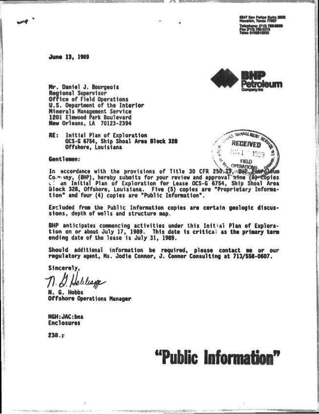
June) 13, 1M9
^ f f f r Potroteurti Nr. Daniel J. Bourgeois R M I onal Suptrvlsor Of f l c t of Field Oporatlons U.S. Departnent of tht Interior Mlntrals Management Servict 1201 Elmwood Park Boulevard Now Orl tans, LA 70123-2394
RE: Ini t ia l Plan of Exploration OCS-G 6754, Ship Shoal Area llock 326 Offshore, Louisiana
Gentlemens
In accordance with the provisions of 7It le 30 CFR 2! Co-**. »ny, (BHP), hereby submits for your rtview and approval nine (9^H?6ples i : an Init ial Plan of Exploration for Least OCS-G 67S4, Ship Shoal Arte dlock 328, Offshort, Louisiana. Five (5) copies art "Proprietary Informat ion" and four (4) copies art "Public Information".
Excluded from the Public Information copies art certain geologic discussions, depth of wells and structure map.
BHP anticipates commencing activit ies under this In i t i a l Plan of Explorat ion on or about July 17, 1989. This date Is cr i t ica l as tht primary tarn tnd lng datt of tht l tast Is July 31, 1989.
Should additional information bt required, please contact at or our regulatory agent, Ms. Jodie Connor, J . Connor Consulting at 713/558-0607.
Slnct r t ly ,
N. G. Hobbs Offshort Operations Manager
NGH:JACtbna Enclosures
238. p
"Public Information'
- • " i l i u m

Mft PubEc Kiifomnafion1
BHP PETROLEUM COMPANY
INITIAL PLAN Of EXPLORATION
SHIP SHOAL AREA BLOCK Stt
OCS-G 6754
BHP N t r o l tu* Company, (BHP), as designated Operator of tht subject least, submits this Initial Plan of Exploration In accordance with tht regulations contained in Title 30 CFR 250.33 and more specifically defined In tht Minerals Management Service Letter to Lessors and Operators dated October 12, 1988.
Undtr th is Ini t ial Plan of Exploration, BHP proposes to d r i l l two (2) wells, Locations A and I . Planned commencement date 1s approximately July 17, 1189, subject to epproval of this I n i t i a l Plan of Exploration and Issuance of the requirod Permits to Dr i l l . The proposed wells should take approximately 84 days eech to d r i l l and complete.
I t should be emphasized that this schedule Is tentative In the meaning of 30 CFR 280.33-1. Additional exploratory dri l l ing must be predicated upon the need to further define the structures and/or reservoir l imitations.
In addition to the dr i l l ing of thtst walls, othtr act ivi t ies which aay bt conducted undtr this Plan would bt tht setting of a well protector structure, a seafloor template, a velocity survey 1n a wellbore, and tht collection of soil borings.
The proposed wells will be d r i l l ed with a typical semi-submersible dr i l l ing r i g . When a rig is selected, the r ig specifications w i l l be made a part of the Applications for Permit to D r i l l . Typical diverter and BOP schematics are enclosed as Attachment A.
Saftty features wil l include w t l l control and blowout prevention equipment as described In 30 CFR 250.50. Tht appropriate l i f e ra f ts , 11ft Jackets, Hug buoys, t t c , as prescribed by th t U.S. Coast Guard w i l l bt maintained on the fac i l i t y at a l l times.

"Public Information' WELL LOCATIONS T M approximate locations of tht Mils proposed In tho Initial Plan of Exploration as wi l as proposed depths* art shown on tht table below and on a plat enclosed as Attachment B:
•ILL. PROPOSED LOCAT IOM TOTAL DEPTH MATER DEPTH
A SL: MOO' FSL A 4500' FWL 11,100' ND 315'
I SL: 6600' FSL A 3400' FWL 11,800' ND 318'
STRUCTURE MAP
A structure Mp drawn to the top of each prospective hydrocarbon accumulation showing the surface and bottom holt locations of tht proposed M i l l Is enclosed as Attachment C.
A bathymetry nap showing tht sur fact location of tht proposed Mils 1s enclosed as Attachment D.
A Site Specific Study prepared by Environmental Geo-Sclences, Inc. on geologic hazards and surface location of the proposed Mils Is enclosed as Attactonent E. BHP concurs with the conclusions and recommendations given In this rtport.
on SPILL ammmi PLAN All dri l l ing, construction and production oporatlons shall bt performed in accordance with Industry standards to prevent pollution of the environment. BHP's Oil Spill Contingency Plan has been approved by NNS. This plan designates an Oil Spill Team consisting of BHP's personnel and contract personnel. This team's duties are to eliminate the source of any spi l l , remove al l sources of possible Ignition, deploy the most reliable Mans of available transportation to monitor the movement of a slick, and contain and remove the slick If possible.
BHP Is a member of Clean Gulf Associates (CGA). The CGA has tw permanent equipment bases In Texas, Port Aransas and Galveston, and four bases in Louisiana, at Venice, Grand Isle, Intracoastal City and Cameron. Each base is equipped with fast response skimmers and there 1s a barge mounted high volume open see skimmer based at Grand Isle, Louisiana. In addition to providing equipment, the CGA also supplies advisors for clean-up operations. Equipwnt available from CGA and tht bast It Is located at Is listed In the CGA Manual, Volume I, Section III.
, • m M M i e ) i"oaffFoM»jafcjpe

BHP Mill make every effort to see thit a spill 1s responded to as quickly as possible. Response equipment and response times will be suitable for anticipated environmental conditions in tfte area. In good weather conditions fast response with oil boom, skimmers, pump and storage tanks would require approximately 10 to 12 hours, including preparation time as Indicated below. A heavy equipment system response would require approximately 24-36 hours, Including 6 hours preparation tlae.
than 1. Procurement of boat capable of handling oil spill 2.0
containment equipment and deployment to nearest CGA Base In Grand Isle, Louisiana.
2. Load out of Fast Response Unit I.S
3. Travel to lease site froa CGA Base 7.0 (102 alios at IS MPH)
Estimated Total Time 10.5
Equlpaent located in Grand Isle, Louisiana would be utilized first with additional equlpaent transported froa the nearest equlpaent base on-site as required.
In the event a spill occurs froa Ship Shoal Block 328, the company has projected trajectory of a spill utilizing Information In the Environmental Impact Statement (EIS) for OCS Lease Sales 118 and 122.
The EIS contains oil spill trajectory simulations using seasonal surface currents coupled with wind data, adjusted every 3 hours for 30 days or until a target Is contacted.
Hypothetical spill trajectories were simulated for each of the potential launch sites across the entire Gulf. These simulations presume 500 spills occurring In each of the four seasons of the year. The results In the EIS were presented as probabilities that an oil spill beginning from a particular launch site would contact a certain land segment within 3, 10, or 30 days. Utilizing the summary of the trajectory analysis (for 10 days) as presented on pages IV-40 through IV-45, the probable projected land fall of an oil spill Is as follows. Also listed Is the CGA Map Number corresponding to the land segaent which will be utilized to determine environmentally sensitive areas that aay be effected by a spi l l .
A l i i Lind Stmtnt ContiCt .JL CGA Mao Number
Ship Shoal Area Block 328 Terrebonne, Louisiana 2% LA Nap No. 6
Section V, Volume II of the CGA Manual containing maps as listed above, also includes equlpaent containment/cleanup protection response modes for the sensitive areas.
•: • ?.

Section VI, Volume II of the CGA Operations Manual depicts the protection response modes that are applicable for oil spill clean-up operations. Each response mo-'.a is schematically represented to show optimum deployment and operation of the equipment in are.is of environmental concern. Implementation of the suggested procedures assures the most effective use of the equipment end wi l l result In reduced adverse Impact of oil sp i l l s on the environment. Supervisory personnel have the option to modify the deployment and operation of equipment to more effectively respond to site-specif ic circumstances.
MPI OR UNUSUAL TECHNOLOGY
No new 1 ' ilques or unusual technology will be required for these operations.
LEASE STIPULATIONS
In accordance with Lease Stipulation No. 1 (Cultural Resource), attached to this lease, an archaeological survey was conducted on Ship Shoal Block 328 by John E. Chance a Associates, Inc.
In accordance with Lease Stipulation No. 2 (Biological), attached to this lease, shunting or monitoring Is required within the "3 mile zone". BHP has submitted a request for a waiver in a letter to Nr. Bourgeois. Copy enclosed es Attachment F.
DISCHARGES
The anticipated discharge rates per well for BHP's dr i l l ing operations In Ship Shoal Block 328 are listed below:
Depth Hole size Quantity (BBLS) Discharqe Rate 300' 30" 314 MAX. 1000 BPH
1000' 26" 552 MAX. 1000 BPH
4500' 17-1/2" 1249 HAX. 1000 BPH
11500' 12-1/4" 1225 MAX. 1000 BPH
Cuttings discharges are based on the average hole size for each section of hole. A l i s t of mud additives in attached as Attachment F.
The permittee Is authorized by the General Permit to discharge the effluents l is ted in the following table. Such discharges will be limited and monitored by the permittee as specified below:

Discharge Monitoring RwlrtwnU and Effluent Discharge ChiracttrUtlc Limitation
Measurement Sample Frequency Type/Method
Free Oil No Free 011 Once/day 1/ visual/Sheen oti receiving water
Toxicity V 30,000 ppm 96-hour LCSO dally min.
V 30,000 ppm oo. average minimum V
Once/month Crab Once/end of Grab well 1/
Once/month Grab
Discharge Rate 1000 bbl/hr Once/Hr. y Estimate
Discharge Rate (See Figure Once/Hr. J7 for Controlled 1) Discharge Rate Areas 5/
Oil Content
Volume (bbls)
Once/day 1/
Once/month
Measure
Grab/Report ft/ Estimate
Recorded
Number of Days Sheen Observed
96-hour LCSO 96-hour LCSO
96-hour LCSO
Maxi Rate
Maxi Rate
Hourly
Hourly
Percent 011 2/
Mnthly Total 7/
1/
y
men discharging; discharge Is authorized only during times when visual sheen observation Is possible for muds to Mhlch any oil has been added tc the mud system for any reason (unless an alternative test procedure has been approved).
The following effluents must be monitored by observation once/day during daylight hours and if sheen 1s observed it must be noted.
Deck Drainage Well Treatment Fluids Completion Fluids Workover Fluids Desallnazatlon Unit Discharge Blowout Preventer Fluid
Uncontaminated Ballast Water Uncontaminated Bilge Water Mud, Cuttings & Cement • ML Uncontaminated Seawater Boiler Blowdown Source Water and Sand
Suspended particulate phase Mith Hysldopsls bahla following approved test method. The sample shall be taken beneath the shale shaker.
Under certain circumstances an alternative toxicity limitation may be requested from the appropriate Regional Administrator.
Sample shall be taken when maximum Mall depth 1s reached.

V No discharge of pr ior i ty pollutants oxcopt In traco amounts. Infonnation on tho specific chemical composition shall bo recorded, but not reported unless requested by EPA.
y Percent oil shall be recorded for the same d r i l l i ng f lu id as monitored for visual sheen.
2 / This information shall be recorded, but not reported unless otherwise requested by EPA.
0/ Monitoring shall be accomplished during daylight by visual observation of the surface of the receiving water In the vic ini ty of sanitary and domestic waste outfa l ls . Observations shall be made following either the moming or mid-day meals and at a time during daylight and maximum estimated discharge.
Discharges wil l be free of o i l and wi l l be In compliance with and monitored as required by EPA NPDES General Permit (GMG 280000) In accordance with 40 CFR 122-6. Any oil contaminated aaid wi l l be transported to shore for proper disposal.
HYTMPfla SULFIDE There has been no previous d r i l l i ng on this leese, however, based on prior d r i l l i n g In surrounding leases, such as Ship Shoal 325, 326 and 351, i t can be shown by correlation of geological and seismic data that there Is an absence of hydrogen sulfide throughout this area.
Therefore, in accordance with 30 CFR 250.67, BHP hereby requests that a determination be made that we w i l l be dr i l l ing In zones where the absence of hydrogen sulfide has been confirmed.
COASTAL ZONE CERTIFICATE
A cert i f icate of Coastal Zone Management Consistency for tho State of Louisiana Is enclosed as Attachment H.
PROJECTED EMISSIONS Projected emissions are included on the enclosed Air Quality Review as Attachment I.
FJbTJMLMMTjL RtflttI
An Environmental Report 1s enclosed as Attachment J .

• H W W J f c r IIMll III 1III.. i n . 1
Ship Shoal Block 328 is located approximately 80 miles from shore. In e Miter depth of approximately 304-330 feet. A map showing the location of Block 328 relet Ive to the shoreline and onshore base Is enclosed as Attachment K.
BHP will utilize existing onshore facilities located In Grand Isle, Louisiana. This Mill serve as port of debarkation for supplies and crews. No onshore expansion or construction is anticipated Mith respect to this activity.
This base 1s capable of providing the services necessary for the proposed activities. It has 24-hour service, a radio tower with a phone patch, dock space, equipment and supply storage base, drinking and drill water, etc. During exploration activities one crew boat will be making seven trips per week, one supply boat will be making seven trips per week and one helicopter wil l be making six trips per week.
The onshore activities associated with Ship Shoal Block 328 should not result In any Increase In the size and number of onshore support and storaoe facil it ies or land and personnel requirements.
AUTHORIZED REPRESENTATIVE
Inquiries regarding this plan may be aade to the following authorized representativt of BHP
Ns. Jodie Connor J . Connor Consulting 11767 Katy Freeway, Suite 812 Houston, TX 77079 (713) 558-0607
LIST Qf flHflMB A Rig Schematic B Location Plat C Structure Nap D Bathymetry Nap E Shallow Hazards Analysis F Copy of Waiver Request • Stipulation No. 2 6 Mud Additives H Coastal Zone Consistency Certification I Air Quality Review J Environmental Report K Vicinity Nap

ATTACHMENT A
B L O W O U T P R E V E N T E R S T A C K
WITH A HYDRIL DIVERTER

4500T— ~i«r-!
•400 '
! I b 'a e o
"Public Mmmatbn"
311 328
338
5
1 oMum
SHIP SHv'.Ar *28 FEOERAL OFF8M L OJl SANA
LOCATION PLAT
115™ 5 L


ATTACHMENT G
DRUL IMS HUD BattBttflB
COMMON CHEMICAL OA CHCN1CV. IBAPE NAME
Alualnua St tarat t "AXTAFLO-S" Barlta Calc lua Carbonate Calclu.r Chlorldt Calcium Oxide Calcium Sulfate Carboxymethyl Cellulost Caustic Potash Catstie Soda Chrome L igni t t Chrcme Lignosulfonate OrM ng Oetergent •E-Pai* Ftrrotnromt Lignosulfoaatt Gel
Gypsum Lignite Lignosulfonate •Hud Swetp' "HOR-REX* •Shale-Trol" Sapp Sodium Bicarbonate Sodium Carboxymethyl Ctl luloM Sodium Chiorice Sodium Chromatt Starch "U-9010" "TORQ-Trla" •Black Magic* "Black Magic a> emi** Diesel
•Jt l f lake* MICA •Plpt-Lax" •Mall-Hut-Wood Fibers
ttaWTIOM Qf MATCIIAL
Aluminum Stearat* Nonionic Surfactint r.riimi Sulfate (*aSo4) Ar«sonlt.-> -TaCri) Hydroph't t t (CaC12) Lime (QH'.JC) Anhydrite (CaSvO Carboxymethyl Cellulose Potassium Hydrate Sodium Hydroxide .OH) Chrome Lignite Chromr '. 'gnosulfor te toot Nor t i . . . 'J , / i t ] adable defoamer Oer.'v«d frora we.in pulp Sodium Nontdorin ui'.te, bentonite, . t tapu lg l t t CeSo«.?H?0 Liyni'e Ltfic t'...natt Ceanvt Pre-flush !!y<frol oyzed Cereal $»il4 Proaflo-aluminum compltx Sodlu.» Carbonate NaHCPli Sod i n Carboxyaethyl Cellulost NaCI HafrH. ZC Corn St*rch Blodtgrsdab't d r i l l i ng lubricant t'iocegradablt d r i l l i ng lubricant Oil bast muvi cone. Sacked concentracted t i l bate and Used to mix ctr ta le l e s s - r I r o i i t i r o aUls Plastic f o i l , shredded etltophant Loss-circulation aat tnai Surfactant mixed with dtestl Ground walnut shells Loss-circulation mattrial

BH, PETROLEUM 33
j u n - »njR jsp-pj wa'rkM c rSHWk! oon.. NOUSTO*. TX. P.2*
AnACHMENT H
COASTAL Z0h£ MANAGENENT
CONSISTENCY CERTTfl CATION
PlrVi Of CnTLMAIlOn1
SHIP SHOAL AREA BLOCK 521
OCS-G 67B<!
The proposed activities described 1n thii PUn romply with Uu1i1om't Approvtd CoitttT Zone Minagement rVogrea end will bo conducted 1n t »annar consistent with such Program,
Arrenosniflts hivt been made with the Stete Tines fo Baton Rouge, Louisiana to publish e legal notice no later than June 20, I960.
Lessee or Operator
t
• i

liliriililllililiHiliMiiliiliyi ATTACHMENT I
P.O. Box 218753 Houston, Texas 77218 ''3-398-0807
PROJECTED AIR EMISSION SCHEDULE FQR EXPLORATION PROJECT
lENERAL UKemUM Location of Block:
Distance Offshore: Narae of Rig: Operator:
Contact Person: Hell footage to be Drilled
In 1989: Oate Orilling Mill Begin:
Ship Shoal Area Block 328 OCS-6 6754 80 nlles Seal-submerslbio BHP Petroleun Conpany 5847 San Felipe, Suite 3600 Houston. Tex s 77057 Nr. N. 6. Ho* bs
23,000* July 17, 1989
MAJOR SOURCE iOfFSHORE) Poller used aboard drilling vessel; approximate rootage to be drilled 23,000'.*
Emitted Substance
CO SO
2 NOx VOC TSP
Projected Emissions Cbi/IIYinOM/Yr.
1989
(396) (32 28
4.55 1.45
21.39 1.72 1.52
Based on 60 hphr/ft. from Table 4-3, "Atmospheric Emissions fron Offshore Oil and Gas Developnent and Production11, EPA No. 450/3-n7-026, June 1977
Emission factors fron Table 3.3.3-1, "Compilation of Air Pollutant Emission Factors", Third Edition, EPA Report AP-42, August, 1977

— I
Projected Air Emissions BHP Petroleum Company Ship Shell Block 328
Pogo 2
MINOR SOURCES (QFFSHORE)*
Including crew boat (7 trips/week) and supply boats (7 trips/week); helicopter (6 trips/week); loading and unloading operations; and incineration of waste paper (average 750 pounds of waste per month).
Emitted Suhitane*
CO SO
2 NOx VOC TSP
Projected Emissions (Tons/Year)
1889
.52
.02
.13
.05
.02
£0 SO m ISE 4.55 1.45 21.39 1.72 1.52
_J2 -J22 _JLi -M 5.07 1.47 21.52 1.77 1.S4
* Tables 3.2.1-3, 3.2.3-1 and 2.1-1, "Compilation of Air Pollutant Emission Factors", Third Edition, EPA Report AP-42, August, 1977.
TOTAL ALL SOURCES .tons/voar)
litt Major HI nor
Total
ONSHORE SOURCES
These should be about the same as minor sources unless new fac i l i t ies aro Instal led at the onshore base. No additional fac i l i t ies are reouired or planned at this time.
EMISSION EXEMPTION DETERMINATION
2/3 2/3 For CO: E - 3400 - 3400 ( 80) - 83,126 tons/year For NOx, VOC, TSP 6 SO : E • 33.30 • 33.3 (80) - 2664 tons/year
2
FINDINGS Of AIR OUALITY RFV1FM
As per DOI/MMS regulations, this facility Is exempt from further air quality review as It has been determined that Its operations will not have a significant adverse Impact on air quality.
• • •• -


ATTACHMENT J
ENVIRONMENTAL REPORT
OCS-6 6754
SHIP SHOAL AREA BLOCK 328
OFFSHORE, LOUISIANA
Prepared by:
J . Connor Consulting P.O. Box 218753
Houston, TX 77218 713/558-0607
June, 1989

TABLE OF CONTENTS
TITLE PA6E 1
TABLE OF CONTENTS 11
I. DESCRIPTION OF PROPOSED ACTION 1
A. DESCRIPTION OF PROPOSED TRAVEL NODES, ROUTES AND FREQUENCY 1
B. ONSHORE SUPPORT BASE 1 C. NEW OR UNUSUAL TECHNOLOGY 1 D. VICINITY MAP 1 E. PROPOSED MEANS TO TRANSPORT OIL ANO GAS TO SHORE,
ROUTES, QUANTITIES 2
I I . DESCRIPTION OF AFFECTED ENVIRONMENT
A. COMMERCIAL FISHING 2 B. SHIPPING 3 C. PLEASURE BOATING, SPORT FISHING AND RECREATION 3 D. POTENTIAL OR KNOWN CULTURAL RESOURCES 4 E. ECOLOGICALLY SENSITIVE FEATURES 5 F. PIPELINES AND CABLES 6 G. OTHER MINERAL USES 6 H. OCEAN DUMPING 6 I. ENDANGERED AND THREATENED SPECIES ANO CRITICAL HABITAT 7
III. UNAVOIDABLE ADVERSE ENVIRONMENTAL INPACTS
A. WATER QUALITY 8 B. EFFECTS ON MARINE ORGANISMS 8 C. WETLANDS AND BEACH 8 D. AIR QUALITY 8 E. COMMERCIAL FISHING 8 F. SHIP NAVIGATION 9 G. CULTURAL RESOURCES 9
H. RECREATION AND AESTHETIC VALUES 9
IV. SUMMARY U
REFERENCES 12

mrnmu u • 7 i ' L .
i
I. DESCRIPTION OF PROPOSED ACTIOM
BMP Petroleua Company (BHP), plans to conduct exploratory activities on Ship Shoal Area Block 328, OCS-6 6754.
As proposed, the Initial Plan of Exploration for Ship Shoal Area Block 328 wil l Include drill and completing two wells.
At this time, the planned commencement date for proposed activities Is on or about July 17, 1989.
A. DESCRIPTION OF PROPOSED TRAVEL MODES. ROUTES AND FREQUENCY
Supply and crew boats, as well as helicopters will be dispatcher' from a support base located in Grand Isle, Louisiana. The boats will normally move to the block via the most direct route from Grand Isle, Louisiana, however, boats operating in the field may travel from other operations nearby. Following is an estimate of trips to the proposed operation.
Drilling Operations,
Supply Boat 7 trips per week Crew Boat 7 trips per week Helicopter 6 trips per week
B. ONSHORE SUPPORT BASE
The proposed activities will utilize a support base located at Grand Isle, Louisiana. This base provides 24-hour service, a radio tower with phone patch, dock space, office space, parking lot, equipment and supply storage space, drinking and drill water, etc. The proposed exploratory activities will help to maintain this base at its present level of activity. No expansion of the physical facilities or the creation of new jobs is expected to result fron the work planned in conjunction with this block.
C. NEW OR UNUSUAL TECHNOLOGY
No new or unusual technology will be required for this operation.
D. VICINITY NAP
Ship Shoal Block 328 Is located approximately 66 nlles south of the Louisiana coastline. Uater depth is approximately 315 feet. See Attachment K.

E. PROPOSED MEANS TQ TRANSPORT QR AMD fcAS TQ Hydrocarbons w i l l be t i e d into and transported v i s pipelines already in /or near Ship Shoal Block 328.
I I . DKCBIPTIQN OF AFFECTED ENVIRONMENT
A. MMMEBXIAI. FISHING The Gulf of Mexico is the single most Important area for f isher ies production in the United States. Louisiana with i t s extensive coastal marshes and nutrient input from the Mississippi and Atchafalaya Rivers is the most productive State in terms of commercial f i sher ies . S ix ty- four per cent (64%) of the t i d a l marshes alot.. the ent i re Gulf Coast are found In Louisiana.
Shrimp (primarily brown and white) are by fa r the most valuable component of the Louisiana landings. Production of shrimp depends largely on environmental conditions in the estuaries during postlarval recruitment. Production Is good when there Is a warn, dry spring.
Menhaden are the s ta te 's largest fishery in terms of pounds landed and ranks second in value. Unlike the shrimp f ishery , th is f ishery operates exclusively offshore. Menhaden are found pr imar i ly in shallow waters wi th about 93X of the f ish ing e f f o r t occurring wi th in 10 miles of shore.
Oysters constitute the t h i r d most valuable commercial f ishery in Louisiana. The most important areas for oyster production are Terrebonne Parish, Baratar ia Bay, and the Lake Borgne Breton Sound System.
The blue crab 1s Louisiana's fourth most valuable commercial f ishery species. Estuarine waters produce over 90% of t h i s catch.
O f..er important Louisiana f isher ies include the food f i n f i sh and those for Indus t r ia l purposes, such as pet food. Approximately SO species of food f i n f i s h are harvested in the Gulf. Some of the more important are croakers, snappers, groupers, black mul let , red and black drums, spotted and s i l ve r seat rout , Spanish mackerel, spots, pompano, flounder, creval les. Gulf k i r .g f i sh , sheepshead, and king mackerel. The majori ty of food f i n f i s h are caught In coastal waters w i th the exception of snappers, groupers, Mackerel, tuna , and b i l l f i s h .
In 1986, the commercial f i sh ing industry landed Louisiana 1,700 m i l l i on pounds valued at $322 m i l l i o n . Louisiana ranked f i r - t in the United States I n pounds landed and second in value.

— -.
B. SHIEElHtt
Fairways play in inpcrtant role in tht avoidance of collisions on tht OCS, particularly in the cast of tht large oceangoing vessels, but not ali vessels stay within the fairways. Nany others, such as fishing boats and OCS support vessels, travel through areas with high concentration of fixed structures. In such cases the nost important mitigation factor is the requi .-ement for adequate marking and lighting of structures. After a structure has been in place for a while, it often becomes a landmark and an aid to navigation for vessels that operate in the area on a regular basis.
Ship Shoal Area Olock 328 is clear of all shipping fairways and anchorage areas. The rig and each of the marine vessels servicing this operation will be equipjel with all U.S. Coast Guard required navigational safety aids.
C. PLEASURE BOATING. SPORT FISHING AND RECREATION
The northern Gulf of Mexico coastal zone is one of the major recreational regions of the United States, particularly in connection with marine fisnlng and beach-related activities. The shorefronts along the Gulf Coasts of Alabama, Mississippi, Louisiana, and Texas offer a diversity of natural and developed landscapes and seascapes. The coastal beaches, barrier Islands, estuarine bays and sounds, river deltas, and tidal marshes are extensively and Intensively utilized for recreational activity by residents of the Gulf South and tourists from throughout the Nation, as well as from foreign countries. Publicly-owned and admlnl «.ered areas such as National seashores, parks, beaches, ano wildlife lands, as well as specially designated preservation areas such as historic and natural sites and landmarks, wilderness areas, wildlife sanctuaries, and scenic rivers attract residents and visitors throughout the year. Commercial and private recreational facilities and establishments, such as resorts, marinas, amusement parks, and ornamental gardens, also serve as primary interest areas and support services for people who seek enjoyment from the recreational resources associated with the Gulf.
The two major recreational areas most directly associated with the offshore leasing and potentially affected by It are the offshore marine environment and the coastal shorefront of the adjoining states. The only major recreational activity occurring on the OCS is offshore marine recreational fishing and diving. Studies, reports, and conference proceedings published by NMS and others have documented a substantial recreat nal fishery including scuba diving, directly associated with oil and gas production platforms. The recreational fishing associated with oil and gas structures stems from their function as high profile artificial fishing reefs. A report on the 1984 Marine Recreational Fishery Statistics Surveys presented by NMFS at the Sixth Annual Gulf of Mexico Information Transfer Netting indicates a majority of the offshore recreational fishing in the Central

and Western Gulf of Mexico is directly associated with the oil and gas structures. There are currently about 4,000 offshore oil and gas structures In the Central and Western Gulf of Mexico. Many other studies have demonstrated that when oil and gas structures are accessible to raarint recreational fishermen and scuba divers they are a major attract ior f: * •mrlne recreational activities and a positive influence on tcurism and coastal economics.
With the exception of Grand Isle and vicinity and a stretch of beach area in Cameron Parish, (Peveto/Constanie'Ocean View Beaches, Holly Beach, Hackberry Beach) Louisiana has very limited beach area suitable for recreation. Most of It Is very narrow, of poor recreational quality and generally inaccessible by automobile. Some of the highest quality beach areas in coastal Louisiana are found along the barrier islands chainoff Terrebonne Parish. Several addition?! significant recreational resources are found •long the Gulf Coast. - j l . iana has ornamental gardens, scale roads, rivers, and trails.
D. POTENTIAL QR KNOWN BflJU M RES0URCE5 Archeological resources are any objects or features which are man-made or modified by human activity. Significant archeological resources are either historic or prehistoric a-.d, as defined by 36 CFR 60.6, generally include L roper*.'es greater than SO y.»ars old which are associated with events that ttvve male a significant conti 1 but Ion to the broad patterns of our history; are associated with the live? of persons significant in the past; embody the distinctive characteristics of a type, period, or method of construction; represent the work of a master; possess high artistic values; represent a significant and distinguishable entity whose components aay lack individual distinction; or have yielded, or eay be likely to yield. Information important in prehistory or history.
A Shallow Hazards Survey was conducted on Ship Shoal Block 328 in November, 19114. The survey equipment included a side scan sonar, sub-bottom profiler, and sparker profiler.
Those reports indicate the proposed surface locations are clear of seafloor obstructions or shipwrecks. The water depth at the proposed locations Is approximately 31S faet.
Ship Shoal Block 328 lies outside the Cultural Resource Demarcation Line (USDI, 1979, Visual 1), and therefore falls In an area where cultural resources are not likely to be found. BHP agrees that if any site, structure, or object of historical or archaeological significance should be discovered during operations, the findings will be Immediately reported to the District Supervisor and every reasonable effort will be mati to preserve •nd protect the cultural resource froa damage until the District Supervisor hes given direction as to its preservation.

E. ECOLOGICALLY SENSITIVE FEATURES Barrltr beaches art a comnon landfona along tho Culf Cottt and strttch 1n an Irregular chain from Florida to Texas. These elongated, narrow lanrtforr*: are composed of sand and other loose sediments transported by waves, currents, storm surges, and wind. In geologic terms, barrier Islands are i young phenomenon, being formed only In the last 5,000 to 6,000 years. The tens "barrier' Identifies the structure as one that protects other features, such as bays, estuaries, and marshes, from direct wove attack of the open ocean. The waters in these bays and estuar'es are a blend of the tern strial-fresh water systems of the mainland and the saltwater system of +he .cean, and among the richest ecosystems known. Many of the species that f;*hatft the bays, estuaries, and adjacent marshes use these areas as spawning, nursery, and feed grounds. It Is estimated that two-thirds of the too value Atlantic and Gulf Coast species of fish are directly dependent in some stages of life on conditions In these estuaries.
Another benefit of both the Islands and their adjacent marshes and bays is that of providing habitats for a large number of birds and other animals. The islands also provide habitat for several thousand threatened or endangered species, for example, the loggerhead turtle, the southem bald eagle, alligators, and brown pelicans.
Louisiana has the most rapidly retreat -Hot in the nation. The average retreat for the Fourchon be-on ,<-.* ' , t 100 years has been in excess of 60 ft/yr. The statewide aven >T ;. tr Oolan et al . (1982) is in excess of 12 ft/yr. The onseqi ni ,^?:*..< island retreat are observed at Isles Dernlers In Torrent *n > s . the Chandeleur Islands In St. Bernard Parish. These bv. \ r e flanked central headlands like the central headland at Fourx, " fuve subsequently become separated from the mainland.
The Importance of the coastal wetlands to fish and wildlife resources is well-documented. FWS studies Indicate that Louisiana contains 40% of the vegetated coastal wetlands in the conterminous United States and 64% of the tidal marshes along the Gulf of Mexico. The Louisiana coastal wetlands support over two-thirds of the Mississippi Flyway wintering waterfowl population (including 20-50% of North America's puddle duck population) and tho largest fur harvest in North America (from 40-68% of the Nation's total por year).
Wetlands in coastal Louisiana are usually established on a substrate of alluvial sediment that is subject to high, natural subsidence r-tes. The effects of natural subsidence are compounded by sea level rise, which has been occurring during the past several millennia. Under natural conditions, sedimentation encourages vertical accretion of wetland areas and may offset the submergence and inundation that result from subsidence and sea level r ise . The deterioration of coastal wetlands, particularly in Louisiana, is an Issue of concern it has been estimated that the state Is losing up to 50 square miles of wetlands every year. Wetlands loss in coastal Louisiana 1s most severe in that area of the State that is to the east of the Atchafalaya
5
-> . - . t - a : : —

River and it commonly referred to as the Mississippi River Deltaic Plain region.
A recent study funded by MMS entitled "Causes of Wetland Loss in the Coastal Central Gulf of Mexico", examined coastal ecosystems of the Northern Gulf of Mexico region and how wetland habitats have changed as a result of natural processes and man's act iv i t ies thereon. The study's primary focus was on assessing and quantifying the direct and Indirect impacts of OCS-related act iv i t ies on wetland areas. OCS-related act iv i t ies began In the Gulf region In the early 1950's and based on the study's findings, of the total direct Impacts to the areas wetlands (which equate to 74,OO0ha), OCS-related Impacts have contributed to only 4-5X (11,000-14,OOOha) of Louisiana's total wetlands loss during the period 1955/86 to 1978 and some 26% of direct Impacts there.
The shelf and shelf edge of the Central and Western Gulf are characterized by topographic features which are Inhabited by benthic communities. The habitat created by the topographic features is important because they support hard-bottom communities of high biomass, high diversity, and high numbers of plant an. animal spades; they support, either as shelter, food, or both, large numbars of commercially and recreationally Important f ishes; they are un-.que to the extent that they are small isolated areas of communities in the vast Gulf of Mexico; they provide a relatively pristine area suitable for sc ient i f ic research; and they have an aes^'U Ical ly attractive intrinsic value.
The Central Gulf of Mexico l i s t s 16 topographic features. Potential damage to features of this type from oil and ga* oporatlons are associated with d r i l l cuttings and dri l l ing fluids settling on these banks and smothering or otherwise damaging benthic organisms. Shi Shoal Area Block 328 surface locations are located within the "3 mile zone" of Ewing Bant where lease stipulations require shunting or monitoring cf the dr i l l ing effluent. Based on data obtained from recent studies, Lease Stipulation No. 2 has been modified for subsequent lease sales to exclude a l l shunting and monitoring requirements for exploratory dr i l l ing within the "3 mile zone".
F. PIPELINES AND CABLES There are no pipelines or cables traversing Ship Shoal Block 328.
6. OTHER MINERAL USES
Tho activities proposed for Ship Shoal Area Block 328 wi l l have no direct or Indirect Impact on other mineral uses.
H. OCEAN DUMPING
Ocean dumping is prohibited in this area.
6

I. ENDANGERED ANP THREATENED SPECIES ANP CRITICAL HABITAT Six Federally listed endangered whale species may occur in the Gulf of Mexico--the blue, fin, humpback, right, sie, and sperm whales. Generally, these large cetaceans inhabit the continental slope and deep oceanic waters; ocasstonally, they are sighted nearshore.
Endangered red wolf hybrids occur along the Gulf Coast in Cameron Parish, Louisiana.
Federally listed endangered sea turtles (Kemp's ridley, green, hawksbill, and leatherneck turtles, and the threatened loggerhead turtle) occur in the Gulf of Mexico. The grr>en turtle is listed as threatened in Louisiana. The Kemp's ridley turtle inhabits shallow coastal and estuarine waters and commonly occur In shallow water areas from Narsh Island to the Mississippi Delta in Louisiana (Hildebrand, 1982). The green turtle is found throughout the Gulf, where Its favored habitats are lagoons and shoals providing an abundance of marine grass and algae on which It feeds. No recent green turtle nesting has been reported along Gulf beaches. The hawksbill turtle inhabits reefs, shallow coastal areas, and passes in water depths of less than 20 m deep. Hawksbill nesting has not been reported along the coast of Louisiana. The leatherback turtle may be found near the continental shelf edge. Sightings have been reported along the Gulf Coast, but no recent nesting has been reported. The loggerhead turtle occurs throughout the Gulf and has been observed as far as 500 miles out in tho open sea. Infrequent nesting occurs on the Northern Gulf Coast. In addition to their usual habitat area, turtles are sometimes seen uround offshore 011/9" platforms.
The American alligator ccurs generally throughout the Gulf Coast region in fresh to brackish water areas. The alligator is listed as "threatened by similarity of appearance" throughout its range.
The endangered red-cockaded woodpecker occurs primarily in mat are open pine forests throughout the Eastern and Central Gulf area and into eastern Texas.
Endangered American and threatened artic peregrine falcons migrate along the Gulf Coast, and some peregrine falcons overwinter in Gulf coastal areas. The artic peregrine falcon migration route occurs along the entire Central and Eastern Gulf of Mexico coafts. The endangered piping plover's winter range Is along the Gulf Coast.
Brown pelicans remain listed as endangered in Louisiana. Three brown pelican rookeries (about 2,500 birds) occur at North Island, Northern St. Berna> Parish, and Queen Bess Island in Louisiana. The habitat of these colonial nesters is small coastal islands in salt and brackish water areas.
These species may be <*r:?:ted by the development of coastal lands and/or the occurrence of oil spins which may affect the species directly or through their food sources. Slr.ce the proposed activities include no plans for the developnent of the co.stal lands, the impact on endangered and threatened species Is primarily based on the occurrence of oil spi l ls.
7

BHP as a prudent operator will take all necessary measures to reduce the probability of oil spills. BHP's proposed exploratory operations on Block 328 should not pose a threat to any endangered or threatened species.
111. UNAVOIDABLE ADVERSE ENVIRONMENTAL EFFECTS
A. MATER QUALITY Exploration activities will temporarily reduce water quality adjacent to the location. This will Increase turbidity In a plume down-current from the work site. Released waters and a minor oil spill could also contribute to water quality degradation.
B. EFFECTS QN MARINE ORGANISMS Some organisms will be killed and some will be temporarily functionally impaired as a result of exploratory operations. The most affected groups will be plankton and benthos Immediately around the rig. Damage will be both mechanical and toxlcological. These Impacts are considered to be localized, short term and reversible at the population level.
An oil spill could affect a broad spectrum of marine organisms. However, most effects would be localized and short term. Any effects on mammals end turtles would % significant.
C. WETLANDS AND BEACH
In the unlikely event of a spill occurring and reaching shore, organisms In wetland and beach habitats could be killed or functionally impaired. Human community disruption could also occur. Although all such effects would be localized, any effects on endangered species and/or critical habitats would bo significant.
D. AIR QUALITY
The air quality at the lease site will be degraded temporarily during operations, but should return to normal once operations are measurably completed. Offshore activities probably will not affect onshore air quality. Air quality at the onshore base will be only Insignificantly reduced by onshore activities. Any such effect will be temporary.
E. COMMERCIAL FISHING
The major impact on fishing activities from the proposed operations Is dri l l ing rig placement, oil spi l ls , and underwater OCS obstructions such as
8

pipelines and debris. Other lapact producing factors Include discharge of drilling auds and removal of structures.
Oil spills that contact the coastal marshes, bays, estuaries, and open Gulf areas with high concentrations of floating eggs and larvae have the greatest potential for damage to commercial fisheries. An oil spill could seriously affect the shrimp, oyster, and finfish catches In Louisiana as these fishes ere estuarine dependent.
Underwater OCS obstructions cause gear conflicts which result In such losses as trawls, shrimp catch, business downtime, and vessel daaage. Gear conflicts caused by underwater OCS obstructions are mitigated by the Fisherman's Contingency Fund.
The installation of pipelines will contribute to fishery habitat loss and, the.' ore, negatively impact fishery resources.
Drilling mud discharges contain chemicals that are toxic to marine fishes; however, only at concentrations four or five orders of magnitude higher than those found more than a few meters from the discharge point.
The removal of platforms results in habitat loss and can cause fish kil ls when explosives are used.
In conclusion, although these factor* impact the commercial fisheries industries, the level of Impact is expected to be very negligible.
F. SHIP NAVIGATION
Very little interference can be expected between the drilling rig and marine vessels utilized during exploratory operations and ships that ise established fairways. However, at night and during rough weather, fog, and heavy seas, ships not using established fairways could collide with the rig. Approved aids to navigation will be Installed in accordance with USCG regulations.
G. CULTURAL RESOURCES
There is only a small probability that an unknown cultural resource exists In the lease area.
H. RECREATION AND AESTHETIC VALUES
The drilling rig and marine vessels may represent an obstacle to soae sport fisherman, but such an effect Is expected to be negligible and not permanent.
Even though existing regulations and orders prohibit indiscriminate littering of the marine environment with trash, offshore oil and gas

operations Involving men, machines, equipment, end supplies Is bound to result In some littering of the ocean. Human nature and accidents associated with offshore operations will contribute some floatable debris to tbe ocean environment which will eventually come ashore on major recreational beaches.
The effects that normal operations or a minor oil spill would have on any fish stocks Important to sport fishermen are also considered to be negligible.
A minor oil spill and/or non-petroleum floating debris could foul beaches Inshore of the lease area. The fouling of the beaches would be an aesthetic detriment that could adversely affect recreation. Any effects on beach recreation could adversely affect tourism, and consequently, the local economy.
10

IV. SUMMARY
Th* proposed activity will be carried out and coapleted with the guarantee of the following items.
A. The best available and safest technologies w i l l be uti l ized throughout the project. Thi.- includes meeting al l applicable requirements for equipment types, general project layout, safety systems, and equipment and monitoring systems.
B. All operations are covered by a Minerals Management Service approved Oil Spill Contingency Plan.
C. All applicable Federal, State, and Local requirements regarding air emission and water quality and discharge for the proposed activities, as well as any other permit conditions, wi l l be complied with.
0. The proposed act iv i t ies described In detail in the Plan of Exploration wi l l comply with Louisiana's Coastal Management Program and wi l l be conducted in a manner consistent with such Program.
11

REFERENCES
1. final Environmental impact Statewnt. Proposed oil ind GasLease Sails 110 ind 112, Gulf of Mexico OCS Region, OCS EIS, RMS 86-0087.
2. Final Environmental Impact Statement. Proposed on ind GasLeise Sales 110 and 112, Gulf of Mexico OCS Region, OCS EIS, MMS 86-0087, visuals.
3. Pinal Environmental Impact Statement. Proposed Oil and Gas Lease Sales 113, 115, and 116, Gulf of Mexico OCS Region, OCS EIS, MMS 87-0077.
4. Final Environmental Impact Statement. Proposed Oil ind Gas Lease Sales 118 and 122, Gulf of Mexico OCS Region, OCS EIS, MMS 88-0044.
12
: I ....... tjj • •• • - • • - • ; ' •'• ' •'

CAS;
BHP Petroleun Cowpanv
Ship Shoel 328 VlClMlfT MAO
«0.


![Nunit Quick Guide 2015-10-18. 목 차목 차 OS2 강의교재 2 Assert.That(bool) Assert.That(bool, string) Assert.That(bool, string, params object[]) Assert.That Mona’s](https://img.dokumen.tips/doc/110x75/56649ed05503460f94bdef75/nunit-quick-guide-2015-10-18-os2-2-assertthatbool.jpg)


![Stuttgart 21 Schlichtung - [5] 2010-11-19 - Volker Kefer: Ökologie](https://img.dokumen.tips/doc/110x75/577d34951a28ab3a6b8e61f7/stuttgart-21-schlichtung-5-2010-11-19-volker-kefer-oekologie.jpg)

![Stuttgart 21 Schlichtung - [1] 2010-10-22 - Volker Kefer](https://img.dokumen.tips/doc/110x75/577d355e1a28ab3a6b9042fa/stuttgart-21-schlichtung-1-2010-10-22-volker-kefer.jpg)
![Stuttgart 21 Schlichtung - [2] 2010-10-29 - Dr. Volker Kefer](https://img.dokumen.tips/doc/110x75/577d352d1a28ab3a6b8fbbcb/stuttgart-21-schlichtung-2-2010-10-29-dr-volker-kefer.jpg)