Embed Size (px)
Citation preview
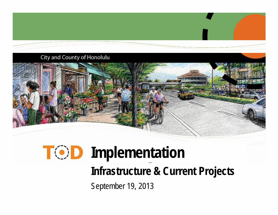
September 19, 2013
ImplementationInfrastructure & Current Projects
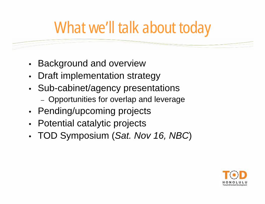
• Background and overview• Draft implementation strategy• Sub-cabinet/agency presentations
– Opportunities for overlap and leverage• Pending/upcoming projects• Potential catalytic projects• TOD Symposium (Sat. Nov 16, NBC)
What we’ll talk about today
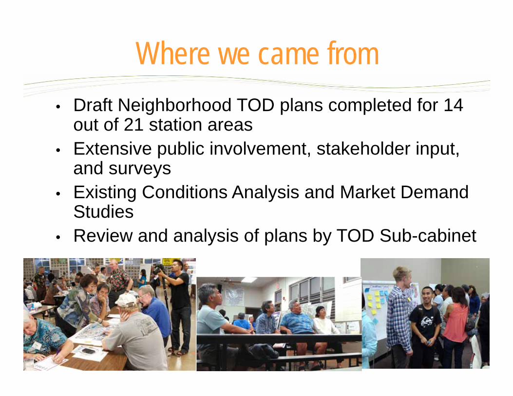
• Draft Neighborhood TOD plans completed for 14 out of 21 station areas
• Extensive public involvement, stakeholder input, and surveys
• Existing Conditions Analysis and Market Demand Studies
• Review and analysis of plans by TOD Sub-cabinet
Where we came from

PROJECT KICKOFF
COMMUNITY WKSHP #2
STATION AREA ALTERNATIVES
PREFERRED STATION AREA
PLANS
DRAFT TOD PLAN & ZONING AND
IMPLEMENTATION
FINAL TOD PLAN
COMMUNITY WKSHP #3
PUBLIC HEARINGSSTAKEHOLDER INTERVIEWS PAC MTG #3
PAC MTG #4 PAC MTG #5PAC MTG #2
PAC MTG #1
RESIDENT SURVEY
COMMUNITY WKSHP #1
VISION & PLAN PRINCIPLES
ISSUES & OPPORTUNITIES
Where we are – and where we’re going
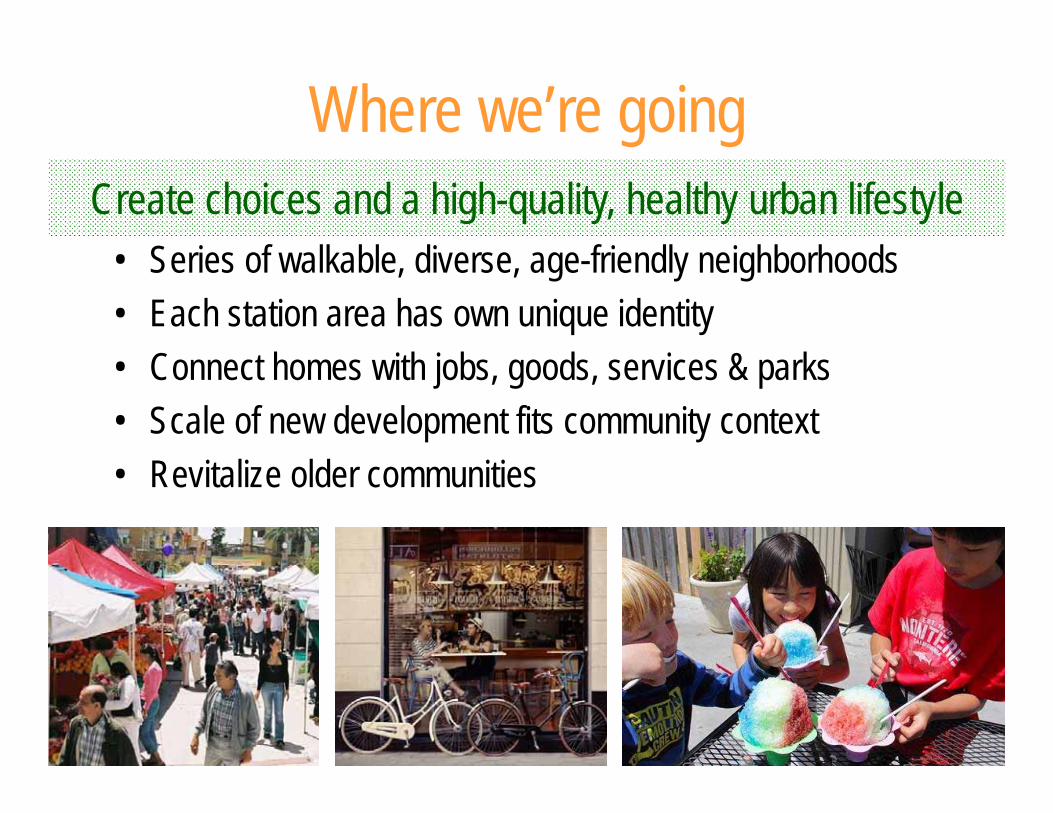
Where we’re going
• Series of walkable, diverse, age-friendly neighborhoods• Each station area has own unique identity• Connect homes with jobs, goods, services & parks• Scale of new development fits community context• Revitalize older communities
Create choices and a high-quality, healthy urban lifestyle
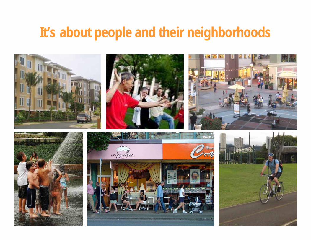
It’s about people and their neighborhoods
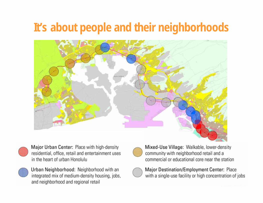
It’s about people and their neighborhoods
Draft Implementation Strategy
• Review agency initiatives, needs, resources• Analyze and refine the TOD Plans• Identify overlapping needs and opportunities • Leverage partner resources and initiatives• Identify short term and long term priority areas• Identify potential catalytic projects• Get public, partner, and Council input
Developing the strategy
• Finalize and adopt Neighborhood TOD Plans• Establish TOD Sub-cabinet; coordinate investments• Enhanced partner roles in TOD• Develop financing and incentive tools• Develop and implement housing policy• Implement zoning & process improvements• Select and develop catalytic projects
– with Council, partner, and public input• TOD Symposium (Sat Nov. 16, NBC)
Draft implementation strategy
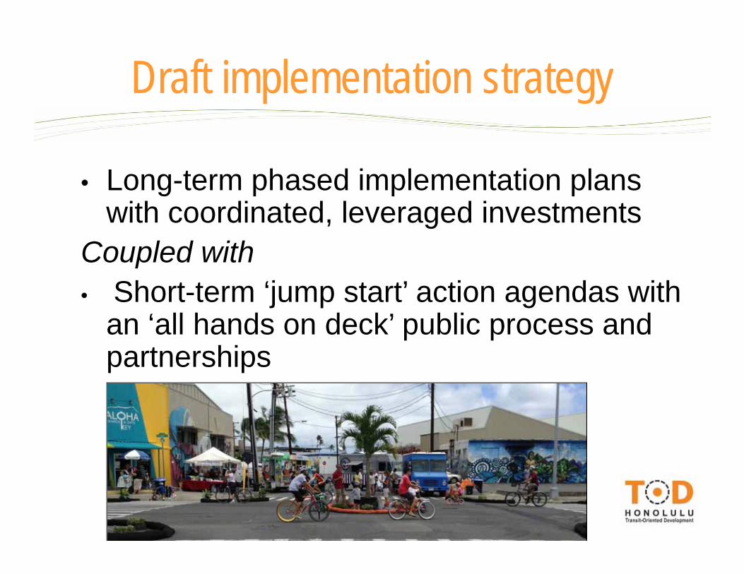
• Long-term phased implementation plans with coordinated, leveraged investments
Coupled with• Short-term ‘jump start’ action agendas with
an ‘all hands on deck’ public process and partnerships
Draft implementation strategy
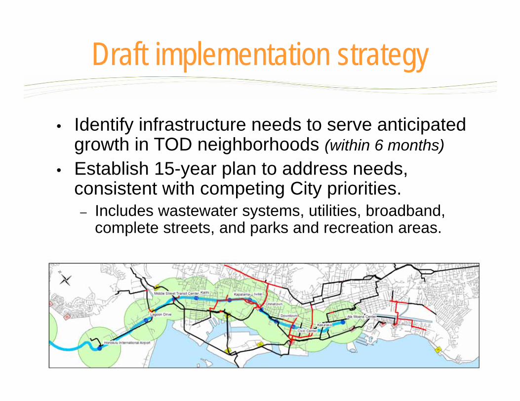
• Identify infrastructure needs to serve anticipated growth in TOD neighborhoods (within 6 months)
• Establish 15-year plan to address needs, consistent with competing City priorities.– Includes wastewater systems, utilities, broadband,
complete streets, and parks and recreation areas.
Draft implementation strategy
• Establish priority funding plan to implement “complete streets” projects in TOD neighborhoods.
Draft implementation strategy
• Create DTS/OTS/HART group for coordination and cooperation on seamless, safe connections – between transit stations, bus stops, streets and
sidewalks, and major activity nodes.
• Adopt financing incentive tools and policy guidelines to stimulate private investments in priority projects in TOD neighborhoods.– For areas where development cannot be accomplished
through traditional marketplace factors.– Options may include property tax credits, GET credits,
tax increment financing, investment huis, and (for affordable housing) state and federal funding and long-term funding mechanisms.
Draft implementation strategy
• Initiate TOD zoning for the transit corridor to facilitate appropriate development.
• Partner with the State on TOD opportunities.• Establish stakeholder groups around TOD
implementation and continue the community building process.
• Aggressively pursue 2-3 public-private partnerships for catalytic projects (by 2014).
Draft implementation strategy
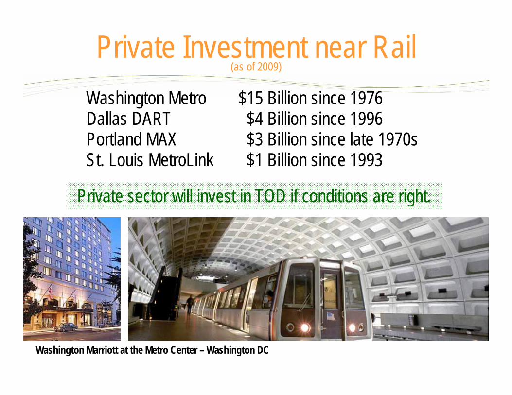
Private sector will invest in TOD if conditions are right.
Washington Marriott at the Metro Center – Washington DC
Private Investment near Rail(as of 2009)
Washington Metro $15 Billion since 1976 Dallas DART $4 Billion since 1996 Portland MAX $3 Billion since late 1970s St. Louis MetroLink $1 Billion since 1993

Busch Stadium - St. Louis
Private Investment near Rail
Waterfront Station – Washington DCHollywood/Vine Station – Los Angeles
Coordination with partners
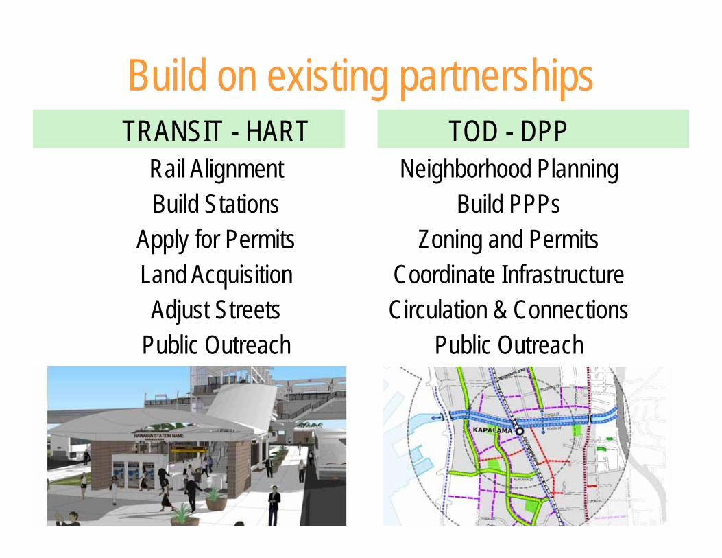
TOD - DPPNeighborhood Planning
Build PPPsZoning and Permits
Coordinate InfrastructureCirculation & Connections
Public Outreach
TRANSIT - HARTRail AlignmentBuild Stations
Apply for PermitsLand AcquisitionAdjust Streets
Public Outreach
Build on existing partnerships
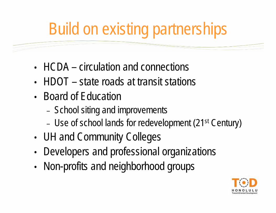
• HCDA – circulation and connections• HDOT – state roads at transit stations• Board of Education
– School siting and improvements– Use of school lands for redevelopment (21st Century)
• UH and Community Colleges • Developers and professional organizations• Non-profits and neighborhood groups
Build on existing partnerships
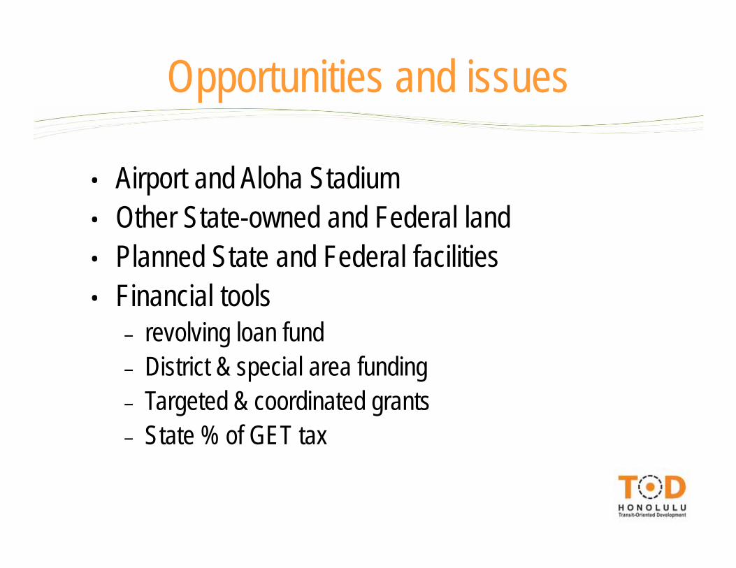
• Airport and Aloha Stadium• Other State-owned and Federal land• Planned State and Federal facilities• Financial tools
– revolving loan fund– District & special area funding– Targeted & coordinated grants– State % of GET tax
Opportunities and issues
Department presentationsFocus on use of existing/pipeline resources, overlap and leveraging opportunities
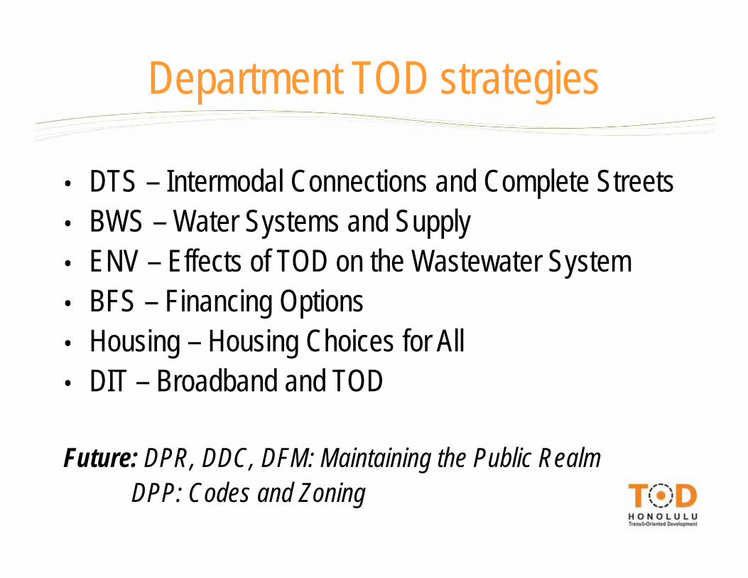
• DTS – Intermodal Connections and Complete Streets• BWS – Water Systems and Supply• ENV – Effects of TOD on the Wastewater System• BFS – Financing Options• Housing – Housing Choices for All• DIT – Broadband and TOD
Future: DPR, DDC, DFM: Maintaining the Public RealmDPP: Codes and Zoning
Department TOD strategies
Intermodal Connections and Complete StreetsDepartment of Transportation ServicesMichael Formby
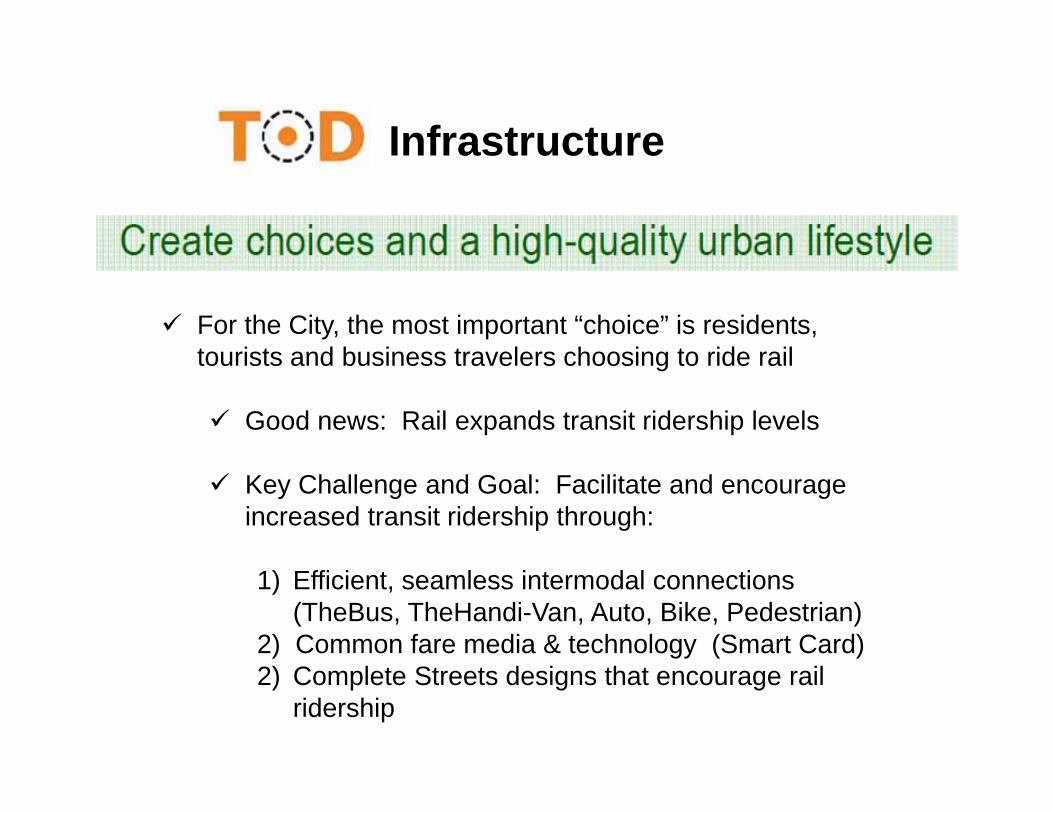
Infrastructure
For the City, the most important “choice” is residents, tourists and business travelers choosing to ride rail
Good news: Rail expands transit ridership levels
Key Challenge and Goal: Facilitate and encourage increased transit ridership through:
1) Efficient, seamless intermodal connections(TheBus, TheHandi-Van, Auto, Bike, Pedestrian)
2) Common fare media & technology (Smart Card)2) Complete Streets designs that encourage rail
ridership
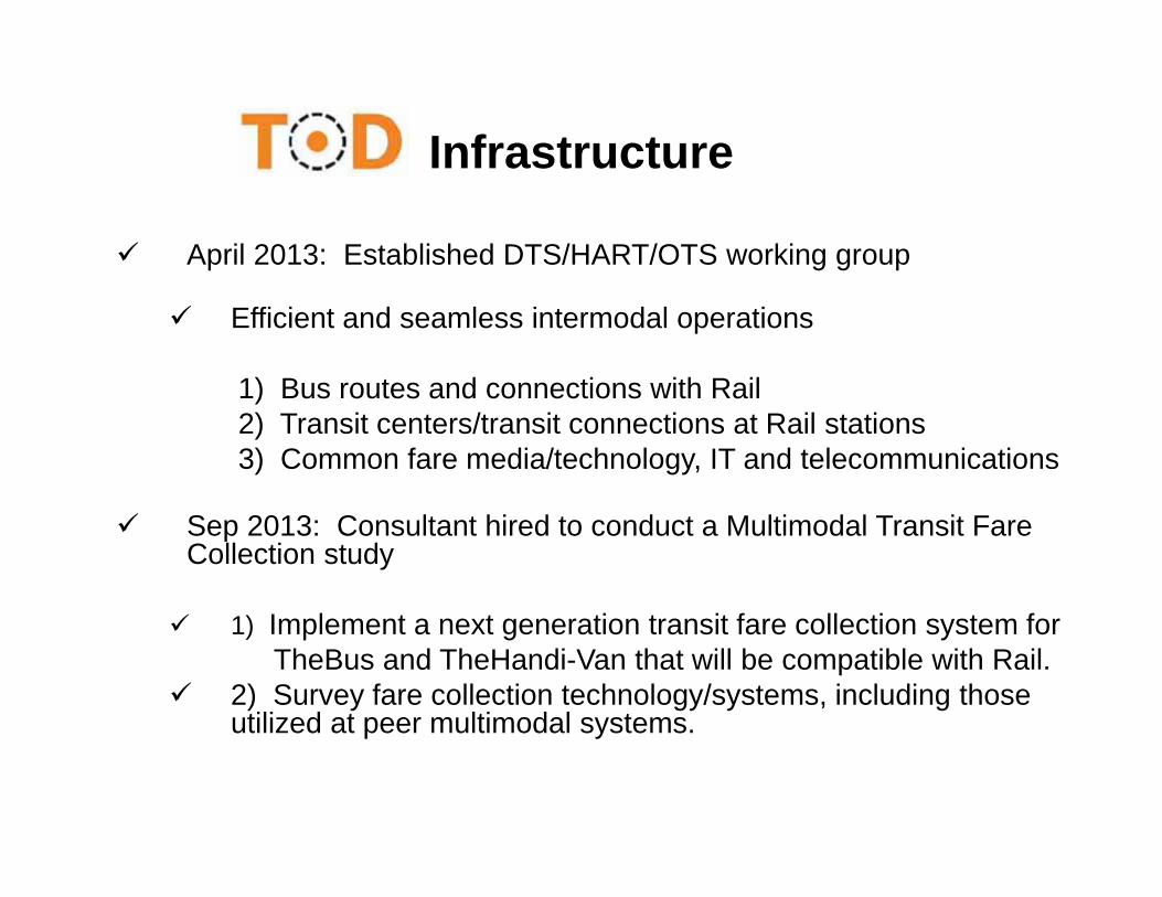
April 2013: Established DTS/HART/OTS working group
Efficient and seamless intermodal operations
1) Bus routes and connections with Rail2) Transit centers/transit connections at Rail stations3) Common fare media/technology, IT and telecommunications
Sep 2013: Consultant hired to conduct a Multimodal Transit Fare Collection study
1) Implement a next generation transit fare collection system forTheBus and TheHandi-Van that will be compatible with Rail.
2) Survey fare collection technology/systems, including those utilized at peer multimodal systems.
Infrastructure
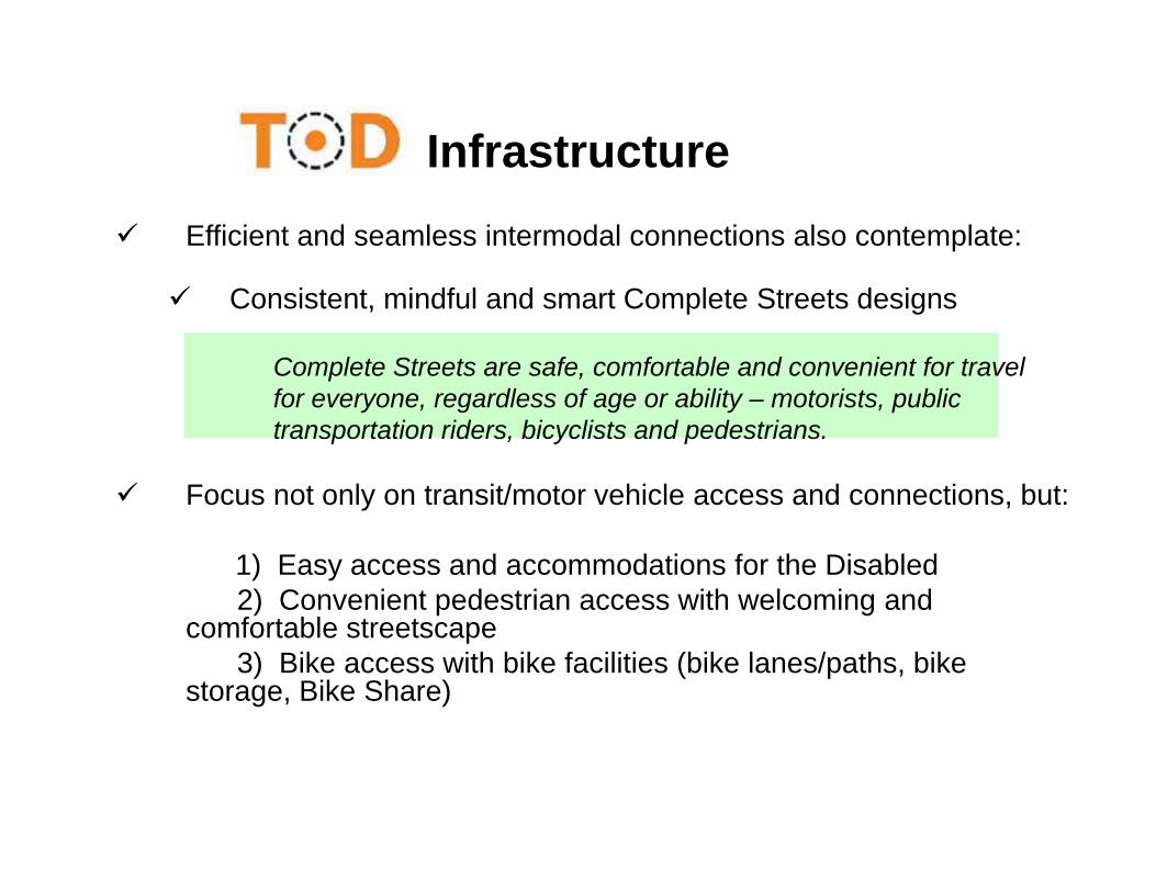
Efficient and seamless intermodal connections also contemplate:
Consistent, mindful and smart Complete Streets designs
Complete Streets are safe, comfortable and convenient for travelfor everyone, regardless of age or ability – motorists, public transportation riders, bicyclists and pedestrians.
Focus not only on transit/motor vehicle access and connections, but:
1) Easy access and accommodations for the Disabled2) Convenient pedestrian access with welcoming and
comfortable streetscape3) Bike access with bike facilities (bike lanes/paths, bike
storage, Bike Share)
Infrastructure

Infrastructure
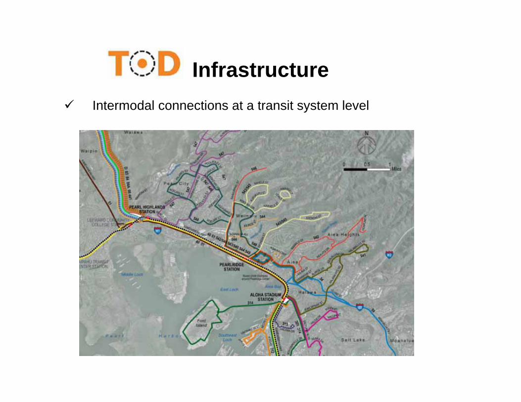
Infrastructure Intermodal connections at a transit system level
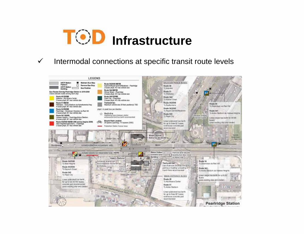
Infrastructure Intermodal connections at specific transit route levels
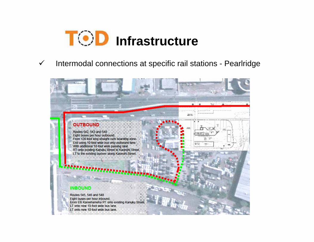
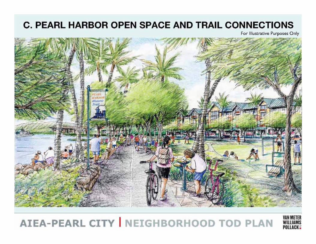
Infrastructure Intermodal connections at specific rail stations - Pearlridge
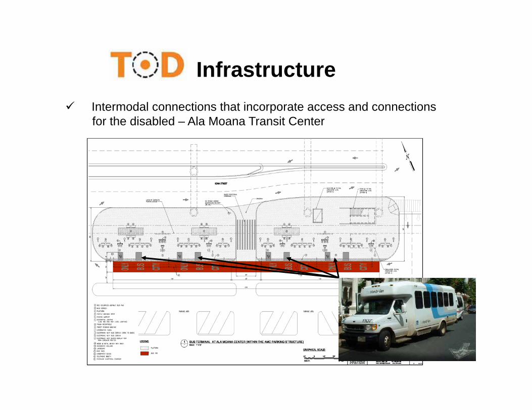
Infrastructure Intermodal connections that incorporate access and connections
for the disabled – Ala Moana Transit Center
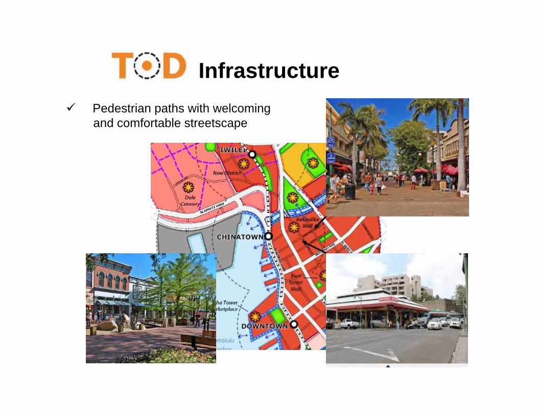
Infrastructure Pedestrian paths with welcoming
and comfortable streetscape
Infrastructure
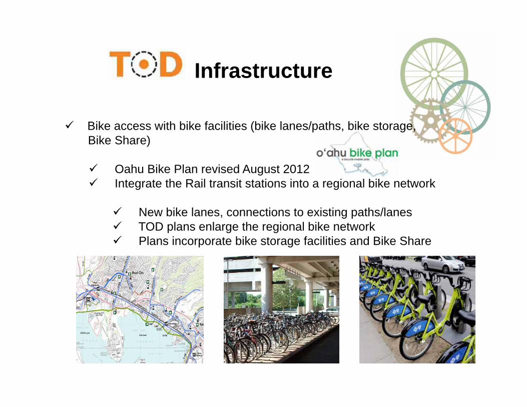
Bike access with bike facilities (bike lanes/paths, bike storage,Bike Share)
Oahu Bike Plan revised August 2012 Integrate the Rail transit stations into a regional bike network
New bike lanes, connections to existing paths/lanes TOD plans enlarge the regional bike network Plans incorporate bike storage facilities and Bike Share
Infrastructure
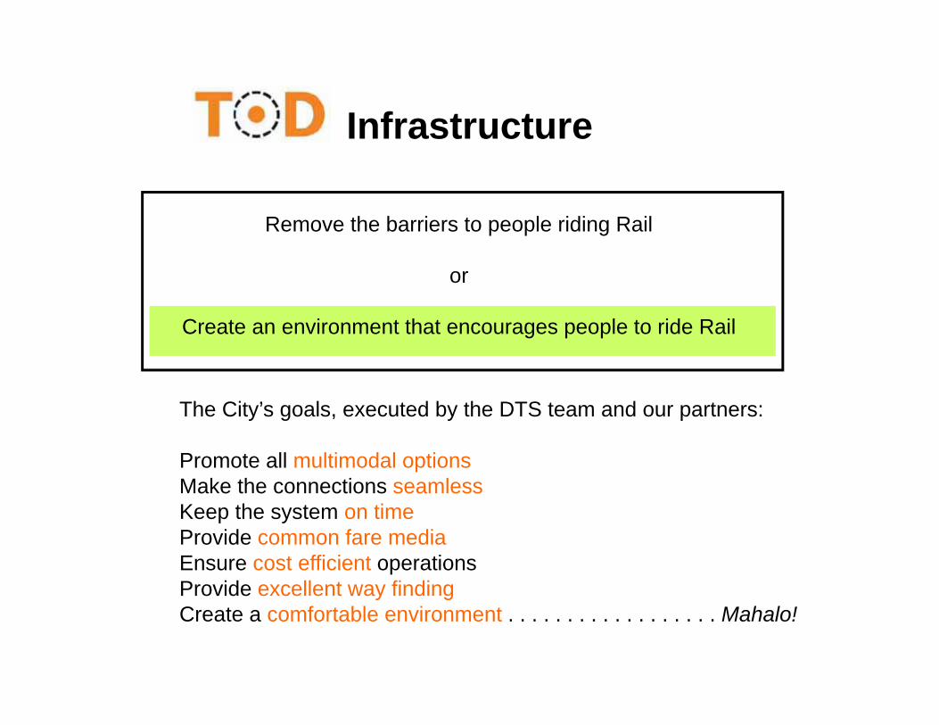
Remove the barriers to people riding Rail
or
Create an environment that encourages people to ride Rail
The City’s goals, executed by the DTS team and our partners:
Promote all multimodal optionsMake the connections seamlessKeep the system on timeProvide common fare mediaEnsure cost efficient operationsProvide excellent way findingCreate a comfortable environment . . . . . . . . . . . . . . . . . . Mahalo!
Water Systems and Supply InfrastructureBoard of Water SupplyErnie Lau

• The rail corridor crosses 5 water systems (215, 228, 285, 277 & 180)
• The water systems in South Oahu are extensive and integrated but aging
• The systems have available but limited capacity and there are no development restrictions at this time
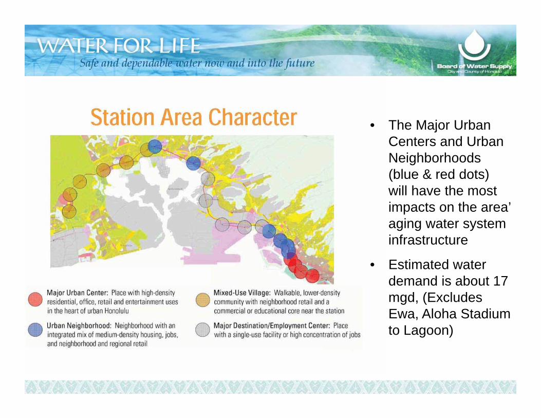
• The Major Urban Centers and Urban Neighborhoods (blue & red dots) will have the most impacts on the area’ aging water system infrastructure
• Estimated water demand is about 17 mgd, (Excludes Ewa, Aloha Stadium to Lagoon)
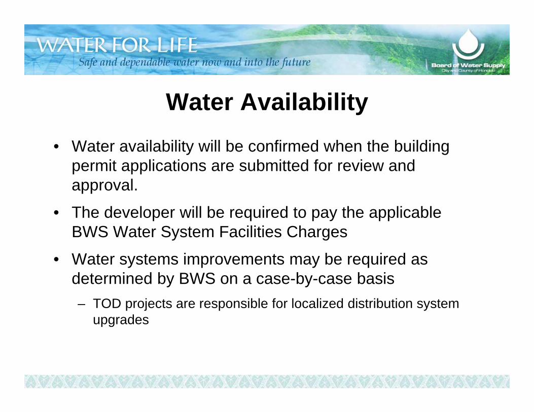
Water Availability• Water availability will be confirmed when the building
permit applications are submitted for review and approval.
• The developer will be required to pay the applicable BWS Water System Facilities Charges
• Water systems improvements may be required as determined by BWS on a case-by-case basis– TOD projects are responsible for localized distribution system
upgrades

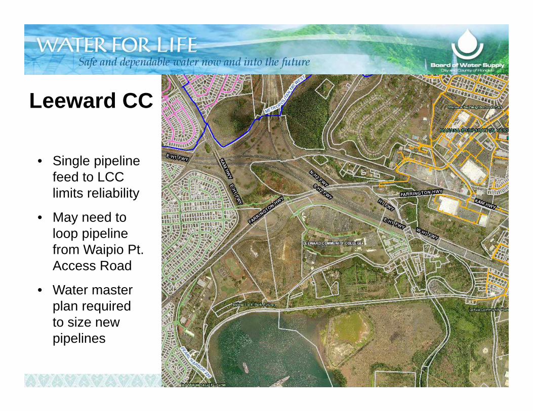
Leeward CC
• Single pipeline feed to LCC limits reliability
• May need to loop pipeline from Waipio Pt. Access Road
• Water master plan required to size new pipelines
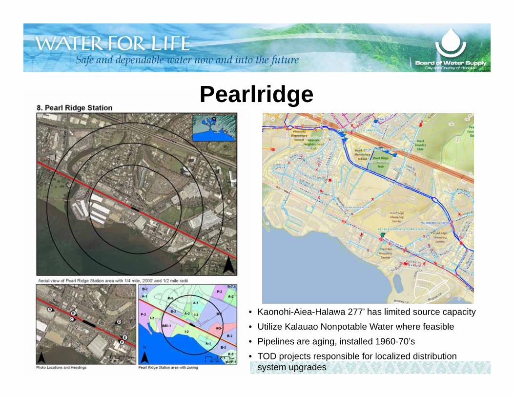
Pearlridge
• Kaonohi-Aiea-Halawa 277’ has limited source capacity• Utilize Kalauao Nonpotable Water where feasible• Pipelines are aging, installed 1960-70’s• TOD projects responsible for localized distribution
system upgrades
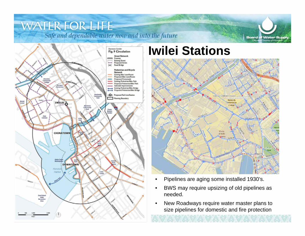
• Pipelines are aging some installed 1930’s. • BWS may require upsizing of old pipelines as
needed.• New Roadways require water master plans to
size pipelines for domestic and fire protection
Kapalama & Iwilei Stations
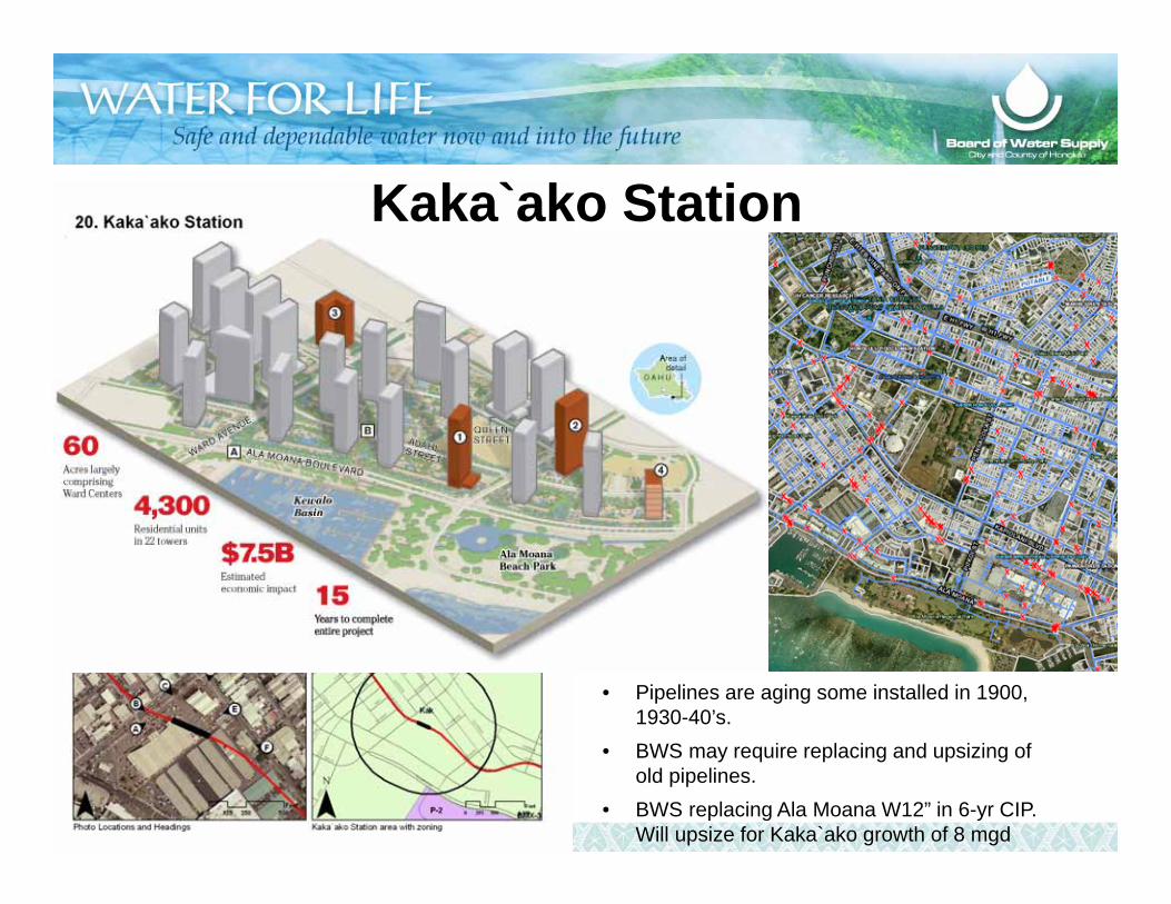
Kaka`ako Station
• Pipelines are aging some installed in 1900, 1930-40’s.
• BWS may require replacing and upsizing of old pipelines.
• BWS replacing Ala Moana W12” in 6-yr CIP. Will upsize for Kaka`ako growth of 8 mgd
Mahalo and Aloha
Effects of TOD on the Wastewater SystemCollaborative Relationship of TOD and Global Consent DecreeDepartment of Environmental ServicesLori Kahikina
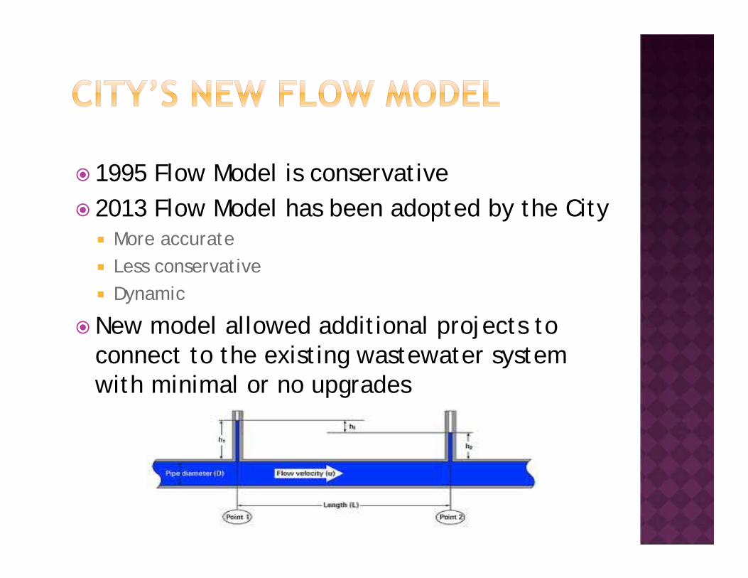
1995 Flow Model is conservative 2013 Flow Model has been adopted by the City
More accurate Less conservative Dynamic
New model allowed additional projects to connect to the existing wastewater system with minimal or no upgrades

Density information along TOD Projected flow information along
TOD at the parcel level Pacific Resource Partnership projection along
rail alignment Projects from major developers
Howard Hughes HCDA General Growth Others
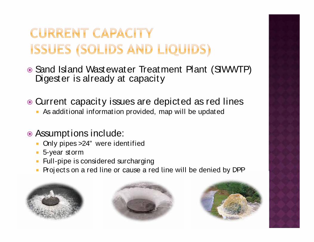
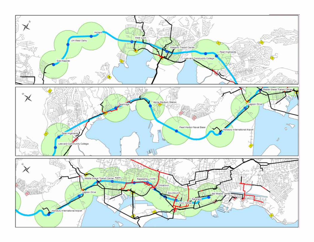
Sand Island Wastewater Treatment Plant (SIWWTP) Digester is already at capacity
Current capacity issues are depicted as red lines As additional information provided, map will be updated
Assumptions include: Only pipes >24” were identified 5-year storm Full-pipe is considered surcharging Projects on a red line or cause a red line will be denied by DPP
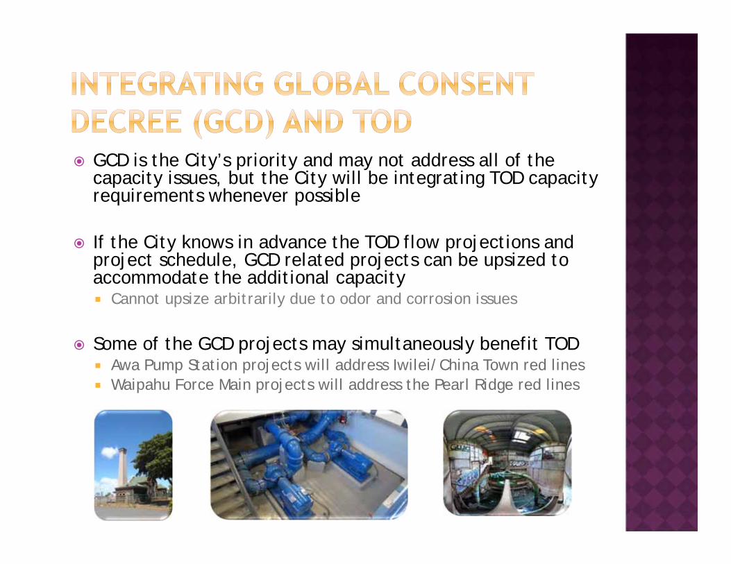
GCD is the City’s priority and may not address all of the capacity issues, but the City will be integrating TOD capacity requirements whenever possible
If the City knows in advance the TOD flow projections and project schedule, GCD related projects can be upsized to accommodate the additional capacity Cannot upsize arbitrarily due to odor and corrosion issues
Some of the GCD projects may simultaneously benefit TOD Awa Pump Station projects will address Iwilei/China Town red lines Waipahu Force Main projects will address the Pearl Ridge red lines
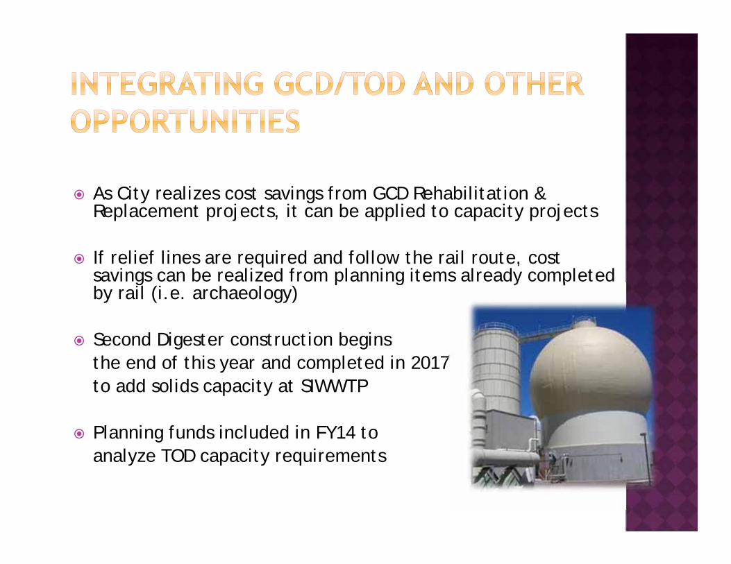
As City realizes cost savings from GCD Rehabilitation & Replacement projects, it can be applied to capacity projects
If relief lines are required and follow the rail route, cost savings can be realized from planning items already completed by rail (i.e. archaeology)
Second Digester construction begins the end of this year and completed in 2017to add solids capacity at SIWWTP
Planning funds included in FY14 to analyze TOD capacity requirements
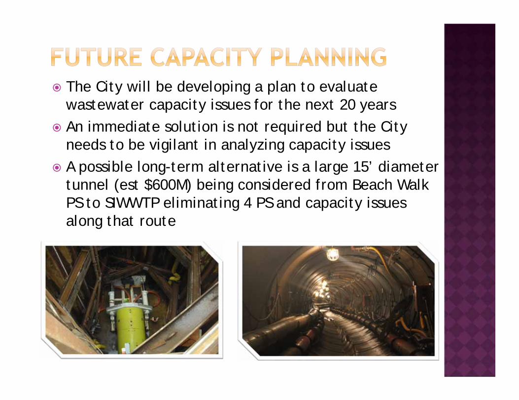
The City will be developing a plan to evaluate wastewater capacity issues for the next 20 years
An immediate solution is not required but the City needs to be vigilant in analyzing capacity issues
A possible long-term alternative is a large 15’ diameter tunnel (est $600M) being considered from Beach Walk PS to SIWWTP eliminating 4 PS and capacity issues along that route
TOD Financing and Incentive ToolsBudget and Fiscal ServicesNelson Koyanagi
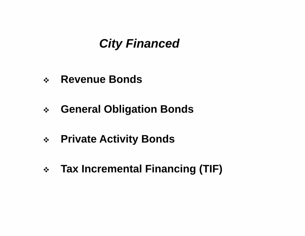
Revenue Bonds
General Obligation Bonds
Private Activity Bonds
Tax Incremental Financing (TIF)
City Financed
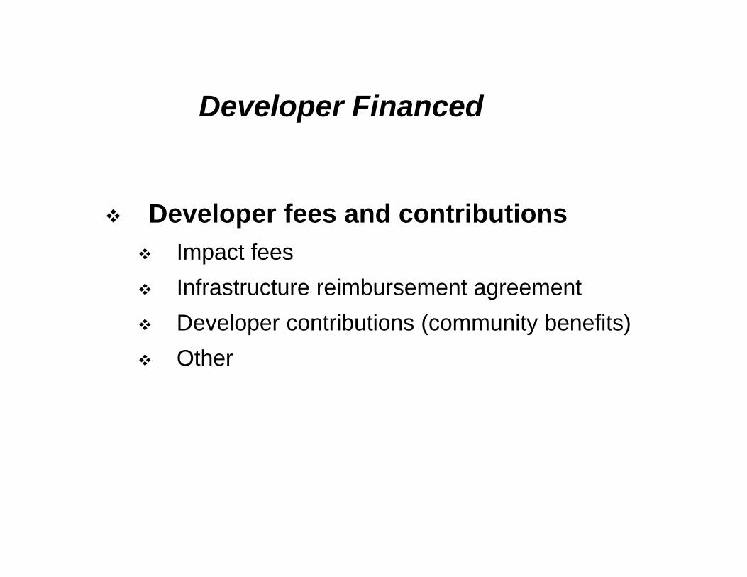
Developer fees and contributions Impact fees Infrastructure reimbursement agreement Developer contributions (community benefits) Other
Developer Financed
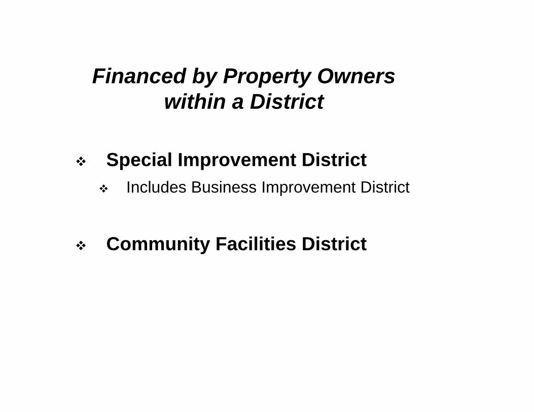
Special Improvement District Includes Business Improvement District
Community Facilities District
Financed by Property Ownerswithin a District
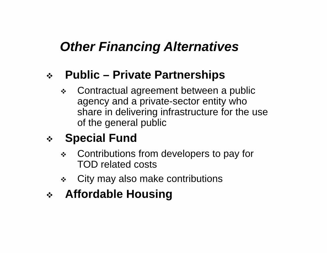
Public – Private Partnerships Contractual agreement between a public
agency and a private-sector entity who share in delivering infrastructure for the use of the general public
Special Fund Contributions from developers to pay for
TOD related costs City may also make contributions
Affordable Housing
Other Financing Alternatives
Zoning Incentives (historically awarded to developers)
Real Property Tax City has complete authority and control over
real property taxes
Developer Incentives
Housing Choices for All Office of HousingJun Yang
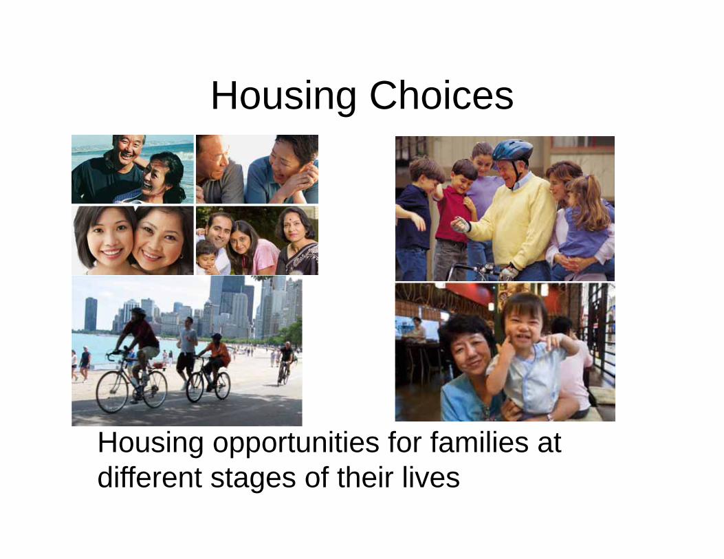
Housing Choices
Housing opportunities for families at different stages of their lives
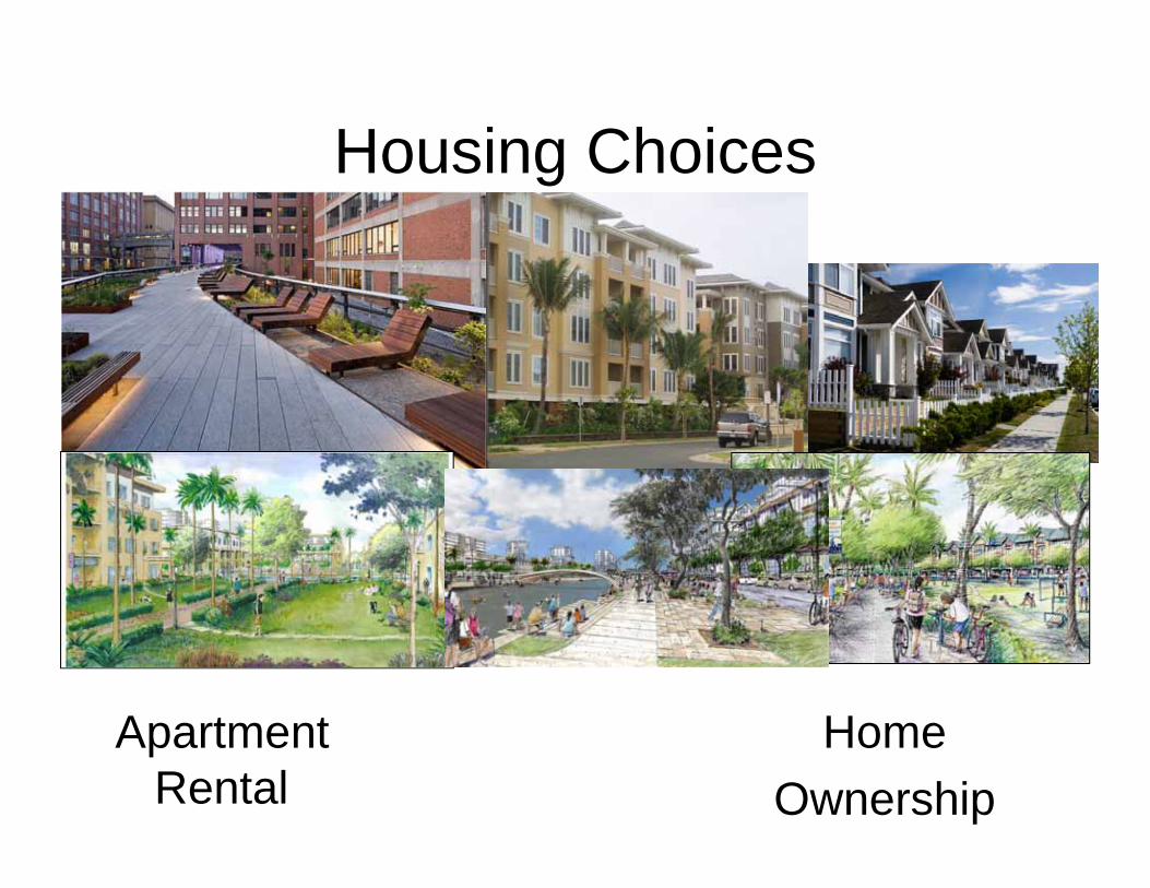
Housing Choices
Apartment Rental
HomeOwnership
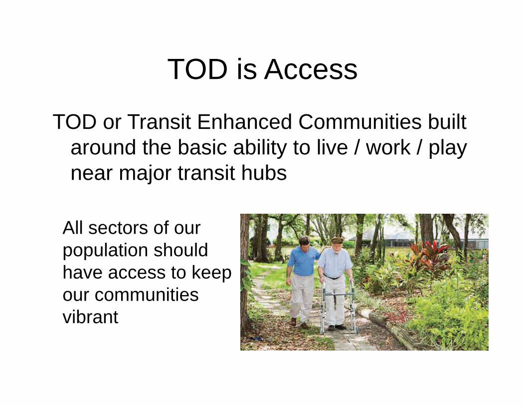
TOD is Access
TOD or Transit Enhanced Communities built around the basic ability to live / work / play near major transit hubs
All sectors of our population should have access to keep our communities vibrant
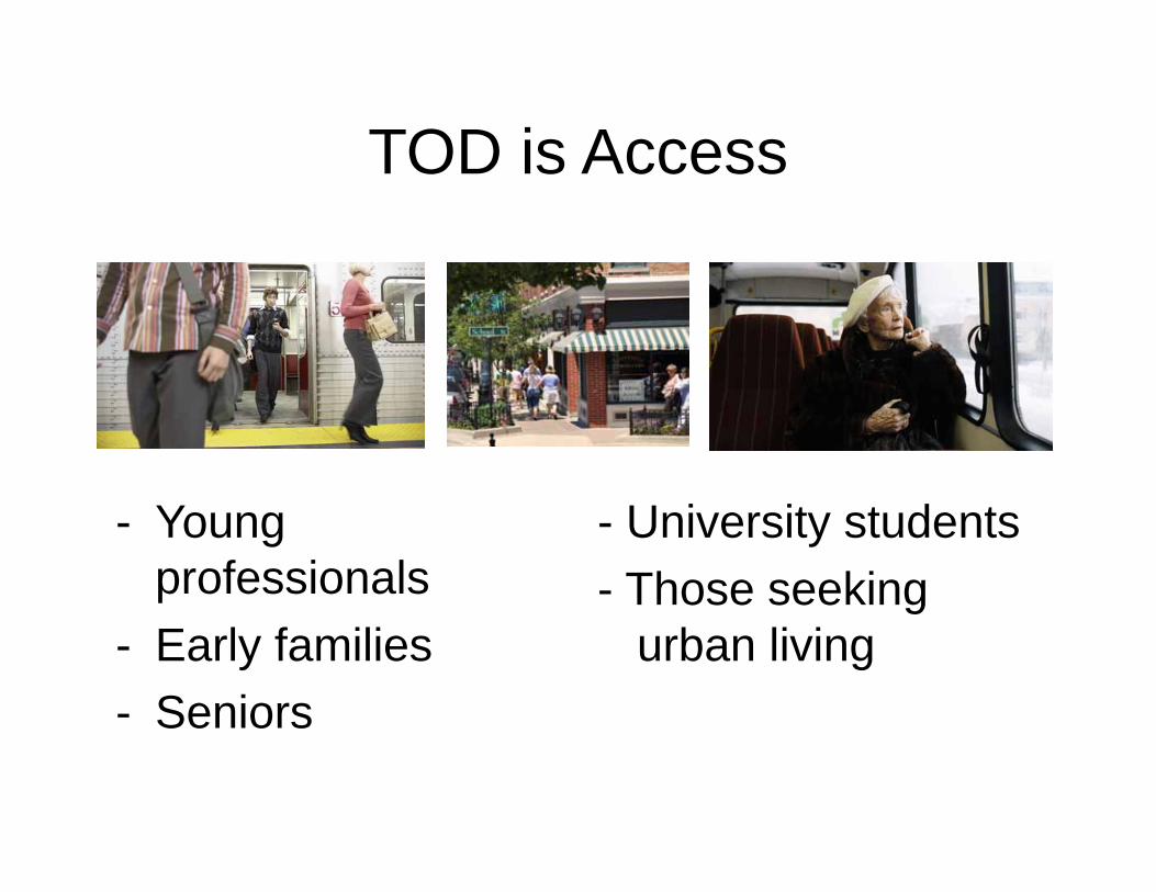
TOD is Access
- Young professionals
- Early families- Seniors
- University students- Those seeking
urban living
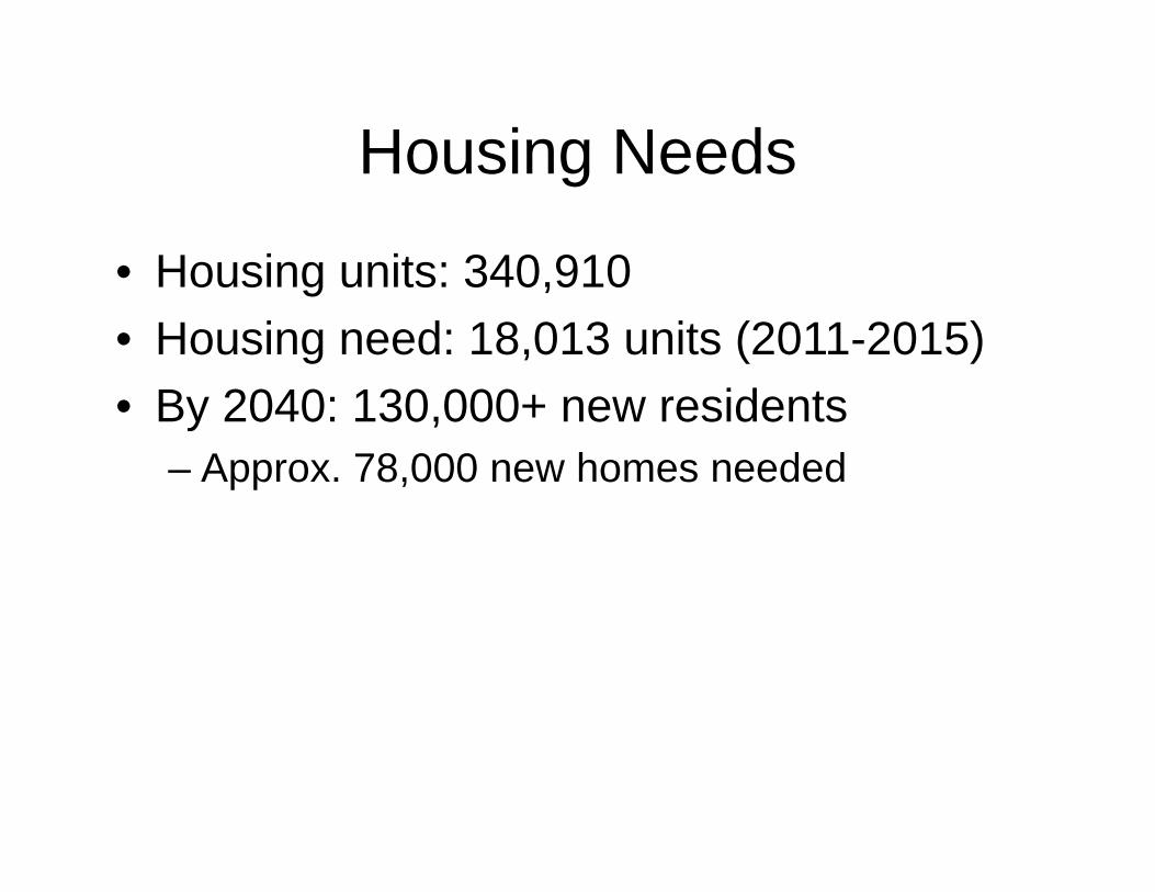
Housing Needs
• Housing units: 340,910• Housing need: 18,013 units (2011-2015)• By 2040: 130,000+ new residents
– Approx. 78,000 new homes needed

Current Housing Policy
• Current City policy triggers development of housing for the workforce through:– Unilateral Agreement (Reso 09-241, CD1)– Real Property Tax Exemption (ROH 8-10.21)– State Laws Governing Affordable Housing
(i.e., HRS 201 H)– CDBG + HOME Funds– Section 8 Program
Current Housing Policy
Unilateral Agreement (Resolution 09-241, CD1)- Triggered by Zone Change when initiated by
developer- Works best with Greenfields and large open
space- May not be as effective for infill development- Affordable Housing is one component- Limited term of affordability- Short supply of housing units
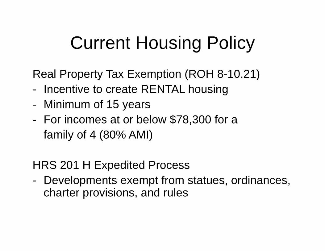
Current Housing PolicyReal Property Tax Exemption (ROH 8-10.21)- Incentive to create RENTAL housing- Minimum of 15 years- For incomes at or below $78,300 for a
family of 4 (80% AMI)
HRS 201 H Expedited Process- Developments exempt from statues, ordinances,
charter provisions, and rules
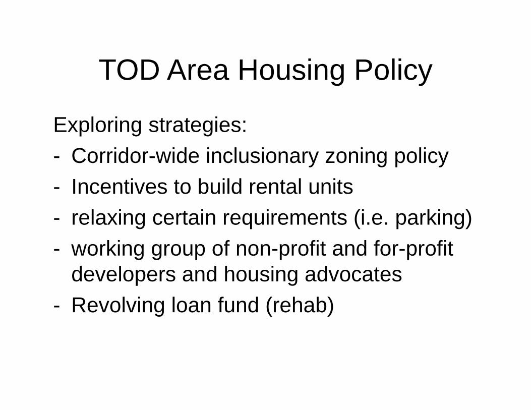
TOD Area Housing Policy
Exploring strategies:- Corridor-wide inclusionary zoning policy- Incentives to build rental units- relaxing certain requirements (i.e. parking)- working group of non-profit and for-profit
developers and housing advocates- Revolving loan fund (rehab)
Broadband and TODDepartment of Information TechnologyMark Wong
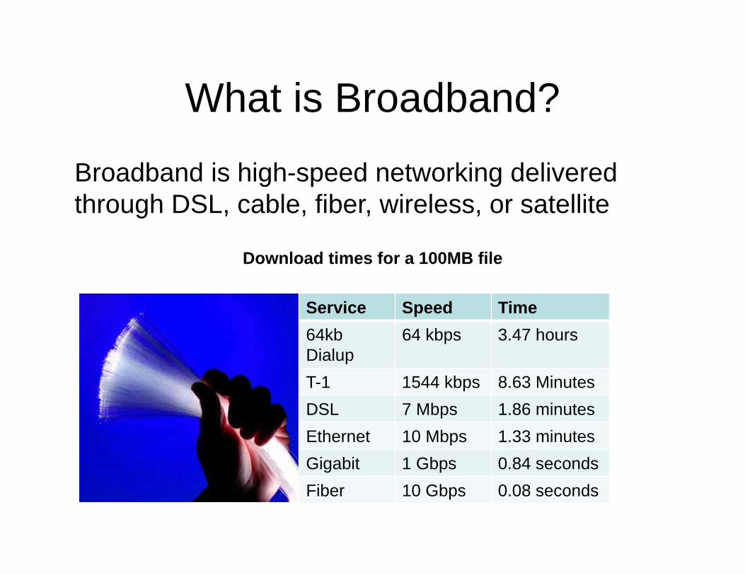
What is Broadband?
Broadband is high-speed networking delivered through DSL, cable, fiber, wireless, or satellite
Download times for a 100MB file
Service Speed Time64kbDialup
64 kbps 3.47 hours
T-1 1544 kbps 8.63 MinutesDSL 7 Mbps 1.86 minutesEthernet 10 Mbps 1.33 minutesGigabit 1 Gbps 0.84 secondsFiber 10 Gbps 0.08 seconds
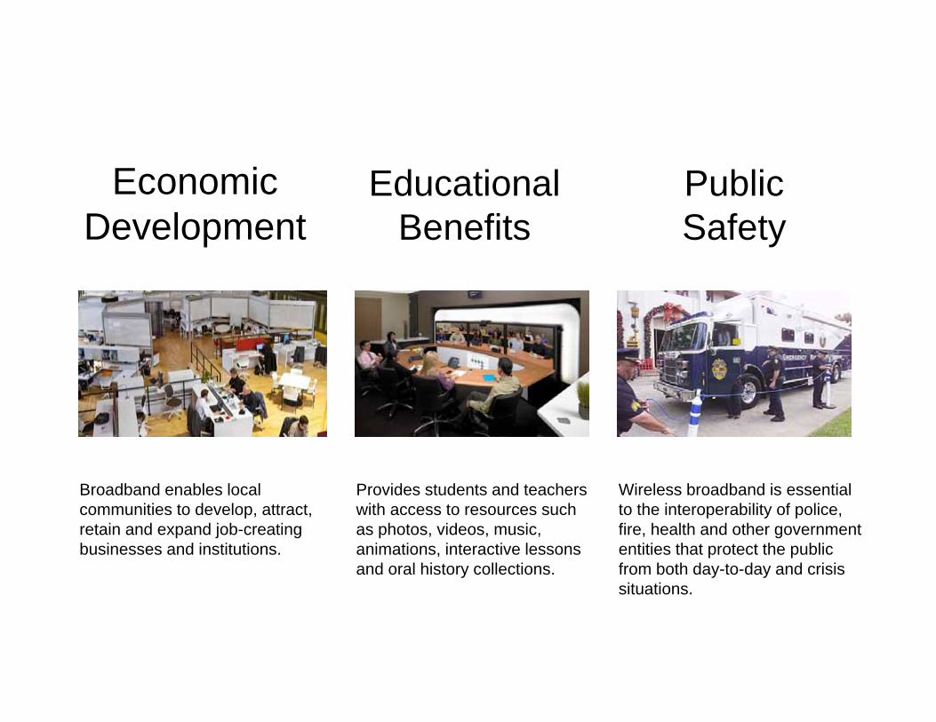
Broadband enables local communities to develop, attract, retain and expand job-creating businesses and institutions.
Educational Benefits
Public Safety
Economic Development
Provides students and teachers with access to resources such as photos, videos, music, animations, interactive lessons and oral history collections.
Wireless broadband is essential to the interoperability of police, fire, health and other government entities that protect the public from both day-to-day and crisis situations.
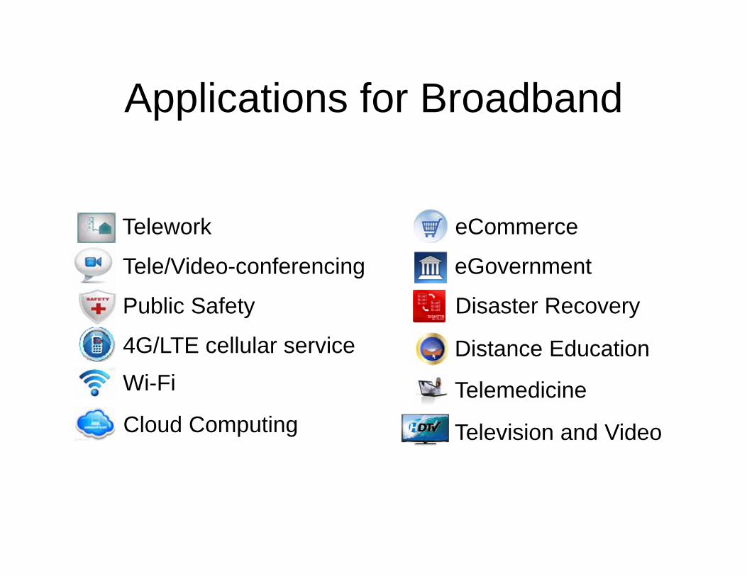
Applications for Broadband
Cloud Computing
eCommerce
Disaster Recovery
Telemedicine
Distance EducationWi-Fi4G/LTE cellular service
Tele/Video-conferencing
Public Safety
eGovernment
Telework
Television and Video
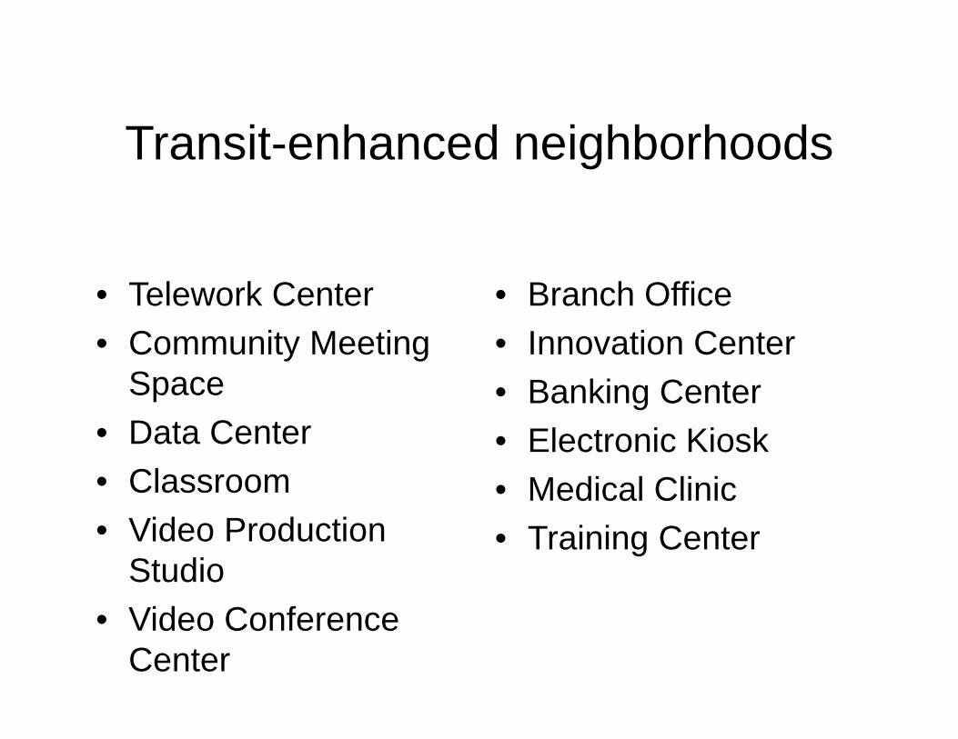
Transit-enhanced neighborhoods
• Telework Center• Community Meeting
Space• Data Center• Classroom• Video Production
Studio• Video Conference
Center
• Branch Office• Innovation Center• Banking Center• Electronic Kiosk• Medical Clinic• Training Center
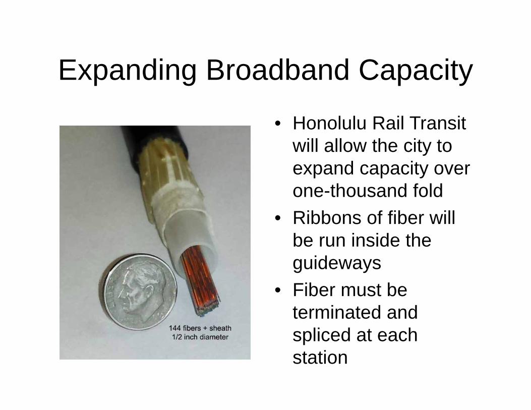
Expanding Broadband Capacity
• Honolulu Rail Transit will allow the city to expand capacity over one-thousand fold
• Ribbons of fiber will be run inside the guideways
• Fiber must be terminated and spliced at each station
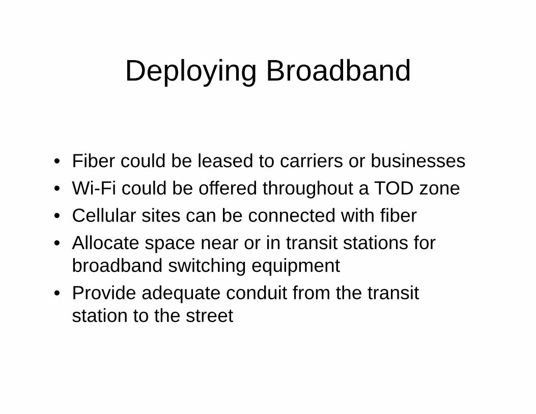
Deploying Broadband
• Fiber could be leased to carriers or businesses• Wi-Fi could be offered throughout a TOD zone• Cellular sites can be connected with fiber• Allocate space near or in transit stations for
broadband switching equipment• Provide adequate conduit from the transit
station to the street
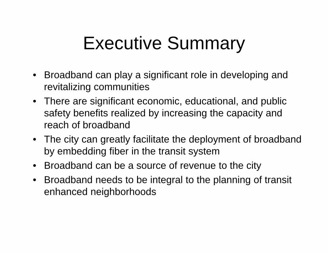
Executive Summary• Broadband can play a significant role in developing and
revitalizing communities• There are significant economic, educational, and public
safety benefits realized by increasing the capacity and reach of broadband
• The city can greatly facilitate the deployment of broadband by embedding fiber in the transit system
• Broadband can be a source of revenue to the city• Broadband needs to be integral to the planning of transit
enhanced neighborhoods
Pending/Upcoming Projects
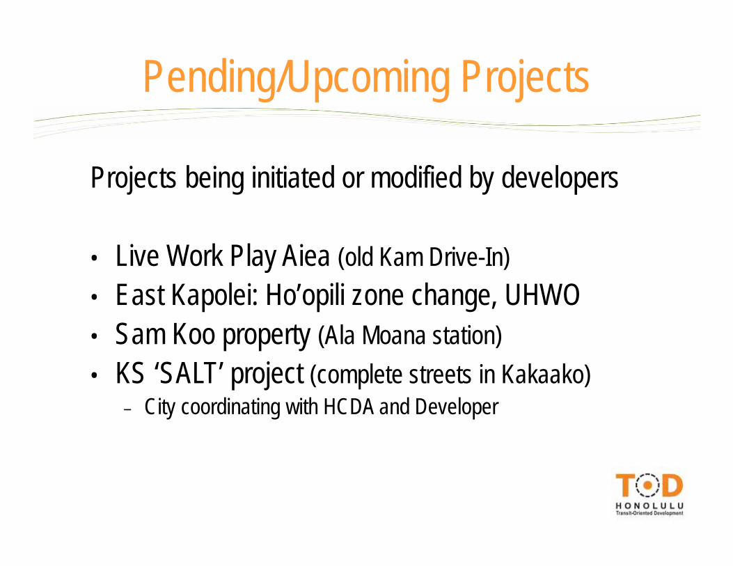
Projects being initiated or modified by developers
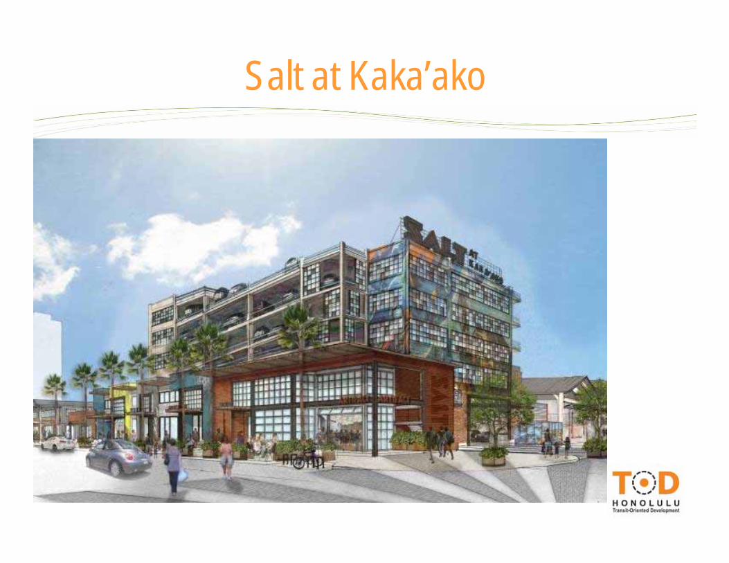
• Live Work Play Aiea (old Kam Drive-In)• East Kapolei: Ho’opili zone change, UHWO• Sam Koo property (Ala Moana station)• KS ‘SALT’ project (complete streets in Kakaako)
– City coordinating with HCDA and Developer
Pending/Upcoming Projects
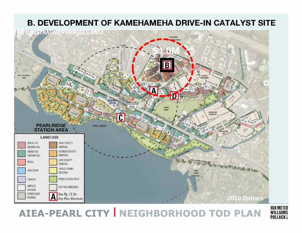
$4.0M
2010 Dollars
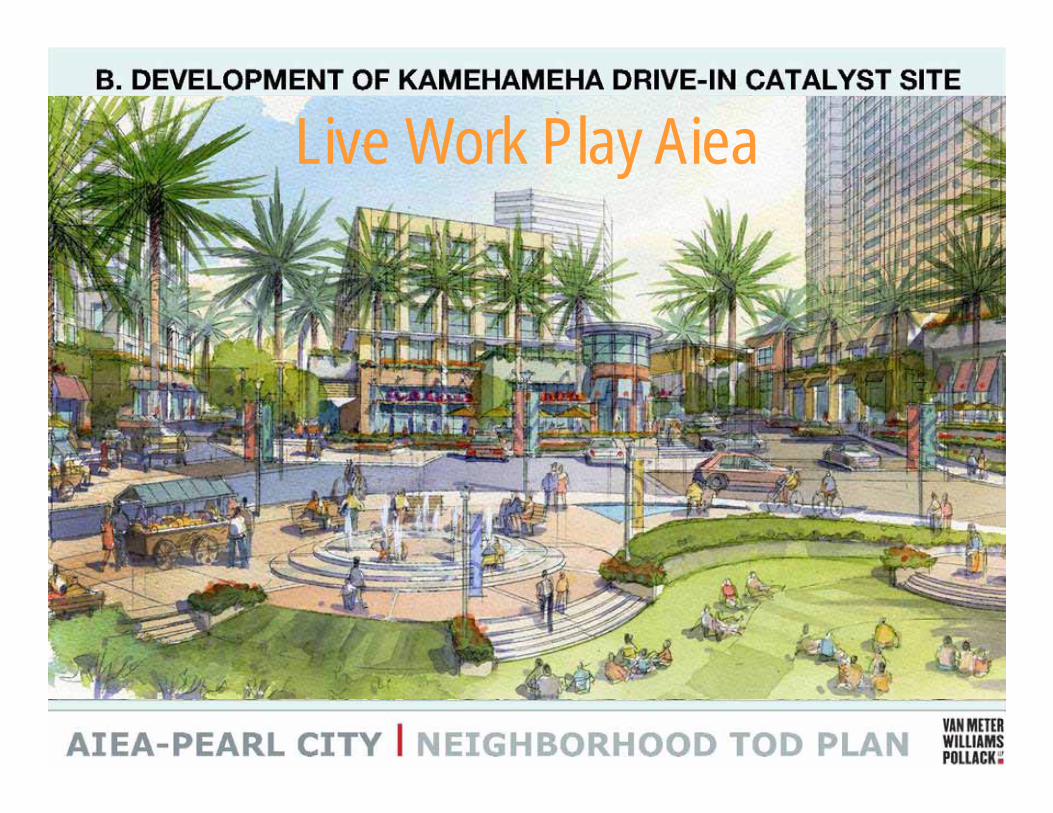
Live Work Play Aiea
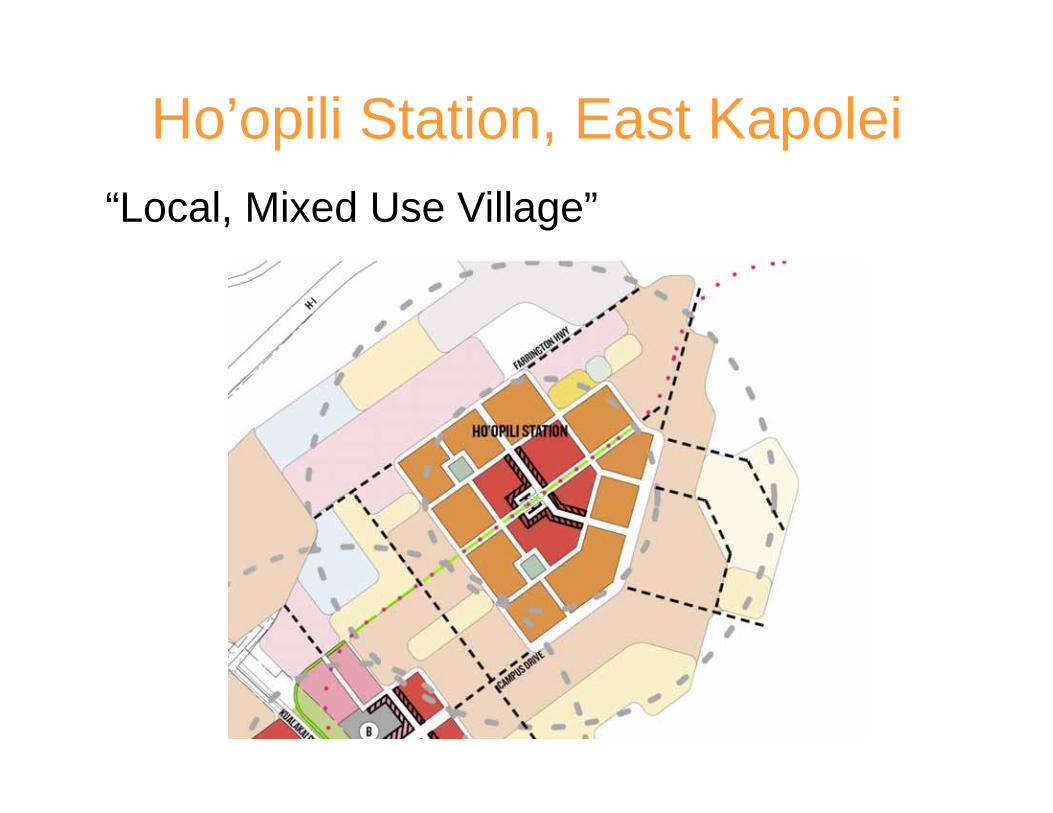
Ho’opili Station, East Kapolei“Local, Mixed Use Village”
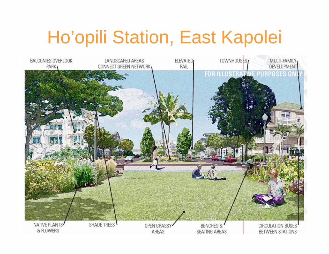
Ho’opili Station, East Kapolei
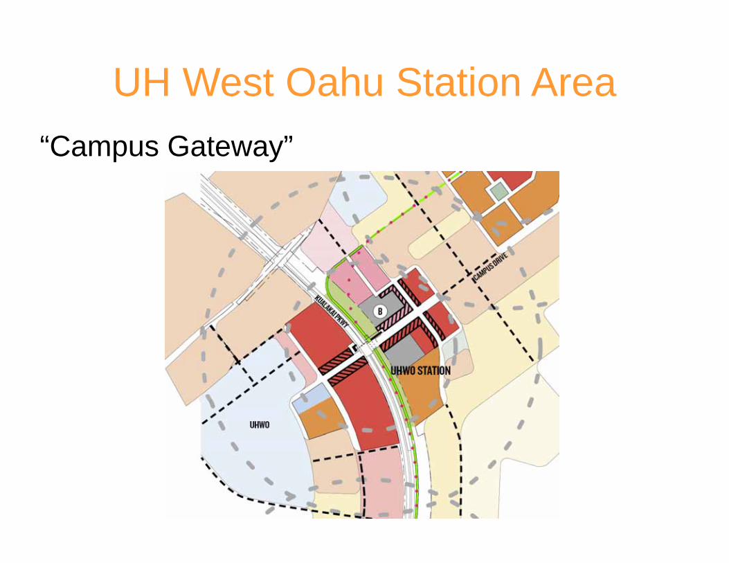
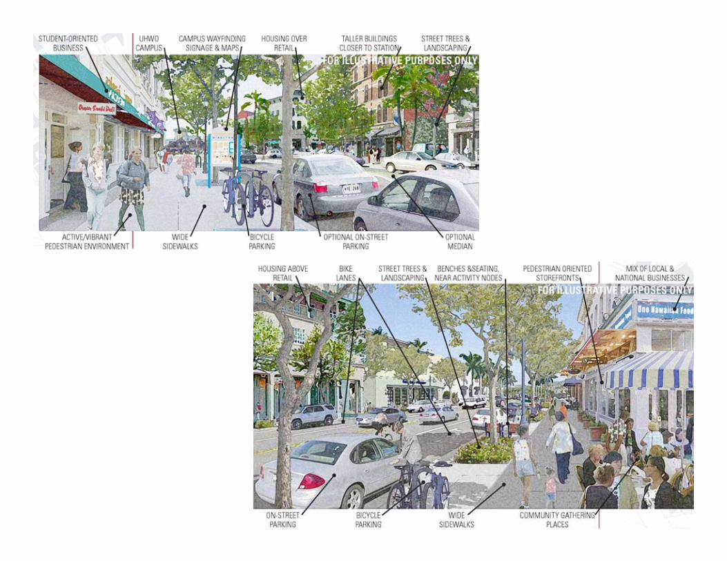
UH West Oahu Station Area“Campus Gateway”
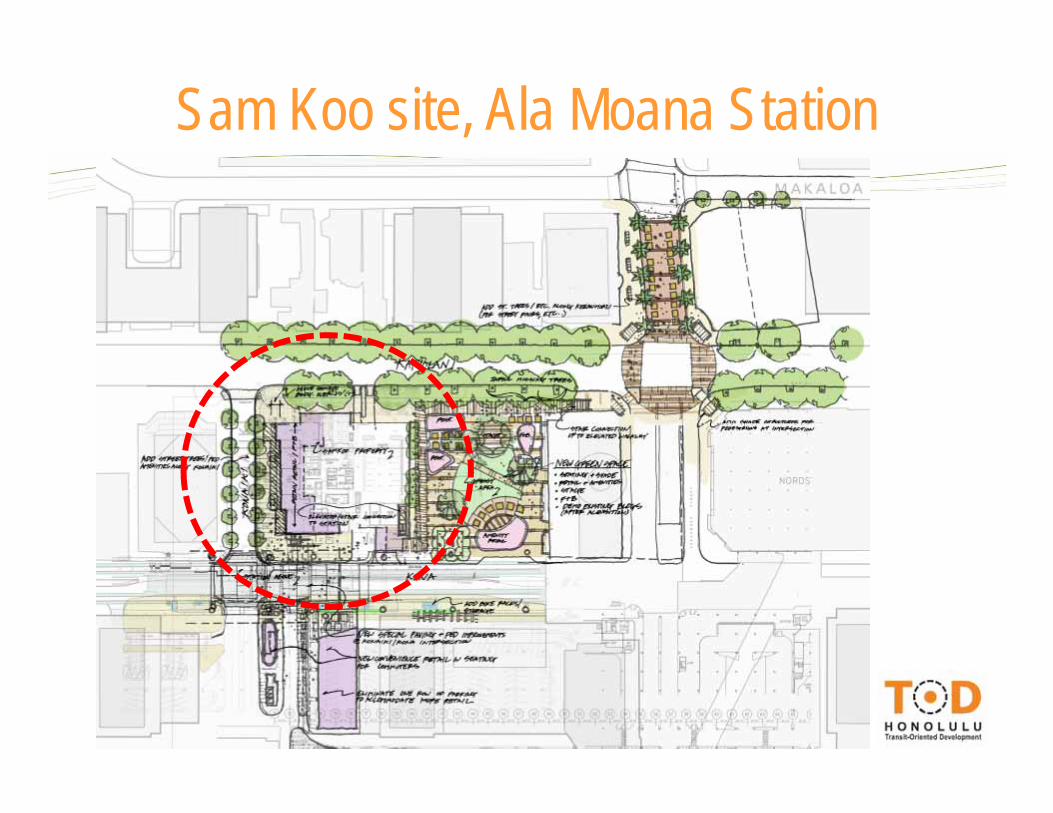
Sam Koo site, Ala Moana Station
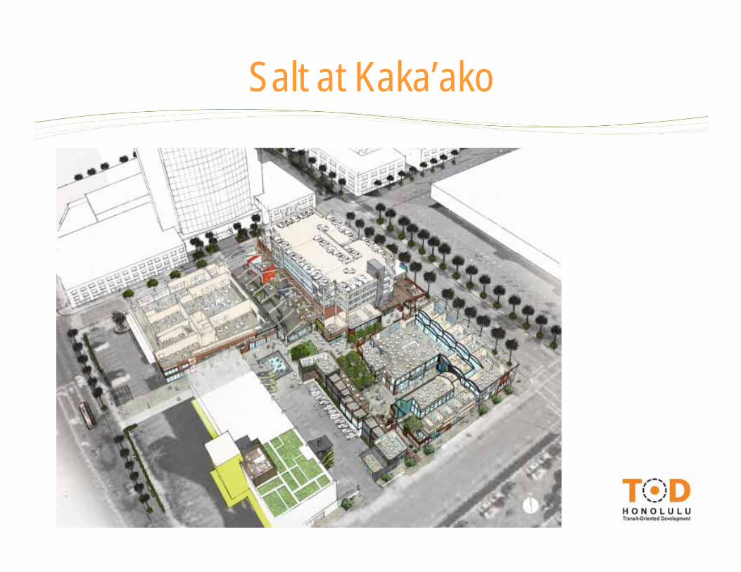
Salt at Kaka’ako
Salt at Kaka’ako
Potential Catalytic Projects
• Likely to ‘catalyze’ other projects to happen in same area; a seed, target or magnet for others
• Limited area - often a few blocks of streetscape, projects on both sides of a street, or all 4 corners
• Can be inspiring/iconic, or just ‘good projects’ that ‘prove the market’
• Can be major private/public investment (long-term) or smaller-scale street or park improvements (short-term)
What is a Catalytic Project?
• Based on the vision and ideas from neighborhood TOD Plan public workshops and stakeholders
• Sub-cabinet and partners are analyzing areas of need and available resources to identify potential publicly-sponsored catalytic investments
• Need to balance geographically and across project types
• Working with partners (private and public) to see how to target and leverage their resources
What is a Catalytic Project?
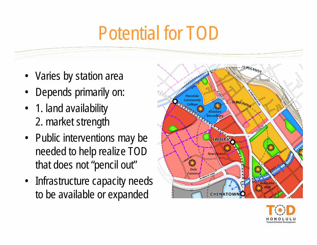
Potential for TOD
• Varies by station area• Depends primarily on: • 1. land availability
2. market strength• Public interventions may be
needed to help realize TOD that does not “pencil out”
• Infrastructure capacity needs to be available or expanded

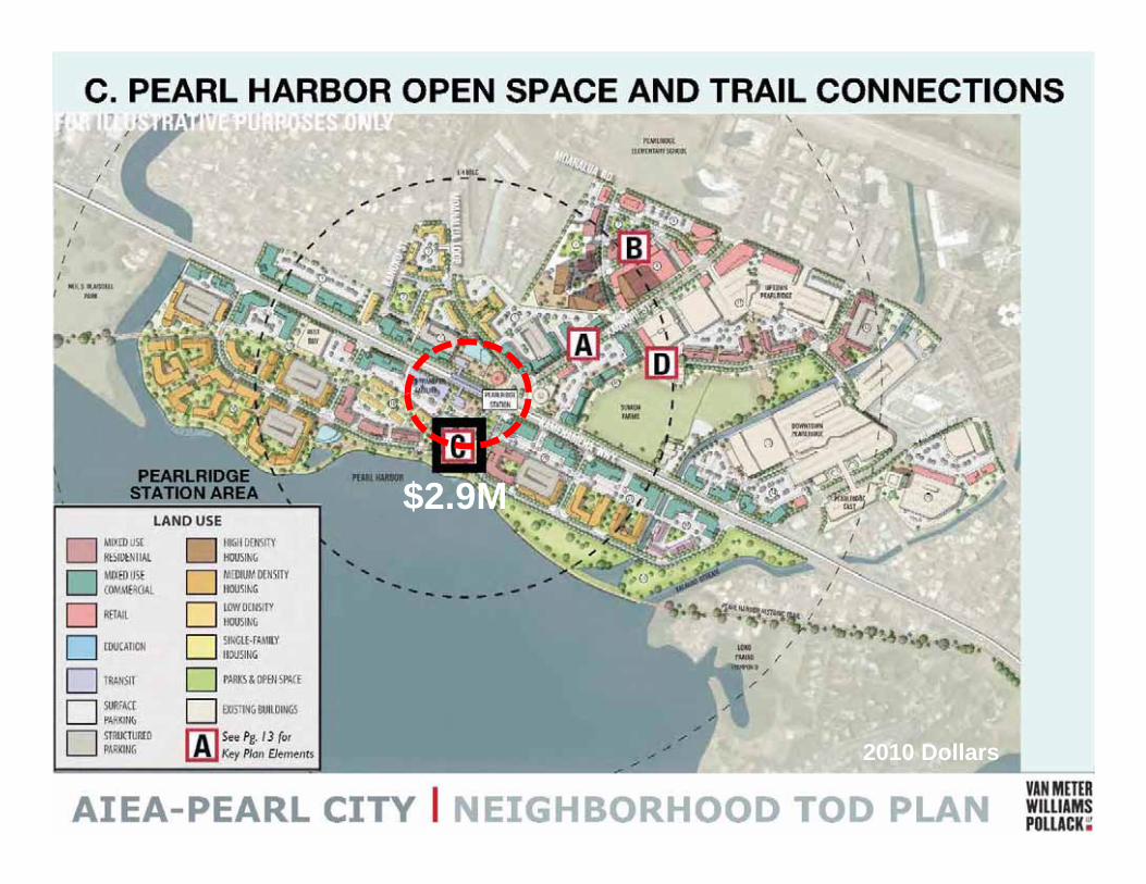
• Revitalization of ‘Blueways’ – Canals, rivers, ‘daylighting’ drainage pipes– Kapalama Canal, River St, Waipahu
• Trail connections and park improvements• Complete Street improvements (several)
– Short-term/ jump start projects, ‘Main Streets’• Blaisdell Center redevelopment• Ala Moana station area placemaking and circulation• Bikesharing initiative
Potential Catalytic Projects
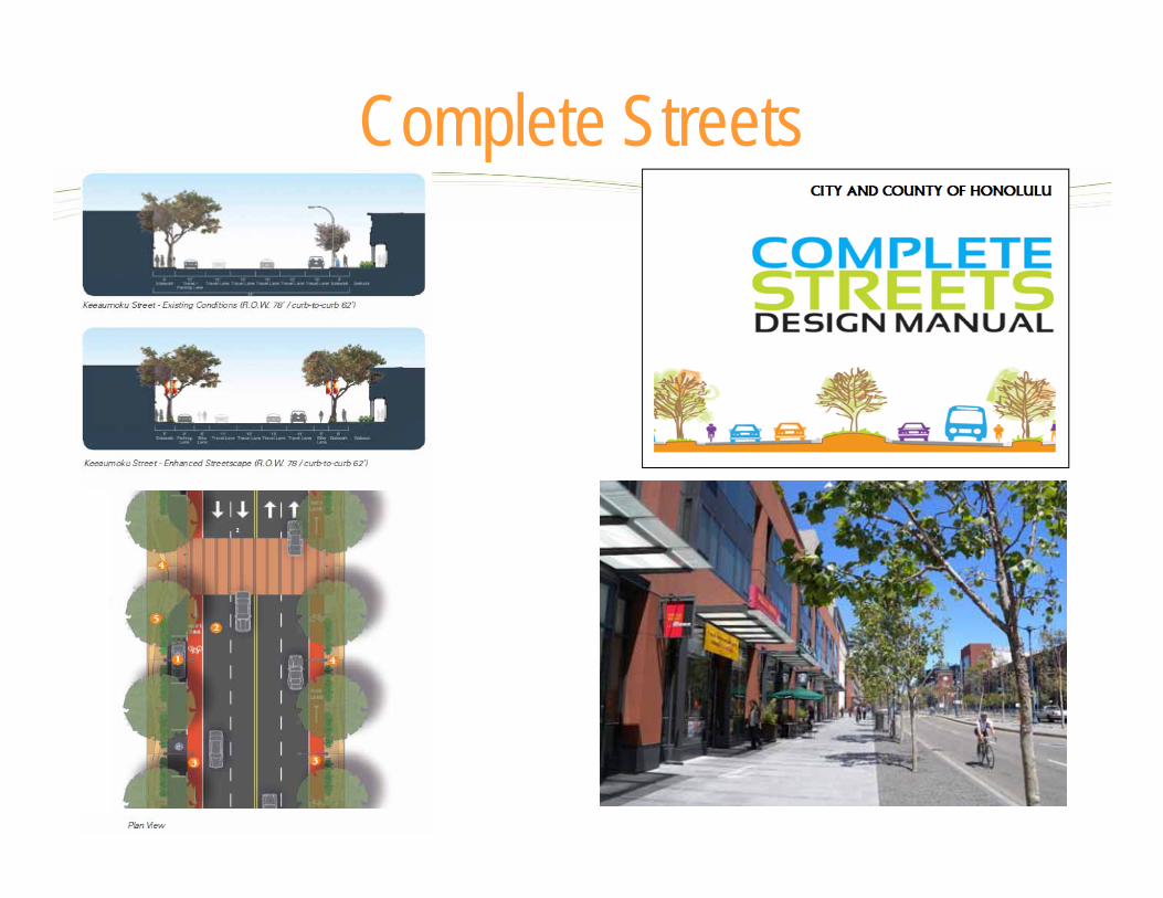
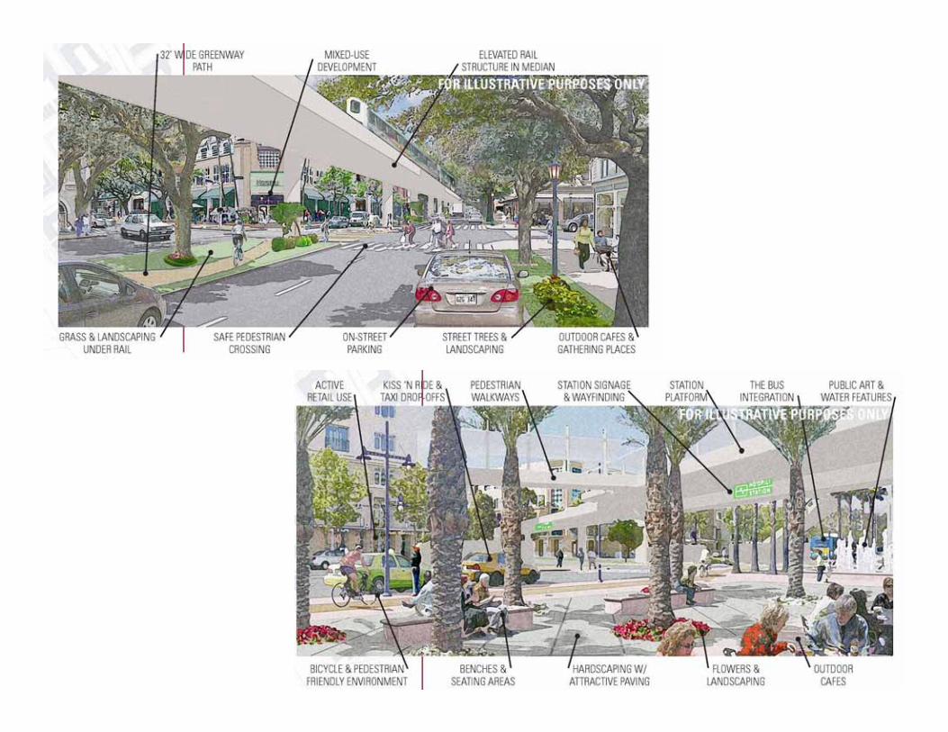
Complete Streets
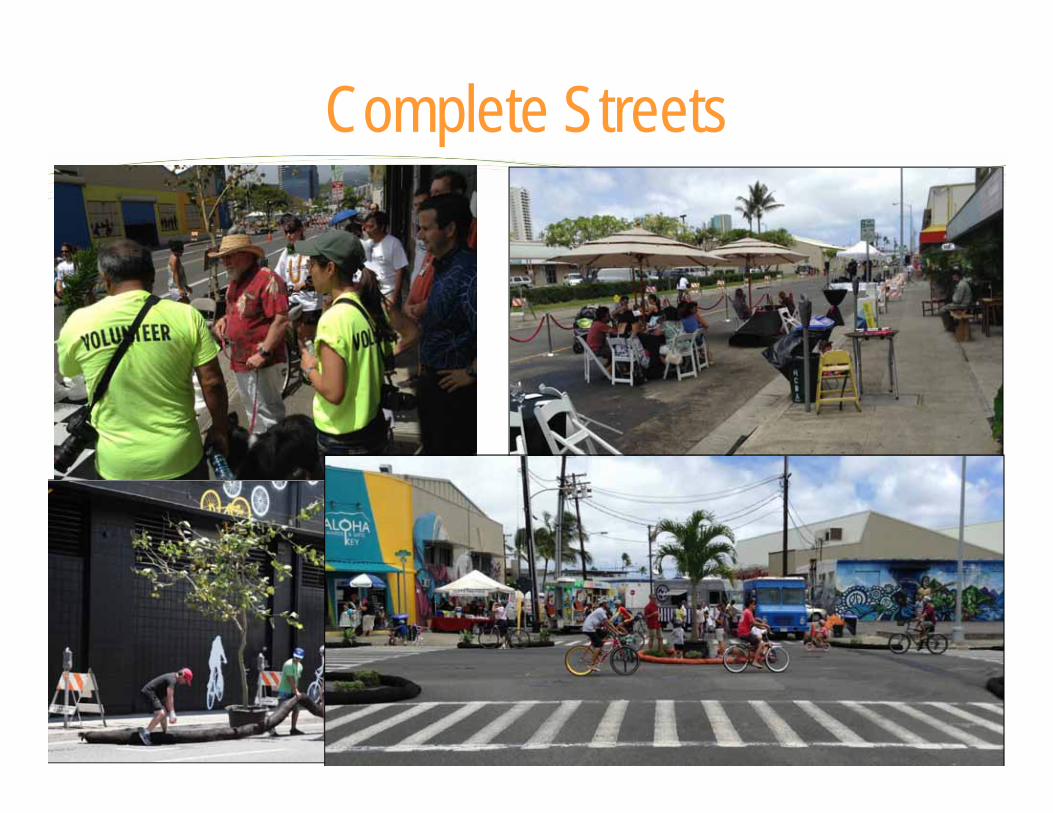
Complete Streets
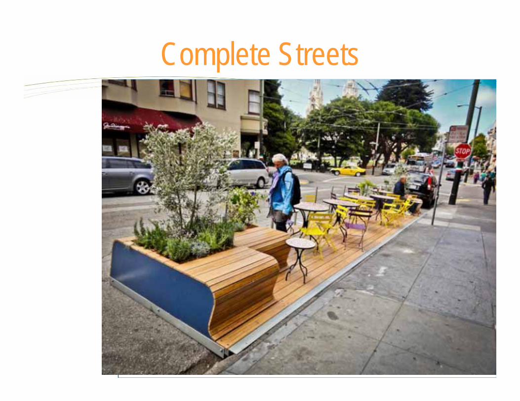
Complete StreetsCreating New Pedestrian Spaces _ Times Square, NYCBefore After
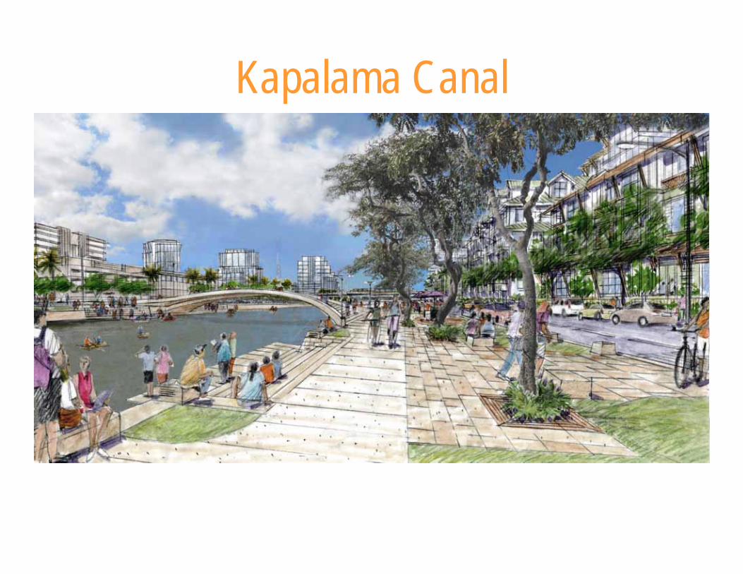
Kapalama Canal
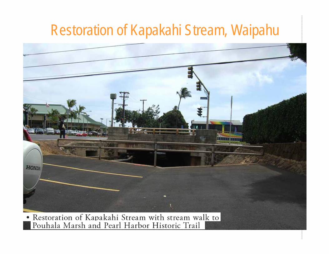
Restoration of Kapakahi Stream, Waipahu
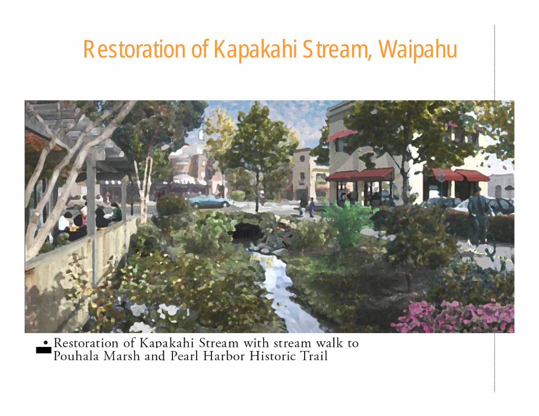
Restoration of Kapakahi Stream, Waipahu
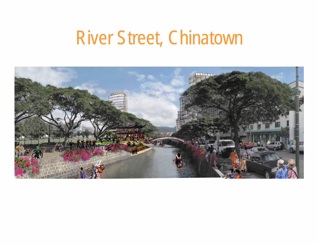
River Street, Chinatown
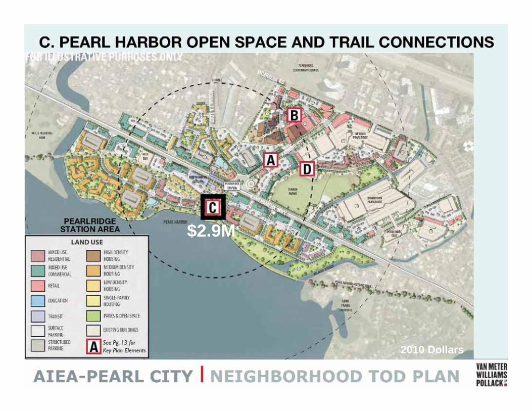
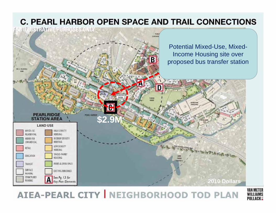
$2.9M
2010 Dollars
$2.9M
2010 Dollars
$2.9M
2010 Dollars
Potential Mixed-Use, Mixed-Income Housing site over
proposed bus transfer station
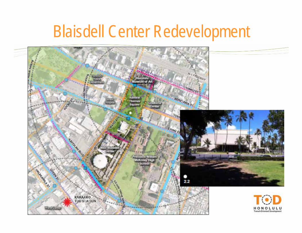
Blaisdell Center Redevelopment
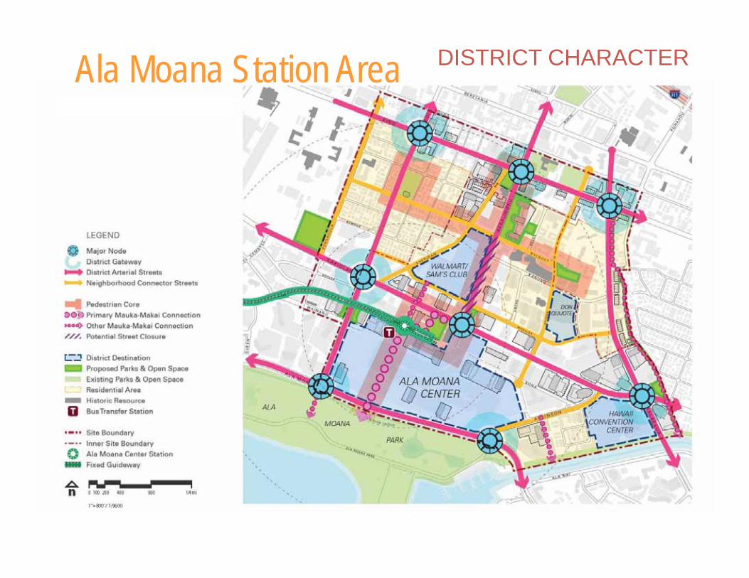
DISTRICT CHARACTER Ala Moana Station Area
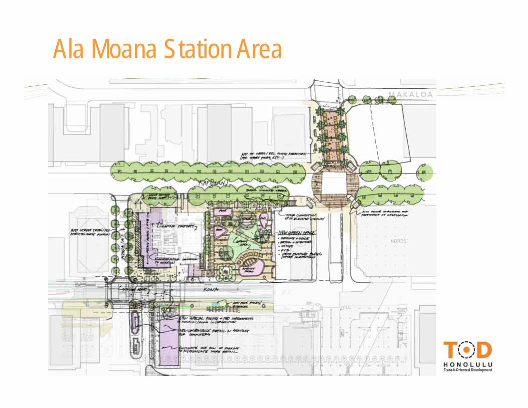
Ala Moana Station Area

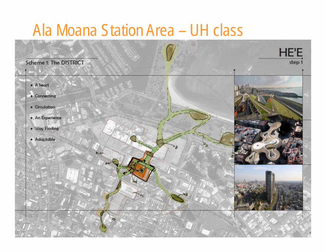
Ala Moana Station Area – UH class
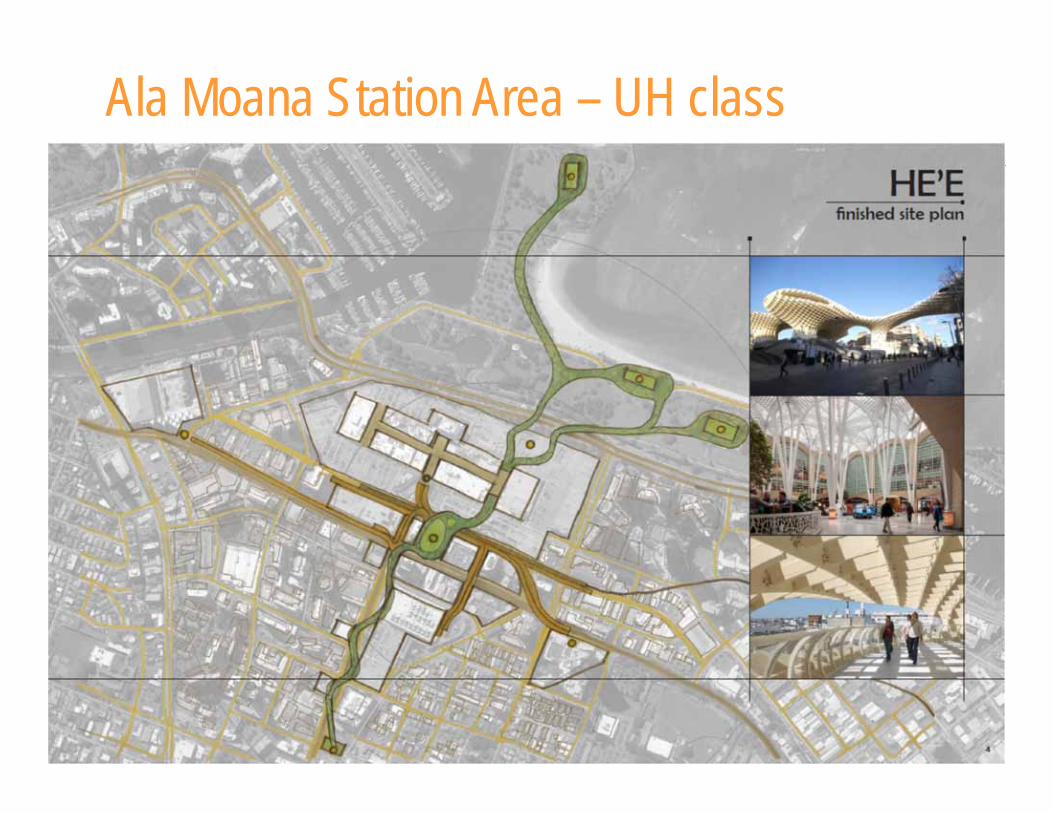
Ala Moana Station Area – UH class
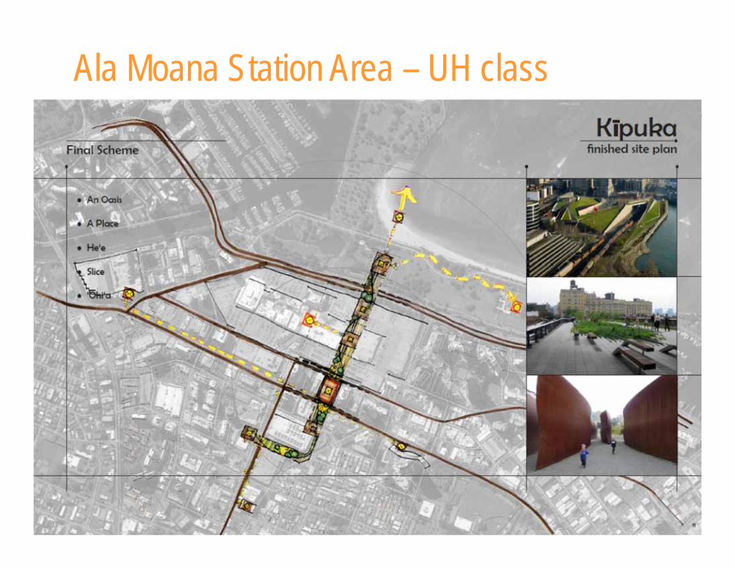
Ala Moana Station Area – UH class
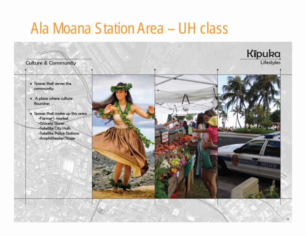
Ala Moana Station Area – UH class
Ala Moana Station Area – UH class
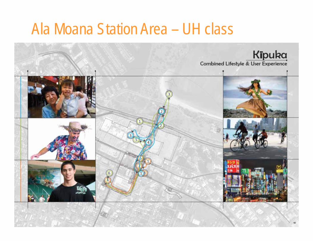
Ala Moana Station Area – UH class
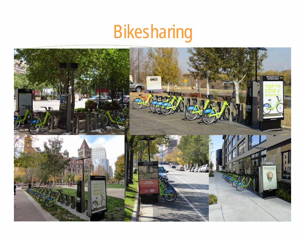
Bikesharing

Upcoming work & next steps
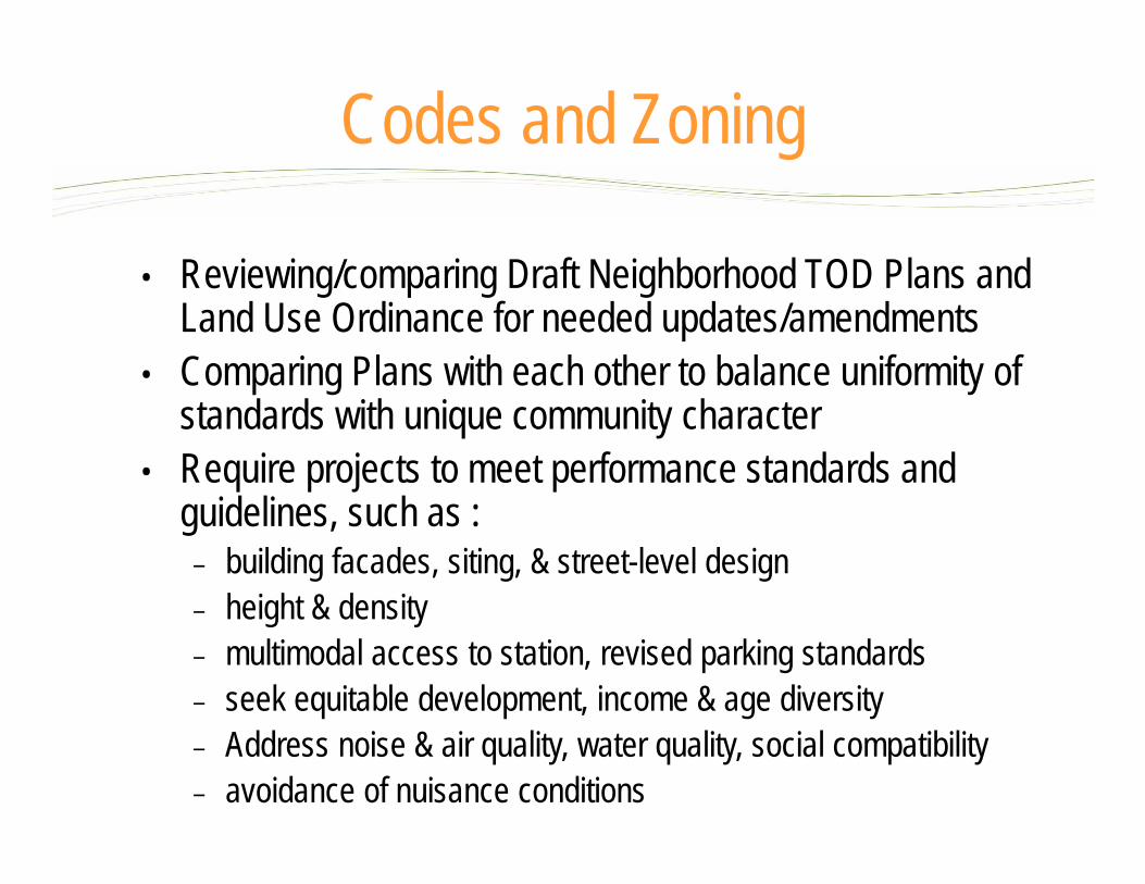
• Reviewing/comparing Draft Neighborhood TOD Plans and Land Use Ordinance for needed updates/amendments
• Comparing Plans with each other to balance uniformity of standards with unique community character
• Require projects to meet performance standards and guidelines, such as :
– building facades, siting, & street-level design – height & density– multimodal access to station, revised parking standards– seek equitable development, income & age diversity– Address noise & air quality, water quality, social compatibility– avoidance of nuisance conditions
Codes and Zoning
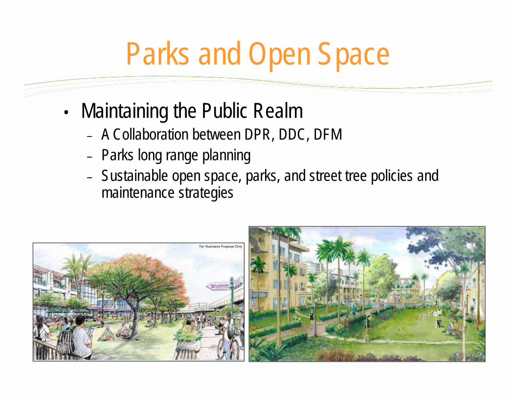
• Maintaining the Public Realm – A Collaboration between DPR, DDC, DFM – Parks long range planning– Sustainable open space, parks, and street tree policies and
maintenance strategies
Parks and Open Space
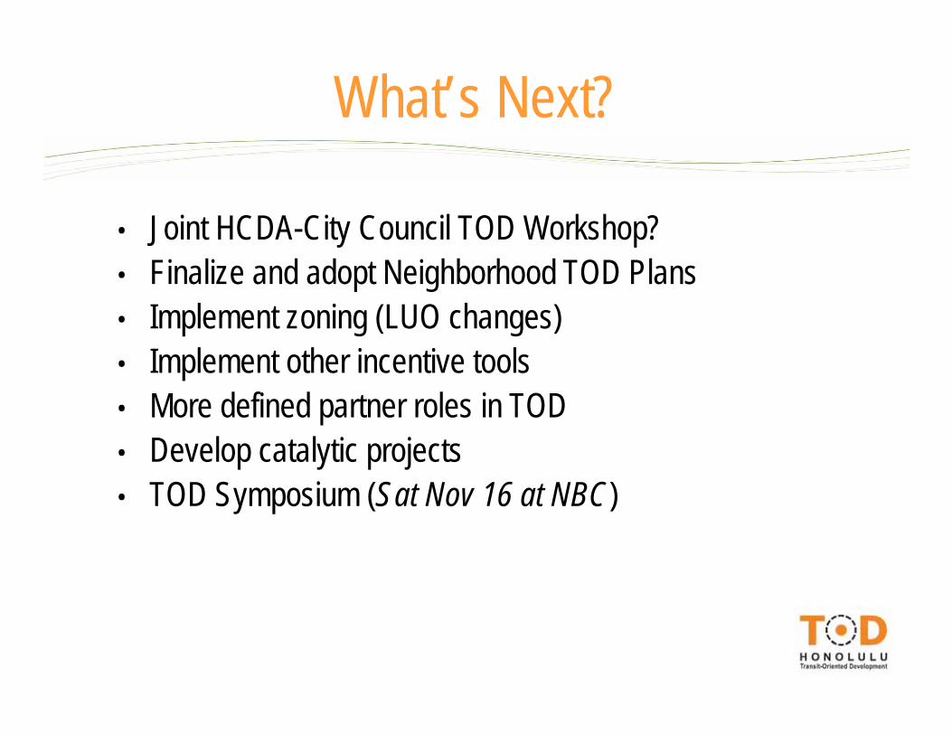
• Joint HCDA-City Council TOD Workshop?• Finalize and adopt Neighborhood TOD Plans• Implement zoning (LUO changes)• Implement other incentive tools• More defined partner roles in TOD• Develop catalytic projects• TOD Symposium (Sat Nov 16 at NBC)
What’s Next?
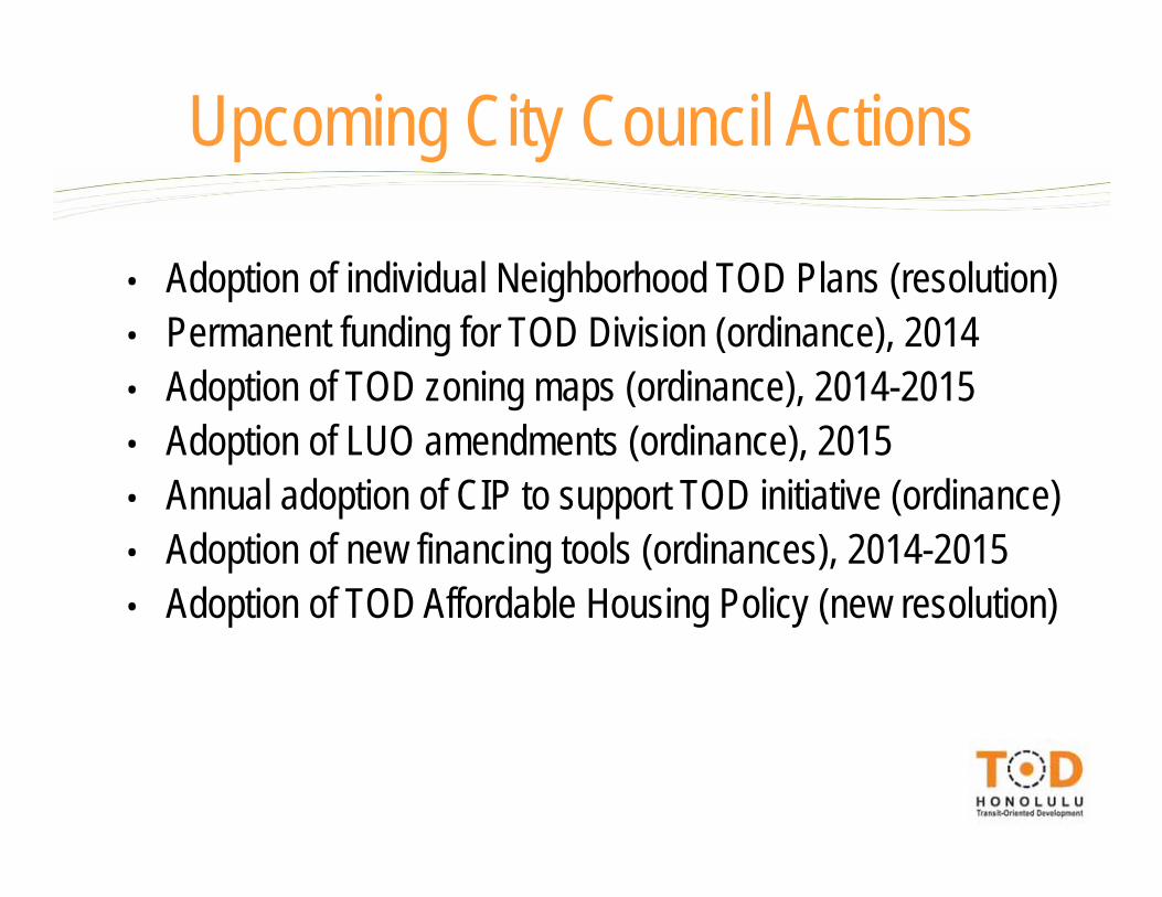
• Adoption of individual Neighborhood TOD Plans (resolution)• Permanent funding for TOD Division (ordinance), 2014• Adoption of TOD zoning maps (ordinance), 2014-2015• Adoption of LUO amendments (ordinance), 2015• Annual adoption of CIP to support TOD initiative (ordinance)• Adoption of new financing tools (ordinances), 2014-2015• Adoption of TOD Affordable Housing Policy (new resolution)
Upcoming City Council Actions

www.todhonolulu.org
Mahalo!