Embed Size (px)
Citation preview

Project Yudhis Minggu ke 2 Nov 2009 - 1
http://www.rumahinspirasi.com
Iklim
Deskripsi
Dalam unit ini kita akan mencari tahu tentang iklim dan apa bedanya dengan cuaca. Aktivitas dalam
unit ini adalah prakarya, percobaan, mencari tahu tentang iklim, ilustrasi iklim, memetakan iklim dan
membedakan iklim.
Tujuan
• Mempelajari Iklim
• Memahami perbedaan Cuaca dan Iklim
• Mempelajari tentang jenis iklim
• Mempelajari perubahan iklim
Iklim adalah kondisi rata-rata cuaca dalam waktu yang panjang. Studi tentang iklim dipelajari dalam
meteorologi. Iklim di bumi sangat dipengaruhi oleh posisi matahari terhadap bumi. Terdapat beberapa
klasifikasi iklim di bumi ini yang ditentukan oleh letak geografis. Secara umum kita dapat
menyebutnya sebagai iklim tropis, lintang menengah dan lintang tinggi. Ilmu yang mempelajari tentang
iklim adalah klimatologi.
Cuaca terdiri dari seluruh fenomena yang terjadi di atmosfer Bumi atau sebuah planet lainnya. Cuaca
biasanya merupakan sebuah aktivitas fenomena ini dalam waktu beberapa hari. Cuaca rata-rata dengan
jangka waktu yang lebih lama dikenal sebagai iklim.

Project Yudhis Minggu ke 2 Nov 2009 - 2
http://www.rumahinspirasi.com
Iklim Wilayah (Regional Climate)
Apa iklim di wilayahmu? Buatlah gambar yang menunjukkan iklim di daerahmu.
Lihat pada peta dan tentukan dimana kamu tinggal. Lalu, carilah artikel tentang iklim di daerahmu.
Setelah membaca, buatlah gambar/grafik yang menunjukkan bagaimana bentuk iklim di tempatmu
pada setiap tahunnya. Termasuk tinggi dan rendahnya temperatur dan curah hujan yang terjadi selama
setahun. Tanyalah pada dirimu sendiri apakah iklim itu kering atah basah, panas atau dingin dan
bagaimana efek iklim tersebut terhadap aktivitasmu.
Iklim di Indonesia hampir seluruhnya adalah tropis. Suhu hangat yang meliputi 81% dari area
Indonesia membuat temperatur tanah menjadi stabil, dengan suhu sekitar 28°C, daerah
pedalaman dan pegunungan sekitar 26°C, dan daerah pegunungan yang lebih tinggi sekitar
23°C.
Temperatur berubah sedikit saja dari musim ke musim, dan Indonesia mengalami sedikit
perubahan jumlah jam di siang hari dari satu musim ke musim yang lain. Perbedaan anntara
hari terpanjang dan hari terpendek dalam setahun hanya 48 menit. Hal ini membuat biji-bijian
dapat tumbuh setiap saat dalam setahun.
Faktor terpenting dari iklim Indonesia bukanlah temperatur atau tekanan udara, tapi curah
hujan. Hal ini menyebabkan kelembaban cukup besar, antara 70-90%. Angin sekedarnya dan
dapat diperkirakan, dengan angin musim hujan yang biasa bertiup dari selatan dan timur di
Bulan Juni sampai September dan dari Utara pada bulan Desember sampai Maret.
Angin puyuh dan badai sekala besar banyak terjadi di perairan Indonesia, yang paling
berbahaya adalah laju arus ombak seperti yang terjadi di selat Lombok dan Sape.(Wikipedia)
Peta Iklim
Misimu adalah membuat peta iklim.
Bedasarkan peta ini buatlah peta iklim Indonesia.

Project Yudhis Minggu ke 2 Nov 2009 - 3
http://www.rumahinspirasi.com
Memperhatikan Iklim (Climate Watch)
Ikuti perkembangan iklim di daerahmu. Catatlah temperatur dan curah hujan di daerahmu setiap hari
pada setiap waktu yang sama. Di akhir bulan, lihatlah catatanmu dengan degan catatan yang ada di
http://www.worldclimate.com/ untuk informasi iklim.
Nb: Projek ini berlangsung 30 hari
Catatan Iklim Jakarta dalam Setahun
Temperatur di Jakarta
Average Maximum Temperature
The monthly mean of the maximum daily temperature.
Jan Feb Mar Apr May Jun Jul Aug Sep Oct Nov Dec Year
°C 30.1 30.3 31.1 32.2 32.3 32.1 32.1 32.4 32.8 33.0 32.2 31.4 31.8
°F 86.2 86.5 88.0 90.0 90.1 89.8 89.8 90.3 91.0 91.4 90.0 88.5 89.2
Source: JAKARTA data derived from GHCN 2 Beta. 191 months between 1960 and 1975
Average Minimum Temperature
The monthly mean of the minimum daily temperature.
Jan Feb Mar Apr May Jun Jul Aug Sep Oct Nov Dec Year
°C 23.4 23.4 23.6 24.0 24.0 23.2 22.8 22.9 23.3 23.7 23.7 23.6 23.5
°F 74.1 74.1 74.5 75.2 75.2 73.8 73.0 73.2 73.9 74.7 74.7 74.5 74.3

Project Yudhis Minggu ke 2 Nov 2009 - 4
http://www.rumahinspirasi.com
Perbedaan Iklim
Bandingkan iklim tempat tinggalmu dengan iklim negara lain.
Pilih sebuah negara, ceritakan secara singkat perbedaan/persamaan iklim dengan iklim negaramu.
Bagaimana kondisi hewan & tanaman yang ada dan yang tidak ada dalam iklim tersebut.
Iklim Kesukaanmu
Pikirkan tentang cuaca. Cuaca apa yang kamu sukai? Dalam iklim apa kamu menemukan cuaca seperti
itu? Di mana kamu mendapatkan iklim itu dan mengapa?
Tulis jawaban dari pertanyaan ini dalam kalimat lengkap dan ceritakan apa yang akan kamu lakukan
jika kamu pindah ke sebuah tempat yang memiliki Iklim yang kamu sukai.
Lalu gambarkan iklim yang kamu sukai tersebut dalam selembar kertas.

Project Yudhis Minggu ke 2 Nov 2009 - 5
http://www.rumahinspirasi.com
Three basic climate groups.
Three major climate groups show the dominance of special combinations of air-mass source regions.
Group I
Low-latitude Climates: These climates are controlled by equatorial a tropical air masses.
• Tropical Moist Climates (Af) rainforest
Rainfall is heavy in all months. The total annual rainfall is
often more than 250 cm. (100 in.). There are seasonal
differences in monthly rainfall but temperatures of 27°C
(80°F) mostly stay the same. Humidity is between 77 and
88%.
High surface heat and humidity cause cumulus clouds to
form early in the afternoons almost every day.
The climate on eastern sides of continents are influenced by maritime tropical air masses.
These air masses flow out from the moist western sides of oceanic high-pressure cells, and
bring lots of summer rainfall. The summers are warm and very humid. It also rains a lot in the
winter
o Average temperature: 18 °C (°F)
o Annual Precipitation: 262 cm. (103 in.)
o Latitude Range: 10° S to 25 ° N
Global Position: Amazon Basin; Congo Basin of equatorial Africa; East Indies, from Sumatra to New
Guinea.
• Wet-Dry Tropical Climates (Aw) savanna
A seasonal change occurs between wet tropical air masses
and dry tropical air masses. As a result, there is a very wet
season and a very dry season. Trade winds dominate
during the dry season. It gets a little cooler during this dry
season but will become very hot just before the wet
season.
o Temperature Range: 16 °C
o Annual Precipitation: 0.25 cm. (0.1 in.).
All months less than 0.25 cm. (0.1 in.)
o Latitude Range: 15 ° to 25 ° N and S
Global Range: India, Indochina, West Africa, southern Africa, South America and the north coast of
Australia
• Dry Tropical Climate (BW) desert biome
These desert climates are found in low-latitude deserts
approximately between 18° to 28° in both hemispheres.
these latitude belts are centered on the tropics of Cancer
and Capricorn, which lie just north and south of the
equator. They coincide with the edge of the equatorial
subtropical high pressure belt and trade winds. Winds are

Project Yudhis Minggu ke 2 Nov 2009 - 6
http://www.rumahinspirasi.com
light, which allows for the evaporation of moisture in the intense heat. They generally flow
downward so the area is seldom penetrated by air masses that produce rain. This makes for a
very dry heat. The dry arid desert is a true desert climate, and covers 12 % of the Earth's land
surface.
o Temperature Range: 16° C
o Annual Precipitation: 0.25 cm (0.1 in). All months less than 0.25 cm (0.1 in).
o Latitude Range: 15° - 25° N and S.
Global Range: southwestern United States and northern Mexico; Argentina; north Africa; south Africa;
central part of Australia.
Group II
Mid-latitude Climates: Climates in this zone are affected by two different air-masses. The tropical air-
masses are moving towards the poles and the polar air-masses are moving towards the equator. These
two air masses are in constant conflict. Either air mass may dominate the area, but neither has exclusive
control.
• Dry Midlatitude Climates (BS) steppe
Characterized by grasslands, this is a semiarid climate. It
can be found between the desert climate (BW) and more
humid climates of the A, C, and D groups. If it received
less rain, the steppe would be classified as an arid desert.
With more rain, it would be classified as a tallgrass
prairie.
This dry climate exists in the interior regions of the North
American and Eurasian continents. Moist ocean air masses are blocked by mountain ranges to
the west and south. These mountain ranges also trap polar air in winter, making winters very
cold. Summers are warm to hot.
o Temperature Range: 24° C (43° F).
o Annual Precipitation: less than 10 cm (4 in) in the driest regions to 50 cm (20 in) in
the moister steppes.
o Latitude Range: 35° - 55° N.
Global Range: Western North America (Great Basin, Columbia Plateau, Great Plains); Eurasian
interior, from steppes of eastern Europe to the Gobi Desert and North China.
• Mediterranean Climate (Cs) chaparral biome
This is a wet-winter, dry-summer climate. Extremely dry
summers are caused by the sinking air of the subtropical
highs and may last for up to five months.
Plants have adapted to the extreme difference in rainfall
and temperature between winter and summer seasons.
Sclerophyll plants range in formations from forests, to
woodland, and scrub. Eucalyptus forests cover most of the
chaparral biome in Australia.
Fires occur frequently in Mediterranean climate zones.
o Temperature Range: 7 °C (12 °F)

Project Yudhis Minggu ke 2 Nov 2009 - 7
http://www.rumahinspirasi.com
o Annual Precipitation: 42 cm (17 in).
o Latitude Range: 30° - 50° N and S
Global Position: central and southern California; coastal zones bordering the Mediterranean Sea;
coastal Western Australia and South Australia; Chilean coast; Cape Town region of South Africa.
• Dry Midlatitude Climates (Bs) grasslands biome
These dry climates are limited to the interiors of North
America and Eurasia.
Ocean air masses are blocked by mountain ranges to the
west and south. This allows polar air masses to dominate
in winter months. In the summer, a local continental air
mass is dominant. A small amount of rain falls during this
season.
Annual temperatures range widely. Summers are warm to hot, but winters are cold.
o Temperature Range: 31 °C (56°F).
o Annual Precipitation: 81 cm. (32 in.).
o Latitude Range: 30° - 55° N and S
Global Position: western North America (Great Basin, Columbia Plateau, Great Plains); Eurasian
interior.
• Moist Continental Climate (Cf) Deciduous Forest biome
This climate is in the polar front zone - the battleground of
polar and tropical air masses. Seasonal changes between
summer and winter are very large. Daily temperatures also
change often. Abundant precipitation falls throughout the
year. It is increased in the summer season by invading
tropical air masses. Cold winters are caused by polar and
arctic masses moving south.
o Temperature Range: 31 °C (56 ° F)
o Average Annual Precipitation: 81 cm (32 in).
o Latitude Range: 30° - 55° N and S (Europe: 45° - 60° N).
Global Position: eastern parts of the United States and southern Canada; northern China; Korea; Japan;
central and eastern Europe.
Group III
High-latitude climates: Polar and arctic air masses dominate these regions. Canada and Siberia are
two air-mass sources which fall into this group. A southern hemisphere counterpart to these continental
centers does not exist. Air masses of arctic origin meet polar continental air masses along the 60th and
70th parallels.
• Boreal forest Climate ( Dfc) taiga biome
This is a continental climate with long, very cold winters,
and short, cool summers. This climate is found in the
polar air mass region. Very cold air masses from the arctic
often move in. The temperature range is larger than any

Project Yudhis Minggu ke 2 Nov 2009 - 8
http://www.rumahinspirasi.com
other climate. Precipitation increases during summer months, although annual precipitation is
still small.
Much of the boreal forest climate is considered humid. However, large areas in western
Canada and Siberia receive very little precipitation and fall into the subhumid or semiarid
climate type.
o Temperature Range: 41 °C (74 °F), lows; -25 °C (-14 °F), highs; 16 °C (60 °F).
o Average Annual Precipitation: 31 cm (12 in).
o Latitude Range: 50° - 70° N and S.
o Global Position: central and western Alaska; Canada, from the Yukon Territory to
Labrador; Eurasia, from northern Europe across all of Siberia to the Pacific Ocean.
• Tundra Climate (E) tundra biome
The tundra climate is found along arctic coastal areas.
Polar and arctic air masses dominate the tundra climate.
The winter season is long and severe. A short, mild
season exists, but not a true summer season. Moderating
ocean winds keep the temperatures from being as severe
as interior regions.
o Temperature Range: -22 °C to 6 °C (-
10 °F to 41 °F).
o Average Annual Precipitation: 20 cm (8 in).
o Latitude Range: 60° - 75° N.
o Global Position: arctic zone of North America; Hudson Bay region; Greenland coast;
northern Siberia bordering the Arctic Ocean.
• Highland Climate (H) Alpine Biome
Highland climates are cool to cold, found in mountains and
high plateaus. Climates change rapidly on mountains,
becoming colder the higher the altitude gets. The climate of
a highland area is closely related to the climate of the
surrounding biome. The highlands have the same seasons
and wet and dry periods as the biome they are in.
Mountain climates are very important to midlatitude
biomes. They work as water storage areas. Snow is kept back until spring and summer when it
is released slowly as water through melting.
o Temperature Range: -18 °C to 10 °C (-2 °F to 50°F)
o Average Annual Precipitation: 23 cm (9 in.)
o Latitude Range: found all over the world
Global Position: Rocky Mountain Range in North America, the Andean mountain range in South
America, the Alps in Europe, Mt. Kilimanjaro in Africa, the Himalayans in Tibet, Mt. Fuji in Japan.

Project Yudhis Minggu ke 2 Nov 2009 - 9
http://www.rumahinspirasi.com
MAKE A RAINBOW
MATERIALS:
• glass of water
• sheet of white paper
• the sun
PROCESS:
Fill the glass all the way to the top with water.
Put the glass of water on a table so that it is half on the table and half off of the table.
Be careful that the glass doesn't fall.
Then, make sure that the sun can shine through the glass of water.
After you do that, place the white sheet of paper on the floor.
Adjust the piece of white paper and the glass of water until a rainbow forms on the
paper.
EXPLANATION:
Why does this happen? Light is made up of a lot of colors. Specifically, the colors are
red, orange, yellow, green, blue, indigo and violet. When light passes through the
water, it is broken up into the colors seen in a rainbow.

Project Yudhis Minggu ke 2 Nov 2009 - 10
http://www.rumahinspirasi.com
WHAT'S IN THE WIND
MATERIALS:
• a few plastic lids
• petroleum jelly
• magnifying glass
• paper punch
• yarn
• windy day
PROCESS:
Punch a hole at one end of each lid.
Thread each hole with a length of yarn and knot the ends of the yarn together to form
a loop for hanging.
Spread petroleum jelly over one side of each lid.
Take the lids outdoors on a windy day and hang them in various areas.
Leave them outside for about an hour or two to collect what may be blowing in the
wind.
Retrieve the lids and see what they have collected.
EXPLANATION:
Some of the items that may have been collected include insects, dirt, seeds and leaves.
Use the magnifying glass for further observation.

Project Yudhis Minggu ke 2 Nov 2009 - 11
http://www.rumahinspirasi.com
MAKE AN ANEMOMETER
MATERIALS:
• 5 three ounce paper Dixie Cups
• 2 soda straws
• pin
• paper punch
• scissors
• stapler
• sharp pencil with an eraser
PROCESS:
1. Take four of the Dixie Cups and use the paper punch to punch one hole in each, about a half
inch below the rim.
2. Take the fifth cup and punch four equally spaced holes about a quarter inch below the rim.
Then punch a hole in the center of the bottom of the cup.
3. Take one of the four cups and push a soda straw through the hole. Fold the end of the straw
and staple it to the side of the cup across from the hole. Repeat this procedure for another one-
hole cup and the second straw.
4. Slide one cup and straw assembly through two opposite holes in the cup with four holes. Push
another one-hole cup onto the end of the straw just pushed through the four-hole cup.
5. Bend the straw and staple it to the one-hole cup, making certain that the cup faces the opposite
direction from the first cup. Repeat this procedure using the other cup and straw assembly and
the remaining one-hole cup.
6. Align the four cups so that their open ends face in the same direction either clockwise or
counter-clockwise around the center cup.
7. Push the straight pin through the two straws where they intersect.
8. Push the eraser end of the pencil through the bottom hole in the center cup. Push the pin into
the end of the pencil eraser as far as it will go.
9. Now your anemometer is ready for use!
EXPLANATION:
An anemometer is useful because it rotates with the wind. To calculate the velocity at which your
anemometer spins, determine the number of revolutions per minute (RPM). Next, calculate the
circumference (in feet) of the circle made by the rotating paper cups. Multiply your RPM value by the
circumference of the circle and you will have an approximation of the velocity of at which your
anemometer spins (in feet per minute). Your anemometer doesn't need to be pointed in the wind for
use.
Note: Some forces are being ignored including drag and friction for this elementary illustration, so the
velocity at which your anemometer spins is not the same as wind speed.
Ps. An anemometer is a device for measuring the wind speed
Project Yudhis Minggu ke 2 Nov 2009 - 12
http://www.rumahinspirasi.com
Resource:
http://en.wikipedia.org/wiki/Climate_of_Indonesia
http://www.worldclimate.com/cgi-bin/data.pl?ref=S06E106+1200+0003001G2
http://www.facebook.com/pages/Bogor-Indonesia/Indonesian-Climate-Student-
Forum/49372716081?ref=mf
http://www.nationalgeographic.com/xpeditions/activities/08/climates.html
http://www.weatherwizkids.com/
http://www.weatherwizkids.com/weather-experiments.htm
http://www.blueplanetbiomes.org/climate.htm
http://www.uwsp.edu/gEo/faculty/ritter/geog101/textbook/climate_systems/climate_cl
assification.html
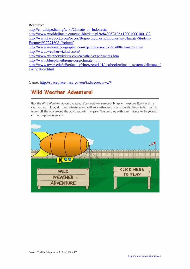
Game: http://spaceplace.nasa.gov/en/kids/goes/wwa/#

Project Yudhis Minggu ke 2 Nov 2009 - 13
http://www.rumahinspirasi.com