Embed Size (px)
Citation preview

Andreas MeyerSafety Management OfficerIntegrated Aviation Analysis Section / ANB
ICAO Big Data Project
ADS‐B Data as a source for analytical solutions of traffic behaviour in airspace
Bogota, 6 September 2016

Management
Big Data process
Analytical Reports Measures
manipulationvisualization
interpretationassessment
AnalysisCollection
Quantitative / QualitativeQuantitative

Code of Conduct (A‐Res 37‐1)GASP - Appendix 3: Code of Conduct on the Sharing and Use of Safety Information– 5.1. b) ensure that shared safety information is
used in an appropriate, fair and consistent manner, solely to improve aviation safety and not for inappropriate purposes, including for the purpose of gaining economic advantage;
ADS‐B Data Summaryhe availability of automatic dependent surveillance broadcast ADS-B) data presents a useful source for analytical efforts on fective and efficient airspace and navigation procedure usage. The sufficient availability of such data depends in-part, on a twork of ground based receivers. Presently most States in the SAM do not have adequate coverage of these receivers for eaningful analysis. This presentation provides an overview on echnical requirements for this type of analysis and illustrates possible solutions for States, once appropriate coverage is
established.

ADS‐B DataADS-B is a system intended to broadcast the precise ocation of the aircraft via a digital link to other aircraft and air traffic control without the need for secondary radar. The system involves a GPS equipped aircraft whose position can be determined through cross-
lidation of multiple on-board sources, and is capable of transmitting that position through a suitable ADS-B
transmitter to a ground station (in the future, satellite-based receivers are perceived).

ADS‐B Datae broadcast consists of information tinually transmitted for monitoring
appropriately equipped aircraft or und stations and is: automatic quires no pilot inputs or external rrogation); dependent (influenced
the accurate position and velocity a from the aircraft’s navigation tem – e.g. GPS); and offers veillance capability. ADS-B data is adcasted every half-second on a
90 MHz datalink and may include:
• flight identification (flight number call sign or call sign);
• ICAO 24‐bit aircraft address (globally unique airframe code);
• position (latitude/longitude);• position integrity/accuracy (GPS horizontal
protection limit);• barometric and geometric altitudes;• vertical rate (rate of climb/descent);• track angle and ground speed (velocity);• emergency indication (when emergency code
selected); and• special position identification (when IDENT
selected).
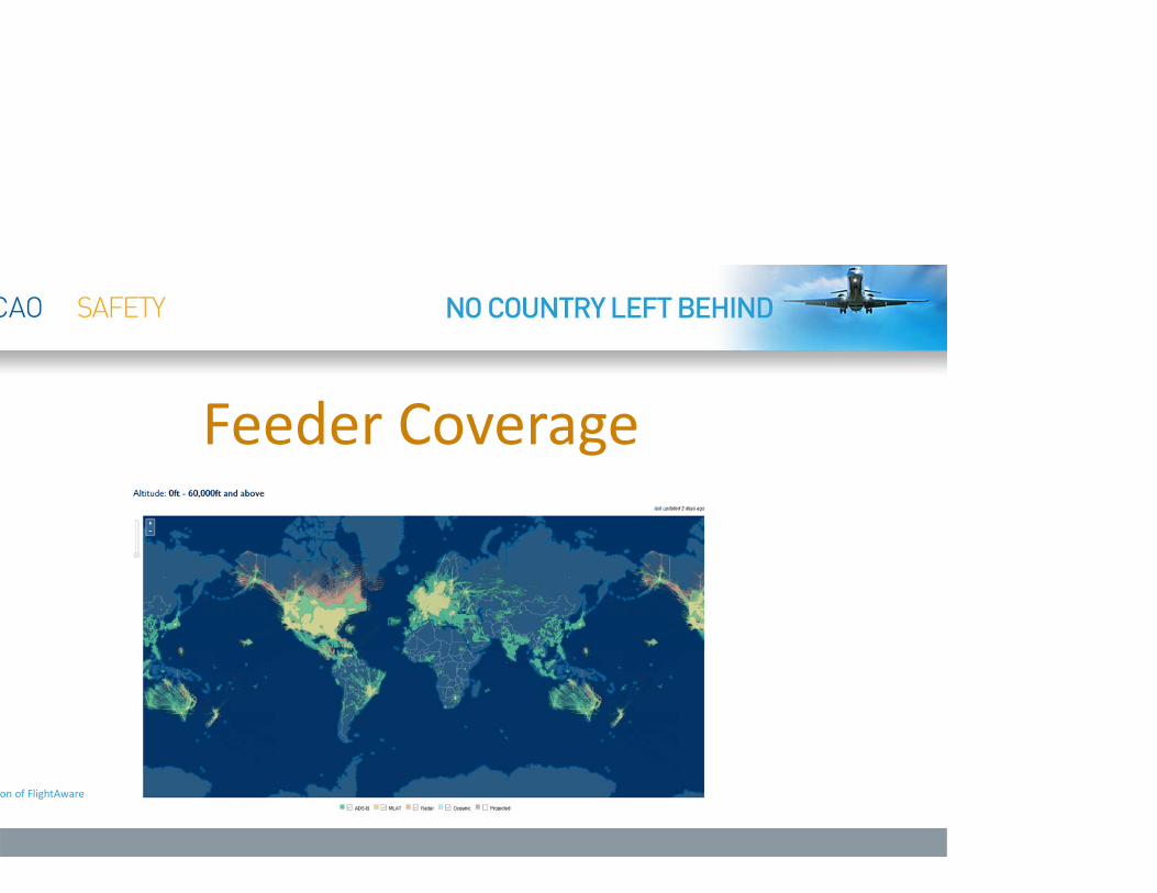
Feeder Coverage
on of FlightAware

Feeder location characteristicsAverage site covers approx.– 50nm up to 5,000ft AGL– 100nm above 10,000ft AGL– 300nm for 20,000 to 40,000ft AGL
Low altitude full coverage requires a grid of 50nmHigh altitude full coverage requires a grid of 150nmSurface coverage requires on site antenna(s)

Coverage vs. Non‐Coverage

Feeder Location
on of FlightAware
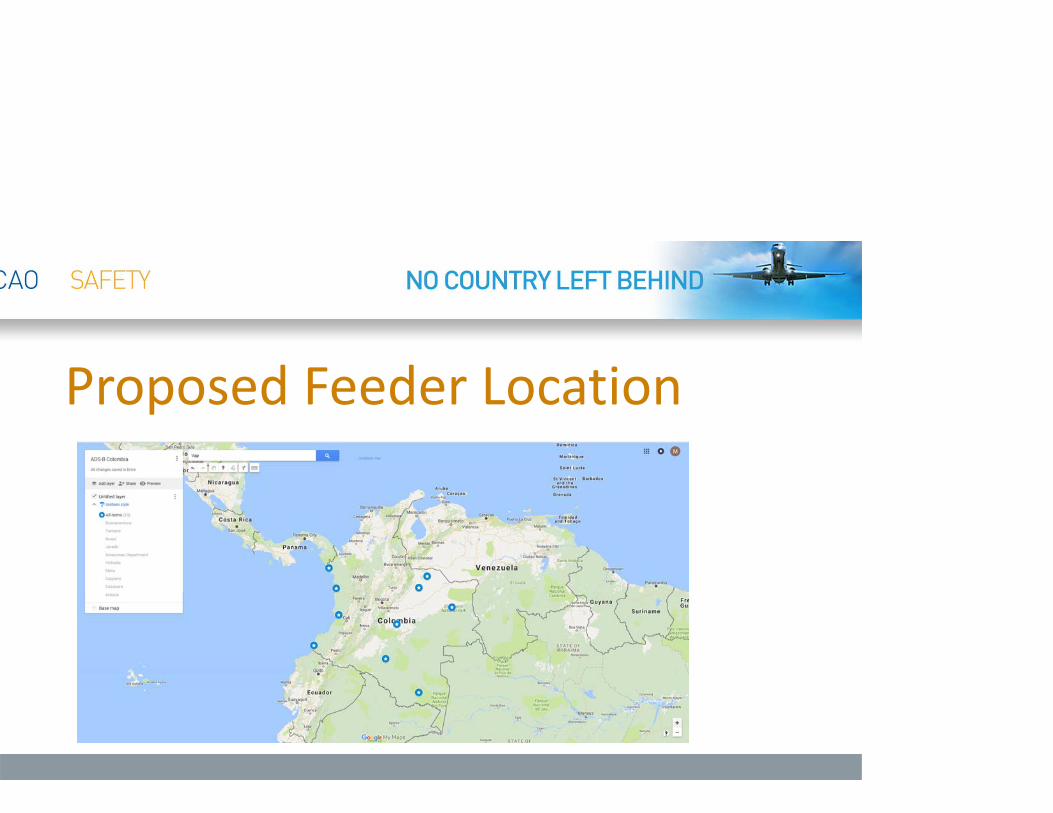
Proposed Feeder Location

Analytical Solutionseral Information
– Number of international airports– Size of Airspace– Number of annual departures– Number of national carriers– Number and details to air traffic
connections
pace– Number of daily overflights– Number of daily inbound flights– Number of daily outbound flights– Number of daily domestic flights– Average airspace density (below
28,000ft and above 28,000ft)– Number of daily active NOTAMS– Daily total of track miles flown within FIR
Airport– Number of flights crossing procedural
waypoints for each airport– Percentage of daily tailwind landings– Percentage of daily bad visibility– Percentage of daily precipitation– Percentage of daily wind conditions– Percentage of daily freezing conditions– Percentage of daily adverse weather
phenomena– Number of daily departures– Number of daily active NOTAMs– Average touch down point of landing
traffic for every runway– (Ground Surface Movements)

Procedures Overlay Solution• Qualified visualization• Exact paths• Any available
procedure• Terminal and Enroute
airspace• Quantified analysis of
rate and numbers for each available procedure
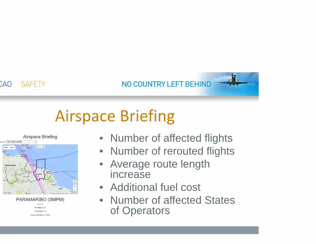
Airspace Briefing• Number of affected flights• Number of rerouted flights• Average route length
increase• Additional fuel cost• Number of affected States
of Operators

RequirementsPromote the installation of ADS-B receivers (at no cost)Promote the cooperation of ANSP to provide radar data in exchange for ADS-B infrastructureProvide secure locations for the ADS-B receiver installationReadiness to share collected dataHave a specific goal

ADS‐B Project PlanExpression of interest to the ROCountry coverage analysis and proposed feeder sitesAgreement on scope of projectMoU (Working agreement)Installation of additional feeder site (at no cost)Let’s GO

Andreas Meyer1 514 954 8219 x [email protected]