Embed Size (px)
Citation preview

Pori 1/250 virtaama
0
200
400
600
800
1000
1200
1400
1 2 3 4 5 6 7 8 9 10 11 12 13 14 15 16 17 18 19 20 21 22 23 24 25 26 27 28 29
Vuorokausi
Vir
taam
a (m
3/s
)
Ka 1/250 1971-2000 Ka 1/250 2020-2049

Hydraulic simulations
• Model used– HEC-RAS 4.0b– 1D model
• Boundary conditions– Upper: Discharge hydrograph– Lower: Constant sea levels [N60+ 0.50…2.50 m]
• Water elevations to Excel (numeric results) and ArcGIS (graphic results)– Output interval: 12 hours (enough?)

Maximum difference: 0.12 m.
1.5
1.6
1.7
1.8
1.9
2
2.1
2.2
2.3
2.4
2.5
2.6
2.7
1.5 1.6 1.7 1.8 1.9 2.0 2.1 2.2 2.3 2.4 2.5 2.6 2.7
W Raumanjuovan haara [N60+m]
W L
uo
tsin
mäe
n h
aara
[N
60+
m]
Raumanjuopa
Luotsimäenhaara

1.50
2.00
2.50
3.00
3.50
0 5 10 15 20 25
Paalu
Ved
enko
rkeu
s [N
60+
m]
Q1243m³/s, yksinkertaistettu Q1243m³/s, mallinnettu Q1104m³/s, yksinkertaistettu Q1104m³/s, mallinnettu
Q950m³/s, yksinkertaistettu Q950m³/s, mallinnettu Q950m³/s, yksinkertaistettu Q707m³/s, mallinnettu
Q656m³/s, yksinkertaistettu Q656m³/s, mallinnettu
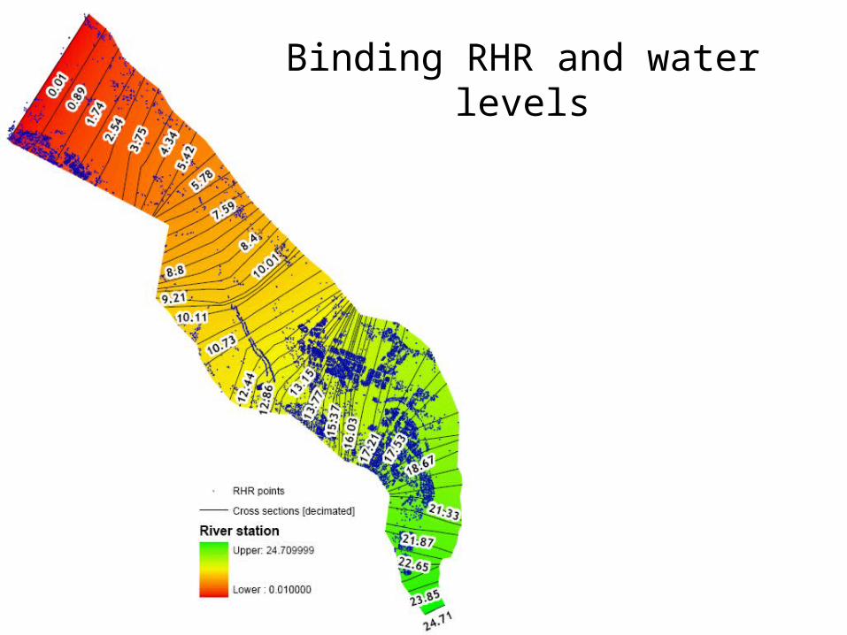
Binding RHR and water levels

0 500 1000 1500 2000 2500 3000 3500 4000
-6
-4
-2
0
2
4
6
8
10
12
Pori_TOLERATE Plan: TOLERATE_uns3/3_20-49_1.5m 7/20/2007
Station (m)
Ele
vatio
n (m
)
Legend
WS Max WS
Ground
Ineff
Bank Sta
.04 .02 .04

Flood mapping process

Initial conditions [650 m³/s, 1.50 m] Maximum water level [1243 m³/s, 1.50 m]

Suggestion for output of results• Simulations for discharge-sea level –scenarios
• HQ 250, 100, 50, 30
• N60+ 0.5, 1.0, 1.5, 2.0 m
• Water levels in main reach cross sections in every 12 hours
• Top levels of embankments included in the results
Comments, suggestions? Shall I calculate the rest of the scenariosand deliver the results to VATT?