Embed Size (px)
Citation preview
Hurricane Andrew:A Look Back at the Last Category 5
Hurricane to Strike the U.S.
Daniel Brown National Hurricane Center
Florida Governor’s Hurricane Conference18 May 2017
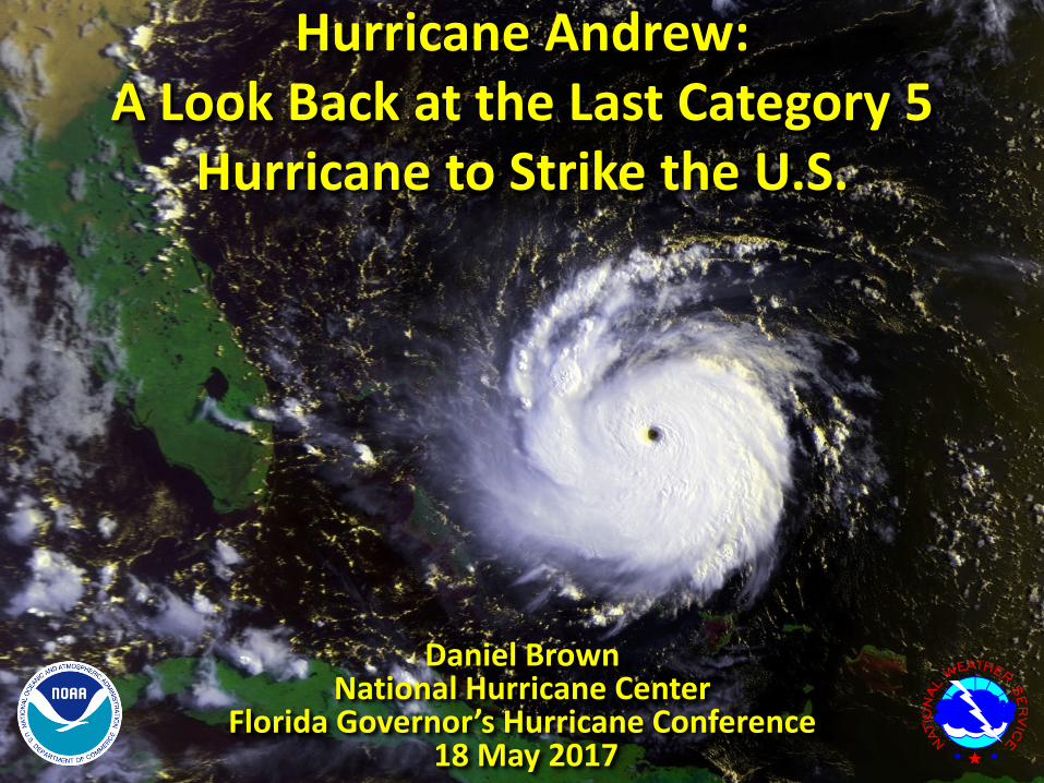
Tropical wave moved off the coast of Africa on 14 August

Tropical wave moved off the coast of Africa on 14 August
First NHC Advisory issued on Tropical Depression Three at
11 PM Sunday August 16

Depression becomes Tropical Storm Andrew at 11 AM Monday August 17

Andrew strengthens to a 50 mph tropical storm by 11 PM Monday August 17

Andrew interacts with an upper-level low which causes weakening on
Thursday August 20

Next day (21 August) Andrew moves away from the upper-low and strengthening begins

Rapid strengthening begins and Andrew becomes a
hurricane early on Saturday August 22
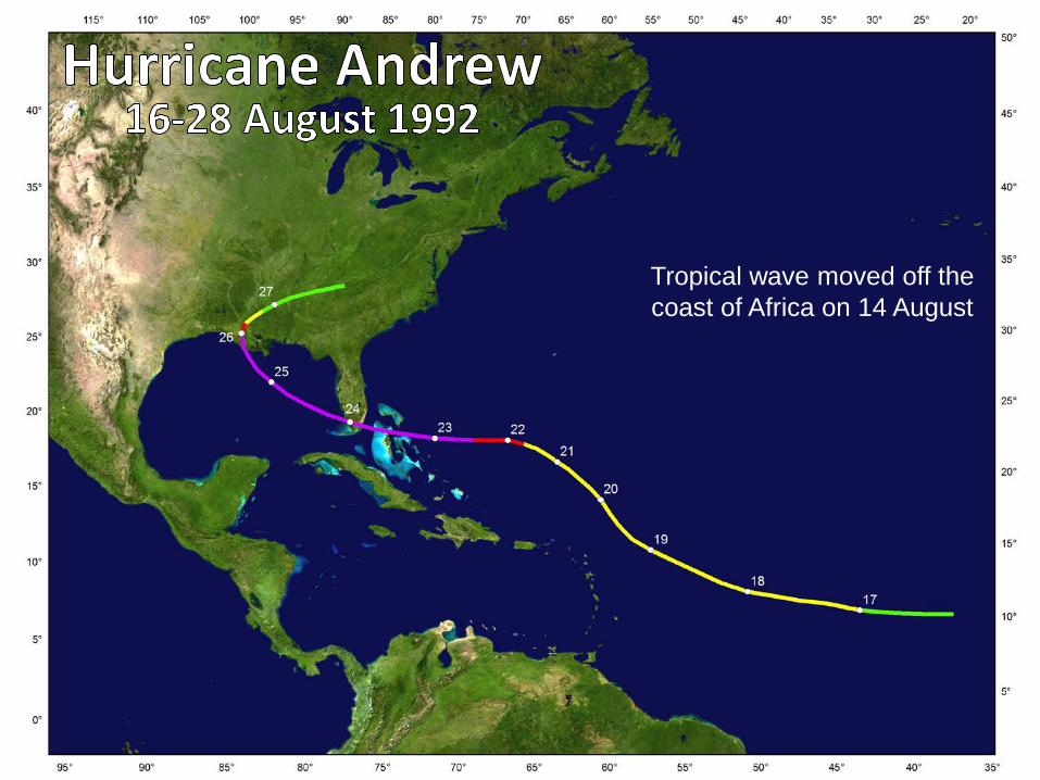
Hurricane Watch issued for the east coast of Florida at
5 PM Saturday August 22

Andrew becomes a major hurricane late on 22 August and a Hurricane Warning is issued for
the east coast of Florida 8 AM Sunday August 23
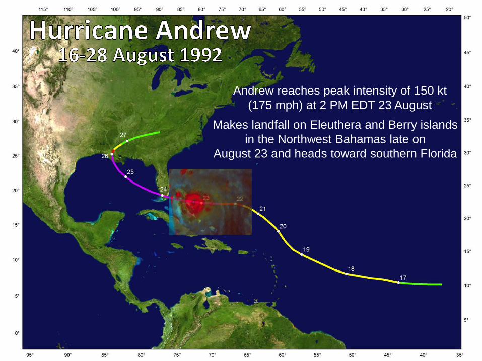
Andrew reaches peak intensity of 150 kt(175 mph) at 2 PM EDT 23 August
Makes landfall on Eleuthera and Berry islands in the Northwest Bahamas late on
August 23 and heads toward southern Florida

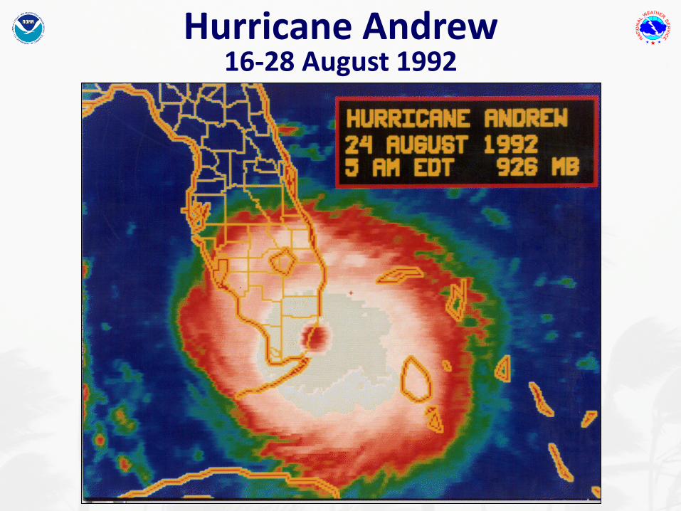
Andrew makes landfall as a category 5 (165 mph) hurricane on Elliott Key in
southern Miami-Dade County just before 5 AM EDT Monday August 24
Hurricane Andrew 16-28 August 1992
Hurricane Andrew 16-28 August 1992
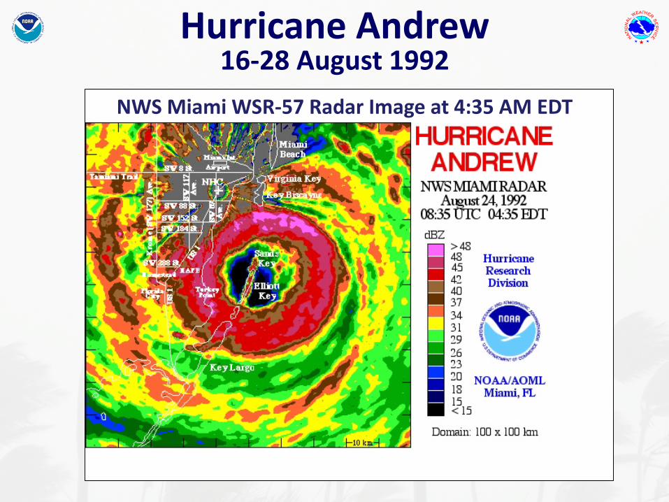
NWS Miami WSR-57 Radar Image at 4:35 AM EDT

Courtesy of B. McNoldy (UM/RSMAS)
NWS Melbourne, Florida WSR-88D Weather Radar Loop of Andrew’s Passage Across South Florida
Hurricane Andrew 16-28 August 1992
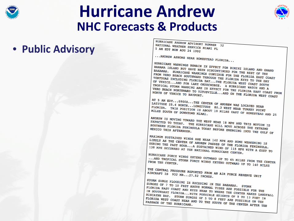
Hurricane Andrew NHC Forecasts & Products
• Public Advisory

Hurricane Andrew NHC Forecasts & Products
• Public Advisory• Marine (Forecast) Advisory
Hurricane Andrew NHC Forecasts & Products
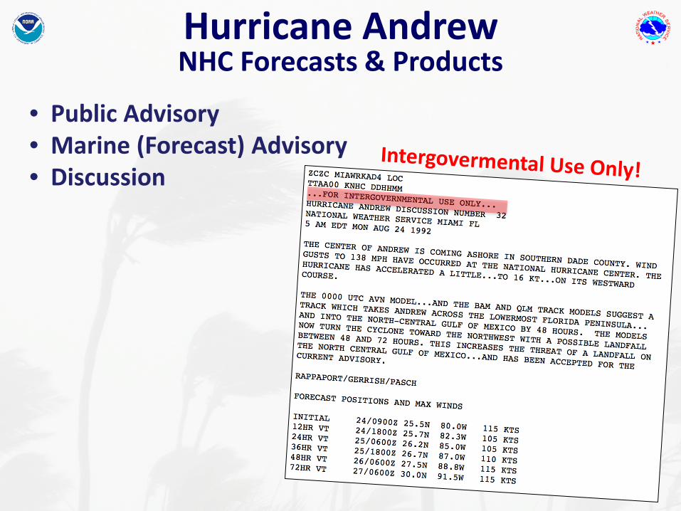
• Public Advisory• Marine (Forecast) Advisory• Discussion
Hurricane Andrew NHC Forecasts & Products
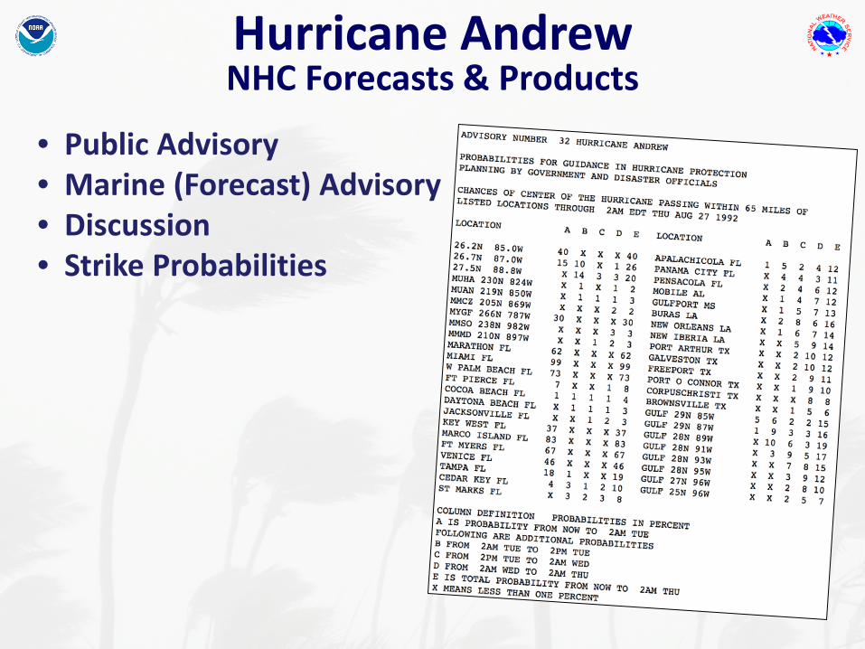
• Public Advisory• Marine (Forecast) Advisory• Discussion• Strike Probabilities

Hurricane Andrew NHC Forecasts & Products
• Public Advisory• Marine (Forecast) Advisory• Discussion• Strike Probabilities

Hurricane Andrew Today’s NHC Products
NHC WebsiteDeveloped in the mid 1990s

Hurricane Andrew Today’s NHC Products
Graphical Tropical Weather OutlookIntroduced in 2007 – Time Period Extended to 5 days in 2013

Hurricane Andrew Today’s NHC Products
Cone Graphic Introduced in 2001 - Forecasts extended to 5-days in 2003
Hurricane Andrew Today’s NHC Products
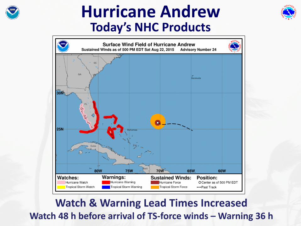
Watch & Warning Lead Times IncreasedWatch 48 h before arrival of TS-force winds – Warning 36 h
Hurricane Andrew Today’s NHC Products
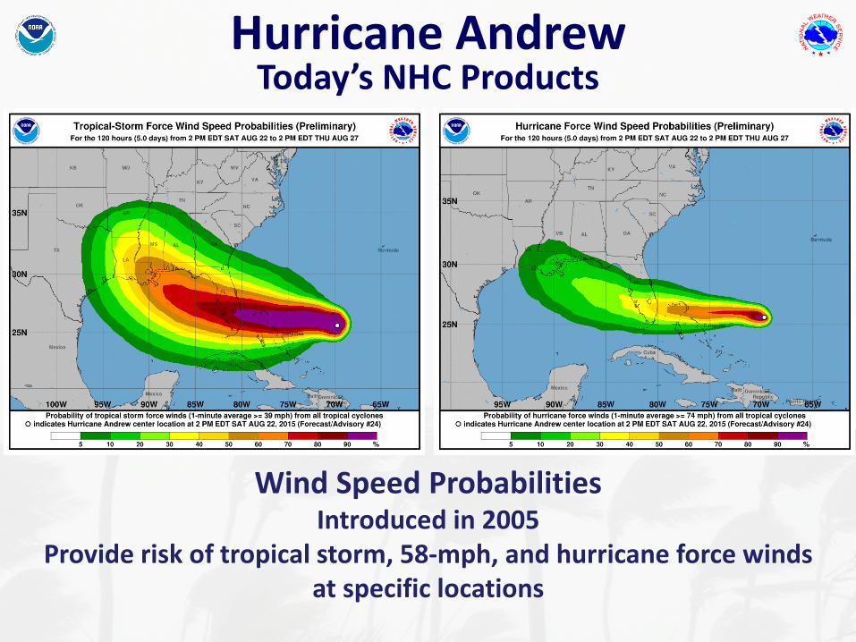
Wind Speed ProbabilitiesIntroduced in 2005
Provide risk of tropical storm, 58-mph, and hurricane force winds at specific locations

Hurricane Andrew Today’s NHC Products
Time of Arrival GraphicExperimental product debuting in 2017
Provides earliest reasonable and most-likely time of arrival of TS-force winds
Hurricane Andrew Today’s NHC Products
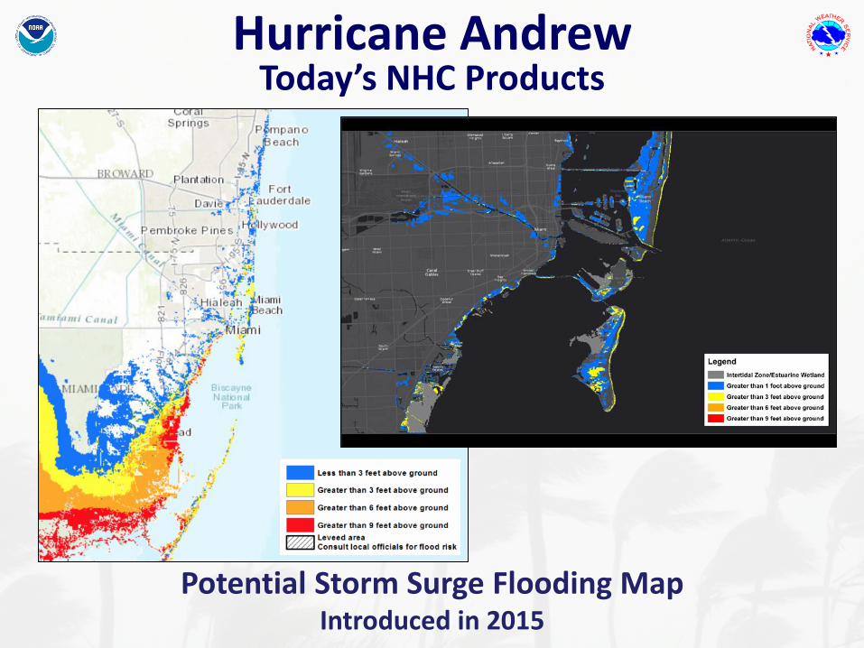
Potential Storm Surge Flooding Map Introduced in 2015

Hurricane Andrew Today’s NHC Products
Storm Surge Watch/WarningPrototype graphic introduced in 2016 – becoming operational in 2017
Storm Surge Watch/Warning Graphic
Hurricane AndrewAdvisory 24 Issued 5:00 PM Sat Aug 22
Storm Surge Warning
Storm Surge Watch

Hurricane Andrew Today’s NHC Products
Social MediaNHC joined Facebook and Twitter in 2011
Key Messages started in 2015
Extremely dangerous Hurricane #Andrew headed for the Bahamas and Florida. Hurricane Warning issued for southeastern Florida.

Improvements in Track Forecasting Since 1992
Average 3-day NHC Track Error
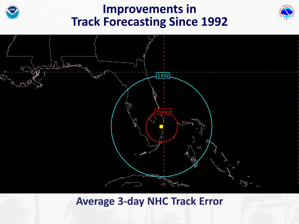
Improvements in Track Forecasting Since 1992
Average 3-day NHC Track Error

Improvements in Track Forecasting Since 1992
Average 2-day NHC Track Error

Improvements in Track Forecasting Since 1992
Average 1-day NHC Track Errors

Improvements in Track Forecasting Since 1992
Average 1-day NHC Track Errors
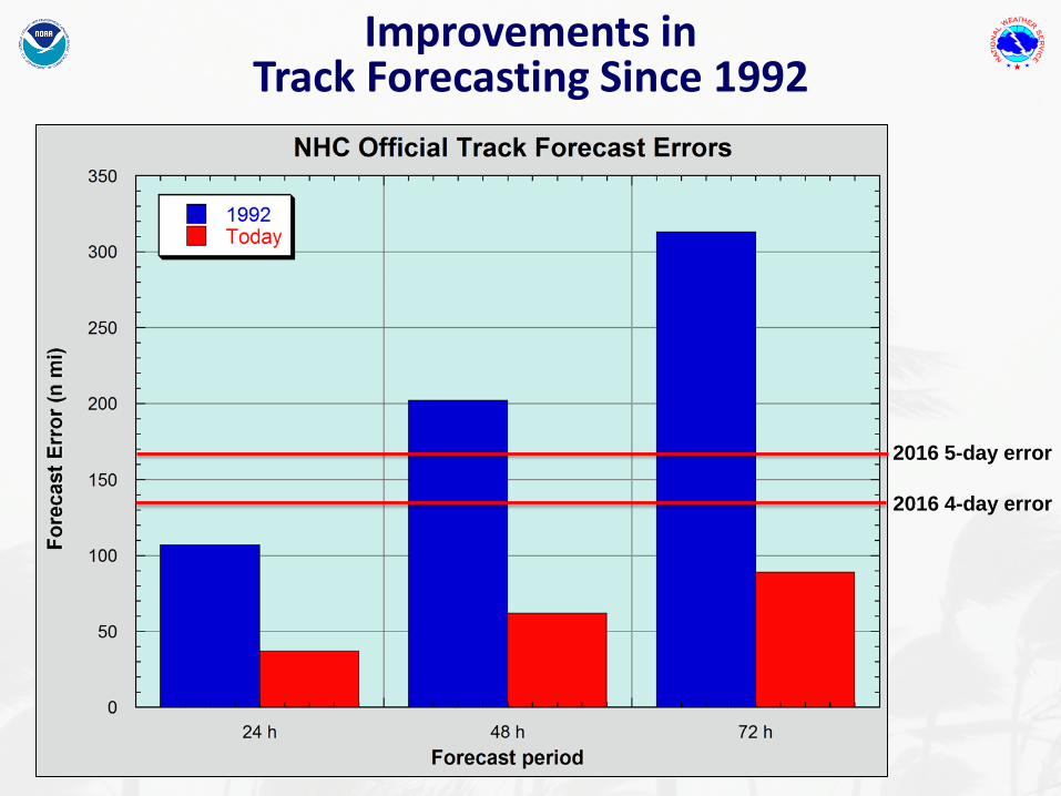
Current 3-day average NHC track error is smaller than the 1-day track error in 1992
Improvements in Track Forecasting Since 1992
Average 1-day NHC Track Errors
2016 4-day error
2016 5-day error
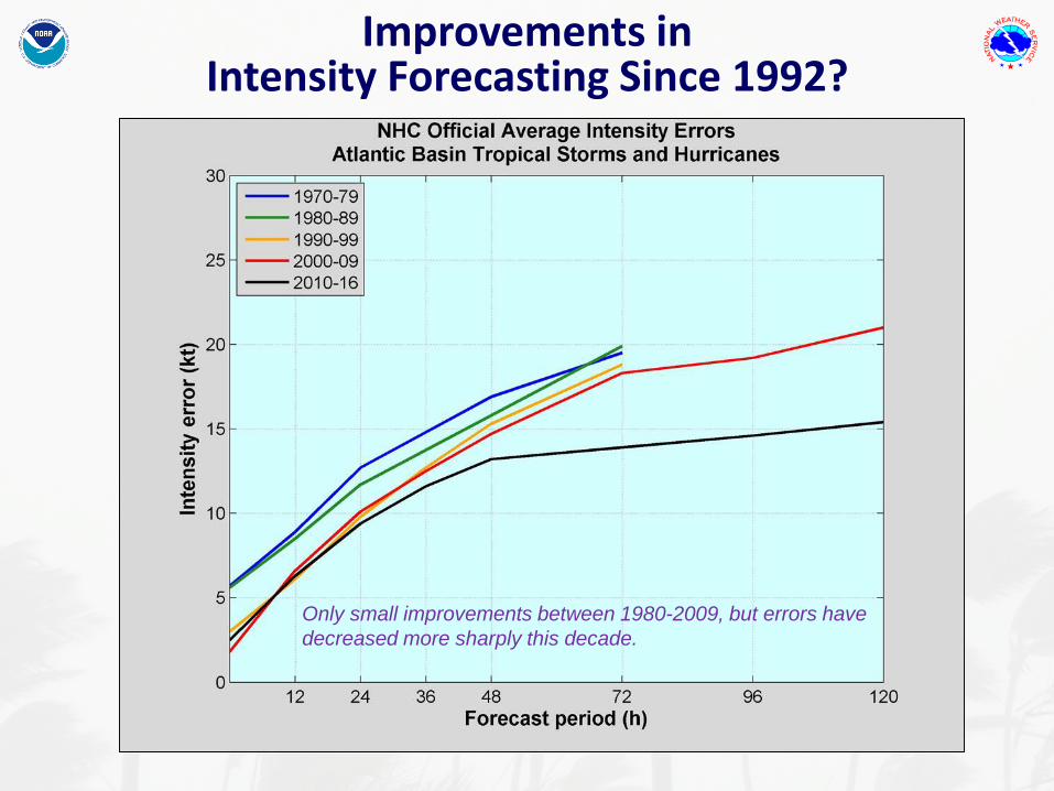
Improvements in Intensity Forecasting Since 1992?
Only small improvements between 1980-2009, but errors have decreased more sharply this decade.
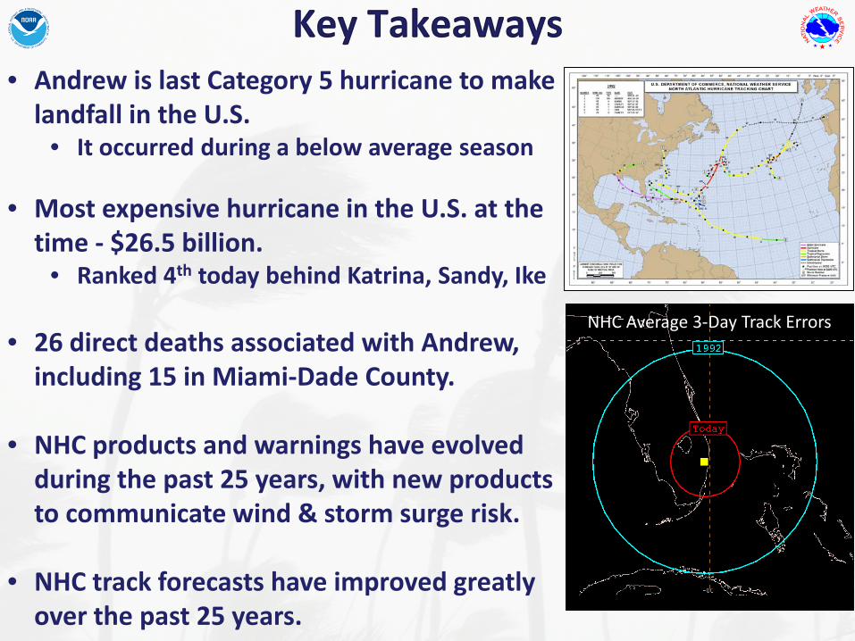
Key Takeaways• Andrew is last Category 5 hurricane to make
landfall in the U.S.• It occurred during a below average season
• Most expensive hurricane in the U.S. at the time - $26.5 billion.
• Ranked 4th today behind Katrina, Sandy, Ike
• 26 direct deaths associated with Andrew, including 15 in Miami-Dade County.
• NHC products and warnings have evolved during the past 25 years, with new products to communicate wind & storm surge risk.
• NHC track forecasts have improved greatly over the past 25 years.
NHC Average 3-Day Track Errors