Embed Size (px)
Citation preview
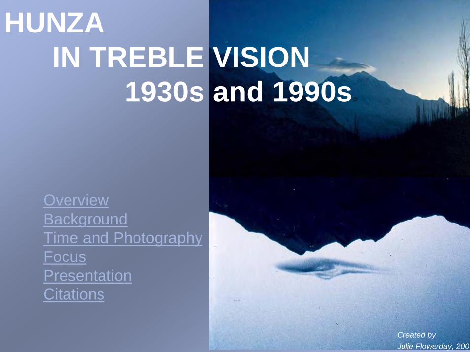
OverviewBackgroundTime and PhotographyFocusPresentationCitations
Created byJulie Flowerday, 2005
©
©
HUNZA IN TREBLE VISION
1930s and 1990s©

Overview of Hunza Valley
Central Hunza of more than half a dozen villages is on the right. Nagir, a different polity, lies across the river chasm on the left
Rakaposhi massif, 25,500’ above sea level
On route to a high mountain pasture
Bubulimuting Peak, dubbed ‘lady finger’
Flowerday©
Flowerday ©
Flowerday ©
Flowerday ©
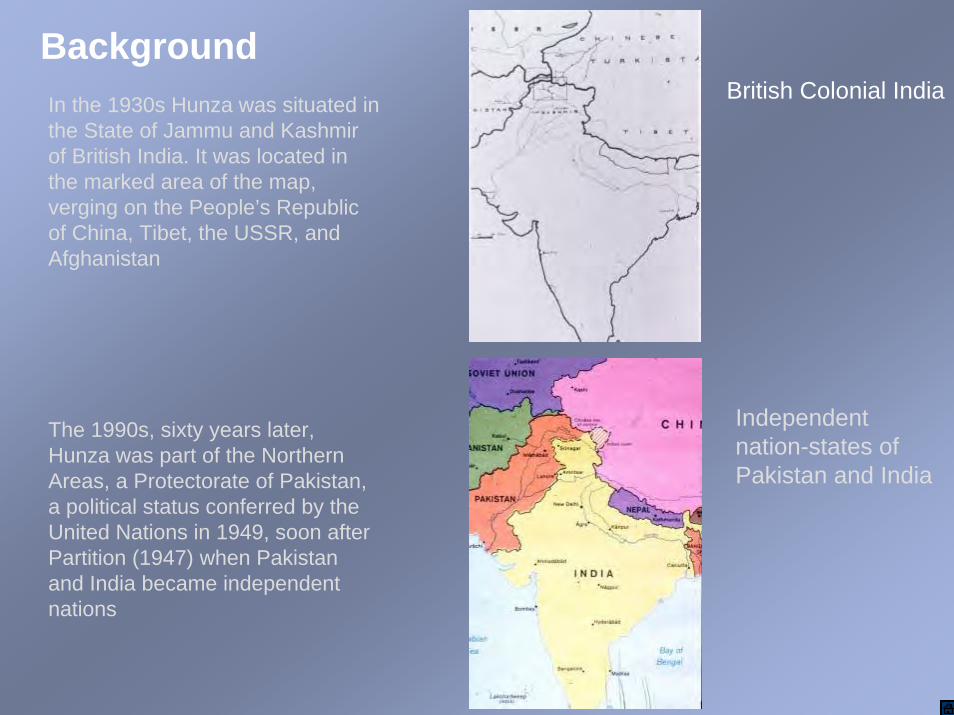
BackgroundIn the 1930s Hunza was situated in the State of Jammu and Kashmir of British India. It was located in the marked area of the map, verging on the People’s Republic of China, Tibet, the USSR, and Afghanistan
The 1990s, sixty years later, Hunza was part of the Northern Areas, a Protectorate of Pakistan, a political status conferred by the United Nations in 1949, soon after Partition (1947) when Pakistan and India became independent nations
British Colonial India
Independent nation-states of Pakistan and India

Hunza Hunzain the Gilgit Agency in the Northern Areas
Hunza was a petty-state, one of several small polities administered under the colonial guise of a Frontier Post (an insecure region). Though the Agency lay within the Maharaja’s State, his government could not collect taxes, establish a judicial system, or station troops there
[The capital of Hunza was Baltit]
On the heels of Partition (1947) Scouts of the GilgitAgency led a coup and seceded from the State of Jammu and Kashmir. The United Nations made the area a Protectorate of Pakistan, and established a cease fire line (1949). In the mid-1970s Pakistan reconstituted the Protectorate as its unofficial fifth province. Hunzabecame a sub-district of Gilgit, one of five such districts of the Northern Areas
[Hunza does not appear as a location on this new map, and Baltit, which appears on it, was already known as Karimabad in the 1990s]
Time and photography
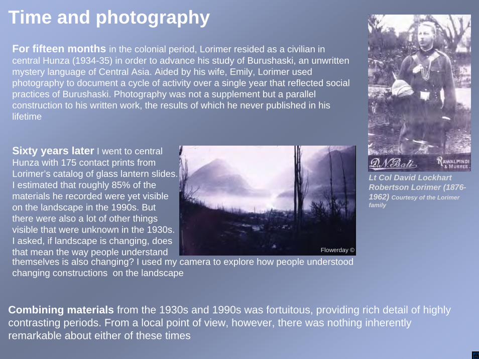
Lt Col David Lockhart Robertson Lorimer (1876-1962) Courtesy of the Lorimerfamily
Sixty years later I went to central Hunza with 175 contact prints from Lorimer’s catalog of glass lantern slides. I estimated that roughly 85% of the materials he recorded were yet visible on the landscape in the 1990s. But there were also a lot of other things visible that were unknown in the 1930s. I asked, if landscape is changing, does that mean the way people understand
For fifteen months in the colonial period, Lorimer resided as a civilian in central Hunza (1934-35) in order to advance his study of Burushaski, an unwritten mystery language of Central Asia. Aided by his wife, Emily, Lorimer used photography to document a cycle of activity over a single year that reflected social practices of Burushaski. Photography was not a supplement but a parallel construction to his written work, the results of which he never published in his lifetime
Combining materials from the 1930s and 1990s was fortuitous, providing rich detail of highly contrasting periods. From a local point of view, however, there was nothing inherently remarkable about either of these times
themselves is also changing? I used my camera to explore how people understood changing constructions on the landscape
Flowerday ©

FocusTwo differences separating the 1930s and 1990s that caught my attention were :
1) political rule and 2) economy
In the 1930s political rule was a confederation of clans headed by a hereditary ruler under patronage to a colonial overlord. Residents depended on local, land-based agricultural resources to support themselves in this scheme
In the 1990s political rule shifted to elected and appointed leaders under the Protectorate of Pakistan. In place of farming, residents incorporated diverse livelihoods associated with the rising nation-state
Photographs documenting political and economic shifts are arranged by examples called
Single Vision Selected thematic photographs made by Lorimer in the 1930sDouble Vision: Paired versions of the early photographs that I made in 1990s Treble Vision: Thematic prospects I recorded at the close of the 20th century
While viewing this presentation, focus on how activities and places of Single Vision fall to background in Double Vision then rise thematically under altered political and economic conditions in Treble Vision

PresentationThemes:
1-Political Access2-Political Rule3-Architecture of Rule4-Hallowed Spaces5-Education6-Economy7-Master Craftsmen8-Bazaar9-Community Activi10-Portrait Gallery
Flowerday ©
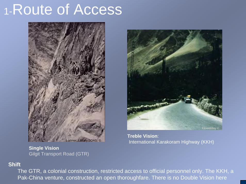
1-Route of Access
Treble Vision: International Karakoram Highway (KKH)
ShiftThe GTR, a colonial construction, restricted access to official personnel only. The KKH, a Pak-China venture, constructed an open thoroughfare. There is no Double Vision here
Single VisionGilgit Transport Road (GTR)
Flowerday ©
Lorimer, Library SOAS ©

2-Political Rule
Mir Tham Sir Mohammad NazimKhan (c 1866-1938), KCIE (Knight Commander of the Indian Empire)
Single Vision:Mir hosted village leaders on roof of his residence at Baltit Fort
Double Vision:Roof of the Baltit Fort was a Museum
Flowerday ©
Lorimer, Library SOAS ©
Lorimer, Library, SOAS ©

Shift: In the 1970s Pakistan dismantled the former colonial state and introduced public elections. In the process, the Nation State conferred a new political identity on the people of Hunza-- an inheritable privilege of generations to come … though lacking full entitlements
Treble Vision: Boys imitated a jalus (meeting) for political electioneering Treble Vision:
Public election campaign
Flowerday ©
Flowerday ©
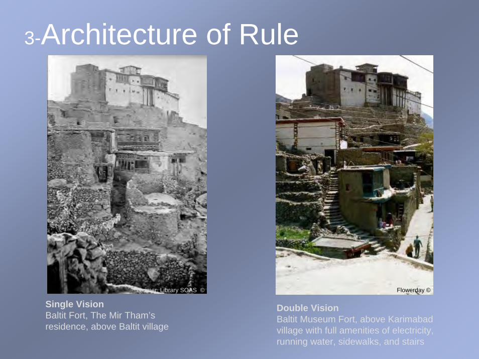
3-Architecture of Rule
Single VisionBaltit Fort, The Mir Tham’sresidence, above Baltit village
Double VisionBaltit Museum Fort, above Karimabadvillage with full amenities of electricity, running water, sidewalks, and stairs
Lorimer. Library SOAS © Flowerday ©
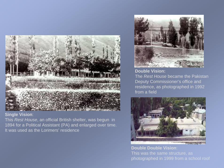
Single Vision: This Rest House, an official British shelter, was begun in 1894 for a Political Assistant (PA) and enlarged over time. It was used as the Lorimers’ residence
Double Vision:The Rest House became the Pakistan Deputy Commissioner’s office and residence, as photographed in 1992 from a field
Double Double Vision: This was the same structure, as photographed in 1999 from a school roof
Lorimer, Library SOAS ©
Flowerday ©
Flowerday ©

ShiftCenter of rule moved from Baltit to New Delhi and London in the colonial period; then it moved from London to Islamabad under the Protectorate of Pakistan. Conversion to Pakistan embodied people’s daily routines and dependency on state services
Treble VisionEach village had its own Post Office
Treble VisionThis was the main police station of two such bases in Central Hunza
Treble VisionHospitals, schools, clinics, and government offices produced new pathways and networks
Flowerday ©
Flowerday ©
Flowerday ©

4-Hallowed Spaces
Single VisionKharum Bat (split rock), a place of local history
Double VisionKharum Bat broken
Double VisionSpecialists blasted it with dynamite
Lorimer, Library SOAS ©Flowerday ©
Flowerday ©

Single VisionAt the time this carved wooden Shiah Masjid (mosque) was constructed, religion was secular, that is, it was practiced under the ruler’s tutelage. Mosques like this one, which were common throughout the villages, spread from the late 17th century with the rise of Ithna Asharism, Shi’ism
Double VisionThis was the fate of many of these old masjids
Lorimer, Library SOAS ©
Flowerday ©

Treble Vision Sunni Mosque, the leading Islamic faith in Pakistan
Treble Vision Jamat Khana, a community house of the prevailing Ismaili sect of Islam in Central Hunza
Treble Vision Shiah Masjid, a mosque of a smaller sect of adherents in Central Hunza
ShiftReligion was no longer secular, but manifested Islamic constructions.
Flowerday ©
Flowerday ©
Flowerday ©

5-Education
Single VisionYoung girls imitated woman embroidering
Double VisionYoung boys imitated their male kin by setting up shop outside a school
Lorimer, Library SOAS ©
Flowerday ©

Treble VisionChildren were taught in three languages-Burushaski, Urdu, and English-and were trained according to Eastern and Western syllabi
Treble VisionStudents wore uniforms, learned to drill, sang prayers, recited a national anthem, and learned a regimen of behavior unlike anything known to the majority of their parents
Flowerday ©
Flowerday ©

Treble Vision‘Follow-up Family Planning’ was a new lesson. Large families were part of the earlier agricultural economy, not the prospects of an industrialized society
Shift: Children were no longer solely educated by family, groomed by special tutors, or apprenticed to masters. Under the new scheme they learned to behave as a social class
Flowerday ©

6-Mixed Economy The first three slides feature Single/Double Vision--of agriculture, tree cultivation, and herding--followed by Treble Vision
Agriculture
Single VisionA family winnowing grain over days, as winds permitted
Double VisionA family winnowing grain over days, as winds permitted
Lorimer, Library SOAS ©Flowerday ©

Single VisionApricots were dried on roofs
Double VisionApricots were dried on roofs
Lorimer, Library SOAS ©
Flowerday ©
Tree Cultivation

Herding
Single VisionBoys herded their family’s goats on toq-s (high grazing grounds) above villages
Lorimer, Library SOAS ©
Double VisionMost boys attended school. Fewer lads combined and minded sheep of several families. They grazed them on grounds nearby villages
Flowerday ©

Treble VisionMen threshed with machines, leaving them time to work other jobs for money
Flowerday ©
Treble VisionPotatoes became a cash crop, but local flour had no place on the market
Flowerday ©

ShiftFields became real estate for houses and shops; trees were cut, and herds culled. People changed from land-based resources to bazaar-based dependencies
Treble VisionPackages of apricots and nuts, store made baked-goods and global products occupied this shop window
Treble VisionHerds were diminished and meat consumption increased as marketers fed on other regions
Flowerday ©Flowerday ©

7-Master Craftsmen
Single VisionBlacksmiths making and mending household equipment
Double VisionBlacksmiths making and mending household equipment
Lorimer, Library SOAS ©
Flowerday ©
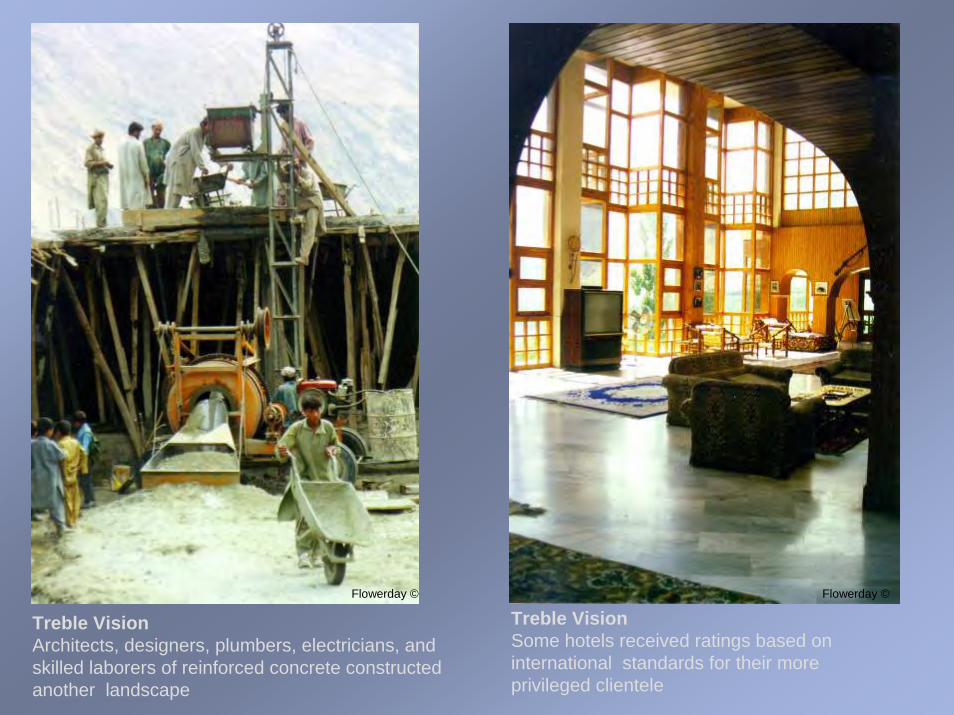
Treble VisionArchitects, designers, plumbers, electricians, and skilled laborers of reinforced concrete constructed another landscape
Flowerday ©
Treble VisionSome hotels received ratings based on international standards for their more privileged clientele
Flowerday ©

ShiftBuilding was the center post of the new economy, including roads, an updated trans-communication system, tourism, and an infrastructure of the nation-state
Flowerday ©

8-Bazaar
Single VisionThis serai (caravan rest house) was the official bazaar (market)
Double VisionIn the 1960s the serai was torn down and this Jamat Khana was raised in its place
Lorimer, Library SOAS ©
Flowerday ©
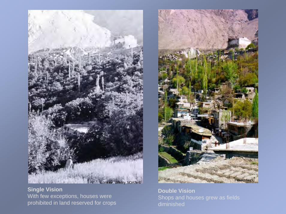
Single VisionWith few exceptions, houses were prohibited in land reserved for crops
Double VisionShops and houses grew as fields diminished
Lorimer, Library SOAS ©Flowerday ©
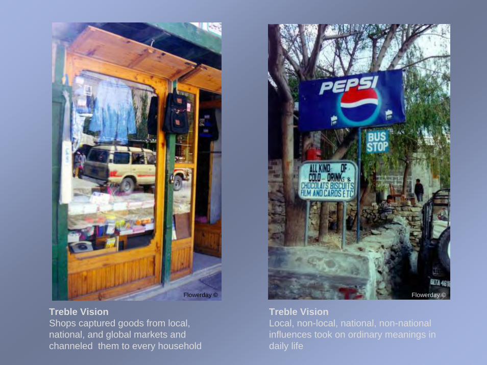
Treble VisionShops captured goods from local, national, and global markets and channeled them to every household
Flowerday ©
Treble VisionLocal, non-local, national, non-national influences took on ordinary meanings in daily life
Flowerday ©
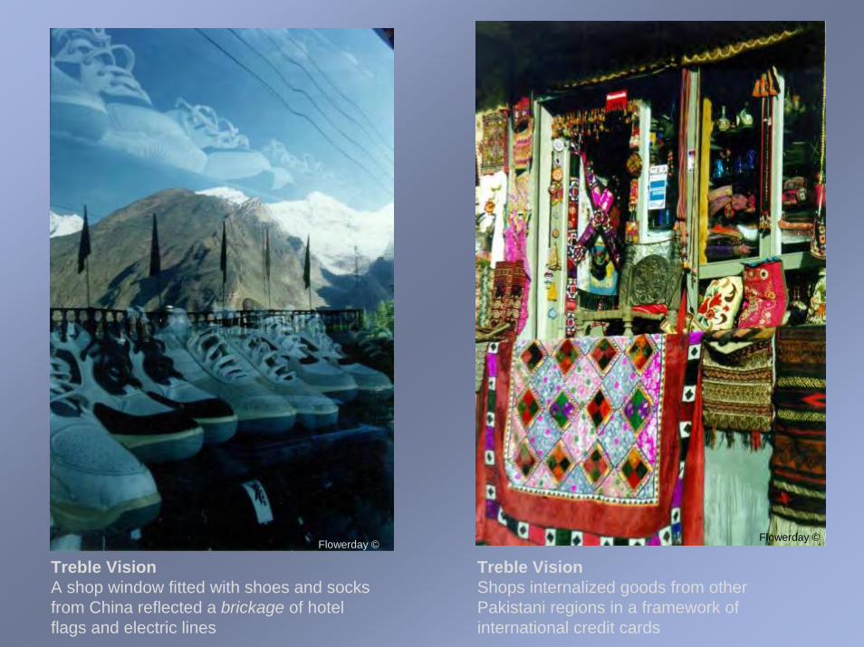
Treble VisionA shop window fitted with shoes and socks from China reflected a brickage of hotel flags and electric lines
Flowerday ©
Treble VisionShops internalized goods from other Pakistani regions in a framework of international credit cards
Flowerday ©

Shift:Fields could not bear what markets produced …. People worked for the bazaar--buying things that made their lives complete to make them happy and selling things they learned that made others happy
Treble VisionThings from disparate traditions juxtaposed new connections in shop interiors
Flowerday ©

9-CommunalActivities
Single VisionCommunity activities were centered by family activities of the ruling house
Double VisionCommunity activities diversified through elected positions, community divisions, and special interests
This occasion opened the Hasegawa School
Lorimer, Library SOAS ©
Flowerday ©

Single VisionFormerly people in all villages celebrated their weddings on the same day of a year
Lorimer, Library SOAS ©
Double VisionMarriages occurred privately throughout the year
Flowerday ©

Single VisionFestivities at Bopfau (the first barley planting of the year) were celebrated over an eight day week
Double VisionVillage elders performed a fifteen minute traditional dance for a school’s Parents’ Day program
Lorimer, Library SOAS ©
Flowerday ©

Single VisionCompetitive polo matches were played between villages and other factions
Double VisionAfter a lapse of more than twenty years, polo was played in honor of the International Conference on Tourism
Lorimer, Library SOAS © Flowerday ©
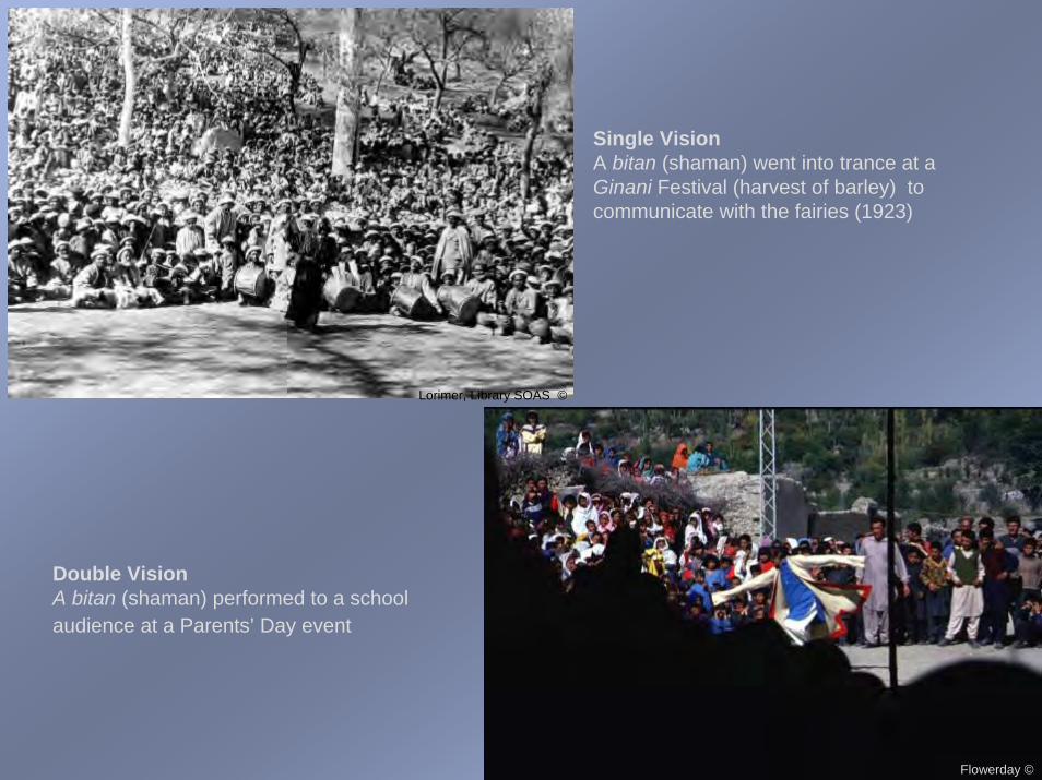
Single VisionA bitan (shaman) went into trance at a Ginani Festival (harvest of barley) to communicate with the fairies (1923)
Double VisionA bitan (shaman) performed to a school audience at a Parents’ Day event
Lorimer, Library SOAS ©
Flowerday ©
ShiftThe center of communal activities changed from the ruling family to the nation-state, from secular to religious identification, from education by masters to class-bred schools. In spite of these changes, people were stateless
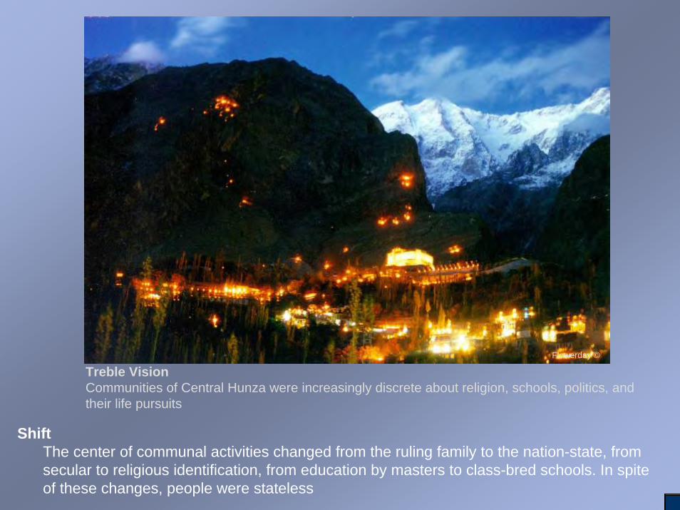
Treble VisionCommunities of Central Hunza were increasingly discrete about religion, schools, politics, and their life pursuits
Flowerday ©

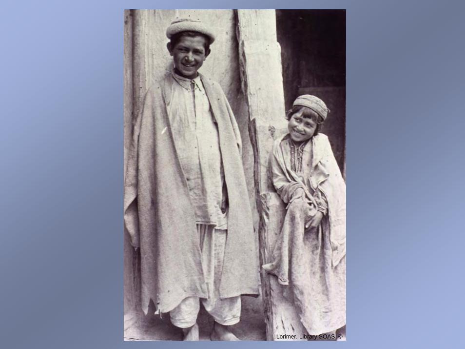
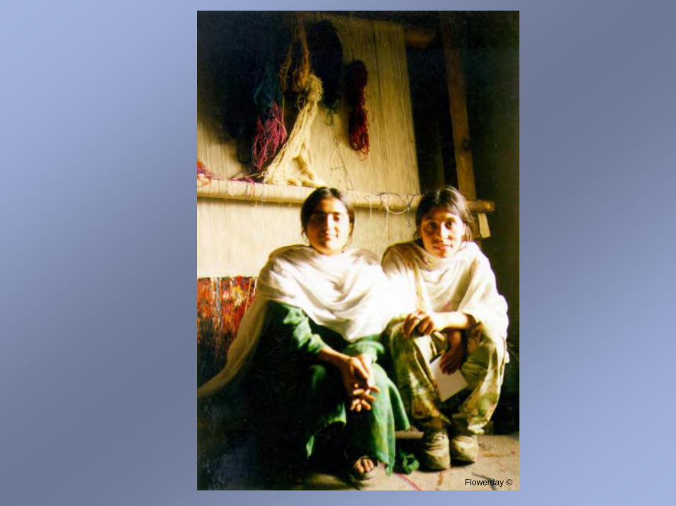
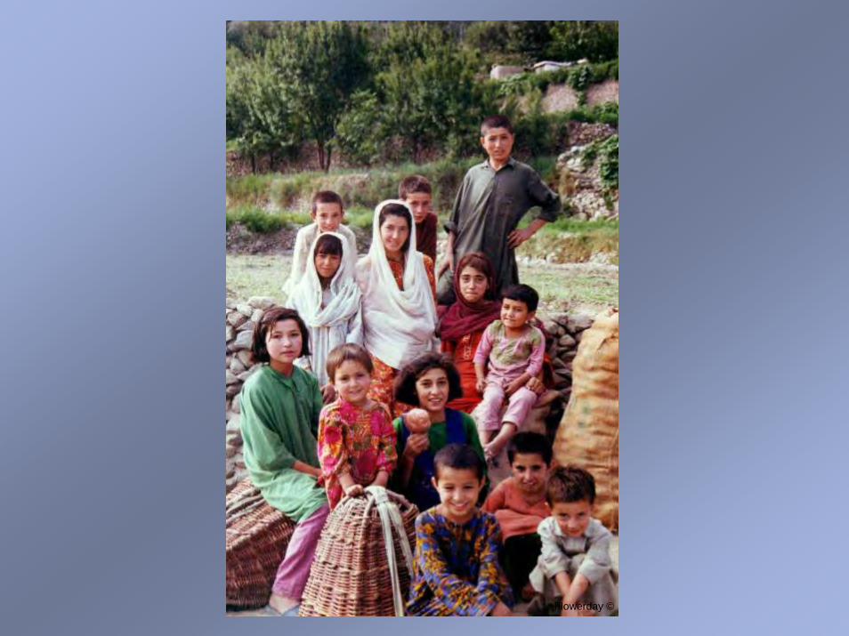
• The portrait gallery is ordered by time
• Three photos of youngsters from the 1930s are featured and these are followed by elders of the 1990s--thus tracing the generational cycle of young people in the 1930s becoming elders in the 1990s
• Portraits thereafter descend by age … from elders to youngsters in a contemporary population--thus focusing on the diversity and complexity of a ‘collective’ population in transition

Lorimer, Library SOAS ©
Lorimer, Library SOAS ©
Lorimer, Library SOAS ©

Flowerday ©

Flowerday ©

Flowerday ©

Flowerday ©

Flowerday ©

Flowerday ©

Flowerday ©
Flowerday ©

Flowerday ©
Flowerday ©

Flowerday ©

©©
Flowerday ©

Flowerday ©

ConclusionThings happening around us happen through us, making memory/knowledge consequential to our changing political and economic conditions
Single VisionFather holding a child of a new generation
Double/Treble VisionMother holding a child of a new generation
Flowerday ©Lorimer, Library SOAS ©

CitationsMaps: British Colonial India, andThe Gilgit Agency Sources unknown. Presently in the LorimerCollection, SOAS, University of London
Pakistan and India. South Asia. 1987. United States Central Intelligence Information. Approximate scale: 1:23,650,000. Publisher Washington, D.C.
Northern Areas. South Asia. 1993. United States Central Intelligence Agency, Approximate scale:1: 3,860,000. Publisher Washington, D.C.
PhotographsLorimer as a young Army Officer. By courtesyof the Lorimer family ©
1930s Images: Taken from glass lantern slides inthe Lorimer’s Hunza Collection held in copyright andby courtesy of SOAS, University of London, Lorimer ©
1990s images. Taken from SLR camera work by Julie Flowerday, Flowerday ©
Grateful acknowledgement is given to the people of Hunza who allowed themselves to be viewed, to the School of Oriental Studies (SOAS) and the Lorimer family for permission to use their photographs, and to the Wm. Fulbright Scholar Program, the American Institute of Pakistan Studies (AIPS), the Mary Duke Biddle Association, and the Aga Khan Cultural Service Pakistan (AKCSP) for funding. Please continue to next page All rights are reserved. Materials may not be reproduced without permission Flowerday ©

Contact information for Julie Flowerday: [email protected]@email.unc.edu
For further information on the Lorimer Collection, please contact• Special Collections Reading Room
The Library Telephone: +44 (0)20 7898 4180 School of Oriental and African Studies Fax: +44 (0)20 7898 4189 Thornhaugh Street, Russell Square E-mail: [email protected] WC1H 0XG Web: www.soas.as.uk/library
• Below is a list of the old photographs used in this presentation. They are listed in the order of their appearance. Those images taken from the SOAS Library’s Lorimer Collection of glass lantern slides include the identification number and the caption created by Lorimer.
• Web Page Collection ID# Lorimer Caption • Background I.1 Map of India • Background. I.2 Map of Gilgit (Agency)• Background Courtesy of the Lorimer family; Lt.-Col.David Lorimer• 1-Route of Access II.1 Earth Pari West of Nilt• 2-Political Rule II.42 Sir Mir Muhammad Nazim Khan, Tham of Hunza• 2-Political Rule II.31 Mir gives feast on roof of fort• 3-Architecture of Rule II.30 Baltit Fort from Village• 3-Architecture of Rule II.9 Aliabad Rest House• 4-Hallowed Spaces III.10 Kharum Bat• 4-Hallowed Spaces II.38 Baltit. Old Mosque• 5-Education IV.32 Apicho, Kaniza etc. • 6-Agriculture III.40 Winnowing. Rahman Big (?)-witth hari bui• 6-Tree Culture III.47 Drying apricots in the sun. (On Baltit roofs) • 6-Herding IV.3 Goats coming home from toq• 7-Master Craftsmen V.35 Blacksmiths at work (2)• 8 Bazaar II.41 Baltit. The Bazar• 8 Bazaar II.27 Baltit from near Graveyard • 9-Communal Activities V.11 Hunza-Nagir Wedding: Bridegroom and Mir, at Karimabad• 9-Communal Activities V.1 Aliabad Himaltar. Bridegrooms• 9 Communal Activities IV.49 The Himalter at Aliabad. Dancing. Middle section• 9 Communal Activities V.6 Blatit Pologround and Fort • 9-Communal Activities V.8 Baltit Pologround. Woman Bitan (dressed in red) 1924• Portrait Gallery IV.44 Gulu• Portrait Gallery IV.43 Nihat• Portrait Gallery V.17 Sangi Khan’s house. Bulul and Jabeli• Conclusion IV.35 Modes of carrying small children. Demonstrated by Afiato