Embed Size (px)
Citation preview

HISTORIC STONE HOME "THE COL./GEN. ROBERT POAGUE
STONE HOME" 6130 PARKER LANE, MAYS LICK, MASON
CO., KENTUCKY 41055 UNIQUE circa 1795 2 1/2 stories of stone over basement stone home, possibly constructed by
Thomas Metcalf (KY's 10th Governor), providing for 3 or 4 bedrooms and one bath,
electric and wood heat, with living room, den, large kitchen, situated on 4.05 acres on a
blacktop county road w/ public water! LISTED ON THE NATIONAL REGISTER, PRICED RIGHT $150,000!!! NEW LISTING C1475
LISTED ON NATIONAL REGISTER OF HISTORIC PLACES (Jan. 8, 1987). Project name: Poague House; Historic registration: National Register: 87000210 (1/8/1987)
Poague House ** (added 1987 - Building - #87000210) Parker Ln., Mays Lick
Historic Significance: Architecture/Engineering Architect, builder, or engineer: Metcalf, Thomas
Architectural Style: Federal, Greek Revival Area of Significance: Architecture
Period of Significance: 1800-1824, 1825-1849 Owner: Private
Historic Function: Domestic Historic Sub-function: Secondary Structure,
Single Dwelling Current Function: Domestic
Current Sub-function: Single Dwelling


ROBERT POAGE (POGUE/POGE) HOUSE CIRCA 1794
Prepared by Craig A. Stanfield, Craig A. Stanfield Real Estate & Auction Services, Tollesboro, Kentucky, for marketing and informational purposes, 2008, All Rights Reserved. The information was compiled from various sources, public and non-public in nature, and not independently verified by the preparer. Some of the following information was provided by the property owner, Douglas Mellor, as well as from the Kentucky Gateway Museum, online research of public records (biography of Thomas Metcalf), and other reference sources including the Kentucky Heritage Council and the National Register for Historic Places and thus is believed accurate and reliable, and is compiled by agent and provided to the reader for their own interpretation, however no warranty or guarantees at to the accuracy of the information, or for any liability thereto, is retained for statements that are not in error or which might be in dispute. It should be noted that online research displays significant ambiguity relative to Robert Pogue, mainly due to the three potential spellings of his last name, the fact that his rank changed (elevated from Colonel to General during War of 1812), and as many military accounts list “Col. Pogue” (spelling of last name can vary) or “Gen. Pogue”, without referencing the first name, regiment (alternatively listed as 3rd Kentucky Mounted Volunteers and/or 4th Kentucky Volunteers), or state of origin (also, other details vary relative to his overseeing construction of Fort Amanda, with statements indicating that the fort was named after his wife or alternatively after a daughter. However his wife’s name was Jane and he did not have a daughter named Amanda, but did have a daughter named Amy). Two and a half-story stone house located on the Parker Lane, near the community of May’s Lick, Mason County, Kentucky. The stone portion of dwelling was built by contractors for Robert Poage (1766-1833) sometime between 1791 and 1795 or so. Robert Poage was the first-born son and second child of William and Ann Kennedy Wilson Poage, and was born in Augusta, Co., Virginia, October 6, 1766, and later moved with his parents to Boonesboro, Kentucky in 1775 and then to Harrodsburg, Kentucky in Feb., 1776 (NOTE: Robert Poage’s father, William Poage, was killed by Shawnee. He was wounded three times in a skirmish outside Harrodsburg September 1,1778, his companions unhurt and forced to retreat. His gun having been captured by the Shawnee, and himself severely wounded, William Poage went into hiding. The next day, Sept. 2, 1778, settlers returned to recover Poage, and attacked the Shawnee who were surprised while awaiting in ambush, killing 4 Shawnee including the Shawnee who had capture Poage’s gun, and thus recovered Poage’s gun. The settlers found Pogue and carried him to his home where he died the next day, Sept. 3, 1778, of his wounds. The recovered gun became the property of Robert Poage, his eldest son). Robert Poage served under General George Rogers Clark as a teenager in the Revolutionary War as a member of the Kentucky Militia. At the outset of the War of 1812, Poage was commissioned a colonel, commanding the 4rth Regiment of Kentucky Volunteers (and/or the 3rd Mounted Regiment Kentucky Volunteers??? Research inconclusive due to numerous spellings of last name and occasional omissions of first names, and as there were a number of officers with same last name during War of 1812. Commissioned as a Colonel at outset of war, applied for pension as a General to which rank he was elevated for meritorious service), under General William Henry Harrison at the outset of the War of 1812. Supervised his troops in the original construction of Fort Amanda on the banks of the Auglaize River in Auglaize County, Ohio during the Fall of 1812. He would distinguish himself at the Battle of the Thames (the battle in which Tecumseh was killed, reportedly by fellow Kentuckian and future Vice-President Richard Mentor Johnson), and ascended to the rank of General before the end of the war. After the War of 1812, Poage retired from military service (an interesting note is that, sometime after the war, the spelling of the name Poage changed to Pogue). On June 4, 1791 (exactly one year prior to the admission of the Commonwealth of Kentucky to the Union as the 15th State) Robert Pogue married Jane Hopkins (born Sept. 14, 1767, the daughter of Kentucky pioneers John and Jean Gordon Hopkins who settled in Harrodsburg in 1774), of Staunton, Virginia. The Pogues were to be blessed with 9 children (the first born in 1792, and the last born in 1808), however three, including their only set of twins, died in infancy. Robert Pogue purchased 150 acres from William May in 1790 on Lee’s Creek in Mason County, Kentucky outside of the settlement of May’s Lick, this being the land upon which the stone home was constructed, and moved with his wife to Mason County, Kentucky, beginning construction of the stone home sometime shortly thereafter. Local lore (oral history) handed down though future owners of the property (Sanford Parker) indicates that the home was constructed possibly by future Kentucky Governor Thomas “Stone-Hammer” Metcalf (1780-1855), and that the contractor was offered a choice of either 100 acres or $100 to construct the residence, and that the contractor opted to take the money rather than the land (NOTE: Based upon the independent online research of the preparer, for this to be true, the subject home was constructed when Thomas Metcalf was aged 11 through 15, depending upon the actual date of construction and assuming that the online biographies of Thomas Metcalf indicating that he was born in 1780 are accurate. One on-line biography of Thomas Metcalf indicates that he began serving as an apprentice stone-mason under his older brother at the age of 16. It is very possible that Thomas Metcalf thus served a role in construction, but probably not as general contractor, but possibly as either an apprentice or journeyman, or just as a laborer. If true, particularly if construction began as early as 1791, it potentially was one of the first, if not the first, stone home that Thomas Metcalf may have been involved in the construction of, and may have therefore been the “spring-board” that lead to his apprenticeship as a stone-mason as he got older? Alternatively, if construction began in 1796, Thomas Metcalf would have turned 16 and may have began his apprenticeship on this very home??? Regardless, in my opinion, it does not appear that the home would have been constructed by Thomas Metcalf as the general contractor due to the time frame estimate of construction versus the age of Thomas Metcalf and the reported age at which he began to serve as an apprentice stone-mason), and (according to Frances McHugh whose parents rented when she was a child) that a civil war soldier was shot in the front yard and buried on the property to hide the act (it was not known conclusively whether the soldier was Union or Confederate). In 1791 (May 5, 1791; Survey Tract # 6850, Survey Date 11-17-1789, Recorded in Book 14 page 350-351), Poage/Pogue received a land grant of 400 acres on the North Fork of the Licking River (one would

assume relative to his service in the Revolutionary War as the War of 1812 in which he was commissioned a Colonel and ascended to rank of General had not yet occurred?). Poage purchased an additional adjoining 500 acres in 1796. Tax records indicate that Robert Pogue paid taxes in Mason County for the first time in 1795, indicating that he probably did not finish permanent improvements (home, outbuildings, etc.) until that time. Oral history indicates that Jane Hopkins Pogue managed a large family of slaves and the large plantation farm during the absence of her husband and eldest son during the War of 1812. The fact that the Poage’s were slave owners is also reflected in a diary kept by a soldier during the construction of Fort Amanda where Col. Poage’s slave/servant, Dave, is mentioned, indicating that Col. Poage was accompanied by his slave as a servant during the War of 1812. Robert Poage owned the property on which the stone home was constructed until 1826, moving to Indiana in 1827 where he lived until he died in 1833 (or alternatively still living in Kentucky until his death in 1833 and being buried in Mason Co., KY according to some genealogical postings???).
**************************************************** Since construction, the stone home has been owned by: General Robert Poage, from construction until 1826; William Waddle from 1826 to 1836; John S. Mitchell from 1836 to 1862; Joseph and Michael R. Burgess from 1862 to 1863; Alexander Shackleford from 1863 to 1877; Samuel Piper from 1877 to 1889; James Shanklin from 1189 to 1911; Molly Parker from 1912 to 1946; Sanford Parker from 1946 to Jan., 2004; current owner Douglas Mellor.
**********************************************************************
The following excerpt is from the KENTUCKY HISTORIC RESOURCES Individual Inventory Form, Description and House Plan, prepared by Carolyn Murray-Wooley, Kentucky Heritage Council, April, 1984 and is used with permission of the author, Carolyn Murray-Wooley (NOTE, the inventory from which this excerpt was taken was prepared in April, 1984. Changes have occurred in the dwelling since that date, most notably rear addition partially removed and a larger rear addition constructed, and the removal of the later added Greek Revival portico/front porch): Two and a half story, three bay, hall-parlor, dry-stone house, 24’x 40’ with cellar and added rear ell. Upper Ordovician limestone, fossiliferous, tooled and coursed. Exterior chimneys each end, flanked by square attic windows. Original mortar fairly flat (even on front), slight steeple; fairly hard, some cement?, repointed in Greek Revival times?, now new cement repointing. Window frames pegged, ovolo trim, nosed sill, 9-11 voussoirs with key the same height. Cornice returned on front; has row of dentils typical of Thomas Metcalf’s work – masonry and chimneys also compatible with his work. Federal trim throughout house except in hall, where chair rail was removed and Greek Revival mantle installed (which is marbleized, under flaking top coat of paint). Late Federal mantel in parlor. Six panel door with beaded diagonal battens on inside. Enclosed corner stair atypically lined with plaster; rare curved plaster ceiling above starway. Horizontal beaded flush wainscot in upstairs stairwell; peg rail in upstairs hall; shelf mantels upstairs. Attic has tray ceiling, all plastered; batten door, board partition wall. Fireplace in cellar; exterior entrance from east end of house, behind chimney. House has two story, two-bay Greek Revival ell added, with stone chimney in gable end. Frame, weatherboarded – has some flush weatherboard. Ell had two story porch on west side, now gone – upstairs door closed off. Ell corresponds with Greek Revival front porch (NOW GONE) and change in hall mantel, with illustrates the change in fashion. One-story room on rear and enclosed side porch are minor detractions. House faces south; located on crest of gentle slope to Lee’s Creek. Ruins of smokehouse in yard southeast of house, illustrating relationship of dependency location to house, may have archaeological value.
***************************************************************** The following excerpt is from EARLY STONE HOUSES OF KENTUCKY by Carolyn Murray-Wooley, where the subject home is featured (with black and white photographs --- photographs show the Greek Revival front porch that was a later addition to the home, and which was in poor condition and which has since been removed from the dwelling) on pages 150-151 (in addition to the following information and photos of the home, also included within the book is a sketch of the plan of the home as well as a front elevation sketch), with a color photo from the 1970s or 1980s on Plate 28. This information is provided with permission of the author, Carolyn Murray-Wooley: “The building date of Robert and Jane Poague’s stone house is unknown, but the house has features of early nineteenth-century construction. It is a two and a half story, three-bay house with a hall-parlor plan, built with a full cellar, exterior gable end chimneys, and a dentiled cornice. Except for later Greek woodwork in the hall, the woodwork is Federal throughout, including the six-panel front door with beaded diagonal battens on the inside. Atypically, the enclosed corner stair rises from the parlor and has a curved, plastered ceiling. Another enclosed corner stair rises from the second floor to the attic; the attic has a fully plastered tray ceiling and is divided into two rooms by a board partition wall. The original kitchen may have been replaced by the two-story, two-bay frame ell that has a gable end stone chimney. The house faces south on a gently slope to the creek”. In addition, the book notes that “Poague’s house is atypical in having two exterior chimney stacks” (this reference would be exclusively relative to and concerning early stone home construction as many early brick homes --- as well as wood frame homes with stone chimneys --- were constructed with exterior chimney stacks).

LEGAL DESCRIPTION Being a 4.050 acre parcel located on the south side of Parker Lane, east of U.S. Hwy. 68 in Mayslick, Mason County, Kentucky and being more particularly described as follows: Beginning at a mag nail set at the existing centerline of Parker lane, corner to Sanford R. Parker (Mason County Deed Book 223 page 253), north side of Parker Lane; thence along existing centerline of Parker Lane N 66 deg. 54 min. 02 sec. E 182.18 feet; Thence N 60 deg. 19 min. 05 sec. E. 40.50 feet to a mag nail set, the true point of beginning, new corner to Parker 4.050 acre lot; thence along existing centerline of Parker Lane N. 60 deg. 19 min. 05 sec. E. 70.07 feet; thence N. 57 deg. 00 min. 44 sec. E. 201.63 feet to a point at the centerline of Parker Lane at intersection of gravel farm road; thence N. 59 deg. 55 min. 07 sec. E. 50.97 feet; thence N. 62 deg. 06 min. 09 sec. E. 39.12 feet; thence N. 65 deg. 36 min. 48 sec. E. 35.06 feet; thence N. 70 eg. 26 min. 24 sec. E. 68.85 feet to a point in the centerline of Parker Lane at intersection of driveway to house; thence N. 73 deg. 5 min. 29 sec. E. 65.92 feet; thence N. 72 deg. 10 min. 46 sec. E. 84.81 feet to a mag nail set, new corner to Parker 4.050 acre lot; thence leaving existing centerline of Parker Lane with a new division line of Parker S. 36 deg. 39 min. 38 sec. E. 20.45 feet to an iron pin & cap set (RDH 3264 5/8” Rebar Typical); thence S. 06 deg. 39 min. 38 sec. E. 374.69 feet to an iron pin & cap set; thence S. 06 deg. 39 min. 38 sec. E. 85.34 feet to an iron pin & cap set, new corner to Parker 4.050 acre lot; thence S. 75 deg. 27 min. 13 sec. W. 192.04 feet to an iron pin & cap set, new corner to Parker; thence N. 17 deg. 43 min. 57 sec. W. 62.83 feet to an iron pin & cap set east side of farm road; thence S. 74 deg. 19 min. 10 sec. W. 20.00 feet crossing farm road to an iron pin & cap set, new corner to Parker; thence N. 62 deg. 28 min. 13 sec. W. 149.68 feet to an iron pin & cap set; thence N. 62 deg. 01 min. 03 sec. W. 231.88 feet to an iron pin & cap set; thence N. 62 deg. 11 min. 42 sec. W. 49.21 feet to point of beginning, Containing 4.050 acres according to survey of R. David Hord PLS 3264 of RDH Surveys, Inc. 12/23/2003. See Minor Plat of Sanford R. Parker & Mary M. Parker dated 12/29/2003. This property is subject to: 1). All legal rights-of-way and easements; and 2). Existing right-of-way for Parker Lane for benefit of the Mason County Fiscal Court. Grantors shall retain a 0.172 acre permanent access easement being more particularly described as follows: Being a 0.172 acre parcel located on the south side of Parker Lane, east of U.S. Hwy. 68 in Mayslick, Mason County, Kentucky and being more particularly described as follows: Beginning at a mag nail set at the existing centerline of Parker Lane, corner to Sanford R. Parker (Mason County Deed Book 223 page 253), north side of Parker Lane; thence along the centerline of Parker Lane N. 66 deg. 54 min. 02 sec. E. 182.18 feet; thence N. 60 deg. 19 min. 05 sec. E. 40.50 feet to a mag nail set, corner to 4.050 acre lot; thence N. 60 deg. 19 min. 05 sec. 70.07 feet; thence N. 57 deg. 00 min. 44 sec. E. 191.63 feet to the true point of beginning; thence N. 57 deg. 00 min. 44 sec. E. 10.00 feet to a point centerline of Parker Lane at intersection of gravel farm road; thence N. 59 deg. 55 min. 07 sec. E. 10.00 feet; thence leaving centerline of Parker Lane S. 24 deg. 17 min. 30 sec. E. 22.99 feet to a gate post; thence S. 14 deg. 07 min. 39 sec. E. 52.86 feet; thence S. 27 deg. 02 min. 59 sec. E. 125.32 feet; thence S. 32 deg. 46 min. 33 sec. E. 110.44 feet; thence S. 18 deg. 13 min. 02 sec. E. 71.95 feet to an iron pin & cap set east side of farm road; thence S. 74 deg. 19 m in. 10 sec. W. 20.00 feet to an iron pin & cap set west side of farm road; thence N. 17 deg. 40 min. 44 sec. W. 66.04 feet; thence N. 32 deg. 46 min. 33 sec. W. 110.44 feet; thence N. 27 deg. 05 min. 40 sec. W. 127.31 feet; thence N. 11 deg. 44 min. 20 sec. W. 50.84 feet to a gate post; thence N. 28 deg. 04 min. 54 sec. W. 23.90 feet to the point of beginning, Containing 0.172 acre. Grantors shall also retain a 0.033 acre water line easement more particularly described as follows: Being a 0.033 acre parcel located on the south side of Parker Lane, east of U.S. Hwy. 68 in Mayslick, Mason County, Kentucky and being more particularly described as follows: Beginning at a mag nail set at existing centerline of Parker Lane at the northeast corner of 4.050 acre lot of Parker; thence S. 72 deg. 10 min. 46 sec. W. 71.28 feet to a point in centerline of Parker Lane the true point of beginning; thence leaving the road S. 21 deg. 27 min. 21 sec. W. 88.94 feet; thence N. 66 deg. 58 min. 31 sec. W. 20.00 feet; thence N. 24 deg. 45 min. 41 sec. E. 76.01 feet to a point at centerline of Parker Lane; thence N. 73 deg. 53 min. 29 deg. E. 6.48 feet; thence N. 72 deg. 10 min. 46 sec. E. 13.53 feet to the point of beginning, Containing 0.033 acre.
SEE SURVEY PLAT ATTACHED FOLLOWING

n syofl 44
N"S
9-!S!S
'67
SA
JvlFO
RD
R
. P
AR
KE
R
D.B. 143, P
G. H
7W
AR
Y
M.
PA
RK
ER
SA
NFO
RO
R
. P
AR
KE
RD
.8. 143,
PG
. 117M
AR
Y
M.
PA
RK
ER
D.B
. 265, P
G.
293
D.1
72
A
CR
EP
ER
MA
NE
NT
.,,A
CC
ES
S
EA
SE
ME
NT v
0.0
33
AC
RE
20'
WA
TER5/8
"
IfWN
R
N3A
P
SE
T
RD
H 3
264
(TYP
ICA
L)
HA
G
MA
IL
SC
T{T
fPIC
ALj
MIN
OR
S
UB
DIV
ISIO
N P
LAT
SA
NFO
RD
R
. P
AR
KE
R
&
MAR
Y
M.
PA
RK
ER
PA
RK
ER
LA
NE
, M
AS
ON
C
OU
NTY
, K
EN
TUC
KY
DA
TE:
12/2
9/2
003
S
CA
LE:
1"
=
100'
100'200'
300'
Isniff"vsa
I SURVEYOR'S CERTIFICATIONm
WIK
IIUU
IHa
\ certify that this
plat dscfcts a survey m
ade by m
e O
f under my supervision:
lhat ad! monum
ents Indicated exist and the*r locations, sted and material are
txHrect; and
Bia
l thla p
lai m
asts ire K
entucky Minim
um S
urveying S
tandards.The unadjusted
pre data
ratio of the
traverae was
1:4
0.9
11
and
was
not adjusted. Tie
survey shown
hereon Is a C
lass A S
urvay and com
plisa uith
the surveying
require m
enu, of Die
Waysvii W
Maaofl C
ounty SubdM
afanR
egulations; and that dedicated
areas including any public vrays or streets ana
et rren'jy ow
ned by Ihe
property ow
ners),
I certify that I have exam
ined trie
deed re
oord
a of (tie
Mason C
ounty Court
CieA
'a oflks
and find
that tM» fa
ih»
FIBS
T
coiweyajioe
made
underpresent ow
iafSbip
and tfte parent tra
6sfh
oa
tfia adoption
of the current
UJ
cs<xaac
R D
avid
Hond
N
66-5V02"
E
182.1
3^
TO
KY 324
•
TO K
Y
4»
9PO
. 253
FARM
ON
E'
SH
EE
T
1
OF
2
CL
PA
RK
ER
LA
NE
(12'4
-/~
WID
E)
RANDOM TRAVERSE
NOTCS:HASNETIC NO
RTH SBW
IWG
OBSERVED ALONGLINE
ON
DATE OF SURVEY,
12/2
3/2
003.
PROPERTY SUBJECT
TO ALL
LEGAL RIGHT OF WAYS, EASEM
ENTSAND
UNRECORDED CO
NVEYANCES.PROEPRTY SUBJECT TO
AHY EXISTING
RIGHT OF WAY FOR PARKER
LANE FOR BENEFIT O
F THE MASON
COUNTY FISCAL COURT.
PROPERTY SUBUECT TO
A 0.172 ACRE PERM
ANENT ACCESS EASEMENT
FOR INGRESS AM
D EGRESS TO REM
AINING FARM
,PROPERTY SUBJECT
TO 0.033
ACRE WATER LINE
EASEMENT
FBOMEXISTING
WATER M
ETER AS SHOW
N AND
«OT€0 O
N PIAT.
RD
M S
UR
VE
YS
, INC
.R
. DA
VID
HO
RD
4209 U
.S. H
WY
62M
AY
SV
1LLE, K
Y 4
1056
606-7
59-7
309
Hsi

DE
DIC
ATIO
N C
ER
TIF
ICA
TIO
N(I) (W
e) hereby certify (Mat (I am
) (We
are) the O
wners) at re
cord
of ttia
property shown a
nd d
escrib
ed
hereon a
cquire
d b
y deed
reco
rded
fn D
eed B
ooh
285 . P
age
293 In
(he M
ason C
ounty Cle
rk'soffice
; do
hereby adopt this
pla
t of lo
ts fo
r this
property; do hereby
dedica
te the
streets and any other a
reas or fa
cilities so
indica
ted
topubfic use
upon H
azarding th
is plat and
do e
stablish
end reserve
Ihein
dica
ted
easements fo
r public u
tilities
(eg. gas, ele
ctric, tele
phone,
cable IN
, wflte
/an/J sanitary sa
ner) a
nd
oth
er purposes
so Indicated.
'UR
E O
F O
WN
ER
SIG
NA
TU
RE
OF
OW
NE
RD
AT
E
STATE OF KENTUCKY COUNTY OF MASON
The
forgoing in
strum
ent w
as acknowfsdged
before m
e th
is
Notary P
ublic
O
My com
mission
expires 3
/2-A
>
LEG
EN
D
AOO
RE
BA
R SO
T DIA
ME
TE
R - 24" LE
NG
TH
IV/P
LAS
TIC
CA
P S
TA
MP
ED
RD
H 3264
(UN
LES
SO
TH
ER
WIS
E N
OTE
D)
ME
AN
DE
R P
OIN
T
MA
QN
AIL
FE
NC
E P
OS
T
TR
EE
(AS
NO
TE
D)
UTILIT
Y P
OLE
BO
UN
DA
RY
LINE
CE
NTE
RLIN
E O
F R
OA
D
ED
GE
OF
PA
VE
ME
NT
—X
X
FE
NC
E U
NE
ST
RE
AM
-LINE
RIG
HT-O
F-W
AY
(RJW
)
MIN
OR
S
UB
DIV
ISIO
N P
LAT
SANFORD R. PARKER & MARY M. PARKER
PARKER LANE, MASON COUNTY, KENTUCKY
DATE: 12/29/2003
SCALE: 1" = 100'
SE
WE
R A
PP
RO
VA
l̂C
ER
TIF
ICA
TIO
N
t Iwrsby certify tttat public
sanrkr] sew
ers are not availBtx'e
to tf-«MO
P«rty and
thai Ihe prtvabU
wega
disposal system Installed
neetsWM
FM
inum standan)3 o
f IhWBuffisfci Trace D
istrict Haaltfi
DA
TE
WA
TE
R S
UP
PLY
AP
PR
OV
AL C
ER
TIF
ICA
TIO
N
I certi'/ that public w
ater supply Is available
Io fte
propertyand tlia
l fte water supply Has been Installed
In accordancew
ith the rain [m
um standards of tf» C
aminonw
ealth of K
entuckyD
epartment of N
atural Resources and that tt>e w
atar supplyhas been dedicated io, and accepted For m
aintenance by 1h«
itON
AfU
ME
AN
DTltL
E
V
BA
TE
MA
YS
VIL
LE
- MA
SO
N C
OU
NT
Y JO
INT
PLA
NN
ING
CO
MM
ISS
ION
- AP
PR
OV
AL C
ER
TIF
ICA
TIO
N
Review
ed and approved by Ihe
MaysvH
e - Mason C
ounty JointP
lanning C
cmiriu
ldrt for R
ecording as a Miner S
ubdivision an this •-
'
DA
TE
CO
UN
TY
CLE
RK
CE
RTIF
ICA
TIO
N
t hereby certify fiat this subdivision
plat *taa presented to me
and accepted for recording In Ihe office of aw
County C
leric andR
ecorders) Mason C
aunbrat Vie C
fty of Maysvilte , K
entucky on*k
3 O
P* day of
yo
MU
&M
L . %
>£¥
at j>.- Vty
iBfual.
VIC
INITY
M
AP
LOC
ATIO
N
MA
P
SH
EE
T
2
OF
2
REC
EPTION
KO.
R D
H S
UR
VE
YS
, JNC
.
R. D
AV
ID H
OR
D4209
U.S
. HW
Y 62
MA
YS
VE
LLE, K
Y 41056
606-759-7309

Revised January 1, 2007
SELLER DISCLOSURE OF PROPERTY CONDITION
The information in this form is based upon the undersigned's observation and knowledge about the property during the period beginningon the date of his or her purchase of it on: r / / . / /y
JAMtiMi/ TO f 2M f and ending on ? //^ / V<T _(date of purchase) (date of this form)
PROPERTY ADDRESS:
This form applies to sales and purchases of residential real estate. This form is not required for:
1 . Residential purchases of new homes if a warranty is offered;2. Sales of real estate at auction; or3. A court supervised foreclosure.
PURPOSE OF STATEMENT: Completion of this form shall satisfy the requirements of KRS 324.360 which mandates the seller'sdisclosure of information about the property he is about to sell. This disclosure is based solely on the seller's observation and knowledgeof the property's condition and the improvements thereon. This statement shall not be a warranty by the seller or seller's agent and shallnot be intended as a substitute for an inspection or warranty the purchaser may wish to obtain. This is a statement of the conditions andinformation concerning the property known by the seller. Unless otherwise advised, the seller does not possess any expertise inconstruction, architectural, engineering, or any other specific areas related to the construction or condition of the improvements on theproperty. Other than having lived at or owning the property, the seller possesses no greater knowledge than that which could be obtainedupon a careful inspection of the property by the potential buyer. Unless otherwise advised, the seller has not conducted any inspection ofgenerally-inaccessible areas such as the foundation or roof. It is not a warranty of any kind by the seller or by any agent representing anyseller in this transaction. It is not a substitute for any inspections. Purchaser is encouraged to obtain his or her own professionalinspections.INSTRUCTIONS TO THE SELLER: (1) Complete all numbered items. (2) Report all known conditions affecting the property. (3) Attachadditional pages, if necessary, with your signature and the date and time of signing. (4) Complete this form yourself or sign theauthorization at the end of this form to authorize the licensee to complete this form on your behalf in accordance with KRS 324.360(9).(5) If some items do not apply to your property, write "not applicable." (6) If you do not know the answer to a question, write "unknown."SELLER'S DISCLOSURE: As seller, I/we disclose the following information regarding the property. This information is true andaccurate to the best of my/our knowledge as of the date signed. Seller authorizes the agent to provide a copy of this statement to a personor entity in connection with actual or anticipated sale of the property or as otherwise provided by law. The following are not therepresentations of the agent.Please answer all questions. If the answer is yes, please explain. If additional space is needed, use the reverse side or make attachments.1. HOUSE SYSTEMS YES NO UNKNOWN
Any past or current problems affecting: , / r> nk if(a) Plumbing ...... . .............. ̂ .mMj3i^..JM., ..... j _ _/(b) Electrical system ............. fi.kU./U&.(A/. ...................................... 2:#.f?.'7 _ _•/(c) Appliances ....................................................................................... _ _¥_(d) Floors and walls ................................................................................. _ v(e) Doors and windows .............. £.}(f) Ceiling and attic fans(g) Security system(h) Sumppump ............................(i) Chimneys, fireplaces, inserts . . . It >?.(j) Pool, hot tubs, sauna(k) Sprinkler system ................... ,.....,..£_.„. ..... .. ........................................ _ \/(1) Heating.. £/£<^./^..M/?y£./Wel_^.j ...... / ............................ _ S(m) Cooling/air conditioning .................... age _ '__ ...................................... _ _s_
Explain: _ / // , _ / _ </ // , _rts ntyWCkPTiAifbi^i. fURE/BASEMENT / '2. FOUNDATION/STRUCTU - s /
(a) Any defects or problems, current or past, to the foundation or slab?(b) Any defects or problems, current or past, to the structure or exterior veneer? ........ \/
Explain: W£ pp / J^'gxff/ - ~Y^\/\4^A I f^/^9/^
(c) Has the basement leaked at anytime since you have owned or lived in the property? ^(d) When was the last time the basement leaked? W&l2f(e) Have you ever had any repairs done to the basement? . .(f) If you have had repairs done to the basement relative to leaking,
when was the repair performed?Explain:
(g) If the basement presently leaks, how often does it lerains, only after an extremely heavy rain, etc.)
Initials (Buyer) Date/Time ' "V Initials (Seller! A/^|x Date/Time *JI/(/

Property Address Ul3D PfifcltglLRevised January 1,2007
YES NO UNKNOWN
(h) Have you experienced, or are you aware of, any water or drainage problems with /Regard to the crawl space? **
3. ROOF(a) Age of the roof? l~t>& f(b) 1. Has the roof leaked at any time since youhave owned or lived in the property?
2. When was the last time the roof leaked? m7) ryw(c ) 1. Have you ever had any repairs done to the roof?J...fc\ -Byi/ty---^ftpr- • *9-Oh tf
2. If you have ever had the roof repaired, when was the repair performed? '(d) 1. Have you ever had the roof replaced? N£^ 'Z-.G&if
2. If you have had the roof replaced, when was the replacement performed? 4s(e) If the roof presently leak^JmaLSfiejijloes it leak? ,(^-g-> e,veiy time it
rains, only after an^xtremely heavy rauQetc.)(f) 1. Have you ever had" roof repairs thai Involved placing shingle^ on the roof instead' /•
of replacing the entire roof? ^2. If you have ever had roof repairs that involved placing shingles on the roofinstead of replacing the entire roof, when was the repair performed? N Af
4. LAND/DRAINAGE /(a) Any soil stability problems? . *^(b) Has the property ever had a drainage, flooding, or grading problem? *s(c) Is the property in a flood plain zone?.^^ /~siL' ^(d) Is there a retention/detention basiny^niiakeyc^eekpmrina or
water shed on or adjoining this property1? .w^/.W^rTT \sExplain:_ _^_____
5. BOUNDARIES(a) Have you ever had a staked or pinned survey of the property?.(b) Do you know the boundaries?(c) Are the boundaries marked in any way?.(d) Are there any encroachments or unrecorded easements relating to the property of s
which you are aware? ^fExplain:
6. WATER(a) 1. Source of water supply C /'
2. Are you aware of below normal water supply or water pressure? ...................... _ y(b) Is there a water purification system or softener remaining with the house? .............. _ J^_(c) Has your water ever been tested? If yes, give results _ </
Explain: _7. SEWER SYSTEM
(a) Property is serviced by:1 . Category I. Public Municipal Treatment Facility; .......................................... _ *S2. Category II. Private Treatment Facility; ...................................................... _ \S3. Category III. Subdivision Package Plant; .................................................... _ _ */4. Category IV. Single Home Aerobic Treatment System (AKA: "Home Package Plant") _ _5. Category V. Septic Tank with drain field, lagoon, wetland, or other onsite dispersal; >s6. Category VI. Septic Tank with dispersal to an offsite, multi-property cluster treatment
system; ............................................................................................. _7. Category VII. No Treatment/Unknown ....................................................... _
(b) For properties with Category IV, V, or VI systems:Date of last inspection (sewer):Date of last inspection (septic): TLfipf? _ Date last cleaned (septic): -
(c) Are you aware of any problems with the sewer system? .................................................... \sExplain: A 1 1 Af £ jA* ~>£P7 'I C~ _ ^ fit <J
8. CONSTRUCTION/REMODELING(a) Have there been any additions, structural modifications, or other alterations made?(b) Were all necessary permits and government approvals obtained?
Explain: _ .4 fc hi // f ,A) T& r^frV- f-f- fa f Mt£ ~2- & / g? _9. HOMEOWNER'S ASSOCIATION ^
(a) 1 . Is the property subject to rules or regulations of a homeowner's association? ............. _ _VL2. If yes, what is the yearly assessment? $ _
Initials (Buyer) _ Date/Tune _ Initials (Seller)/) '̂ Date/Time ~J/^ j £>%
gJ\A ^

Revised January 1,2007 Property AddrCSS_ ( { f i t
YES NO UNKNOWN(b) Are you aware of any condition which may result in an increase -
in taxes or assessments? ^(c) Are any features of the property shared_in_common with adjoining
landowners, such as walls, fencesr'driveways^etc,? i^----; v^Explain: l-A^fyM-'l-H/*? ^ -*?
10. MISCELLANEOUS s(a) Was this house built before 1978? _*L .(b) Are you aware of any use of ureaformaldehyde, asbestos materials, or ,
lead based paint in or on this home? v(c) 1. Are you aware of any testing for radon gas? \s
2. Results, if tested(d) Are you aware of any underground storage tanks, old septic tanks, ,
field lines, cisterns or abandoned vyells on the property? _^_(e) Are you aware of any present on^ast wood infestation (i.e. termites,
bores, carpenter ants, fungi, etc.}?(f) Are you aware of any damage due to wood infestation? _yl(g) 1. Have the house or other improvements ever been treated for wood infestation? \/
2. If yes, when, by whom, and any warranties?
(h) Are you aware of any existing or threatened legal action affecting this property? \s(i) Are there any assessments other than property assessments that apply /
to this property (i.e. sewer assessments)? _^L.(j) Are you aware of any violations of local, state, or federal laws, codes,
or ordinances relating to this property? •*(k) Are you aware of any other conditions which are defective with regard
to this property? -S(1) Are there any environmental hazards known to seller? ^(m) Are there any warranties to be passed on? •</(n) Has this house ever been damaged by fire or other disaster (i.e., tornado, hail, etc.)? /
If yes, please explain: _vl(o) Are you aware of the existence of mold or other fungi in the property? ^(p) Has this house ever had pets living in it? , ^/
If yes, Explain £..£W4(I m/JffrT ffflC4 : . ,(q) Is the property in a historic district? .pJl..LL~&~.?.iA.jti.l.ii....i/\.i.£iA*-..>./.~..i<s}^:.\£f\Aj- _it
SPACE FOR ADDITIONAL INFORMATION
The seller has owned this property since 1"ft/$- %£) t'j! (>£ ¥ (date) and makes these representations only since that date. Selleragrees to immediately notify Buyer of any changes which may become known to seller prior to closing..
'
Seller /; /, . \ A A ^ i Ci»,Seller/Y/0 ;, /
THE LICENSEE NAMED HERE ( _ _____ ) HAS BEEN REQUESTED B¥ THE OWNER TO COMPLETETHIS FORM AND HAS DONE SO. I HEREBY AGREE TO HOLD HARMLESS THE NAMED LICENSEE FOR ANYREPRESENTATION THAT APPEAR ON THIS FORM IN ACCORDANCE WITH KRS 324.360(9).Seller: _ DateTHE SELLER REFUSES TO COMPLETE THIS FORM AND ACKNOWLEDGES THAT THE AGENT SHALL SO INFORM THEBUYER.Seller: _ Seller: _Date: _ Date: _THE SELLER HAS REFUSED TO COMPLETE THIS FORM AND HAS REFUSED TO ACKNOWLEDGE HIS FAILURE TOCOMPLETE THE FORMBroker/ Agent: _ ___ _ __ _ Date: _THE BUYER ACKNOWLEDGES RECEIPT OF THIS FORM.
Buyer Date Buyer DateTHE SELLER MAY DISCLOSE ADDITIONAL INFORMATION NOT REQUESTED OF THIS FORM AND MAY RESPOND TOADDITIONAL INQUIRIES OF THE BUYER.
Initials (Buyer) _ Date/Time _ Initials (Seller) M/Vl /Date/Time 7 / / ̂ 7 //^
^ '
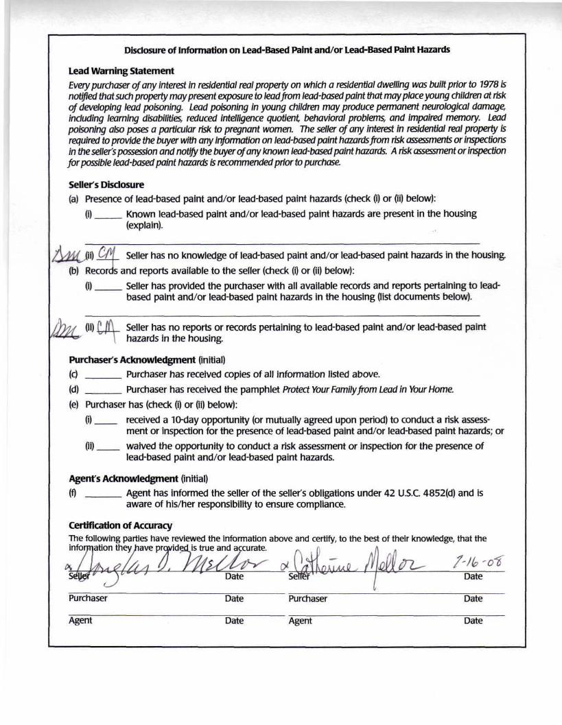
Disclosure of Information on Lead-Based Paint and/or Lead-Based Paint Hazards
Lead Warning Statement
Every purchaser of any interest in residential real property on which a residential dwelling was built prior to 1978 isnotified that such property may present exposure to lead from lead-based paint that may place young children at riskof developing lead poisoning. Lead poisoning in young children may produce permanent neurological damage,including learning disabilities, reduced intelligence quotient, behavioral problems, and impaired memory. Leadpoisoning also poses a particular risk to pregnant women. The seller of any interest in residential real property isrequired to provide the buyer with any information on lead-based paint hazards from risk assessments or inspectionsin the seller's possession and notify the buyer of any known lead-based paint hazards. A risk assessment or inspectionfor possible lead-based paint hazards is recommended prior to purchase.
Seller's Disclosure
(a) Presence of lead-based paint and/or lead-based paint hazards (check (i) or (ii) below):(i) Known lead-based paint and/or lead-based paint hazards are present in the housing
(explain).
|ii) ^n Seller has no knowledge of lead-based paint and/or lead-based paint hazards in the housing.
(b) Records and reports available to the seller (check (i) or (ii) below):(i) Seller has provided the purchaser with all available records and reports pertaining to lead-
based paint and/or lead-based paint hazards in the housing (list documents below).
CO Seller has no reports or records pertaining to lead-based paint and/or lead-based painthazards in the housing.
Purchaser's Acknowledgment (initial)
(c) Purchaser has received copies of all information listed above.
(d) Purchaser has received the pamphlet Protect Your Family from Lead in Your Home.(e) Purchaser has (check (i) or (ii) below):
(i) received a 10-day opportunity (or mutually agreed upon period) to conduct a risk assess-ment or inspection for the presence of lead-based paint and/or lead-based paint hazards; or
(ii) ___ waived the opportunity to conduct a risk assessment or inspection for the presence oflead-based paint and/or lead-based paint hazards.
Agent's Acknowledgment (initial)
(f) Agent has informed the seller of the seller's obligations under 42 U.S.C 4852(d) and isaware of his/her responsibility to ensure compliance.
Certification of AccuracyThe following parties have reviewed the information above and certify, to the best of their knowledge, that theinformation they have prc
Date
Purchaser
Agent
Date
Date
Purchaser
Agent
Date
Date