Embed Size (px)
Citation preview

Historic Resources Survey Report
West Los Angeles Community Plan Area
Prepared for:
City of Los Angeles Department of City Planning Office of Historic Resources Prepared by:
SAPPHOS ENVIRONMENTAL, INC. Pasadena, CA
August 15, 2012

SurveyLA West Los Angeles Community Plan Area
Table of Contents
Project Overview 1 SurveyLA Methodology Summary 1 Project Team 3 Survey Area 3 Designated Resources 10 Community Plan Area Survey Methodology 12
Summary of Findings 14 Summary of Property Types 14 Summary of Contexts and Themes 16
For Further Reading 44
Appendices Appendix A: Individual Resources Appendix B: Non-Parcel Resources Appendix C: Historic Districts & Planning Districts

SurveyLA 1
West Los Angeles Community Plan Area
Project Overview
This historic resources survey report (“Survey Report”) has been completed on behalf of the City of Los Angeles Department of City Planning’s Office of Historic Resources (OHR) for the SurveyLA historic resources survey of the West Los Angeles Community Plan Area (CPA). This project was undertaken from September 2011 to May 2012 by Sapphos Environmental, Inc. This Survey Report provides a summary of the work completed, including a description of the survey area; an overview of the field methodology; a summary of relevant contexts, themes, and property types; and complete lists of all surveyed resources. This Survey Report is intended to be used in conjunction with the SurveyLA Field Results Master Report (“Master Report”), which provides a detailed discussion of SurveyLA methodology and explains the terms used in this report and associated appendices. The Master Report, Survey Report, Appendices, and Results Map are available at www.surveyla.org.
SurveyLA Methodology Summary Below is a brief summary of SurveyLA methodology. Refer to the Master Report discussed above for more information. Field Survey Methods Properties surveyed for SurveyLA are evaluated for eligibility for listing in the
National Register of Historic Places, California Register of Historical Resources, and for local designation as City Historic-Cultural Monuments (HCM) or Historic Preservation Overlay Zones (HPOZ), commonly known as historic districts.
Field surveyors cover the entire area within the boundaries of a CPA. However, only resources that have been identified as significant within the contexts developed for SurveyLA are recorded.
Consultants making resource evaluations meet professional qualification standards in Architectural History, History, or a related field.
Surveys focus on identifying significant resources dating from about 1850 to 1980.
All surveys are completed from the public right-of-way (from vehicles or on foot as needed).
Digital photographs are taken of all evaluated resources.
SurveyLA 2
West Los Angeles Community Plan Area
Field Surveys do not include:
Individual resources and historic districts (including HPOZs) that are already designated (listed in the National, California, or local registers).
Community Redevelopment Area (CRA) surveys conducted within the last five years.
Potential Historic Preservation Overlay Zone (HPOZ) areas that have been surveyed in the last five years and are in the process of being designated.
Industrial properties, which will be surveyed in a later phase of SurveyLA. SurveyLA Resources Types SurveyLA identifies individual resources, non-parcel resources, historic districts, and district contributors and non-contributors. Each of these is described below. Appendices A, B, and C are organized by resource type. Individual Resources are generally resources located within a single assessor
parcel such as a residence or duplex. However, a parcel may include more than one individual resource, if each appears to be significant.
Non-Parcel Resources are not associated with Assessor Parcel Numbers (APNs) and generally do not have addresses. Examples include street trees, street lights, landscaped medians, bridges, and signs.
Historic Districts are areas that are related geographically and by theme. Districts may include single or multiple parcels, depending on the resource. Examples of resources that may be recorded as historic districts include residential neighborhoods, garden apartments, commercial areas, large estates, school and hospital campuses, and industrial complexes.
District Contributors and Non-Contributors are buildings, structures, sites, objects, and other features located within historic districts. Generally, non-contributing resources are those that are extensively altered, built outside the period of significance, or that do not relate to historic contexts and themes defined for the district.
Planning Districts are areas that are related geographically and by theme, but do not meet eligibility standards for designation. This is generally because the majority of the contributing features have been altered, resulting in a cumulative impact on the overall integrity of the area that makes it ineligible as a Historic District. The Planning District determination, therefore, is used as a tool to inform new Community Plans being developed by the Department of City Planning. These areas have consistent planning features – such as height, massing, setbacks, and street trees – which warrant consideration in the local planning process.

SurveyLA 3
West Los Angeles Community Plan Area
Project Team The West Los Angeles CPA survey was conducted by the following personnel from Sapphos Environmental Inc.: Leslie Heumann, Historic Resources Manager; Marlise Fratinardo, Senior Cultural Resources Coordinator; and Laura Carías, Cultural Resources Coordinator. Additional assistance was provided by intern Marilyn Novell.
Survey Area The identified survey area for West Los Angeles corresponds with the boundary for the West Los Angeles Community Plan Area (CPA). The West Los Angeles CPA is located in the western portion of the City of Los Angeles approximately twelve miles west of downtown. It has an irregular boundary that can be generally defined by Wilshire Boulevard and Santa Monica Boulevard on the north; Durango Avenue, Robertson Boulevard, and Canfield Avenue on the east; National Boulevard, Pico Boulevard, and Exposition Boulevard on the south; and Centinela Avenue on the west. (See Survey Area Map below.) The West Los Angeles CPA comprises a total of 16,107 parcels. Of these, approximately 15,040 parcels within the CPA were surveyed by SurveyLA, comprising the “West Los Angeles Survey Area.” SurveyLA generally does not include properties constructed after 1980; individual resources and historic districts (including HPOZs) designated under federal, state, or local programs; and proposed HPOZs that have been surveyed within the last five years and are in the process of being designated. Industrial properties will be surveyed as a group in a later phase of SurveyLA. The natural topography of the West Los Angeles CPA is highly variable. Densely developed flat plains comprise the majority of the CPA’s western and central portions, which are occupied by residential neighborhoods, linear commercial strips that line major streets, and occasional swaths of concentrated industrial areas along freeway corridors. Traveling to the east, the CPA slopes upward and consists of rolling hills interspersed with small plateaus. This eastern area is developed almost exclusively with neighborhood residential properties and neighborhood amenities, such as parks and schools. Distinct elevation changes are common throughout the CPA, both within its neighborhoods to the east and along several major streets, such as Exposition Boulevard and Manning Avenue. The CPA consists of 4,565 acres, which is 1.74 percent of the total land area in the City of Los Angeles. The predominant street pattern consists of orthogonal grids that cover much of the flat plains and other level areas. In the CPA’s hilly eastern portion, curvilinear streets and cul-de-sacs reflect the dips and curves of the rolling topography. The superblocks of Century City and Fox Studios in the north central portion of the CPA contrast with the scale of the surrounding residential neighborhoods. There are two

SurveyLA 4
West Los Angeles Community Plan Area

SurveyLA 5
West Los Angeles Community Plan Area
large vegetated areas within an otherwise dense urban environment: Rancho Park Golf Course/Cheviot Hills Recreational Area and Hillcrest Country Club, both located in the center of the CPA. To the south, the linear and partially green former Pacific Electric Railroad right-of-way easement traverses the CPA from Overland west to the city of Santa Monica border. Major transportation routes through the CPA include two interstate freeways: Interstate 405 (San Diego Freeway) that bisects the CPA roughly in a north-south direction; and Interstate 10 (Santa Monica Freeway), portions of which run from east to west along the CPA’s southern boundary. These two major freeway corridors are elevated above the street level, and with their associated access ramps, establish barriers and provide funnels for traffic through the surrounding street grid in the southern and western portions of the CPA. Primarily characterized by commercial, industrial, and high-density residential uses, the prominent north-south corridors of the CPA include Sepulveda Boulevard, Westwood Boulevard, Overland Avenue, and Avenue of the Stars. Major east-west routes include Wilshire Boulevard, Santa Monica Boulevard, and West Pico Boulevard, which are characterized by their commercial strip uses. Another major east-west route is West Olympic Boulevard, which is somewhat unusual among other similar streets in that it remains largely residential east of Interstate 405 and transitions to commercial and industrial uses as it continues to the west. The neighborhoods of the West Los Angeles CPA are diverse in uses and property types. The CPA includes the Los Angeles neighborhoods of Sawtelle, West Los Angeles, Cheviot Hills, Beverlywood, Rancho Park, and Century City.1 The westernmost portion of the Pico-Robertson neighborhood is also located within the boundaries of the CPA. The CPA can generally be characterized by its mix of quiet residential neighborhoods and busy arterials lined with commercial uses. The neighborhood also contains or is adjacent to several large open spaces, specifically, Rancho Park Golf Course/Cheviot Hills Recreational Area, Hillcrest Country Club, and the Veterans Administration Hospital Complex (located outside the CPA boundary to the north of Wilshire Boulevard), each of which lends a park-like feel to its immediate surroundings. The area’s prominence as a center of business activity is evident in the large areas of land occupied by Fox Studios and Century City. In particular, Century City’s high-rise towers are visible throughout the Los Angeles basin. Prior to the arrival of Spanish explorers in 1769, members of the group historically known as the Gabrieleño tribe occupied the vast territory that comprises the present-day range of metropolitan Los Angeles. As early as 400 AD, within the CPA, a communal spring known as Kuruvunga, which was later associated with the Kuruvunga village, was located on the site of University High School, roughly at Santa Monica Boulevard and Barrington Avenue. Today, the continued preservation of this spring and sacred site is supported by the Gabrielino/Tongva Springs Foundation; the Tongva Sacred
1 Mapping L.A.: Los Angeles Times. http://projects.latimes.com/mapping-la/neighborhoods/region/westside/
(accessed March 15, 2012).

SurveyLA 6
West Los Angeles Community Plan Area
Springs are designated as City of Los Angeles Historic-Cultural Monument No. 522. During the late 1800s, the spring fed into the water supply of the City of Santa Monica.2 3 After the secularization of the Spanish Missions in 1833, the CPA area was occupied by portions of several Spanish and Mexican land grants that were divided, sold, and resold over time. These ranchos were Rancho Rincon de los Bueyes (the portion of the survey area south of Pico Boulevard between Manning Avenue and Robertson Boulevard), San Jose de los Buenos Ayres (the area north of Pico Boulevard), Rancho Rodeo de los Aguas (the area to the east), and Rancho La Ballona (the area to the southwest). During the 1890s, the Arnaz tract of Rancho Rincon de los Bueyes began to be subdivided. By 1905, the Los Angeles Times, foreshadowing the future of the region, noted that the area was under consideration for “the platting of choice suburban tracts.”4 The Sawtelle neighborhood, which occupies the CPA’s westernmost portion, is the only neighborhood in the CPA that was an incorporated city prior to its consolidation with the City of Los Angeles in 1922. The pre-consolidation boundary of the City of Sawtelle is defined by Centinela Avenue on the west, Wilshire Boulevard on the north, Pico Boulevard on the south, and Sepulveda Boulevard on the east. The area that would become known as Sawtelle was chosen for the western branch of the National Home for Disabled Volunteer Soldiers, authorized for construction in the western United States by Congress during the 1880s. Established in 1888, the “Old Soldier’s Home” (now known as the Veterans Administration Hospital) was constructed on land just north of the CPA. Further impetus for the growth of Sawtelle was provided by the establishment of an interurban rail line in 1896 that followed the present-day route of Santa Monica Boulevard, connecting Sawtelle with Hollywood and Beverly Hills to the east and Santa Monica to the west. The City of Sawtelle began its development in 1896 after its purchase by two entrepreneurs who formed the Pacific Land Company, purchasing 225 acres south of the Soldiers’ Home. With its affordable lots and ready access to transportation, hospital workers, veterans, and their families soon moved to the area, which by the turn of the century supported a one-room schoolhouse, a church, a small commercial district, and a public meeting hall. In 1902, the Los Angeles Times called Sawtelle “the little village that has sprung up round the Soldiers’ Home.”5 Early Sawtelle functioned primarily as an adjunct to the Soldier’s Home. In addition to the Soldier’s Home, agriculture was a key local industry. During the early 1900s, the southern sections of Sawtelle were largely agricultural, and the interurban railway provided the means to transport crops. Sawtelle had large fields of potatoes, barley, and strawberries and was a top producer of lima beans, with a nationally recognized lima bean cannery located at Santa Monica Boulevard and Missouri Avenue. By the 1910s, the area was increasingly becoming more residential and less
2 “Motion Presented by Cindy Miscikowski,” 17 May 2005.
3 Gabrielino Tongva Springs Foundation. http://gabrielinosprings.com/ (accessed 2 July 2012).
4 “More Acreage to Be Platted,” 2 July 1905. Los Angeles Times, p. V20.
5 “Why Not Jail the Urchins Parents?” 7 March 1902. Los Angeles Times, p. 11.

SurveyLA 7
West Los Angeles Community Plan Area
agricultural, prompting the development of less land-intensive agricultural uses. Large plant nurseries, such as the renowned Walter Armacost Nursery, located at Armacost and La Grange Avenue, in addition to the presence of other local farms, attracted skilled Japanese nationals or first-generation Japanese Americans (“Issei”) farmers and horticulturalists seeking employment to the area. Sawtelle became a point of entry for the Japanese-American community in Los Angeles during this period and, by the 1920s, a thriving Japanese-American commercial area had developed along Sawtelle Boulevard, to the south of Santa Monica Boulevard. Vegetable farming, gardening, and nursery work provided the livelihood for many Japanese-American residents in West Los Angeles prior to their removal to relocation camps during World War II. Japanese-American cultural and social influences are still apparent in Sawtelle today, with Japanese restaurants, shops, and, in particular, long-standing nursery businesses with direct historical ties to the original Japanese-American community that settled in the Sawtelle vicinity. The Sawtelle area has numerous residential front yard Japanese style gardens, characterized by lanterns, bonsai, statuary, and plants native to Japan, such as Japanese maple, pine, bamboo, and aralia; these gardens also reflect the area’s Japanese-American heritage. In many parts of the City, the availability of streetcar service was a key factor in laying the groundwork for future development. In West Los Angeles, streetcars played an important role, as, for example, in the early development of the Sawtelle area with its interurban line. In 1904, the Soldier’s Home became a stop on the Pacific Electric “Balloon Route,” a tourist excursion trolley that covered a balloon-shaped loop of Los Angeles attractions. In other parts of the CPA, however, development patterns clearly reflect automobile influences, as evidenced by the numerous low-density single-family residential tracts located in its hilly eastern portion that were developed beginning in the 1920s. The evolution of Pico Boulevard, a narrow dirt road that was paved in 1926, indicates the development that occurred in the area during the mid-1920s. By 1930, there were two automobiles for every three residents in Los Angeles. U.S. Highway 66, popularly known as "Route 66," was the nation's first all-weather highway linking Chicago to Los Angeles; a portion of this famous highway is today’s Santa Monica Boulevard, a section of which serves as the northern border of the CPA. With its expanses of open land consisting of level agricultural fields and pastoral hills, West Los Angeles was poised for residential development in the early years of the twentieth century. A combination of factors contributed to the area’s desirability among individuals with middle-class and upper-middle-class incomes, including the development of the University of California’s Los Angeles campus in nearby Westwood (opened in 1929), the charms of beach accessible living in adjacent Santa Monica and Venice, and the local entertainment industry presence. During the 1920s, large residential tracts were developed by several of Los Angeles’ key community builders, including the Janss Investment Company, Frank Meline, Frans Nelson, and Ole Hansen, who recognized the opportunity in the relatively cheap land and the pressing demand for single-family homes. For example, the area generally identified today as “Cheviot Hills” consists of several residential tracts that date from

SurveyLA 8
West Los Angeles Community Plan Area
this period: Country Club Highlands (1923); Cheviot Hills (1924); and Monte Mar Vista (1926). Although many of the single-family residences built in these tracts have been altered, sometimes extensively, the original site planning of these subdivisions is often intact. Today, each of these neighborhoods retains a distinct feeling: Cheviot Hills with its Old World charm; Beverlywood with its Olmsted-like parkways, curvilinear streets, and mature vegetation; and the large-scale Janss tracts with the relative homogeneity of the houses and the regularity of setbacks and the orthogonal grid street pattern. Like many other community builders, the Janss Investment Company, which developed the large “Westwood” tract that comprises much of the central portion of the West Los Angeles Survey Area, was a vertically integrated operation that purchased and subdivided land, designed and built houses, and advertised and sold properties. The intensity of the company’s newspaper advertising campaign was unprecedented and the properties in its developments sold quickly. Although not as active in the West Los Angeles survey area as in other parts of the city, Walter H. Leimert, the developer of Leimert Park, is associated with the development of Beverlywood during the 1940s. Beverlywood is notable for its site planning emphasis at its inception and for the establishment of the Beverlywood Homes Association, one of the first and among the strongest homeowners associations in Los Angeles. Developed somewhat concurrently with its earliest residential subdivisions during the 1920s, golf courses and country clubs were a key factor in attracting new homebuyers and contributing to the overall popularity of the area. Developers of the surrounding residential subdivisions advertised these local recreational amenities. Today, these areas continue to provide green open space and recreational opportunities. The entertainment industry has a long-standing association with West Los Angeles. Fox Studios (now Twentieth Century Fox), one of Los Angeles’ “Big Eight” major motion picture studios, established its West Los Angeles operations in 1928 on a large open tract that had been previously used as a “ranch” set location in silent-era films for Hollywood cowboy movie star Tom Mix. The presence of the studio contributed to the area’s “Hollywood” cachet as well as its residential development by providing employment, which, in turn, furthered the need for local housing. Advertisements promoting the new Janss Investment Company subdivisions during the 1920s depicted maps indicating the location of Fox Studios as well as other nearby studios, touting West Los Angeles as “The Second Hollywood.” Jewish residents of the “Westside” have played an important role in the development of the area. One factor was discrimination. Excluded from existing country clubs and prevented from buying houses by deed restrictions in older neighborhoods, a community of well-to-do Ashkenazi Jews from Germany settled in the area during the 1910s and founded the Hillcrest Country Club on Pico Boulevard in 1920. For about ten years, the club denied membership to the Eastern European Jews associated with the Hollywood entertainment industry and the adjacent Fox Studios. However, economic hardship during the Depression era caused the club to reconsider its policy and broaden its membership base, which resulted in the admittance of a group of Jewish

SurveyLA 9
West Los Angeles Community Plan Area
comedians, including Danny Kaye, Milton Berle, Groucho Marx, George Burns, and Jack Benny, among other Hollywood celebrities and movie executives many of whom resided locally. A thriving commercial strip that reflects this historical association with the Jewish community is located in the northeast corner of the CPA along Pico Boulevard. It has become the spine of the Pico-Robertson neighborhood; numerous long-standing small businesses and religious buildings continue to cater to the local Jewish population. Because early extensive residential development in the West Los Angeles CPA during the 1920s had consumed most of the large tracts of land, post–World War II suburbanization had a smaller impact. One notable exception is the 410-parcel California Country Club Estates located near the southeast corner of the CPA, which was built and sold by prominent developer Sanford D. Adler between 1951 and 1955. Appealing to individuals with middle-class incomes who worked in the entertainment industry, the California Country Club Estates development—then valued at $15,000,000—was sold out by 1955. The 1950s and 1960s also brought an increase in infrastructural, governmental, and business uses to West Los Angeles that continue to characterize the area today. The construction of the West Los Angeles Civic Center reflects the expansion of the City of Los Angeles in the post–World War II era and the corresponding need for local governmental services. The West Los Angeles Branch City Hall was opened in 1961 in partial realization of the City Planning Commission’s Master Plan, which called for decentralization of City services to outlying areas to serve the rapidly expanding population during this era. Another key development, conceived of as a “city within a city,” the Century City complex built during the 1960s is one the city’s several important commercial centers. Master-planned by Welton Becket, the complex included high-rise office towers, a retail center, residential towers, and the Century Plaza hotel, designed by renowned architect Minoru Yamasaki.6 Explored in a series of visionary plans, the full scope of the Century City development was unrealized. However, several key individual buildings designed by the era’s most renowned architects, such as I.M. Pei and Welton Becket, were built as originally envisioned. The spine of the development and an enduring component of Century City is Avenue of the Stars, a broad and fast-moving road of landscaped medians, custom street lights, mature vegetation, and a prominent fountain that conveys the grandeur of the development. Although barely 50 years old, Century City has been subject to redevelopment pressures; one of the newest additions to the area is the new Creative Artists Agency building, opened circa 2007 on the former ABC site across from the Century Plaza Hotel, and designed by Gensler. Strong and consistent property values in West Los Angeles have meant that the area’s affluent homeowners have had resources to expand and remodel their residences
6 Although Century City was originally conceived according to a single vision, its subsequent development and
appearance today do not reflect the master plan.

SurveyLA 10
West Los Angeles Community Plan Area
extensively. As a result, many of the original houses in the survey area have been altered significantly or demolished in favor of larger houses or infill multi-family residences. Recently constructed commercial buildings generally occupy assembled parcels, with much larger buildings than the earlier neighborhood businesses; most of the earlier commercial buildings have been demolished or extensively remodeled with replacement windows, doors, and façades. Beginning in the 1940s and continuing to the present day, large swaths of multi-family apartments and condominiums of varying styles and sizes were constructed along major streets in the CPA. In many cases, concentrations of multi-family residences extend into the earlier tract developments, creating a marked division between the older single-family residences and the considerably newer and larger multi-family buildings. Commercial uses along primary streets expanded consistently during 1920s through the 1950s. The development of neighborhood shopping corridors, in particular, Westwood Boulevard, Pico Boulevard, and Santa Monica Boulevard, provided local services to the area’s new neighborhoods. Numerous examples of long-standing local businesses, neighborhood theaters, and recreational amenities that were established during this period are located along these corridors. Today, the West Los Angeles Survey Area contains a wide range of residential, commercial and institutional resource types that represent a range of historic contexts and themes.

SurveyLA 11
West Los Angeles Community Plan Area
Designated Resources The following map depicts designated resources within the West Los Angeles CPA at the time of the survey. These include properties listed on the National Register of Historic Places (NR) and/or the California Register of Historical Resources (CR), as well as locally designated Los Angeles Historic-Cultural Monuments (HCM). The PDF-format map of survey findings (available at www.surveyla.org) for this CPA provides more detailed information on resources designated at the time of the survey. For the most up-to-date information on designated resources, contact the Office of Historic Resources.

SurveyLA 12
West Los Angeles Community Plan Area

SurveyLA 13
West Los Angeles Community Plan Area
Community Plan Area Survey Methodology The field survey was conducted using the methodology established by the Office of Historic Resources for SurveyLA, which includes the citywide Historic Context Statement and customized mobile Field Guide Survey System (FiGSS).7 A number of other community plan areas were being surveyed concurrently with the West Los Angeles CPA. Prior to commencing fieldwork in West Los Angeles, the project managers of these CPAs coordinated to conduct a group reconnaissance of each area. Project managers included Christy McAvoy of Historic Resources Group, Leslie Heumann of Sapphos Environmental, Inc., and Teresa Grimes of Galvin Preservation Associates. The purpose of this group reconnaissance was to establish consistency among the various survey areas, specifically regarding the application of the historic context statement and establishment of integrity thresholds. Following this group reconnaissance, each team developed a work plan specific to its survey area. The field work was completed in two phases: Identification and Documentation. The Identification Phase was conducted by a team of two qualified survey professionals, both of whom meet the Secretary of the Interior’s Professional Qualifications Standards. Using the sub-area framework, this phase involved a detailed and methodical review of each neighborhood, street, and individual property within the Survey Area. It was during this phase that decisions were made about which properties and districts should be documented, and how those properties should be evaluated. By making these decisions up-front and as a team, this methodology ensured a more thoughtful approach to resource identification and evaluation, created greater consensus among the field survey teams, and produced more consistent survey results. It also substantially streamlined the documentation process, enabling the field teams to document large numbers of properties quickly and efficiently. Once the Identification Phase was completed, the Documentation Phase began. During this phase, field work was conducted by teams of two surveyors. Properties that were identified during the previous phase, along with those that had significant associative qualities identified in pre-loaded data in FiGSS, were documented and evaluated for potential historic, cultural, or architectural significance. The field surveys were conducted from the public right-of-way. Documentation included a digital photograph, recordation of historic features and subsequent alterations, and the reason for a property’s potential historic significance. Surveyed properties include residential, commercial, institutional, and industrial buildings; infrastructural features such as street lights; and landscape features such as street trees and parks. Following the completion of field work, all survey data was reviewed in detail by a qualified survey professional to ensure accuracy and consistency throughout.
7 For more information about the SurveyLA methodology, see the SurveyLA Field Results Master Report.

SurveyLA 14
West Los Angeles Community Plan Area
The West Los Angeles Survey Area presented several challenges for the field survey teams. Some of the largest properties in the CPA could not be fully observed from the public right-of-way because of walls, fences, or hedges. These included the private Hillcrest Country Club and Fox Studios. Traffic congestion along the major transportation corridors in the CPA, such as Santa Monica Boulevard and Pico Boulevard, required that survey efforts be conducted on foot. All properties were evaluated to the extent possible based on observation from the public right-of-way and follow-up research. Survey teams conducted research on individual properties and neighborhoods throughout the field survey process. When specific information was needed to complete an evaluation, research was conducted using building permits, newspapers and periodicals. Supplemental research on historic tracts and developers helped to identify potentially significant historic districts and planning districts. Research on the specific community builders and developers of the numerous subdivisions in West Los Angeles was critical to the understanding of the area’s history. Resources included historic tract maps, community websites such as California Japantowns (http://www.californiajapantowns.org/), online Los Angeles Times and Sanborn Map Company archives provided by the Los Angeles Public Library, and the numerous newspaper advertising campaigns that accompanied the subdividing and sales of West Los Angeles’s multiple housing developments.
SurveyLA 15
West Los Angeles Community Plan Area
Summary of Findings The following discussion of Property Types, Contexts, and Themes relates to the resources identified and recorded as eligible for designation.
Summary of Property Types The West Los Angeles Survey Area contains a varied and diverse mix of property types representing all periods of its development since the early 1900s. The following is a brief summary of those property types that were documented and evaluated as historically, culturally, or architecturally significant. Residential Properties Residential properties account for the majority of the survey area. A small number of intact residential properties, typically single-family dwellings and duplexes in the Craftsman style, which date from approximately 1905 to 1922, were identified for their association with the City of Sawtelle prior to its consolidation with the City of Los Angeles in 1922. The area occupied by the former City of Sawtelle roughly covers the portion of the CPA located to the west of Sepulveda Boulevard. The survey also identified several single-family residential subdivisions within the survey area that date generally from the 1920s to the 1950s. Built by several of the most notable developers working in Los Angeles during this period, these residential subdivisions maximized the use of local topography and offered residents deep lots with consistent setbacks, tree-lined streets, ornamental street lights, and, in some cases, small parks and parkways. Many of these neighborhood characteristics remain extant today and provide a sense of overall design continuity in these areas. However, many individual properties display moderate to extensive degrees of alteration, and therefore concentrations of highly intact examples of residential properties within these subdivisions are relatively uncommon. Infill and replacement has also impacted the overall character of these neighborhoods. Several areas were identified that retained an overall sense of place in their scale, massing, and original site planning characteristics but were evaluated as “Planning Districts” as they do not exhibit sufficient overall integrity for consideration as historic districts. Numerous examples of multi-family dwellings constructed from the post–World War II era until the present day are located in the survey area. Several notable examples of multi-family residential properties were also identified as significant for their representative architectural styles. One multifamily historic district, the Smithwood Edris Multifamily Historic District, was identified in the survey area. The CPA has significant examples of residential properties dating from the 1920s through the 1960s that were identified for their architectural merit. Architectural

SurveyLA 16
West Los Angeles Community Plan Area
styles recorded represent Spanish Colonial Revival, Tudor Revival, Late American Colonial Revival, Mid-Century Modernism, and Late Modern Residential. Several of these properties are reflect the work of noted architects from the post–World War II period, including A. Quincy Jones, Ray Kappe, Carl Marston, and I.M. Pei. Commercial Properties The survey identified numerous examples of commercial property types, constructed from the 1920s to the 1960s, which serve the needs of adjacent residential neighborhoods. Typically located along major commercial corridors, examples include small retail businesses as well as isolated examples of neighborhood theaters, restaurants, a car wash, and a department store. Many of these businesses have remained in continuous operation since they were established decades ago. Examples of commercial signage were also identified. Commercial properties in the survey area reflect a variety of architectural styles, including Mid-Century Modernism, Googie, Corporate International, New Formalism, High Tech (Structural Expressionism), and Brutalism. High-rise examples of commercial properties were identified in Century City. Institutional Properties The CPA has several examples of institutional property types with educational, religious, civic, and recreational functions, including schools, fraternal clubs, municipal fire stations, a Department of Water and Power distribution station, and recreational facilities. Several institutional properties were also recorded as excellent examples of their style, which included Mediterranean Revival, Spanish Colonial Revival, and Mid-Century Modernism. One local branch civic administrative center, the West Los Angeles Civic Center, was identified as a historic district. A school from the pre-consolidation period of the City of Sawtelle was also identified. Cultural Landscape Properties Two designed landscapes located in the western portion of the CPA were identified under the Cultural Landscapes Context: a Japanese style garden and a small park.

SurveyLA 17
West Los Angeles Community Plan Area
Summary of Contexts and Themes Many of the contexts and themes developed for the SurveyLA Citywide Historic Context Statement are represented in the West Los Angeles survey area. The following is a representative sampling of some of the more common Context/Theme combinations used in the survey, as well as some representative examples that are specific to the West Los Angeles Survey Area. For a complete list of individual resources identified as meeting eligibility standards and criteria for the National Register, California Register, and/or local listing, see Appendix A. For a complete list of non-parcel resources identified as meeting eligibility standards and criteria for the National Register, California Register, and/or local listing, see Appendix B. For a complete list of historic districts identified as meeting eligibility standards and criteria for the National Register, California Register, and/or local listing, see Appendix C. This appendix also includes planning districts, which do not meet eligibility standards and criteria for listing but may warrant special consideration for local planning purposes.

SurveyLA 18
West Los Angeles Community Plan Area
Context: Pre-Consolidation Communities of Los Angeles, 1850-1932 Theme: Sawtelle, 1850-1922 Sub-Theme: Important Events in Sawtelle History, 1850-1922 This Context/Theme was used to evaluate properties representing development from Sawtelle’s pre-consolidation period. This includes properties that are located within the incorporated city of Sawtelle boundaries and pre-date the area’s consolidation to Los Angeles in 1922. Identified properties are primarily single-family residences; these Sawtelle remnants tend to be isolated examples that are interspersed with later development. One institutional property was identified, the original Fourth Street School (today the Nora Sterry Elementary School) located at 1727 S. Sawtelle Boulevard.
Address: 11322 W. LaGrange Avenue Address: 1638 S. Stoner Avenue Date: 1902 Date: 1919
Address: 2103 S. Colby Avenue Address: 11260 S. Mississippi Avenue Date: 1908 Date: 1915

SurveyLA 19
West Los Angeles Community Plan Area
Context: Residential Development & Suburbanization, 1850-1980 Theme: Developers and the Development Process, 1888-1975 Sub-Theme: Community and Operative Builders, 1888-1940 Single-family residential subdivisions developed by prominent community builders, including Janss Investment Company (Janss Westwood); Frans Nelson & Son (Cheviot Hills); and W.R. McConnell, Fred W. Forrester, and John P. Hayes as well as Ole Hanson and the Frank Meline Company (Monte Mar Vista), were evaluated under this Context/Theme and identified as Planning Districts. Located in the central and eastern portions of the CPA, these tree-lined subdivisions are associated with the rapid expansion of West Los Angeles during the 1920s. Original site planning elements of these subdivisions, including setbacks, curvilinear streets, and small parks interspersed among the residences, reflect the comprehensive vision of their developers.
Name: Monte Mar Vista Planning District Name: Cheviot Hills Planning District Date: : 1926-1940 Description: Street view of Club Circle Park, looking north at the intersection of Cresta Drive and Club Drive
Date: : 1924-1939 Description: Street view looking north along Motor Avenue at the intersection of Cheviot Drive
Name: Janss Westwood 1 Planning District Date:: 1923-1933 Description: Street view looking southwest from the intersection of Missouri Avenue and Westholme Avenue

SurveyLA 20
West Los Angeles Community Plan Area
Context: Residential Development & Suburbanization, 1850-1980 Theme: Developers and the Development Process, 1888-1975 Sub-Theme: Merchant Builders, 1940-1975
This Context/Theme was used to evaluate single-family residential subdivisions associated with merchant builders during the mid-twentieth century. Two examples were identified in the CPA. The Beverlywood Planning District, located to the east of Hillcrest Country Club near the eastern border of the CPA, was developed by Walter H. Leimert during the 1940s. The California County Club Planning District, in the CPA’s southwest portion immediately north of Manning Avenue and east of Queensbury Drive, was developed by Sanford D. Adler during the mid-1950s. These developments were largely targeted to individuals with middle-class incomes who worked in the entertainment industry.
Name: Beverlywood Planning District Name: California Country Club Planning District Date: 1940-1949 Description: Street view looking south along South Beverly Drive at the intersection of Monte Mar Drive
Date: 1952-1955 Description: Street view looking south on Dannyhill Drive towards Cheviot Drive

SurveyLA 21
West Los Angeles Community Plan Area
Context: Commercial Development, 1850-1980 Theme: Commercial Identity, 1850-1980 This Context/Theme was used to evaluate examples of long-standing local businesses that contributed to the commercial development of the area. . Demonstrating the importance of ready accessibility to their neighborhood customers, such properties are typically located along commercial corridors, and specifically within the survey area, Sawtelle Boulevard or Pico Boulevard. In addition to the role these businesses played in providing goods and/or services to local neighborhoods, many have an association with the social or cultural history of West Los Angeles and reflect the prominence of the Japanese-American and Jewish communities in the CPA.
Address: 1903 S. Sawtelle Boulevard Address: 10801 W. Pico Boulevard Name: Yamaguchi Bonsai Nursery Name: The Apple Pan Date: 1934
Date: 1923
Address: 2029 S. Sawtelle Boulevard Address: 9128 W. Pico Boulevard Name: Satsuma Imports Name: Beverlywood Bakery Date: 1924 Date: 1948

SurveyLA 22
West Los Angeles Community Plan Area
Context: Commercial Development, 1850-1980 Theme: Neighborhood Theaters, Pre–World War II, 1915-1942 The Context/Theme was used to evaluate significant examples of neighborhood theaters constructed prior to 1942. Designed to fit into the scale of the surrounding commercial buildings, theaters evaluated under this Context/Theme are prominently located in the commercial core of a community or neighborhood. Two neighborhood theaters located along Santa Monica Boulevard were identified in the CPA: the Nuart Theater and the Royal Theatre. The distinctive marquee sign of the Nuart Theater was also evaluated under the Commercial Signs Theme.
Address: 11272 W. Santa Monica Boulevard Address: 11525 W. Santa Monica Boulevard Name: Nuart Theater Name: Royal Theatre Date: 1930 Date: 1923

SurveyLA 23
West Los Angeles Community Plan Area
Context: Commercial Development, 1850-1980 Theme: Department Stores, 1920-1980 The Context/Theme was used to evaluate properties with an association with an early or major department store in Los Angeles. One example was identified: the West Los Angeles branch location of the May Company California chain of department stores. Occupying a prominent corner location at the intersection of Pico Boulevard and Overland Avenue, the construction of the building is representative of the rapid expansion of the company in the Los Angeles metropolitan area during the 1960s and reflects the desirability of Pico Boulevard as a shopping destination at the time of its construction.
Address: 10700 W. Pico Boulevard Name: May Company California Date: 1964

SurveyLA 24
West Los Angeles Community Plan Area
Context: Commercial Development, 1850-1980 Theme: Hotels, 1880-1980 Theme: Commercial Signs, 1906-1980 Sub-Theme: Projecting Blade Signs, 1906-1980 Significant examples of early hotels were evaluated under this Context/Theme. The hotels were also noted for their projecting blade signs which appear to be original. The attention-grabbing perpendicular orientation of this sign type, typically illuminated in neon, was popular choice for businesses, such as hotels, which relied upon walk-in traffic to sell their on-premise services.
Address: 1538 S. Sawtelle Boulevard Address: 1541 S. Sawtelle Boulevard Name: West End Hotel Name: Hotel Brooks Date: 1930 Date: 1939

SurveyLA 25
West Los Angeles Community Plan Area
Context: Public & Private Institutional Development, 1850-1980 Sub-Context: Education, 1876-1980 Theme: Public Schools and the LAUSD, 1876-1980 Sub-Theme: Pre-1933 Long Beach Earthquake, 1920-1933 One property, University High School, was evaluated using the Context/Theme for public schools constructed prior to the 1933 Long Beach Earthquake, which significantly damaged or destroyed dozens of LAUSD schools such that intact examples of these properties are relatively rare. Like other examples of its property type, the two-story building serves in an administration function for a large campus comprised of several other buildings. University High School was also evaluated under the Architecture & Engineering Context as an excellent example of Renaissance Revival style institutional architecture.
Address: 11800 W. Texas Avenue Name: University High School Date: 1924
SurveyLA 26
West Los Angeles Community Plan Area
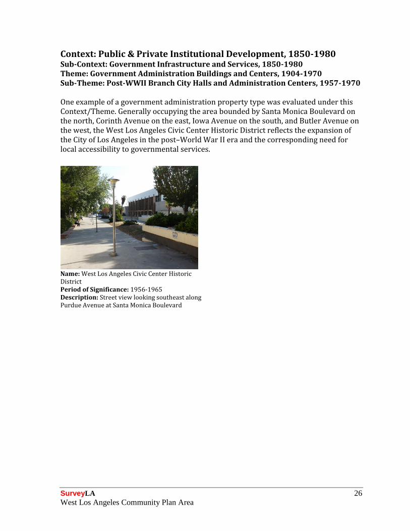
Context: Public & Private Institutional Development, 1850-1980 Sub-Context: Government Infrastructure and Services, 1850-1980 Theme: Government Administration Buildings and Centers, 1904-1970 Sub-Theme: Post-WWII Branch City Halls and Administration Centers, 1957-1970 One example of a government administration property type was evaluated under this Context/Theme. Generally occupying the area bounded by Santa Monica Boulevard on the north, Corinth Avenue on the east, Iowa Avenue on the south, and Butler Avenue on the west, the West Los Angeles Civic Center Historic District reflects the expansion of the City of Los Angeles in the post–World War II era and the corresponding need for local accessibility to governmental services.
Name: West Los Angeles Civic Center Historic District
Period of Significance: 1956-1965 Description: Street view looking southeast along Purdue Avenue at Santa Monica Boulevard

SurveyLA 27
West Los Angeles Community Plan Area
Context: Public & Private Institutional Development, 1850-1980 Sub-Context: Government Infrastructure and Services, 1850-1980 Theme: Public Works, 1900-1980 Sub-Theme: Street Lights and the Bureau of Street Lighting, 1900-1980 One contiguous concentration of historic street lights, located along both sides of Olympic Boulevard from Beverly Glen Boulevard on the east and Cotner Avenue on the west, was identified in the survey area for its association with a municipal street lighting program to complete streetscape improvements prior to the 1932 Olympic Games.
Name: Olympic Boulevard Street Lights Date: 1925

SurveyLA 28
West Los Angeles Community Plan Area
Context: Public & Private Institutional Development, 1850-1980 Sub-Context: Private Recreation, 1880-1980 Theme: Private Recreation Facilities, 1880-1980 Significant examples of recreational property types were evaluated under this Context/Theme. Two examples were identified under separate sub-themes, one as a private Country Club and one as a private Golf Course (which was later converted to a public facility). Both properties represent the recreational amenities that typified this area during the 1920s, which were advertised by developers of nearby subdivisions as inducements for prospective home buyers. The properties are located adjacent to one another along West Pico Boulevard.
Address: 10100 W. Pico Boulevard Address: 10460 W. Pico Boulevard Name: Hillcrest Country Club Date: 1920
Name: Rancho Park Golf Course/Cheviot Hills Recreation Center
Date: 1921

SurveyLA 29
West Los Angeles Community Plan Area
Context: Public & Private Institutional Development, 1850-1980 Sub-Context: Religion & Spirituality, 1850-1980 Theme: Religion & Spirituality and Ethnic/Cultural Associations, 1850-1980 Significant examples of religious property types with ethnic/cultural associations were evaluated under this Context/Theme. One example, the West Los Angeles Buddhist Temple, was identified for its associations with the West Los Angeles Japanese-American community. The property also reflects the heritage of Jodo Shinshu Buddhism in West Los Angeles.
Address: 2003 S. Corinth Avenue Name: West Los Angeles Buddhist Temple Date: 1954

SurveyLA 30
West Los Angeles Community Plan Area
Context: Public & Private Institutional Development, 1850-1980 Sub-Context: Education, 1876-1980 Theme: Education and Ethnic/Cultural Associations, 1876-1980 Significant examples of educational property types with ethnic/cultural associations were evaluated under this Context/Theme. Founded in 1925 to promote the teaching and use of the Japanese language, the Japanese Institute of Sawtelle was identified during the survey for its long-standing associations with the Japanese-American community in West Los Angeles. During World War II, instruction at the property ceased when the West Los Angeles chapter of the American Red Cross utilized the property for the duration of the war. The school resumed its community service activities after the war by serving as a hostel for Japanese-Americans returning to the area from wartime internment camps. The property continues its long tradition of community service by providing instruction in the Japanese language to youths and meeting space to a variety of nonprofit community organizations.
Address: 2110 S. Corinth Avenue Name: Japanese Institute of Sawtelle Date: 1929

SurveyLA 31
West Los Angeles Community Plan Area
Context: Public & Private Institutional Development, 1850-1980 Sub-Context: Government Infrastructure & Services, 1850-1980 Theme: Municipal Fire Stations, 1900-1980 Sub-Theme: Post-WWII Fire Stations, 1947-1960 Fire stations from the post–World War II period were evaluated under this Context/Theme for their association with Los Angeles’ postwar growth and expansion. The exponential growth that occurred during this period required the construction of new municipal facilities to meet the need for emergency services. Two examples were identified in West Los Angeles, both of which display the smooth surfaces, horizontal orientation, stucco or brick exteriors, rectangular massing, and boxy volumes of the Mid-Century Modern style, a popular choice for municipal fire stations during this era.
Address: 10550 W. Pico Boulevard Address: 11505 W. Olympic Boulevard Name: Fire Station No. 92 Name: Fire Station No. 59 Date: 1959 Date: 1963

SurveyLA 32
West Los Angeles Community Plan Area
Context: Public & Private Institutional Development, 1850-1980 Sub-Context: Military Institutions & Activities, 1850-1980 Theme: Air Raid Sirens & Civil Defense, 1939-1960 Air raid sirens were installed throughout Los Angeles during the World War II and Cold War periods. Air raid sirens within the CPA are located near prominent intersections along commercial corridors that border residential neighborhoods. Two resources were documented under this sub-theme in the CPA. They include rare, intact examples of the Federal Model SD-10 “Wire Spool” air raid siren. Both were installed on a freestanding support pole.
Name: Air Raid Siren 048 Name: Air Raid Siren 049 Date: circa 1940 Description: Street view looking south along Texas Avenue, mid-block between Armacost Avenue and Brockton Avenue
Date: circa 1940 Description: Street view looking southeast at the intersection of Mississippi Avenue and Stoner Avenue

SurveyLA 33
West Los Angeles Community Plan Area
Context: Public & Private Institutional Development, 1850-1980 Sub-Context: Government Infrastructure and Services, 1850-1980 Theme: Municipal Water and Power, 1916-1980 Sub-Theme: Distributing and Receiving Stations, 1916-1980 One property, a Department of Water and Power Distribution Headquarters, was evaluated under this Context/Theme. Constructed in the postwar era, the property reflects the need for power distribution facilities due to the rapid expansion of West Los Angeles after World War II. Located near the busy intersection of Centinela Avenue and Olympic Boulevard at the edge of an industrial area, the property was the only example of a large-scale power distribution facility observed in the survey area.
Address: 12300 W. Nebraska Avenue Name: DWP Distribution Headquarters Date: 1955

SurveyLA 34
West Los Angeles Community Plan Area
Context: Architecture & Engineering, 1850-1980 Theme: Mediterranean and Indigenous Revival, 1887-1952 Sub-Theme: Spanish Colonial Revival, 1915-1942 This Context/Theme/Sub-Theme was used to evaluate significant examples of Spanish Colonial Revival architecture. Identified resources that exhibit a high quality of design were located throughout the survey area. These properties exhibit the stucco exteriors; asymmetrical façade design; arched openings; clay tile roofs; embellished door and window surrounds; and balconies, patios, or courtyards that are indicative of the Spanish Colonial Revival style. Residential and institutional property types in the Spanish Colonial Revival style were located throughout the survey area.
Name: Smithwood Edris Multifamily Historic District
Address: 10405 West Cheviot Drive Date: 1930
Period of Significance: 1931-1935 Description: Street view looking south at the intersection of Smithwood Drive and Edris Drive
Architect: Unknown (original permit unavailable)
Address: 2379 S. Westwood Boulevard Name: Westwood Hills Congregational Church Date: 1946 Architect: Roland S. Tuttle

SurveyLA 35
West Los Angeles Community Plan Area
Context: Architecture & Engineering, 1850-1980 Sub-Context: L.A. Modernism, 1919-1980 Theme: Post-War Modernism, 1946-1976 Sub-Theme: Mid-Century Modernism, 1945-1970 This Context/Theme was used to evaluate significant examples of Mid-Century Modern architecture. Residential and commercial examples identified as excellent and intact examples of the style were located throughout the survey area. Many represent the work of noted architects, including A. Quincy Jones, Frederick E. Emmons, Ray Kappe, and Carl Marston. Identified resources exhibit a high quality of design and craftsmanship and typically exhibit the direct expression of the structural system, unornamented surfaces, and smooth geometric volumes indicative of the Mid-Century Modern style. In West Los Angeles, examples of Mid-Century Modern architecture were typically identified as individual resources.
Address: 10565 W. National Boulevard Address: 10567 W. National Boulevard Date: 1954 Architect: Ray Kappe
Date: 1955 Architect: Carl Marston
Address: 2926 S. Club Drive Address: 10680 W. Pico Boulevard Date: 1955 Architect: A. Quincy Jones and Frederick E. Emmons
Date: 1964 Architect: Unknown (original permit unavailable)

SurveyLA 36
West Los Angeles Community Plan Area
Context: Architecture & Engineering, 1850-1980 Sub-Context: L.A. Modernism, 1919-1980 Theme: Post-War Modernism, 1946-1976 Sub-Theme: Googie, 1935-1969 This Context/Theme was used to evaluate significant examples of Googie architecture. One example of a property type that is often associated with the Googie style, a car wash, was identified under this sub-theme in the survey area. The property was recorded as an excellent, intact example that exhibits the sharp angles, dramatic rooflines, neon signage, and geometric orientation that typify the Googie style of architecture. The property was also recorded as an example of a property type associated with commercial development and the automobile.
Address: 10381 W. Pico Boulevard Name: Crown Car Wash Date: 1960

SurveyLA 37
West Los Angeles Community Plan Area
Context: Architecture & Engineering, 1850-1980 Sub-Context: L.A. Modernism, 1919-1980 Theme: Post-War Modernism, 1946-1976 Sub-Theme: Corporate International, 1946-1976 This Context/Theme was used to evaluate significant examples of Corporate International architecture. The example depicted below is a commercial high-rise tower associated with Century City that was recorded as an excellent and intact example of the style. Displaying a high quality of design the building exhibits the box-shaped form, horizontal bands of windows, and steel and glass construction materials that typify Corporate International architecture.
Address: 10160 W. Santa Monica Boulevard Name: Gateway East Date: 1963 Architect: Welton Becket and Associates

SurveyLA 38
West Los Angeles Community Plan Area
Context: Architecture & Engineering, 1850-1980 Sub-Context: L.A. Modernism, 1919-1980 Theme: Post-War Modernism, 1946-1976 Sub-Theme: New Formalism, 1955-1976 This Context/Theme was used to evaluate significant examples of New Formalist architecture. One example, the iconic Century Plaza Hotel, has served as a center of social, business, and political activity in West Los Angeles since 1966. Designed by master architect Minoru Yamasaki, the property was built as the centerpiece of the original Century City master plan developed by Welton Becket and Associates. The property was recorded as an excellent example of New Formalist commercial architecture. Exhibiting a high quality of design, the property reflects the strict symmetry, formality, and monumental form that are indicative of New Formalist architecture. The property was also recorded under the Commercial Development Context as a notable example of a hotel.
Address: 2025 S. Avenue of the Stars Name: Century Plaza Hotel Date: 1966 Architect: Minoru Yamasaki

SurveyLA 39
West Los Angeles Community Plan Area
Context: Architecture & Engineering, 1850-1980 Sub-Context: L.A. Modernism, 1919-1980 Theme: Late Modernism, 1966-1980 Sub-Theme: Late Modern Residential, 1966-1980 This Context/Theme was used to evaluate significant examples of Late Modern Residential architecture, which were recorded as excellent and intact examples of their style. This pair of residential high-rise towers, associated with the development of Century City, was designed by I.M. Pei and Welton Becket and Associates. They display high quality design and the distinctive features of Late Modern Residential architecture, including the absence of traditional ornamentation and pronounced horizontal fenestration.
Address: 2220 S. Avenue of the Stars Name: Century Tower Apartments Date: 1964 Architect: I. M. Pei, Welton Becket and Associates

SurveyLA 40
West Los Angeles Community Plan Area
Context: Architecture & Engineering, 1850-1980 Sub-Context: L.A. Modernism, 1919-1980 Theme: Late Modernism, 1966-1980 Sub-Theme: High Tech (Structural Expressionism), 1966-1980 This Context/Theme was used to evaluate excellent and intact examples of High Tech (Structural Expressionism) architecture that exhibit a high quality of design. The two identified examples depicted below are iconic commercial high-rise towers associated with Century City. Both are designed by master architects: Century Plaza Towers by Minoru Yamasaki and 1900 Avenue of the Stars by Albert C. Martin and Associates. Indicative of High Tech (Structural Expressionism) architecture, each exhibits an artistically treated and exposed structural system and metal and glass exteriors with a limited color palette of white, black, or gray.
Address: 1900 Avenue of the Stars Address: 2039 S. Century Park East Date: 1969 Architect: Albert C. Martin and Associates
Name: Century Plaza Towers Date: 1973 Architect: Minoru Yamasaki

SurveyLA 41
West Los Angeles Community Plan Area
Context: Architecture & Engineering, 1850-1980 Sub-Context: L.A. Modernism, 1919-1980 Theme: Late Modernism, 1966-1980 Sub-Theme: Brutalism, 1966-1980 This Context/Theme was used to evaluate significant examples of Brutalist architecture. One example was identified in the survey area as an excellent and intact example of the style that exhibits a high quality of design and craftsmanship. This property displays the unpainted exposed raked concrete, bold angularity, and distinctive geometries that are indicative of the style. This commercial property is the only example of Brutalist architecture identified in the survey area.
Address: 1180 S. Beverly Drive Name: Liberty Savings Building Date: 1966 Architect: Kurt Meyer & Associates

SurveyLA 42
West Los Angeles Community Plan Area
Context: Entertainment Industry, 1908-1980 Theme: Industrial Properties Associated with the Entertainment Industry, 1908-1980 Sub-Theme: Motion Picture Industry – Major Studio Era (“The Big Eight”), 1919-1949 This Context/Theme was used to evaluate major film studios. Dubbed “The Big Eight,” these studios were the primary players during the major studio era. They included Fox Film Corporation (later 20th Century-Fox), Loew’s Incorporated (which included Metro-Goldwyn-Mayer), Paramount Pictures, RKO Radio Pictures, Warner Bros., Universal Pictures, Columbia Pictures, and United Artists. Although centered in Hollywood, the studios also built lots in the San Fernando Valley (e.g., Universal, Warner Bros.) and the Westside (e.g., MGM). One film studio was constructed in the West Los Angeles CPA, Fox Film Corporation. Founded in 1915 by William Fox, the company merged in 1935 with Twentieth Century Pictures, which had been formed two years earlier by Darryl F. Zanuck, Joseph Schenk, Raymond Griffith, and William Goetz. The West Los Angeles plant, originally comprising some 300 acres, opened in 1926 and became known as “Movietone City.” Today, the fenced and gated lot occupies a super block extending from Pico Boulevard to Olympic Boulevard, west of Century City, and consists of sound stages, offices, crafts shops, standing sets, and other facilities.
Address: 10201 W. Pico Boulevard Name: Fox Studios Date: 1928

SurveyLA 43
West Los Angeles Community Plan Area
Context: Cultural Landscapes, 1875-1980 Sub-Context: Designed Landscapes, 1875-1980 Theme: Monumental Civic Improvements, 1916-1940 Examples of designed landscapes associated with civic improvements were evaluated under this Context/Sub-Context/Theme. One example in West Los Angeles was identified, a small landscaped triangular park located at the intersection of Santa Monica Boulevard, South Bundy Drive, and Ohio Avenue. The property is an excellent and intact example of a civic improvement that reflects the value of urban planning and local beautification efforts during the period, and demonstrates the contribution of civic improvements to local aesthetics. The Ohio and Bundy Triangle Park is the only example of its property type observed in the survey area.
Name: Ohio and Bundy Triangle Park Date: 1925 Description: Street view looking southwest at the intersection of Santa Monica Boulevard and Ohio Avenue

SurveyLA 44
West Los Angeles Community Plan Area
Context: Cultural Landscapes, 1875-1980 Sub-Context: Designed Landscapes, 1875-1980 Theme: Japanese Style Gardens, 1946-1969 Excellent and intact examples of gardens designed in the Japanese style were evaluated under this Context/Sub-Context/ Theme. Within the survey area, an extremely rare pre–World War II example of this property type was identified along the eastern edge of Stoner Park. Continuously reinterpreted throughout the decades, this Japanese style garden, with its mature vegetation and commemorative plaques, reflects the long-standing Japanese-American influence in the Sawtelle neighborhood of West Los Angeles. The property originated in 1931, when a group of Japanese-Americans planted a garden in the Sawtelle neighborhood’s Stoner Park "for the promotion of better understanding."
Name: Stoner Park Japanese Garden Date: 1931 Description: Street view looking southeast towards Stoner Park, located along the west side of Stoner Avenue between Nebraska Avenue to the north and Missouri Avenue to the south

SurveyLA 45
West Los Angeles Community Plan Area
For Further Reading The following is a list of general sources on the history and development of West Los Angeles. This list is not comprehensive but is being provided for informational purposes.
Fujimoto, Jack. Sawtelle: West Los Angeles’s Japantown. Images of America Series. San Francisco, CA: Arcadia Publishing, 2007.
Gabler, Neal. An Empire of Their Own: How the Jews Invented Hollywood. New York, NY: Anchor Books, 1988.
Gottlieb, Robert, Regina Freer, and Mark Vallianatos. The Next Los Angeles: The Struggle for a Livable City. Berkeley and Los Angeles, CA: University of California Press, 2006.
Hise, Greg. Magnetic Los Angeles: Planning the Twentieth-Century Metropolis. Baltimore, MD: Johns Hopkins Press, 1997.
Hise, Greg, and William Francis Deverell. Eden by Design: The 1930 Olmsted-Bartholomew Plan for the Los Angeles Region. Berkeley and Los Angeles, CA: University of California Press, 2000.
Houlgate, Deke. Frans Nelson: A Biography. Los Angeles, CA: Pueblo Press, 1940.
Ingersoll, Luther A. Ingersoll’s Century History: Santa Monica Bay Cities. Los Angeles, CA: Luther A. Ingersoll, 1908.
“Lines of the Pacific Electric: Western Division” in Interurbans, Vol. 15, No. 6, December 1957.
Longstreth, Richard. City Center to Regional Mall: Architecture, the Automobile, and Retailing in Los Angeles, 1920-1950. Cambridge, MA: MIT Press, 1998.
Loomis, Jan. Brentwood. Images of America. San Francisco, CA: Arcadia Publishing, 2008.
Myers, William A., and Scott, Ira L. Trolleys to the Surf: The Story of the Los Angeles Pacific Railway. Glendale, CA: Interurban Publications Inc., 1976.
Sitton, Tom, and William Deverell, eds. Metropolis in the Making: Los Angeles in the 1920s. Berkeley, CA: University of California, 2001.
Waldinger, Roger, and Mehdi Bozorgmehr, eds. Ethnic Los Angeles. New York, NY: Russell Sage Foundation, 1996.
Wanamaker, Marc. Westwood. Charleston, SC: Arcadia Publishing, 2010.

SurveyLA West Los Angeles Community Plan Area