Embed Size (px)
Citation preview
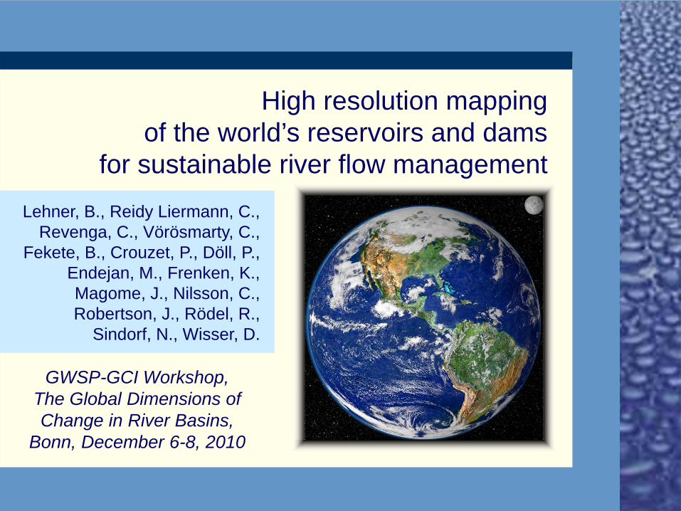
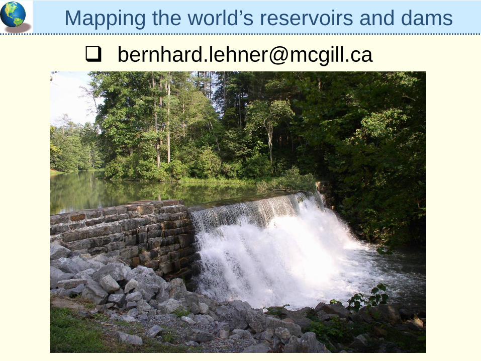
High resolution mappingof the world’s reservoirs and dams
for sustainable river flow managementLehner, B., Reidy Liermann, C.,
Revenga, C., Vörösmarty, C., Fekete, B., Crouzet, P., Döll, P.,
Endejan, M., Frenken, K., Magome, J., Nilsson, C., Robertson, J., Rödel, R.,
Sindorf, N., Wisser, D.
GWSP-GCI Workshop,The Global Dimensions of Change in River Basins,
Bonn, December 6-8, 2010
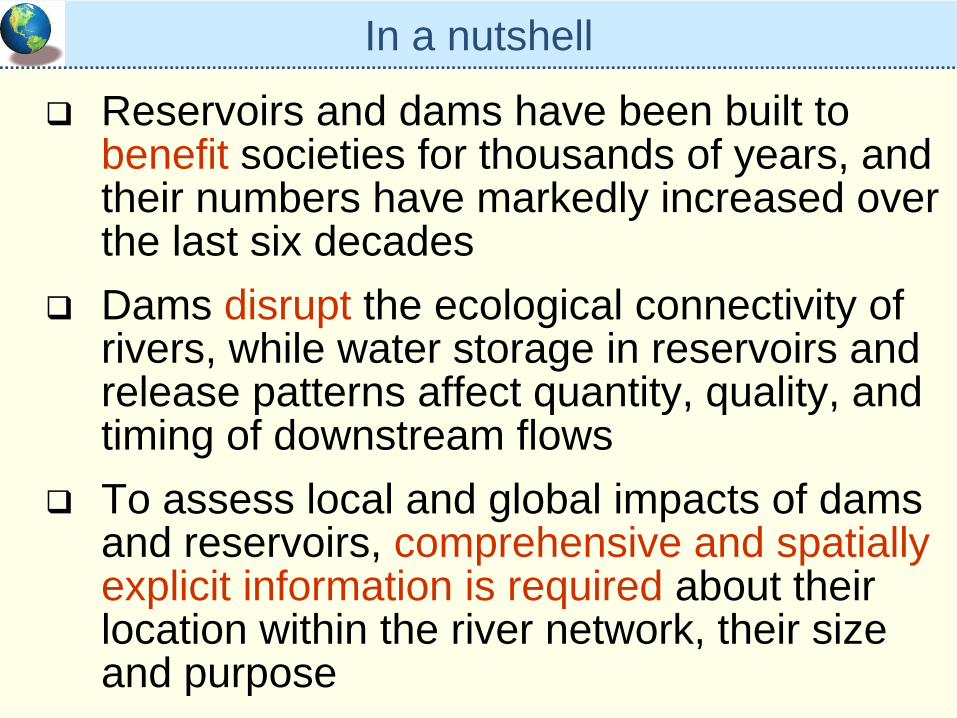
In a nutshell
Reservoirs and dams have been built to benefit societies for thousands of years, and their numbers have markedly increased over the last six decadesDams disrupt the ecological connectivity of rivers, while water storage in reservoirs and release patterns affect quantity, quality, and timing of downstream flowsTo assess local and global impacts of dams and reservoirs, comprehensive and spatially explicit information is required about their location within the river network, their size and purpose
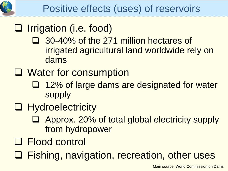
Positive effects (uses) of reservoirs
Irrigation (i.e. food)30-40% of the 271 million hectares of irrigated agricultural land worldwide rely on dams
Water for consumption12% of large dams are designated for water supply
HydroelectricityApprox. 20% of total global electricity supply from hydropower
Flood controlFishing, navigation, recreation, other uses
Main source: World Commission on Dams
Damn!
Dam
Dams and reservoirs – a fish’s perspective
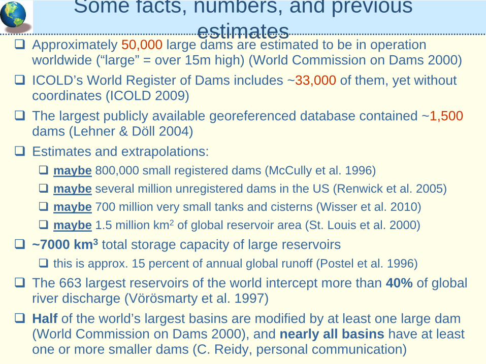
Some facts, numbers, and previous estimates
Approximately 50,000 large dams are estimated to be in operation worldwide (“large” = over 15m high) (World Commission on Dams 2000)ICOLD’s World Register of Dams includes ~33,000 of them, yet without coordinates (ICOLD 2009)The largest publicly available georeferenced database contained ~1,500dams (Lehner & Döll 2004)Estimates and extrapolations:
maybe 800,000 small registered dams (McCully et al. 1996)maybe several million unregistered dams in the US (Renwick et al. 2005)maybe 700 million very small tanks and cisterns (Wisser et al. 2010)maybe 1.5 million km2 of global reservoir area (St. Louis et al. 2000)
~7000 km3 total storage capacity of large reservoirs this is approx. 15 percent of annual global runoff (Postel et al. 1996)
The 663 largest reservoirs of the world intercept more than 40% of global river discharge (Vörösmarty et al. 1997)Half of the world’s largest basins are modified by at least one large dam (World Commission on Dams 2000), and nearly all basins have at least one or more smaller dams (C. Reidy, personal communication)
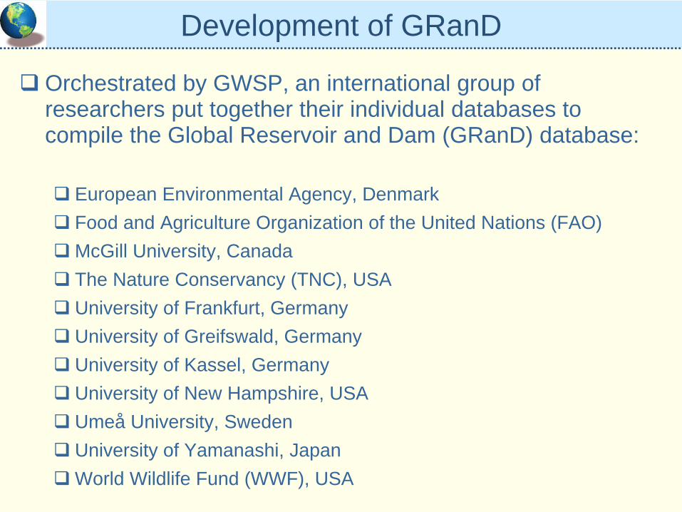
Development of GRanD
Orchestrated by GWSP, an international group of researchers put together their individual databases to compile the Global Reservoir and Dam (GRanD) database:
European Environmental Agency, DenmarkFood and Agriculture Organization of the United Nations (FAO)McGill University, CanadaThe Nature Conservancy (TNC), USAUniversity of Frankfurt, GermanyUniversity of Greifswald, GermanyUniversity of Kassel, GermanyUniversity of New Hampshire, USAUmeå University, SwedenUniversity of Yamanashi, JapanWorld Wildlife Fund (WWF), USA
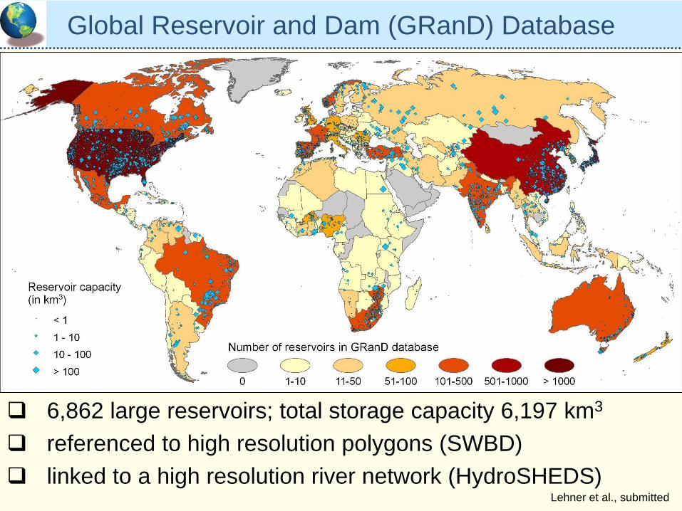
Global Reservoir and Dam (GRanD) Database
6,862 large reservoirs; total storage capacity 6,197 km3
referenced to high resolution polygons (SWBD)linked to a high resolution river network (HydroSHEDS)
Lehner et al., submitted
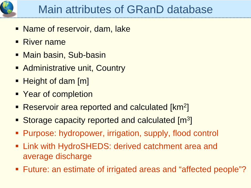
Main attributes of GRanD databaseName of reservoir, dam, lakeRiver nameMain basin, Sub-basinAdministrative unit, CountryHeight of dam [m]Year of completionReservoir area reported and calculated [km2]Storage capacity reported and calculated [m3]Purpose: hydropower, irrigation, supply, flood controlLink with HydroSHEDS: derived catchment area and average dischargeFuture: an estimate of irrigated areas and “affected people”?
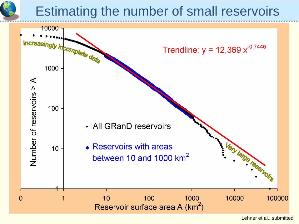
Estimating the number of small reservoirs
Lehner et al., submitted
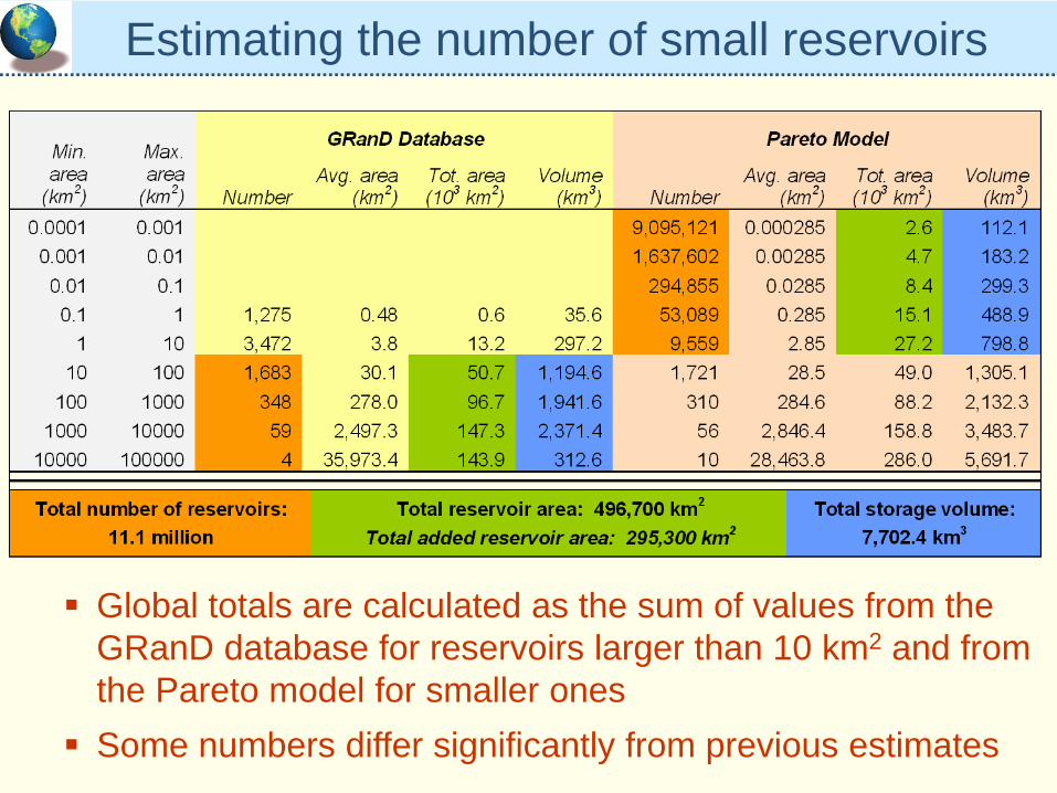
Estimating the number of small reservoirs
Global totals are calculated as the sum of values from the GRanD database for reservoirs larger than 10 km2 and from the Pareto model for smaller onesSome numbers differ significantly from previous estimates
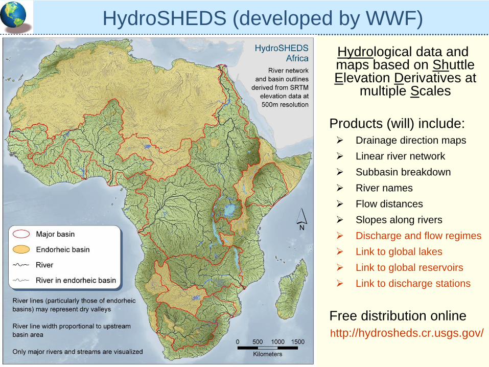
HydroSHEDS (developed by WWF)Hydrological data and maps based on Shuttle Elevation Derivatives at
multiple Scales
Products (will) include:Drainage direction mapsLinear river networkSubbasin breakdownRiver namesFlow distancesSlopes along riversDischarge and flow regimesLink to global lakesLink to global reservoirsLink to discharge stations
Free distribution onlinehttp://hydrosheds.cr.usgs.gov/
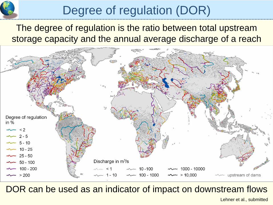
Degree of regulation (DOR)The degree of regulation is the ratio between total upstream
storage capacity and the annual average discharge of a reach
DOR can be used as an indicator of impact on downstream flowsLehner et al., submitted
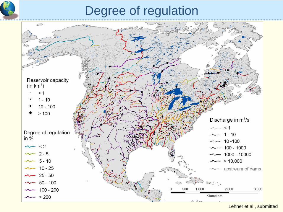
Degree of regulation
Lehner et al., submitted
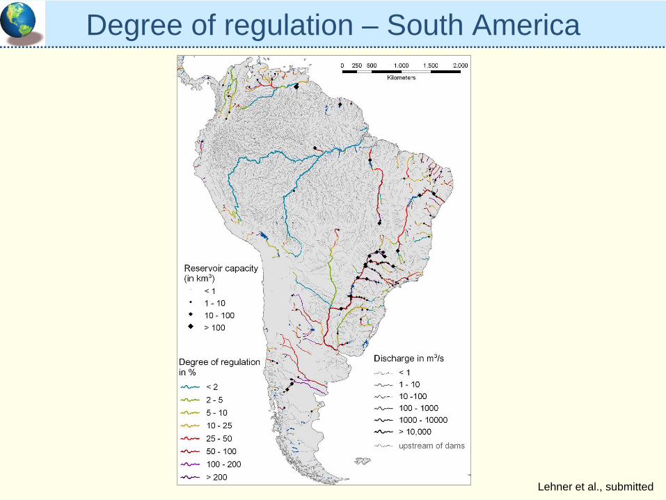
Degree of regulation – South America
Lehner et al., submitted
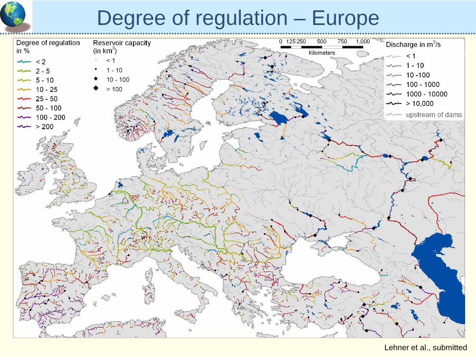
Degree of regulation – Europe
Lehner et al., submitted
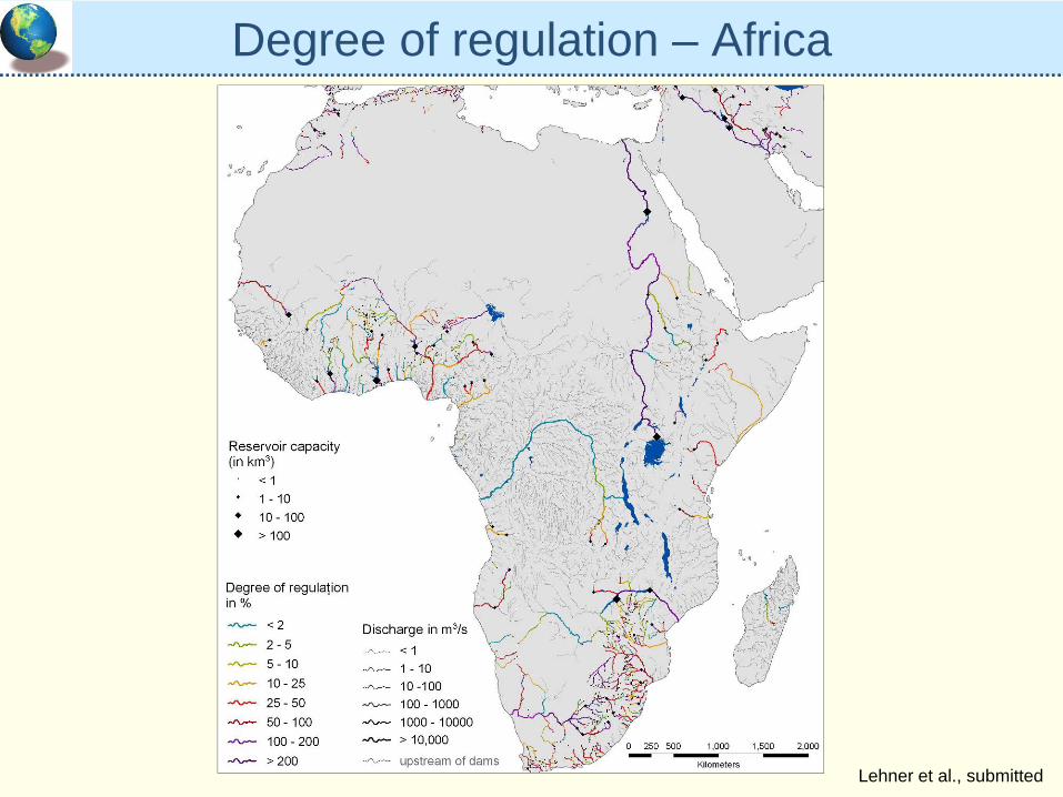
Degree of regulation – Africa
Lehner et al., submitted
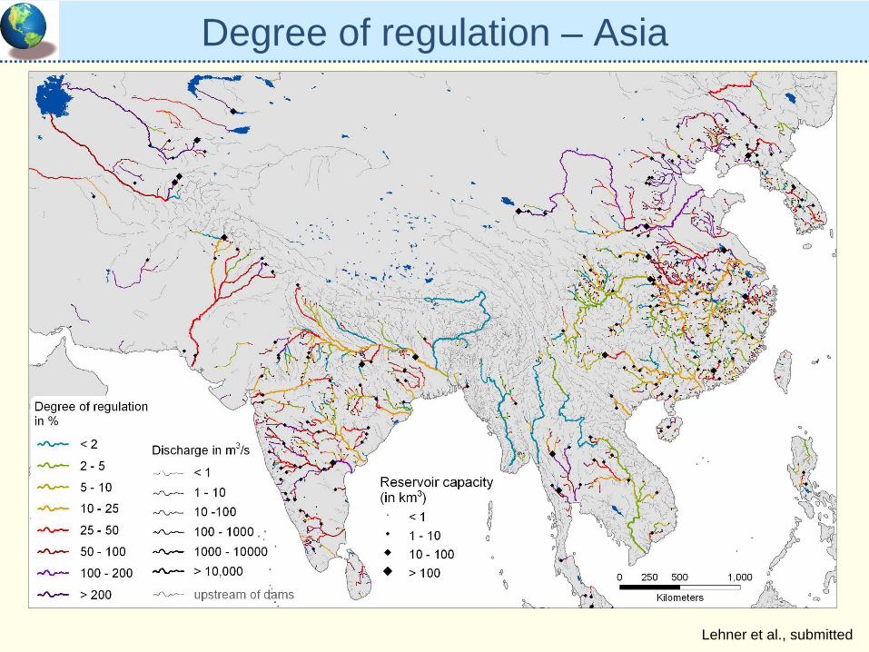
Degree of regulation – Asia
Lehner et al., submitted
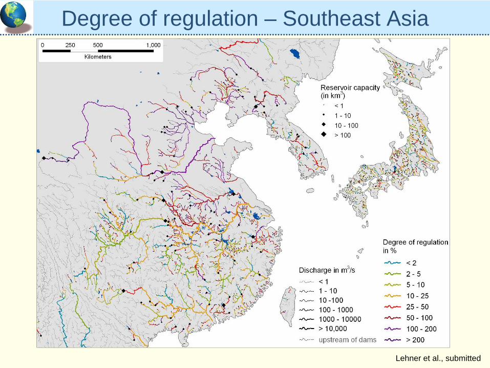
Degree of regulation – Southeast Asia
Lehner et al., submitted
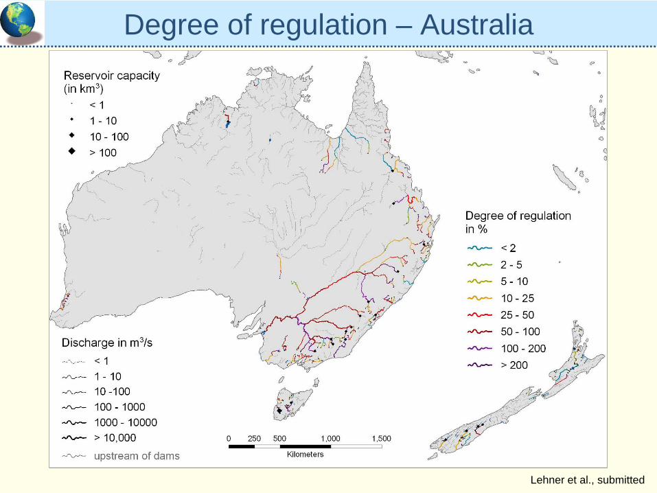
Degree of regulation – Australia
Lehner et al., submitted
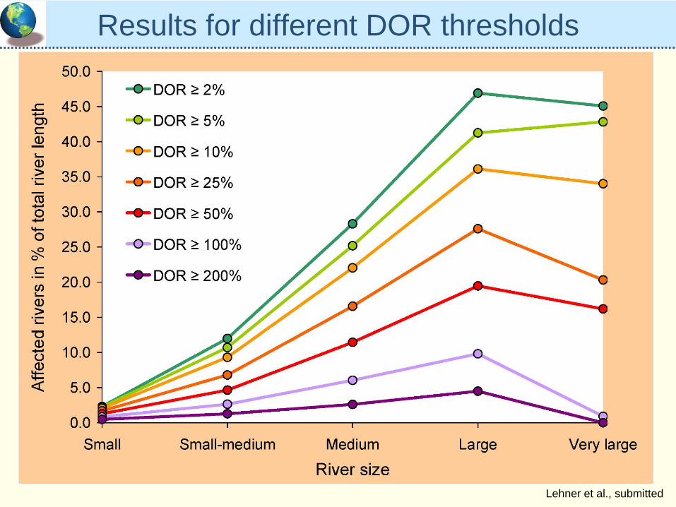
Results for different DOR thresholds
Lehner et al., submitted
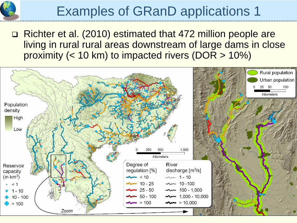
Examples of GRanD applications 1Richter et al. (2010) estimated that 472 million people are living in rural rural areas downstream of large dams in close proximity (< 10 km) to impacted rivers (DOR > 10%)
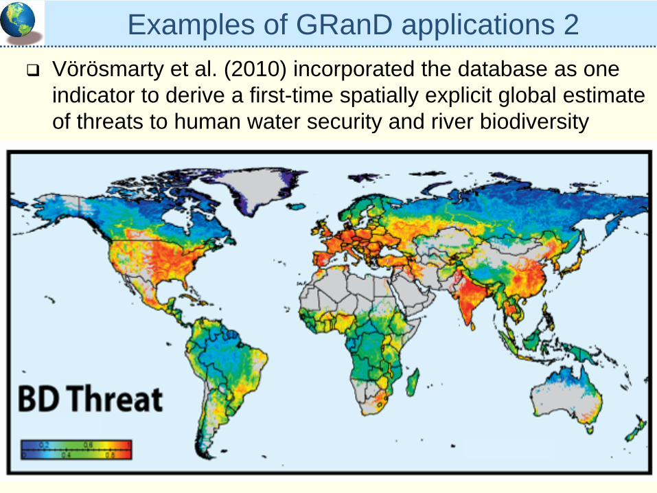
Examples of GRanD applications 2Vörösmarty et al. (2010) incorporated the database as one indicator to derive a first-time spatially explicit global estimate of threats to human water security and river biodiversity
SummaryGRanD is currently the most comprehensive, publicly available, geo-referenced database of reservoirsThe GRanD database, together with the HydroSHEDS river network, can serve as a “backbone” to advance ecohydrological studies and assist sustainable flow management strategiesPossible fields of application:
implementation of environmental flow standardsstrategic prioritization of dam location based on minimal downstream impactimprovement of dam operationsupdated estimates of river fragmentation (i.e. disrupted connectivity)hopefully many more…