Embed Size (px)
Citation preview
ACN 092 471 513
6 November 2017 ASX Release
HIGH GRADE GOLD DEFINED IN TARGETED UNDERGROUND
EXTENSION OF NEW PENNY’S FIND OPEN PIT MINE
High grade gold mineralisation confirmed by assays has been outlined by WA gold miner, Empire Resources Ltd (‘Empire’, ASX code: ERL, the “Company”) in the area targeted by the Company for a potential underground extension of its new Penny’s Find open pit gold mine, 50km northeast of Kalgoorlie. The assays are from a recent six hole diamond drilling program beneath the open pit. Better results include:
➢ 1.63m @ 15.60 g/t Au from 168.37m in hole PFD17-02
➢ 3.52m @ 6.32 g/t Au from 172.50m in hole PFD17-02
including 1.22m @ 12.34 g/t Au from 174.80m
➢ 5.00m @ 8.83 g/t Au from 148.00m in hole PFD17-04
including 2.22m @ 12.52 g/t Au from 150.78m
➢ 1.94m @ 10.57 g/t Au from 162.36m in hole PFD17-05
Figure 1 shows the hole pierce points and assays on long section and Table 1 the complete list of assay results. The aim of this drilling was to increase confidence in the gold mineralisation beneath the open pit, convert some Inferred resources to Indicated and to obtain important additional geotechnical data for ongoing underground mining studies. The new drill data has increased Empire’s confidence in the integrity of drilling results* previously obtained from below the current open pit e.g. 5m @ 20.88g/t Au, 3m @ 14.42g/t Au, 14m @ 5.34g/t Au, 6m @ 6.77g/t Au, 7m @ 5.27g/t Au and 3m @ 8.89g/t Au. Following completion of an updated resource calculation, the Company will commence a final underground feasibility study, expected to be finalised within a few months. *As reported in various ASX announcements and quarterlies in 2007 and 2012
For
per
sona
l use
onl
y

Empire’s Managing Director, Mr David Sargeant:
“Results from the recent underground drilling have given us the confidence to move ahead with a final underground feasibility to extend Penny’s Find’s mine life beyond the open pit. “With gold mineralisation open at depth, there is good potential to add to the current underground Indicated and Inferred resource of 170,000t @ 5.40g/t Au.” Penny Find’s mineralisation extends to 250m below surface and remains open at depth.
High grade gold mineralisation is hosted by quartz veins at the contact between sediments
and basalt.
Testwork has shown fresh mineralisation to be free milling with a high gravity recoverable
gold component of 85%.
Empire holds a 60% direct interest in the Penny’s Find gold project with the remaining 40%
interest held by unlisted Brimstone Resources Ltd.
The Company last month poured its first gold bar from the open pit operations, with the mine’s ore being toll processed at two nearby regional gold mills. DAVID SARGEANT MANAGING DIRECTOR November 2017 For further information on the Company, Tel: +61 8 9361 3100 Visit: www.resourcesempire.com.au
Competent Persons Statements
The information in this report that relates to Exploration Results has been compiled by Mr David Ross B.Sc(Hons), M.Sc, who is an employee of the Company. He is a member of the Australasian Institute of Mining and Metallurgy and the Australian Institute of Geoscientists. He has sufficient experience which is relevant to the style of mineralization and type of deposit under consideration and to the activity to which he is undertaking to qualify as a Competent Person as defined in the 2012 Edition of the “Australasian Code for Reporting of Exploration Results, Mineral Resources and Ore Reserves”. David Ross consents to the inclusion in the public release of the matters based on his information in the form and context
in which it appears.
The information is this release concerning the Mineral Resources for the Penny’s Find deposit has been estimated by Mr
Peter Ball B.Sc who is a director of DataGeo Geological Consultants and is a member of the Australasian Institute of Mining
and Metallurgy (AusIMM). Mr Ball has sufficient experience which is relevant to the style of mineralization and type of
deposit under consideration and qualifies as a Competent Person as defined in the 2012 Edition of the “Australasian Code
for Reporting of Exploration Results, Mineral Resources and Ore Reserves”. Mr Ball consents to the inclusion in this public
release of the matters based on his information in the form and context in which it appears.
For
per
sona
l use
onl
y

TABLE 1 : PENNY’S FIND DIAMOND DRILLING RESULTS
HOLE ID NORTH EAST AZ DIP EOH FROM TO LENGTH GRADE
GDA94 z51 (m) (m) (m) (m) (g/t Au)
PFD17-01 392039.6 6621938.7 233 -67.5 229.2 212.23 214.00 1.77 4.32
PFD17-02 392040.6 6621929.7 232 -54.5 194.2 168.37 170.00 1.63 15.60
incls 168.37 168.95 0.58 35.33
172.50 176.02 3.52 6.32
incls 174.80 176.02 1.22 12.34
PFD17-03 392043.0 6621839.8 247 -60.0 150.4 137.40 137.85 0.45 15.25
PFD17-04 392047.4 6621846.4 263 -60.0 166.1 148.00 153.00 5.00 8.83
incls 150.78 153.00 2.22 12.52
PFD17-05 392061.2 6621847.6 247 -65.0 190.0 162.36 164.30 1.94 10.57
PFD17-06 392066.0 6621848.7 263 -68.0 200.2 174.00 178.33 4.33 4.54
Assays on half core by 50gm fire assay/OES. Lower cut-off is 1.5 g/t Au, no high cut has been applied.
Maximum internal dilution is 1.0m @ <1.5g/t Au. True widths are approximately 85% of drill widths.
Figure 1 : Penny’s Find Long Section with drill hole pierce points
For
per
sona
l use
onl
y

Table 2 : Penny’s Find Resources - September 2015*
*Announced to the ASX on 2 September 2015
Figure 2 : Penny’s Find Long Section showing Preliminary Underground Mine Design
Class Tonnes Au g/t Tonnes Au g/t Tonnes Au g/t
Measured - - - - - -
Indicated 218,000 4.64 84,000 4.90 302,000 4.71
Inferred 82,000 1.79 86,000 5.89 168,000 3.89
TOTAL 300,000 3.86 170,000 5.40 470,000 4.42
Reportable In Situ Mineral Resource by location and cut-off
Open Cut (0.5g/t) Underground (1.5g/t) Combined
For
per
sona
l use
onl
y

Figure 3 : Penny’s Find Open Pit and Preliminary Underground Mine Design
(Looking northwest)
JORC 2012 COMPLIANCE TABLE
Section 1: Sampling Techniques and Data
Criteria JORC Code Explanation
Commentary
Sampling techniques
• Nature and quality of sampling (e.g. cut
channels, random chips, or specific
specialised industry standard measurement
tools appropriate to the minerals under
investigation, such as down hole gamma
sondes, or handheld XRF instruments, etc.).
These examples should not be taken as
limiting the broad meaning of sampling.
• A total of 6 diamond core drill holes with RC pre-
collars were completed to infill previous RC and
diamond drilling. Maximum hole depth was
229.2m.
• Include reference to measures taken to
ensure sample representivity and the
appropriate calibration of any
measurement tools or systems used.
• Half core was sampled. Sample length was no
greater than 1 metre.
• Aspects of the determination of
mineralisation that are Material to the
Public Report. In cases where ‘industry
standard’ work has been done this would
be relatively simple (e.g. ‘reverse
circulation drilling was used to obtain 1 m
samples from which 3 kg was pulverised to
produce a 30 g charge for fire assay’). In
other cases more explanation may be
required, such as where there is coarse
gold that has inherent sampling problems.
Unusual commodities or mineralisation
types (e.g. submarine nodules) may
warrant disclosure of detailed information.
• Diamond core drilling was used to obtain NQ2 core
from which half core was crushed and pulverised to
produce a 50 g charge for fire assay. Sampling was
done to geological boundaries with no sample being
greater than 1 metre in length.
For
per
sona
l use
onl
y
Drilling techniques
• Drill type (e.g. core, reverse circulation,
open-hole hammer, rotary air blast, auger,
Bangka, sonic, etc.) and details (e.g. core
diameter, triple or standard tube, depth of
diamond tails, face-sampling bit or other type,
whether core is oriented and if so, by what
method, etc.).
• NQ2 diamond core. Core was orientated at the end of
each drill run using a Reflex Ezi-Ori tool.
Drill sample recovery
• Method of recording and assessing core and chip sample recoveries and results assessed.
• Measures taken to maximise sample recovery and ensure representative nature of the samples.
• Whether a relationship exists between sample
recovery and grade and whether sample bias
may have occurred due to preferential
loss/gain of fine/coarse
material.
• Core recovery was recorded for each run. Recovery
ranged from 90 – 100%.
• No significant sample bias is considered to have
occurred
Logging
• Whether core and chip samples have been
geologically and geotechnically logged to a
level of detail to support appropriate Mineral
Resource estimation, mining studies and
metallurgical studies.
• Whether logging is qualitative or quantitative
in nature. Core (or costean, channel, etc.)
photography.
• The total length and percentage of the
relevant intersections logged.
• All core was geologically and geotechnically logged.
Sub-sampling
techniques and
sample
preparation
• If core, whether cut or sawn and whether
quarter, half or all core taken.
• If non-core, whether riffled, tube sampled,
rotary split, etc. and whether sampled wet or
dry.
• For all sample types, the nature, quality and
appropriateness of the sample preparation
technique.
• Quality control procedures adopted for all
sub-sampling stages to maximise
representivity of samples.
• Measures taken to ensure that the sampling is
representative of the in situ material collected,
including for instance results for field
duplicate/second-half sampling.
• Whether sample sizes are appropriate to the
grain size of the material being sampled.
• Core was sawn in half. Samples were maximum length
1m, or less if to geological boundaries.
• Not applicable
• The sample preparation of the core samples follows
industry best practice in sample preparation
involving crushing, pulverising of the entire sample
to a grind size of 85% passing 75 micron.
• QAQC procedures involved the use of certified
standards and blanks.
• Duplicate samples were not taken
• The sample sizes are considered appropriate to the
deposit type.
Quality of assay data
and laboratory
tests
• The nature, quality and appropriateness of
the assaying and laboratory procedures used
and whether the technique is considered
partial or total.
• For geophysical tools, spectrometers,
handheld XRF instruments, etc., the
parameters used in determining the analysis
including instrument make and model,
reading times, calibrations factors applied
and their derivation, etc.
• Nature of quality control procedures
adopted (e.g. standards, blanks, duplicates,
external laboratory checks) and whether
acceptable levels of accuracy (i.e. lack of
bias) and precision have been established .
• The analytical technique used was a 50gm fire
assay/OES finish. This achieves total extraction of the
gold from the sample.
• No geophysical tools were used to determine any
element concentrations.
• Certified standards and blanks were inserted roughly
every 15 samples.
Assays returned acceptable levels of
accuracy.
Verification of
sampling and
assaying
• The verification of significant intersections by
either independent or alternative company
personnel. • The use of twinned holes. • Documentation of primary data, data entry
procedures, data verification, data storage
(physical and electronic) protocols.
• Discuss any adjustment to assay data.
• Significant intersections are checked by the
exploration manager.
• No twinned holes were drilled.
• Data was entered into an Excel spreadsheet
• No adjustments were made to any assay data used
in this report. For
per
sona
l use
onl
y
Location of data
points
• Accuracy and quality of surveys used to
locate drill holes (collar and down-hole
surveys), trenches, mine workings and other
locations used in Mineral Resource
estimation. • Specification of the grid system used. • Quality and adequacy of topographic control.
• Hole collar coordinates have been picked up using a
RTK GPS with all co-ordinates and RL data considered
reliable.
• The grid system used for the location of all drill holes
is MGA_GDA94, Zone 51.
Data spacing and
distribution
• Data spacing for reporting of Exploration
Results.
• Whether the data spacing and distribution is
sufficient to establish the degree of
geological and grade continuity appropriate
for the Mineral Resource and Ore Reserve
estimation procedure(s) and classifications
applied.
• Whether sample compositing has been
applied.
• Drill spacing was based on infill requirements. • Not applicable
• No compositing has been applied to the sample
results.
Orientation of data in
relation to
geological
structure
• Whether the orientation of sampling achieves
unbiased sampling of possible structures and
the extent to which this is known, considering
the deposit type.
• If the relationship between the drilling
orientation and the orientation of key
mineralised structures is considered to have
introduced a sampling bias, this should be
assessed and reported if material.
• All holes were drilled at -54.5 to -68 degrees, roughly
perpendicular to the mineralization.
• Given the nature of the mineralizing system, no
orientation based sampling bias has been identified in
the data at this point. True widths of mineralization are
approximately 85% of drill widths.
Sample security
• The measures taken to ensure sample security. • Samples were delivered direct to the laboratory by a
contract geologist employed by Empire Resources.
Audits or reviews • The results of any audits or reviews of sampling techniques and data.
• No review has been carried out to date.
Section 2: Reporting of Exploration Results
Criteria JORC Code Explanation
Commentary
Mineral tenement and
land tenure
status
• Type, reference name/number, location
and ownership including agreements or
material issues with third parties such as
joint ventures, partnerships, overriding
royalties, native title interests, historical sites,
wilderness or national park and
environmental settings.
• The security of the tenure held at the time
of reporting along with any known
impediments to obtaining a licence to
operate in the area.
• Penny’s Find is located wholly within Mining Lease
M27/156 of which Empire Resources Limited has a
60% interest.
• A native title claim has recently been lodged over
the general area.
• The tenement is subject to one third party royalty.
• The tenement is a granted Mining Lease, is in good
standing and no known impediments exist.
Exploration
done by other
parties
• Acknowledgment and appraisal of
exploration by other parties.
• Previous exploration has been conducted at Penny’s
Find by Croesus Mining, Defiance Mining and
Brimstone Resources Ltd. They each carried out
small drilling programs which intersected gold
mineralization.
• A Mineral Resource estimate by JV partners Brimstone
Resources was released to the ASX in February 2015.
Geology • Deposit type, geological setting and style of mineralisation.
• Gold mineralization at Penny’s Find is hosted by
quartz veins in a shear zone at the contact between
mafic volcanics and sediments.
For
per
sona
l use
onl
y
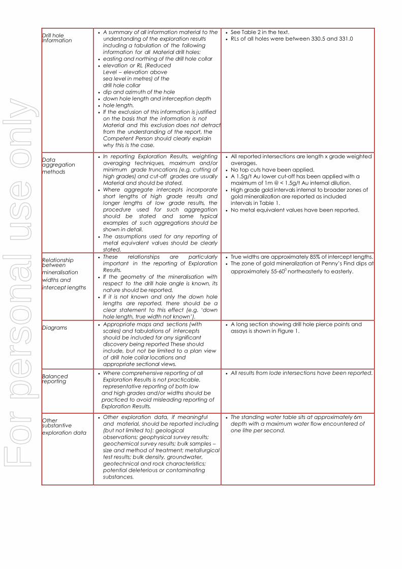
Drill hole Information
• A summary of all information material to the
understanding of the exploration results
including a tabulation of the following
information for all Material drill holes:
• easting and northing of the drill hole collar
• elevation or RL (Reduced
Level – elevation above
sea level in metres) of the
drill hole collar
• dip and azimuth of the hole
• down hole length and interception depth
• hole length.
• If the exclusion of this information is justified
on the basis that the information is not
Material and this exclusion does not detract
from the understanding of the report, the
Competent Person should clearly explain
why this is the case.
• See Table 2 in the text.
• RLs of all holes were between 330.5 and 331.0
Data aggregation
methods
• In reporting Exploration Results, weighting
averaging techniques, maximum and/or
minimum grade truncations (e.g. cutting of
high grades) and cut-off grades are usually
Material and should be stated.
• Where aggregate intercepts incorporate
short lengths of high grade results and
longer lengths of low grade results, the
procedure used for such aggregation
should be stated and some typical
examples of such aggregations should be
shown in detail.
• The assumptions used for any reporting of
metal equivalent values should be clearly
stated.
• All reported intersections are length x grade weighted
averages.
• No top cuts have been applied.
• A 1.5g/t Au lower cut-off has been applied with a
maximum of 1m @ < 1.5g/t Au internal dilution.
• High grade gold intervals internal to broader zones of
gold mineralization are reported as included
intervals in Table 1.
• No metal equivalent values have been reported.
Relationship between
mineralisation
widths and
intercept lengths
• These relationships are particularly
important in the reporting of Exploration
Results.
• If the geometry of the mineralisation with
respect to the drill hole angle is known, its
nature should be reported.
• If it is not known and only the down hole
lengths are reported, there should be a
clear statement to this effect (e.g. ‘down
hole length, true width not known’).
• True widths are approximately 85% of intercept lengths.
• The zone of gold mineralization at Penny’s Find dips at
approximately 55-600 northeasterly to easterly.
Diagrams
• Appropriate maps and sections (with
scales) and tabulations of intercepts
should be included for any significant
discovery being reported These should
include, but not be limited to a plan view
of drill hole collar locations and
appropriate sectional views.
• A long section showing drill hole pierce points and
assays is shown in Figure 1.
Balanced reporting
• Where comprehensive reporting of all
Exploration Results is not practicable,
representative reporting of both low
and high grades and/or widths should be
practiced to avoid misleading reporting of
Exploration Results.
• All results from lode intersections have been reported.
Other substantive
exploration data
• Other exploration data, if meaningful
and material, should be reported including
(but not limited to): geological
observations; geophysical survey results;
geochemical survey results; bulk samples –
size and method of treatment; metallurgical
test results; bulk density, groundwater,
geotechnical and rock characteristics;
potential deleterious or contaminating
substances.
• The standing water table sits at approximately 6m
depth with a maximum water flow encountered of
one litre per second.
For
per
sona
l use
onl
y

Further work
• The nature and scale of planned further
work (e.g. tests for lateral extensions or
depth extensions or large-scale step-out
drilling).
• Diagrams clearly highlighting the areas of
possible extensions, including the main
geological interpretations and future
drilling areas, provided this information is
not commercially sensitive.
• Not applicable
• See Figure 2
For
per
sona
l use
onl
y