Embed Size (px)
Citation preview

BUILDING STRONG®
HERBERT HOOVER DIKE REHABILITATION PROJECT Briefing for the Water Resources
Advisory Committee,
Recreation Workshop
Presented by
US Army Corps of Engineers
Jacksonville District
Ingrid Bon, PE
Project Manager Forward
15 September 2014

BUILDING STRONG®
Overview
Problems
Solutions
Rehabilitation Progress
LOST Closures
Current Projects
Implementation Timeline
Presentation Outline
2

BUILDING STRONG®
Lake Okeechobee is approximately 720 square miles
Basin is over 5,600 square miles
Average water depth is 9 feet
One foot of rainfall runoff from the basin can result in a three to four foot rise of the lake
During large flood events, water can flow into the lake much faster than it can be released
Lake Okeechobee
Herbert Hoover Dike Overview
3

BUILDING STRONG®
143 miles of embankment around Lake Okeechobee
32 federal culverts
5 spillway inlets
5 spillway outlets
9 navigation locks
9 pump stations
No overflow capability
Built by hydraulic dredge and fill methods
Not acceptable to today’s construction standards
Herbert Hoover Dike Today
4

BUILDING STRONG®
Culvert deterioration
Piping
Sinkhole
Internal erosion (seepage & piping)
Through embankment
Through foundation
Culvert structures
Soil erosion into conduit
Erosion/Piping around conduit
Overwash/Overtopping
Erosion of downstream slope
Dam Safety Action Classification (DSAC) Level 1- Assigned 2006
HHD Problems (Failure Modes)
5

BUILDING STRONG®
SAND CUT
N
Reach Boundary
Town/City
Port Mayaca
Okeechobee
Canal Point
Pahokee
Belle Glade Lake Harbor
Clewiston
Lake
Okeechobee
6
8
1
2
3
4
5
7
Moore Haven
South Bay
Sand Cut
FISHEATING
CREEK
Major Rehabilitation Report (MRR) - 2000
Reach 1 initial phase
Cutoff wall constructed
Federal Water Control Structures - 2011
32 Federal culverts within the entire HHD system
Replacement or removal
Dam Safety Modification Study (DSMS) - 2015
System-wide approach
Risk reduction measures below tolerable guidelines
Prioritize implementation
HHD Solutions
6

BUILDING STRONG®
KEY
FY 2011
FY 2012
FY 2013
FY 2014
FY 2015
FY 2016
FY 2017 278 274
2
268
272
282
281
275
273
6
FY11
FY20
Water Control Structure (Culvert)
Replacements - Construction
Contract Awards
265
266
4
284
288
287
286
271
267
4
285
291
290
4
292
279
270
269
280
4
276
277
2

BUILDING STRONG®
Lake Okeechobee Scenic Trail CURRENT CLOSURES
www.saj.usace.army.mil
Sections of the Lake Okeechobee Scenic Trail are closed while the U.S. Army Corps of
Engineers conducts Herbert Hoover Dike maintenance and rehabilitation.
The Port Mayaca to Canal Point section, the Pahokee to Torry
Island section, the South Bay to Clewiston section, the Liberty
Point to Moore Haven section, the Moore Haven to Lakeport
section, and the Taylor Creek to Nubbin Slough section remain
closed seven days a week for major dike rehabilitation activities.
The Corps does not anticipate opening some of these sections of
the trail until 2016 or later. The Herbert Hoover Dike
Rehabilitation Project’s goal is to reduce flood risk to the public
and the environment.
Contractors are using heavy construction vehicles and large
equipment within these areas. Truck traffic on the roads during
production is a constant flow, and any additional traffic on the
narrow trail or dike crest poses a safety hazard for recreationists
and equipment operators.
This map does not reflect future closures. If you are planning an
event, please contact the Corps’ South Florida Operations Office
for information by calling 863-983-8101.
N

BUILDING STRONG®
Recreation Concerns LOST – Closed in various sections due to construction
LOST pavement – To be replaced over culvert locations
Boat Ramps
► Rardin Park - Closed
► Clewiston and Canal Point - Open
Navigation hazards
► Cofferdams
► Turbidity barriers
Taylor Creek access – Closed to public by private
landowner
BUILDING STRONG®
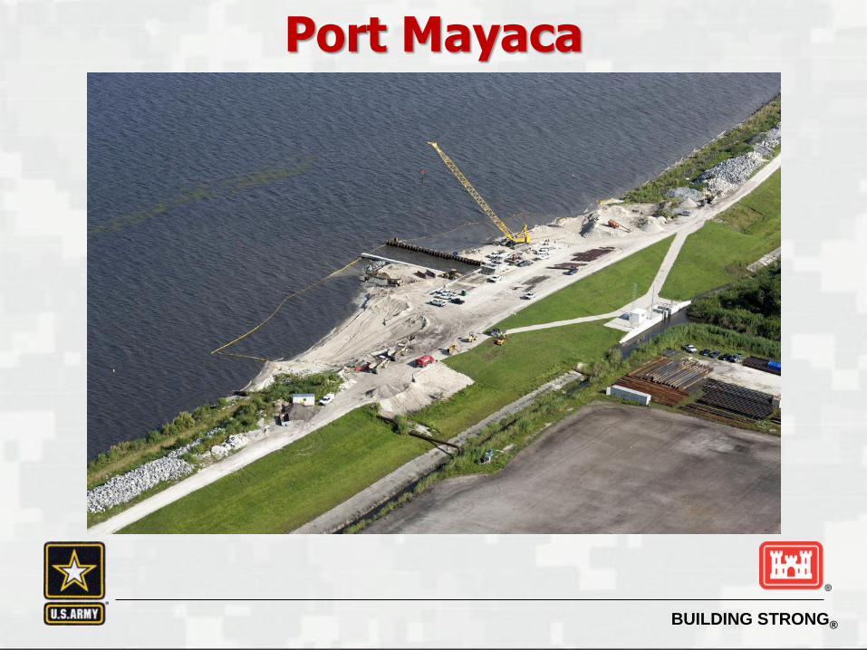
Port Mayaca
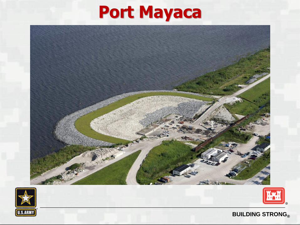
BUILDING STRONG®
Port Mayaca

BUILDING STRONG®
Canal Point

BUILDING STRONG®
Belle Glade

BUILDING STRONG®
South Bay

BUILDING STRONG®
Moore Haven

BUILDING STRONG®
Moore Haven

BUILDING STRONG®
Questions