Embed Size (px)
Citation preview

Hearth
• The region from which innovative ideas originate• Example: Early cultural hearths
1. Nile River2. Indus River3. Wei-Huang Valley4. Ganges River Valley5. Mesopotamia6. Mesoamerica7. West Africa


Types of Diffusion
• Relocation Diffusion• Expansion Diffusion– Hierarchical Diffusion– Contagious Diffusion– Stimulus Diffusion

Relocation Diffusion
• “The spread of a feature or trend through bodily movement of people from one place to another”
• People move, they bring things with them (culture, language, religion, etc.)
• Examples:– Euro coins– Religion with migrating settlers– Columbian Exchange

Expansion Diffusion
• “The spread of a feature or trend among people from one area to another in a snowballing process”
• Types– Hierarchical– Contagious– Stimulus (least common)

Hierarchical Diffusion
• “The spread of a feature or trend from one key person or node of authority or power to other persons or places”
• Large cities small cities small towns• Important people down the social hierarchy• Examples:– Hip-hop/rap music– Fashion trends

Contagious Diffusion
• “The rapid, widespread diffusion of a feature or trend throughout a population”
• No hierarchy, spreads by contact• Examples: – Disease– Information on the internet– Hinduism in India
Stimulus Diffusion
• “The spread of an underlying principle, even though a specific characteristic is rejected”
• Spread of a concept, with a twist• Examples:– Early computers– Surfers skateboarders

Space-Time Compression
• The reduction in the time it takes to diffuse something to a distant place as a result of improved communications and transportation systems
• Example: The Arab Spring

Friction of Distance
• “Based on the notion that distance usually requires some amount of effort, money, and/or energy to overcome.”
• Shorter distance = more interaction• Larger distance = less interaction

Distance Decay
• “The diminishing in importance and eventual disappearance of a phenomenon with increasing distance from its origin”
Human-Environment Interaction
• Cultural Ecology: geographic approach that emphasizes human-environment relationships
• Two schools of thought:– Environmental Determinism– Possibilism

Theories
Environmental Determinism
• “A nineteenth- & early twentieth-century approach to the study of geography which argued that the general laws sought by human geographers could be found in the physical sciences. Geography was therefore a study of how the physical environment caused human activities.”
Possibilism
• “The theory that the physical environment may set limits on human actions, but people have the ability to adjust to the physical environment and choose a course of action from many alternatives.”

Site
• “The unique physical characteristics of a place”• Examples:– Climate– Water sources– Topography– Soil– Vegetation– Latitude– Elevation

Situation
• “The location of a place relative to other places”
• Directions– Ex: “Go over the railroad tracks, turn right at the
McDonalds, it’s the third house on the right”• Helps us to understand importance– Singapore is important due to the fact it is situated
in a major shipping passage in Southeast Asia

Mathematical Location
• Meridian: arc from North pole to South pole– Longitude
• Parallel: circle drawn around the globe parallel to the equator– Latitude
• Las Vegas: 36˚ 10’ 30” N/115˚ 8’ 11” W

Lines of Latitude/Longitude
• Equator: circle around the world at 0˚ latitude• Prime Meridian: arc around the world at 0˚
longitude• International Date Line: arc around the world
at 180˚ longitude (generally)

Projections
• Types– Robinson– Mercator– Goode’s homolosine– General classes• Conic• Cylindrical• Planar (azimuthal)

Robinson

Mercator

Goode’s Homolosine

Interrupted vs. Uninterrupted


Scale • Small scale map (greater
area)
• Large scale map (greater detail)

Local Global
CityCountyStateRegionCountryContinentWorld

GIS
• Geographic Information System
• “A computer system that stores, organizes, analyzes, & displays geographic data”
• Different layers can be compared to show relationships among different information
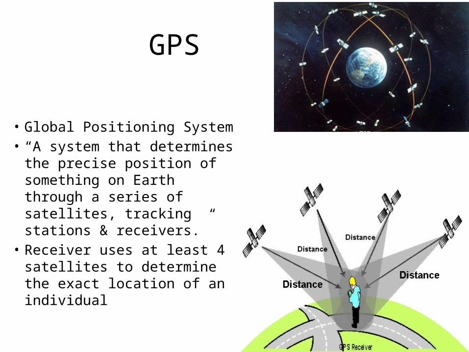
GPS
• Global Positioning System• “A system that determines
the precise position of something on Earth through a series of satellites, tracking stations & receivers.”
• Receiver uses at least 4 satellites to determine the exact location of an individual

Remote Sensing
• “The acquisition of data about Earth’s surface from a satellite orbiting the planet or from other long-distance methods”
• Remote sensing images are created by combining picture elements or pixels

Other
• Polls & Surveys• Field Observations• Census

Regions
• Larger than a point & smaller than the planet• Types– Formal region– Functional region– Vernacular region

Formal Region
• a.k.a. uniform region or homogenous region• “An area in which everyone shares in one or
more distinctive characteristics”• Examples:– Montana– American wheat belt– Areas characterized as a predominantly
“Republican” or “Democratic” state
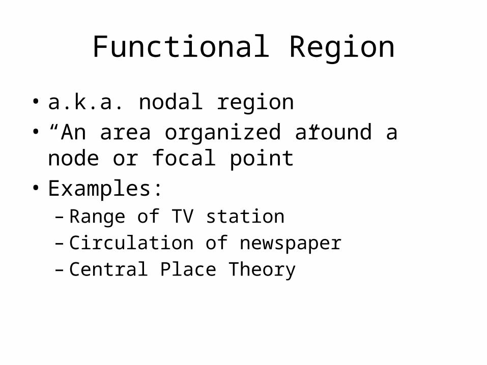
Functional Region
• a.k.a. nodal region• “An area organized around a node or focal
point”• Examples:– Range of TV station– Circulation of newspaper– Central Place Theory

Vernacular Region
• a.k.a. perceptual region• “An area that people believe exists as part of
their cultural identity”• Examples:– American “South”

Time Zones
• 360˚ / 24 hours per day= each time zone represents 1 hour and 15˚
• Non-standard time zones: – Iran GMT+3:30– Afghanistan GMT+4:30– India GMT+5:30– Nepal GMT+5:45– Myanmar (Burma) GMT+6:30– Central Australia GMT+9:30– Venezuela GMT-2:30– Newfoundland GMT-3:30


![[PPT]RIVER VALLEY CIVILIZATIONS - Belton Independent … · Web viewRIVER VALLEY CIVILIZATIONS WARM-UP Title your map “River Valley Civilizations” Locate the 4 River Valley Civilizations](https://img.dokumen.tips/doc/110x75/5acd72367f8b9aa1518d7c48/pptriver-valley-civilizations-belton-independent-viewriver-valley-civilizations.jpg)