Embed Size (px)
Citation preview

motorcyclemeanders.com
GUIDE TO TIBET
MOTORBIKE TOUR
Sept-Oct 2013

2
Tibet, September-October, 2013
Lhasa to Kathmandu
A Ride across the Tibetan Plateau
with
Extreme Bike Tours Lead by HE Zander Combe (Hon Oz)
This guide brought to you by:
motorcyclemeaders.com©

3
Tibet ride Table of Contents
Map of the Ride ........................................................................................................................................ 4
Kathmandu Valley .................................................................................................................................... 4
Kathmandu ............................................................................................................................................... 5
Durbar Square ...................................................................................................................................... 5
Swayambhunath................................................................................................................................... 5
Boudhanath Stupa ................................................................................................................................ 6
Nagarkot ............................................................................................................................................... 6
Lhasa ........................................................................................................................................................ 6
Lhasa to Gyantse ...................................................................................................................................... 7
Gyantse .................................................................................................................................................... 7
Gyantse to Shigatse .................................................................................................................................. 8
Shigatse .................................................................................................................................................... 8
Shigatse to Xegar ...................................................................................................................................... 9
Xegar ........................................................................................................................................................ 9
Xegar to Rongbuk Everest Base Camp ...................................................................................................... 9
Rongbuk Everest Base Camp .................................................................................................................. 10
Rongbuk Everest Base Camp to Nyalam ................................................................................................. 10
Nyalam ................................................................................................................................................... 11
Nyalam to Kathmandu ........................................................................................................................... 11
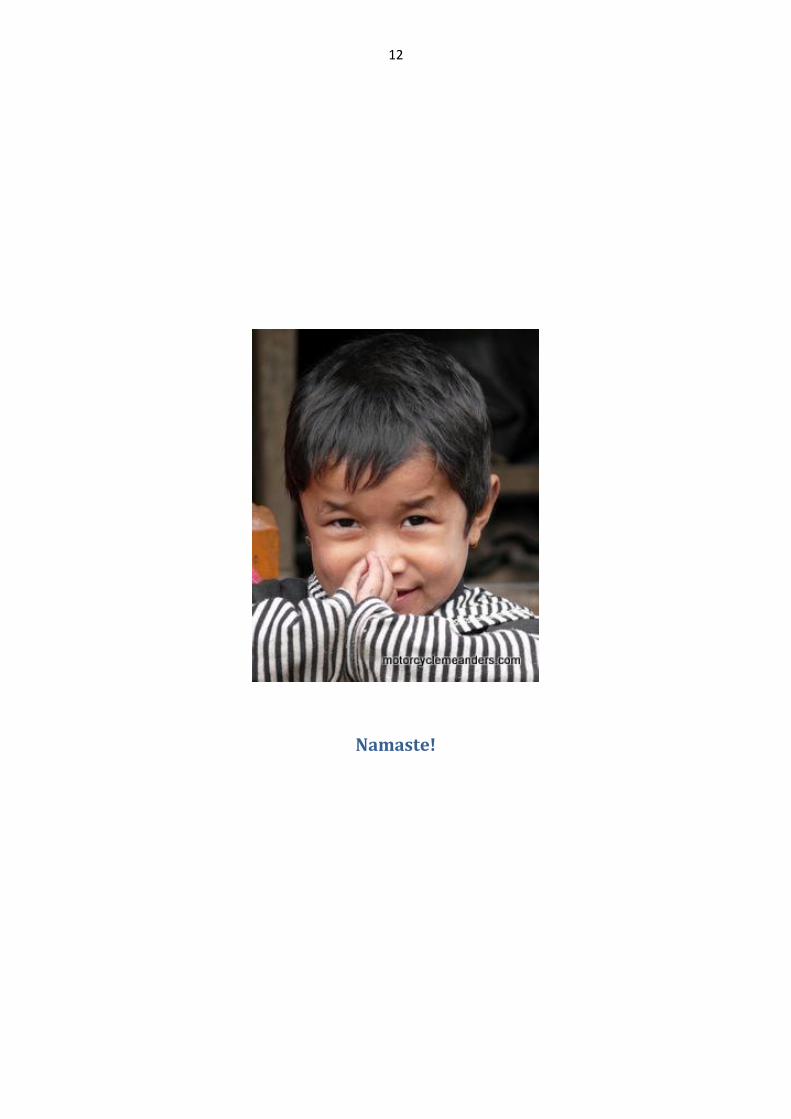
Namaste! ................................................................................................................................................ 12

4
Map of the Ride
See http://goo.gl/maps/Zix4E for interactive map of the ride.
Kathmandu Valley

5
Kathmandu
Although the ride starts in Lhasa, the adventure begins in Kathmandu while we get visas and entry
permits before flying to Lhasa. Kathmandu is also the ride’s final destination.
Kathmandu is not only the capital of Nepal but the central city amongst a conglomerate of satellite
cities, notably Patan (aka Lalitpur) and Bhaktapur, and urban areas within the bowl-shaped
Kathmandu Valley and spreading outside the valley. The city has an elevation of 1,400m; and the
valley is surrounded by four major mountains.
There were times when the term ‘Nepal’ referred only to the Kathmandu Valley. It has a history going
back over 2,000 years as evidenced by several inscriptions found in the valley.
Durbar Square
Durbar Square is a generic name used to describe plazas and areas opposite the old royal palaces in
Nepal. Durbar Squares consist of temples, idols, open courts, water fountains and more. They are the
most prominent remnants of the small kingdoms that once
constituted Nepal. The most famous Durbar Squares in the
Kathmandu Valley are: Kathmandu Durbar Square, Patan
Durbar Square, and Bhaktapur Durbar Square. All three are
UNESCO World Heritage Sites.
According to Lonely Planet, Bhaktapur's Durbar Sq is larger
than Kathmandu's, much less crowded with temples than
Patan's and less vibrant than either…!
Kathmandu Durbar Square is made up of two sub-areas.
The outer complex is renowned for numerous interesting temples, while the inner complex comprises
the old palace area. Contrary to Lonely Planet’s back-handed compliment, Bhaktapur Durbar Square is
said to be one of the most charming architectural showpieces of the valley as it highlights the ancient
arts of Nepal. Patan is the oldest of all the three cities of the Kathmandu Valley and is the best known
for its artistic heritage. Patan Durbar Square is full of Hindu temples and Buddhist monuments with
bronze gateways, guardian deities and impressive carvings.
Swayambhunath
Swayambhunath (Monkey Temple) is an ancient religious complex
on a hill in the Kathmandu Valley, west of Kathmandu. It is one of
the most sacred Buddhist sites in Nepal, second only to the
Boudhanath Stupa. The Swayambhunath Stupa is a golden spire
crowning a conical wooded hill. It is the most ancient and
enigmatic of all the holy shrines in Kathmandu Valley. Located on
a hill on the outskirts of Kathmandu, the temple affords
magnificent views over the city and on a clear day to the
mountains beyond. At the heart of the temple complex is the
stupa, topped by the painted eyes of Buddha, surrounded by
prayer wheels and numerous smaller temples.

6
Boudhanath Stupa
Boudhanath Stupa (or Bodnath Stupa)
is the largest stupa in Nepal and the
holiest Tibetan Buddhist temple
outside Tibet. The stupa is located in
the town of Boudha, on the eastern
outskirts of Kathmandu. It was
probably built in the 14th century after the Mughal invasions. After the arrival of thousands of
Tibetans following the 1959 Chinese invasion, the temple has become one of the most important
centres of Tibetan Buddhism.
From above, Bodnath Stupa looks like a giant mandala, or diagram of the Buddhist cosmos. As in all
Tibetan mandalas, four of the Dhyani Buddhas mark the cardinal points, with the fifth, Vairocana,
enshrined in the centre (in the white hemisphere of the stupa). The five Buddhas also personify the
five elements (earth, water, fire, air and ether), which are represented in the stupa's architecture.
Nagarkot
Nagarkot is situated 32km east of Kathmandu
at an altitude of 2,200m. It provides a
panoramic view of the major peaks of the
eastern Nepal Himalayas including Mt. Everest
and Annapurna. From here one has a
fascinating and mesmerizing view of the
sunrise. When the sun reflects on these snowy
peaks the view is said to be absolutely spell
binding.
Lhasa
The Potala Palace is undoubtedly the focus of
interest in Tibet. Originally built in the 7th century
as an imperial palace, it has been reconstructed a
few times since. It contains the living quarters of
the Dalai Lamas and their sumptuous golden
tombs.
Other key attractions in Lhasa include: Jokhang
Temple, located in the city centre and said to be
the best combination of architecture of Tibet,
Han, Nepal and India; Norbulingka Summer
Palace, originally constructed by the seventh Dalai Lama, with each successive ruler adding his own
buildings; the Barkhor Street market, the oldest street in a very traditional style, around the Jokhang
Temple in the centre of the old section of Lhasa - also one of the most important religious paths along
which pilgrims walk around Jokhang Temple; Drepung Monastery, founded in 1416 by a disciple of
Tsong Khapa, formerly the biggest and richest monastery in Tibet; and Sera Monastery which became
famous for its tantric teachings and its notorious monks who were considered clever and dangerous.

7
Lhasa to Gyantse
The ride itself begins by heading south-west out of Lhasa following the Yarlung River on the Friendship
Highway for about 60km. We’ll cross the Yarlung River and pick up the S307, which was part of the
original Friendship Highway between Lhasa and Nepal. The new highway stays with the Yarlung River
to Shigatse, where we will rejoin it.
Not long after joining the S307, we climb to the first pass of the ride – Khamba La at 4,794m. From
here there are spectacular views of the luminescent blue-green Yamdrok Lake (aka Yamdrok Yumco or
Yumsto) – all meaning jade lake, one of Tibet’s three sacred lakes (it is said to be the incarnation of a
goddess). After following the lake and passing the much smaller Kongmu Co (lake), we come to
Nagarze.
As we head further west we’ll cross Karo La at 5,074m. The road over Karo La provides views of Nojin
Kangsang, which at 7,206m is the highest mountain in the massif around Karo La. Coming down from
Karo La, two huge glaciers can be seen close to the highway. As we approach our destination of
Gyantse we’ll pass several typical Tibetan villages.
Gyantse
After overnighting in Gyantse, we spend the next
morning here before heading for Shigatse.
Gyantse is noted for its restored Gyantse Dzong
and its unique Kumbum of the Palcho Monastery,
the largest chorten in Tibet.
The Dzong is a 14th century historical fort that
overlooks the town. It became a central focus of
British attacks during the Younghusband expedition
(1902-03) and was defended to the end by its
Tibetan occupants until little remained of the walls.
What remained was further destroyed by PRC authorities in 1967. However, restoration work has
subsequently been undertaken.
Tibet conquest: meeting between English officers and Tibetans. (Petit Journal, 14 February 1904)

8
The Palcho Monastery is a complex of
structures, which includes its Kumbum
(Pelkor Choede), a multi-storied aggregate of
Buddhist chapels. The Kumbum is believed to
be the largest such structure in Tibet. It has
nine tiers, each with its unique chapels and
Tibetan Buddhist murals.
Gyantse to Shigatse
This is a relatively short (half day) run over fairly flat terrain. We are likely to encounter local villagers
working in the fields or transporting themselves and their produce in horse and carts, providing an
insight into rural life on the Tibetan Plateau. There are lots of barley and canola fields; and small
villages with low but characteristic Tibetan buildings.
Shigatse
Shigatse is the second largest city in Tibet.
The centrepiece of Shigatse is the Tashilhunpo
Monastery, founded in 1447 by the first Dalai
Lama. The monastery is the traditional seat of
the Panchen Lama, the second head of
Tibetan Buddhism. It remains one of the
largest functioning monasteries in Tibet.
Also in Shigatse is the imposing castle of the
Shigatse Dzong (or Samdrubtse Dzong), a
smaller version of the Polata Palace in Lhasa.
Probably built in the 15th century, it was
completely dismantled at the instigation of the
PRC in 1961; but has since been restored.

9
Shigatse to Xegar
Today’s ride starts with a continuation of the
open, flat plains we experienced from
Gyantse before some initial gentle climbing
through picturesque valleys and over Simi La at
4,500m and back down to wide valleys.
After about 150km, we pass through the
town of Lahtse situated in the Yarlung River
Valley. From there we start some more
serious high altitude riding traversing Gyatso
La/Lhakpa La at 5,250m – it seems to get
called by both names. This pass is the
highest point on the Friendship Hwy between Lhasa and Kathmandu.
It’s here that we’ll get our first view of Mt Everest, which the Tibetans call Qomolagma or
Chomolungma or variations of either.
The descent from Gyatso La/Lhakpa La offers great scenery as we pass through several villages along
the valleys before reaching Xegar.
Xegar
Xegar, also called Shegar and New Tingri, is about 7km NW off the
Friendship Hwy.
Xegar was built at the foot of the ruins of the impressive Xegar Dzong
(fortress), which was destroyed during the Chinese invasion of the
1950s. Xegar was once the capital of the Tingri region and used to be
an important trading post where Sherpas from Nepal exchanged rice,
grain and iron for Tibetan wool and salt. Today, it’s mostly known as a
starting point for climbers of Mt Everest and other mountains in the
Himalayan region, including Mt. Lhotse and Mt. Makalu.
Xegar to Rongbuk Everest Base Camp
From Xegar we continue along the
Friendship Hwy for a short distance before
turning south and heading for Rongbuk
Everest Base Camp.
Before long we’ll be into the 42
switchbacks that take us to the top of Pang
La at 5,200m. If the day is clear, the view
from Pang La spectacularly takes in several
of the Eight Thousanders (the 14 peaks
>8,000m): Makalu (5th highest),

10
Shishapangma (baby of the eight thousanders at 14th highest), Cho-Oyu (6th highest), Lhotse (4th
highest) and, of course, Qomolagma (highest).
From Pang La, we ride down 54 switchbacks into a deep canyon where hamlets hang precariously
from the side walls before we ride up the Rongbuk Valley on a pretty rough dirt road to the Rongbuk
Monastery, said to be the highest monastery in the world.
Rongbuk Everest Base Camp
The term ‘Everest Base Camp’ on the Tibetan
side can mean one of two places. One is the
group of dining and accommodation tents for
tourists just past Rongbuk Monastery. The
other is the base camp for climbers 8km
further up the road and about 200m higher.
The latter is only accessible by park buses.
There are several references to a monastery
or sacred places of worship being here for
hundreds of years. The current Nyingmapa
sect monastery was rebuilt in 1901 by the
Lama Ngawang Tenzin; and two of the golden and copper images of Padmasambhava (Guru Rinpoche
in Tibetan) are the most sacred statues in it since after the reconstruction. It was destroyed by fire in
the 1970s and has been rebuilt in more recent times.
The monastery is only 200 metres lower than the north side Everest Base Camp of Mount Everest; and
in the background of Rongbuk Monastery is the top of the world - Qomolangma
Rongbuk Everest Base Camp to Nyalam
We start by heading back up the valley towards Xegar, but after about 10km – long before the road
begins its climb back over Pang La – we turn out of the valley and soon begin to climb to Lamna La, at
5,150m – about the same height at Pang La, which we crossed the day before.
This road takes us over high altitude plains and
stunning mountain passes before finally bringing us
back to the Friendship Highway near (Old) Tingri –
a lot further west than when we left it .
From (Old) Tingri, we head westwards across the
Tibetan plateau, with spectacular views of high
snow mountains and deep valleys, confronting the
double passes of Lalung La at 4,950m and Shung La
at 5,200m, the last pass in Tibet. Both passes
provide great views of Shishipangma (the baby of the Eight Thousanders at 8,013m). Then there’s a
40km downhill ride into Nyalam.

11
Nyalam
Nyalam is situated at 3,750m. A town of stone buildings
and tin roofs, it was nicknamed ‘The Gate of Hell’ by the
Nepalese traders because the trail from the Nepalese
border to Nyalam was so treacherous to negotiate.
The only cultural sight close to Nyalam is Miarepa's Cave.
Milarepa was a famous Buddhist mystic and composer of
songs (Tibet's St Francis of Assisi, says one site) who lived in
the late 11th and early 12th centuries. During his time
spent in long meditation in this cave he renounced all luxuries and survived on a diet of local weeds
(famously turning green as a result). The cave, however, is about 10km out of town.
Nyalam to Kathmandu
Heading south from Nyalam the road drops
abruptly through the gorge of the Matsang
Tsangpo, dropping some 1,000m over 30km to
Zhangmu. The road is very steep with lots of sharp
turns. The road provides views of ancient trees
and fast-flowing waterfalls. We’ll need to do some
border crossing formalities at Zhangmu (Tibet)
and Kodari (Nepal), crossing the Friendship Bridge
between the two locations.
We then start our final ride into Nepal to Kathmandu.
This segment of the day’s ride starts with pleasant scenery of small villages, old temples on river
islands, stupas with prayer flags and local trading places. Eventually, we get into the Kathmandu Valley
for the final climb through the sprawling metropolis of Kathmandu to our final destination of the tour.
Prayer Wheels at Swayambhunath Stupa, Kathmandu (Monkey Temple) Durbar Square, Kathmandu
12
Namaste!