Embed Size (px)
Citation preview
Facts published by | Mackay Regional Council | © 2010
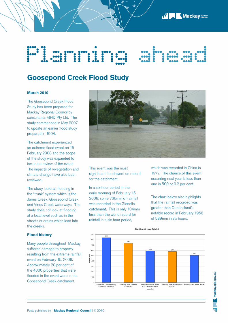
which was recorded in China in 1977. The chance of this event occurring next year is less than one in 500 or 0.2 per cent.
The chart below also highlights that the rainfall recorded was greater than Queensland’s notable record in February 1958 of 589mm in six hours.
Goosepond Creek Flood Study
March 2010
The Goosepond Creek Flood Study has been prepared for Mackay Regional Council by consultants, GHD Pty Ltd. The study commenced in May 2007 to update an earlier flood study prepared in 1994.
The catchment experienced an extreme flood event on 15 February 2008 and the scope of the study was expanded to include a review of the event. The impacts of revegetation and climate change have also been reviewed.
The study looks at flooding in the “trunk” system which is the Janes Creek, Goosepond Creek and Vines Creek waterways. The study does not look at flooding at a local level such as in the streets or drains which lead into the creeks.
Flood history
Many people throughout Mackay suffered damage to property resulting from the extreme rainfall event on February 15, 2008. Approximately 20 per cent of the 4000 properties that were flooded in the event were in the Goosepond Creek catchment.
This event was the most significant flood event on record for the catchment.
In a six-hour period in the early morning of February 15, 2008, some 736mm of rainfall was recorded in the Glenella catchment. This is only 104mm less than the world record for rainfall in a six-hour period,
Significant 6 hour Rainfall
840
736
589 580
508
0
100
200
300
400
500
600
700
800
900
August 1977, Muducaidang(China-World Record)
February 2008, Glenella(unofficial)
February 1958, Mt Pelion(QLD Notable Record)
February 2008, Mackay Alert(official)
February 1958, Finch Hatton
Location
Rain
fall
(mm
)
Planning ahead

Facts published by | Mackay Regional Council | © 2010
What does the flood study say?
The flood study has found that recent developments have been constructed to levels which are mostly greater than the current design requirement of the one in 100-year ARI (Average Recurrence Interval) event. In fact, council’s requirement for development prior to 2006 was to have ground levels greater than the 50-year ARI event.
The February 2008 event was greater than a 500 year ARI event and was generally 1.4 metres higher along Goosepond Creek than the design 100-year ARI event.
Unfortunately, it is not considered feasible to protect dwellings from flooding from events as significant as the 2008 flood.
Mitigation options
There are few areas requiring mitigation in the design 100-year ARI event, however, one of the more significant problems is around the Heaths Road and Glenella Road intersection. In order to mitigate this problem the following works are proposed:
• increasetheculvertsunderSugarshed Road
• increasethesizeofthedrainfrom 5-10 metres to 50 metres wide.
The estimated cost of these works is about $3,000,000. In addition to reducing flooding in
result of climate change. This will cause increased flood levels of between 5cm and 22cm
• revegetationofareasasperthe Draft Goosepond Creek Catchment Management Plan may increase flood levels by up to 16cm in some areas.
the immediate area, downstream flooding will reduce by up to 7cm downstream of Glenella Road for the 100-year ARI event.
Climate change and revegetation
The flood study also identifies:
• a20percentincreaseinrainfall intensity is expected as a

Facts published by | Mackay Regional Council | © 2010
What does the flood study say?
Consultation and additional modelling
The Goosepond Creek Flood Study was released for public comment from October 14 to November 31, 2009. Public presentations held on November 18, 2010 were attended by about 150 people.
Fifteen (15) written submissions were received on the flood study. The four most common issues raised in the submissions were:
• theneedtoinvestigateincreasing the culverts under the Port Access Corridor (PAC) railway embankment (owned by QR Limited) at Glenella
• concernaboutrevegetationincreasing flood levels
• theneedforregularmaintenance of the floodway
• concernaboutnewdevelopment in the catchment and changed landuse.
Considering the above, it was decided to undertake additional modelling and investigate upgrading of the culverts under the PAC and the impact of changes to landuse in the catchment.
GHD modelled increasing the culverts by about three times the sizeoftheexistingculvertsunderthe PAC railway embankment. The increased culverts tested in the model comprised 15x1500
flood levels decreased by up to 35cm in Valetta Gardens, however, flood levels increased downstream by 1-4cm.
• modifyinglandusehaslocalised improvements, however, flood levels downstream are slightly elevated.
The other issues raised by consultation will need to be dealt with by the Goosepond Creek working group.
Recommendations
The study recommends that a working group within council be formed to address issues in the Goosepond Creek catchment such as:
• developmentandfloodlevels
• mitigationmeasuresandfunding
• emergencymanagement
• maintenance
• waterquality.
RCPs. The modelling found:
•fora100-yearARIevent,increasing the culverts under the railway line increased the peak flood levels downstream by between 12-13cm along the majority of Goosepond Creek.
• foranextremeevent,suchas the 2008 flood, increasing the culverts under the railway line reduces upstream levels by 14-16cm, however, the railway embankment is still overtopped.
In summary, it was found there was little benefit in increasing thesizeoftheculvertsundertherailway line by three times their existingsize.
Changing land used for sugar cane cultivation that adjoins a residential area into an open space/sports field revealed:
• fora100-yearARIevent,floodlevels decreased by 13-23cm in the area of the change (eg Windmill Waters) with flood levels increasing downstream by 1-3cm.
• foranextremeevent(2008),

Facts published by | Mackay Regional Council | © 2010
February 2008 flood findings and update
The working group would be responsible for overseeing activities in the catchment and would consult with other organisations and the community as relevant.
It is also recommended that council further investigates the mitigation options of:
• thehighflowdiversiontoFursden Creek
• changedlanduseintheGlenella Catchment from rural to open space.
What else has council been doing in the Goosepond Creek area following the February 2008 flood?
Council has undertaken the following works in the catchment since the 2008 flood:
• re-designedanewsubdivisionin the Glenella area to lower road levels to facilitate an improved
• clearedvegetationdownstreamof Evans Avenue
• repairednumerousdamagedstormwater drainage systems
• repairedroadssaturatedbyfloodwaters • liasedwithQueenslandRailregarding the maintenance of culverts under the port access corridor railway embankment at Glenella.
outlet along the road to Janes Creek
• removedasmallcausewaycrossing of Jones Creek near Glenfields residential development Glenella
• installedanadditional900mmdiameter pipe downstream of Angelina Avenue, Glenella
• clearedvegetationalongtheedge of Jane Creek tributary to improve the flow along the creek
For more information visit
www.mackay.qld.gov.au to view the report.