Embed Size (px)
Citation preview

GOOGLE EARTH INTRODUCTION
2013

Overview
Why Google Earth / Maps
Start, install and setup Google earth
Highlight some features and how to’s
Practical - Use your earth.

Why Google Earth
Keyhole Markup Language (KML),
Standardised file for geography like PDF
Open standard developed by Google.
KMZ = Zip Compressed KML
Google Earth is one application that uses KML,
QGIS is another

Why for Artisanal
Complimentary to High End GIS (eg QGIS)
Great Viewer
More accessible to artisanal fisher-people
Easy and Fun?

Imagery

Different Resolutions

Starting
My Places

Status Bar
Time Slider Button Bar
Historical Image
Date

Navigating
Navigation Panel
Mouse (ctrl, shift, option)
Keyboard (arrows, +-)
Features.
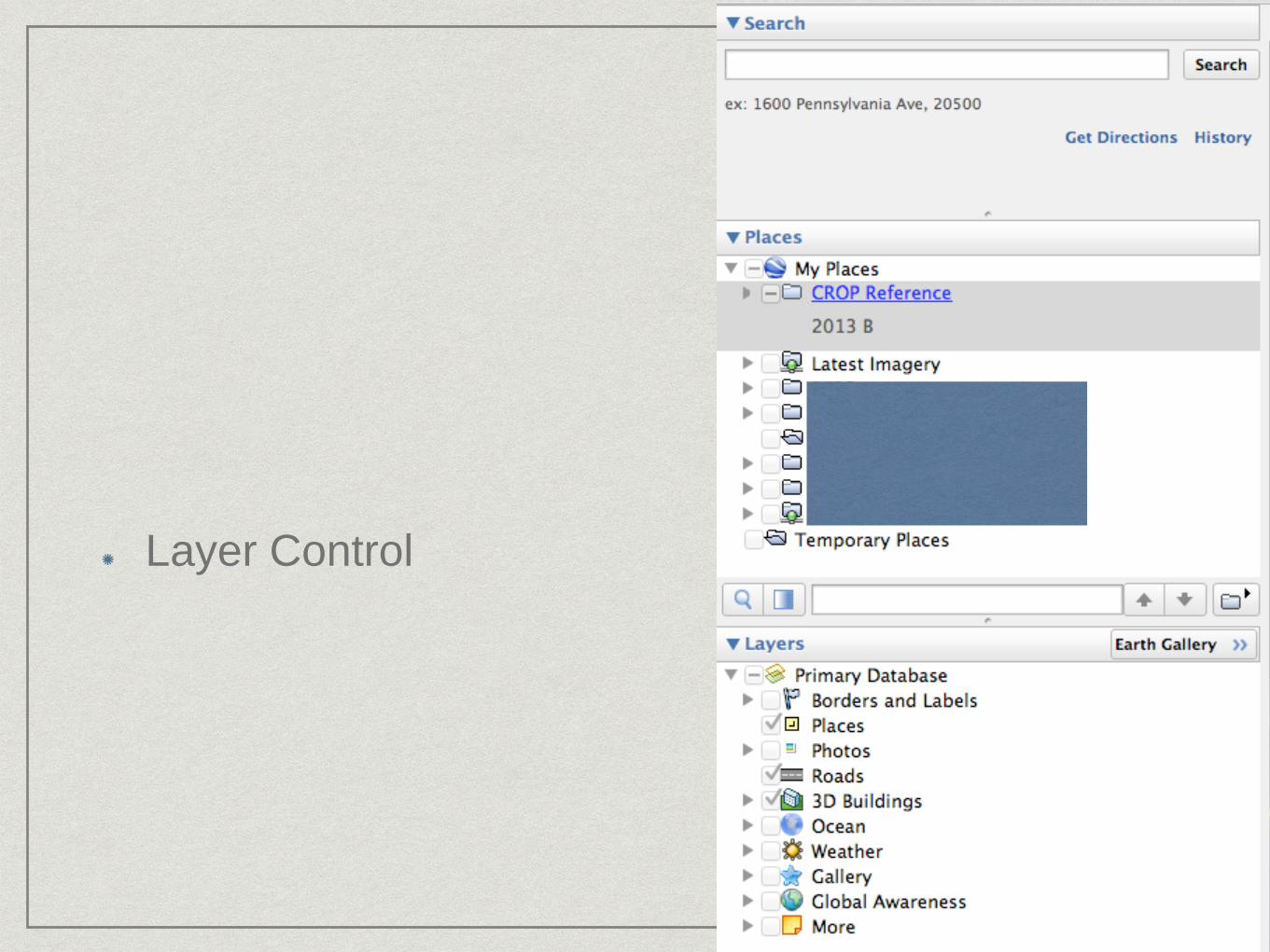
Layer Control

View Menu

Measure Distance

Options

Reference Layers
Open KMZ File, offline
Updates each Year
EEZ source
available, redistributable, doc
http://www.marineregions.org/
12Nm/Coast - Performance

LOST

Historical Imagery
View Menu / Historical Imagery


Creating Data
Allow you to add your own data
Examples might be
Patrol Plan
MPA
Zones
Survey Locations

Folders Are Key
Right Click “My Places”
choose add / Folder
Name “Training”
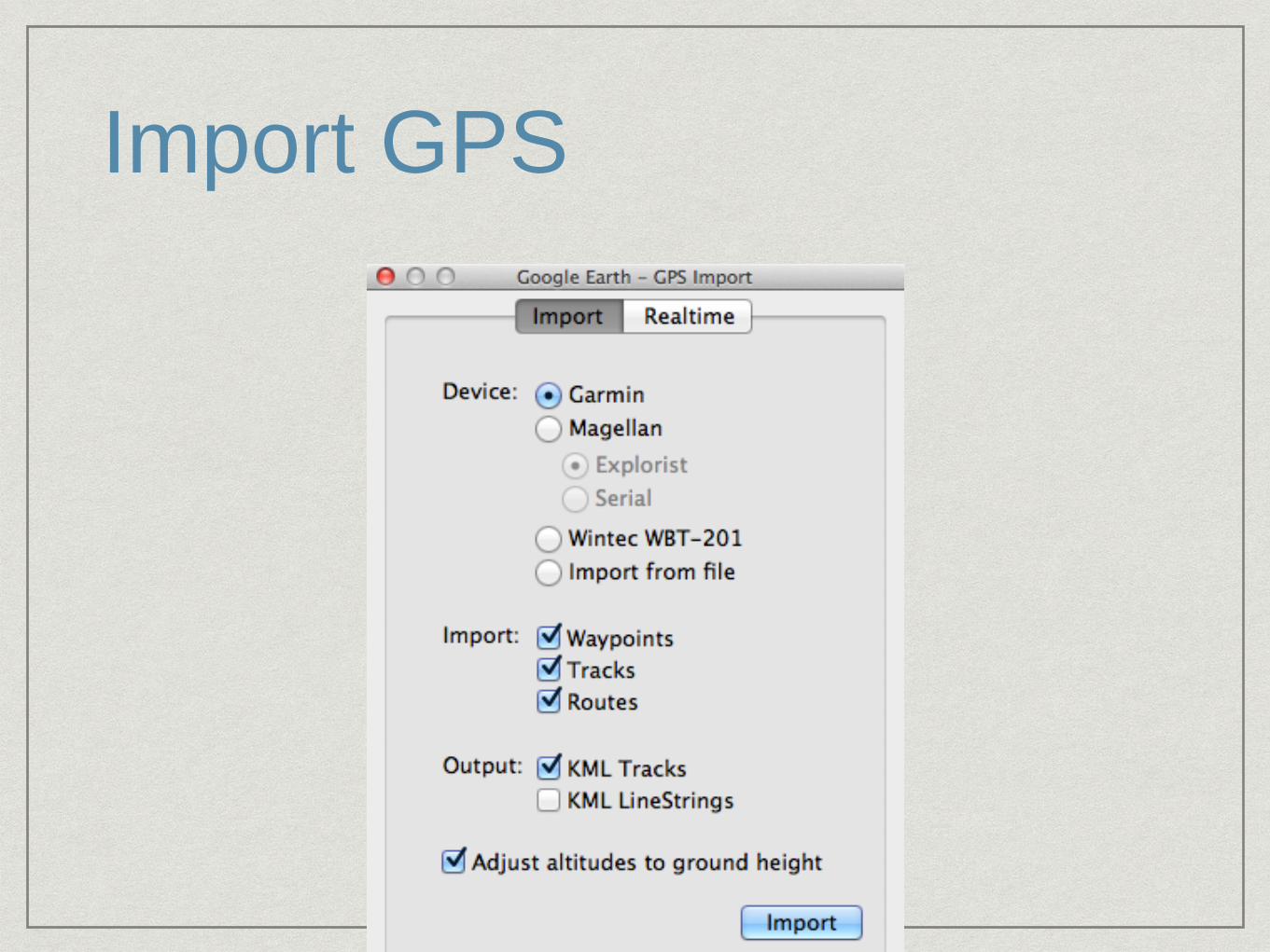
Import GPS

Elevation Profile

Add Features
From Tool Bar choose “Add Path”
Click to add the start point
Click to add the next point, and so on
Click and hold to trace a line

Editing the Line
Right click and choose info / properties
Note red points and one blue point
Blue is current point.
Mouse over and point becomes green. click

Sample Path Edit

Styling
Info dialog for a feature
Style / Color Tab

Labels
Trick
Points without icon
Add a point set icon to “No Icon”

Saving Data
Right click on Folder
and choose save as
KMZ is compressed
version

Data Sources
FFA Reference Layers
Google Earth “Ocean Layers”
“Earth Gallery”
http://bbs.keyhole.com

Network Link

Questions?

Country KML
Country KML file supplied.
Just open KML file
Need to be online
AIS

Time Slider

Time Slider Ranging

Time Slider Options


Why Google Earth
Free
Intuitive
Can be standalone / low bandwidth
Multiple options for data sources
Can be interactive, add additional data
Continuous Improvement
Not fisheries specific, FFA focus is

Accuracy
Can vary depending upon source.
Not a prosecution or navigation tool
Situational Awareness tool
Detect potential issues in GE then confirm