Embed Size (px)
Citation preview

Glaciologic remote sensing activities at LABTEL
Bram Leo Willems
Laboratorio de Teledetección-LABTEL Facultad de Ciencias Físicas
Universidad Nacional Mayor de San Marcos Lima-Perú
Laboratorio de Teledetección - LABTEL Started its activities in 1998
Group leader:
• Joel Rojas Acuña, PhD
Group Members:
• Bram Leo Willems, PhD (UNMSM)
• Juan Mendoza Nolorbe, MSc (UNMSM)
• Eleazar Rufasto Campos. Eng (UNPRG-Lambayeque)
• Flavio Carrillo Gomero, Eng (UNMSM)
• Walter Solano, MSc (UNSCH - Ayacucho)
• Pacha Ricaj Study Group (20 undergraduate students)
• Master students (09)

Agentes Endógenos y
Exógenos
Research methodology
Cambios en las condiciones de los ecosistemas
•Biofísico
•Químico
•Biodiversidad
Cambios en servicios de:
•Provisionamiento (cosechas)
•Regulación (regulación climática)
•Soporte (ciclos de nutrientes)
•Cultural (estética)
Bienestar humano
•Ingresos
•Salud
•Pobreza
•Riesgos
Evaluar las compensaciones
(decisiones políticas)
Valor intrínseco
Adaptado de: Millenium Ecosystem Assessment
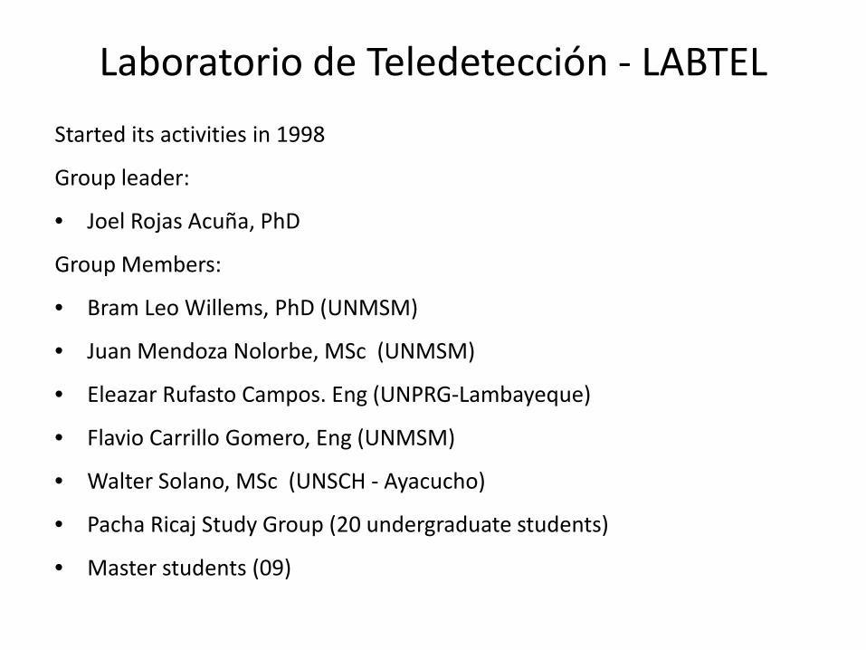
Objectives of research activities
Contribute with new knowledge
Data retrieval Adaptation/development of
methodologies for enhancing the detection capacity of
satellite images
Development of support tools for decision and policy makers: Monitoring and early warning
systems Software “Pacha Ricaj”
Capacity building: Under and post-graduate
programs Governmental entities

Satellite images • Are the most efficient and economic tools for
monitoring events that occur on the sea/land surface • Can be used for implementing monitoring systems • There is an important availability of free images
(important for sustainability) • Images available from the early 70’s (Landsat) • Offers the possibility to retrieve data from
inaccessible locations and are useful for filling spatial-temporal gaps in data
• There are several useful indices: NDVI, NDWI, LST, SST, etc.
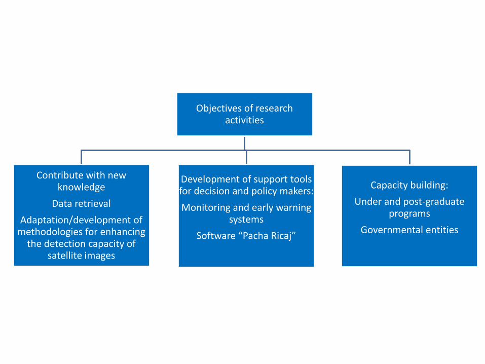
Remote sensing in a nutshell
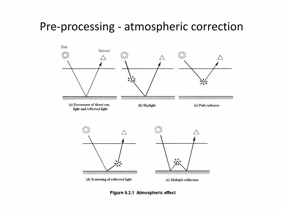
Pre-processing - atmospheric correction

0,2 0,3 0,4 0,5 0,6 0,70,80,9 1 2 3 4
0,0
0,2
0,4
0,6
0,8
1,0
Frost Snow Soil Ice Vegetation
Refle
ctan
ce
Wavelength (µm)
Spectral signature of endmembers (pure surface cover)
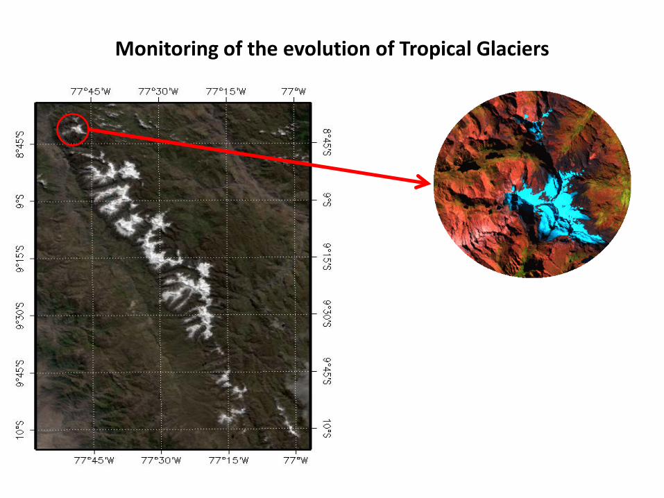
Monitoring of the evolution of Tropical Glaciers
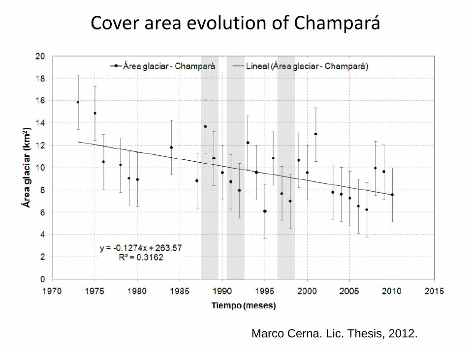
Cover area evolution of Champará
Marco Cerna. Lic. Thesis, 2012.

Marco Cerna. Lic. Thesis, 2012.
Cover area evolution of Huascarán

Automatized delineation using pattern recognition techniques – elastic net algorithm
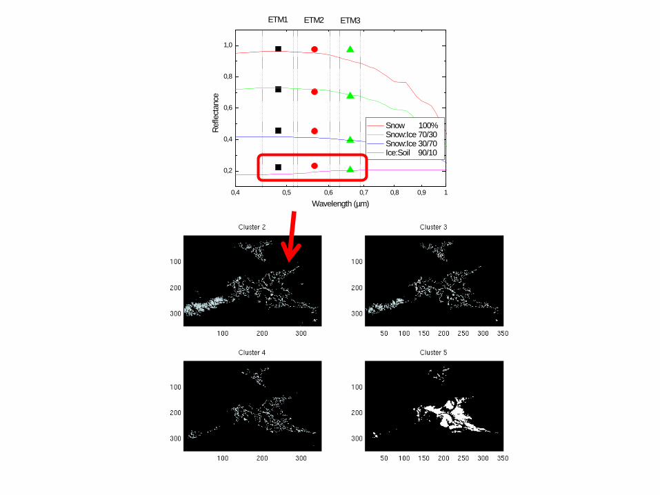
L 7 ETM+ Band 1 3 highest valued clusters out of 6
B.L. Willems et al., submitted to RSE


0,4 0,5 0,6 0,7 0,8 0,9 1
0,2
0,4
0,6
0,8
1,0
ETM3ETM2ETM1
Snow 100% Snow:Ice 70/30 Snow:Ice 30/70 Ice:Soil 90/10
Refle
ctan
ce
Wavelength (µm)
Multiple endmember spectral analysis

0,4 0,5 0,6 0,7 0,8 0,9 1
0,2
0,4
0,6
0,8
1,0
ETM3ETM2ETM1
Snow 100% Snow:Ice 70/30 Snow:Ice 30/70 Ice:Soil 90/10
Refle
ctan
ceWavelength (µm)

0,4 0,5 0,6 0,7 0,8 0,9 1
0,2
0,4
0,6
0,8
1,0
ETM3ETM2ETM1
Snow 100% Snow:Ice 70/30 Snow:Ice 30/70 Ice:Soil 90/10
Refle
ctan
ceWavelength (µm)

0,4 0,5 0,6 0,7 0,8 0,9 1
0,2
0,4
0,6
0,8
1,0
ETM3ETM2ETM1
Snow 100% Snow:Ice 70/30 Snow:Ice 30/70 Ice:Soil 90/10
Refle
ctan
ceWavelength (µm)
0,4 0,5 0,6 0,7 0,8 0,9 1
0,2
0,4
0,6
0,8
1,0
ETM3ETM2ETM1
Snow 100% Snow:Ice 70/30 Snow:Ice 30/70 Ice:Soil 90/10
Refle
ctan
ceWavelength (µm)
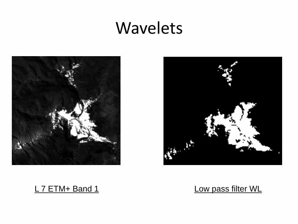
Wavelets
L 7 ETM+ Band 1 Low pass filter WL

Comparison with traditional band ratio techniques
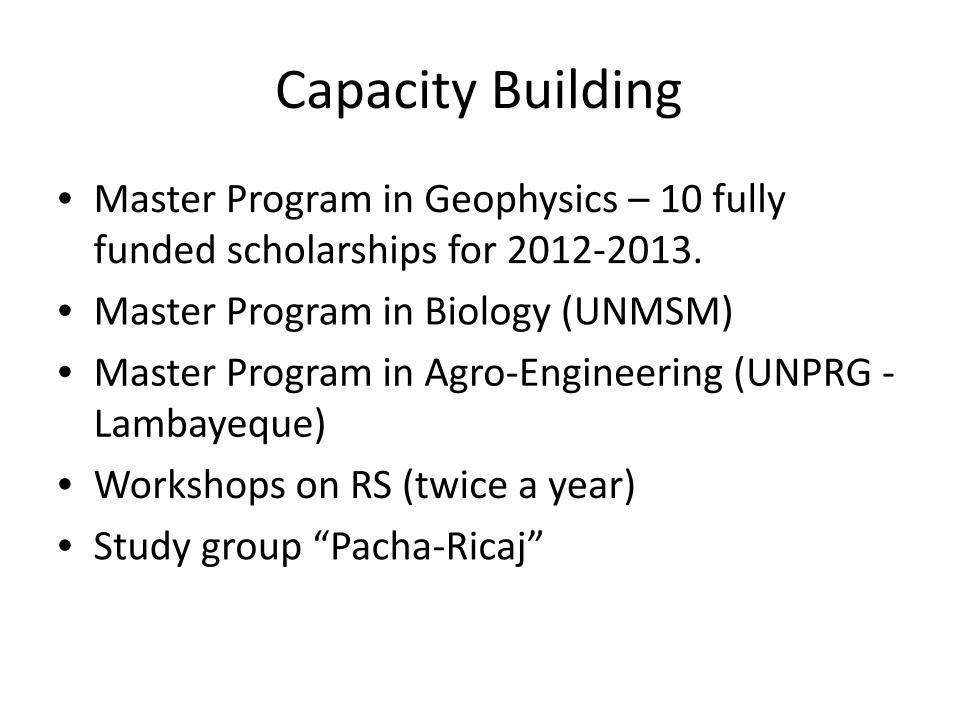
Capacity Building
• Master Program in Geophysics – 10 fully funded scholarships for 2012-2013.
• Master Program in Biology (UNMSM) • Master Program in Agro-Engineering (UNPRG -
Lambayeque) • Workshops on RS (twice a year) • Study group “Pacha-Ricaj”
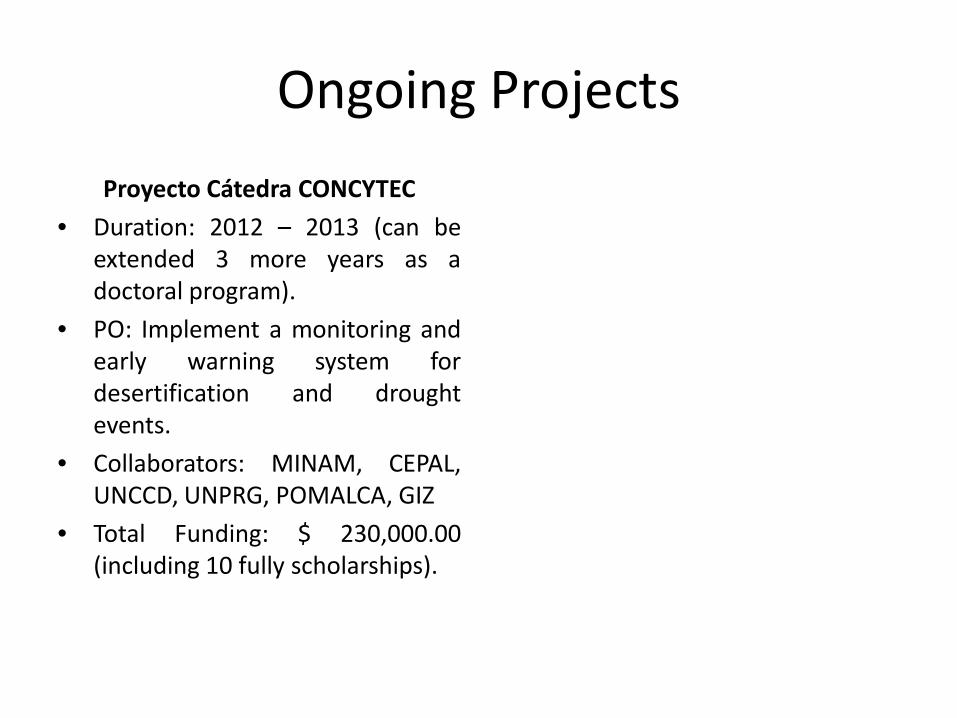
Ongoing Projects Proyecto Cátedra CONCYTEC
• Duration: 2012 – 2013 (can be extended 3 more years as a doctoral program).
• PO: Implement a monitoring and early warning system for desertification and drought events.
• Collaborators: MINAM, CEPAL, UNCCD, UNPRG, POMALCA, GIZ
• Total Funding: $ 230,000.00 (including 10 fully scholarships).

Prediction of the onset of drought events using SST and NDVI
NDVI AVHRR – NOAA NDVI - VEGETATION SPOT 4 - PERÚ
23

Estimation of soil salinity content using ASTER images

Underground water detection
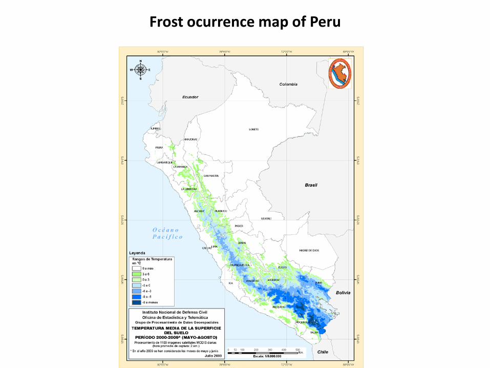
Frost ocurrence map of Peru

Ongoing Projects Proyecto Cátedra CONCYTEC
• Duration: 2012 – 2013 (can be extended 3 more years as a doctoral program).
• PO: Implement a monitoring and early warning system for desertification and drought events.
• Collaborators: MINAM, CEPAL, UNCCD, UNPRG, POMALCA, GIZ
• Total Funding: $ 230,000.00 (including 10 fully scholarships).
Implementation of a Satellite Based Environmental Monitoring
System for Cajamarca • Start: May-June 2012 • Monitor wetlands, land
degradation and deforestation • Capacity building in the Region • Collaborators: RGC and the UNC • Budget (first year): $ 250,000.00

Ongoing Projects Los Andes desde el espacio
• Funded by the ESA • Aimed at introducing the use of
satellite images in teaching activities in schools.
• We contributed with two case studies, one of them involves glacier retreat.
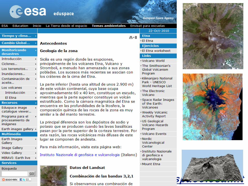
www.eduspace.esa.int

Muchas gracias!!!
CONTACTOS Dr. Bram Willems: [email protected] Dr. Joel Rojas: [email protected] Telfs.: (+51-1) 5658667 http://fisica.unmsm.edu.pe/~labtel Av. Venezuela S/N (Ciudad Universitaria), Cercado, Lima, Perú Apartado Postal 14-0149, Lima 14.