Embed Size (px)
Citation preview

Alyson Wood
GIS Portfolio June 2015
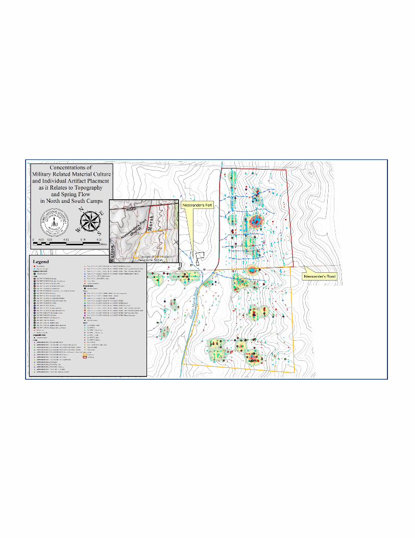
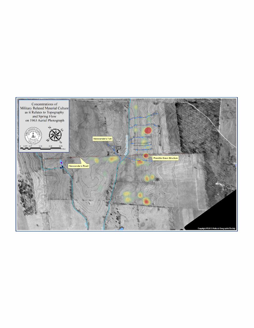
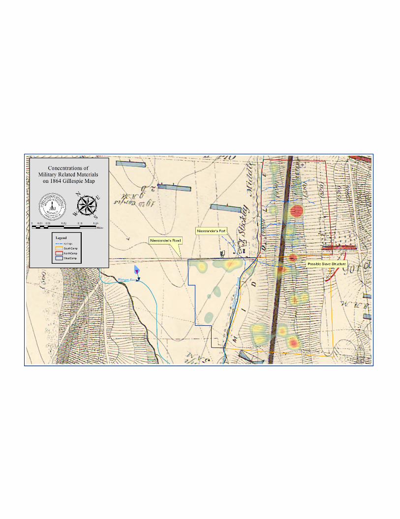
Analysis of concentrations of artifacts from metal detecting data collection revealed that encampment placement was restricted to lobes and ravines. Ravines showed an increase in encampment “trash” deposits. Lobes showed pockets of burned materials, where camp fires would have been placed. The locations of wet-weather springs were collected towards the end of field data collection. Initial GIS analysis revealed the locations of springs to be ravines with no wet-weather water flow. However, after several field seasons and test-pitting analysis the ravines were revealed to have early spring and late fall water content. These wet-weather springs were then considered for ideal placement for encampment dumps. Hydrography would have been useful with a larger site and a predicative modeling methodology.
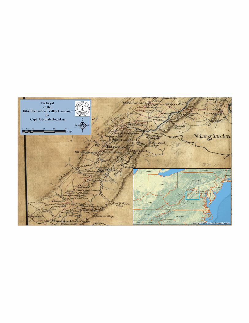
This series of maps introduces and illustrates concentrations of military-related artifacts found at the Battle of Cedar Creek investigations from 2008-2014. These maps were created for James Madison University by Alyson Wood.
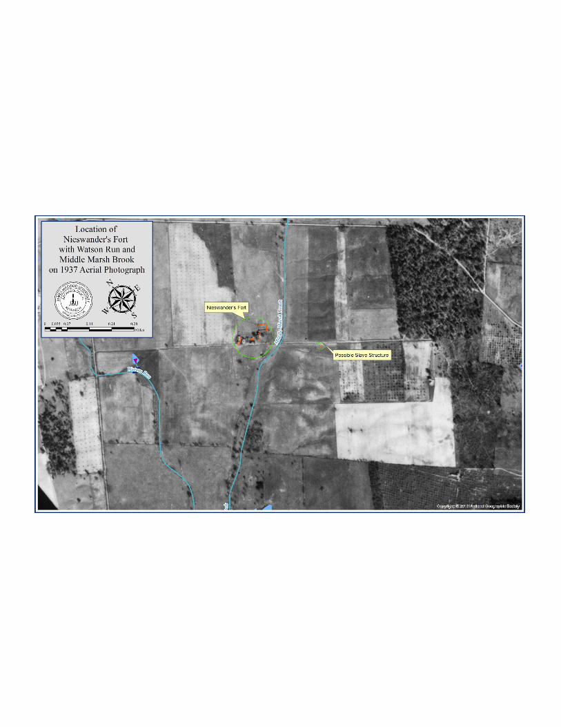
Historic aerial and military maps were georeferenced and used in conjunction with modern aerial
and topographic maps.
This map also includes the data collection for
architectural features of the Nieswander’s Fort, its accompanying slave
quarters, and access road. All of the spatial
data was collected using a Trimble Geo-XM
handheld unit and a Nikon Total Station.
The analysis was conducted using
ArcGIS 10.